Mori Atlas logo
Wildlife reserveRattlesnake Wilderness

A wild, roadless corridor preserving essential headwaters and rugged mountain ridges in western Montana.

Rattlesnake Wilderness: Mapping the Protected High Country of the Northern Rockies in Montana

Rattlesnake Wilderness functions as a strictly protected, roadless core within the larger landscape of the Lolo National Forest in western Montana. Rising directly north of Missoula, this wildlife reserve safeguards the high-elevation basins, conifer forests, and alpine ridges of the Rattlesnake Mountains. By securing the headwaters of the Rattlesnake Creek drainage, the wilderness maintains an ecologically intact vertical gradation that represents the essential character of the northern Rockies.

wilderness areanorthern RockiesLolo National Forestconiferous forestalpine terrainheadwaters

Rattlesnake Wilderness

Wildlife reserve

Park overview

Structured park overview, official facts, and landscape profile for Rattlesnake Wilderness

Rattlesnake Wilderness park facts, protected area profile, and essential visitor context

Review the core facts for Rattlesnake Wilderness, including designation, size, terrain, visitor scale, habitats, and operating context in one park-focused overview.

About Rattlesnake Wilderness

Rattlesnake Wilderness occupies a meaningful position in the network of American wilderness areas, both because of the landscape it protects and because of its unusual proximity to a major Montana city. Located in Missoula County and administered by the U.S. Forest Service as part of Lolo National Forest, the wilderness anchors the upper reaches of the Rattlesnake Mountains, where forested ridges and alpine elevations define much of the local terrain. For residents of Missoula and visitors traveling through western Montana, it represents an accessible fragment of the true Northern Rockies high country.

The wilderness was formally designated in 1980 through an act of Congress, completing a decades-long push to formally protect an area whose qualities had long been recognized at the regional level. Its designation placed roughly 33,000 acres of the Rattlesnake Mountains under the strictest standards of the 1964 Wilderness Act, ensuring that the landscape would remain roadless, undeveloped, and free from logging, mining, and mechanized travel. Today it functions as the most ecologically conservative component of the wider Rattlesnake National Recreation Area, a layered protected landscape that includes both the wilderness core and surrounding lands managed for a broader mix of recreation.

In ecological terms, Rattlesnake Wilderness lies within the Northern Continental Divide ecosystem of the northern Rocky Mountains. Its terrain reflects the transitions typical of mid-latitude Northern Rockies ranges, with lower slopes dominated by coniferous forest, mid-elevation zones marked by mixed evergreens and openings, and higher terrain shaped by exposure, snow, and the slow processes of alpine weathering. The wilderness contains the headwaters and upper reaches of streams that descend toward the Clark Fork valley, giving it substantial hydrological significance for downstream water quality and base flows.

The area's recreational character is shaped by these same qualities. Trails climb from the forest edge into the higher country, connecting Alpine meadows, ridge lines, and remote basins. Camping, fishing, and seasonal hunting are permitted within the framework of the Wilderness Act, while the absence of roads and mechanical access preserves the sense of solitude that has long been associated with formally designated wilderness. Although the wilderness itself is the focus here, it must be understood in the context of the larger recreation area that surrounds it, since most visitors approach the wilderness through the trail system that begins outside its strict boundaries.

Quick facts and research context for Rattlesnake Wilderness

Rattlesnake Wilderness covers roughly 33,000 acres in the Rattlesnake Mountains of western Montana and lies within Lolo National Forest, managed by the U.S. Forest Service. It was designated in 1980 and is classified as IUCN Category Ib, reflecting its wilderness-level protection. The area functions as the protected core of the broader Rattlesnake National Recreation Area and sits only a few miles north of Missoula, giving it unusually close access to a regional population center.

Park context

Deeper park guide and search-rich context for Rattlesnake Wilderness

Rattlesnake Wilderness history, landscape, wildlife, and travel context

Explore Rattlesnake Wilderness through its history, landscape character, ecosystems, wildlife, conservation priorities, cultural context, and seasonal travel timing in a structured park guide built for atlas discovery and search intent.

Why Rattlesnake Wilderness stands out

Rattlesnake Wilderness is best known for protecting the high-elevation forested terrain of the Rattlesnake Mountains and for being one of the closest designated wilderness areas to a sizable Montana city. Its identity rests on the rugged, road-free character of the Northern Rockies landscape, including conifer forests, alpine ridges, and the headwaters of drainages flowing south toward the Clark Fork River valley near Missoula. The wilderness is also recognized as the protected backbone of the larger Rattlesnake National Recreation Area, providing the most restrictive and ecologically intact tier of management within that composite landscape. This combination of proximity, accessibility by trail, and strong legal protection defines the area's reputation more than any single scenic feature.

Rattlesnake Wilderness history and protected-area timeline

The push to formally protect the high country of the Rattlesnake Mountains culminated on October 19, 1980, when Congress designated the Rattlesnake Wilderness through federal legislation. This action placed roughly 33,000 acres under the protections outlined in the 1964 Wilderness Act, ending any prospect of road construction, logging, mining, or mechanized infrastructure within the designated area.

The wilderness was created within the existing framework of Lolo National Forest, and was simultaneously incorporated into the broader Rattlesnake National Recreation Area, a composite designation that combined strict wilderness protections in the core with more flexible recreation management on surrounding lands. This layered approach allowed the highest and most ecologically sensitive terrain to be locked into a wilderness management regime while still permitting a wider range of public uses on adjacent national forest lands.

Over the decades since its designation, Rattlesnake Wilderness has retained the qualities that justified its protection. No roads have been built within its boundaries, no commercial logging or mining occurs, and its landscape continues to evolve under natural processes. Its proximity to Missoula has shaped patterns of recreational use, with hiking, backpacking, fishing, and seasonal hunting forming the main categories of human interaction with the area. In this sense, the history of the wilderness is less a story of change than one of enduring protection under the standards of the 1964 Wilderness Act.

Rattlesnake Wilderness landscape and geographic character

The landscape of Rattlesnake Wilderness is defined by the Rattlesnake Mountains, a northern Rockies range that rises just north of the Clark Fork River valley near Missoula. The terrain unfolds in elevation tiers typical of this part of Montana, with lower forested slopes giving way to steeper mid-elevation ridges and, at the upper ends, exposed alpine ridges and basins shaped by long winters and short, intense summers.

Forested zones dominate much of the wilderness, with conifer stands covering the slopes and valleys. As elevation increases, tree cover thins and the landscape becomes more open, with rock, meadow, and snow-affected terrain taking over in the highest basins. This vertical gradation gives the wilderness a layered visual character, from dense forest at lower elevations to the more austere scenery typical of high-country northern Rockies ranges.

The network of streams and ridges that runs through the wilderness is shaped by glacial and erosional history common to the region. Water gathered on these slopes feeds the Rattlesnake Creek drainage and contributes to the larger Clark Fork watershed. The absence of roads, combined with the rugged relief, leaves the wilderness visually and physically intact, with natural patterns of drainage, vegetation, and slope processes largely undisturbed since formal designation.

Rattlesnake Wilderness ecosystems, habitats, and plant life

Ecologically, Rattlesnake Wilderness sits within the broader Northern Continental Divide ecosystem, a region defined by its coniferous forests, mountainous terrain, and cold-winter climate. The wilderness reflects the typical vegetation patterns of mid-latitude Northern Rockies ranges, with coniferous forest dominating lower and mid-elevations, and increasingly sparse cover as altitude increases.

The hydrological systems of the wilderness are a defining ecological feature. Headwaters and upper tributaries collected within the protected area flow downhill into the larger Rattlesnake Creek system, ultimately connecting to the Clark Fork River. Because the wilderness is roadless and undeveloped, these streams run through terrain whose runoff, sediment patterns, and water quality remain largely governed by natural processes rather than land use.

The vegetation mosaic in the wilderness reflects elevation, exposure, slope, and snowpack. Lower and sheltered slopes support denser conifer stands, while higher, wind-exposed terrain transitions into more open ground. This range of conditions provides the structural diversity that supports wildlife habitat across the area and gives the wilderness its ecological coherence as a northern Rockies protected landscape.

Rattlesnake Wilderness wildlife and species highlights

The northern Rockies setting of Rattlesnake Wilderness supports wildlife communities typical of forested mountainous terrain in western Montana, including species commonly associated with the Northern Continental Divide ecosystem. The range of elevations, habitats, and water resources within the wilderness allows it to function as habitat for both forest-associated species and animals that range into higher, more open terrain.

Because the area lies within Lolo National Forest and connects ecologically with the broader mountain landscape to the north and east, the wilderness contributes to a wider network of habitat. Its roadless, undeveloped character is a key element of this habitat value, since species that depend on interior forest conditions or undisturbed alpine environments benefit from the absence of road-related disturbance, mechanized intrusion, and habitat fragmentation.

The role of Rattlesnake Wilderness in supporting wildlife is closely tied to its conservation framework. Seasonal hunting is permitted under the management provisions applied to wilderness areas within national forests, allowing regulated use while maintaining the broader integrity of habitat. In this way, the wilderness operates as both a refuge for wildlife and a setting for traditional outdoor activities carried out within the legal bounds of the Wilderness Act.

Rattlesnake Wilderness conservation status and protection priorities

Rattlesnake Wilderness represents the most strictly protected tier of management within the broader Rattlesnake National Recreation Area and within Lolo National Forest as a whole. Its 1980 designation brought the area fully under the standards of the 1964 Wilderness Act, prohibiting roads, commercial logging, mining, and the use of motorized or mechanized vehicles within its boundaries.

The conservation significance of the area rests on what those standards preserve: a roadless, undeveloped northern Rockies landscape whose ecological processes continue to operate without the influence of major land-use conversions. By keeping its forests unlogged, its streams unroaded, and its alpine zones free of mechanized intrusion, the wilderness maintains the ecological character that originally justified its protection.

The wilderness also plays a meaningful hydrological and habitat role in the larger regional landscape. Its headwaters contribute to downstream water quality in the Rattlesnake Creek drainage and, more broadly, the Clark Fork watershed, while its contiguous forested and alpine terrain supports wildlife movement and habitat integrity at a regional scale. In the context of the Northern Continental Divide ecosystem, Rattlesnake Wilderness functions as a relatively compact but well-protected anchor within a matrix of national forest land subject to a wider range of management activities.

Rattlesnake Wilderness cultural meaning and human context

The Rattlesnake Mountains and the broader landscape surrounding Missoula have long been part of the regional identity of western Montana. The Rattlesnake name carries historical resonance in the area, associated with both the natural drainage that flows south toward Missoula and the cultural memory of the region. The wilderness itself is a relatively recent addition to this longer story, formally set aside only in 1980.

For the residents of nearby Missoula, the wilderness holds an unusual cultural position: it is one of the closest federally designated wilderness areas to a sizable Montana city, and its trail network serves as a touchstone for outdoor identity in the region. Hiking, backpacking, and fishing traditions that extend back generations in western Montana continue to play out within and around the wilderness, giving the area a contemporary cultural role that complements its ecological significance.

Top sights and standout views in Rattlesnake Wilderness

Rattlesnake Wilderness stands out for its combination of rugged northern Rockies scenery, strict legal protection, and unusual proximity to the city of Missoula. It delivers the roadless, undeveloped character expected of a designated wilderness, with forested slopes, alpine terrain, and headwater streams intact and undisturbed by mechanized activity.

The wilderness is also distinguished by its place within the broader Rattlesnake National Recreation Area, where it functions as the protected core of a layered landscape that includes more flexible recreation zones on surrounding national forest land. This combination of formal wilderness status, recreational accessibility, and ecological significance makes Rattlesnake Wilderness a defining feature of the protected-area network in western Montana.

Best time to visit Rattlesnake Wilderness

Seasonal conditions strongly shape the experience of Rattlesnake Wilderness, as with most mountain wilderness areas in the northern Rockies. Summer and early fall typically offer the most accessible conditions, when lower elevations are free of heavy snow, trails are generally passable on foot, and high-country basins are most reachable for backpacking and fishing.

Winter and early spring bring heavy snowpack at higher elevations, limiting access to the alpine zones and concentrating any visitation in the lower forested portions of the area. Shoulder seasons can offer quieter conditions and, in the case of fall, sharper contrasts in vegetation and weather, but visitors should expect that rugged northern Rockies terrain is best matched with the warmer, drier part of the year for most trail-based activity.
Monthly climate preview

Long-term monthly temperature and precipitation patterns measured across representative terrain

Rattlesnake Wilderness Climate Normals, Annual Temperature and Precipitation Rhythm

Rattlesnake Wilderness records long-term monthly averages ranging from freezing winter minimums to warm summer maximums alongside varying daily precipitation rates. Examining the complete twelve-month climate profile reveals detailed temperature shifts and precipitation trends across the protected landscape.
Annual mean4 °C
-8 °C17 °C
Jan-8°
Feb-7°
Mar-2°
Apr
May
Jun12°
Jul17°
Aug17°
Sep12°
Oct
Nov-3°
Dec-7°
Warmest month
July

17.4 °C

Coolest month
January

-7.5 °C

Wettest month
June

2.7 mm/day

Driest month
July

1.1 mm/day

Park location guide

Geography guide, regional context, and park location map for Rattlesnake Wilderness

Rattlesnake Wilderness park geography, regions, and map view in United States of America

Understand where Rattlesnake Wilderness sits in United States of America through a broader geographic reading of the surrounding landscape, nearby location context, and its mapped position within the national park landscape.

How Rattlesnake Wilderness fits into United States of America

The United States of America is a federal presidential republic and one of the world's largest countries by area and population. It consists of 50 states across a vast territory spanning multiple time zones, with its capital in Washington, D.C. and largest city in New York City. The nation has a diverse economy, influential political system, and significant cultural and military presence globally.

Wider geography shaping Rattlesnake Wilderness in United States of America

The United States occupies a vast territory in North America, bordered by Canada to the north and Mexico to the south. The 48 contiguous states stretch from the Atlantic to the Pacific Ocean, while Alaska occupies the northwestern region and Hawaii is an archipelago in the Pacific. The country encompasses diverse terrain including the Rocky Mountains, Appalachian Mountains, Great Plains, and extensive river systems.

Map view of Rattlesnake Wilderness

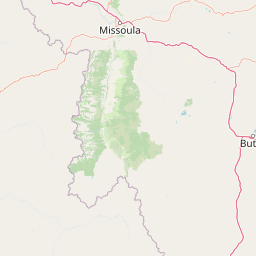
Use this park location map to pinpoint Rattlesnake Wilderness in United States of America, understand its exact geographic position, and read its mapped placement within the surrounding landscape more clearly.

Pigeon | © OpenStreetMap contributors

Location context for Rattlesnake Wilderness

Montana
Recorded earthquake history

Explore Historical Earthquake Records for Rattlesnake Wilderness

View the documented seismic history associated with the high country of the Rattlesnake Mountains. This MoriAtlas catalogue provides a clear record of past activity near the wilderness to assist with regional geography and geological research.

Rattlesnake Wilderness Earthquake History

Catalogued events

44 events

Strongest magnitude

Magnitude 4.8

Most recent event

Aug 28, 2026

This history includes earthquakes recorded inside the park or within 50 km of its borders

Park atlas

Compare adjacent northern Rockies landscapes and regional wilderness reserves

Explore Parks Near Rattlesnake Wilderness and Surrounding Protected Areas

Browse nearby national parks and protected areas sharing the rugged mountainous terrain found around Rattlesnake Wilderness. Comparing adjacent forest reserves and alpine headwaters provides broader context for regional conservation ecosystems in western Montana.
Protected areaMontana
Park boundaries overlap#1 closest

West

Lolo National Forest: An Atlas of Protected Lands and Mountainous Terrain in Montana

Ecological transition zone of the northern Rocky Mountains

This protected area covers two million acres of diverse northern Rocky Mountain geography. Known for its massive western red cedars and transitional ecology, the forest features a complex network of ridgelines, glacial lake basins, and river corridors that serve as vital habitat across the Montana landscape.

Area
8,894.85 km²
Established
1906
Relief
Mountain
Climate
Temperate
A watercolor painting of a serene landscape with coniferous trees, rolling hills, and soft-toned, layered mountains.
Protected landscapeMontana
About 4.8 km away#2 closest

Southwest

Rattlesnake National Recreation Area: Geography and Protected Landscape Analysis

A mapped Northern Rockies gateway in western Montana

The recreation area encompasses 28,000 acres of forested mountain terrain, montane wetlands, and creek-carved valleys located just north of Missoula. This protected landscape is defined by its diverse trail network and significant ecological systems, including the rare Sphagnum bogs of Shoo Fly Meadows. The area provides essential habitat for grizzly bears, elk, and bull trout while framing a transition zone into the remote backcountry of the surrounding national forest.

Area
110 km²
Established
1980
Relief
Mountain
Scope
Terrestrial
Wildlife reserveMontana
19 km away#3 closest

North

Mission Mountains Wilderness: A Rugged Protected Area in the Montana Rocky Mountains

Glacial topography and high elevation alpine ecosystems

Mission Mountains Wilderness is a defining landmark in northwestern Montana, characterized by a steep and narrow mountain spine that rises abruptly above the Flathead Valley. The area protects a full spectrum of ecosystems, from dense coniferous forests to exposed talus slopes and alpine tundra. With its glacially carved cirques and deep U shaped valleys, this wilderness functions as a key component of a larger, jointly managed regional conservation landscape in the United States.

Area
298.97 km²
Established
1975
IUCN
Ib
Relief
Mountain
A watercolor painting depicting a soft, stylized mountain range and a river winding through a valley.
Protected landscapeMontana
64 km away#4 closest

East

Helena-Lewis and Clark National Forest: Geographic Overview and Protected Area Map

Montana wilderness spanning the Continental Divide

Spanning from the rolling eastern plains to the crest of the Northern Rockies, Helena-Lewis and Clark National Forest serves as a massive protected landscape in central Montana. This forest system protects eight unique mountain ranges and critical wilderness corridors, offering a comprehensive look at the ecological transition zones of the American Mountain West.

Area
11,000 km²
Established
1897
Relief
Mountain
Climate
Temperate
A soft watercolor painting depicting rolling mountains in the background with a line of forest in the midground and open terrain in the foreground.
Protected landscapeMontana
119 km away#5 closest

Northwest

Kootenai National Forest: Geography and Protected Land Map for Northwestern Montana

Northern Rockies mountain ranges and watershed analysis.

Spanning over two million acres, Kootenai National Forest represents a critical protected landscape in the Northern Rockies. This atlas entry details the interplay between the Cabinet Mountains, regional river systems like the Kootenai and Clark Fork, and the dense conifer forests that define this uniquely wet corner of Montana.

Area
8,900 km²
Established
1907
Relief
Mountain
Climate
Temperate
National parkMontana
128 km away#6 closest

North

Glacier National Park: A Montana National Park with Distinct Protected Landscape Geography

Explore its mapped boundaries and regional natural terrain.

Glacier National Park represents a significant national park entity within Montana, providing a unique lens for understanding protected landscapes and regional geography. As a key component of the US protected areas network, it offers valuable insights into mapped park boundaries and the surrounding natural terrain. This page serves as a gateway to exploring the specific geographic context and landscape identity of Glacier National Park.

Area
4,100.77 km²
Established
1910
IUCN
II
Visitors
2.9M annual
Soft watercolor illustration of a rolling mountain landscape with a forested foreground and faded, distant peaks.
Protected landscapeIdaho
141 km away#7 closest

South

Salmon, Challis National Forest: Geography and Protected Land Map in Central Idaho

Extensive alpine ridges and wild river corridors

Spanning over 4.2 million acres, Salmon, Challis National Forest is a foundational protected landscape in Idaho. This area includes the highest peaks in the state, such as Borah Peak, and holds the majority of the Frank Church, River of No Return Wilderness. Utilize this atlas resource to examine the intricate mountain topography, expansive river systems, and the contiguous wild corridors that define this significant portion of the northern Rockies.

Area
17,142.2 km²
Established
1908
Relief
Mountain
Climate
Temperate
Watercolor painting of a light-colored landscape featuring a river meandering through green trees and soft hills against a hazy background.
Wildlife reserveMontana
143 km away#8 closest

East

Gates of the Mountains Wilderness: Montana Protected Landscape and Geographic Overview

Explore Missouri River canyon boundaries and local terrain

Gain insight into the geological drama of Gates of the Mountains Wilderness, a protected reserve in Montana. This atlas entry focuses on the limestone canyon walls and historic river corridors that define the regional geography, offering a structured look at its protected boundaries and terrain.

Area
115.59 km²
Established
1964
IUCN
Ib
Relief
Mountain

Common questions about visiting, size, designation, and location context for Rattlesnake Wilderness

Rattlesnake Wilderness FAQs for park facts, access, geography, and protected area context

Find quick answers about Rattlesnake Wilderness, including protected-area facts, park geography, trail and visitor context, and how the park fits into its surrounding country and regional landscape.
MoriAtlas Explorer

Continue Your Protected Areas Search Across the Global Atlas

Deepen your exploration by continuing the structured search for national parks and protected areas worldwide. Utilize the comprehensive filtering capabilities to compare different conservation landscapes and refine your understanding of global park geography. Discover more about the distribution and characteristics of protected natural areas.

Global natural geography