
Trip Timing
When to Visit Reisa National Park: The Short Answer
For travelers planning a trip to Reisa National Park, the primary window for exploration is condensed into the fleeting subarctic summer, generally spanning from late June through late August. During this period, the snowpack retreats from the valley floor and lower mountain slopes, allowing for access to the dramatic river-cut landscape that defines the region. Because the park is situated deep within the northern reaches of Troms county, visitors must prioritize accessibility over tranquility, as this brief season represents the only time when the terrain is reliably navigable for most hikers and river users.
Balancing Light and Variable Conditions
Determining the best time to visit requires an understanding of how extreme daylight and shifting weather interact with the park's rugged topography. Between late June and August, the region experiences nearly constant daylight, a phenomenon that provides an immense advantage for those looking to maximize their time in the field. This extended light cycle allows for flexibility in scheduling, as the absence of a traditional sunset removes the pressure of navigating complex terrain in darkness. However, this same period is characterized by higher precipitation levels compared to the colder shoulder seasons. Travelers should prepare for frequent, rapid shifts in weather, where calm, mild conditions can quickly transition into heavy cloud cover or rain, particularly within the deep gorges where moisture often accumulates.
Navigation and Terrain Considerations
While the summer months offer the most favorable temperature ranges, with mean values often reaching between 7 and 11 degrees Celsius, the environment remains inherently harsh. The park consists of a challenging mix of mountain plateaus and steep canyon walls, meaning even in the peak of summer, ambient temperatures can drop significantly if a weather front moves through. Visitors seeking the most comfortable experience should focus on the mid-summer peak, but they must accept that the park remains a wilderness area regardless of the date. Access to higher elevations, such as the expansive mountain plateaus that surround the Reisa River, may remain difficult even in July depending on the severity of the preceding winter snowmelt. The interaction between the thawing permafrost, high river flow from melting snow, and the physical limitations of the valley floor means that the most accessible time is also the period when the landscape is at its most active and saturated.
By focusing on late June through August, travelers align their visit with the period of greatest biological activity and physical access. This trade-off between the desire for milder temperatures and the inevitable presence of cool, damp, and unpredictable subarctic weather is the core of any itinerary planning for this protected landscape.
Seasonal Comparison
Best Months to Visit Reisa National Park at a Glance
Peak Hiking and River Exploration: July and August
The most reliable period for outdoor activities within the Reisa River valley falls between July and August. During these months, the daily mean temperature ranges from approximately 9 to 11 degrees Celsius, offering the most comfortable conditions for long-distance trekking and navigating the canyon trails. The primary benefit of this window is the combination of persistent daylight and the absence of deep snow on higher elevations, which facilitates access to the mountain plateau. However, visitors should note that this period corresponds with the park's highest precipitation levels, with July averages reaching over 4 millimeters per day. While the temperature is relatively mild, the frequent rain necessitates high-quality waterproof gear for anyone planning multi-day hikes along the river.
The Transitional Window: Late June and Early September
Late June and early September serve as transitional phases that offer unique experiences for those prepared for rapid climate shifts. By late June, the landscape experiences 24 hours of daylight, which provides an unusual sense of temporal freedom for photographers and long-distance hikers. The environment, however, remains cool, with mean temperatures near 7 degrees Celsius, and the ground may still retain moisture from the recent spring snowmelt. September presents a different set of conditions as daylight begins to wane toward 12 hours. Average maximum temperatures drop to approximately 13 degrees Celsius, and the first hints of winter,including potential frost or early snowfall at higher elevations,can appear suddenly. These shoulder periods suit travelers who prioritize avoiding the peak visitor frequency of mid-summer, provided they remain flexible regarding their daily itineraries.
Winter and Shoulder Season Constraints: October through May
The remainder of the year is characterized by subarctic winter conditions that significantly limit accessibility. From October through April, the park experiences plummeting temperatures, with mean values often falling well below zero and reaching extreme lows in January and February. Daylight hours become severely restricted, dropping to zero in December. During these months, the valley and mountain plateau become inhospitable for standard hiking due to heavy snow accumulation and high winds, which average between 3.5 and 4.7 meters per second. This period is not suitable for typical park exploration unless visitors are specifically equipped for Arctic winter expeditions and are familiar with the risks of extreme cold and limited visibility. Most standard trekking routes are considered effectively closed, and the primary focus shifts away from the summer-based valley experiences to survival-oriented winter conditions.
Annual Climate Overview
Temperature, Precipitation, and Daylight Trends in Reisa National Park
Understanding the climate of this subarctic wilderness requires recognizing the sharp divide between the short, relatively mild summer and the long, deep-freeze winter. The following patterns are based on long-term climate normals (1991 to 2020) recorded at an elevation of approximately 600 meters. These figures represent the baseline climate for the park's mid-elevation terrain, but they are not localized weather forecasts. Conditions can vary significantly across the river valley and the higher mountain plateaus, and travelers should rely on current meteorological reports for specific dates.
The Shift Toward Summer and Daylight Expansion
The most dramatic environmental transition occurs as spring gives way to early summer. From April through May, daylight increases rapidly, jumping from about 15 hours to over 21 hours by the end of May. During this time, the average daily maximum temperature shifts from just above freezing to double digits, crossing the 10-degree Celsius threshold. By June, the park experiences the phenomenon of near-constant daylight, which stays at 24 hours. While the average temperature is moderate, the transition from the colder months is marked by higher humidity levels and a gradual increase in precipitation. The onset of warmer days in June and July provides the most hospitable window for visiting, characterized by average maximums reaching nearly 20 degrees Celsius.
Patterns in Precipitation and Humidity
Rainfall and humidity patterns are closely tied to the seasonal temperature cycle. The mid-summer months of July and August receive the highest levels of daily precipitation, often exceeding 3.5 to 4 millimeters per day. This period also sustains higher humidity, which remains above 85 percent even in the relative warmth of summer. While these months are the most accessible, the persistent moisture is a defining feature of the park's climate. As the calendar shifts into September, precipitation levels begin to taper off, and the air feels noticeably crisper. The humidity remains high, particularly as temperatures drop, reflecting the influence of the subarctic environment where the cooling of moist air leads to consistent ground-level saturation.
The Transition to Prolonged Winter
Beginning in October, the climate undergoes a rapid contraction. Daylight hours plummet from 12.7 hours in September to just over 8 hours by late October. Average temperatures fall below the freezing point, and the frequency of sub-zero minimums becomes the standard. By November and December, the park settles into a deep winter phase with total darkness for parts of the season and average temperatures frequently dropping below minus 10 degrees Celsius. Wind speeds, which hover at lower levels during the relatively calm summer window, begin to increase toward the end of the year, amplifying the impact of low temperatures. Visitors looking for stable, accessible conditions should view these seasonal shifts as firm boundaries, as the combination of freezing temperatures, minimal daylight, and high humidity renders the higher terrain largely inaccessible for standard hiking activities during the winter half of the year.
Annual Climate Phases
Understanding Seasonal Transitions and Weather Cycles in Reisa National Park
The Brief Arctic Summer Window: July and August
The most distinct phase in Reisa National Park occurs during July and August, representing the only reliable period where snow-free terrain and peak accessibility coincide. This phase is characterized by temperatures that typically remain positive, with mean temperatures hovering between 8.8 and 11 degrees Celsius. While these months see the highest average precipitation, the trade-off is the extended daylight and the thawing of higher mountain plateau routes that remain impassable or hazardous for the remainder of the year. During this window, the river valley experiences its most active state, with the Reisa River flow reaching its peak and the landscape exhibiting its maximum seasonal growth.
The Rapid Transitional Shoulder: June and September
The transitions into and out of the short summer are marked by profound environmental shifts that create distinct challenges for travellers. June acts as the threshold of the growth season, characterized by the final retreat of winter snowpack from the lower valley floors. While daylight reaches its annual maximum of 24 hours, night temperatures can still dip below freezing, and the landscape remains saturated from snowmelt. This period is less about stable hiking conditions and more about the park's awakening. Conversely, September represents the swift closure of the autumn season. Mean temperatures drop toward 3.8 degrees Celsius, and the first significant frost returns to the landscape. This phase functions as a sharp contraction, as the risk of early seasonal snow increases significantly and the dramatic drop in daylight hours,falling to 12.7 hours by month's end,signals the end of the viable trekking window.
The Prolonged Winter Dormancy: October through May
For the vast majority of the year, the park exists in a state of winter dormancy. This extended period, lasting from October until the end of May, is defined by consistently sub-zero mean temperatures and persistent snow cover. The landscape transitions from a dark, frigid environment in mid-winter,where daylight hours drop to near zero,to a prolonged period of spring thaw. While the daylight begins to return rapidly in April and May, the ground remains largely frozen or slushy, preventing standard summer activities. This phase is not merely a colder version of summer; it is an entirely different environmental state where the mountain plateaus are dominated by winter conditions and the valley floor is locked in a cycle of ice and snow. Visitors during these months should anticipate limited infrastructure functionality and extreme, rapidly changing weather patterns that contrast sharply with the relative stability of the mid-summer months.
Seasonal Experiences
What Visiting Reisa National Park Is Like Throughout the Year
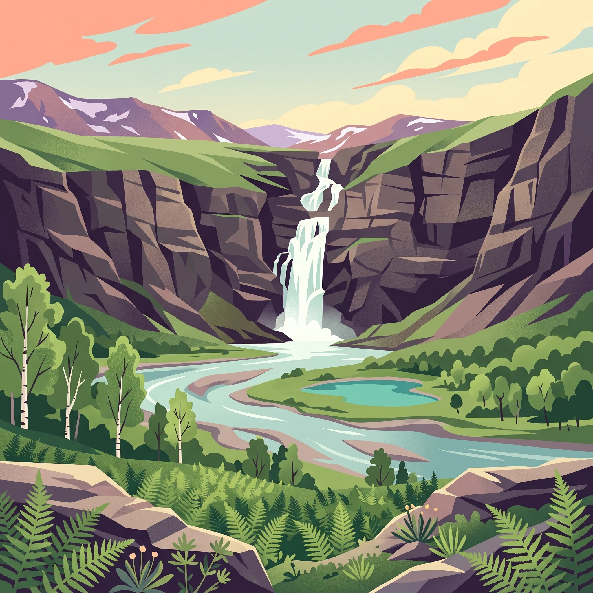
The experience of visiting the Reisa River valley shifts dramatically alongside the subarctic daylight cycle and the seasonal progression of water flow. During the brief summer period, the landscape transitions from snowmelt-driven vitality to a accessible wilderness that supports long-distance trekking and river-based excursions. The period between late June and late August serves as the primary window for viewing landmark features such as the 269-meter Mollisfossen waterfall. When flow volumes are high, the mist and power of these cataracts are most intense, providing a stark contrast to the frozen, dormant state the falls reach during the deep winter months from October to May.
River Navigation and Canyon Exploration
The Reisa River serves as the primary artery for exploring the deeper sections of the park. During July and early August, water levels typically accommodate riverboat transport, which remains a traditional method for accessing the interior of the valley and sites like the Imofossen waterfalls. This is also the window when kayaking and canoeing become practical, provided travelers are prepared for the cold water temperatures that persist even after the snow has receded. The accessibility of the river valley during these months allows for a direct connection to the park's canyons, where the steep, dramatic walls highlight the scale of the river's erosion. Visitors seeking to reach these features should note that these conditions rely on the thawing of the high mountain plateau, making early July significantly more favorable than the transitional weeks of June.
Wildlife Observation and Cultural Landmarks
The presence of diverse subarctic fauna is tied to the availability of habitat across the valley and adjacent plateaus. The rough-legged buzzard and various birds of prey, such as golden eagles and gyrfalcons, are most actively observed during the summer months when the region's intense daylight provides near-constant opportunities for viewing. While wolverines, lynx, and the occasional brown bear inhabit the surrounding rugged terrain, sightings remain infrequent and demand significant distance from the visitor. Cultural heritage, such as the ancient Sámi rock carvings at the Sieimma site, is best accessed during the peak summer window when ground trails are free of snow. These historical markers are sensitive to environmental conditions, and late-season visits risk encountering early snow cover that may obscure or prevent safe passage to the site.
Seasonal Constraints for Trekking
For those planning to traverse parts of the Arctic Trail or explore the network of paths around the valley, the timing determines the physical feasibility of the terrain. The transition into September often brings an abrupt end to the primary trekking season, as dropping temperatures and shorter daylight hours limit the time available for movement across the mountain plateau. While the onset of autumn color can offer unique scenery, the risk of early winter weather makes the late-summer period the most reliable choice for multi-day excursions. Visitors should prioritize the stability of the July and August window, as the rapid environmental changes in late September can quickly turn a clear hiking path into a precarious route exposed to cold winds and moisture.
Visitor Priorities
Optimizing Your Reisa National Park Visit by Personal Interest
Balancing Warmth and Activity Access
For travelers who prioritize milder temperatures for hiking, the window between early July and mid-August is the most suitable. During this period, the average daily maximum temperature reaches its annual peak, often hovering near 19°C. This warmth is essential for comfortable movement across the mountain plateau and valley floors, where subarctic winds can otherwise lower the wind chill significantly. The trade-off for these higher temperatures is a higher risk of precipitation, with average rainfall levels peaking during July. While you gain thermal comfort, you must be prepared for damp conditions that can make trails and river crossings more challenging. Travelers should focus on this period if their primary goal is reaching landmarks like the Mollisfossen waterfall or the Sieimma rock carvings, as the thaw is typically complete and river-based transport is most reliable.
Prioritizing Maximum Daylight
If your primary interest is experiencing the extended light of the subarctic, the window from late June through July provides the most dramatic results. By late June, daylight reaches twenty-four hours, offering an environment where traditional day-night cycles vanish. This provides unparalleled flexibility for hiking schedules, as the risk of losing daylight during a long trek or a river journey is effectively removed. The primary compromise is the intensity of the light, which can affect sleep patterns and requires specific eye protection. Furthermore, this period of continuous light coincides with the tail end of the spring snowmelt in higher elevations, meaning some trails may remain wet, muddy, or obscured by lingering patches of snow even while temperatures are rising.
Seeking Drier Conditions and Transition Landscapes
Visitors who prioritize drier weather often look toward the transition period in late August and early September. As the peak of summer wanes, the statistical probability of daily precipitation begins to decrease compared to the high-moisture months of July and August. This period offers a unique aesthetic shift as the subarctic tundra begins to take on autumn colors. However, this preference comes with the significant trade-off of rapidly decreasing temperatures and shortening daylight hours. By September, the mean temperature drops to roughly 4°C, and night frosts become a common occurrence. While this timeframe is excellent for photographers or those seeking a quieter experience in the valley, it requires robust thermal gear and a recognition that the window for high-mountain access is closing quickly as the first signs of winter approach.
Visitor access
Seasonal access and trip planning requirements for Reisa National Park
Access to Reisa National Park is primarily governed by the seasonal transformation of the Reisadalen valley and its surrounding mountain plateaus. Because the landscape is characterized by deep river gorges and high-elevation terrain, physical access remains highly sensitive to snow melt in early summer and the return of winter conditions in autumn. While the valley floor may offer some regional access, entry into the deeper sections of the park or higher plateaus generally requires stable, snow-free conditions that typically align with the peak summer months of July and August.
Travel logistics and entry points
For visitors planning their arrival, the village of Storslett in the Nordreisa municipality serves as the central hub for approaching the park. The most flexible method for reaching the park boundary is by private vehicle, as it allows for direct travel to trailheads. From Storslett, the route leads to the village of Saraelv, which is widely considered the primary gateway for valley expeditions. It is important to note that the final stretch of this road is gravel, which can vary in quality depending on recent weather and seasonal maintenance.
Those relying on air travel often transit through airports in Tromso or Alta. The local airport at Sorkjosen provides additional regional connectivity. Regardless of the chosen entry point, visitors should always verify the current status of roads, potential weight or vehicle restrictions, and any limitations on local parking at trailheads with municipal authorities or the official park website before departure. Public transport options exist between larger regional towns and Storslett, but local connections from Storslett to the park boundary can be sporadic or seasonal. Travelers depending on buses must consult current timetables and local service providers, as these are not guaranteed to align with individual backcountry itineraries.
Managing expectations for park operations
Reisa National Park does not operate with a single standardized open or closed date for its entire territory. Instead, access fluctuates based on natural conditions. The presence of snowpack in the mountains, water levels in the Reisa River, and the physical state of trails are the primary factors determining whether specific areas are accessible to visitors. Information regarding trail maintenance, river crossing conditions, or any potential restrictions on motorized or non-motorized access in specific zones must be confirmed through the park’s official management channels. Do not assume that the availability of a trail in one season translates to safe or permitted use during the same calendar month in a different year. Always check the park’s management website for current alerts, wildlife protection zones, and regulatory notices that may supersede general seasonal planning.
Safety and Preparation
Weather, Safety, and Essential Preparation for Reisa National Park
Preparation for a visit to this wilderness area requires a pragmatic approach to the rapidly fluctuating subarctic climate. While the summer months offer relative accessibility, the environment remains volatile. Visitors should prioritize layering systems that can adapt to changing conditions in real time, as temperatures can drop significantly even during the height of the season in July and August. Moisture management is critical, given that the summer months often see increased precipitation, and humidity levels remain relatively high throughout the year.
Navigating Seasonal Weather Risks
Because the climate normals indicate that mean temperatures can hover near freezing during transition months like June and September, you must prepare for the possibility of cold snaps regardless of your arrival date. The primary weather-related safety factor is the combination of wind and moisture, which can accelerate heat loss. Relying on breathable, water-resistant layers is generally more effective than a single heavy garment, as this allows you to adjust to the intensity of your movement and the specific terrain of the valley floor or the exposed mountain plateau.
Equipment for Variable Terrain
The landscape, characterized by deep river gorges and uneven, rugged paths, demands reliable navigation tools. Digital mapping and GPS devices are helpful, but they cannot replace a physical map and a traditional compass, especially given that mobile phone reception is notoriously inconsistent within the deep canyons of the Reisa valley. Because river levels can change rapidly following heavy rain or snowmelt, avoid assuming that crossings remain safe based on earlier reports or seasonal expectations. Always evaluate the current state of water levels and trail integrity rather than relying on historical averages.
Safety Protocols and Local Guidance
Safety in this park is largely a matter of self-sufficiency. Always leave a detailed itinerary with a trusted contact outside of the area, and ensure you have sufficient food and clothing to sustain yourself if a weather event forces a longer stay than planned. Wildlife awareness is a necessary component of your preparation; keep a distance from elk, wolverines, and other fauna to minimize stress for both the animals and your party. It is essential to treat all climate data as a broad guide rather than a forecast. Before starting your journey, verify current trail conditions, specific safety alerts, and local guidance provided by park authorities. Relying on current, official information for the status of mountain paths and river crossings is the most effective way to manage the inherent risks of this subarctic environment.
Trip decision
Selecting your ideal window for visiting Reisa National Park
Synthesizing your personal priorities for a Reisa visit
Choosing the right time to travel to Reisa National Park requires a candid assessment of what you are willing to trade in exchange for specific conditions. Because the park environment is defined by a short subarctic growing season, your window for activity is narrow. If your primary objective is physical access to the interior valley, the canyons, or remote landmarks like Mollisfossen, you must align your dates with the post-thaw period. July and August stand out as the only months where the climate normals suggest relatively reliable ground conditions and milder average temperatures, though these months also carry the highest statistical probability of rainfall. By visiting in this window, you prioritize accessibility and landscape visibility over absolute weather stability or dry conditions.
Balancing environmental exposure against activity goals
For those drawn to the unique light of the north, late June offers an intense, near-constant daylight experience that can be highly rewarding, provided you are prepared for the residual moisture and lower temperature averages that persist as the snowpack recedes. Conversely, choosing late August or early September shifts your focus toward the onset of autumn, where you might enjoy slightly drier conditions and the early emergence of fall colors, at the cost of rapidly shortening days and a sharp increase in the likelihood of sub-freezing night temperatures. There is no period that simultaneously offers the warmth of a temperate summer and the dry, crisp conditions of a stable high-pressure system. Your decision must therefore hinge on whether you value the endless light of midsummer or the autumnal atmosphere of the shoulder season.
Moving from climate expectations to active planning
Once you have determined which seasonal window best matches your physical and experiential goals, you must transition from interpreting long-term climate normals to preparing for current reality. Remember that these seasonal averages are meant to provide a structural guide for your decision, not a forecast for your specific trip dates. The high-latitude environment of northern Norway is subject to rapid, localized weather shifts that can obscure trails or render mountain plateau routes impassable regardless of what the monthly data indicates. Before you commit to your final dates or finalize your itinerary, verify current trail accessibility, local transit options, and relevant safety alerts through official park resources. By combining an informed understanding of these seasonal trade-offs with a commitment to checking real-time conditions, you create a realistic and manageable foundation for your visit to the valley.