Mori Atlas logo
National parkReisa National Park

Mapped geographic context of a significant protected area in Northern Norway's alpine terrain.

Reisa National Park: Dramatic Subarctic River Valley and Protected Landscape in Troms

Reisa National Park represents a significant protected landscape within Norway's Troms region, distinguished by its dramatic subarctic terrain. The park's core geographic feature is the Reisa River valley, a spectacular canyon system carved through a high mountain plateau, encompassing features like the towering Mollisfossen waterfall. This atlas-focused entry helps users understand the park's mapped boundaries, its unique river-carved landscape, and its place within the broader natural geography of Northern Norway.

National ParksNorwaySubarctic EnvironmentsRiver ValleysBirdwatchingLarge Predators

Reisa National Park

National park

Park overview

Structured park overview, official facts, and landscape profile for Reisa National Park

Reisa National Park park facts, protected area profile, and essential visitor context
Review the core facts for Reisa National Park, including designation, size, terrain, visitor scale, habitats, and operating context in one park-focused overview.

About Reisa National Park

Reisa National Park protects a remarkable subarctic landscape in the far north of Norway, centered on the dramatic valley carved by the Reisa River through the mountain plateau of Troms county. Established by royal decree on 28 November 1986, the 803-square-kilometer park encompasses the Reisadalen valley and surrounding mountainous terrain, preserving both the natural landscape and the traditional land-use patterns that have shaped the region for centuries. The Reisa River has cut a deep canyon north of Imo, creating the long fertile valley that serves as the park's central feature. Waterfalls cascade dramatically into the valleys and gorges, with Mollisfossen standing as one of the most spectacular at 269 meters in height. The park's location adjacent to Käsivarsi Wilderness Area in Finland creates a transboundary protected area spanning the international border. The subarctic environment supports a rich community of wildlife, particularly birds of prey and large mammals, making the park significant for both conservation and ecological monitoring in northern Europe.

Quick facts and research context for Reisa National Park

Reisa National Park covers 803 km² of subarctic terrain in Troms county, northern Norway, along the Reisa River valley. The park was established by royal decree on 28 November 1986 and is managed by the Norwegian Directorate for Nature Management. The landscape features the dramatic Reisadalen valley, steep gorges, and the impressive Mollisfossen waterfall dropping 269 meters. The area has been important for hunting, fishing, and reindeer herding for centuries, with traditional practices like tar production from Scots pine leaving visible remnants throughout the valley.

Park context

Deeper park guide and search-rich context for Reisa National Park

Reisa National Park history, landscape, wildlife, and travel context
Explore Reisa National Park through its history, landscape character, ecosystems, wildlife, conservation priorities, cultural context, and seasonal travel timing in a structured park guide built for atlas discovery and search intent.

Why Reisa National Park stands out

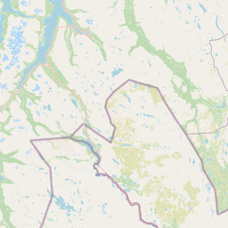
Reisa National Park is best known for its dramatic river-cut valley and canyon system within the subarctic landscape of northern Norway. The park protects the Reisadalen valley, where the Reisa River has carved deep gorges through the mountain plateau, creating spectacular scenery with cascading waterfalls including the 269-meter Mollisfossen. The park is significant for its predator populations, hosting rough-legged buzzards as the most common bird of prey alongside golden eagles, gyrfalcons, wolverines, Eurasian lynx, and occasional brown bears. The Sámi place name Njállaávzi (meaning Arctic fox gorge) reflects the historical presence of Arctic foxes in the area.

Mountainous landscape with turquoise lake, snow-dusted peaks, rocky terrain, and winding river under partly cloudy sky
Mountainous landscape featuring a turquoise lake and snow-capped peaks in Reisa National Park

Reisa National Park history and protected-area timeline

The valley and adjacent mountains of what is now Reisa National Park have been valuable for hunting, animal trapping, and fishing for centuries. The local population historically engaged in traditional practices that left lasting marks on the landscape. Scots pine forests were harvested for timber and tar production, with nearly every farm in the valley earning supplementary income from tar production—a practice that continued far into the 20th century. The remains of many tar kilns can still be found throughout the area. Snares are sometimes still set to catch ptarmigan and willow grouse in the traditional manner, continuing centuries-old hunting practices. The park and surrounding areas provided crucial seasonal grazing for semi-domesticated reindeer, with herds moving between coastal areas in summer and the interior Finnmark region near Kautokeino in winter. The establishment of the park in 1986 formalized protection for this landscape while acknowledging its historical importance as a working wilderness.

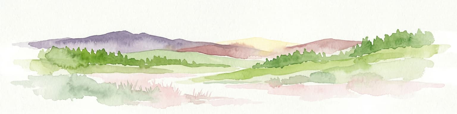
Reisa National Park landscape and geographic character

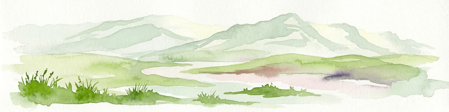
The physical landscape of Reisa National Park is defined by the dramatic valley system carved by the Reisa River through a high mountain plateau. The river has cut a deep canyon north of the village of Imo, creating the long, relatively fertile valley known as Reisadalen that bisects the park. Steep gorges descend from the plateau into the valley floor, with numerous waterfalls cascading into these carved channels. The Mollisfossen waterfall, dropping 269 meters, is among the most spectacular in the region. The surrounding terrain consists of mountainous plateau country typical of northern Norway's subarctic interior, with elevations rising from the valley floor to alpine terrain. The combination of river-carved valley, steep gorges, and cascading waterfalls creates a landscape of considerable scenic diversity within the subarctic environment.

A tall waterfall flowing down rocky cliffs with a river in the foreground and sparse trees below.
Mollisfossen waterfall cascading through rocky cliffs in Reisa National Park, Norway.

Reisa National Park ecosystems, habitats, and plant life

The nature of Reisa National Park reflects the subarctic environmental conditions of northern Norway, supporting ecosystems adapted to harsh winters and short summers. The valley floors support birch forest with fern understory, while the surrounding higher terrain features tundra vegetation appropriate to the latitude and elevation. The Reisa River and its tributaries provide aquatic habitat through the valley system. The landscape supports a mix of boreal and arctic species at the southern edge of their range, creating an ecological transition zone. The park's protected status ensures the continuation of these subarctic ecosystems and the ecological processes that sustain them, including the seasonal movements of reindeer that have traditionally utilized the area.

Reisa National Park wildlife and species highlights

Reisa National Park supports a notable community of wildlife, with particular significance attached to birds of prey and large predators. The rough-legged buzzard is the most common bird of prey in the park, a characteristic species of northern regions. Hikers may also spot golden eagles, common kestrels, and gyrfalcons soaring over the terrain or hunting in the valleys. Among mammals, wolverines and Eurasian lynx are resident in the park and surrounding mountains, representing significant predators in the Norwegian fauna. The largest Norwegian predator, the brown bear, is occasionally seen within the park boundaries. The Sámi place name Njállaávzi, meaning Arctic fox gorge, suggests that Arctic foxes must have historically lived in the area, though their current status in the park is less clear. The surrounding mountains provide habitat for species typical of northern Norwegian wilderness.

Reisa National Park conservation status and protection priorities

Reisa National Park serves as an important protected area within Norway's network of national parks, preserving a representative subarctic landscape in the northern regions. The park's establishment in 1986 formalized protection for the Reisadalen valley system and its surrounding terrain, recognizing both its natural values and cultural significance. As an IUCN Category II protected area, the park aims to protect ecological processes and biodiversity while allowing for sustainable recreation and traditional land use. The presence of significant predator populations—including wolverines, Eurasian lynx, and occasional brown bears—indicates the ecological integrity of the area. The park's adjacency to Käsivarsi Wilderness Area in Finland creates a transboundary conservation context that supports broader ecosystem protection across the international border.

Reisa National Park cultural meaning and human context

Reisa National Park lies within a region of deep cultural significance to the Sámi people, the indigenous inhabitants of northern Norway, Sweden, Finland, and Russia. The valley and adjacent mountains have been important for traditional livelihoods including hunting, fishing, and reindeer herding for centuries. The Sámi name for part of the gorge—Njállaávzi, meaning Arctic fox gorge—reflects the historical presence of Arctic foxes and the naming conventions of the indigenous culture. Traditional practices such as setting snares for ptarmigan and willow grouse continue in some form, while the remains of tar kilns from the historic pine tar industry can still be found throughout the valley. The semi-domesticated reindeer herds that utilize the park area in spring, summer, and autumn represent a continuation of pastoral traditions that have shaped the landscape for generations, with seasonal movements between coastal grazing areas and interior winter ranges.

Top sights and standout views in Reisa National Park

The park protects one of Norway's most dramatic river valleys in the subarctic north, with the Reisa River having carved a spectacular canyon system through mountain plateau terrain. Mollisfossen waterfall at 269 meters ranks among Norway's tallest and most impressive. The wildlife viewing opportunities include rough-legged buzzards, golden eagles, gyrfalcons, wolverines, and occasional brown bears in a relatively accessible mountain landscape. The valley has been a working landscape for centuries, with tar production and reindeer herding leaving cultural traces visible throughout the area. The park forms part of a cross-border wilderness area with adjacent Finnish protection.

Best time to visit Reisa National Park

Reisa National Park can be visited throughout the year, with each season offering distinct character. Summer months (June through August) provide the most accessible conditions for hiking and wildlife viewing, with long daylight hours and relatively mild temperatures in the valley. Autumn brings excellent conditions for observing migratory birds and experiencing the subarctic landscape in its fall colors. Winter transforms the valley into a snow-covered wilderness, though access becomes more challenging. The shoulder seasons of late spring and early autumn often offer the best combination of accessibility and relatively stable weather for exploring the park's landscapes and wildlife.

Park location guide

Geography guide, regional context, and park location map for Reisa National Park

Reisa National Park park geography, regions, and map view in Norway
Understand where Reisa National Park sits in Norway through a broader geographic reading of the surrounding landscape, nearby location context, and its mapped position within the national park landscape.

How Reisa National Park fits into Norway

Norway, officially the Kingdom of Norway, is a Nordic country in Northern Europe located on the Scandinavian Peninsula. It encompasses mainland Norway, the Arctic islands of Svalbard and Jan Mayen, and maintains dependencies including Bouvet Island and Antarctic claims. The country has a population of about 5.6 million and is bordered by Sweden, Finland, and Russia. Norway is a unitary parliamentary constitutional monarchy with Oslo as its capital and largest city.

Wider geography shaping Reisa National Park in Norway

Norway occupies the western and northern portions of the Scandinavian Peninsula in Northern Europe. The country shares a long eastern border with Sweden, and borders Finland and Russia to the northeast. Norway has an extensive coastline facing the Skagerrak, North Sea, Norwegian Sea, and Barents Sea. The terrain is predominantly mountainous with numerous fjords along the coastline.

Map view of Reisa National Park

Use this park location map to pinpoint Reisa National Park in Norway, understand its exact geographic position, and read its mapped placement within the surrounding landscape more clearly.

Pigeon | © OpenStreetMap contributors

Location context for Reisa National Park

Nordreisa MunicipalityTroms

Explore the dramatic river-cut valley, towering waterfalls, and distinct subarctic habitats defining Reisa National Park's protected landscape.

Reisa National Park Photos: Explore Subarctic Landscapes and Scenic River Valley Views
Browse through an extensive collection of Reisa National Park photos to gain a deeper understanding of its distinctive subarctic landscapes, from deep river gorges to high mountain plateaus. These images provide essential visual context for appreciating the park's dramatic scenery, diverse habitats, and overall protected wilderness character.

Mountainous landscape with turquoise lake, snow-dusted peaks, rocky terrain, and winding river under partly cloudy sky

Green ferns and trees in a forested area

A tall waterfall flowing down rocky cliffs with a river in the foreground and sparse trees below.

Park atlas

Compare Subarctic Landscapes and Northern Norway's Protected Geography Surrounding Reisa National Park

Explore Nearby Protected Areas and National Parks Near Reisa National Park, Norway
Discover other national parks and protected areas across northern Norway, exploring the diverse subarctic environments and river-carved terrain adjacent to Reisa National Park. Compare geographic features, conservation efforts, and regional park spread to deepen your understanding of these interconnected landscapes.
National parkTroms

Øvre Dividal National Park: Arctic Alpine Protected Landscape in Troms, Norway

Mapped boundaries and unique ecological terrain of a pristine wilderness.

Øvre Dividal National Park stands as a premier example of Arctic alpine wilderness, meticulously preserved as a national park in Norway's Troms region. This entry facilitates a detailed exploration of its mapped protected boundaries and the distinct elevational ecological zones, from boreal forests to high-altitude tundra. Gain geographic context for this vital landscape, which supports diverse habitats and contributes to Scandinavia's largest contiguous wilderness areas.

Area
750 km²
Established
1971
IUCN
II
Relief
Mountain
National parkKarasjok Municipality

Anárjohka National Park: Mapped Subarctic Wilderness and Protected Landscape

Explore Norway's Finnmarksvidda plateau geography.

Anárjohka National Park, a protected area in Norway's Finnmark region, offers a compelling atlas-level view of subarctic wilderness. The park's landscape is defined by its location on the Finnmarksvidda plateau, featuring rolling birch woodlands, open pine barrens, and extensive wetlands, all mapped within its protected boundaries. This park provides a crucial point of discovery for understanding regional geography, natural terrain, and the interconnectedness of protected lands across northern Europe.

Area
1,409 km²
Established
1976
IUCN
II
Relief
Mixed relief
National park

Stabbursdalen National Park: Protected Arctic Landscape and Northernmost Pine Forest Atlas

Explore Finnmark's unique geography and protected terrain.

Stabbursdalen National Park preserves a remarkable ecological boundary, featuring the planet's northernmost Scots pine woodland within a dramatic Arctic landscape. This protected area offers a deep dive into rugged mountain terrain, river valley formations, and vital wetland habitats. As a key component of Norway's protected lands, it provides essential context for understanding regional geography and the limits of forest ecosystems on the mapped landscape.

Area
747 km²
Established
1970
IUCN
II
Relief
Mixed relief
National parkFinnmark

Seiland National Park: Arctic Island Landscape and Northernmost Scandinavian Glaciers

Mapped boundaries of protected terrain in Finnmark

Seiland National Park offers a distinct glimpse into Arctic island geography, renowned for protecting Scandinavia's northernmost glaciers. This protected area in Finnmark features a dramatic landscape shaped by glaciated mountains, deep coastal fjords, and alpine terrain, making it a key destination for understanding Nordic natural environments. MoriAtlas facilitates exploration of its mapped boundaries and the unique combination of glacial and marine ecosystems present.

Area
316 km²
Established
2006
IUCN
II
Relief
Mountain
National parkTroms

Rohkunborri National Park: Northern Norway's Dramatic Protected Landscape

Explore its mapped terrain, canyon, and alpine ecosystems.

Rohkunborri National Park offers a profound encounter with northern Norway's wild geography. As a designated national park in Troms county, it features the iconic Sørdalen canyon, a dominant geological feature that shapes its diverse terrain. The park's landscape encompasses a rich ecological gradient, from boreal forests to alpine tundra, supporting a variety of wildlife. This protected area is crucial for understanding Scandinavian mountain ecosystems and transboundary conservation efforts, providing rich content for atlas-based exploration of its mapped boundaries and natural context.

Area
571 km²
Established
2011
IUCN
II
Relief
Mountain
Watercolor painting showing rolling hills, forests, and distant mountains under a soft sky
National parkLapland

Pallas-Yllästunturi National Park: Lapland's Premier Protected Fell Landscape for Atlas Exploration

Explore its ancient mountain geography and mapped protected area.

Pallas-Yllästunturi National Park presents a unique atlas of Lapland's ancient geography, characterized by a vast chain of rounded fells that are the remnants of three-billion-year-old mountains. As Finland's most popular national park, it offers a deep dive into protected landscape discovery, showcasing diverse boreal forests, mires, and exceptional fell terrain. Understand its geographic scope and protected boundaries for comprehensive map-based exploration.

Area
1,020 km²
Established
2005
IUCN
II
Visitors
598.8K annual
National parkNorrbotten County

Vadvetjåkka National Park: Arctic Mountain Landscape and Karst Terrain

Northernmost National Park in Norrbotten County, Sweden

Vadvetjåkka National Park offers a unique atlas perspective on Sweden's northernmost protected mountain landscape. Explore its remote Arctic terrain, characterized by glaciers existing at unusual low altitudes and significant karst cave systems carved into limestone bedrock. This is a vital point for understanding the mapped geography and protected natural features of Norrbotten County and Swedish Lapland.

Area
26.3 km²
Established
1920
IUCN
II
Relief
Mountain
National parkFinland

Lemmenjoki National Park: Finland's Protected Landscape Geography

Explore mapped park boundaries and regional natural context.

Lemmenjoki National Park is a vital protected area situated within Finland's vast northern geography. This page details its designation as a national park, offering a clear view of its mapped boundaries and landscape character. Users can explore the park's geographic context within Finland and understand its contribution to the region's network of conservation lands, facilitating structured atlas-style discovery.

Area
2,850 km²
Established
1956
IUCN
Ib
Visitors
21.1K annual

Common questions about visiting, size, designation, and location context for Reisa National Park

Reisa National Park FAQs for park facts, access, geography, and protected area context
Find quick answers about Reisa National Park, including protected-area facts, park geography, trail and visitor context, and how the park fits into its surrounding country and regional landscape.
MoriAtlas Explorer

Continue Your Protected Areas Search Across the Global Atlas

Deepen your exploration by continuing the structured search for national parks and protected areas worldwide. Utilize the comprehensive filtering capabilities to compare different conservation landscapes and refine your understanding of global park geography. Discover more about the distribution and characteristics of protected natural areas.

Global natural geography