Mori Atlas logo
National parkØvre Dividal National Park

Discover the expansive mapped boundaries and unique biome zones of this Troms protected area.

Øvre Dividal National Park: Arctic Alpine Wilderness and Protected Landscape Atlas

(Øvre Dividal nasjonalpark)

Øvre Dividal National Park represents a significant expanse of Arctic alpine wilderness within Troms, Norway, preserved as a protected landscape and national park. This atlas entry provides detailed insights into its mapped boundaries and the remarkable ecological gradients that characterize its terrain, from pine forests to alpine tundra. Explore the unique geographic context of this expansive protected area, which forms part of a vital transboundary conservation corridor.

Arctic wildernessAlpine tundraBoreal forestMountain birchNational parkNorthern Norway

Øvre Dividal National Park

National park

Park overview

Structured park overview, official facts, and landscape profile for Øvre Dividal National Park

Øvre Dividal National Park park facts, protected area profile, and essential visitor context
Review the core facts for Øvre Dividal National Park, including designation, size, terrain, visitor scale, habitats, and operating context in one park-focused overview.

About Øvre Dividal National Park

Øvre Dividal National Park represents one of Norway's most significant protected wilderness areas in the Arctic alpine zone. Established in 1971 with the original intention of preserving a largely undisturbed inland valley and mountain environment, the park encompasses approximately 750 square kilometers of diverse terrain in the heart of northern Norway's interior. The park's location in Målselv Municipality places it within Troms county, a region known for its dramatic mountainous landscapes and long winters. What makes Øvre Dividal particularly distinctive is its position in one of Norway's driest valleys—Dividalen receives only 282 millimeters of annual precipitation, making it the second-driest valley in the country. This semi-arid character creates conditions quite different from the coastal areas that dominate much of northern Norway, fostering an ecological community adapted to continental climate extremes. The park forms part of a larger transboundary wilderness complex that includes adjacent unprotected areas in Norway and extends into Sweden, creating a significant ecological corridor across national boundaries. The Nordkalottruta trail, a long-distance hiking route connecting the Nordic countries, passes through the park, offering visitors access to this remote landscape while maintaining the area's wilderness character.

Quick facts and research context for Øvre Dividal National Park

Øvre Dividal National Park is located in Målselv Municipality, Troms county, northern Norway, approximately 100 kilometers south of Narvik. The park was established on 9 July 1971 and is managed by the Norwegian Environment Agency under IUCN Category II protection. The park sits at elevations between 300 and 1,600 meters, protecting an Arctic alpine landscape that includes the second-driest valley in Norway. The name combines 'øvre' (upper), the Sami-derived 'Divi' (meaning round and dry hill), and 'dal' (valley). The Nordkalottruta hiking trail traverses the park, connecting it to a broader network of Nordic wilderness routes.

Park context

Deeper park guide and search-rich context for Øvre Dividal National Park

Øvre Dividal National Park history, landscape, wildlife, and travel context
Explore Øvre Dividal National Park through its history, landscape character, ecosystems, wildlife, conservation priorities, cultural context, and seasonal travel timing in a structured park guide built for atlas discovery and search intent.

Why Øvre Dividal National Park stands out

Øvre Dividal is best known for its exceptional Arctic alpine wilderness character and its remarkable ecological gradient spanning multiple biome zones within a single protected area. The park protects one of Norway's driest inland valleys, creating unique conditions that support both boreal and tundra species. It is particularly notable for its population of wolverines, one of the densest in Scandinavia, and for being one of the few Norwegian parks where all four mainland large predators, brown bear, wolf, wolverine, and lynx, are represented, though wolves are rare and may not have a permanent presence. The presence of Arctic rhododendron at its northern limit, combined with the dramatic landscape of ravines carved by glacial rivers and scattered glacial erratics, gives the park a distinctive character within Norway's protected area network.

Øvre Dividal National Park history and protected-area timeline

Øvre Dividal National Park was established on 9 July 1971, representing Norway's commitment to preserving its Arctic alpine wilderness heritage in the northern counties. The creation of the park reflected a growing environmental awareness in Norway during the 1960s and early 1970s, a period when several national parks were designated to protect representative examples of the country's diverse landscapes. The original purpose of the park was to preserve a largely undisturbed inland valley and mountain area, recognizing that the Dividal region represented ecological and landscape values worth protecting for future generations. The park was designated under the Norwegian environmental protection framework and is managed by the Norwegian Environment Agency, which oversees protected area management throughout Norway. The park's creation also acknowledged the cultural significance of the region, particularly the traditional reindeer herding practiced by Sami communities, which continues in the area today. The establishment of the park preceded Norway's more comprehensive environmental legislation but has proven enduring, with the park maintaining its protected status for over five decades.

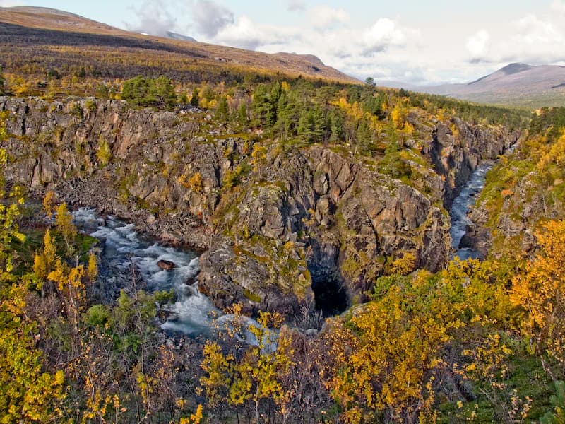
Øvre Dividal National Park landscape and geographic character

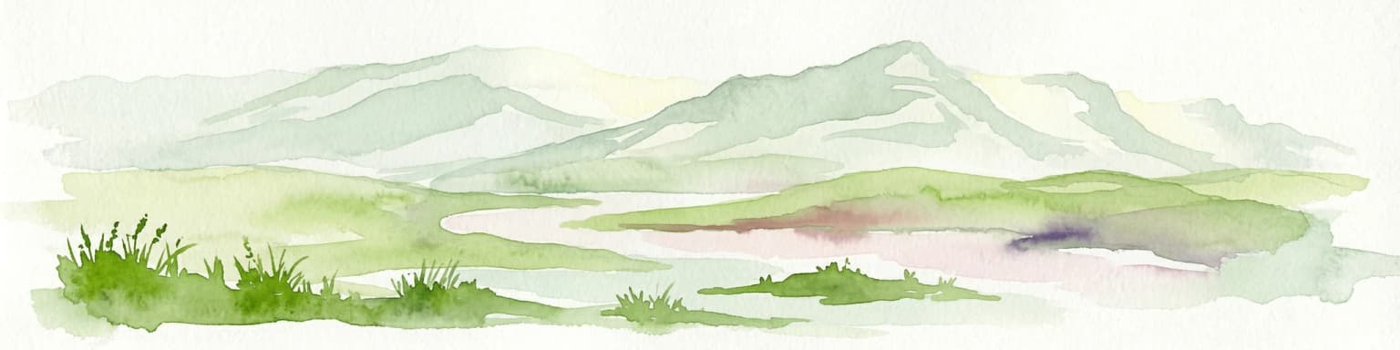
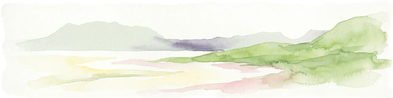
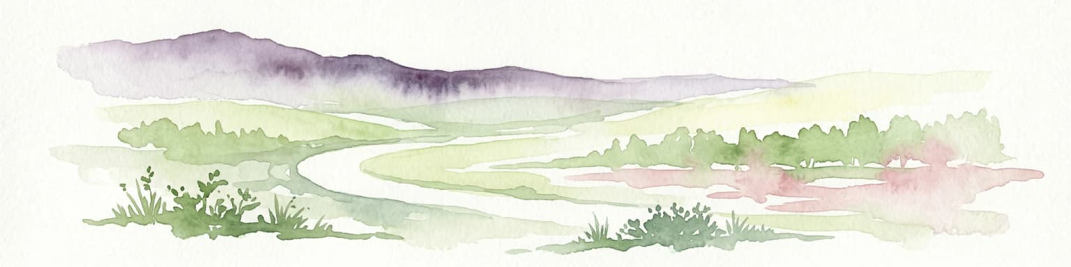
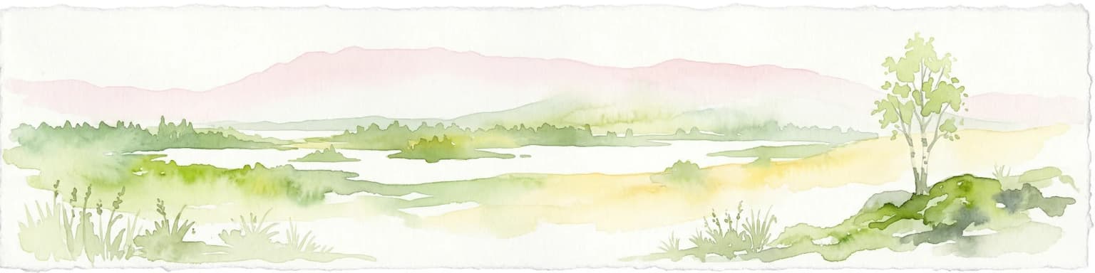
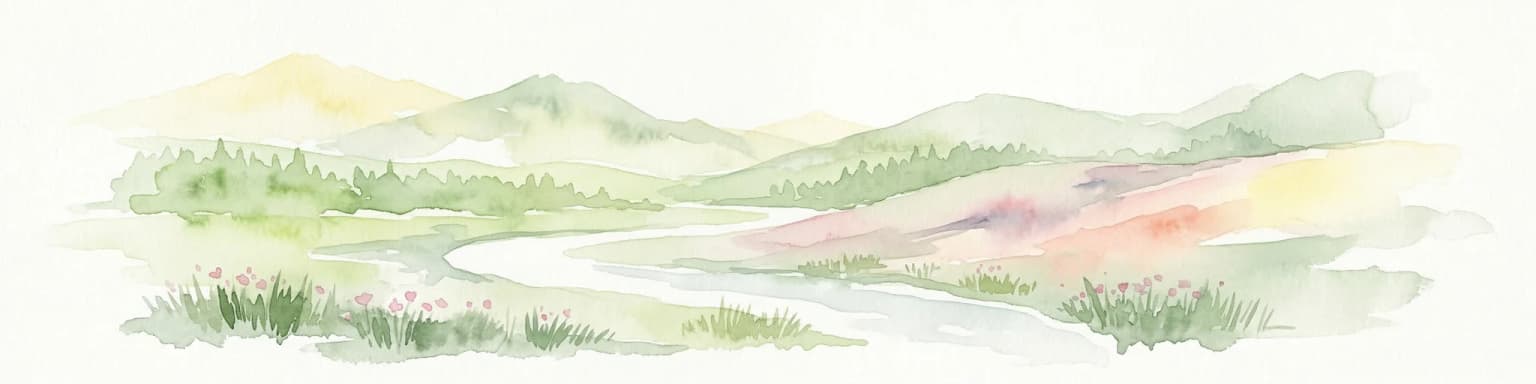
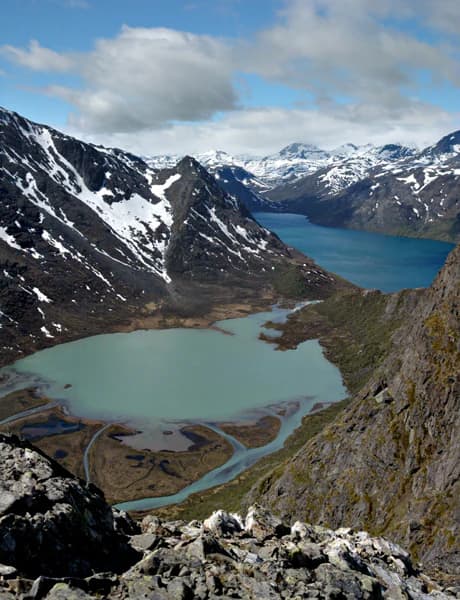
The landscape of Øvre Dividal National Park is characterized by dramatic Arctic alpine terrain that reflects both glacial and fluvial processes acting over millennia. The valley floor sits at approximately 228 meters above sea level, though the park extends up to 1,600 meters in elevation, creating substantial topographical variation. The underlying bedrock consists of conglomerate, sandstone, and slate—sedimentary formations that have been sculpted by water and ice into the terrain visible today. Several rivers, most notably the Divi River (Divielva), have carved ravines through the landscape, creating steep-sided valleys and waterfalls that add to the scenic complexity. A distinctive geological feature is the presence of large glacial erratics—rocks transported by ice-age glaciers and deposited in seemingly unlikely locations when the ice retreated. These scattered boulders, often sitting atop smoother terrain, serve as reminders of the park's glacial past. The landscape transitions from forested valley bottoms through birch-dominated slopes to open alpine tundra at higher elevations, creating a visual gradient that exemplifies the Arctic alpine environment. The semi-arid character of the valley, with only 282 millimeters of annual precipitation, contributes to an open landscape with limited dense vegetation in the lower reaches.

Øvre Dividal National Park ecosystems, habitats, and plant life

The ecological character of Øvre Dividal National Park is defined by a remarkable vertical zonation that packs multiple distinct habitat types into a relatively limited elevation range. At the lowest elevations, pine forests dominate, representing the northern limit of some species' range. These give way upward to mountain birch woodlands, Norway's characteristic subalpine forest type, which forms a transitional zone between boreal forest and open tundra. Higher still, willow and dwarf birch form shrubland that transitions into open alpine tundra, where only the most hardy plants survive the harsh conditions. Some grey alder grows along the Divi River, adding to the botanical diversity. A total of 315 plant species have been recorded within the park, including the Arctic rhododendron (Rhododendron lapponicum), which reaches its northern natural distribution in this area. The park's climate is characterized by continental extremes—mean annual temperature of 0.8°C with January averages at -9°C and July at 13°C. Permafrost is absent at lower elevations but becomes common above 700 meters, influencing soil conditions and plant community distribution. This combination of elevational zonation, continental climate, and relatively low precipitation creates ecological conditions found nowhere else in Norway.

Øvre Dividal National Park wildlife and species highlights

The wildlife community of Øvre Dividal National Park is notable for the presence of all four mainland large predators, making it one of Norway's most ecologically significant protected areas for carnivore conservation. Brown bears, wolves, wolverines, and lynx all occur within the park, though wolf populations are rare and may not maintain a permanent presence. The wolverine population is particularly robust, with the area supporting one of the highest densities of this formidable mustelid in Scandinavia. Wolverines are well-adapted to the harsh Arctic environment and are efficient predators and scavengers. Large herbivores are represented by moose and reindeer, with the latter being owned by Sami herders and representing the continuation of traditional pastoral practices in the region. The Arctic fox, once present in the area, historically inhabited the park though its current status is less certain. This predator community, combined with the diverse habitats created by the park's elevational gradient, makes Øvre Dividal ecologically significant within the Nordic context, particularly as these species require large territories and intact ecosystems to thrive.

Øvre Dividal National Park conservation status and protection priorities

Øvre Dividal National Park serves as a core protected area within a larger transboundary wilderness complex that extends into Sweden and encompasses adjacent undisturbed areas in Norway. This regional conservation context is significant because many of the species found in the park—including the large predators—require extensive territories that cross national boundaries. The park's designation as IUCN Category II reflects its primary purpose of protecting natural ecosystems while allowing for compatible sustainable use. The protection of the park's Arctic alpine environment is particularly important given the sensitivity of tundra and boreal ecosystems to climate change and development pressures. The semi-arid character of Dividalen, making it Norway's second-driest valley, creates conditions for plant communities found nowhere else in the country, emphasizing the irreplaceability of this protected area. The long-term conservation of this landscape also supports the traditional Sami reindeer herding practices that have shaped the region's cultural landscape over centuries.

Øvre Dividal National Park cultural meaning and human context

The cultural context of Øvre Dividal National Park is deeply connected to the Sami people, whose traditional territory encompasses this region of northern Norway. The park's Northern Sami name, Dieváidvuovddi álbmotmeahcci, reflects this indigenous connection to the landscape. Reindeer herding by Sami communities continues in and around the park today, representing a way of life that has persisted in the Arctic and sub-Arctic regions for centuries. The relationship between the Sami people and the land goes beyond economic use, encompassing spiritual and cultural connections to the terrain, seasons, and resources of the region. The name 'Dividal' itself has roots in the Northern Sami language, with 'dievvá' meaning 'round and dry hill,' demonstrating how indigenous toponymy has been incorporated into the official Norwegian naming of the area. This cultural heritage adds depth to the park's significance beyond its ecological values, representing the intersection of natural protection and cultural continuity in northern Scandinavia.

Top sights and standout views in Øvre Dividal National Park

The highlights of Øvre Dividal National Park include its unique status as one of Norway's most significant Arctic alpine wilderness areas, protecting a transboundary landscape that connects with Swedish wilderness areas. The park offers exceptional ecological diversity through its elevational gradient from pine forest through birch woodland to alpine tundra, all within a single protected area. The presence of all four mainland large predators, particularly the strong wolverine population, makes the park significant for Scandinavian carnivore conservation. The dramatic landscape features—including river-carved ravines, glacial erratics, and the distinctive semi-arid valley character—create scenic diversity uncommon in Norwegian protected areas. The Nordkalottruta trail provides backcountry access for hikers seeking to experience this remote wilderness, while the park's dry climate creates conditions that support plant species found nowhere else in Norway.

Best time to visit Øvre Dividal National Park

The best time to visit Øvre Dividal National Park is during the summer months of June through August, when temperatures are mildest and the hiking season is at its peak. July average temperatures reach 13°C, making the alpine tundra accessible for exploration. The relatively dry conditions mean that summer precipitation is lower than in coastal areas, though visitors should still be prepared for changeable weather. The short Arctic summer brings extended daylight hours, allowing for long hiking days. Autumn can also be rewarding, with the mountain birch turning golden and the landscape taking on dramatic colors, though temperatures drop quickly as September approaches. Winter visits are not practical for most visitors, as temperatures plunge to -9°C or lower in January and snow covers the terrain for much of the year. The park's continental climate means that the hiking season is shorter than in more temperate regions, but the summer months offer exceptional wilderness experiences in one of Norway's most unspoiled mountain environments.

Park location guide

Geography guide, regional context, and park location map for Øvre Dividal National Park

Øvre Dividal National Park park geography, regions, and map view in Norway
Understand where Øvre Dividal National Park sits in Norway through a broader geographic reading of the surrounding landscape, nearby location context, and its mapped position within the national park landscape.

How Øvre Dividal National Park fits into Norway

Norway, officially the Kingdom of Norway, is a Nordic country in Northern Europe located on the Scandinavian Peninsula. It encompasses mainland Norway, the Arctic islands of Svalbard and Jan Mayen, and maintains dependencies including Bouvet Island and Antarctic claims. The country has a population of about 5.6 million and is bordered by Sweden, Finland, and Russia. Norway is a unitary parliamentary constitutional monarchy with Oslo as its capital and largest city.

Wider geography shaping Øvre Dividal National Park in Norway

Norway occupies the western and northern portions of the Scandinavian Peninsula in Northern Europe. The country shares a long eastern border with Sweden, and borders Finland and Russia to the northeast. Norway has an extensive coastline facing the Skagerrak, North Sea, Norwegian Sea, and Barents Sea. The terrain is predominantly mountainous with numerous fjords along the coastline.

Map view of Øvre Dividal National Park

Use this park location map to pinpoint Øvre Dividal National Park in Norway, understand its exact geographic position, and read its mapped placement within the surrounding landscape more clearly.

Pigeon | © OpenStreetMap contributors

Location context for Øvre Dividal National Park

Målselv MunicipalityTroms
Park atlas

Trace the surrounding Arctic alpine wilderness and explore regional protected landscapes of Northern Norway.

Discover Nearby National Parks and Protected Areas Beyond Øvre Dividal National Park
Continue your journey from Øvre Dividal National Park by exploring other national parks and protected areas in the broader Nordic region. Compare varied Arctic terrains, diverse ecological gradients, and distinct glacial formations to deepen your geographical understanding of Scandinavia's conservation efforts.
National parkTroms

Rohkunborri National Park: Northern Norway's Dramatic Protected Landscape

Explore its mapped terrain, canyon, and alpine ecosystems.

Rohkunborri National Park offers a profound encounter with northern Norway's wild geography. As a designated national park in Troms county, it features the iconic Sørdalen canyon, a dominant geological feature that shapes its diverse terrain. The park's landscape encompasses a rich ecological gradient, from boreal forests to alpine tundra, supporting a variety of wildlife. This protected area is crucial for understanding Scandinavian mountain ecosystems and transboundary conservation efforts, providing rich content for atlas-based exploration of its mapped boundaries and natural context.

Area
571 km²
Established
2011
IUCN
II
Relief
Mountain
Watercolor painting showing green hills, a body of water, and distant mountains
National parkNorrbotten County

Abisko National Park

Subarctic national park with unique landscapes

Abisko National Park in Swedish Lapland offers a glimpse into dramatic subarctic terrain. Explore its protected boundaries, river canyons, and alpine tundra through structured geographic data.

Area
77 km²
Established
1909
IUCN
II
Visitors
50K annual
National parkNorrbotten County

Vadvetjåkka National Park: Arctic Mountain Landscape and Karst Terrain

Northernmost National Park in Norrbotten County, Sweden

Vadvetjåkka National Park offers a unique atlas perspective on Sweden's northernmost protected mountain landscape. Explore its remote Arctic terrain, characterized by glaciers existing at unusual low altitudes and significant karst cave systems carved into limestone bedrock. This is a vital point for understanding the mapped geography and protected natural features of Norrbotten County and Swedish Lapland.

Area
26.3 km²
Established
1920
IUCN
II
Relief
Mountain
National parkTroms

Reisa National Park: Dramatic River Valley and Protected Landscape Atlas

Subarctic terrain and geographic context in Troms, Norway.

MoriAtlas offers detailed geographic context for Reisa National Park, a protected landscape in Norway's Troms county. Explore the park's identity as a significant subarctic river valley, carved by the Reisa River into a dramatic canyon system. This page provides insights into its mapped natural features, regional landscape setting, and its importance within the broader atlas of protected areas. Understand the park's protected boundaries and terrain for structured geographic discovery.

Area
803 km²
Established
1986
IUCN
II
Relief
Mixed relief
National parkSenja

Ånderdalen National Park: Ancient Coastal Pine Forest and Glacial Valley Landscape

Norway's protected area within the Senja region.

Delve into the detailed protected landscape of Ånderdalen National Park, a national park located on Norway's Senja island. This entry offers a focused atlas exploration of its unique geographic features, including its celebrated ancient coastal pine forest, dramatic glacial valleys carved from granite, and its significance as a representative example of the northern Norwegian coastal mountain terrain. Understand the mapped boundaries and the natural context of this vital conservation area.

Area
134 km²
Established
1970
IUCN
II
Relief
Mixed relief
Watercolor painting of a landscape featuring a body of water, green fields, a single tree, and distant mountains under a light sky
National parkNorrbotten County

Stora Sjöfallet National Park: Protected Arctic Landscape in Norrbotten County

Explore mapped terrain and regional geography.

Stora Sjöfallet National Park stands as a significant protected landscape within Norrbotten County, Sweden, renowned for its striking Arctic mountain scenery centered on the Áhkká massif. As a key component of the Laponian Area UNESCO World Heritage Site, its vast expanse of over 1,278 square kilometers offers critical insights into subarctic ecosystems, glacial terrain, and the mapped boundaries of a protected natural territory. Discover the unique geographic features and ecological value of this expansive national park.

Area
1,278 km²
Established
1909
IUCN
II
Relief
Mountain
Watercolor illustration of a mountainous landscape with a river, grass, and distant hills
National parkNorrbotten County

Sarek National Park: Mapping Sweden's Rugged Alpine Wilderness and Glacial Terrain

Explore the mapped geography of Norrbotten County's largest alpine national park.

Sarek National Park represents the heart of Sweden's alpine wilderness, a protected landscape defined by its towering mountain peaks, expansive glaciers, and deeply carved glacial valleys. Situated in Norrbotten County, the park's geography is characterized by a remote and rugged terrain, making it a prime destination for understanding high-altitude natural environments through mapped context. Discover the unique contours of this iconic national park and its place within the broader regional geography of Swedish Lapland.

Area
1,970 km²
Established
1909
IUCN
II
Relief
Mountain
Watercolor illustration showing mountains, a lake, and rolling hills
National parkNordland

Møysalen National Park: Coastal Alpine Protected Landscape in Nordland, Norway

Mapped boundaries, dramatic terrain, and coastal ecosystems.

Møysalen National Park offers a compelling study in coastal alpine geography, situated within Nordland county, Norway. This protected area is renowned for its dramatic mountain scenery where peaks plunge directly into the sea and deep fjords. The park's 51 square kilometres encompass a unique ecological transition from alpine summits to sea level, featuring jagged peaks, sheltered valleys with birch forests, and coastal wetlands. Explore the mapped landscape of this distinctive Norwegian national park and understand its place in regional geography and protected land networks.

Area
51 km²
Established
2003
IUCN
II
Relief
Mountain

Common questions about visiting, size, designation, and location context for Øvre Dividal National Park

Øvre Dividal National Park FAQs for park facts, access, geography, and protected area context
Find quick answers about Øvre Dividal National Park, including protected-area facts, park geography, trail and visitor context, and how the park fits into its surrounding country and regional landscape.
MoriAtlas Explorer

Continue Your Protected Areas Search Across the Global Atlas

Deepen your exploration by continuing the structured search for national parks and protected areas worldwide. Utilize the comprehensive filtering capabilities to compare different conservation landscapes and refine your understanding of global park geography. Discover more about the distribution and characteristics of protected natural areas.

Global natural geography