Mori Atlas logo
National parkAnárjohka National Park

Discover the geographic scope and unique subarctic terrain of this extensive national park.

Anárjohka National Park: Mapped Protected Landscape on Norway's Finnmarksvidda Plateau

(Anárjohka nasjonalpark)

Anárjohka National Park represents a significant protected area, spanning approximately 1,409 square kilometers of pristine subarctic wilderness on the Finnmarksvidda plateau in Norway. This national park showcases a distinct landscape characterized by rolling birch woodlands, open pine barrens, extensive bog systems, and numerous lakes, offering a rich context for geographic exploration. Situated within Karasjok Municipality, Anárjohka National Park is an integral part of the Scandinavian Arctic's protected land network and a crucial area for understanding regional geography and mapped natural terrain.

National ParkNorwaySubarctic WildernessFinnmarkSami CultureBirch Forest

Anárjohka National Park

National park

Park overview

Structured park overview, official facts, and landscape profile for Anárjohka National Park

Anárjohka National Park park facts, protected area profile, and essential visitor context
Review the core facts for Anárjohka National Park, including designation, size, terrain, visitor scale, habitats, and operating context in one park-focused overview.

About Anárjohka National Park

Anárjohka National Park represents one of Norway's most significant protected areas in the subarctic zone, encompassing a landscape that has remained largely untouched by modern development. The park sits on the Finnmarksvidda, a vast inland plateau that stretches across northern Finland and Norway, forming one of Scandinavia's last great wilderness areas. This region experiences a continental subarctic climate characterized by long, cold winters where temperatures routinely drop well below freezing, and short but relatively warm summer periods that allow the brief growing season to sustain the fragile tundra ecosystem.

The park's terrain is characterized by a mosaic of birch-dominated woodland in the more sheltered valleys and slopes, giving way to open pine barrens on exposed ridges and higher ground. Extensive bog systems, formed over millennia of peat accumulation, punctuate the landscape and play a critical role in water regulation and carbon storage. The numerous lakes scattered throughout the park provide critical habitat for both resident and migratory fish species, while also serving as important feeding grounds for waterfowl.

The ecological significance of Anárjohka extends beyond its borders, forming part of a transboundary conservation network with adjacent Finnish protected areas. This cross-border cooperation helps maintain ecological corridors that allow wildlife to move freely across the region, supporting genetic exchange between populations and resilience against environmental changes. The park's position on the inland plateau places it away from the moderating influence of the sea, resulting in temperature extremes that have shaped the unique adaptations of the flora and fauna found here.

Quick facts and research context for Anárjohka National Park

Anárjohka National Park lies in Finnmark county, Norway's northernmost region, on the interior Finnmarksvidda plateau at approximately 68.7°N latitude. The park was established in 1976 and is managed by the Norwegian Environment Agency. It encompasses 1,409 km² of subarctic terrain including birch forest, pine barrens, peat bogs, and lake systems. The park borders Lemmenjoki National Park in Finland to the east. The area is characterized by extreme continental climate with cold winters and brief summers, supporting a unique subarctic ecosystem adapted to these harsh conditions.

Park context

Deeper park guide and search-rich context for Anárjohka National Park

Anárjohka National Park history, landscape, wildlife, and travel context
Explore Anárjohka National Park through its history, landscape character, ecosystems, wildlife, conservation priorities, cultural context, and seasonal travel timing in a structured park guide built for atlas discovery and search intent.

Why Anárjohka National Park stands out

Anárjohka is best known for its pristine subarctic wilderness on the Finnmarksvidda, one of Europe's last great untouched inland areas. The park protects extensive birch woodland ecosystems that transition into open pine barrens and vast peat bogs, creating a landscape of remarkable ecological diversity within the boreal forest zone. The area is particularly significant for its reindeer husbandry traditions, with the park containing 12 winter grazing units that sustain semi-nomadic Sami reindeer herding. The park also serves as a refuge for populations of brown bear and wolverine, species that are rare elsewhere in Norway.

Mountainous landscape with turquoise lake, snow-capped peaks, rocky terrain, and partly cloudy sky
Panoramic view of snow-capped mountains and turquoise lake under partly cloudy sky

Anárjohka National Park history and protected-area timeline

Anárjohka National Park was established in 1976 as part of Norway's expansion of protected areas during the late 20th century. The park was initially named Øvre Anárjohka National Park, using the Norwegian word for "upper" to reference the upper reaches of the Anárjohka River that flows through the area. In 2021, the park's official name was changed to simply Anárjohka National Park, dropping the geographic qualifier while preserving the original Sami-derived name.

A significant development occurred in 2009 when a process was initiated to expand the national park by adding approximately 624.6 square kilometres of adjacent territory. This expansion would have increased the protected area by nearly 45%, reflecting growing recognition of the region's ecological significance. However, the expansion proposal was cancelled in 2015 following opposition from local communities, illustrating the complex balance between conservation objectives and traditional land use practices in Sami territory. The local communities, particularly those engaged in reindeer herding, expressed concerns about the implications of expanded protection for their traditional economic activities, demonstrating the ongoing challenges of managing protected areas within living cultural landscapes.

Anárjohka National Park landscape and geographic character

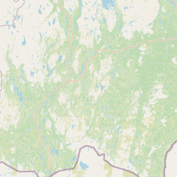
The physical landscape of Anárjohka National Park is defined by its position on the Finnmarksvidda plateau, a vast expanse of gently undulating terrain that represents one of Europe's most extensive flatland areas north of the Arctic Circle. The elevation ranges are relatively modest, with the landscape characterized by smooth hillsides, broad valleys, and extensive flat areas where glacial deposits have created the underlying topography. The underlying geology consists primarily of ancient Precambrian bedrock covered by glacial deposits and a thick layer of podzol soils that have developed under the boreal forest vegetation.

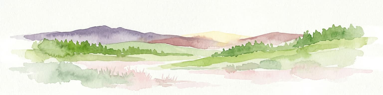
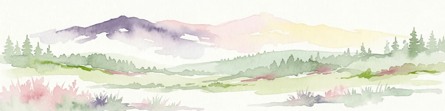
The park's vegetation follows distinct patterns dictated by local conditions, with birch woodland dominating the valleys and lower slopes where snow accumulation provides insulation through the winter months. These birch forests represent the northern limit of tree growth in continental Europe in some areas, forming a transition zone between the boreal forest to the south and the open tundra beyond. On drier, more exposed sites, pine dominates, creating open woodland or barrens where the trees are widely spaced and the ground cover shifts to heath vegetation dominated by lingonberry, blueberry, and various mosses and lichens.

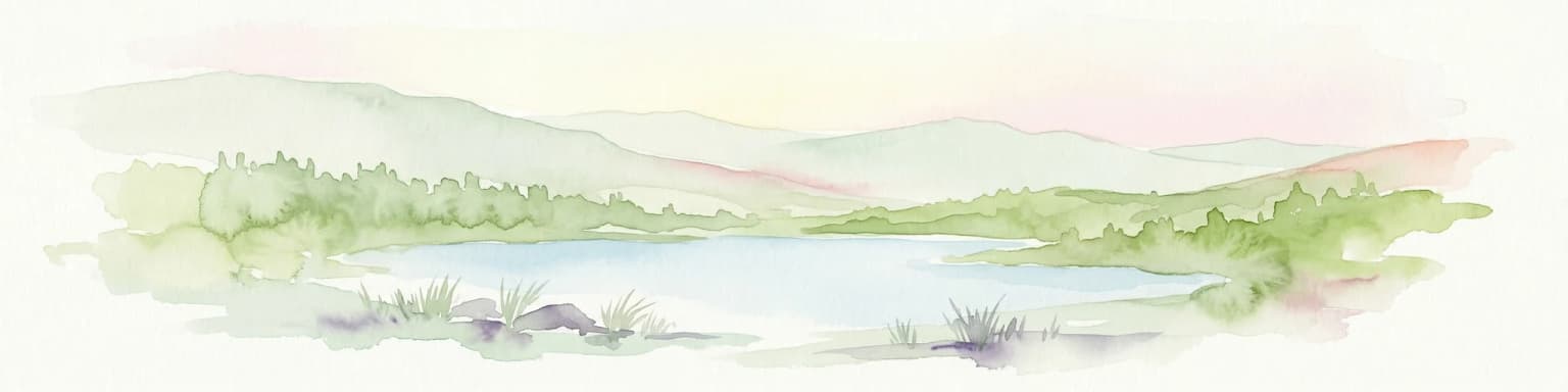
Water is a defining feature of the landscape, with numerous lakes of varying sizes scattered across the plateau and numerous streams connecting them. The lakes occupy depressions left by glacial activity and are often bordered by peat bogs that extend into the water. These wetland areas are particularly extensive in the lower-lying portions of the park, creating a landscape where water, forest, and open bog intermingle in complex patterns that change with the seasons as water levels fluctuate and frozen ground creates different drainage patterns.

Anárjohka National Park ecosystems, habitats, and plant life

The ecological character of Anárjohka reflects its position in the boreal/subarctic transition zone, where continental climate conditions create a distinctive set of habitats supporting species assemblages that differ from both the more maritime forests of coastal Norway and the true Arctic tundra further north. The birch woodlands represent the southern limit of subarctic birch forest in this part of Scandinavia, while the pine barrens extend the boreal forest character into areas too harsh for successful birch growth.

The peat bog systems within the park constitute one of its most ecologically significant features, representing both important carbon stores and unique habitats for specialized flora. These bogs have developed over thousands of years as Sphagnum mosses have accumulated faster than they decompose in the cold, wet conditions, building up layers of peat that now support a distinctive community of plants adapted to nutrient-poor, acidic conditions. The bog vegetation is dominated by cottongrass, various dwarf shrubs, and a distinctive assemblage of bog-orchids, while the margins where bog transitions to forest provide important habitat for species like the globally significant Scandinavian population of bean geese.

The lake systems support productive aquatic ecosystems despite the short growing season, with the clear, cold waters providing ideal conditions for species like brown trout, Arctic char, and grayling. The fish populations, in turn, support populations of piscivorous birds including various diving ducks and mergansers, while the lakes themselves serve as important nesting sites for red-throated divers and other waterfowl species that migrate to the Arctic to breed during the brief summer period.

Anárjohka National Park wildlife and species highlights

The wildlife community of Anárjohka reflects both the subarctic location and the variety of habitats found within the park, creating an ecosystem where species from both northern and boreal zones coexist. The largest mammal species present is the moose, though these animals frequently migrate to more forested areas outside the park during winter when deep snow makes movement difficult in the more open terrain of the plateau. The park is more significantly defined during winter by the presence of large herds of reindeer, which occupy the 12 designated winter grazing units within the park from November through April, completely dominating the landscape during these months.

The park provides important habitat for some of Norway's rarest large carnivores, with brown bears maintaining winter dens within the park boundaries, making it one of the most important bear conservation areas in the country. Wolverines, though present, are more secretive and only visit the area sporadically. Smaller predators including red fox and stoat are common throughout the park, their populations fluctuating in response to cycles in small rodent abundance that characterize the Arctic ecosystem.

Small rodent populations, particularly lemmings, field voles, root voles, and northern water voles, form the base of the food web for many predators and exhibit dramatic population cycles that influence predator populations throughout the region. The northern red-backed vole, a characteristic Siberian species, is particularly associated with the old-growth birch forests of the park. The fish community is diverse, with species including salmon, trout, grayling, pike, perch, and the more restricted Arctic char found in only one of the park's lakes.

Anárjohka National Park conservation status and protection priorities

Anárjohka National Park plays a critical role in Norway's conservation network as one of the largest protected areas in the country's northern region and as a core area within the transboundary Fennoscandian Green Belt that connects protected areas across Norway, Finland, and Russia. The park is designated under IUCN Category II, reflecting its primary purpose of protecting natural ecosystems while allowing for the continuation of traditional Sami land uses including reindeer husbandry, which is permitted within the park boundaries under careful management arrangements.

The conservation significance of the park extends beyond its borders through its role in protecting the Finnmarksvidda plateau, which represents one of Europe's last remaining large intact wilderness areas. This continental subarctic landscape has escaped the extensive fragmentation that has affected most European forests, maintaining ecological processes and species assemblages that have been lost or heavily modified in more densely populated regions. The park's wetland systems, particularly the extensive bog complexes, represent significant carbon stores whose protection contributes to climate mitigation efforts.

The management approach recognizes that this is a living cultural landscape where conservation must be balanced with the traditional rights and practices of the Sami people. The 2009 proposal to expand the park, which was ultimately cancelled in 2015, highlighted the ongoing challenges of reconciling conservation ambitions with local community needs and traditional land uses, a theme that continues to shape management decisions throughout the Arctic region.

Anárjohka National Park cultural meaning and human context

Anárjohka National Park lies at the heart of Sami ancestral territory in Norway, an area where the Indigenous Sami people have maintained their traditional way of life for centuries. The park's name itself derives from the Northern Sami language, with "johka" meaning "river," connecting the protected area to the linguistic and cultural heritage of the Sami people. The region surrounding the park has been inhabited by the Sami for millennia, with archaeological evidence of human presence in the Finnmarksvidda dating back thousands of years.

The most significant continuing cultural practice within the park is semi-nomadic reindeer husbandry, which remains central to the Sami economy and identity in this region. The 12 winter grazing units within the park represent traditional grazing areas that have been used by Sami reindeer herders for generations, and the seasonal movement of reindeer herds through the park maintains a cultural landscape that has been shaped by these practices over centuries. This integration of traditional land use with protected area management represents a model for recognizing Indigenous rights within conservation frameworks.

The municipalities of Karasjok and Kautokeino, which encompass the park, are centers of Sami culture in Norway, with strong traditions of duodji (traditional Sami crafts), joik (traditional Sami singing), and other cultural practices that continue to thrive in these northern communities. The park exists within this living cultural context, requiring management approaches that respect both ecological conservation objectives and the cultural rights and traditions of the Indigenous communities whose ancestral lands the park encompasses.

Top sights and standout views in Anárjohka National Park

Anárjohka National Park protects one of Europe's last great subarctic wilderness areas, the vast Finnmarksvidda plateau, where intact birch forests, open pine barrens, and extensive bog systems create a landscape of remarkable ecological value. The park supports significant populations of brown bear and wolverine, species that are rare elsewhere in Norway, while the winter months bring large herds of reindeer that have shaped the cultural landscape for centuries. The transboundary location bordering Finland's Lemmenjoki National Park creates one of the largest protected area complexes in northern Europe, supporting ecological connectivity across the Scandinavian Arctic. The park's Sami cultural heritage, reflected in both the place name and the ongoing traditional reindeer husbandry practices, adds depth to the conservation narrative, demonstrating how Indigenous knowledge and practices have shaped this northern landscape.

Best time to visit Anárjohka National Park

The best time to visit Anárjohka National Park depends on the experience sought, with the brief summer season from June through August offering the most accessible conditions for visitors. During this period, the midnight sun provides extended daylight hours, temperatures are relatively mild for the Arctic, and the landscape is alive with breeding birds and active wildlife. The birch forests are in full leaf, the bogs are carpeted with flowers, and the lakes are free of ice, creating optimal conditions for hiking, fishing, and experiencing the subarctic environment. Winter visitors, however, experience a dramatically different landscape where snow-covered terrain, frozen lakes, and the possibility of viewing the northern lights offer their own appeal, though the extreme cold and limited daylight require careful preparation. The reindeer-dominated period from November through April defines the park's character in winter, when the herds move onto the plateau and create a quintessential Arctic experience.

Park location guide

Geography guide, regional context, and park location map for Anárjohka National Park

Anárjohka National Park park geography, regions, and map view in Norway
Understand where Anárjohka National Park sits in Norway through a broader geographic reading of the surrounding landscape, nearby location context, and its mapped position within the national park landscape.

How Anárjohka National Park fits into Norway

Norway, officially the Kingdom of Norway, is a Nordic country in Northern Europe located on the Scandinavian Peninsula. It encompasses mainland Norway, the Arctic islands of Svalbard and Jan Mayen, and maintains dependencies including Bouvet Island and Antarctic claims. The country has a population of about 5.6 million and is bordered by Sweden, Finland, and Russia. Norway is a unitary parliamentary constitutional monarchy with Oslo as its capital and largest city.

Wider geography shaping Anárjohka National Park in Norway

Norway occupies the western and northern portions of the Scandinavian Peninsula in Northern Europe. The country shares a long eastern border with Sweden, and borders Finland and Russia to the northeast. Norway has an extensive coastline facing the Skagerrak, North Sea, Norwegian Sea, and Barents Sea. The terrain is predominantly mountainous with numerous fjords along the coastline.

Map view of Anárjohka National Park

Use this park location map to pinpoint Anárjohka National Park in Norway, understand its exact geographic position, and read its mapped placement within the surrounding landscape more clearly.

Pigeon | © OpenStreetMap contributors

Location context for Anárjohka National Park

FinnmarkKarasjok MunicipalityKautokeino Municipality

Explore Anárjohka's Unique Subarctic Scenery: Mapped Habitats, Boreal Forests, and Extensive Peat Bogs

Anárjohka National Park Photos: Visualizing Subarctic Wilderness Landscapes and Environments
Browse a curated visual gallery of Anárjohka National Park, revealing its vast subarctic wilderness, undulating Finnmarksvidda plateau, and diverse boreal ecosystems. Understand the distinct character of its birch woodlands, open pine barrens, numerous lakes, and extensive bog systems that define this protected Norwegian landscape.

Mountainous landscape with turquoise lake, snow-capped peaks, rocky terrain, and partly cloudy sky

Park atlas

Map the interconnected protected landscapes of Norway's Finnmarksvidda and the broader Scandinavian Arctic

Discover Protected Areas and National Parks Near Anárjohka National Park in Karasjok Municipality
Explore national parks and protected areas bordering or adjacent to Anárjohka National Park, tracing the unique subarctic wilderness and extensive wetland systems of Finnmarksvidda. Compare different conservation landscapes, understand regional ecological connectivity, and gain deeper geographic context beyond Karasjok Municipality for atlas-style exploration.
National parkFinland

Lemmenjoki National Park: Finland's Protected Landscape Geography

Explore mapped park boundaries and regional natural context.

Lemmenjoki National Park is a vital protected area situated within Finland's vast northern geography. This page details its designation as a national park, offering a clear view of its mapped boundaries and landscape character. Users can explore the park's geographic context within Finland and understand its contribution to the region's network of conservation lands, facilitating structured atlas-style discovery.

Area
2,850 km²
Established
1956
IUCN
Ib
Visitors
21.1K annual
Watercolor painting showing rolling hills, forests, and distant mountains under a soft sky
National parkLapland

Pallas-Yllästunturi National Park: Lapland's Premier Protected Fell Landscape for Atlas Exploration

Explore its ancient mountain geography and mapped protected area.

Pallas-Yllästunturi National Park presents a unique atlas of Lapland's ancient geography, characterized by a vast chain of rounded fells that are the remnants of three-billion-year-old mountains. As Finland's most popular national park, it offers a deep dive into protected landscape discovery, showcasing diverse boreal forests, mires, and exceptional fell terrain. Understand its geographic scope and protected boundaries for comprehensive map-based exploration.

Area
1,020 km²
Established
2005
IUCN
II
Visitors
598.8K annual
National parkTroms

Reisa National Park: Dramatic River Valley and Protected Landscape Atlas

Subarctic terrain and geographic context in Troms, Norway.

MoriAtlas offers detailed geographic context for Reisa National Park, a protected landscape in Norway's Troms county. Explore the park's identity as a significant subarctic river valley, carved by the Reisa River into a dramatic canyon system. This page provides insights into its mapped natural features, regional landscape setting, and its importance within the broader atlas of protected areas. Understand the park's protected boundaries and terrain for structured geographic discovery.

Area
803 km²
Established
1986
IUCN
II
Relief
Mixed relief
National park

Stabbursdalen National Park: Protected Arctic Landscape and Northernmost Pine Forest Atlas

Explore Finnmark's unique geography and protected terrain.

Stabbursdalen National Park preserves a remarkable ecological boundary, featuring the planet's northernmost Scots pine woodland within a dramatic Arctic landscape. This protected area offers a deep dive into rugged mountain terrain, river valley formations, and vital wetland habitats. As a key component of Norway's protected lands, it provides essential context for understanding regional geography and the limits of forest ecosystems on the mapped landscape.

Area
747 km²
Established
1970
IUCN
II
Relief
Mixed relief
National parkLapland

Urho Kekkonen National Park: Detailed Map and Protected Landscape Exploration in Lapland

Discover Finland's expansive Arctic wilderness and fell terrain.

Urho Kekkonen National Park represents a significant portion of Finland's protected Arctic landscape, offering a rich opportunity for geographic and atlas-based discovery. This national park in Lapland showcases dramatic fell formations, boreal forests, and extensive wetlands, with mapped boundaries that define its wild eastern reaches and more accessible western trails. Users can explore the unique terrain and understand its place within the broader regional geography, appreciating the vastness of this protected natural area.

Area
2,550 km²
Established
1983
IUCN
II
Visitors
435.9K annual
National park

Øvre Pasvik National Park: Norway's Pristine Siberian Taiga & Mapped Boreal Geography

Explore ancient forests, wetlands, and transboundary protected landscapes.

Øvre Pasvik National Park is a landmark protected area in Northern Norway, showcasing a remarkably intact Siberian taiga ecosystem characterized by ancient Scots pine forests and extensive wetlands. This national park offers a unique geographic perspective with its notably flat terrain, distinguishing it within the broader Norwegian atlas. As part of the Pasvik, Inari Trilateral Park, it highlights significant transboundary conservation efforts and provides a valuable mapped resource for understanding European boreal landscapes and their unique wildlife habitats.

Area
119 km²
Established
1970
IUCN
II
Relief
Lowland
National parkFinnmark

Seiland National Park: Arctic Island Landscape and Northernmost Scandinavian Glaciers

Mapped boundaries of protected terrain in Finnmark

Seiland National Park offers a distinct glimpse into Arctic island geography, renowned for protecting Scandinavia's northernmost glaciers. This protected area in Finnmark features a dramatic landscape shaped by glaciated mountains, deep coastal fjords, and alpine terrain, making it a key destination for understanding Nordic natural environments. MoriAtlas facilitates exploration of its mapped boundaries and the unique combination of glacial and marine ecosystems present.

Area
316 km²
Established
2006
IUCN
II
Relief
Mountain
National parkTroms

Øvre Dividal National Park: Arctic Alpine Protected Landscape in Troms, Norway

Mapped boundaries and unique ecological terrain of a pristine wilderness.

Øvre Dividal National Park stands as a premier example of Arctic alpine wilderness, meticulously preserved as a national park in Norway's Troms region. This entry facilitates a detailed exploration of its mapped protected boundaries and the distinct elevational ecological zones, from boreal forests to high-altitude tundra. Gain geographic context for this vital landscape, which supports diverse habitats and contributes to Scandinavia's largest contiguous wilderness areas.

Area
750 km²
Established
1971
IUCN
II
Relief
Mountain

Common questions about visiting, size, designation, and location context for Anárjohka National Park

Anárjohka National Park FAQs for park facts, access, geography, and protected area context
Find quick answers about Anárjohka National Park, including protected-area facts, park geography, trail and visitor context, and how the park fits into its surrounding country and regional landscape.
MoriAtlas Explorer

Continue Your Protected Areas Search Across the Global Atlas

Deepen your exploration by continuing the structured search for national parks and protected areas worldwide. Utilize the comprehensive filtering capabilities to compare different conservation landscapes and refine your understanding of global park geography. Discover more about the distribution and characteristics of protected natural areas.

Global natural geography