Mori Atlas logo
National parkLemmenjoki National Park

Trace the mapped boundaries and regional context of this national park within Northern Europe.

Lemmenjoki National Park: A Protected Landscape in Finland's Geographic Atlas

Lemmenjoki National Park represents a significant protected area within the Nordic landscape of Finland. As a dedicated national park, its boundaries contribute to the country's mapped natural territories, offering a unique geographic entity for exploration. MoriAtlas provides structured data to understand Lemmenjoki National Park's position within Finland's extensive network of protected lands, facilitating a deeper appreciation of its regional landscape and map context.

Wilderness AreaBoreal ForestNational ParkArctic LandscapeGold ProspectingRiver Valley

Lemmenjoki National Park

National park

Park overview

Structured park overview, official facts, and landscape profile for Lemmenjoki National Park

Lemmenjoki National Park park facts, protected area profile, and essential visitor context
Review the core facts for Lemmenjoki National Park, including designation, size, terrain, visitor scale, habitats, and operating context in one park-focused overview.

About Lemmenjoki National Park

Lemmenjoki National Park represents one of the most significant wilderness protection areas in Northern Europe, serving as a cornerstone of Finland's commitment to preserving vast tracts of untouched Arctic and sub-Arctic landscape for future generations. The park's extraordinary size of 2,850 square kilometres places it among the largest protected areas in Europe, encompassing a diverse range of ecosystems from river valleys and forest wetlands to open fell landscapes. The Lemmenjoki River, stretching 80 kilometres through the park, serves as a vital ecological corridor and cultural landmark, its waters having attracted both historical and contemporary gold prospectors to its banks. The park's location in Lapland places it within one of Europe's most sparsely populated regions, where the rhythms of nature still dominate the landscape far more than human activity. Management by Metsähallitus ensures that the park maintains its wilderness character while providing sustainable access for visitors through a network of marked trails, wilderness huts, and environmental education programs. The park's transboundary relationship with Norway's Anárjohka National Park creates an international conservation corridor that supports wildlife migration and ecosystem continuity across national borders.

Quick facts and research context for Lemmenjoki National Park

Lemmenjoki National Park spans 2,850 km² (1,100 sq mi) across Lapland, Finland, making it the country's largest national park and one of Europe's biggest wilderness protected areas. Located at approximately 68.5°N latitude, well above the Arctic Circle, the park was established in 1956 and now receives approximately 21,100 visitors annually. The park is named after the 80-kilometre-long Lemmenjoki River that flows through its territory, and it shares a border with Norway's Anárjohka National Park. The area features about 60 kilometres of marked hiking trails, more than ten free wilderness huts, and three bookable accommodation huts, with the Gold Route (Kultareitti) offering a themed exploration of the region's gold prospecting heritage.

Park context

Deeper park guide and search-rich context for Lemmenjoki National Park

Lemmenjoki National Park history, landscape, wildlife, and travel context
Explore Lemmenjoki National Park through its history, landscape character, ecosystems, wildlife, conservation priorities, cultural context, and seasonal travel timing in a structured park guide built for atlas discovery and search intent.

Why Lemmenjoki National Park stands out

Lemmenjoki National Park is best known for its extraordinary vastness as Finland's largest protected wilderness area, featuring pristine boreal forests, river valleys, and Arctic tundra landscapes that remain largely untouched by modern development. The park is distinctive for its living gold prospecting tradition, where approximately 100 people continue to manually panning for gold during summer months on established claims throughout the park. The Gold Route (Kultareitti) thematic hiking trail educates visitors about this unique heritage while passing through historically significant gold fields. The park also holds special significance as a Sámi cultural landscape, where traditional reindeer herding practices intersect with conservation objectives and wilderness preservation.

Lemmenjoki National Park history and protected-area timeline

Lemmenjoki National Park was established in 1956 as part of Finland's post-war commitment to preserving representative examples of the nation's natural heritage. The park was subsequently expanded twice, growing to become Finland's largest national park by area. The history of human activity in this region stretches far deeper than the protected area designation, with the Lemmenjoki River valley serving as a pathway for settlement, trade, and resource extraction for centuries. Gold prospecting has been practiced in the region since the 19th century, creating a unique cultural layer that continues to define the park's character. A significant turning point occurred in 2020 when mechanized gold mining was definitively banned following the expiration of a nine-year transition period that began after legislative reforms in 2011. This policy shift reflected growing recognition that mechanized mining practices were incompatible with the park's wilderness protection objectives, having caused environmental degradation through soil disturbance, water quality impacts, and disruption to both aquatic ecosystems and Sámi traditional livelihoods. All former operators were required to remove machinery and restore disturbed areas by 2022. Today, gold prospecting continues using traditional manual methods only, preserving this cultural practice while protecting the park's ecological integrity.

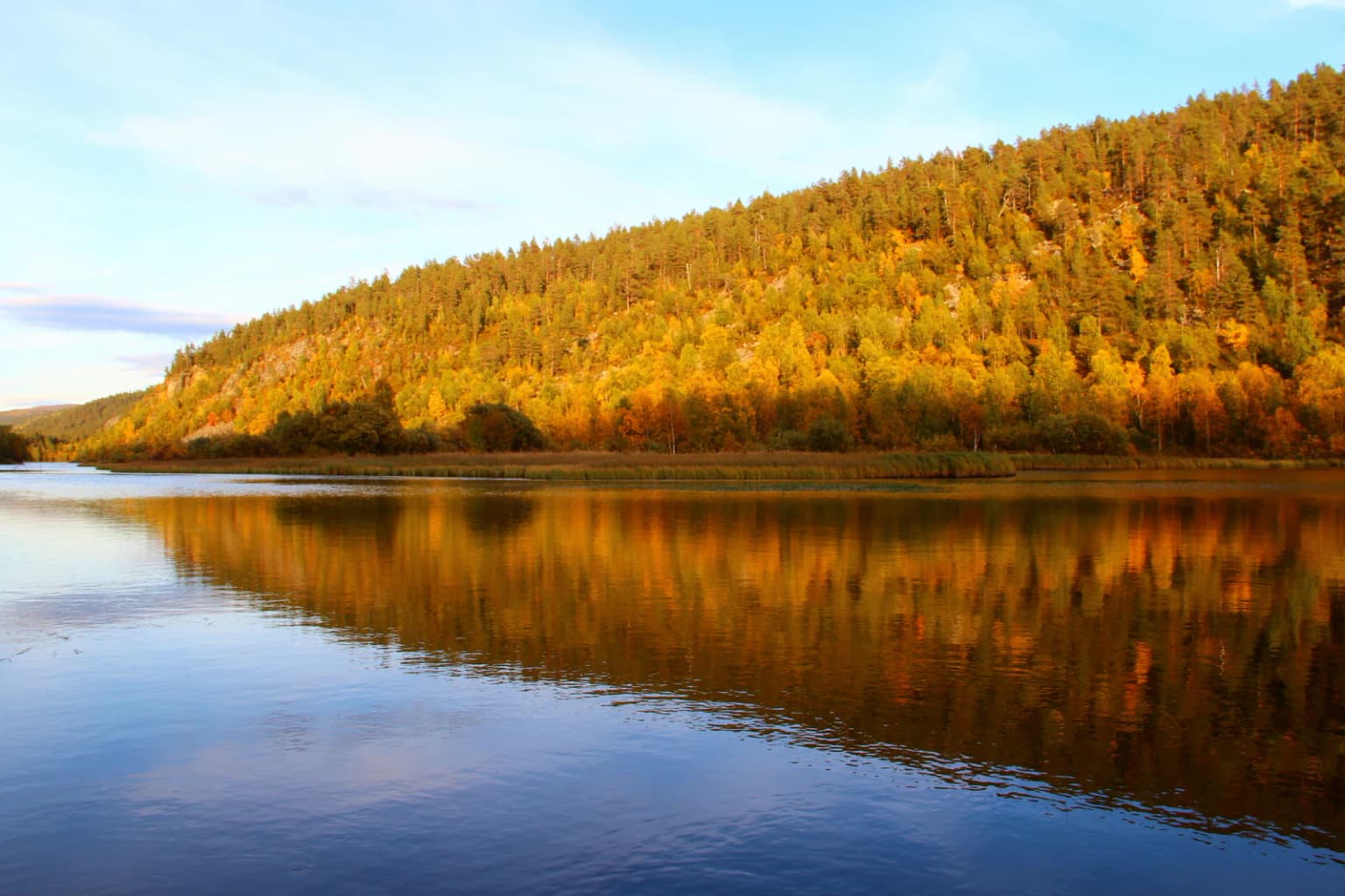
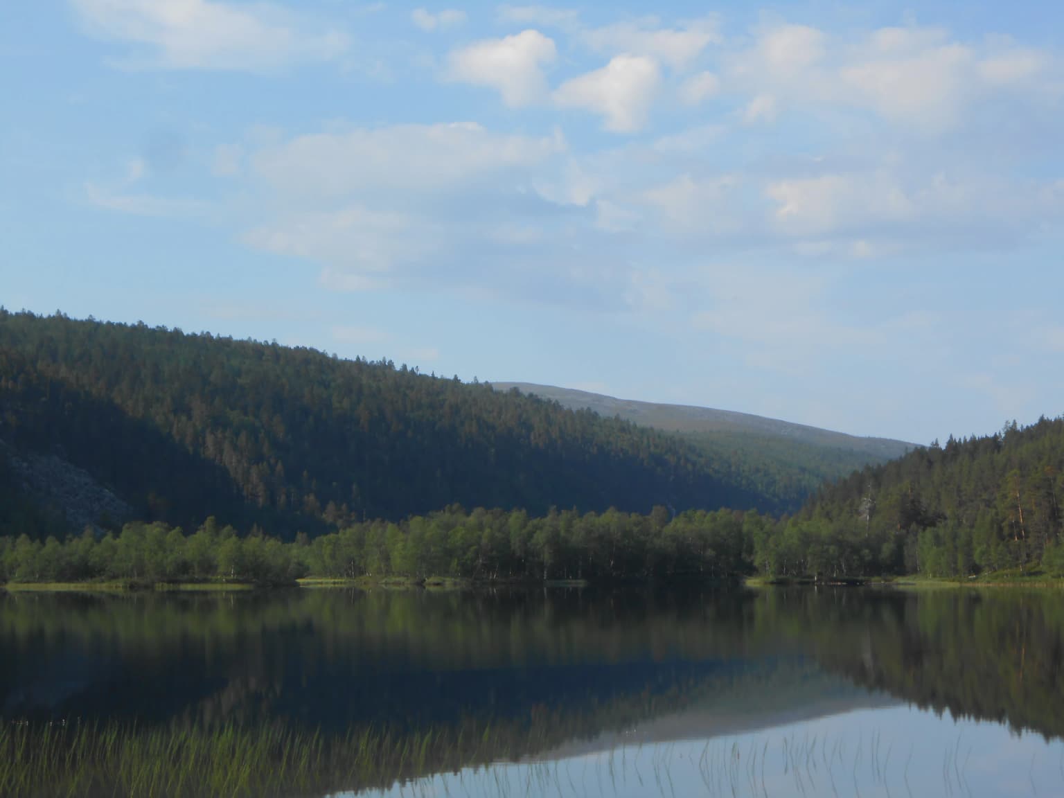
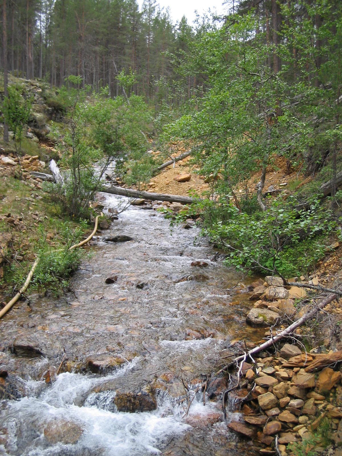
Lemmenjoki National Park landscape and geographic character

The landscape of Lemmenjoki National Park exemplifies the dramatic Arctic and sub-Arctic terrain of northern Finland, characterized by extensive boreal forest systems, winding river valleys, open heathlands, and scattered fells rising above the tree line. The Lemmenjoki River, flowing for 80 kilometres through the park, has carved a distinctive valley that serves as the park's central geographic feature, its course marked by gravel bars, river rapids, and riparian zones that contrast with the surrounding coniferous forests. The terrain varies from relatively flat marshy areas to gentle hills, with the landscape transitioning from dense spruce and pine forests in lower elevations to birch woodland and finally open alpine or sub-alpine tundra at higher elevations. The park's northern location well above the Arctic Circle means that the landscape experiences dramatic seasonal transformations, from the brief but intense growing season of summer to the prolonged snow-covered winter that defines the region for most of the year. The presence of the gold-bearing river terraces and glacial deposits adds geological interest to the landscape, while the relatively low human density has allowed natural processes to shape the terrain with minimal modification.

Lemmenjoki National Park ecosystems, habitats, and plant life

Lemmenjoki National Park protects one of Finland's most extensive and least disturbed boreal forest ecosystems, representing a critical area for biodiversity conservation in the European Arctic. The park's vast territory encompasses a range of habitat types including old-growth coniferous forests, peatlands and mires, riverine environments, and sub-alpine birch woodlands. These habitats support ecological communities adapted to the harsh Arctic climate, including species tolerant of prolonged winter cold and short summer growing seasons. The protected area functions as a significant corridor for wildlife movement across the northern landscape, connecting with the transboundary Anárjohka National Park in Norway to form a larger conservation unit. The Lemmenjoki River and its tributaries support aquatic ecosystems including populations of salmonid fish, with the river's gravel-bottomed sections providing spawning habitat. The park's designation as an IUCN Category Ib wilderness area reflects the priority given to allowing natural ecological processes to proceed without significant human intervention, maintaining the area's ecological integrity as a core conservation objective.

Lemmenjoki National Park wildlife and species highlights

The wildlife of Lemmenjoki National Park reflects the Arctic and boreal character of northern Finland, with species communities adapted to the region's extreme seasonal variations. The extensive forest ecosystems provide habitat for typical northern mammal species including moose, reindeer (both wild and semi-domesticated from Sámi herding), and smaller mammals such as hares and foxes. The riparian areas along the Lemmenjoki River attract waterfowl and provide important feeding and resting habitat during migration periods. The river systems support populations of brown trout and grayling, maintaining traditional fishing opportunities that connect to the region's cultural heritage. Birdlife in the park includes species characteristic of northern boreal and Arctic environments, with the open fell areas and forest edges providing diverse nesting and foraging habitats. The park's position in Lapland places it within the range of species at the southern edge of their Arctic distribution, creating ecological significance as a transition zone between different biogeographic provinces. The wilderness character of the protected area ensures that wildlife populations can maintain natural population dynamics with minimal disturbance from human activity.

Lemmenjoki National Park conservation status and protection priorities

Lemmenjoki National Park serves as a flagship conservation area for Finland, representing the nation's commitment to protecting vast wilderness landscapes in an increasingly developed Europe. The park's IUCN Category Ib designation as a wilderness area places it among the highest protection categories for preserving natural ecosystems, emphasizing the importance of allowing ecological processes to function without significant human interference. The 2020 ban on mechanized gold mining demonstrates the park's evolving conservation priorities, transitioning from a management approach that permitted some extractive activities toward strict wilderness protection that prohibits heavy machinery and large-scale ground disturbance. This policy shift addressed concerns about environmental impacts including soil erosion, water quality degradation, disruption to fish populations, and interference with Sámi cultural practices. The restoration requirements imposed on former mining operators further reflect the park's commitment to ecological recovery and habitat restoration. The transboundary conservation relationship with Norway's Anárjohka National Park enhances the ecological significance of the protected area by creating an international wilderness corridor that supports ecosystem continuity across national borders.

Lemmenjoki National Park cultural meaning and human context

Lemmenjoki National Park exists within a landscape of deep cultural significance to the Sámi people, the indigenous inhabitants of northern Finland, Norway, and Sweden whose traditional territories include this region of Lapland. The park's Inari Sami name (Lemmee aalmuglâšmecci) and Northern Sami name (Leammi álbmotmeahcci) reflect this indigenous connection to the land, with the area serving as traditional territory for reindeer herding that remains an important cultural practice for Sámi communities. The prohibition on mechanized mining in 2020 was specifically motivated in part by concerns about impacts on Sámi traditional livelihoods, recognizing that habitat fragmentation and increased human presence from mining operations interfered with reindeer herding activities. The gold prospecting tradition, while not indigenous in origin, has become embedded in the region's cultural landscape since the 19th century, creating a unique cultural layer that distinguishes Lemmenjoki from other Finnish national parks. The Gold Route (Kultareitti) hiking trail preserves and communicates this heritage, passing through historically significant gold fields while educating visitors about prospecting methods, local legends, and regional geology.

Top sights and standout views in Lemmenjoki National Park

Lemmenjoki National Park offers visitors the rare opportunity to experience one of Europe's last great wilderness areas, with its vast 2,850 km² of protected territory providing endless possibilities for backcountry exploration. The Gold Route (Kultareitti) themed trail provides a uniquely Lemmenjoki experience, leading hikers through historic gold prospecting sites while explaining the methods and cultural significance of this enduring tradition. The park's network of over ten free wilderness huts and three bookable accommodations enables multi-day backpacking adventures through the Arctic landscape, while approximately 60 kilometres of marked trails provide accessible options for day visitors. The chance to witness traditional gold panning in action, with prospectors working the river gravels using methods unchanged for generations, offers a connection to the region's living heritage that few other protected areas can match. The park's transboundary location adjacent to Norway's Anárjohka National Park creates opportunities for international wilderness experiences that cross between countries.

Best time to visit Lemmenjoki National Park

The optimal time to visit Lemmenjoki National Park is during the summer months of June through August, when the midnight sun illuminates the Arctic landscape for extended periods, allowing for long days of exploration along the park's trails and river valleys. This period coincides with the active gold prospecting season, when visitors may observe traditional panning activities along the Lemmenjoki River. The summer also offers the most comfortable conditions for backcountry hiking, with relatively mild temperatures and abundant daylight. The shoulder seasons of late May and early September offer alternative experiences, with autumn bringing the spectacular colours of the boreal forest and spring signaling the return of migratory birds. Winter visits are possible but require specialized equipment and preparation for extreme cold and limited daylight, making them suitable only for experienced winter wilderness travelers. The park's popularity with backcountry hikers means that summer weekends can be busy, while weekday visits and the shoulder seasons offer more solitude.

Park location guide

Geography guide, regional context, and park location map for Lemmenjoki National Park

Lemmenjoki National Park park geography, regions, and map view in Finland
Understand where Lemmenjoki National Park sits in Finland through a broader geographic reading of the surrounding landscape, nearby location context, and its mapped position within the national park landscape.

How Lemmenjoki National Park fits into Finland

Finland, officially the Republic of Finland, is a Nordic country in Northern Europe with a population of 5.6 million. It borders Sweden, Norway, and Russia, with the Gulf of Bothnia to the west and the Gulf of Finland to the south. The country gained independence from Russia in 1917 and is a unitary parliamentary republic. Its landscape is characterized by extensive boreal forests and over 180,000 lakes.

Wider geography shaping Lemmenjoki National Park in Finland

Finland is located in Northern Europe, occupying a peninsula bordered by the Gulf of Bothnia to the west and the Gulf of Finland to the south. It shares land borders with Sweden to the northwest, Norway to the north, and Russia to the east. The terrain is predominantly flat with extensive forest coverage and numerous lakes.

Map view of Lemmenjoki National Park

Use this park location map to pinpoint Lemmenjoki National Park in Finland, understand its exact geographic position, and read its mapped placement within the surrounding landscape more clearly.

Pigeon | © OpenStreetMap contributors

Location context for Lemmenjoki National Park

Lapland
Park atlas

Trace the vast Arctic landscapes and connected protected areas surrounding Lemmenjoki National Park in Finland's Lapland region.

Discover More National Parks Near Lemmenjoki, Exploring Northern Finland's Protected Wilderness
Continue your exploration beyond Lemmenjoki National Park by browsing other nearby protected areas and national parks across Finland's northern Lapland. Comparing regional park geography helps reveal the wider spread of Arctic wilderness, boreal forests, and unique conservation landscapes in this expansive sub-Arctic territory.
National parkKarasjok Municipality

Anárjohka National Park: Mapped Subarctic Wilderness and Protected Landscape

Explore Norway's Finnmarksvidda plateau geography.

Anárjohka National Park, a protected area in Norway's Finnmark region, offers a compelling atlas-level view of subarctic wilderness. The park's landscape is defined by its location on the Finnmarksvidda plateau, featuring rolling birch woodlands, open pine barrens, and extensive wetlands, all mapped within its protected boundaries. This park provides a crucial point of discovery for understanding regional geography, natural terrain, and the interconnectedness of protected lands across northern Europe.

Area
1,409 km²
Established
1976
IUCN
II
Relief
Mixed relief
Watercolor painting showing rolling hills, forests, and distant mountains under a soft sky
National parkLapland

Pallas-Yllästunturi National Park: Lapland's Premier Protected Fell Landscape for Atlas Exploration

Explore its ancient mountain geography and mapped protected area.

Pallas-Yllästunturi National Park presents a unique atlas of Lapland's ancient geography, characterized by a vast chain of rounded fells that are the remnants of three-billion-year-old mountains. As Finland's most popular national park, it offers a deep dive into protected landscape discovery, showcasing diverse boreal forests, mires, and exceptional fell terrain. Understand its geographic scope and protected boundaries for comprehensive map-based exploration.

Area
1,020 km²
Established
2005
IUCN
II
Visitors
598.8K annual
National parkLapland

Urho Kekkonen National Park: Detailed Map and Protected Landscape Exploration in Lapland

Discover Finland's expansive Arctic wilderness and fell terrain.

Urho Kekkonen National Park represents a significant portion of Finland's protected Arctic landscape, offering a rich opportunity for geographic and atlas-based discovery. This national park in Lapland showcases dramatic fell formations, boreal forests, and extensive wetlands, with mapped boundaries that define its wild eastern reaches and more accessible western trails. Users can explore the unique terrain and understand its place within the broader regional geography, appreciating the vastness of this protected natural area.

Area
2,550 km²
Established
1983
IUCN
II
Visitors
435.9K annual
National park

Øvre Pasvik National Park: Norway's Pristine Siberian Taiga & Mapped Boreal Geography

Explore ancient forests, wetlands, and transboundary protected landscapes.

Øvre Pasvik National Park is a landmark protected area in Northern Norway, showcasing a remarkably intact Siberian taiga ecosystem characterized by ancient Scots pine forests and extensive wetlands. This national park offers a unique geographic perspective with its notably flat terrain, distinguishing it within the broader Norwegian atlas. As part of the Pasvik, Inari Trilateral Park, it highlights significant transboundary conservation efforts and provides a valuable mapped resource for understanding European boreal landscapes and their unique wildlife habitats.

Area
119 km²
Established
1970
IUCN
II
Relief
Lowland
National parkTroms

Reisa National Park: Dramatic River Valley and Protected Landscape Atlas

Subarctic terrain and geographic context in Troms, Norway.

MoriAtlas offers detailed geographic context for Reisa National Park, a protected landscape in Norway's Troms county. Explore the park's identity as a significant subarctic river valley, carved by the Reisa River into a dramatic canyon system. This page provides insights into its mapped natural features, regional landscape setting, and its importance within the broader atlas of protected areas. Understand the park's protected boundaries and terrain for structured geographic discovery.

Area
803 km²
Established
1986
IUCN
II
Relief
Mixed relief
National park

Stabbursdalen National Park: Protected Arctic Landscape and Northernmost Pine Forest Atlas

Explore Finnmark's unique geography and protected terrain.

Stabbursdalen National Park preserves a remarkable ecological boundary, featuring the planet's northernmost Scots pine woodland within a dramatic Arctic landscape. This protected area offers a deep dive into rugged mountain terrain, river valley formations, and vital wetland habitats. As a key component of Norway's protected lands, it provides essential context for understanding regional geography and the limits of forest ecosystems on the mapped landscape.

Area
747 km²
Established
1970
IUCN
II
Relief
Mixed relief
Watercolor illustration showing a lake, rolling hills, and vegetation.
National parkLapland

Pyhä-Luosto National Park: Ancient Geological Heritage and Fell Landscape

Explore Lapland's southernmost large fell system and deep gorges.

Pyhä-Luosto National Park offers a unique window into Finland's deep geological past and its boreal ecosystems. As a protected area, it encompasses a prominent chain of twelve fells composed of two-billion-year-old quartzite, showcasing the southernmost large fell system in the country. The park's landscape is further defined by features like Isokuru, Finland's deepest gorge, and extensive old-growth forests, providing rich context for map-based discovery and regional geographic understanding within Lapland.

Area
142 km²
Established
2005
IUCN
II
Visitors
198.9K annual
National parkFinnmark

Seiland National Park: Arctic Island Landscape and Northernmost Scandinavian Glaciers

Mapped boundaries of protected terrain in Finnmark

Seiland National Park offers a distinct glimpse into Arctic island geography, renowned for protecting Scandinavia's northernmost glaciers. This protected area in Finnmark features a dramatic landscape shaped by glaciated mountains, deep coastal fjords, and alpine terrain, making it a key destination for understanding Nordic natural environments. MoriAtlas facilitates exploration of its mapped boundaries and the unique combination of glacial and marine ecosystems present.

Area
316 km²
Established
2006
IUCN
II
Relief
Mountain

Common questions about visiting, size, designation, and location context for Lemmenjoki National Park

Lemmenjoki National Park FAQs for park facts, access, geography, and protected area context
Find quick answers about Lemmenjoki National Park, including protected-area facts, park geography, trail and visitor context, and how the park fits into its surrounding country and regional landscape.
MoriAtlas Explorer

Continue Your Protected Areas Search Across the Global Atlas

Deepen your exploration by continuing the structured search for national parks and protected areas worldwide. Utilize the comprehensive filtering capabilities to compare different conservation landscapes and refine your understanding of global park geography. Discover more about the distribution and characteristics of protected natural areas.

Global natural geography