Mori Atlas logo
National parkPallas-Yllästunturi National Park

Discover the worn-down ancient mountain range and vast protected area of Lapland's premier fell landscape.

Pallas-Yllästunturi National Park: Finland's Iconic Fell Landscapes and Protected Area Atlas

Pallas-Yllästunturi National Park, situated in the heart of Lapland, Finland, offers an unparalleled glimpse into an ancient, worn-down mountain range stretching approximately 100 kilometers. This protected national park encompasses a dramatic geography dominated by rounded fells and diverse boreal terrain. Explore its vastness through the MoriAtlas, understanding its precise mapped boundaries and its significance as a cornerstone of Finland's protected lands and regional landscape context.

Boreal forestsFell landscapesArctic CircleNational parksNorthern lightsHiking trails
Stylized illustration of a mountain with snow, a lake, autumn-colored trees, and a waterfall in the background

Pallas-Yllästunturi National Park

National park

Park overview

Structured park overview, official facts, and landscape profile for Pallas-Yllästunturi National Park

Pallas-Yllästunturi National Park park facts, protected area profile, and essential visitor context
Review the core facts for Pallas-Yllästunturi National Park, including designation, size, terrain, visitor scale, habitats, and operating context in one park-focused overview.

About Pallas-Yllästunturi National Park

Pallas-Yllästunturi National Park represents one of Finland's most significant protected areas, combining outstanding natural diversity with extensive outdoor recreation opportunities. The park's long, north-south oriented territory encompasses a remarkable range of arctic and boreal habitats, from the ancient rounded summits of the fell chain down through coniferous forests and into extensive mire systems. The geological foundation of the landscape dates to approximately three billion years ago, when the original folded mountain range was formed. Subsequent glacial processes and weathering have shaped today's characteristic fells, with their distinctive kero summits representing the treeless, rounded tops unique to Scandinavian mountain terrain. The park straddles the boundary between Metsä-Lappi (Forest Lapland) and Peräpohjola (Northern Lapland) vegetation zones, creating ecological diversity that supports both northern and southern species. Beyond its ecological significance, the park holds cultural importance as Finland's most visited protected area, with a visitor infrastructure developed over decades that includes three well-equipped visitor centres, serviced wilderness huts, lean-to shelters, and an extensive network of marked trails suitable for hikers of all ability levels. The park's air quality is exceptional, with some of the world's cleanest air measured at the Sammaltunturi weather station.

Quick facts and research context for Pallas-Yllästunturi National Park

Pallas-Yllästunturi National Park is located in Western Lapland, north of the Arctic Circle, spanning four municipalities across approximately 1,020 square kilometres. The park protects a 100-kilometre chain of ancient fells, with the highest point at Taivaskero (809m). The landscape includes taiga forests, mires, old-growth forests, and open fell terrain. The park was originally established in 1938 as Pallas-Ounastunturi National Park and expanded significantly in 2005 to include the Ylläs-Aakenus Nature Reserve and surrounding conservation areas. The Hetta-Pallas Trail, Finland's oldest marked hiking trail dating to 1934, runs approximately 50 kilometres through the park. The park is managed by Metsähallitus and has three visitor centres: Yllästunturi Visitor Centre Kellokas, Pallastunturi Visitor Centre, and Fell Lapland Visitor Centre in Hetta.

Park context

Deeper park guide and search-rich context for Pallas-Yllästunturi National Park

Pallas-Yllästunturi National Park history, landscape, wildlife, and travel context
Explore Pallas-Yllästunturi National Park through its history, landscape character, ecosystems, wildlife, conservation priorities, cultural context, and seasonal travel timing in a structured park guide built for atlas discovery and search intent.

Why Pallas-Yllästunturi National Park stands out

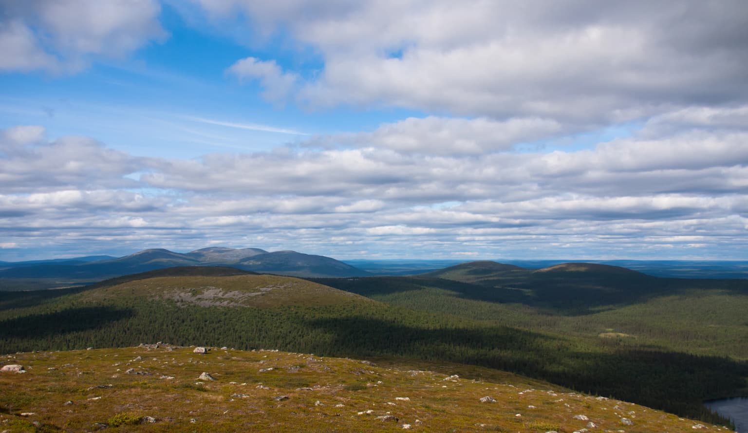
Pallas-Yllästunturi National Park is best known for its exceptional chain of fells and the quality of its outdoor recreation infrastructure. The Pallastunturi Fells, recognized as one of Finland's national landscapes, provide iconic arctic scenery with their rounded, treeless summits and panoramic views. The park offers Finland's most extensive trail network, with over 340 kilometres of marked summer hiking paths, more than 500 kilometres of ski trails, and the famous Hetta-Pallas Trail, the country's oldest marked hiking route. Visitors particularly appreciate the combination of dramatic fell landscapes, diverse boreal forest terrain, well-maintained trails, and the safety and cleanliness of the park environment. The area's proximity to the Arctic Circle also makes it a notable destination for experiencing phenomena like the midnight sun and northern lights.

Wide landscape view showing rolling hills, forested areas, and a partly cloudy sky
Panoramic view of rolling fells and forested landscape in Pallas-Yllästunturi National Park

Pallas-Yllästunturi National Park history and protected-area timeline

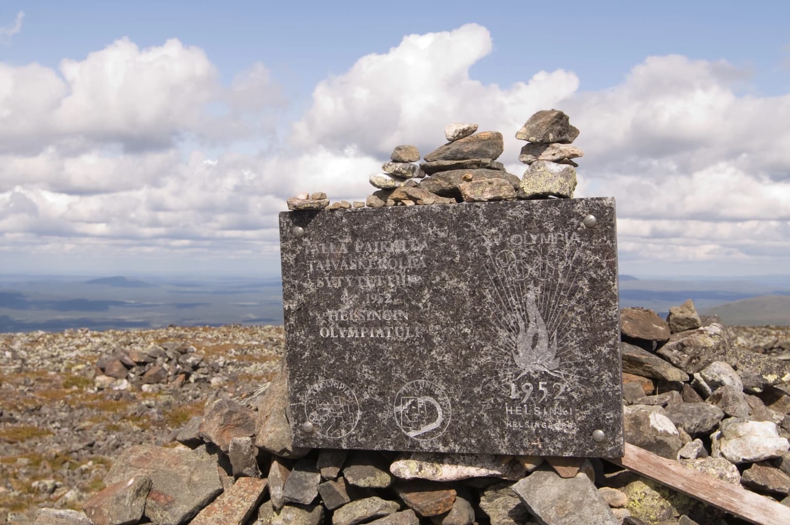
The establishment of Pallas-Yllästunturi National Park reflects Finland's broader movement toward nature conservation in the twentieth century. The idea of creating national parks was first proposed in 1910 when the management committee for protected forests recommended establishing protected areas at Pallastunturi Fells and Pyhätunturi Fell in Pelkosenniemi. Finnish botanist Kaarlo Linkola played a major role in advocating for protection of the Pallastunturi area. After years of proposals and reports, Finland's first national parks were finally established in 1938, with Pallas-Ounastunturi National Park among the founding sites. Tourism in the area had begun in the 1930s when the first fell skiing courses were organized at Pyhäkero and Pallastunturi. The original Pallastunturi Hotel, completed in 1938 in functionalist architectural style, was destroyed by German forces in October 1944 during the Lapland War, rebuilt in 1948 at a lower location on the fell slope. In 2005, the modern Pallas-Yllästunturi National Park was created by combining the original Pallas-Ounastunturi National Park with the Ylläs-Aakenus Nature Reserve and nearby areas from other conservation programmes, expanding the protected area to its current size of over 1,000 square kilometres.

Pallas-Yllästunturi National Park landscape and geographic character

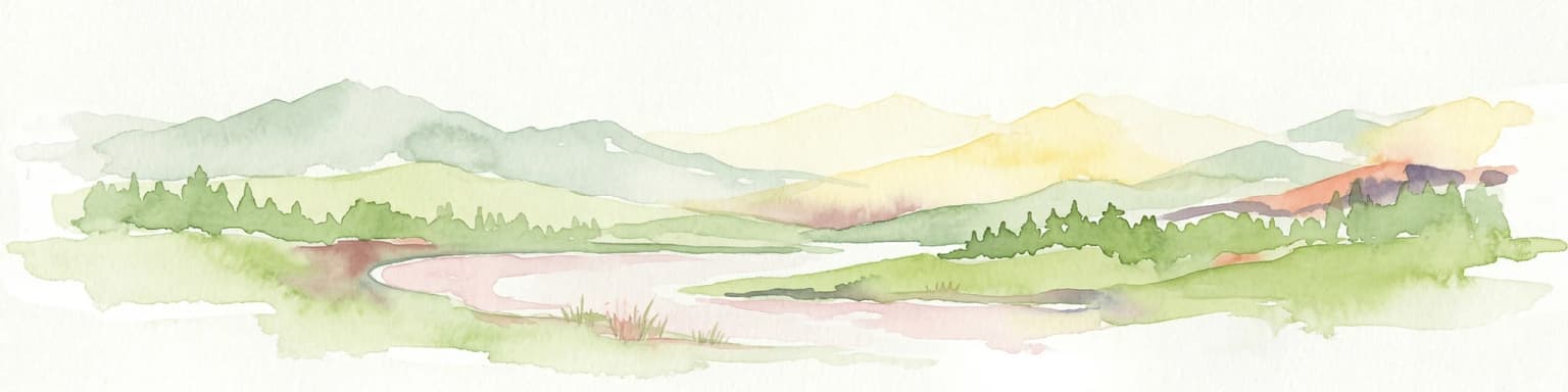
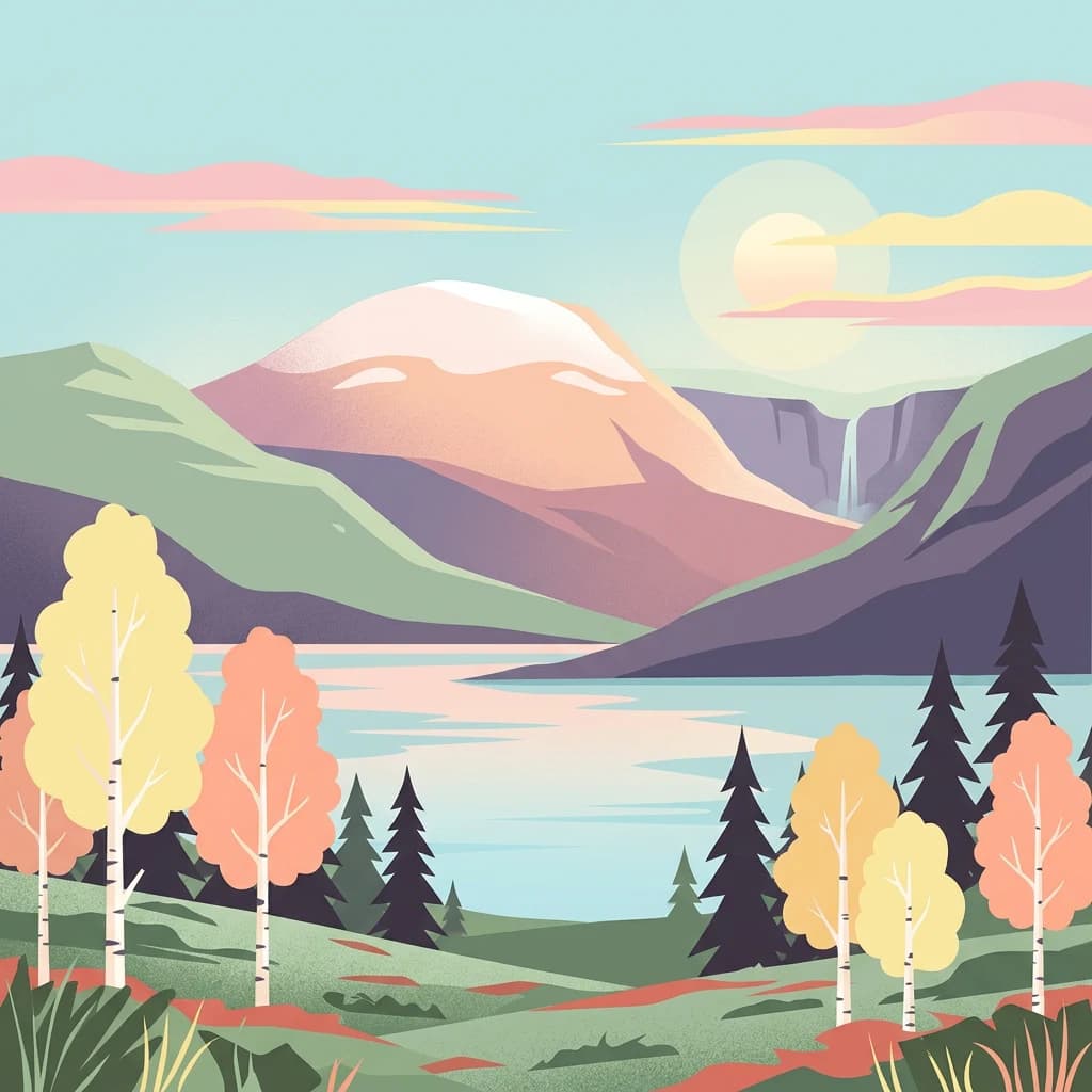
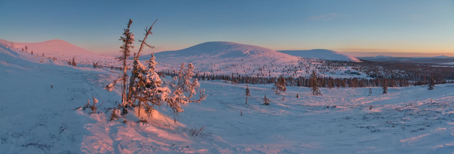
The defining landscape feature of Pallas-Yllästunturi National Park is its approximately 100-kilometre chain of fells, which represent the worn-down base of ancient folded mountains from roughly three billion years ago. These rounded fells, with their distinctive kero summits (the Finnish term for treeless, rounded fell tops), create a striking arctic mountain landscape. The highest point in the park is Taivaskero at 809 metres above sea level, with other notable peaks including Pyhäkero, Lumikero, Laukukero and Palkaskero. The geology varies across the park, with Ounastunturi consisting mainly of quartzite while Pallastunturi is primarily amphibolite. The landscape also includes deep ravines and gorges such as Vatikuru, Pirunkuru and Varkaankuru, which were carved by glacial meltwater. Between the fells lie valleys containing numerous lakes and ponds, with Pallasjärvi being the largest at 36 metres deep. The terrain also features glacial deposits including till, eskers, and kame formations, as well as wetland areas that form a typical component of the park's character alongside the fells and forests.

Snow-covered trees and hills under a partly cloudy sky with pink and blue hues
Snow-covered Pallastunturi ridge under a twilight sky

Pallas-Yllästunturi National Park ecosystems, habitats, and plant life

The nature of Pallas-Yllästunturi National Park is remarkably diverse, encompassing multiple distinct habitat types within the boreal zone. The park spans the boundary between Metsä-Lappi (Forest Lapland) and Peräpohjola (Northern Lapland) vegetation zones, with a transition zone running from Pallas to Pahakuru. The vegetation is rich, with pine, spruce, and fell birch thriving across the area. The tree line (puuraja) varies between 350 and 550 metres depending on slope aspect and exposure, with spruce dominating in southern areas and pine in the north. Between the forests and the open fells lies the subarctic zone (puolipaljakka), characterized by scattered trees and tree groups, typically spruce and pine in the south and fell birch in the north. The open fell areas (paljakat) support characteristic low-growing plants including dwarf birch, pincushion plants, alpine bearberry and crowberry. Mires are a typical landscape feature, with aapas wetland zones typical of both Forest Lapland and Northern Lapland. The park also contains herb-rich creek-side groves and old-growth forests with rare mosses and fungi. In calcareous areas, rare orchids are found.

Snow-covered landscape with sparse trees, distant mountains, and sunset sky in Pallas-Yllästunturi National Park
Winter landscape at Pallastunturi fells during sunset in Muonio, Lapland, Finland

Pallas-Yllästunturi National Park wildlife and species highlights

Pallas-Yllästunturi National Park supports approximately 30 mammal species and around 180 bird species, making it significant for both northern and southern fauna. Large mammals include reindeer and elk, with reindeer particularly spending time on the fells and in mire areas during summer. Common mammals include hare, fox, weasel, Norway lemming, various shrew and vole species, and squirrel. The park is home to two of Finland's large predators: bear and lynx, both of which live permanently in the area. The park is notable as a meeting point for northern and southern bird species. Northern species include rock ptarmigan, willow grouse, and Eurasian dotterel at the southern edge of their range. Southern species such as common blackbird and wood warbler inhabit the lush spruce forests. Other notable birds include various tit species, Siberian jays, pine grosbeaks, white-throated dipper (which dives for food in streams even in winter), bluethroat, wood sandpiper, western yellow wagtail, ruff and spotted redshank. The park records 48 threatened or near-threatened bird species.

A dirt trail winding through a landscape with red and orange autumn foliage, leading towards distant mountains under a cloudy sky
Autumn view from Kellostapuli trail towards Kesänki fell, Pallas-Yllästunturi National Park

Pallas-Yllästunturi National Park conservation status and protection priorities

Pallas-Yllästunturi National Park holds significant conservation value as part of Finland's national park network and the European Natura 2000 network. The park was granted European Charter certification by the EUROPARC Federation for both 2013-2018 and 2019-2023 periods, recognizing its sustainable management and visitor services. The park's conservation significance is enhanced by its diverse habitats including old-growth forests, aapa mires, and alpine fell environments, many of which are protected under the Natura 2000 network. The park participates in Finland's litter-free hiking programme, with visitors expected to carry out their own waste and use serviced recycling points at visitor centres. Air quality monitoring at Sammaltunturi station shows some of the cleanest air in the world, with fine particle concentrations below 4 μg/m³, well below WHO guidelines.

Pallas-Yllästunturi National Park cultural meaning and human context

The Pallas-Yllästunturi area has a long human history spanning over 7,000 years, with evidence of Stone Age settlement in the Ounasselkä area. Bronze Age trade brought increased activity, including fur trading and the establishment of temporary bases. Reindeer herding, originating from Norwegian and Swedish Lapland in the 1300s, became established in the 1600s, though settled reindeer pastoralism ended in the early 1900s. Permanent peasant settlement in the river valleys began in the second millennium. The area's tourism history dates to the 1930s when fell skiing courses began and the Hetta-Pallas Trail was marked in 1934, Finland's oldest marked hiking trail. The original Pallastunturi Hotel (1938) represented functionalist architecture before its destruction in the Lapland War and subsequent reconstruction. The park contains cultural heritage including the ruins of Pyhäkero tourist cabin and the old Pallastunturi Hotel, as well as traditional reindeer husbandry landscapes.

Stone monument with engraved text and Olympic flame symbol, situated on a rocky hilltop with a cloudy sky and distant landscape background
Olympic flame monument on Taivaskero within Pallas-Yllästunturi National Park

Top sights and standout views in Pallas-Yllästunturi National Park

Pallas-Yllästunturi National Park offers an exceptional combination of arctic fell landscapes, boreal forest wilderness, and outstanding outdoor recreation infrastructure. The 100-kilometre chain of fells provides Finland's most iconic subarctic mountain scenery, with the Pallastunturi Fells recognized as a national landscape. The Hetta-Pallas Trail, Finland's oldest marked hiking route at approximately 50 kilometres, traverses fell plateaus, ravines, and multiple summits. The park's three visitor centres (Yllästunturi Kellokas, Pallastunturi, and Fell Lapland) provide comprehensive information, exhibitions on local nature and culture, and access to over 340 kilometres of marked summer trails and 500 kilometres of ski trails. The area's location north of the Arctic Circle offers extraordinary seasonal experiences including the midnight sun of summer and northern lights in winter. The exceptional air quality at Sammaltunturi station ranks among the cleanest measured anywhere in the world.

Snow-covered landscape with scattered coniferous trees and a distant fell under a purple and orange sky
Sunset over Outtakka Fell in Pallas-Yllästunturi National Park

Best time to visit Pallas-Yllästunturi National Park

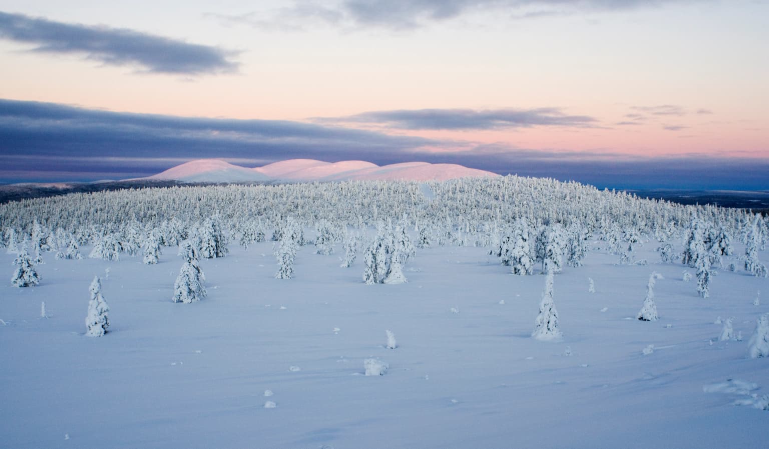
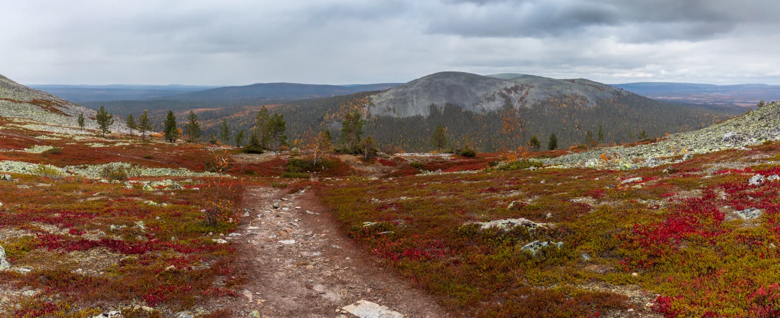
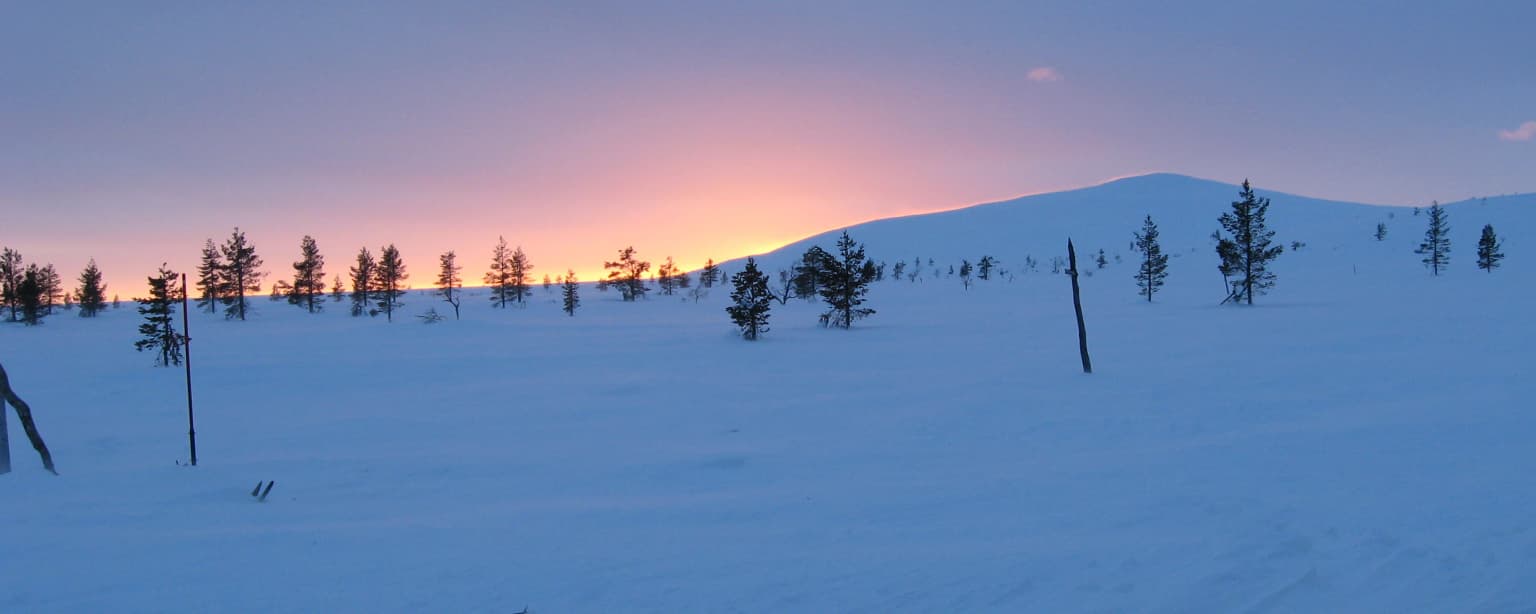
Pallas-Yllästunturi National Park offers distinct experiences across all seasons, each with its own character. Summer (mid-June to August) features the midnight sun, providing continuous daylight for extended hiking and outdoor activities. This is the peak season for hiking, with all trails open and the landscape displaying lush vegetation. Autumn (mid-September to October) brings the ruská (autumn colours) period lasting two to three weeks, with the fell birch turning golden and the moorlands displaying rich hues. Winter (November to March) offers dark days, polar night in December-January, and excellent conditions for skiing, snowshoeing, and winter hiking. Snow cover is thickest in March-April, often exceeding one metre. The extreme cold can drop to -30°C, but clear winter nights provide excellent opportunities for northern lights viewing. Spring (April to mid-June) sees rapidly increasing daylight and the snow melting, creating a different landscape character. Each season offers distinct wilderness experiences, though the most popular time for hiking is the brief summer-autumn period.

Park location guide

Geography guide, regional context, and park location map for Pallas-Yllästunturi National Park

Pallas-Yllästunturi National Park park geography, regions, and map view in Finland
Understand where Pallas-Yllästunturi National Park sits in Finland through a broader geographic reading of the surrounding landscape, nearby location context, and its mapped position within the national park landscape.

How Pallas-Yllästunturi National Park fits into Finland

Finland, officially the Republic of Finland, is a Nordic country in Northern Europe with a population of 5.6 million. It borders Sweden, Norway, and Russia, with the Gulf of Bothnia to the west and the Gulf of Finland to the south. The country gained independence from Russia in 1917 and is a unitary parliamentary republic. Its landscape is characterized by extensive boreal forests and over 180,000 lakes.

Wider geography shaping Pallas-Yllästunturi National Park in Finland

Finland is located in Northern Europe, occupying a peninsula bordered by the Gulf of Bothnia to the west and the Gulf of Finland to the south. It shares land borders with Sweden to the northwest, Norway to the north, and Russia to the east. The terrain is predominantly flat with extensive forest coverage and numerous lakes.

Map view of Pallas-Yllästunturi National Park

Use this park location map to pinpoint Pallas-Yllästunturi National Park in Finland, understand its exact geographic position, and read its mapped placement within the surrounding landscape more clearly.

Pigeon | © OpenStreetMap contributors

Location context for Pallas-Yllästunturi National Park

Lapland

Discover the distinctive kero summits, ancient taiga forests, and pristine mire wetlands that define Finland's iconic national landscape.

Explore Pallas-Yllästunturi National Park: Arctic Fell Landscapes and Boreal Forest Scenery Through Imagery
Browse comprehensive imagery of Pallas-Yllästunturi National Park to visually grasp its expansive arctic fell chain, ancient boreal forest ecosystems, and serene wetland environments. These images help clarify the protected area's unique character, revealing its distinctive rounded fells and diverse taiga habitats within Finland's prominent national park geography.

Wide landscape view showing rolling hills, forested areas, and a partly cloudy sky

Dog sled team pulling a sled across a snow-covered frozen lake with distant mountains under a clear sky

Snow-covered trees and hills under a partly cloudy sky with pink and blue hues

Snow-covered landscape with sparse trees, distant mountains, and sunset sky in Pallas-Yllästunturi National Park

A dirt trail winding through a landscape with red and orange autumn foliage, leading towards distant mountains under a cloudy sky

Tall pine trees with autumn foliage under a cloudy sky, grassy undergrowth

Stone monument with engraved text and Olympic flame symbol, situated on a rocky hilltop with a cloudy sky and distant landscape background

Snow-covered landscape with scattered coniferous trees and a distant fell under a purple and orange sky

Several reindeer standing on a gravel surface in front of a large building with a red roof and the word 'PALLAS' visible

Snow-covered lake surrounded by bare tree branches with distant hills under a pale sky

Reindeer standing on rocky terrain with distant mountains and lakes under a partly cloudy sky.

Panoramic view of Lake Vuontisjärvi from a rocky hilltop, surrounded by forested terrain under a cloudy sky

Snow-covered landscape with coniferous trees under dark blue sky featuring green aurora borealis arch

Black and white photograph of reindeer grazing on a rocky mountain landscape with rolling hills in the background

Two mountain bikers on a gravel trail with a forested mountain landscape behind them

Aerial view showing a large lake surrounded by grassy plains and forests with mountains in the background under a partly cloudy sky.

Park atlas

Trace the protected landscapes and fell geography surrounding Pallas-Yllästunturi National Park in Western Lapland.

Discover Nearby National Parks and Protected Areas Beyond Pallas-Yllästunturi National Park
Discover other national parks and protected areas geographically related to Pallas-Yllästunturi National Park, revealing comparable fell landscapes, boreal forests, and taiga ecosystems in Western Lapland. This comparative view offers valuable geographic context for understanding Finland's broader protected-area network and distinct subarctic conservation efforts.
National parkKarasjok Municipality

Anárjohka National Park: Mapped Subarctic Wilderness and Protected Landscape

Explore Norway's Finnmarksvidda plateau geography.

Anárjohka National Park, a protected area in Norway's Finnmark region, offers a compelling atlas-level view of subarctic wilderness. The park's landscape is defined by its location on the Finnmarksvidda plateau, featuring rolling birch woodlands, open pine barrens, and extensive wetlands, all mapped within its protected boundaries. This park provides a crucial point of discovery for understanding regional geography, natural terrain, and the interconnectedness of protected lands across northern Europe.

Area
1,409 km²
Established
1976
IUCN
II
Relief
Mixed relief
National parkFinland

Lemmenjoki National Park: Finland's Protected Landscape Geography

Explore mapped park boundaries and regional natural context.

Lemmenjoki National Park is a vital protected area situated within Finland's vast northern geography. This page details its designation as a national park, offering a clear view of its mapped boundaries and landscape character. Users can explore the park's geographic context within Finland and understand its contribution to the region's network of conservation lands, facilitating structured atlas-style discovery.

Area
2,850 km²
Established
1956
IUCN
Ib
Visitors
21.1K annual
National parkTroms

Reisa National Park: Dramatic River Valley and Protected Landscape Atlas

Subarctic terrain and geographic context in Troms, Norway.

MoriAtlas offers detailed geographic context for Reisa National Park, a protected landscape in Norway's Troms county. Explore the park's identity as a significant subarctic river valley, carved by the Reisa River into a dramatic canyon system. This page provides insights into its mapped natural features, regional landscape setting, and its importance within the broader atlas of protected areas. Understand the park's protected boundaries and terrain for structured geographic discovery.

Area
803 km²
Established
1986
IUCN
II
Relief
Mixed relief
National parkLapland

Urho Kekkonen National Park: Detailed Map and Protected Landscape Exploration in Lapland

Discover Finland's expansive Arctic wilderness and fell terrain.

Urho Kekkonen National Park represents a significant portion of Finland's protected Arctic landscape, offering a rich opportunity for geographic and atlas-based discovery. This national park in Lapland showcases dramatic fell formations, boreal forests, and extensive wetlands, with mapped boundaries that define its wild eastern reaches and more accessible western trails. Users can explore the unique terrain and understand its place within the broader regional geography, appreciating the vastness of this protected natural area.

Area
2,550 km²
Established
1983
IUCN
II
Visitors
435.9K annual
Watercolor illustration showing a lake, rolling hills, and vegetation.
National parkLapland

Pyhä-Luosto National Park: Ancient Geological Heritage and Fell Landscape

Explore Lapland's southernmost large fell system and deep gorges.

Pyhä-Luosto National Park offers a unique window into Finland's deep geological past and its boreal ecosystems. As a protected area, it encompasses a prominent chain of twelve fells composed of two-billion-year-old quartzite, showcasing the southernmost large fell system in the country. The park's landscape is further defined by features like Isokuru, Finland's deepest gorge, and extensive old-growth forests, providing rich context for map-based discovery and regional geographic understanding within Lapland.

Area
142 km²
Established
2005
IUCN
II
Visitors
198.9K annual
National parkTroms

Øvre Dividal National Park: Arctic Alpine Protected Landscape in Troms, Norway

Mapped boundaries and unique ecological terrain of a pristine wilderness.

Øvre Dividal National Park stands as a premier example of Arctic alpine wilderness, meticulously preserved as a national park in Norway's Troms region. This entry facilitates a detailed exploration of its mapped protected boundaries and the distinct elevational ecological zones, from boreal forests to high-altitude tundra. Gain geographic context for this vital landscape, which supports diverse habitats and contributes to Scandinavia's largest contiguous wilderness areas.

Area
750 km²
Established
1971
IUCN
II
Relief
Mountain
National park

Stabbursdalen National Park: Protected Arctic Landscape and Northernmost Pine Forest Atlas

Explore Finnmark's unique geography and protected terrain.

Stabbursdalen National Park preserves a remarkable ecological boundary, featuring the planet's northernmost Scots pine woodland within a dramatic Arctic landscape. This protected area offers a deep dive into rugged mountain terrain, river valley formations, and vital wetland habitats. As a key component of Norway's protected lands, it provides essential context for understanding regional geography and the limits of forest ecosystems on the mapped landscape.

Area
747 km²
Established
1970
IUCN
II
Relief
Mixed relief
National parkNorrbotten County

Muddus National Park: Explore Sweden's Largest Old-Growth Protected Forest Landscape

Mapped boreal terrain with ancient pines and dramatic ravines.

Muddus National Park is a landmark protected area in Norrbotten County, celebrated for its immense scale and preserved old-growth forest character. This national park features a unique geography defined by ancient coniferous forests, including Sweden's oldest pine tree, alongside striking ravines and extensive mire systems. As part of the Laponian Area UNESCO World Heritage Site, Muddus offers an unparalleled opportunity for atlas-based discovery of an undisturbed boreal ecosystem accessible solely by foot, highlighting its profound natural and mapped landscape significance.

Area
493.4 km²
Established
1942
IUCN
II
Relief
Upland

Common questions about visiting, size, designation, and location context for Pallas-Yllästunturi National Park

Pallas-Yllästunturi National Park FAQs for park facts, access, geography, and protected area context
Find quick answers about Pallas-Yllästunturi National Park, including protected-area facts, park geography, trail and visitor context, and how the park fits into its surrounding country and regional landscape.
MoriAtlas Explorer

Continue Your Protected Areas Search Across the Global Atlas

Deepen your exploration by continuing the structured search for national parks and protected areas worldwide. Utilize the comprehensive filtering capabilities to compare different conservation landscapes and refine your understanding of global park geography. Discover more about the distribution and characteristics of protected natural areas.

Global natural geography