Mori Atlas logo
National parkPyhä-Luosto National Park

Discover the mapped protected area of Lapland's southernmost large fell system.

Pyhä-Luosto National Park: Ancient Quartzite Fells and Finland's Deepest Gorge Landscape

Pyhä-Luosto National Park, situated in the Lapland region of Finland, protects a distinct landscape shaped by ancient geological processes. This national park features a dramatic chain of twelve fells, representing the southernmost large fell system in the country, composed of two-billion-year-old quartzite formations. Visitors can explore the geographic context of this protected area, including Finland's deepest gorge, Isokuru, and vast old-growth boreal forests, offering a unique atlas perspective on northern Finnish nature.

National ParkFinlandLaplandOld-Growth ForestBoreal EcosystemFell Landscape
Stylized illustration showing a waterfall cascading into a lake with rocky mountains, evergreen trees, and rolling hills under a partly cloudy sky

Pyhä-Luosto National Park

National park

Park overview

Structured park overview, official facts, and landscape profile for Pyhä-Luosto National Park

Pyhä-Luosto National Park park facts, protected area profile, and essential visitor context
Review the core facts for Pyhä-Luosto National Park, including designation, size, terrain, visitor scale, habitats, and operating context in one park-focused overview.

About Pyhä-Luosto National Park

Pyhä-Luosto National Park stands as a remarkable protected landscape in the heart of Finnish Lapland, where ancient geological processes have created a distinctive terrain of fells, gorges, and old-growth forests. The park's foundation rests upon a chain of twelve tunturi peaks that form the southernmost large fell system in Finland. These quartzite mountains, rising dramatically from the relatively flat surrounding terrain, represent the erosion-resistant remnants of an ancient mountain range that once rivaled the Alps in scale. Over nearly two billion years of geological time, softer rock has been worn away, leaving behind these distinctive bare-rock ridges that define the park's character. The most striking geological feature is Isokuru Gorge, Finland's deepest, where a steep-walled valley cuts through the quartzite terrain to a depth of over 200 meters, exposing visible glacial wave marks that document the power of ice age processes. The park's ecological character is defined by the transition from fell terrain through old-growth coniferous forest to extensive aapa mire wetlands. The forests on the lower slopes contain some of Finland's oldest living trees, with specimens exceeding 400 years of age, supporting rare polypore fungi that depend on dead wood. The wetlands, known as aapasuot in Finnish, represent a characteristic boreal landscape type that supports distinctive flora adapted to northern conditions. The park's significance extends beyond its natural values to encompass Finland's national park heritage, as the 2005 expansion that joined Pyhätunturi with Luosto created one of the nation's most visited protected areas.

Quick facts and research context for Pyhä-Luosto National Park

Pyhä-Luosto National Park covers approximately 144 square kilometers in Finnish Lapland. The park was formally established in 1938 as Finland's oldest national park, though it was significantly expanded in 2005 when the Luosto area was incorporated, making it simultaneously one of Finland's oldest and newest national parks. The park features twelve prominent fell summits along a 35-kilometer quartzite ridge, with the highest points being Noitatunturi at 540 meters and Ukko-Luosto at 514 meters. The park contains Isokuru Gorge, Finland's deepest gorge at over 200 meters, as well as the Pyhäkasteenputous waterfall. In 2024, the park welcomed nearly 199,000 visitors, ranking as Finland's fifth most visited national park. The area belongs to the Kemi River watershed system.

Park context

Deeper park guide and search-rich context for Pyhä-Luosto National Park

Pyhä-Luosto National Park history, landscape, wildlife, and travel context
Explore Pyhä-Luosto National Park through its history, landscape character, ecosystems, wildlife, conservation priorities, cultural context, and seasonal travel timing in a structured park guide built for atlas discovery and search intent.

Why Pyhä-Luosto National Park stands out

Pyhä-Luosto is best known for its exceptional geological heritage, featuring the oldest mountain range remnants in Finland and the country's deepest gorge. The park protects extensive old-growth boreal forests with trees among the oldest in Finland, some exceeding 400 years. The twelve-peak tunturi chain represents the southernmost large fell system in the country, with its quartzite ridges dating back approximately two billion years. The park also serves as a critical habitat for the Siberian jay, which serves as the park's emblematic bird species. The combination of ancient geological formations, primeval forests, and deep gorges makes this park a distinctive protected area within Finland's network.

Wooden boardwalk trail running alongside a dark stream in a forested area with lush green vegetation and tall trees
Wooden boardwalk trail alongside a calm stream in a forested ravine

Pyhä-Luosto National Park history and protected-area timeline

Pyhä-Luosto National Park traces its institutional history to 1938, when Pyhätunturi National Park was established as one of Finland's original national parks. For decades, this protected area focused on the Pyhätunturi fell area, preserving its distinctive tunturi landscape and surrounding forests. In 2005, a significant expansion occurred when the Luosto area was incorporated into the national park, effectively joining two previously separate protected landscapes into a single unified park. This expansion transformed Pyhä-Luosto into one of Finland's largest national parks while creating a unique distinction: the park simultaneously claims the status of being both one of Finland's oldest and newest national parks. The 2005 expansion reflected a growing recognition of the need to protect larger, contiguous ecosystems and to connect the Pyhätunturi and Luosto areas for both ecological coherence and visitor experience. The park is managed by Metsähallitus, Finland's state-owned enterprise responsible for managing state-owned land and water areas. Throughout its history, the park has become increasingly popular, growing from around 128,000 visitors in 2009 to nearly 199,000 visitors in 2024, making it Finland's fifth most visited national park.

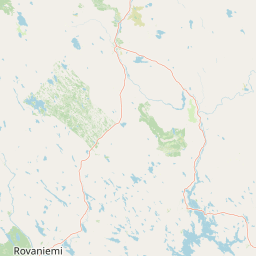
Pyhä-Luosto National Park landscape and geographic character

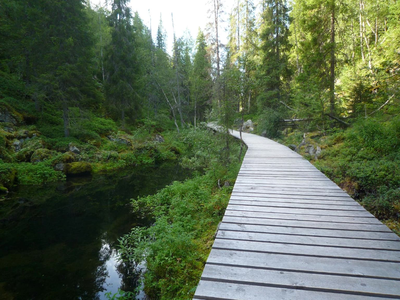
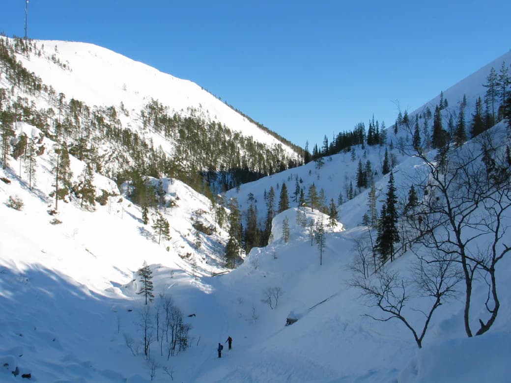
The landscape of Pyhä-Luosto National Park is defined by a dramatic chain of twelve fells that rise abruptly from the surrounding flat terrain of northern Finland. These tunturit, the southernmost large fell system in the country, form a prominent ridge system extending approximately 35 kilometers. The fells consist primarily of quartzite, an extremely durable rock that has survived billions of years of erosion since the original mountains were formed. The highest summits, Noitatunturi at 540 meters and Ukko-Luosto at 514 meters, offer panoramic views across the Lapland landscape. Between the fell peaks, deep gullies and gorges have been carved by glacial meltwater during the Ice Ages. The most impressive of these is Isokuru Gorge, a steep-walled canyon over 200 meters deep that represents Finland's deepest gorge. The gorge contains Pyhäkasteenlampi, a lake fed by the 17-meter-high Pyhäkasteenputous waterfall. Additional distinctive landscape features include block fields known as rakkakivikot, formed by frost weathering, and the transition from rocky fell terrain through forest to extensive wetlands. The tree line occurs at approximately 320 to 400 meters above sea level, creating a distinct alpine zone above the continuous forest.

Two people walking through a snow-covered valley between mountain slopes with scattered pine trees under clear blue sky
Snow-covered Isokuru gorge in Pyhä-Luosto National Park with mountain slopes and scattered pine trees

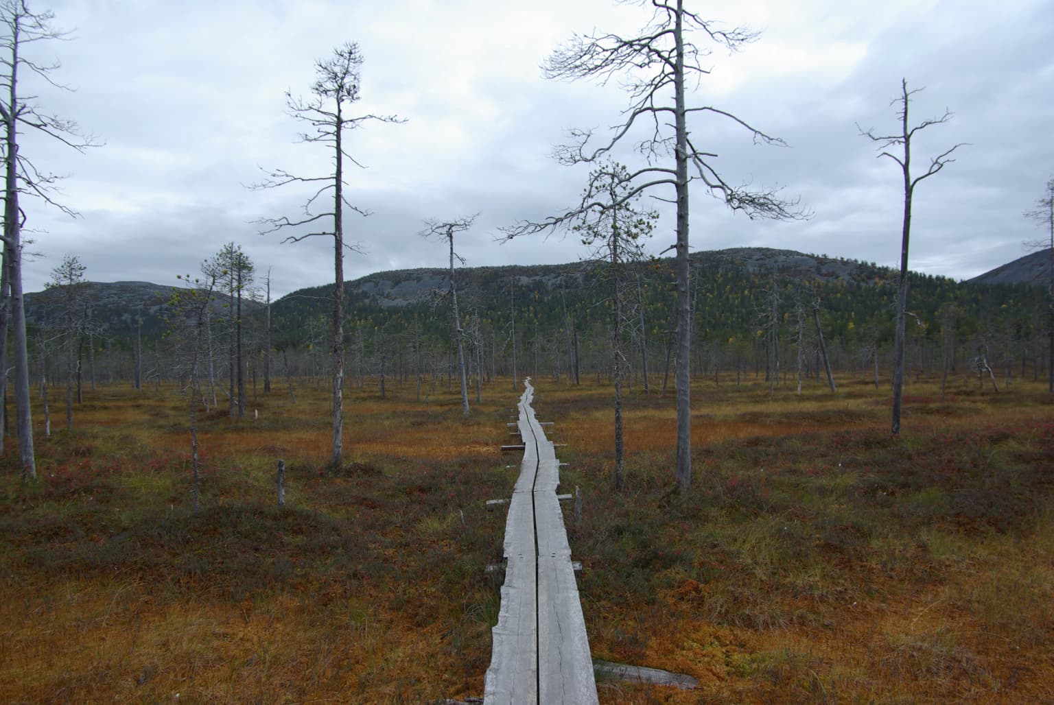
Pyhä-Luosto National Park ecosystems, habitats, and plant life

The nature of Pyhä-Luosto National Park exemplifies the boreal ecosystem of northern Finland, with distinctive zonation from fell summits through old-growth forest to wetland systems. The lower slopes and valleys support old-growth pine and spruce forests that are among the most significant in Finland, with some trees exceeding 400 years in age. These ancient forests represent critical habitat for rare species, particularly polypore fungi that require dead wood for their survival. The forest floor supports characteristic boreal flora including lingonberry, blueberry, cloudberry, and crowberry. As elevation increases, the forest transitions to subalpine vegetation dominated by mountain birch, with characteristic species such as subspecies of crowberry, alpine azalea, and alpine bearberry. The wetland systems of the park, known as aapasuot, represent a distinctive feature of the northern Finnish landscape. These mires vary from wet flark fens to drier pine bogs and spruce mires, with particularly rich fens found in the lower reaches of the Siurunjoki area near Luosto. The park also contains areas of unusually lush vegetation in riparian zones and lower slopes, featuring species such as wood cranesbill and lady fern that are rare in the Lapland context. The lichen and polypore diversity of the area is particularly noteworthy, with numerous species dependent on the old-growth forest conditions.

Wooden boardwalk traversing a marshy bog landscape with sparse trees and distant hills under overcast sky
Wooden boardwalk extending through an aapa bog landscape in Pyhä-Luosto National Park, Finnish Lapland

Pyhä-Luosto National Park wildlife and species highlights

Pyhä-Luosto National Park supports a diverse boreal wildlife community typical of northern Finnish forests and wetlands. The mammalian fauna includes reindeer, which have been semi-domesticated and roam the northern landscapes, along with elk, brown bear, and European otter. The park's bird community is particularly well-documented, with nearly 130 species recorded in the area. The Siberian jay serves as the park's emblematic bird species, a characteristic corvid of the boreal forest that has become associated with the park's identity. Other notable bird species include the bluethroat, yellow wagtail, rough-legged buzzard, sparrowhawk, whooper swan, crane, wood sandpiper, and green sandpiper. The old-growth forests provide critical habitat for woodpeckers, while the open wetlands and mires support waterfowl and wading birds. The diverse habitats from fell summits through forest to wetland create ecological corridors that support species movement across the landscape.

Pyhä-Luosto National Park conservation status and protection priorities

Pyhä-Luosto National Park represents an important conservation target within Finland's protected area network, protecting a combination of geological, forest, and wetland ecosystems that are characteristic of northern Finland but increasingly under pressure. The park's designation as an IUCN Category II protected area reflects its primary purpose of ecosystem conservation and recreation. The old-growth forests within the park are of particular conservation significance, as these forests have become rare in Finland through centuries of forestry and land use. The presence of trees exceeding 400 years in age, along with the associated community of rare polypore fungi, indicates ecological continuity that is essential for species dependent on ancient forest conditions. The geological features, including the ancient quartzite ridge and Isokuru Gorge, represent scientific and educational values that warrant protection. The wetlands function as important carbon sinks and provide habitat for specialist species adapted to wet boreal conditions. The park's popularity, with nearly 200,000 annual visitors, demonstrates the challenge of balancing conservation with public access, requiring careful management to minimize impact on sensitive ecosystems.

Pyhä-Luosto National Park cultural meaning and human context

The cultural context of Pyhä-Luosto National Park includes elements of Sámi heritage and historical land use in the broader Lapland region. According to local tradition recorded by ethnographer Samuli Paulaharju, the Pyhäkasteenlampi lake in Isokuru Gorge received its name from an event in 1648 when Esaias Fellman baptized Sámi people to Christianity at that location. The name Pyhä, meaning sacred in Finnish, reflects the traditional significance of the fell area. The landscape has been shaped by centuries of seasonal land use, including reindeer husbandry that continues in the surrounding areas. The park lies within the Kemijoki river basin, the largest river system in Finland. Nearby Luosto hosts the Lampivaara amethyst mine, one of the few gemstone mines that welcome visitors, illustrating the geological richness of the broader region.

Top sights and standout views in Pyhä-Luosto National Park

The highlights of Pyhä-Luosto National Park include the dramatic fell landscape with its twelve summits, the deep Isokuru Gorge with its waterfall and lake, old-growth forests containing some of Finland's oldest trees, and the extensive wetland systems. The park offers a network of hiking trails of varying difficulty connecting the Pyhä and Luosto village areas along a 30-kilometer trail. The Luontokeskus Naava visitor center provides interpretation and services. The combination of geological antiquity, ecological significance, and recreational opportunities makes this park a distinctive destination within Finland's national park system.

Best time to visit Pyhä-Luosto National Park

The best time to visit Pyhä-Luosto National Park depends on the experience sought. The summer months of June through August offer the most accessible hiking conditions, with long daylight hours and generally mild temperatures suitable for exploring the trail network. The autumn season brings vibrant fall colors to the forests and is a popular time for berry picking, particularly for cloudberries and lingonberries. Winter transforms the landscape into a snowy wilderness, with opportunities for cross-country skiing and snowshoeing on marked winter trails. The northern location means winter darkness returns early, but the aurora borealis can be visible during clear winter nights. Spring offers a transitional period as snow melts and the landscape awakens, though trail conditions may be variable. The park remains accessible year-round, with each season offering a distinctly different character.

Park location guide

Geography guide, regional context, and park location map for Pyhä-Luosto National Park

Pyhä-Luosto National Park park geography, regions, and map view in Finland
Understand where Pyhä-Luosto National Park sits in Finland through a broader geographic reading of the surrounding landscape, nearby location context, and its mapped position within the national park landscape.

How Pyhä-Luosto National Park fits into Finland

Finland, officially the Republic of Finland, is a Nordic country in Northern Europe with a population of 5.6 million. It borders Sweden, Norway, and Russia, with the Gulf of Bothnia to the west and the Gulf of Finland to the south. The country gained independence from Russia in 1917 and is a unitary parliamentary republic. Its landscape is characterized by extensive boreal forests and over 180,000 lakes.

Wider geography shaping Pyhä-Luosto National Park in Finland

Finland is located in Northern Europe, occupying a peninsula bordered by the Gulf of Bothnia to the west and the Gulf of Finland to the south. It shares land borders with Sweden to the northwest, Norway to the north, and Russia to the east. The terrain is predominantly flat with extensive forest coverage and numerous lakes.

Map view of Pyhä-Luosto National Park

Use this park location map to pinpoint Pyhä-Luosto National Park in Finland, understand its exact geographic position, and read its mapped placement within the surrounding landscape more clearly.

Pigeon | © OpenStreetMap contributors

Location context for Pyhä-Luosto National Park

Lapland

Visualizing Finland's Deepest Gorge and Old-Growth Forests: A Protected-Area Gallery Reference for Pyhä-Luosto

Pyhä-Luosto National Park Photos: Explore Lapland's Ancient Fell Landscapes and Boreal Forest Scenery
Browse a comprehensive collection of Pyhä-Luosto National Park images to understand its dramatic fell landscapes, ancient quartzite ridges, and old-growth boreal forests. These visual assets provide essential context for exploring the park's unique geological heritage, deep Isokuru Gorge, and characteristic Lapland habitats, offering a clear view of its distinct protected environment.

Wooden boardwalk trail running alongside a dark stream in a forested area with lush green vegetation and tall trees

Waterfall cascading down a rocky cliff face with a small body of water reflecting the waterfall and surrounding landscape

Two people walking through a snow-covered valley between mountain slopes with scattered pine trees under clear blue sky

Wooden boardwalk traversing a marshy bog landscape with sparse trees and distant hills under overcast sky

Park atlas

Compare the unique fell landscapes and boreal ecosystems of national parks in Finnish Lapland.

Browse More National Parks and Protected Areas Around Pyhä-Luosto National Park
Explore an atlas of other national parks and protected areas situated within or adjacent to the regional context of Pyhä-Luosto National Park. Compare their distinct geological features, boreal ecosystems, and conservation landscapes to deepen your understanding of Finland's protected natural heritage.
National parkLapland

Salla National Park: Mapped Protected Landscape in Lapland, Finland

Explore its geographic context and protected area identity.

Understand Salla National Park as a distinct protected landscape situated within the expansive northern Finnish region of Lapland. This MoriAtlas entry focuses on its identity as a national park, detailing its mapped boundaries and geographic setting. Discover how Salla National Park contributes to the atlas of protected areas, offering a specific point of reference for exploring the natural terrain and regional geography of this subarctic territory.

Area
99.83 km²
Established
2022
IUCN
II
Visitors
55.9K annual
National parkLapland

Riisitunturi National Park: Explore Protected Landscape and Lapland Geography

Mapped boundaries of a national park in northern Finland.

Delve into the protected landscape of Riisitunturi National Park, a key national park situated in the expansive region of Lapland, Finland. This MoriAtlas entry provides detailed geographic context, focusing on the park's mapped boundaries and its role within the natural terrain of northern Finland. Understand its identity as a protected area and its significance within a broader atlas of natural landscapes.

Area
77 km²
Established
1982
IUCN
II
Visitors
58.8K annual
National parkLapland

Oulanka National Park: Protected Landscape Atlas and Geographic Context in Lapland

Explore mapped boundaries and regional terrain.

Discover Oulanka National Park as a distinct protected landscape entity within the extensive northern region of Lapland, Finland. This page provides structured geographic information, focusing on the park's mapped area, its regional setting, and its identity as a national park. MoriAtlas facilitates an atlas-driven understanding of Oulanka National Park's place in Finland's protected lands and its inherent natural terrain.

Area
270 km²
Established
1956
IUCN
II
Visitors
187.4K annual
National parkLapland

Urho Kekkonen National Park: Detailed Map and Protected Landscape Exploration in Lapland

Discover Finland's expansive Arctic wilderness and fell terrain.

Urho Kekkonen National Park represents a significant portion of Finland's protected Arctic landscape, offering a rich opportunity for geographic and atlas-based discovery. This national park in Lapland showcases dramatic fell formations, boreal forests, and extensive wetlands, with mapped boundaries that define its wild eastern reaches and more accessible western trails. Users can explore the unique terrain and understand its place within the broader regional geography, appreciating the vastness of this protected natural area.

Area
2,550 km²
Established
1983
IUCN
II
Visitors
435.9K annual
Watercolor landscape featuring green hills, pine trees, and a yellowish field
National parkFinland

Syöte National Park: Mapped Protected Landscape and Fell Geography in Finland

Explore Finland's southernmost fell and diverse northern wilderness.

Delve into the protected territory of Syöte National Park, a key national park in northern Finland. This page highlights the park's distinct geographic features, including its southernmost fell, Iso-Syöte, alongside expansive mire systems and old-growth boreal forests. Understand the mapped boundaries and the unique ecological transition zone it represents within the Finnish atlas, offering a comprehensive view of its landscape context and protected area status.

Area
299 km²
Established
2000
IUCN
II
Visitors
88.2K annual
Watercolor illustration of a landscape with lake, trees, and hills
National parkRepublic of Karelia

Paanajärvi National Park: Republic of Karelia's Premier Protected Landscape

Explore mapped boundaries and regional geography of this national park.

This MoriAtlas entry details Paanajärvi National Park, a significant protected area situated in the Republic of Karelia. Delve into its specific geographic profile, understand its mapped protected boundaries, and see how it fits into the wider atlas of Russia's natural and protected landscapes. It serves as a dedicated point for focused discovery of this national park's unique landscape context.

Area
1,043.71 km²
Established
1992
IUCN
II
Relief
Highland
National parkFinland

Lemmenjoki National Park: Finland's Protected Landscape Geography

Explore mapped park boundaries and regional natural context.

Lemmenjoki National Park is a vital protected area situated within Finland's vast northern geography. This page details its designation as a national park, offering a clear view of its mapped boundaries and landscape character. Users can explore the park's geographic context within Finland and understand its contribution to the region's network of conservation lands, facilitating structured atlas-style discovery.

Area
2,850 km²
Established
1956
IUCN
Ib
Visitors
21.1K annual
Watercolor painting showing rolling hills, forests, and distant mountains under a soft sky
National parkLapland

Pallas-Yllästunturi National Park: Lapland's Premier Protected Fell Landscape for Atlas Exploration

Explore its ancient mountain geography and mapped protected area.

Pallas-Yllästunturi National Park presents a unique atlas of Lapland's ancient geography, characterized by a vast chain of rounded fells that are the remnants of three-billion-year-old mountains. As Finland's most popular national park, it offers a deep dive into protected landscape discovery, showcasing diverse boreal forests, mires, and exceptional fell terrain. Understand its geographic scope and protected boundaries for comprehensive map-based exploration.

Area
1,020 km²
Established
2005
IUCN
II
Visitors
598.8K annual

Common questions about visiting, size, designation, and location context for Pyhä-Luosto National Park

Pyhä-Luosto National Park FAQs for park facts, access, geography, and protected area context
Find quick answers about Pyhä-Luosto National Park, including protected-area facts, park geography, trail and visitor context, and how the park fits into its surrounding country and regional landscape.
MoriAtlas Explorer

Continue Your Protected Areas Search Across the Global Atlas

Deepen your exploration by continuing the structured search for national parks and protected areas worldwide. Utilize the comprehensive filtering capabilities to compare different conservation landscapes and refine your understanding of global park geography. Discover more about the distribution and characteristics of protected natural areas.

Global natural geography