Mori Atlas logo
National parkSalla National Park

Discover the geographic identity and protected area context of Salla National Park.

Salla National Park: Mapped Protected Landscape in Finland's Lapland Region

Salla National Park represents a significant protected landscape within the expansive geography of Lapland, Finland. As a designated national park, its mapped boundaries define an area of natural significance, offering insight into the region's terrain and ecological context. This MoriAtlas entry serves as a key point for understanding Salla National Park's role in Finland's network of protected lands and its place within the broader atlas of natural geography.

National parksOld-growth forestsBogs and miresGlacial landscapesLaplandFinnish-Russian border

Salla National Park

National park

Park overview

Structured park overview, official facts, and landscape profile for Salla National Park

Salla National Park park facts, protected area profile, and essential visitor context
Review the core facts for Salla National Park, including designation, size, terrain, visitor scale, habitats, and operating context in one park-focused overview.

About Salla National Park

Salla National Park protects a remote and ecologically significant corner of Finnish Lapland, preserving ancient forests, bog ecosystems, and dramatic glacial terrain near the eastern border with Russia. The park's establishment in 2022 marked a major expansion of Finland's national park network, adding protection to landscapes that had long been valued for their wilderness character and ecological diversity. The terrain is dominated by hills and ridges shaped by glacial processes, with extensive forest cover transitioning between coniferous taiga and more open fell landscapes. Small bogs and mires add to the ecological diversity, creating a mosaic of habitats that support characteristic northern Finnish biodiversity. The park's location near the Russian border places it in a region with complex historical layers, from Stone Age settlement through Sámi land use to more recent Finnish frontier history. The area has attracted increasing visitor interest since its establishment, with infrastructure development including viewing platforms, wilderness huts, and improved trail connections helping visitors access the park's natural wonders while maintaining the wilderness character that defines this newest of Finland's national parks.

Quick facts and research context for Salla National Park

Salla National Park lies in eastern Lapland near the Finnish-Russian border, approximately 10 kilometers northwest of the town of Salla and about 90 kilometers north of Rovaniemi. The park protects representative ancient forests, bog ecosystems, and glacial landforms including hills and ridges. Established in 2022, it is Finland's most recent national park and the 41st in the national park system. The area holds archaeological evidence of human settlement dating back to the Stone Age, with connections to the traditional land use of the Forest Sámi community. The park is managed by Metsähallitus and recorded approximately 55,900 visitors in 2024.

Park context

Deeper park guide and search-rich context for Salla National Park

Salla National Park history, landscape, wildlife, and travel context
Explore Salla National Park through its history, landscape character, ecosystems, wildlife, conservation priorities, cultural context, and seasonal travel timing in a structured park guide built for atlas discovery and search intent.

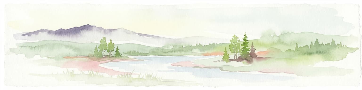
Why Salla National Park stands out

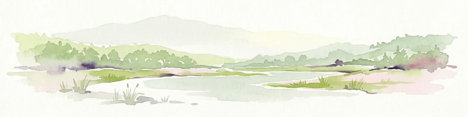
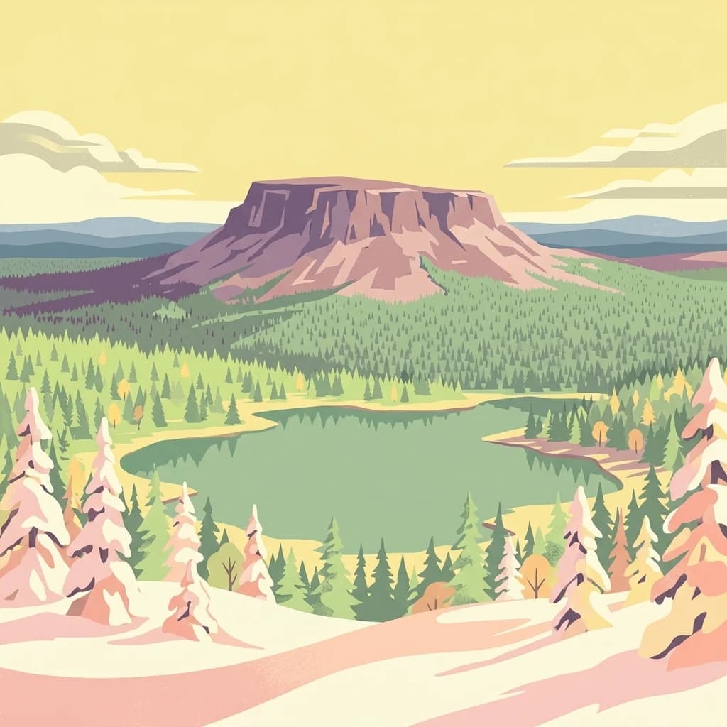
Salla National Park is best known for its pristine ancient forests that represent the old-growth woodland ecosystems once widespread across northern Finland. The glacier-shaped hills and ridges of the Sallatunturit fells provide the park's most distinctive visual identity, with notable peaks including Pyhätunturi offering panoramic views. The park also preserves remnants of the 1960 Tuntsa wildfire, Finland's largest recorded forest fire, which burned approximately 20,000 hectares on both sides of the Finnish-Russian border and left lasting ecological and visual traces on the northern Salla landscape.

Salla National Park history and protected-area timeline

The Salla region has a long human history extending back to the Stone Age, with archaeological evidence indicating settlement in the Salla uplands soon after the Ice Age. Lakeshore sites such as Kenttälampi and rows of hunting pits remain visible in the terrain, testifying to millennia of human presence. From at least the 16th century, the area belonged to the Kuolajärvi Lapp village, a siida used by Forest Sámi whose seasonal land use combined fishing, hunting and early reindeer keeping. Later Finnish settlement brought slash meadows and hay barns, remnants of which survive along streams and mires. During the Winter War and the Continuation War, the Salla front saw sustained fighting, and after the Moscow Peace Treaty Finland ceded large parts of Old Salla east of the new border, with wartime fortifications still remaining in the landscape. In 1960, the Tuntsa wildfire burned roughly 20,000 hectares on both sides of the border, Finland's largest recorded forest fire, leaving long-lasting ecological and visual traces. Most of the present park lies within the Aatsinki-Onkamo Natura 2000 site designated in 1998, with parts earlier identified in national mire and old-growth forest protection programmes. The core of the future park was established as the state-owned Sallatunturi nature reserve by Government Decree 646/2017 before formal national park establishment in 2022.

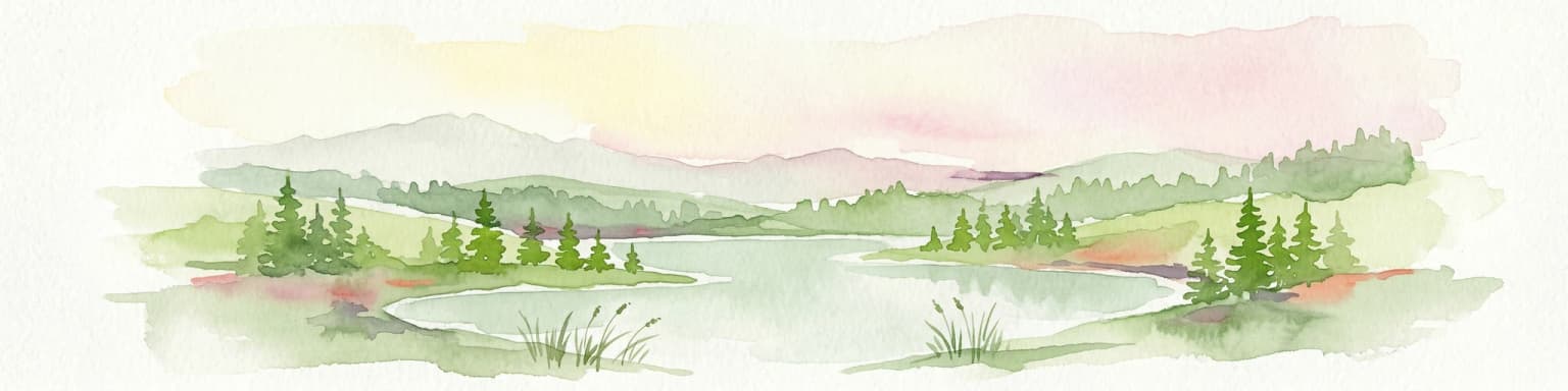
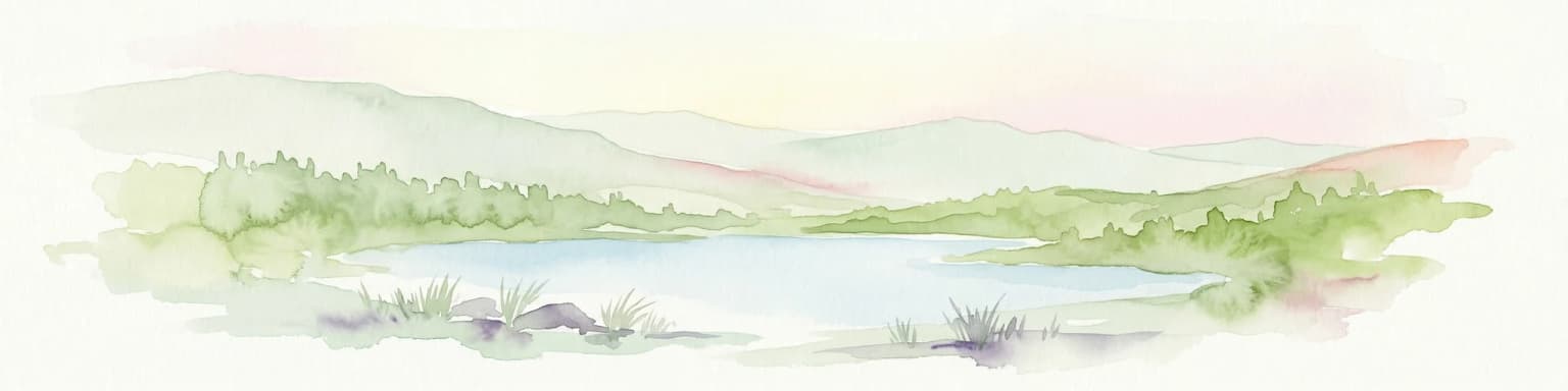
Salla National Park landscape and geographic character

The landscape of Salla National Park is characterized by glacier-shaped hills and ridges that form the Sallatunturit fell range, with prominent peaks including Pyhätunturi offering sweeping views from its summits. The terrain is interspersed with small bogs and mires that add ecological and visual diversity to the forested slopes. Ancient forests cover much of the lower terrain, representing the old-growth woodland that once dominated this region of Lapland. The western part of the park is adjacent to the tourist and ski center of Sallatunturi, where more developed infrastructure meets the wilderness boundary. The eastern boundary follows the Finnish-Russian border, creating a remote frontier character. The combination of forested valleys, open fell terrain, and wetland areas creates a varied landscape that is characteristic of the eastern Lapland border region.

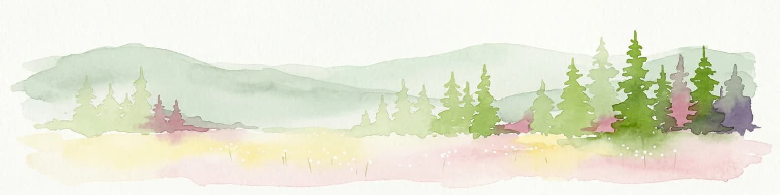
Salla National Park ecosystems, habitats, and plant life

The park protects representative ancient forests that are among the most significant ecological features of Salla National Park. These old-growth woodlands represent ecosystems once widespread across northern Finland but now largely confined to protected areas. The small bogs and mires add important wetland habitat to the forest matrix, contributing to biodiversity and the characteristic Finnish lakeland and mire landscape. The transitional zone between coniferous taiga forests and the more open fell environments creates ecological diversity that supports various species adapted to northern conditions. The Aatsinki-Onkamo Natura 2000 site, which encompasses most of the present park, was designated in 1998 specifically to protect these representative forest and mire ecosystems.

Salla National Park wildlife and species highlights

The park's diverse habitats, ranging from old-growth forests to bogs and open fell terrain, support the characteristic wildlife of northern Finnish Lapland. The ancient forest environments provide habitat for species associated with old-growth woodland, while the wetland areas attract waterfowl and bird species typical of boreal mires. The remote border location and limited human disturbance contribute to the area's value for wildlife, though specific species documentation is limited in the available source material.

Salla National Park conservation status and protection priorities

Salla National Park represents an important addition to Finland's protected area network, preserving representative examples of ancient forests, bogs, and glacial terrain in eastern Lapland. The park was established within the framework of the European Union's Natura 2000 network, with most of the area lying within the Aatsinki-Onkamo site designated in 1998. Earlier protection efforts included identification of parts of the area in national mire and old-growth forest protection programmes. The establishment of the core area as the Sallatunturi nature reserve by Government Decree in 2017 preceded the formal national park designation in 2022. The park protects ecosystems that were once widespread across northern Finland but have been largely lost to logging and development, making its conservation value significant for preserving Finland's natural heritage.

Salla National Park cultural meaning and human context

The Salla region carries deep historical layers spanning millennia of human presence. The area was used by Forest Sámi from at least the 16th century as part of the Kuolajärvi Lapp village, a siida system where seasonal land use combined fishing, hunting and early reindeer keeping. Later Finnish settlement introduced slash meadows and hay barns, with remnants still visible along streams and mires. The border region experienced significant historical upheaval during the Winter War and Continuation War, with Finland ceding large portions of Old Salla after the Moscow Peace Treaty. Wartime fortifications remain in the landscape as visible reminders of this turbulent period. The 1960 Tuntsa wildfire, Finland's largest recorded forest fire, burned extensively on both sides of the border, leaving lasting ecological and visual traces that remain part of the area's character.

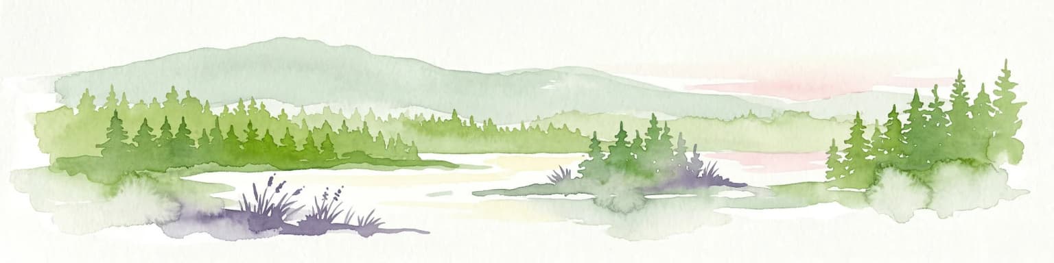
Top sights and standout views in Salla National Park

The ancient forests of Salla National Park represent some of the best-preserved old-growth woodland in eastern Lapland, offering visitors an immersive experience of the boreal taiga environment. The Sallatunturit fell range provides dramatic backdrop views and hiking opportunities, with the Pyhätunturi peaks offering panoramic vistas across the park and toward the Russian border. The park's relatively recent establishment means it retains a strong sense of wilderness character while visitor infrastructure has been developed sensitively to enhance access without compromising the natural experience. The combination of forest, bog, and fell ecosystems creates a varied landscape that rewards exploration across seasons.

Best time to visit Salla National Park

The best time to visit Salla National Park aligns with the traditional Finnish outdoor recreation seasons, with summer and early autumn offering the most accessible conditions for hiking and experiencing the full diversity of the landscape. The boreal summer brings extended daylight hours and relatively mild temperatures that allow extended exploration of the trail network. Winter also offers distinctive appeal for winter sports enthusiasts, particularly given the park's proximity to the Sallatunturi ski center, though conditions become more challenging and visitors should be prepared for Arctic temperatures and limited daylight. The shoulder seasons of spring and late autumn present transitional conditions that may offer fewer visitors but also more limited facilities and services.

Park location guide

Geography guide, regional context, and park location map for Salla National Park

Salla National Park park geography, regions, and map view in Finland
Understand where Salla National Park sits in Finland through a broader geographic reading of the surrounding landscape, nearby location context, and its mapped position within the national park landscape.

How Salla National Park fits into Finland

Finland, officially the Republic of Finland, is a Nordic country in Northern Europe with a population of 5.6 million. It borders Sweden, Norway, and Russia, with the Gulf of Bothnia to the west and the Gulf of Finland to the south. The country gained independence from Russia in 1917 and is a unitary parliamentary republic. Its landscape is characterized by extensive boreal forests and over 180,000 lakes.

Wider geography shaping Salla National Park in Finland

Finland is located in Northern Europe, occupying a peninsula bordered by the Gulf of Bothnia to the west and the Gulf of Finland to the south. It shares land borders with Sweden to the northwest, Norway to the north, and Russia to the east. The terrain is predominantly flat with extensive forest coverage and numerous lakes.

Map view of Salla National Park

Use this park location map to pinpoint Salla National Park in Finland, understand its exact geographic position, and read its mapped placement within the surrounding landscape more clearly.

Pigeon | © OpenStreetMap contributors

Location context for Salla National Park

Lapland
Park atlas

Trace connected protected landscapes, fell ranges, and vast forest reserves across eastern Lapland, comparing Salla National Park with regional protected areas.

Explore Nearby National Parks and Protected Areas Near Salla National Park in Eastern Lapland
Extend your discovery from Salla National Park to explore additional national parks and protected areas across Finland's Lapland, tracing its ancient forests, glacial fells, and distinct boreal ecosystems. Compare these regional protected landscapes to understand their shared geography, conservation values, and the unique environmental patterns defining northern Finland's expansive border region.
National parkLapland

Oulanka National Park: Protected Landscape Atlas and Geographic Context in Lapland

Explore mapped boundaries and regional terrain.

Discover Oulanka National Park as a distinct protected landscape entity within the extensive northern region of Lapland, Finland. This page provides structured geographic information, focusing on the park's mapped area, its regional setting, and its identity as a national park. MoriAtlas facilitates an atlas-driven understanding of Oulanka National Park's place in Finland's protected lands and its inherent natural terrain.

Area
270 km²
Established
1956
IUCN
II
Visitors
187.4K annual
National parkLapland

Riisitunturi National Park: Explore Protected Landscape and Lapland Geography

Mapped boundaries of a national park in northern Finland.

Delve into the protected landscape of Riisitunturi National Park, a key national park situated in the expansive region of Lapland, Finland. This MoriAtlas entry provides detailed geographic context, focusing on the park's mapped boundaries and its role within the natural terrain of northern Finland. Understand its identity as a protected area and its significance within a broader atlas of natural landscapes.

Area
77 km²
Established
1982
IUCN
II
Visitors
58.8K annual
Watercolor illustration of a landscape with lake, trees, and hills
National parkRepublic of Karelia

Paanajärvi National Park: Republic of Karelia's Premier Protected Landscape

Explore mapped boundaries and regional geography of this national park.

This MoriAtlas entry details Paanajärvi National Park, a significant protected area situated in the Republic of Karelia. Delve into its specific geographic profile, understand its mapped protected boundaries, and see how it fits into the wider atlas of Russia's natural and protected landscapes. It serves as a dedicated point for focused discovery of this national park's unique landscape context.

Area
1,043.71 km²
Established
1992
IUCN
II
Relief
Highland
Watercolor illustration showing a lake, rolling hills, and vegetation.
National parkLapland

Pyhä-Luosto National Park: Ancient Geological Heritage and Fell Landscape

Explore Lapland's southernmost large fell system and deep gorges.

Pyhä-Luosto National Park offers a unique window into Finland's deep geological past and its boreal ecosystems. As a protected area, it encompasses a prominent chain of twelve fells composed of two-billion-year-old quartzite, showcasing the southernmost large fell system in the country. The park's landscape is further defined by features like Isokuru, Finland's deepest gorge, and extensive old-growth forests, providing rich context for map-based discovery and regional geographic understanding within Lapland.

Area
142 km²
Established
2005
IUCN
II
Visitors
198.9K annual
Watercolor landscape featuring green hills, pine trees, and a yellowish field
National parkFinland

Syöte National Park: Mapped Protected Landscape and Fell Geography in Finland

Explore Finland's southernmost fell and diverse northern wilderness.

Delve into the protected territory of Syöte National Park, a key national park in northern Finland. This page highlights the park's distinct geographic features, including its southernmost fell, Iso-Syöte, alongside expansive mire systems and old-growth boreal forests. Understand the mapped boundaries and the unique ecological transition zone it represents within the Finnish atlas, offering a comprehensive view of its landscape context and protected area status.

Area
299 km²
Established
2000
IUCN
II
Visitors
88.2K annual
National parkFinland

Hossa National Park: Detailed National Park and Protected Landscape Geography

Explore mapped boundaries and regional context within Finland.

Delve into the protected landscape of Hossa National Park, a designated national park in Finland. This page provides structured geographic information, focusing on its mapped boundaries and position within the country's natural terrain. Understand how Hossa National Park contributes to the atlas of protected areas in Northern Europe, offering insights into its specific landscape character and regional significance for geographic discovery.

Established
2017
Scope
Terrestrial
National parkLapland

Urho Kekkonen National Park: Detailed Map and Protected Landscape Exploration in Lapland

Discover Finland's expansive Arctic wilderness and fell terrain.

Urho Kekkonen National Park represents a significant portion of Finland's protected Arctic landscape, offering a rich opportunity for geographic and atlas-based discovery. This national park in Lapland showcases dramatic fell formations, boreal forests, and extensive wetlands, with mapped boundaries that define its wild eastern reaches and more accessible western trails. Users can explore the unique terrain and understand its place within the broader regional geography, appreciating the vastness of this protected natural area.

Area
2,550 km²
Established
1983
IUCN
II
Visitors
435.9K annual
National parkRepublic of Karelia

Kalevalsky National Park: Rare Old-Growth Boreal Forest and Kalevala Epic Landscape

Mapped protected wilderness in the Republic of Karelia

Kalevalsky National Park is a significant protected area within the Republic of Karelia, Russia, safeguarding one of Europe's last remaining old-growth boreal pine forests. This vast national park protects a landscape characterized by numerous lakes, rivers, and marshes resting on ancient Baltic Shield bedrock, offering a clear representation of primeval taiga ecosystems. Its profound cultural ties to the Kalevala epic, Finland's national poem, make it a unique destination for exploring both natural and mythological geography. Understand the park's mapped boundaries and its place within the regional context.

Area
744 km²
Established
2007
IUCN
II
Relief
Lowland

Common questions about visiting, size, designation, and location context for Salla National Park

Salla National Park FAQs for park facts, access, geography, and protected area context
Find quick answers about Salla National Park, including protected-area facts, park geography, trail and visitor context, and how the park fits into its surrounding country and regional landscape.
MoriAtlas Explorer

Continue Your Protected Areas Search Across the Global Atlas

Deepen your exploration by continuing the structured search for national parks and protected areas worldwide. Utilize the comprehensive filtering capabilities to compare different conservation landscapes and refine your understanding of global park geography. Discover more about the distribution and characteristics of protected natural areas.

Global natural geography