Mori Atlas logo
Nature reserveRéserve naturelle régionale des étangs de Mépieu

Explore the unique ecological mosaic and mapped terrain of this protected site in the Auvergne-Rhône-Alpes region

Réserve naturelle régionale des étangs de Mépieu: Mapping Protected Wetlands and Dry Landscapes

The Réserve naturelle régionale des étangs de Mépieu protects a compact, north-south oriented corridor of five ponds, peatlands, and wet meadows nestled within the Isle-Crémieu plateau. This small but ecologically rich site in the Auvergne-Rhône-Alpes region contrasts these humid aquatic habitats directly against dry grasslands and rocky slopes. By tracing these mapped boundaries, observers can study how diverse environmental conditions concentrate biodiversity in a single protected area.

regional nature reservepondswetlandspeatlandsdry grasslandsheathland

Réserve naturelle régionale des étangs de Mépieu

Nature reserve

Park overview

Structured park overview, official facts, and landscape profile for Réserve naturelle régionale des étangs de Mépieu

Réserve naturelle régionale des étangs de Mépieu park facts, protected area profile, and essential visitor context

Review the core facts for Réserve naturelle régionale des étangs de Mépieu, including designation, size, terrain, visitor scale, habitats, and operating context in one park-focused overview.

About Réserve naturelle régionale des étangs de Mépieu

The Réserve naturelle régionale des étangs de Mépieu is a small protected area in southeastern France, dedicated to the conservation of a network of ponds and the mosaic of habitats surrounding them. Although its total surface area is modest, the reserve stands out for the diversity of natural environments it brings together in a compact territory and for the role it plays in preserving both local biodiversity and broader migratory pathways.

The reserve lies in the northern part of the Isère department, in the Auvergne-Rhône-Alpes region, on the commune of Creys-Mépieu. It is situated near the Rhône and the Isle-Crémieu area, a region known for its rural landscapes, dry slopes, woodland patches and traditional land use. The protected site occupies a north–south strip about 2.5 kilometres long, centred on a chain of five ponds at roughly 250 metres of elevation, and integrates both humid and terrestrial habitats into a single coherent ecological ensemble.

From an ecological perspective, the site is notable for combining ponds, peatlands, wet meadows and aquatic vegetation with dry grasslands, heathland and rocky outcrops. This juxtaposition of wet and dry environments supports a high diversity of species and gives the reserve a particular importance for wetland birds and for plant species adapted to both open water and exposed ground conditions. The site's classification as a regional nature reserve reflects its role in maintaining ecological processes, habitat connectivity and species populations that would otherwise be vulnerable to local land use changes.

Beyond its ecological function, the reserve is also a piece of the local cultural and rural landscape of northern Isère. It is open to the public throughout the year and offers general viewpoints, including from the nearby Potet promontory, also known as the roche de Sormier, and from the RD 16 road that runs along the northern edge of the main pond. Managed by the Association Nature Nord Isère Lo Parvi, it represents a local, association-driven approach to conservation integrated with the farming, fishing and traditional land uses that have shaped the area for generations.

Quick facts and research context for Réserve naturelle régionale des étangs de Mépieu

The Réserve naturelle régionale des étangs de Mépieu was formally classified as a regional nature reserve on 25 September 2008 and is identified internally as RNR159. The reserve covers about 161.78 hectares and lies entirely within the commune of Creys-Mépieu in the Isère department, in the Auvergne-Rhône-Alpes region of southeastern France.

It stretches in a narrow north–south band of roughly 2.5 kilometres around a cluster of five ponds, at an altitude of around 250 metres. The reserve is managed by the Association Nature Nord Isère Lo Parvi and sits within a ZNIEFF type I zone and a Site of Community Interest focused on the ponds, dry slopes and caves of Isle-Crémieu.

Protection and recognition

Documented terrestrial protection scope, management records, and formal international recognition data

Réserve naturelle régionale des étangs de Mépieu Protection Status and Designated Area Record

Terrestrial protection status, management scope, and international recognition records provide factual context for Réserve naturelle régionale des étangs de Mépieu. Structured database entries outline official conservation designations without assuming specific legal outcomes or governance frameworks.

Protection details

Protection scope
Terrestrial
Transboundary protection
No
WDPA ID
555514332
Park context

Deeper park guide and search-rich context for Réserve naturelle régionale des étangs de Mépieu

Réserve naturelle régionale des étangs de Mépieu history, landscape, wildlife, and travel context

Explore Réserve naturelle régionale des étangs de Mépieu through its history, landscape character, ecosystems, wildlife, conservation priorities, cultural context, and seasonal travel timing in a structured park guide built for atlas discovery and search intent.

Why Réserve naturelle régionale des étangs de Mépieu stands out

The Mépieu reserve is best known for the tight mosaic of wetland and dry habitats it concentrates in a very small surface area. Five ponds, surrounded by peatland, wet meadows and aquatic vegetation, are set directly against dry grasslands, heathland and rocky slopes, producing an unusual ecological contrast within a single site. This combination of habitat types, together with the site's position along bird migration routes, makes it especially valued for wetland birds, amphibians and aquatic flora. The presence of protected plants such as water caltrop, fragrant orchid, marsh fern and rare pondweeds, along with a rich breeding and migratory bird community, gives the reserve a disproportionately strong ecological identity relative to its modest size.

Réserve naturelle régionale des étangs de Mépieu history and protected-area timeline

The ponds and surrounding lands of Mépieu have a long history of human use. The site has been shaped over many years by agricultural, fishing and hunting activities, and it is documented as early as 1860, notably in relation to the presence of water caltrop, Trapa natans, in its waters.

Following naturalist inventories and observations, the commune of Creys-Mépieu and the Vicat company, who owned much of the land, began the process of seeking protected-area status. In 2001 they initiated a voluntary nature reserve classification procedure as a way to formalise the conservation of the site's habitats and species.

The formal classification as a regional nature reserve was decided on 25 September 2008. Since then, the reserve has been managed on the ground by the Association Nature Nord Isère Lo Parvi, in partnership with the local authorities and landowners. The site is also integrated into broader ecological inventories, including ZNIEFF type I areas and a Site of Community Interest designated for the ponds, dry slopes and caves of Isle-Crémieu, reinforcing its role within the wider regional ecological framework.

Réserve naturelle régionale des étangs de Mépieu landscape and geographic character

The landscape of the Mépieu reserve is defined by a narrow corridor of ponds, peatlands and wet terrain embedded in the gently rolling countryside of northern Isère. The protected area forms a north–south oriented strip roughly 2.5 kilometres long, centred on a chain of five ponds, at an altitude of around 250 metres. The overall terrain is relatively low-lying, reflecting the proximity of the Rhône valley, but the surrounding landscape rises into the broader Isle-Crémieu plateau with its mixture of woodland, fields and dry hillsides.

Within the reserve, the terrain shifts sharply between water and dry land. The ponds and peatlands occupy the wetter parts, edged by reedbeds, marshy meadows and wet woodland patches that grade imperceptibly into the surrounding fields. A short distance away, the same reserve contains dry grasslands, heath-like vegetation and rocky slopes, including the promontory of Potet, also referred to as the roche de Sormier, which provides an elevated viewpoint over the ponds below.

The combination of these features creates a striking local landscape in which open water, marshland and dry, sun-exposed slopes all coexist within a very short distance. The RD 16 road traces the northern edge of the main pond, allowing visitors to see the open water and its fringing vegetation, while the broader mosaic of ponds, meadows and dry hills defines the visual character of the protected site.

Réserve naturelle régionale des étangs de Mépieu ecosystems, habitats, and plant life

The nature of the Mépieu reserve is shaped by the unusual coexistence of humid and dry habitats in a very small area. The site combines ponds, peatlands and wet meadows with dry grasslands, heath vegetation and rocky slopes. Together these habitats form a complementary ecological ensemble rather than a single uniform environment, which is one of the main reasons the area was designated for protection.

The wet habitats are dominated by standing water in five interconnected ponds and their surrounding peat-forming vegetation, supporting aquatic plants, floating vegetation and marshland flora. The dry habitats include sun-exposed slopes with low, sparse vegetation adapted to thin soils and limited water availability. Between these extremes lie transitional zones, including damp grassland, scrub and woodland margins, that add further ecological complexity.

Overall, the reserve's ecological value lies less in any single habitat and more in the tight mosaic that emerges from their proximity, allowing species with very different ecological requirements to share the same small territory.

Réserve naturelle régionale des étangs de Mépieu wildlife and species highlights

The reserve hosts a notably rich wildlife community given its modest size. More than 170 bird species have been recorded, making the site especially significant for ornithology. It supports breeding and passage populations of wetland and reedbed species, including the Savi's warbler, the great reed warbler, the purple heron, the little bittern, the red-crested pochard and the common pochard, as well as open-country species such as the woodlark.

Mammals are represented by around 35 species, with bats a particular feature of the site's fauna, including the greater horseshoe bat. The reserve also supports a well-developed amphibian community of around 11 species, among them the great crested newt, the European tree frog and the natterjack toad, while reptiles, also roughly 11 species, include the European pond turtle, found in and around the ponds.

Invertebrate life is also diverse. The ponds and peatlands support a range of dragonflies and other aquatic insects, including the white-tailed darter and protected species such as the stag beetle, reflecting the combination of clean standing water, surrounding wetlands and woodland that the reserve maintains.

Réserve naturelle régionale des étangs de Mépieu conservation status and protection priorities

From a conservation standpoint, the Mépieu reserve concentrates a high level of ecological importance into a very compact surface area. The site's classification as a regional nature reserve reflects its role in protecting both a small aquatic network and the mosaic of terrestrial habitats that surrounds it. The combination of ponds, peatland, wet meadows, dry grasslands and rocky slopes supports species that are vulnerable elsewhere in the region, including protected plants and animals dependent on the long-term stability of these habitats.

The reserve is integrated into a broader ecological framework. It is included within a ZNIEFF type I area and forms part of the Site of Community Interest dedicated to the ponds, dry slopes and caves of Isle-Crémieu, a designation that recognises the site's importance at European level for maintaining certain habitat types and species. This layered protection reinforces the role of Mépieu as a key local node within the wider conservation strategy of the northern Isère region.

Local management is carried out by the Association Nature Nord Isère Lo Parvi, which combines habitat monitoring, public awareness and coordination with landowners. The continued viability of traditional activities such as farming, fishing and hunting, alongside formal protection, allows the conservation approach to remain firmly rooted in the local land-use context of the area.

Réserve naturelle régionale des étangs de Mépieu cultural meaning and human context

The Mépieu reserve is closely tied to the rural identity of the Creys-Mépieu area and the broader Isle-Crémieu region. The ponds, meadows and dry slopes have supported agricultural, fishing and hunting traditions for generations, and references to the site go back to the mid-nineteenth century, when the presence of water caltrop was already documented. This long continuity of human use has shaped both the landscape and the way conservation is now organised.

The fact that the protection process was initiated jointly by the local commune and a private landowner, the Vicat company, and that management is now carried out by a regional naturalist association, reflects a locally driven approach. The reserve thus stands as an example of how rural land uses, local institutions and conservation goals have come together to preserve a distinctive piece of the Isère countryside.

Top sights and standout views in Réserve naturelle régionale des étangs de Mépieu

The reserve's main highlights are the five ponds at the heart of the site, the surrounding peatlands and dry grasslands, and the exceptional bird diversity supported by this habitat mosaic. Although small in area, it offers a rare combination of protected plants, amphibians, bats and wetland birds, including several species whose regional populations are otherwise limited.

The viewpoints from the Potet promontory, also known as the roche de Sormier, and from the RD 16 road along the main pond, give visitors an accessible way to appreciate the landscape, while the association-based management ensures the site remains closely connected to local traditions and land use.

Best time to visit Réserve naturelle régionale des étangs de Mépieu

Because the site remains open to the public throughout the year, the experience of visiting the reserve shifts with the seasons rather than being limited to a particular window. Spring and early summer are typically the most rewarding periods for seeing breeding wetland birds and amphibians at the ponds, when reedbed species are most active and the surrounding meadows are in growth.

Autumn can be productive for observing migratory birds using the ponds as a stopover, while winter offers quieter landscape views of the open water and surrounding dry slopes. The protected site is accessible year-round, and its character remains strongly tied to the seasonal rhythms of the ponds and the surrounding rural landscape.
Monthly climate preview

Long term temperature ranges and precipitation patterns recorded across representative coordinates

Réserve naturelle régionale des étangs de Mépieu Climate Normals And Annual Weather By Month

Historical climatology data captures measured monthly temperature swings and precipitation averages across the protected terrain of Réserve naturelle régionale des étangs de Mépieu. Detailed twelve month climate statistics provide complete monthly breakdowns for comprehensive temperature and rainfall analysis.
Annual mean10 °C
1 °C19 °C
Jan
Feb
Mar
Apr
May13°
Jun17°
Jul19°
Aug19°
Sep15°
Oct11°
Nov
Dec
Warmest month
July

19.4 °C

Coolest month
January

0.9 °C

Wettest month
November

3.3 mm/day

Driest month
March

2.2 mm/day

Park location guide

Geography guide, regional context, and park location map for Réserve naturelle régionale des étangs de Mépieu

Réserve naturelle régionale des étangs de Mépieu park geography, regions, and map view in France

Understand where Réserve naturelle régionale des étangs de Mépieu sits in France through a broader geographic reading of the surrounding landscape, nearby location context, and its mapped position within the national park landscape.

How Réserve naturelle régionale des étangs de Mépieu fits into France

France is a unitary semi-presidential republic and one of the world's largest economies. It borders Belgium, Luxembourg, Germany, Switzerland, Italy, Monaco, Andorra, and Spain, with a maritime border to the United Kingdom. The country is known for its cultural influence, art, cuisine, and political history spanning centuries.

Wider geography shaping Réserve naturelle régionale des étangs de Mépieu in France

France is located in Western Europe. Metropolitan France extends from the Rhine to the Atlantic Ocean and from the Mediterranean Sea to the English Channel and North Sea. The country borders Belgium, Luxembourg, Germany, Switzerland, Italy, Monaco, Andorra, Spain, and has a maritime border with the United Kingdom.

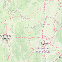
Map view of Réserve naturelle régionale des étangs de Mépieu

Use this park location map to pinpoint Réserve naturelle régionale des étangs de Mépieu in France, understand its exact geographic position, and read its mapped placement within the surrounding landscape more clearly.

Pigeon | © OpenStreetMap contributors

Location context for Réserve naturelle régionale des étangs de Mépieu

Auvergne-Rhône-Alpes
Park atlas

Compare adjacent wetland reserves, peatlands, and regional protected landscapes.

Parks Near Réserve naturelle régionale des étangs de Mépieu and Surrounding Protected Areas

Browsing other protected areas near Réserve naturelle régionale des étangs de Mépieu reveals connected wetland ecosystems and diverse regional park geography. Examining adjacent reserves broadens understanding of local habitat mosaics, northern Isère terrain, and broader ecological inventories.
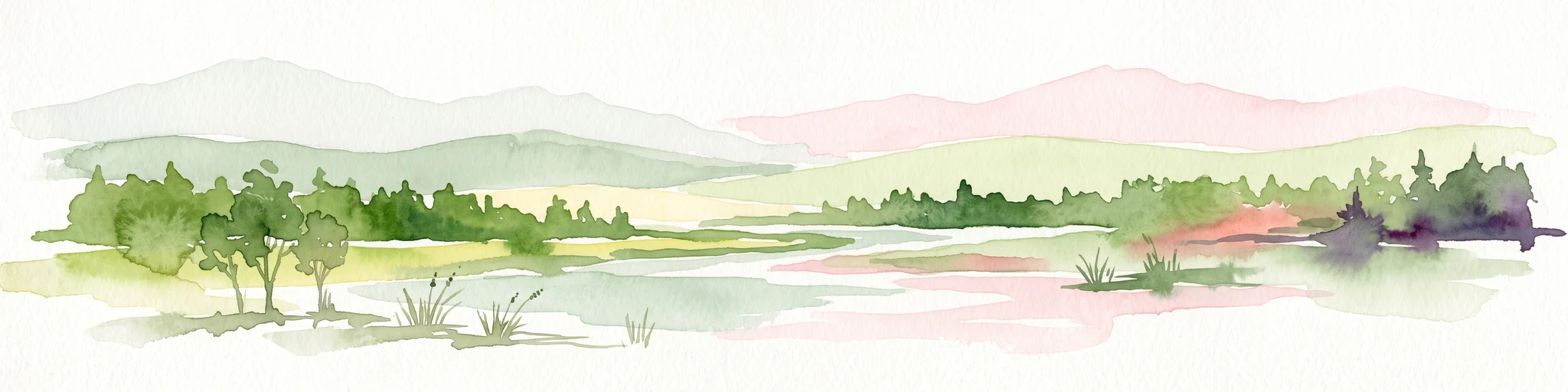
A soft watercolor painting depicting a wide river flowing through a lush green landscape with distant rolling purple hills in the background.
Nature reserveAuvergne-Rhône-Alpes
About 20 km away#1 closest

Southeast

Rhône du Pont de Groslée à Murs-et-Gélignieux: Alluvial Nature Reserve & River Geography

Protected riparian habitat in Auvergne-Rhône-Alpes, France.

Analyze the complex fluvial dynamics of the Rhône du Pont de Groslée à Murs-et-Gélignieux nature reserve. This site features a well-preserved landscape of alder and ash floodplain forests, isolated side channels, and marshy meadows that provide an essential ecological corridor through the Rhône river valley.

Area
21.05 km²
Relief
Lowland
Scope
Terrestrial
Water
Water-dominated
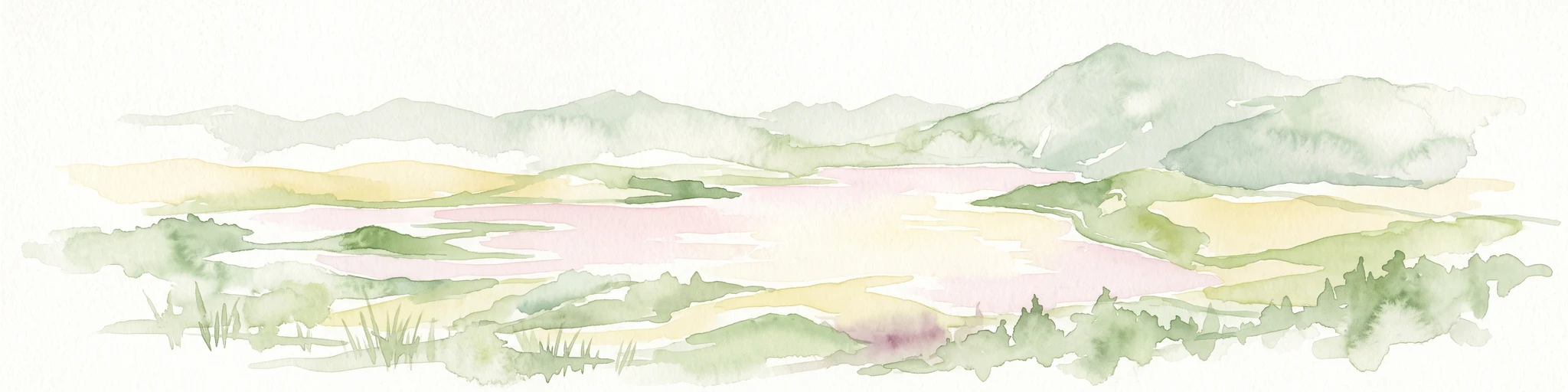
A soft watercolor painting of a wetland landscape featuring a central pond, surrounding reeds, and distant rolling hills in pale green and pink hues.
Nature reserveAuvergne-Rhône-Alpes
About 26 km away#2 closest

Southwest

Réserve naturelle régionale de l'étang de Saint-Bonnet: Wetland Atlas and Map Discovery

Examining protected wetland geography in the Isère department

This protected area centers on the étang de Saint-Bonnet, a wetland habitat defined by dense reedbeds and pond-centered ecosystems. It provides a distinct example of nature conservation situated between major urban corridors, showcasing how amphibians and diverse bird communities thrive within a small, managed lowland basin.

Area
0.514 km²
Established
1987
IUCN
IV
Relief
Lowland
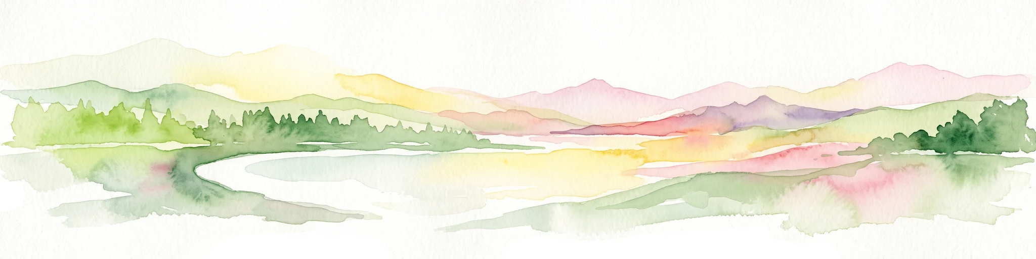
A watercolor illustration showing a soft, panoramic view of a calm lake surrounded by gentle, rolling green mountains.
Nature reserveAuvergne-Rhône-Alpes
About 32 km away#3 closest

Southeast

Réserve naturelle régionale du lac d'Aiguebelette: Protected Lake and Forest Geography

Regional nature reserve landscape in the Savoie Prealps

This protected area encompasses the glacial basin of Lake Aiguebelette and the forested slopes of the Montagne de l'Épine. Discover a terrain defined by the contrast between deep mountain water and upland ridgelines, representing a critical habitat and species management zone within the Auvergne-Rhône-Alpes region.

Area
8.442 km²
Established
2015
IUCN
IV
Relief
Mountain
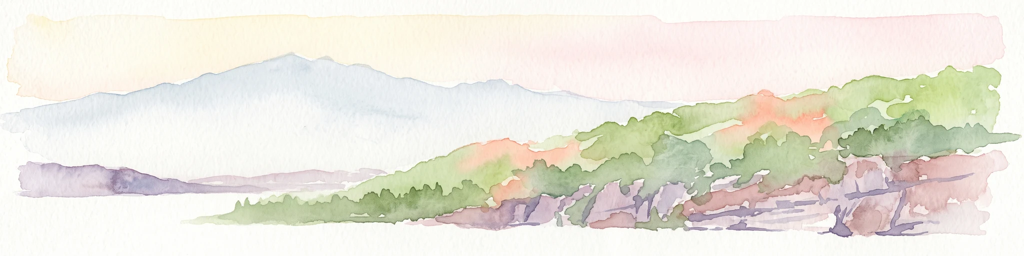
A soft, panoramic watercolor illustration of rolling hills, mountains, and trees in pastel shades of green, yellow, and pink.
Nature reserveAuvergne-Rhône-Alpes
About 48 km away#4 closest

North

Réserve naturelle nationale de la grotte de Hautecourt: Jura Mountain Cave Geography

Protected subterranean landscapes in the Ain department of France.

This nature reserve protects a complex underground environment characterized by a vertical 36-meter cave system and rich invertebrate biodiversity. Located on the flank of Mont Rosset in the Auvergne-Rhône-Alpes region, the area provides a crucial habitat that balances delicate subterranean passages with surface limestone ridges and dry grassland ecosystems.

Area
0.102 km²
Established
1980
IUCN
IV
A soft, light watercolor painting of a winding river flowing through a gentle, rolling landscape with trees and distant hills against a pale, warm sky.
Nature reserveAuvergne-Rhône-Alpes
About 55 km away#5 closest

Northeast

Réserve naturelle régionale de la galerie du Pont-des-Pierres Regional Nature Reserve

Protected gorge landscapes and underground habitats in France

An essential record of the Réserve naturelle régionale de la galerie du Pont-des-Pierres, detailing its critical role in safeguarding cliff and underground habitats within the Valserine gorges. This protected land in the Ain department represents a vital ecological intersection of geological features and specialized faunal refuges.

Area
0.093 km²
Established
2009
IUCN
IV
Relief
Mountain
A horizontal watercolor painting depicting a gentle mountain silhouette behind a forested shoreline sloping toward the water.
Nature reserveFrance
About 60 km away#6 closest

East

Roc de Chère Nature Reserve: Mapping the Botanical Diversity and Geological Features of Haute-Savoie

A protected alpine promontory bordering Lake Annecy

Roc de Chère stands as a distinct geological landmark where limestone and sandstone soils create sharp microclimate contrasts. This protected reserve provides a critical habitat for diverse plant species and rare dragonflies within a small, defined area of the French Alps. The site acts as a key element of the Lake Annecy landscape, offering insight into the post-glacial environmental history of the Savoie region through its protected cliffs and hollows.

Area
0.69 km²
Established
1977
Relief
Mountain
Climate
Temperate
Nature reserveAuvergne-Rhône-Alpes
About 61 km away#7 closest

West

Réserve naturelle régionale de la mine du Verdy: A Subterranean Protected Area in France

Mapping the ecological geography of the Monts du Lyonnais.

The Réserve naturelle régionale de la mine du Verdy stands as France's smallest nature reserve, protecting an intricate network of abandoned mining galleries beneath the surface of the Monts du Lyonnais. This site serves as a crucial underground sanctuary for diverse bat species and cave-dwelling invertebrates, showcasing how repurposed industrial landscapes can harbor significant biodiversity within the Auvergne-Rhône-Alpes region.

Area
0.001 km²
Established
1990
IUCN
IV
Relief
Upland
Nature reserveAuvergne-Rhône-Alpes
About 62 km away#8 closest

North

Réserve naturelle régionale du récif fossile de Marchon - Christian Gourrat Geological Site

A protected Jurassic fossil reef in the Auvergne-Rhône-Alpes region

Located in the Ain department, this small nature reserve is scientifically renowned for its Kimmeridgian reef outcrop. The site protects a fossilized coral and rudist assemblage within the forêt de Marchon, offering a quiet, forested setting for studying France's ancient marine geological history.

Area
0.001 km²
Established
2015
IUCN
IV
Scope
Terrestrial

Common questions about visiting, size, designation, and location context for Réserve naturelle régionale des étangs de Mépieu

Réserve naturelle régionale des étangs de Mépieu FAQs for park facts, access, geography, and protected area context

Find quick answers about Réserve naturelle régionale des étangs de Mépieu, including protected-area facts, park geography, trail and visitor context, and how the park fits into its surrounding country and regional landscape.
MoriAtlas Explorer

Continue Your Protected Areas Search Across the Global Atlas

Deepen your exploration by continuing the structured search for national parks and protected areas worldwide. Utilize the comprehensive filtering capabilities to compare different conservation landscapes and refine your understanding of global park geography. Discover more about the distribution and characteristics of protected natural areas.

Global natural geography