
Mori Atlas logo
Nature reserveRéserve naturelle régionale des gorges de la Maronne et Tours de Merle

Understanding the convergence of river gorge terrain and medieval heritage in the Corrèze region

Réserve naturelle régionale des gorges de la Maronne et Tours de Merle: A Protected Landscape Map

(Réserve naturelle régionale des gorges de la Maronne et Tours de Merle (RNR342))

The Réserve naturelle régionale des gorges de la Maronne et Tours de Merle represents a significant protected area within the northern foothills of the Massif Central in Nouvelle-Aquitaine. This reserve encompasses the steep riverine corridor carved by the Maronne river, which flows toward the Dordogne system, alongside the remains of the Tours de Merle. The mapped landscape integrates dramatic rocky slopes, riparian habitats, and cultural architectural remnants into a single, cohesive protected natural site.

regional nature reserveriver gorgeMassif CentralCorrèzeNouvelle-Aquitainemedieval towers
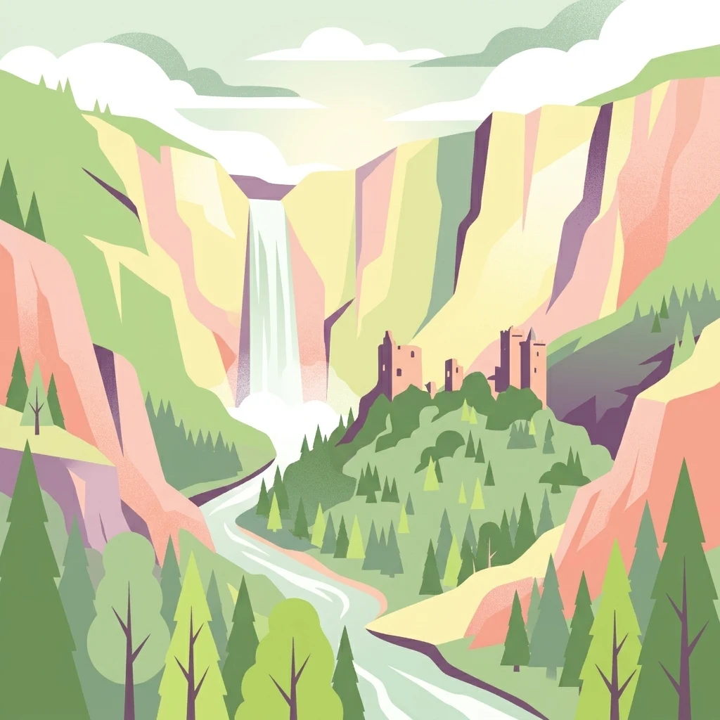
A stylized digital illustration of a river canyon with a waterfall and medieval stone towers situated on a forested hillside.

Réserve naturelle régionale des gorges de la Maronne et Tours de Merle

Nature reserve

Park overview

Structured park overview, official facts, and landscape profile for Réserve naturelle régionale des gorges de la Maronne et Tours de Merle

Réserve naturelle régionale des gorges de la Maronne et Tours de Merle park facts, protected area profile, and essential visitor context

Review the core facts for Réserve naturelle régionale des gorges de la Maronne et Tours de Merle, including designation, size, terrain, visitor scale, habitats, and operating context in one park-focused overview.

About Réserve naturelle régionale des gorges de la Maronne et Tours de Merle

The Réserve naturelle régionale des gorges de la Maronne et Tours de Merle sits in the Corrèze department of Nouvelle-Aquitaine, a region of central-southern France known for its varied terrain combining river valleys, forested slopes, and upland landscapes. The reserve focuses on a stretch of the Maronne valley, where the river has carved a narrow, steep-sided gorge typical of the crystalline and metamorphic formations found in the northern Massif Central.

The protected area was formally created by a regional council deliberation on 16 June 2025, making it one of the most recently designated regional nature reserves in metropolitan France. With a total area of approximately 205.9 hectares, it is a relatively compact site, but its compactness reflects a deliberate effort to concentrate protection on a coherent landscape unit comprising the river corridor, the adjacent rocky slopes, and the hilltop land occupied by the Tours de Merle.

The reserve operates under the French système de réserves naturelles régionales, which is dedicated to the conservation of regionally significant natural heritage and is classed as IUCN Category IV. This category covers areas managed primarily for the protection of particular species or habitats, often with continuation of traditional land uses where compatible. In the context of the Maronne gorges, this approach allows conservation of fragile gorge habitats while maintaining the continuity of the cultural landscape shaped by centuries of rural life.

Administratively, the reserve extends across three communes: Saint-Cirgues-la-Loutre, Saint-Bonnet-les-Tours-de-Merle, and Saint-Geniez-ô-Merle. These small rural municipalities lie in the transitional countryside between the uplands of the Massif Central and the river valleys that feed south and west toward the Dordogne basin. Together, they frame the gorge and the medieval towers within a broader rural setting of meadows, woodlands, and scattered hamlets.

Quick facts and research context for Réserve naturelle régionale des gorges de la Maronne et Tours de Merle

The Réserve naturelle régionale des gorges de la Maronne et Tours de Merle is located in the Corrèze department of the Nouvelle-Aquitaine region, in south-central France. It is classified as a regional nature reserve (réserve naturelle régionale) under the French system, corresponding to IUCN Category IV for habitat and species management areas.

Officially established by a deliberation of the Regional Council on 16 June 2025, the reserve spans approximately 205.9 hectares across three communes: Saint-Cirgues-la-Loutre, Saint-Bonnet-les-Tours-de-Merle, and Saint-Geniez-ô-Merle. Its territory includes both the riverine gorge landscape of the Maronne and the medieval hilltop site known as the Tours de Merle.

Park context

Deeper park guide and search-rich context for Réserve naturelle régionale des gorges de la Maronne et Tours de Merle

Réserve naturelle régionale des gorges de la Maronne et Tours de Merle history, landscape, wildlife, and travel context

Explore Réserve naturelle régionale des gorges de la Maronne et Tours de Merle through its history, landscape character, ecosystems, wildlife, conservation priorities, cultural context, and seasonal travel timing in a structured park guide built for atlas discovery and search intent.

Why Réserve naturelle régionale des gorges de la Maronne et Tours de Merle stands out

The reserve is best known for two complementary features. First, it protects the gorges of the Maronne river, a steep-sided valley characteristic of the northern Massif Central and part of the broader Dordogne watershed, where riverine and rocky-slope habitats meet. Second, the reserve includes the Tours de Merle, a striking group of ruined medieval towers that once formed the heart of a fortified settlement overlooking the gorge. This pairing of natural gorge scenery and medieval heritage architecture is the defining identity of the protected area and distinguishes it from purely ecological or purely cultural sites in the region.
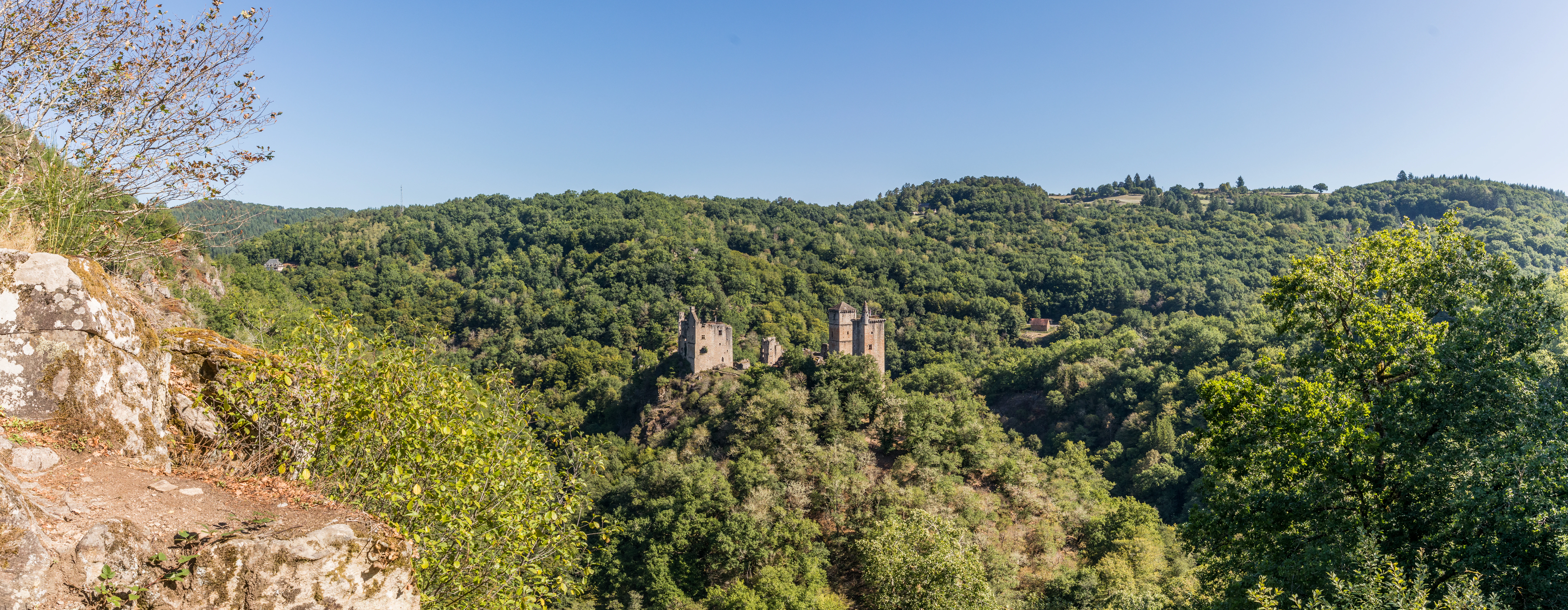
Panoramic view of medieval stone tower ruins on a forested hillside under a clear blue sky.
A panoramic view of the Tours de Merle historical site situated within the wooded landscape of the nature reserve.

Réserve naturelle régionale des gorges de la Maronne et Tours de Merle history and protected-area timeline

The historical significance of the area long predates its formal protection. The Tours de Merle, the hilltop group of ruined towers at the heart of the reserve, reflect the medieval seigneurial and defensive landscape of the Corrèze. The site was once a fortified settlement occupying a commanding position above the Maronne gorge, and the surviving towers are remnants of that earlier stratified history of the valley.

In more recent centuries, the region around the Maronne gorges developed as a comparatively remote rural area, with traditional agriculture, pastoral land use, and forestry shaping both the slopes and the valley floor. This long history of human occupation has left cultural and ecological imprints on the landscape that modern conservation efforts must take into account.

The decisive moment for modern protection came on 16 June 2025, when the Conseil régional formally classified the area as a regional nature reserve through an official deliberation. This step integrated the gorge's ecological value with the heritage value of the Tours de Merle, ensuring that the two dimensions of the site would be managed within a single coherent framework.

Réserve naturelle régionale des gorges de la Maronne et Tours de Merle landscape and geographic character

The dominant landscape feature of the reserve is the gorge of the Maronne, a river that flows through the northern Corrèze on its way toward the Dordogne system. The valley takes the form typical of rivers in this part of the Massif Central, with relatively narrow corridors flanked by steep slopes, rocky outcrops, and wooded sides.

Above the gorge itself, the terrain rises into a plateau-like upper landscape, dissected by smaller valleys and tributary streams. The transition from river level to upper slopes is often abrupt, creating the kind of vertical relief that defines much of the visual character of the area. Rock faces, scree, and cliff-edge vegetation are prominent along the river's course.

Pedestrian-scale exploration of the reserve reveals a mix of riverine flatlands near the water, where riparian vegetation thrives, and rugged higher ground where exposed rock and thin soils support distinctive plant communities. The viewpoint qualities are also central to the landscape: the Tours de Merle and other elevated terrain offer panoramic outlooks over the Maronne corridor, providing visitors with an understanding of the full vertical and spatial structure of the gorge.

Réserve naturelle régionale des gorges de la Maronne et Tours de Merle ecosystems, habitats, and plant life

The ecological interest of the reserve arises from the confluence of contrasting habitats compressed into a relatively small area. The river corridor supports riparian vegetation along the banks and exposed gravel and rock surfaces in the active channel, while the gorge slopes offer dry, rocky habitats that contrast sharply with the wetter conditions near the water.

This juxtaposition of wet and dry, shaded and sun-exposed, horizontal and vertical environments, is typical of southern Massif Central gorges and is associated with notable biodiversity in similar sites throughout the region. The varied microclimates created by topography, together with the rocky substrates, contribute to habitat diversity even within a compact territory like the reserve.

While detailed species inventories for the reserve are still developing, the broader ecological pattern of the area suggests a mosaic that includes riverine woodland, rocky-slope vegetation, and upland forest communities typical of the transitional landscape between the Massif Central and the Dordogne basin. The integration of natural and built heritage within the reserve offers a model for managing Mediterranean-edge and Atlantic-edge ecological transitions under one framework.

Réserve naturelle régionale des gorges de la Maronne et Tours de Merle conservation status and protection priorities

The conservation significance of the reserve lies in its recognition of the Maronne gorge as a regionally important natural area whose rocky and riverine habitats merit formal protection. As a regional nature reserve, the site benefits from a legal status that regulates land use, building, and activities within its perimeter, helping to prevent habitat fragmentation and degradation in a gorge landscape that is inherently fragile.

The reserve's IUCN Category IV designation underlines its function as a habitat and species management area, balancing conservation with the continuation of compatible traditional uses. This is particularly relevant here because the surrounding landscape has been shaped by centuries of low-intensity agricultural and forestry activity, and the conservation strategy must reflect the cultural as well as the ecological character of the terrain.

By bringing the Tours de Merle into the same perimeter, the reserve also acknowledges that long-term ecological integrity in the gorge depends on broader landscape coherence around the historic site. This integration of natural and cultural protection into a unified reserve framework strengthens both the conservation of gorge habitats and the preservation of the medieval heritage landscape overlooking the river.

Réserve naturelle régionale des gorges de la Maronne et Tours de Merle cultural meaning and human context

The cultural dimension of the reserve is dominated by the Tours de Merle, a striking ensemble of medieval towers and ruins perched on a rocky spur above the Maronne gorge. The site testifies to the medieval period of small fortified communities that grew up at strategically important points in the river valleys of the Massif Central and the Dordogne basin.

The surrounding communes of Saint-Cirgues-la-Loutre, Saint-Bonnet-les-Tours-de-Merle, and Saint-Geniez-ô-Merle carry place-names that echo this medieval heritage, with several explicitly referencing the Tours de Merle. Their very names encode the long-standing relationship between the local population and the towers above the gorge, illustrating how the medieval site has continued to shape regional identity long after the original settlement declined.

The reserve thus functions as a place where rural Corrèze heritage, vernacular architecture, and traditional land use meet the formal structures of modern nature conservation, providing a venue in which the cultural significance of the valley can be presented alongside its ecological value.

Top sights and standout views in Réserve naturelle régionale des gorges de la Maronne et Tours de Merle

The reserve combines one of south-central France's characteristic river gorges with a prominent group of medieval tower ruins, offering a rare integrated natural and cultural protected landscape in northern Corrèze.

Its compact perimeter, set within three small rural communes, makes the site a focal point for understanding both the ecological dynamics of the Maronne valley and the medieval heritage of the Dordogne basin fringe.

Best time to visit Réserve naturelle régionale des gorges de la Maronne et Tours de Merle

As a relatively recent designation, the reserve's seasonal character is shaped primarily by the natural rhythms of the gorge rather than by formal access arrangements. Spring and early summer tend to favor active river flow and fresh riparian foliage, while the warmer months offer extended daylight and clearer views from elevated terrain like the Tours de Merle.

Autumn brings distinctive color in the valley's woodlands and a quieter visitation atmosphere, ideal for viewing the towers and gorge in more contemplative conditions. Winter, with reduced vegetation cover, can sharpen the contrast between rocky outcrops and built stone, though conditions on the slopes require caution. Across all seasons, the compactness of the reserve allows visitors to experience a coherent slice of the Maronne landscape within a short visit.
Monthly climate preview

Long-term monthly temperature averages and precipitation patterns measured at representative coordinates

Annual Temperature and Precipitation Normals for Réserve Naturelle Régionale des Gorges de la Maronne et Tours de Merle

Historical climate data from 1991 to 2020 documents the measured annual temperature spread and monthly precipitation rhythm across representative coordinates within Réserve naturelle régionale des gorges de la Maronne et Tours de Merle. Examining the complete twelve-month record provides detailed monthly temperature bounds and precipitation levels for comprehensive analytical comparison.
Annual mean11 °C
3 °C20 °C
Jan
Feb
Mar
Apr10°
May14°
Jun18°
Jul20°
Aug20°
Sep16°
Oct12°
Nov
Dec
Warmest month
August

20.5 °C

Coolest month
January

3 °C

Wettest month
November

3.2 mm/day

Driest month
July

1.9 mm/day

Park location guide

Geography guide, regional context, and park location map for Réserve naturelle régionale des gorges de la Maronne et Tours de Merle

Réserve naturelle régionale des gorges de la Maronne et Tours de Merle park geography, regions, and map view in France

Understand where Réserve naturelle régionale des gorges de la Maronne et Tours de Merle sits in France through a broader geographic reading of the surrounding landscape, nearby location context, and its mapped position within the national park landscape.

How Réserve naturelle régionale des gorges de la Maronne et Tours de Merle fits into France

France is a unitary semi-presidential republic and one of the world's largest economies. It borders Belgium, Luxembourg, Germany, Switzerland, Italy, Monaco, Andorra, and Spain, with a maritime border to the United Kingdom. The country is known for its cultural influence, art, cuisine, and political history spanning centuries.

Wider geography shaping Réserve naturelle régionale des gorges de la Maronne et Tours de Merle in France

France is located in Western Europe. Metropolitan France extends from the Rhine to the Atlantic Ocean and from the Mediterranean Sea to the English Channel and North Sea. The country borders Belgium, Luxembourg, Germany, Switzerland, Italy, Monaco, Andorra, Spain, and has a maritime border with the United Kingdom.

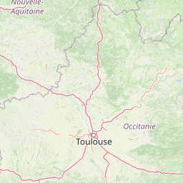
Map view of Réserve naturelle régionale des gorges de la Maronne et Tours de Merle

Use this park location map to pinpoint Réserve naturelle régionale des gorges de la Maronne et Tours de Merle in France, understand its exact geographic position, and read its mapped placement within the surrounding landscape more clearly.

Pigeon | © OpenStreetMap contributors

Location context for Réserve naturelle régionale des gorges de la Maronne et Tours de Merle

Nouvelle-Aquitaine

Examine the rugged riverine terrain, steep rocky slopes, and medieval architectural remnants across the protected reserve.

Visual Exploration of Réserve naturelle régionale des gorges de la Maronne et Tours de Merle Photos and Scenery

Photographic documentation reveals the dramatic vertical relief of the Maronne river gorge and the interspersed medieval stone towers overlooking the valley floor. Visual records of riparian vegetation, exposed rock faces, and elevated viewpoints provide a comprehensive geographic understanding of the protected landscape.

Panoramic view of medieval stone tower ruins on a forested hillside under a clear blue sky.

Park atlas

Compare surrounding regional reserves and river valley landscapes across the Massif Central

Explore Protected Areas Near Réserve Naturelle Régionale des Gorges de la Maronne et Tours de Merle

Browse other protected areas near Réserve Naturelle Régionale des Gorges de la Maronne et Tours de Merle to examine related river gorge terrain and valley habitats. Comparing adjacent regional reserves helps place local conservation geography within the broader framework of south-central France.
A soft, horizontal watercolor painting depicting a gentle, rolling landscape with green hills, sparse trees, and a hazy background in pale green and pink tones.
Regional parkOccitanie
About 34 km away#1 closest

Southwest

Parc naturel régional des Causses du Quercy: Protected Karst Plateaus and River Valleys

Geographic atlas of the Causses du Quercy karst landscapes

An essential look at the geography of Parc naturel régional des Causses du Quercy. This protected area in Occitanie features an expansive network of limestone plateaus and carved river gorges. Learn about the karst terrain, sedimentary history, and the natural boundaries that define this French regional park and internationally recognized geopark.

Area
1,855 km²
Established
1999
IUCN
V
Nature reserveOccitanie
About 36 km away#2 closest

Southwest

Réserve naturelle régionale du marais de Bonnefont: Protected Wetland and Regional Atlas

Exploring the largest reedbed in the Lot department.

Situated in the heart of the Causses du Quercy, this protected nature reserve shelters the most significant reedbed in the Lot department of Occitanie. The site serves as a vital hydrological marker, demonstrating a rare transition between wetland habitats and the characteristic dry limestone plateaus of the region. This overview examines the geography, terrain, and structural importance of the reserve within the broader French protected lands network.

Area
0.42 km²
Established
2011
IUCN
IV
Relief
Lowland
Protected areaLot
About 40 km away#3 closest

Southwest

Vallée de la Dordogne quercynoise: Regional Protected Area and River Valley Geography

A detailed geographic study of limestone slopes and riparian corridors in the Lot department.

Spanning 5,567 hectares across the Lot department, this protected area preserves the ecological integrity of the Dordogne river. The region is marked by its transition from narrow, hill-enclosed upstream stretches to broader floodplain zones, creating a complex habitat mosaic of alluvial meadows, travertine springs, and rocky chasmophytic slopes that support important European biodiversity.

Area
55.67 km²
Established
2007
Relief
Upland
Climate
Temperate
A soft, light-toned watercolor painting showing rolling green hills and valley slopes under a pale sky.
Nature reserveOccitanie
About 56 km away#4 closest

Southeast

Réserve naturelle régionale des coteaux du Fel, A Protected Landscape in Occitanie, France

Regional nature reserve in the Aveyron department.

Located along the Lot valley, the Réserve naturelle régionale des coteaux du Fel preserves a mosaic of sun-drenched oak and chestnut woodlands, heathlands, and historic meadows. This nature reserve provides a critical study of small-area conservation and dryland habitat management within the rural landscape of Occitanie. Use this resource to understand the park's terrain, mapped boundaries, and its ecological importance in the northern Aveyron region.

Area
123.38 km²
Established
2011
IUCN
IV
Watercolor painting of a soft, hazy mountain landscape with rolling green fields and a distant forest, set against a light, warm, pale background.
Nature reserveAuvergne-Rhône-Alpes
About 61 km away#5 closest

East

Réserve naturelle régionale des tourbières du Jolan et de la Gazelle: Geographic Overview

A vital wetland protected area in the Auvergne volcanic highlands.

Located in the Cantal department, the Réserve naturelle régionale des tourbières du Jolan et de la Gazelle features a unique collection of peatland habitats, trembling mires, and acidic grasslands. This area sits within the broader volcanic terrain of the Parc naturel régional des Volcans d'Auvergne, offering a protected catchment for diverse marshland flora and fauna.

Area
1.558 km²
Established
2018
IUCN
IV
Relief
Highland
A horizontal watercolor illustration depicting a soft landscape with rolling hills, a body of water in the foreground, and pine trees on the right side.
Nature reserveNouvelle-Aquitaine
About 66 km away#6 closest

North

Réserve naturelle régionale de la haute vallée de la Vézère: Protected Highland Geography

Wetland ecosystems of the Corrèze and Plateau de Millevaches.

Representing a vital network of peatland and bog systems, this nature reserve in the Nouvelle-Aquitaine region preserves essential highland habitats. Its scattered parcels illustrate the complex wetland geography of the Massif Central, offering a focused look at how protected boundaries safeguard specialized ecosystems within the upper Vézère river catchment area.

Area
1.963 km²
Established
2015
IUCN
IV
Relief
Lowland
A soft watercolor painting of a wide, gently rolling landscape with green fields, forested hills in the distance, and native vegetation in the foreground.
Nature reserveHaute-Vienne
About 79 km away#7 closest

Northwest

Lande de la Flotte et du Cluzeau: Geological Landscapes of Haute-Vienne, France

Nature reserve featuring rare serpentinite heathland habitats

Lande de la Flotte et du Cluzeau preserves a rare type of serpentine heathland on the Limousin plateau. By protecting stony outcrops that contrast with the local forest and farmland, this reserve maintains a significant botanical environment within Haute-Vienne, reflecting the complex metamorphic history of the region.

Area
132 km²
Established
1993
IUCN
IV
A soft watercolor painting depicting rolling green hills and distant faint mountains under a light sky.
Nature reservePuy-de-Dôme
About 82 km away#8 closest

Northeast

Réserve naturelle nationale du rocher de la Jaquette Protected Area and Volcanic Landscape

Explore rocky cliffs and rare entomological habitats in the Puy-de-Dôme region.

Situated on the flanks of a volcanic outcrop above the Rentières valley, this nature reserve protects a diverse habitat mosaic within the Massif Central. The site provides essential breeding grounds for protected raptors and represents one of the most significant insect sites in central France, offering a clear view into regional volcanic ecology and mountain-valley geography.

Area
0.362 km²
Established
1976
IUCN
IV
Relief
Mountain

Common questions about visiting, size, designation, and location context for Réserve naturelle régionale des gorges de la Maronne et Tours de Merle

Réserve naturelle régionale des gorges de la Maronne et Tours de Merle FAQs for park facts, access, geography, and protected area context

Find quick answers about Réserve naturelle régionale des gorges de la Maronne et Tours de Merle, including protected-area facts, park geography, trail and visitor context, and how the park fits into its surrounding country and regional landscape.
MoriAtlas Explorer

Continue Your Protected Areas Search Across the Global Atlas

Deepen your exploration by continuing the structured search for national parks and protected areas worldwide. Utilize the comprehensive filtering capabilities to compare different conservation landscapes and refine your understanding of global park geography. Discover more about the distribution and characteristics of protected natural areas.

Global natural geography