
Mori Atlas logo
Nature reserveRéserve naturelle régionale des landes et marais de Glomel

Mapping the distinct wetland mosaic and rare acid-loving ecosystems within the Bretagne regional landscape

Réserve naturelle régionale des landes et marais de Glomel: Protected Heathlands and Marshland Geography

The Réserve naturelle régionale des landes et marais de Glomel serves as a vital protected refuge in the Montagnes Noires, featuring a rare combination of wet heathland, marshy meadows, and bog woodland that once defined much of the inland French landscape. Comprising two distinct sites at Lan Bern and Magoar-Pen Vern, this nature reserve protects a mosaic of sphagnum bogs and acidic soil habitats from agricultural fragmentation. Users can explore the terrain, ranging from canal-side heaths to stream-fed wetlands, to understand how this ecological enclave preserves biodiversity in central Bretagne.

wetlandheathlandpeat bognature reserveBrittanyMontagnes Noires
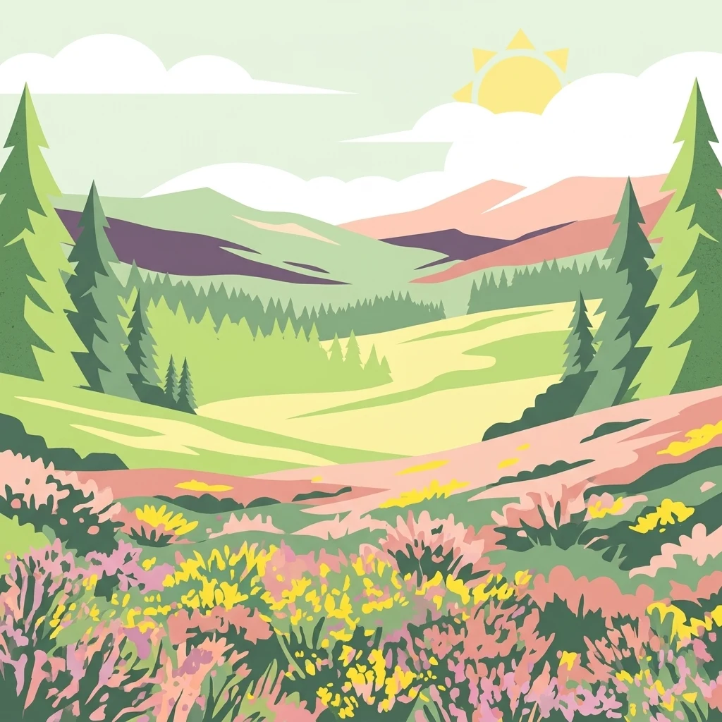
A stylized, flat-design illustration showing a landscape with colorful wildflowers in the foreground, coniferous trees on the sides, and rolling hills under a sunny sky with soft clouds.

Réserve naturelle régionale des landes et marais de Glomel

Nature reserve

Park overview

Structured park overview, official facts, and landscape profile for Réserve naturelle régionale des landes et marais de Glomel

Réserve naturelle régionale des landes et marais de Glomel park facts, protected area profile, and essential visitor context

Review the core facts for Réserve naturelle régionale des landes et marais de Glomel, including designation, size, terrain, visitor scale, habitats, and operating context in one park-focused overview.

About Réserve naturelle régionale des landes et marais de Glomel

The Réserve naturelle régionale des landes et marais de Glomel stands at the heart of the Montagnes Noires, a low mountain ridge of central Brittany where old farming and grazing landscapes still meet patches of unusually well-preserved semi-natural habitat. Although the reserve is small by national standards, it exists to defend one of the rarest types of environment in lowland France: extensive complexes of wet heath, peat bog, marsh and bog woodland that have survived only where active, low-intensity management has continued.

The protected area is split into two geographically and ecologically distinct sites. The northern site, the heathlands of Lan Bern, lies along the canal de Nantes à Brest and consists mainly of humid and peaty heaths with sphagnum mosses, gorse and heather. The southern site, the Magoar-Pen Vern area, wraps around the Grazius stream and combines wet meadows, low marshes, mesophile and peaty heaths, and patches of willow and birch wet woodland, with acid-loving oak woodland and a few oligotrophic wet prairies on its eastern fringe. Together these two sites give the reserve a layered ecological identity combining open bog-like habitats with fringing woodland and stream-side wetlands.

The reserve's significance is amplified by the broader mapping designations attached to its two sites. Lan Bern is recognized as a ZNIEFF of type I and falls within a Special Area of Conservation tied to the Montagnes Noires. Magoar-Pen Vern is similarly listed and falls within the Rivière Ellé conservation area. These designations underline that the small reserve is not an isolated conservation curiosity but part of an ecological network across inland Brittany.

Because the habitats it protects would quickly close over and lose their conservation value without intervention, the reserve is managed as a living working landscape. The managing association, the AMV, runs practical conservation work including cutting, light grazing, maintenance of open water features and the upkeep of public paths, while also welcoming visitors through short educational trails. A conservatory orchard of old apple varieties at Lan Bern adds an additional layer of cultural and agricultural heritage to the site.

Quick facts and research context for Réserve naturelle régionale des landes et marais de Glomel

The Réserve naturelle régionale des landes et marais de Glomel is a regional nature reserve in Brittany, France, located in the commune of Glomel in the Côtes-d'Armor department, within the Montagnes Noires. Created by regional deliberation on 20 December 2008 and managed by the Association de Mise en Valeur de Lan Bern et Magoar (AMV) since 1992, it covers approximately 108 hectares across two distinct sites.

The reserve protects wet and peaty heathlands, peat bogs, wet meadows and humid woodland along the Nantes to Brest canal and the Grazius stream. Its ecological profile is shaped by habitats normally lost to agricultural intensification, and it supports a rich flora of more than 400 plant species and a notable avifauna of 77 bird species, along with a wide range of reptiles, amphibians and rare insects.

Protection and recognition

Documented terrestrial designation history and management scope for the protected area.

Réserve naturelle régionale des landes et marais de Glomel Protection Status

Terrestrial protection status for Réserve naturelle régionale des landes et marais de Glomel includes documented designation history established in 2008. Official records track administrative classification parameters and recognized boundaries within the global protected area registry.

Protection details

Protection scope
Terrestrial
Designated year
2008
Transboundary protection
No
WDPA ID
555514353
Park context

Deeper park guide and search-rich context for Réserve naturelle régionale des landes et marais de Glomel

Réserve naturelle régionale des landes et marais de Glomel history, landscape, wildlife, and travel context

Explore Réserve naturelle régionale des landes et marais de Glomel through its history, landscape character, ecosystems, wildlife, conservation priorities, cultural context, and seasonal travel timing in a structured park guide built for atlas discovery and search intent.

Why Réserve naturelle régionale des landes et marais de Glomel stands out

The reserve is best known for its rare and well-preserved wet heaths and peat bog communities of inland Brittany, including sphagnum bogs, sundews and other specialist bog plants that thrive in acidic, waterlogged conditions. It is also notable as one of the few protected sites in central Brittany where fragmented heathland, marshland and bog woodland occur together in a working landscape shaped by centuries of human management. A defining trait of the reserve is the contrast between its two parts: the open, drier-feeling Lan Bern heathland beside the canal and the wetter, mosaic-like wetland mosaic of Magoar-Pen Vern. Together these two sites illustrate how traditional low-intensity practices maintained a patchwork of heath, marsh and woodland that today supports rare Dartford warblers, nightjars, hobbies, dragonflies, amphibians and even otters along the connected waterways.
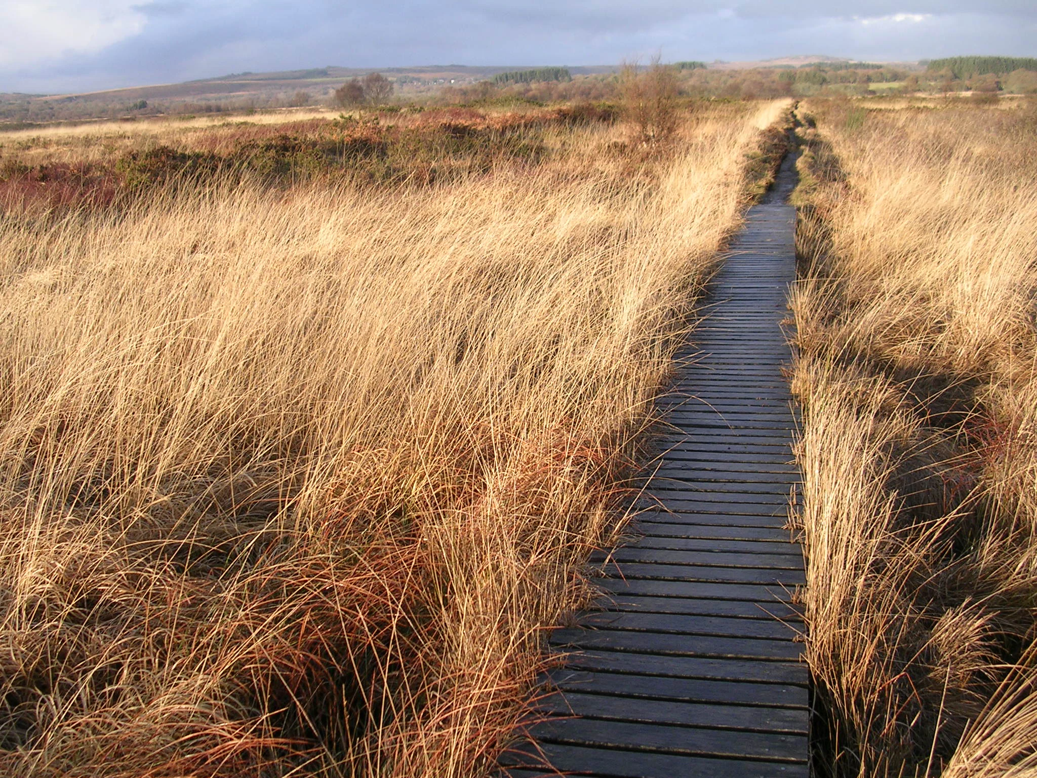
Boardwalk in the peat bog
Typical landscape of the nature reserve

Réserve naturelle régionale des landes et marais de Glomel history and protected-area timeline

Although the site's formal protection as a regional nature reserve dates only from 20 December 2008, the foundations of the reserve were laid earlier through local conservation efforts in the 1990s. The Association de Mise en Valeur de Lan Bern et Magoar (AMV) has been managing the area since 1992, organizing the practical care of habitats and welcoming visitors before there was any formal regional designation.

The reserve gained its official status in 2008 through a deliberation creating the Réserve naturelle régionale des landes et marais de Glomel, a step that elevated the AMV's existing work into a recognized regional protected area. In 2016 the reserve took its current name; previously it had been known more narrowly as the landes de Lan Bern et Magoar-Pen Vern. The two sites themselves had long existed as relic heathland and wetland patches in a region where similar habitats were being steadily lost to agricultural intensification, drainage and land abandonment following the closure of the Nantes to Brest canal to commercial navigation.

The broader legal context of the reserve was strengthened by national ecological mapping. Its two sites were recorded within ZNIEFF inventories and incorporated into Natura 2000 Special Areas of Conservation, confirming both their local and European importance and reinforcing the case for ongoing management by the AMV.

Réserve naturelle régionale des landes et marais de Glomel landscape and geographic character

The Montagnes Noires form the low but distinct backbone of central Brittany, and the reserve occupies the inland slopes and valleys of this modest range. The terrain is gently rolling rather than dramatic, with broad ridges, shallow valleys and a network of small streams that feed the Aulne and Ellé river basins. The two sites of the reserve sit about ten kilometers apart but share a common geological and climatic character of acidic soils, abundant rainfall and poor natural drainage.

The northern site at Lan Bern lies along a section of the historic canal de Nantes à Brest, an artificial waterway that cuts through the heathland and helps maintain the waterlogged conditions essential to the site. The southern site, Magoar-Pen Vern, is structured around the small Grazius stream, with marshy flats, wet meadows and gentle slopes draining toward the watercourse. Together the two sites form a patchy mosaic of open heath, boggy ground, marshy hollows and fringing woodland.

Because the soils are largely acidic and the management history includes long periods of grazing, cutting and periodic burning, the reserve lacks the lush green look of more fertile countryside. Instead, its visual identity is shaped by the russet and ochre tones of heather, the spiky dark green of gorse, the pale yellow-green of sphagnum hummocks and the soft greens of bog woodland. The result is a quiet, slightly otherworldly heath- and bog-dominated scenery unusual for lowland Brittany.
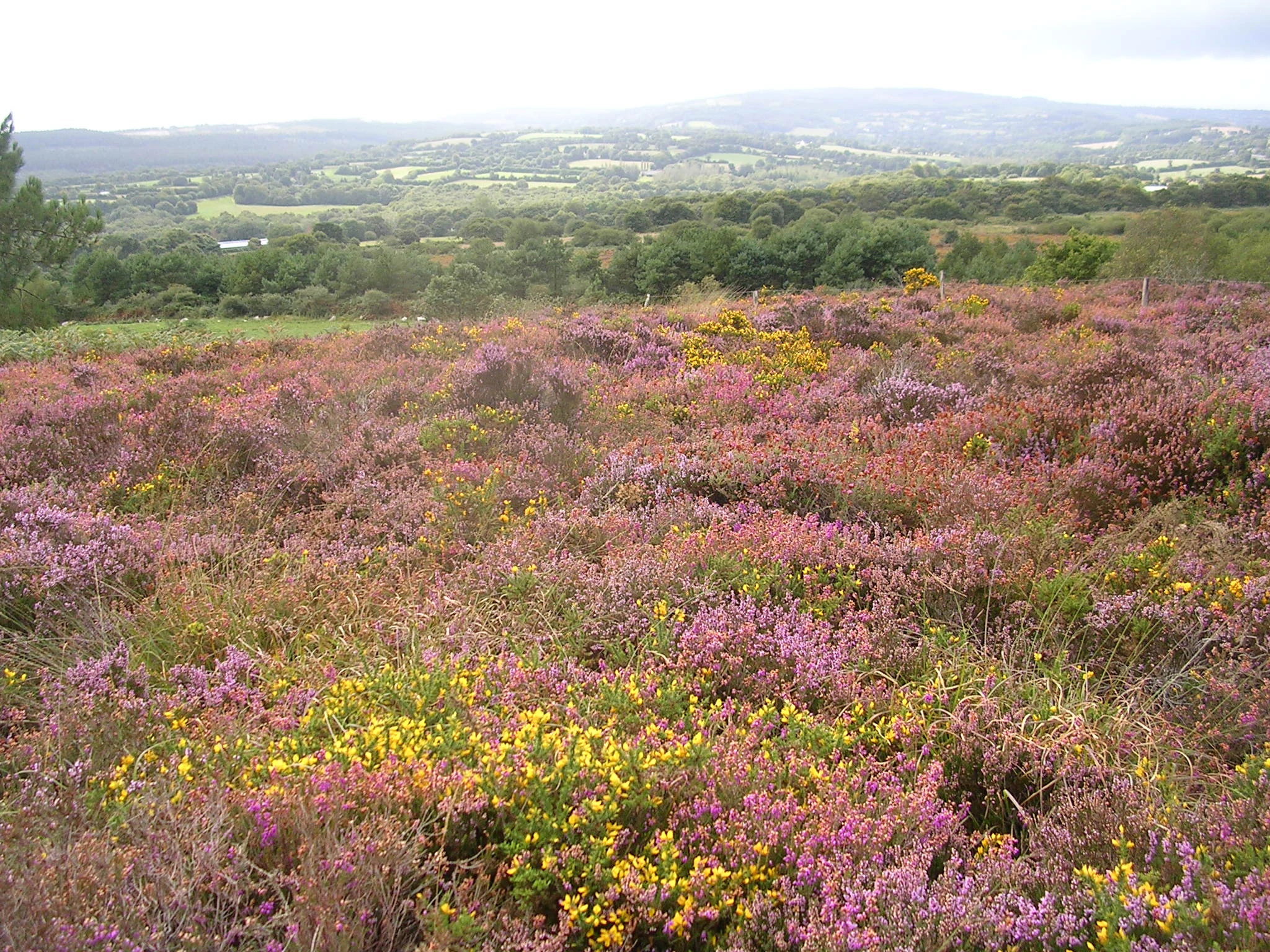
A wide view of a rolling landscape covered in purple heather and yellow gorse in the foreground, with distant green trees and hills in the background.
A landscape of heath and gorse at the Réserve naturelle régionale des landes et marais de Glomel.

Réserve naturelle régionale des landes et marais de Glomel ecosystems, habitats, and plant life

Ecologically, the reserve is dominated by a handful of interconnected wet-to-dry habitat gradients built on acidic, nutrient-poor soils. Sphagnum-rich peaty heaths with gorse, heather and cross-leaved heath are central at Lan Bern, while Magoar-Pen Vern adds wet meadows, low marshes, mesophile heaths and boggy fringing woodland. Small areas of acid-loving oak woodland occur alongside willow and birch wet woodland, and a few oligotrophic wet prairies and tall-herb communities appear on the eastern side.

A defining feature of the reserve's nature is the presence of functioning peat-forming vegetation. Sphagnum mosses build up soft, waterlogged carpets in which specialist plants such as round-leaved and intermediate sundews take root, alongside rarities like bog asphodel, four-angled heath, the floating bur-reed Luronium natans, the pillwort fern, the marsh clubmoss and the small bog orchid Gentiana pneumonanthe. These species are tightly linked to the open, acidic, nutrient-poor conditions that the reserve's management seeks to preserve.

The wider ecological matrix also supports more common but characteristic communities: juncus-rich wet meadows, buckthorn scrub, willow carrs, humid birch stands and bracken- or gorse-dominated dry heaths. This structural diversity, combined with the variety of aquatic, boggy and dry habitats, creates a habitat mosaic of unusual richness for inland Brittany.

Réserve naturelle régionale des landes et marais de Glomel wildlife and species highlights

The reserve's wildlife profile is shaped by the fact that the habitats it protects form a refuge in a landscape otherwise dominated by farmland and forestry. More than 400 plant species have been recorded across the two sites, and the reserve hosts an avifauna of 77 bird species. Among the most distinctive birds are the Dartford warbler, a specialist of low gorse and heather, the European nightjar, a crepuscular hunter of open heath, and the hobby, a fast aerial predator that feeds on dragonflies and other insects above the open ground.

The invertebrate fauna is exceptionally diverse, with 330 recorded insect species, 14 of which are considered determinant for conservation. These include the marsh fritillary, a butterfly dependent on devil's-bit scabious in wet meadows, alongside the scarce black darter dragonfly and several rare blue butterflies tied to bog and heath habitats. Such rich entomological diversity in turn supports the bird and amphibian life of the reserve.

Reptiles and amphibians use the bog pools, ditches and marshy ground as core breeding habitat. Marbled and crested newts breed in the reserve's ponds, and the agile frog, tree frog, slow-worm, grass snake and adder are all recorded. Mammals include the European otter along the connected streams and canals and the water shrew, both of them indicators of relatively clean, well-vegetated aquatic environments.

Réserve naturelle régionale des landes et marais de Glomel conservation status and protection priorities

The reserve's primary conservation value lies in the preservation of rare wet heath and peat bog ecosystems in a region where they have been heavily depleted. These habitats are fragile because they depend on a balance of factors that modern land use tends to disrupt: stable water levels, acidic nutrient-poor soils, periodic cutting or grazing, and a lack of fertilization. Without active management they would either dry out, become overgrown with birch and pine, or be converted to more intensive land uses.

As a regional nature reserve, the site benefits from a formal protection framework established in 2008, reinforced by its integration into broader European networks. Both sites lie within Special Areas of Conservation tied to the Montagnes Noires and the Rivière Ellé, and they are catalogued as ZNIEFF of type I, recognizing their national and European significance. This layered protection reflects the view that even small sites can be ecologically critical when they host threatened habitats and species.

The greatest threat to the reserve is habitat closure: when traditional grazing, cutting or other low-intensity uses stop, scrub and woodland rapidly encroach. The managing association AMV therefore remains central to the reserve's conservation success, carrying out active interventions to keep the heath and bog habitats open while monitoring species such as sundews, bog orchids, marsh fritillaries, breeding newts and otters as indicators of ecological condition.

Réserve naturelle régionale des landes et marais de Glomel cultural meaning and human context

Beyond its ecological role, the reserve reflects a long human relationship with the uplands of central Brittany. The heathland and bog habitat mosaic it protects is not a pristine wilderness but a product of centuries of grazing, cutting, peat-digging and small-scale management. The very openness of the landscape, with its lack of mature forest in many areas, is a reflection of this historical land use.

The presence of the Nantes to Brest canal beside the Lan Bern heathland links the reserve to one of Brittany's most notable 19th-century engineering projects, while its transitions from canal-side heath to inland marsh illustrate how rural infrastructure, agriculture and natural heritage intersect in this part of the region. The conservatory orchard of 92 traditional apple trees at Lan Bern adds a further living heritage element, preserving local fruit varieties that belong to the agricultural identity of inland Brittany.

Top sights and standout views in Réserve naturelle régionale des landes et marais de Glomel

A compact but ecologically dense reserve combining two distinct heath and wetland sites in the Montagnes Noires, with sphagnum bogs, sundews and more than 400 plant species within walking distance. Visitors encounter a well-developed network of short educational trails and a heritage orchard that anchors the cultural landscape of Lan Bern.

Best time to visit Réserve naturelle régionale des landes et marais de Glomel

Late spring and early summer are generally the most rewarding periods to experience the reserve's heathland and bog vegetation, when gorse, heather and bog plants are at their most active and wildflowers are easiest to observe. Early summer mornings and evenings are also the best times to see Dartford warblers, nightjars and hobbies, which are most visible in the still, warm air around dusk when insect activity peaks.

Autumn and winter bring their own character: the russet tones of mature heather become more visible, bog pools fill with rainwater, and the reserve feels quieter and more contemplative, though some paths may be soft underfoot. Whatever the season, visitors should expect wet, acidic ground and a cool inland Breton climate, and should plan for footwear and clothing suited to boggy heath terrain rather than long coastal walks.
Monthly climate preview

Long-term temperature and monthly precipitation averages for Bretagne

Réserve naturelle régionale des landes et marais de Glomel Climate Normals

Measured coordinates for Réserve naturelle régionale des landes et marais de Glomel document a consistent annual rhythm of shifting thermal maximums, minimums, and daily precipitation rates. Detailed monthly comparisons across the full twelve-month span reveal complete long-term climatological profiles for the protected landscape.
Annual mean11 °C
6 °C18 °C
Jan
Feb
Mar
Apr10°
May13°
Jun16°
Jul18°
Aug18°
Sep16°
Oct12°
Nov
Dec
Warmest month
August

18.3 °C

Coolest month
January

5.6 °C

Wettest month
December

3.1 mm/day

Driest month
July

1.5 mm/day

Park location guide

Geography guide, regional context, and park location map for Réserve naturelle régionale des landes et marais de Glomel

Réserve naturelle régionale des landes et marais de Glomel park geography, regions, and map view in France

Understand where Réserve naturelle régionale des landes et marais de Glomel sits in France through a broader geographic reading of the surrounding landscape, nearby location context, and its mapped position within the national park landscape.

How Réserve naturelle régionale des landes et marais de Glomel fits into France

France is a unitary semi-presidential republic and one of the world's largest economies. It borders Belgium, Luxembourg, Germany, Switzerland, Italy, Monaco, Andorra, and Spain, with a maritime border to the United Kingdom. The country is known for its cultural influence, art, cuisine, and political history spanning centuries.

Wider geography shaping Réserve naturelle régionale des landes et marais de Glomel in France

France is located in Western Europe. Metropolitan France extends from the Rhine to the Atlantic Ocean and from the Mediterranean Sea to the English Channel and North Sea. The country borders Belgium, Luxembourg, Germany, Switzerland, Italy, Monaco, Andorra, Spain, and has a maritime border with the United Kingdom.

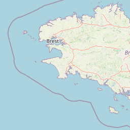
Map view of Réserve naturelle régionale des landes et marais de Glomel

Use this park location map to pinpoint Réserve naturelle régionale des landes et marais de Glomel in France, understand its exact geographic position, and read its mapped placement within the surrounding landscape more clearly.

Pigeon | © OpenStreetMap contributors

Location context for Réserve naturelle régionale des landes et marais de Glomel

Bretagne

Visualizing the wet heaths, peat bogs, and protected terrain of central Brittany

Réserve naturelle régionale des landes et marais de Glomel Photos and Landscape Scenery

Visual documentation reveals the distinctive terrain, wet heathland habitats, and bog mosaics that define the protected environment of Réserve naturelle régionale des landes et marais de Glomel. Examining these landscape photographs provides a clearer understanding of the rare botanical communities and ecological character preserved across the Montagnes Noires.

Boardwalk in the peat bog

A close-up view of a small round-leaved sundew plant with red, glandular leaves growing in a damp, mossy bog environment next to a small pool of water.

A wide view of a rolling landscape covered in purple heather and yellow gorse in the foreground, with distant green trees and hills in the background.

Park atlas

Compare regional protected areas and wetland habitats across central Brittany.

Other Parks Near Réserve naturelle régionale des landes et marais de Glomel

Visitors exploring Réserve naturelle régionale des landes et marais de Glomel can compare nearby protected landscapes and wetland reserves. Regional park data reveals connected habitats, surrounding topography, and related conservation areas throughout the Montagnes Noires.
Nature reserveFinistère
About 17 km away#1 closest

West

Vallée de l'Aulne Nature Reserve: A Detailed Mapping of Finistère River Valley Geography

Protected riparian landscapes, watershed ecology, and regional basin boundaries

The Vallée de l'Aulne serves as a central artery for the natural landscapes of western France. Spanning from inland Brittany toward the Atlantic, this protected reserve encompasses riverine corridors, bocage terrain, and tidal estuary zones. Use this detailed profile to examine the geographic distribution of protected habitats, river basin features, and the integrated environmental protections that define this key Finistère landscape.

Area
35.64 km²
Established
2014
Relief
Lowland
Climate
Temperate
A horizontal watercolor illustration of a soft green landscape with rolling hills, patches of grass, and distant tree lines against a white background.
Nature reserveBretagne
About 34 km away#2 closest

Northwest

Réserve naturelle régionale des landes et tourbières du Cragou et du Vergam: Regional Park Geography

Protected granite ridges and Atlantic peatland ecosystems in Finistère

The Réserve naturelle régionale des landes et tourbières du Cragou et du Vergam stands as a critical reference for understanding Breton upland ecology. Spanning the Monts d'Arrée, these protected sites provide a distinct map of wet heath, acidic flushes, and diverse botanical habitats that define the inland character of northwestern France.

Area
3.434 km²
Established
2008
IUCN
IV
Relief
Upland
A watercolor painting showing a wide, panoramic view of a marshy landscape with green clumps of grass in the foreground and soft purple hills in the distance.
Nature reserveFinistère
About 41 km away#3 closest

Northwest

Réserve naturelle nationale du Venec: Protected Peatland and Monts d'Arrée Geography

A core nature reserve and active sphagnum bog ecosystem in Finistère

Located in central Brittany, the Réserve naturelle nationale du Venec represents the only remaining large, active raised bog in the region. This protected area within the Finistère department offers deep insight into the geomorphology of the Yeun-Elez basin, mapping the transition from granite-edged dry moorland through marshy transition zones to the central, ombrotrophic peat dome.

Area
3.341 km²
Established
1993
IUCN
IV
Relief
Upland
Nature reserveBretagne
About 43 km away#4 closest

North

Réserve naturelle régionale des landes, prairies et étangs de Plounérin: Protected Habitat Atlas

Inland Bretagne landscape mosaic and regional nature reserve mapping

This protected area in the heart of Brittany serves as a vital refuge for heathland, meadows, and ponds. Examine the site's mapped boundaries and understand its role as an IUCN Category IV conservation landscape within the broader geography of the Côtes-d'Armor department.

Area
1.607 km²
Established
2016
IUCN
IV
A soft watercolor painting showing a green landscape with a small pond in the foreground and rolling hills in the background under a pastel sky.
Nature reserveMorbihan
About 50 km away#5 closest

South

Réserve naturelle régionale des étangs du Petit et du Grand Loc'h: Wetland Landscape Atlas

Coastal protected area in Morbihan, Brittany

Located along the Atlantic coast near Guidel, this regional nature reserve protects a vital corridor of freshwater ponds, wet meadows, and reclaimed polders. The area is defined by its complex hydrology and serves as a key refuge for wintering and migratory bird populations within the Morbihan landscape, showcasing the intersection of maritime and terrestrial environments.

Area
1.18 km²
Established
2008
IUCN
IV
Relief
Lowland
A watercolor painting showing a soft, panoramic view of a coastal wetland with small islands in the distance and grassy foreground dunes.
Regional parkBretagne
About 63 km away#6 closest

Southeast

Parc naturel régional du Golfe du Morbihan: Coastal Landscape and Marine Park Geography

Protected maritime territory and island geography in Bretagne

Covering over 80,000 hectares of combined land and marine space, Parc naturel régional du Golfe du Morbihan offers a unique view into the intersection of Atlantic coastal heritage and environmental conservation. Learn about the park's structural role in the Bretagne region through its intricate network of inlets, peninsulas, and marshland habitats that define its distinctive maritime character.

Area
642 km²
Established
2014
IUCN
V
A soft watercolor illustration showing a calm coastal bay with distant low hills, green shorelines, and sandy patches under a pale sky.
Nature reserveCôtes-d'Armor
About 63 km away#7 closest

Northeast

Réserve naturelle nationale de la baie de Saint-Brieuc: Coastal Geography and Protected Terrain

Tidal mudflats and salt marshes on the North-Armorican coast.

Located in the Côtes-d'Armor department, this French nature reserve spans over 1,000 hectares of intertidal terrain. The area features a complex mosaic of sandy flats, brackish marshes, and dune systems, providing a critical study of coastal processes and tidal ecosystems along the Brittany shoreline.

Area
11.4 km²
Established
1998
IUCN
IV
Relief
Lowland
Watercolor painting of soft, rolling green hills and pinkish, jagged coastal cliffs on a white background.
Nature reserveBretagne
About 77 km away#8 closest

West

Réserve naturelle régionale des sites d'intérêt géologique de la presqu'île de Crozon: Protected Area and Atlas

Coastal geological heritage and maritime landscapes in the heart of Bretagne.

Spanning 27 distinct locations, the Réserve naturelle régionale des sites d'intérêt géologique de la presqu'île de Crozon documents millions of years of volcanic, tectonic, and sedimentary evolution. The reserve anchors its scientific value in its open-air exposures of Paleozoic rock, while simultaneously providing a sanctuary for specialized coastal flora and fauna along the Atlantic edge of Bretagne.

Area
1.564 km²
Established
2013
IUCN
IV
Relief
Upland

Common questions about visiting, size, designation, and location context for Réserve naturelle régionale des landes et marais de Glomel

Réserve naturelle régionale des landes et marais de Glomel FAQs for park facts, access, geography, and protected area context

Find quick answers about Réserve naturelle régionale des landes et marais de Glomel, including protected-area facts, park geography, trail and visitor context, and how the park fits into its surrounding country and regional landscape.
MoriAtlas Explorer

Continue Your Protected Areas Search Across the Global Atlas

Deepen your exploration by continuing the structured search for national parks and protected areas worldwide. Utilize the comprehensive filtering capabilities to compare different conservation landscapes and refine your understanding of global park geography. Discover more about the distribution and characteristics of protected natural areas.

Global natural geography