Mori Atlas logo
Nature reserveRéserve naturelle régionale des marais du Bout de Sac

Mapped boundaries and landscape context for this protected Atlantic coastal marshland

Réserve naturelle régionale des marais du Bout de Sac: A Coastal Wetland Nature Reserve

(Réserve naturelle régionale des Marais du Bout de Sac (RNR344))

The Réserve naturelle régionale des marais du Bout de Sac encompasses 187.1 hectares of distinct coastal wetland terrain. This protected area features a mosaic of polders, tidal channels, and reedbeds that define its ecological identity near the Atlantic coast. By tracking its mapped boundaries and spatial distribution, observers can better understand the interplay between terrestrial marsh habitats and maritime influences within this regional reserve.

regional natural reservewetlandmarshlandcoastal marshVendéePays de la Loire

Réserve naturelle régionale des marais du Bout de Sac

Nature reserve

Park overview

Structured park overview, official facts, and landscape profile for Réserve naturelle régionale des marais du Bout de Sac

Réserve naturelle régionale des marais du Bout de Sac park facts, protected area profile, and essential visitor context

Review the core facts for Réserve naturelle régionale des marais du Bout de Sac, including designation, size, terrain, visitor scale, habitats, and operating context in one park-focused overview.

About Réserve naturelle régionale des marais du Bout de Sac

The Réserve naturelle régionale des marais du Bout de Sac is a recently established regional natural reserve in western France, positioned within the Pays de la Loire region and the Vendée department. It lies on the commune of Beauvoir-sur-Mer, on the northern edge of the Marais breton, a low-lying coastal landscape shaped by centuries of interaction between human land use and the tidal influence of the Atlantic Ocean. The reserve's 187.1 hectares capture a fragment of this marsh environment under formal protection, adding a new anchor point to the mosaic of wetlands that line the Vendée coast.

The broader geographic context is central to understanding the reserve. The Marais breton is part of a vast coastal plain where former marine embayments have been progressively reclaimed through dikes, channels, and sluice systems. The result is a landscape where saline and fresh waters meet, where pastures, meadows, reedbeds, and open water alternate, and where traditional grazing and mowing practices continue to shape habitat structure. The Bout de Sac marsh fits within this pattern, offering a mix of wet grassland, channels, and marsh vegetation that supports both resident and migratory wetland species.

By classifying the area in September 2025, the Conseil régional des Pays de la Loire recognized the ecological value of this marsh complex and committed to a long-term protection framework typical of French regional natural reserves. The IUCN Category IV designation reflects the site's role as a habitat and species management area, where active conservation and monitoring are expected to take place alongside the maintenance of compatible land uses. Although the reserve is newly designated, its significance is rooted in a landscape with deep ecological continuity, linking inland wetlands of the Marais breton with the marine-influenced environments of the nearby Baie de Bourgneuf.

Quick facts and research context for Réserve naturelle régionale des marais du Bout de Sac

The Réserve naturelle régionale des marais du Bout de Sac is a regional natural reserve (réserve naturelle régionale) in the Pays de la Loire region of France. It is situated in the Vendée department, on the commune of Beauvoir-sur-Mer, in the Marais breton area near the Atlantic coast. The reserve covers 187.1 hectares of coastal wetland and was officially created by deliberation of the Conseil régional on 26 September 2025. It is classified under IUCN Category IV, recognizing its role as a habitat and species management area. The reserve is catalogued internally as RNR344 and is administered under the French regional natural reserve framework.

Park context

Deeper park guide and search-rich context for Réserve naturelle régionale des marais du Bout de Sac

Réserve naturelle régionale des marais du Bout de Sac history, landscape, wildlife, and travel context

Explore Réserve naturelle régionale des marais du Bout de Sac through its history, landscape character, ecosystems, wildlife, conservation priorities, cultural context, and seasonal travel timing in a structured park guide built for atlas discovery and search intent.

Why Réserve naturelle régionale des marais du Bout de Sac stands out

The reserve is best known for protecting a representative section of the Bout de Sac coastal marsh in Vendée, an area where reclaimed polders, wet meadows, channels, and reedbeds form a characteristic wetland mosaic near the Baie de Bourgneuf. Its significance lies in the ecological value of these habitats for wetland-dependent birdlife and the broader continuity it provides to the protected wetland network of coastal Pays de la Loire. The reserve is also notable as one of France's most recently designated regional natural reserves, reflecting ongoing regional efforts to formalize protection for the Marais breton.

Réserve naturelle régionale des marais du Bout de Sac history and protected-area timeline

The Bout de Sac marsh has long existed as part of the broader Marais breton landscape in coastal Vendée, where centuries of reclamation, drainage, and traditional land use have shaped the wetland environment. Its formal conservation history, however, is recent. Until 2025, the area lacked the specific regional protection framework that defines a French réserve naturelle régionale.

On 26 September 2025, the Conseil régional des Pays de la Loire adopted a deliberation creating the Réserve naturelle régionale des Marais du Bout de Sac, thereby classifying the 187.1-hectare site under the regional natural reserve system. This designation brought the marsh under the administration and management obligations that apply to France's regional natural reserves, including long-term ecological monitoring, habitat management, and regulation of activities within the perimeter.

The creation of the reserve reflects an ongoing regional strategy to formalize the protection of representative and ecologically valuable wetland sites in Pays de la Loire, particularly within the Marais breton. By anchoring protection to Beauvoir-sur-Mer, the reserve integrates the area into a wider network of conservation initiatives along the Vendée coast and the Atlantic frontage of the region.

Réserve naturelle régionale des marais du Bout de Sac landscape and geographic character

The reserve occupies a section of the Bout de Sac marsh within the broader Marais breton, a flat, low-elevation coastal plain shaped by the interplay of reclaimed land and tidal influence. The terrain is characteristic of Atlantic coastal wetlands: gently leveled polders, former salt pans and meadows now converted to wet grassland, intersected by a network of channels, ditches, and drainage features inherited from the historic reclamation of the marsh.

Proximity to the Bay of Biscay coastline and the Baie de Bourgneuf subjects the landscape to strong maritime influences, including saline intrusion, tidal variation in lower channels, and exposure to coastal winds. Vegetation within the protected area reflects this transitional setting, with marshy meadows, reed formations, and other hydrophilic plant communities arranged around the water network. Open water surfaces are interspersed with taller marsh vegetation and grazed or mown grasslands, creating a textured mosaic visible across the entire 187.1-hectare perimeter.

The visual character of the reserve is defined as much by its horizons as by its features. Wide, open skies over low marshland, linear channels stretching toward the sea, and subtle transitions between wet and drier zones give the Bout de Sac its distinctive geographic identity within the coastal Vendée landscape.

Réserve naturelle régionale des marais du Bout de Sac ecosystems, habitats, and plant life

The Bout de Sac marsh lies within one of the most ecologically important wetland complexes of coastal Vendée, where habitats characteristic of the Marais breton converge with coastal and estuarine influences. The reserve's ecosystems are built around a network of channels, wet meadows, reedbeds, and seasonally flooded grasslands, all of which contribute to the biological richness typical of this part of the Atlantic coast.

Ecological interest in the reserve centers on the habitat mosaic it preserves. Wet grasslands and meadows support a variety of herbaceous and marsh-adapted plant communities, while the channel network provides aquatic and riparian environments for invertebrates, fish, and other aquatic fauna. Reedbeds and tall marsh vegetation offer nesting and shelter, while open water surfaces serve as feeding habitat for waterbirds. The combination of saline, brackish, and fresh water conditions enlarges the range of ecological niches found within the reserve.

By protecting this mosaic as a single managed unit, the reserve contributes to the ecological continuity of the Marais breton and the broader wetland corridor along the Vendée coast. The site's position near the Baie de Bourgneuf, a major coastal inlet, also means that ecological processes in the reserve are closely linked to the dynamics of the neighboring marine and estuarine ecosystems.

Réserve naturelle régionale des marais du Bout de Sac wildlife and species highlights

The wildlife value of the Bout de Sac marsh is closely tied to wetland habitats typical of coastal Vendée. The reserve's channels, wet meadows, and reedbeds provide feeding, resting, and breeding conditions for a variety of waterbird species, including waders, herons, and waterfowl associated with both freshwater marshes and tidal environments. The combination of open water, emergent vegetation, and grazed marshland supports a mix of resident species and seasonal visitors.

Beyond birds, the reserve's aquatic and semi-aquatic habitats support populations of fish, amphibians, and invertebrates typical of Atlantic coastal marsh ecosystems. Reptiles and small mammals associated with wet grassland and reedbed edges are also likely to find refuge in the mosaic of habitats protected under the reserve's perimeter.

Because the reserve was only formally established in 2025, detailed species inventories are still expected to be developed under the management plan. From a regional perspective, however, the Bout de Sac fits within a landscape known for its high biodiversity and its importance for migratory and breeding waterbirds along the French Atlantic coast.

Réserve naturelle régionale des marais du Bout de Sac conservation status and protection priorities

The Réserve naturelle régionale des marais du Bout de Sac is a conservation designation aimed at preserving a representative section of coastal marshland within the Marais breton. Its IUCN Category IV status situates it within a framework dedicated to habitat and species management, where active stewardship rather than strict exclusion is the primary conservation approach. This framing is well suited to a landscape where traditional land uses, including grazing and mowing, help maintain the open wetland habitats that many species depend on.

The reserve's conservation significance lies in its role within the larger wetland network of the Vendée coast. By protecting a contiguous block of marsh habitat near Beauvoir-sur-Mer, the reserve helps maintain ecological corridors and stepping stones between inland marshes and the more marine-influenced environments of the Baie de Bourgneuf. The protection status also provides a stable legal and administrative framework for long-term monitoring, habitat management, and regulation of activities within the perimeter.

At a regional level, the creation of the reserve reflects the strategic importance that the Pays de la Loire region places on preserving the ecological character of the Marais breton. Although the designation is recent, its long-term contribution to wetland conservation in Atlantic France is expected to grow as management planning, monitoring programs, and ecological inventories are implemented.

Réserve naturelle régionale des marais du Bout de Sac cultural meaning and human context

The Bout de Sac marsh is embedded in the cultural landscape of the Marais breton, an area historically defined by the coexistence of human settlement and tidal marsh. Communities in this part of coastal Vendée, including Beauvoir-sur-Mer, have long shaped and been shaped by the wetland environment, reclaiming land, managing channels, and maintaining pastoral traditions across the saline and freshwater marshes.

Traditional land uses, including extensive grazing and the maintenance of an intricate network of drainage channels and sluices, are part of the area's cultural fabric. The very name 'Bout de Sac' evokes local geographic and topographic references that have long been part of how residents describe their marshland surroundings. The reserve's protection recognizes that the cultural and ecological value of the marsh are closely linked, and any long-term management plan is likely to engage with these continuing human-environment relationships.

Top sights and standout views in Réserve naturelle régionale des marais du Bout de Sac

Among the strengths of the Réserve naturelle régionale des marais du Bout de Sac are its 187.1 hectares of coastal marsh habitat on the commune of Beauvoir-sur-Mer, its position within the ecologically rich Marais breton, and its formal IUCN Category IV protection under the French regional natural reserve framework. The reserve joins a recent wave of regional designations in Pays de la Loire that anchor conservation effort in specific wetland sites along the Atlantic coast. Its proximity to the Baie de Bourgneuf gives it added significance as part of a broader coastal ecosystem where marine and terrestrial processes converge.

Best time to visit Réserve naturelle régionale des marais du Bout de Sac

Visits to coastal marsh reserves in Vendée are typically most rewarding in the cooler half of the year, when migratory waterbirds are present and the open landscapes are at their most wildlife-active. Spring and early autumn often bring active bird movement, while late spring into summer highlights reed and meadow vegetation and breeding activity. Winter visits can offer the highest concentrations of waterfowl and waders in the channels and wet meadows, though weather and accessibility conditions may vary. Specific access conditions for the Bout de Sac reserve should be confirmed locally, as the site is a protected natural area under regional administration.
Monthly climate preview

Long-term representative temperature and precipitation patterns across twelve recorded months

Réserve naturelle régionale des marais du Bout de Sac Climate Normals and Annual Weather Rhythm

Historical measurements for Réserve naturelle régionale des marais du Bout de Sac establish a clear annual temperature and precipitation rhythm across the representative coordinate. Reviewing the complete monthly profile provides deeper analytical insight into long-term meteorological variations.
Annual mean12 °C
6 °C19 °C
Jan
Feb
Mar
Apr11°
May14°
Jun17°
Jul19°
Aug19°
Sep17°
Oct14°
Nov10°
Dec
Warmest month
August

19.4 °C

Coolest month
January

6.4 °C

Wettest month
November

3 mm/day

Driest month
July

1.4 mm/day

Park location guide

Geography guide, regional context, and park location map for Réserve naturelle régionale des marais du Bout de Sac

Réserve naturelle régionale des marais du Bout de Sac park geography, regions, and map view in Romania

Understand where Réserve naturelle régionale des marais du Bout de Sac sits in Romania through a broader geographic reading of the surrounding landscape, nearby location context, and its mapped position within the national park landscape.

How Réserve naturelle régionale des marais du Bout de Sac fits into Romania

Romania is a unitary semi-presidential republic located in Southeast and Central Europe. It borders Ukraine, Hungary, Serbia, Bulgaria, Moldova, and the Black Sea. The country has a population of approximately 19 million and covers an area of 238,397 km². Bucharest is the capital and largest city. Romania joined the European Union in 2007.

Wider geography shaping Réserve naturelle régionale des marais du Bout de Sac in Romania

Romania lies on the lower course of the Danube River, north of the Balkan Peninsula, and on the northwestern shore of the Black Sea. The terrain is varied, featuring the Carpathian Mountains in the center, the Transylvanian Plateau, the Moldavian Plateau, and plains along the Danube and in the south. The country has a diverse landscape that includes forests, meadows, and wetland areas.

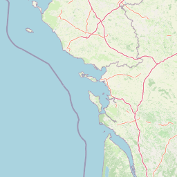
Map view of Réserve naturelle régionale des marais du Bout de Sac

Use this park location map to pinpoint Réserve naturelle régionale des marais du Bout de Sac in Romania, understand its exact geographic position, and read its mapped placement within the surrounding landscape more clearly.

Pigeon | © OpenStreetMap contributors
Park atlas

Compare adjacent wetland networks and regional protected landscapes across coastal Vendée

Parks Near Réserve naturelle régionale des marais du Bout de Sac and Coastal Reserves

Browsing nearby protected areas allows visitors to compare wetland habitats and coastal marsh networks beyond Réserve naturelle régionale des marais du Bout de Sac. Extending the geographic view reveals regional conservation corridors and connected natural terrain across the Atlantic littoral.
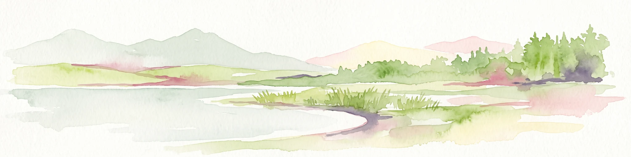
Watercolor painting of a coastal polder landscape with green grassy mounds, light yellow flat areas, and soft purple hills in the distance.
Nature reservePays de la Loire
About 9.6 km away#1 closest

Northwest

Réserve naturelle régionale du polder de Sébastopol: Coastal Wetland and Polder Geography

Protected coastal landscape on the Île de Noirmoutier.

This 133-hectare nature reserve in the Pays de la Loire region encompasses a distinctive 19th-century drainage landscape. The area features a long, narrow geometry of brackish ponds and salt-influenced terrain that provides essential stopover and breeding habitats for coastal waterbirds along the Vendée shoreline.

Area
1.33 km²
Established
2008
IUCN
IV
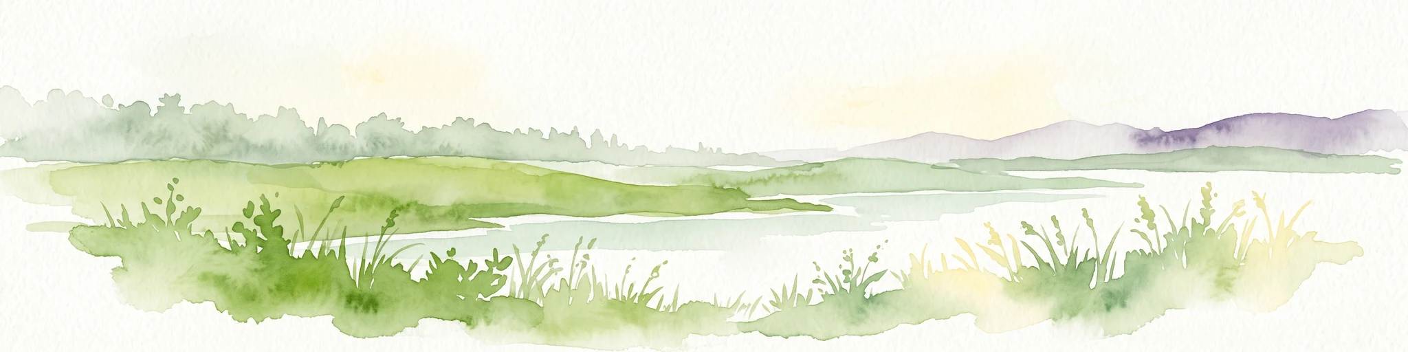
A horizontal watercolor painting depicting a soft coastal scene with green grassy shores; distant hills; and a calm expanse of water.
Nature reservePays de la Loire
About 30 km away#2 closest

Northwest

Réserve naturelle régionale de la pointe Saint-Gildas: Coastal Geography and Protected Map

Regional Nature Reserve in Pays de la Loire, France

The Réserve naturelle régionale de la pointe Saint-Gildas represents a significant protected coastal headland. Located in Loire-Atlantique, the site encompasses 11.5 hectares of land where freshwater estuarine influences converge with Atlantic saltwater, providing a unique focus for regional geographic and landscape conservation studies.

Area
0.115 km²
Established
2014
IUCN
IV
Relief
Lowland
Nature reservePays de la Loire
About 44 km away#3 closest

East

Réserve naturelle régionale du bocage humide des Cailleries: Protected Landscape and Regional Map

Wet bocage and oak woodland in the Lake Grand-Lieu watershed

Covering roughly 18 hectares, this protected area features a fine-textured mosaic of woody hedgerows, wet meadows, and multiple small ponds. The site acts as a functional refuge for varied flora and fauna, illustrating the traditional Atlantic landscape character within western France through its structured management of meadows and pond systems.

Area
0.182 km²
Established
2012
IUCN
IV
Relief
Lowland
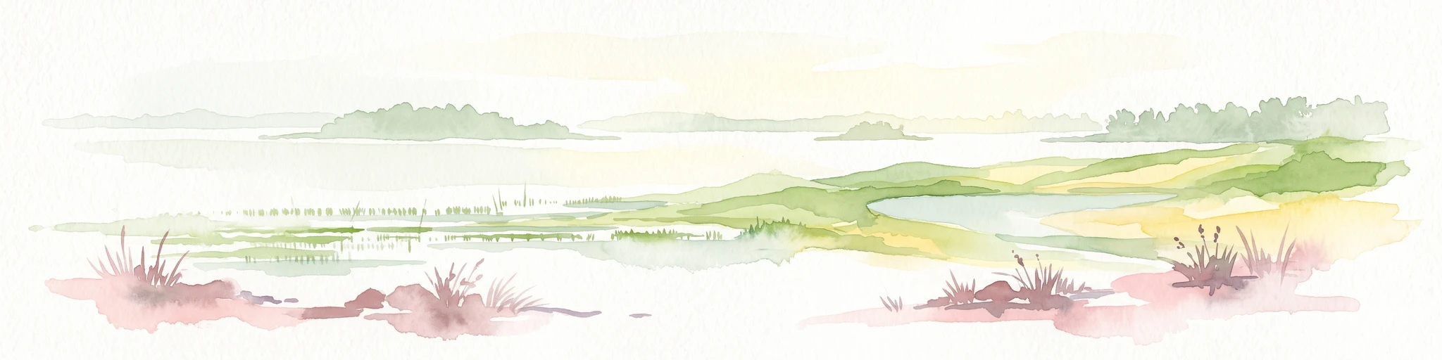
A soft watercolor illustration depicting a serene wetland scene with a calm body of water, grassy marshland, and distant rolling hills under a pale sky.
Nature reservePays de la Loire
About 54 km away#4 closest

North

Réserve naturelle régionale du marais de Brière: Protected Wetland Geography in Western France

A vital conservation mosaic of reedbeds, canals, and flooded meadows.

Located in the Pays de la Loire region, this protected area preserves the distinctive Grande Brière marshland landscape. The reserve manages a complex network of channels, islands, and damp meadows, providing essential habitat for migratory waterbirds and wetland wildlife. It represents a significant effort to maintain the ecological integrity of inland marsh complexes through structured regional conservation.

Area
8.36 km²
Established
2012
IUCN
IV
Nature reservePays de la Loire
About 63 km away#5 closest

Northeast

Réserve naturelle régionale de la tourbière de Logné: Protected Wetland Landscape Map

A rare peatland refuge in the Pays de la Loire administrative region

Located on the outskirts of Nantes, the Réserve naturelle régionale de la tourbière de Logné protects a delicate raised bog system. This atlas entry provides a detailed look at the basin terrain, its surrounding hills, and the wetland connectivity that supports its status as a critical botanical and invertebrate sanctuary within the Erdre valley.

Area
0.706 km²
Established
2011
IUCN
IV
Nature reserveLoire-Atlantique
About 69 km away#6 closest

Northwest

Réserve naturelle régionale de l'étang du pont de fer: Protected Wetlands of Loire-Atlantique

Coastal freshwater pond, wooded buffers, and wetland connectivity.

This regional nature reserve encompasses a sizeable freshwater pond and surrounding marshes, serving as a vital link in the chain of wetlands between the Vilaine estuary and the Guérande region. Its distinctive landscape, defined by floating sedge islets and dense alder woodland, supports a high density of avifauna and rare plant species. As a key component of the protected terrain in Loire-Atlantique, the reserve offers insight into coastal wetland ecosystems and their function as biodiversity corridors in western France.

Area
0.626 km²
Established
2008
IUCN
IV
Relief
Lowland
A watercolor painting showing a soft, panoramic view of a coastal wetland with small islands in the distance and grassy foreground dunes.
Regional parkBretagne
About 77 km away#7 closest

Northwest

Parc naturel régional du Golfe du Morbihan: Coastal Landscape and Marine Park Geography

Protected maritime territory and island geography in Bretagne

Covering over 80,000 hectares of combined land and marine space, Parc naturel régional du Golfe du Morbihan offers a unique view into the intersection of Atlantic coastal heritage and environmental conservation. Learn about the park's structural role in the Bretagne region through its intricate network of inlets, peninsulas, and marshland habitats that define its distinctive maritime character.

Area
642 km²
Established
2014
IUCN
V
Nature reservePays de la Loire
About 81 km away#8 closest

Northeast

Réserve naturelle régionale de la ferme de la Chauffetière: Geographic and Landscape Atlas

Protected nature reserve in the Pays de la Loire region

Spanning 30 hectares, the Réserve naturelle régionale de la ferme de la Chauffetière showcases the authentic Mauges bocage landscape. Its varied terrain includes humid valleys, dry calcareous slopes, and agricultural plateaus, providing essential habitat for amphibians, rare orchids, and saproxylic insects within a living, working farm environment.

Area
0.3 km²
Established
2008
IUCN
IV
Relief
Upland

Common questions about visiting, size, designation, and location context for Réserve naturelle régionale des marais du Bout de Sac

Réserve naturelle régionale des marais du Bout de Sac FAQs for park facts, access, geography, and protected area context

Find quick answers about Réserve naturelle régionale des marais du Bout de Sac, including protected-area facts, park geography, trail and visitor context, and how the park fits into its surrounding country and regional landscape.
MoriAtlas Explorer

Continue Your Protected Areas Search Across the Global Atlas

Deepen your exploration by continuing the structured search for national parks and protected areas worldwide. Utilize the comprehensive filtering capabilities to compare different conservation landscapes and refine your understanding of global park geography. Discover more about the distribution and characteristics of protected natural areas.

Global natural geography