
Mori Atlas logo
Nature reserveRéserve naturelle régionale des Prairies du Val de Sambre

Mapping the floodplain meadows and ecological corridors of the middle Sambre valley in Hauts-de-France

Réserve naturelle régionale des Prairies du Val de Sambre: A Protected Wetland Meadow Landscape

(Réserve naturelle régionale des Prairies du Val de Sambre (RNR254))

Réserve naturelle régionale des Prairies du Val de Sambre preserves a vital fragment of traditional alluvial hay meadows in northern France. Located in the middle Sambre valley, this protected area features a low-lying terrain of wet grasslands, ditches, and seasonally inundated pools. Its geographic position serves as an essential link between the massive Forest of Mormal to the north and the characteristic bocage landscapes of the Thiérache region to the south.

wet meadowsfloodplainregional nature reserveHauts-de-FranceNord departmentAvesnois
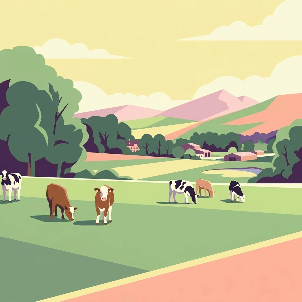
A stylized flat-design illustration of cattle grazing in a green meadow with rolling hills, trees, and farm buildings in the background under a soft sunset sky.

Réserve naturelle régionale des Prairies du Val de Sambre

Nature reserve

Park overview

Structured park overview, official facts, and landscape profile for Réserve naturelle régionale des Prairies du Val de Sambre

Réserve naturelle régionale des Prairies du Val de Sambre park facts, protected area profile, and essential visitor context

Review the core facts for Réserve naturelle régionale des Prairies du Val de Sambre, including designation, size, terrain, visitor scale, habitats, and operating context in one park-focused overview.

About Réserve naturelle régionale des Prairies du Val de Sambre

The Réserve naturelle régionale des Prairies du Val de Sambre is a small but ecologically targeted regional nature reserve in the Hauts-de-France region of northern France. It sits within the Avesnois, on the right bank of the canalised Sambre, between the communes of Locquignol and Maroilles. The reserve's footprint is modest, around 49 hectares, but its setting places it at the heart of one of the most characteristic rural landscapes in northern France, where hedgerows, meadows, woodland edges, and floodplain features combine into a recognisably traditional bocage mosaic.

The defining feature of the protected area is its series of wet, seasonally inundated grasslands. These meadows are the last reminders of a once much more extensive system of floodplain hay meadows that defined the valley of the Sambre before the second half of the twentieth century. Their botanical composition, hydrology, and associated ponds give rise to a particular set of habitats that support amphibians, dragonflies, wet-meadow plants, and bird species tied to open, mosaic countryside.

Ecologically, the reserve is closely linked to neighbouring environmental assets. To the north rises the forested massif of Mormal, one of the largest woodlands of the Nord, while to the south the bocage of Thiérache extends across the border region with Aisne. This geography places the reserve at a junction between forest, valley, and bocage, helping explain why such a small site can carry disproportionate value for landscape connectivity and for species that depend on the interface between habitats.

Beyond its ecological role, the reserve illustrates a particular French model of conservation: a regional nature reserve (réserve naturelle régionale) created by regional deliberation, managed by a specialised NGO, and integrated into a wider stewardship programme run by the Conservatoire d'espaces naturels des Hauts de France. That programme extends well beyond the reserve itself; the Conservatoire oversees roughly 89 hectares of floodplain meadows across the same Sambre zone, of which the RNR is the official protected core.

Quick facts and research context for Réserve naturelle régionale des Prairies du Val de Sambre

Designated as a regional nature reserve (Réserve naturelle régionale) on 15 October 2012, the Prairies du Val de Sambre is listed under IUCN Category IV as a habitat and species management area. It is recorded in the World Database on Protected Areas under ID 555559620 and managed by the Conservatoire d'espaces naturels des Hauts de France.

The reserve sits in the Avesnois region of the Nord department, in the middle valley of the Sambre, near the villages of Locquignol and Maroilles. Its surroundings include the forest of Mormal to the north and the bocage of Thiérache to the south, situating it within one of the most characteristic rural landscapes of the Hauts-de-France region.

Protection and recognition

Structured protected area designation facts and international recognition records

Protection Status and International Recognition for Réserve naturelle régionale des Prairies du Val de Sambre

Examine the documented protection status, management scope, and official designation records established for Réserve naturelle régionale des Prairies du Val de Sambre. Review verified administrative data and international recognition sources compiled within the global protected area registry.

Protection details

WDPA ID
555559620
Park context

Deeper park guide and search-rich context for Réserve naturelle régionale des Prairies du Val de Sambre

Réserve naturelle régionale des Prairies du Val de Sambre history, landscape, wildlife, and travel context

Explore Réserve naturelle régionale des Prairies du Val de Sambre through its history, landscape character, ecosystems, wildlife, conservation priorities, cultural context, and seasonal travel timing in a structured park guide built for atlas discovery and search intent.

Why Réserve naturelle régionale des Prairies du Val de Sambre stands out

The reserve is best known for protecting a remnant of the floodplain meadows (prairies inondables) that historically dominated the middle Sambre valley. These wet grasslands, together with associated ponds and seasonally inundated areas, form the core ecological identity of the site. It also stands out as part of a broader effort led by the Conservatoire d'espaces naturels des Hauts de France to maintain traditional Sambre valley meadow systems against more intensive modern land uses. The species flagged in conservation materials, such as the great crested newt, the green lestes damselfly, and shrikes, reflect the reserve's role as a refuge for wetland-dependent fauna typical of this kind of valley habitat.
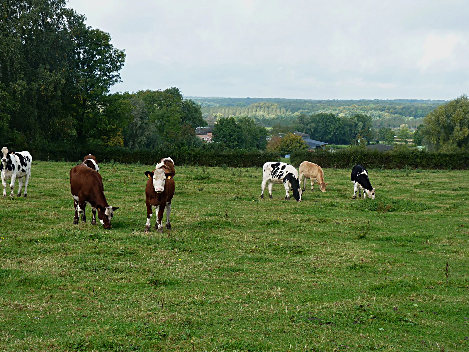
A group of cows of varying colors graze in a grassy green pasture with a valley landscape in the background under an overcast sky.
Cattle grazing in a pasture within the Helpe Mineure valley, a characteristic landscape of the Prairies du Val de Sambre.

Réserve naturelle régionale des Prairies du Val de Sambre history and protected-area timeline

The valley of the Sambre has supported human activity for many millennia, with signs of occupation going back roughly nine thousand years. The medieval period left a major mark on the rural landscape: from the seventh century onward, the Benedictine Abbey of Maroilles in Maroilles exercised a strong influence over the surrounding land, and between the seventh and thirteenth centuries the local bocage system of fields enclosed by hedgerows began to take shape around the villages of the area.

From the nineteenth into the twentieth century, the valley was characterised by extensive livestock farming on the floodplain meadows, with traditional mown grasslands dominating the riverine landscape. This long pastoral history produced both the ecological character of the meadows and the cultural identity of the Avesnois landscape.

From the 1960s to the early 1990s, however, the meadows underwent major transformations. Poplar plantations expanded across the valley, agricultural practices became more intensive, and hunting ponds were dug into the floodplain. These changes progressively reduced the extent of traditional wet grasslands, motivating conservation actors to safeguard the remaining fragments.

In response, the Réserve naturelle régionale des Prairies du Val de Sambre was formally created by a regional deliberation on 15 October 2012, with management entrusted to the Conservatoire d'espaces naturels des Hauts de France. The reserve now functions as the protected core of a broader conservation effort covering around 89 hectares of floodplain meadows in the same valley.

Réserve naturelle régionale des Prairies du Val de Sambre landscape and geographic character

The reserve occupies the alluvial floodplain of the middle Sambre, on the right bank of the canalised river, in a zone shaped by recurring seasonal flooding. Its terrain is essentially flat and low-lying, characteristic of an inland floodplain, and dominated by open grassland rather than woodland or topography.

Around the reserve, the regional landscape forms a clear geographic frame. To the north stands the large forested massif of Mormal, one of the most extensive woodlands of the Nord. To the south, the landscape transitions into the bocage of Thiérache, a region defined by dense hedgerow patterns, small pastures, and scattered woodland. The reserve itself sits at the meeting point of these two major regional landscapes, giving the protected site a strong landscape-context value beyond its own footprint.

Within the reserve, the dominant land features are wet meadows intersected by ditches, pools, and other still-water bodies created during the period of artificial pond construction. The visual character is one of open, lush valley ground, shaped more by hydrology and grass than by relief. This understated but coherent landscape is what gives the site its particular value within the broader Avesnois.

Réserve naturelle régionale des Prairies du Val de Sambre ecosystems, habitats, and plant life

The reserve's ecological identity is built around floodplain meadow habitats. It protects a remnant of the prairies inondables, wet grasslands that depend on regular seasonal flooding and traditional mowing practices, together with the network of ponds and ditches that have accumulated in the floodplain over time. These habitats together form the structural backbone of the site's biodiversity.

Vegetation in the reserve reflects the meadow's long pastoral history. Among the species highlighted in the available material is the lesser spearwort (Ranunculus flammula), a small wetland plant characteristic of damp grasslands and pool margins. The combination of grazed and mown meadows, slow-moving water, and edge habitats creates the conditions for a typical floodplain meadow flora.

Ecologically, the reserve is also strongly shaped by hydrology. Because the site sits in the active floodplain of the Sambre, water levels and seasonal inundation patterns control the type of vegetation that can establish, the presence of amphibian breeding sites, and the dynamics of the aquatic invertebrate community. Maintaining the open, water-influenced character of these grasslands is central to the site's ecological interest.

Réserve naturelle régionale des Prairies du Val de Sambre wildlife and species highlights

The species highlighted in conservation materials for the reserve reflect its character as a wet, open valley habitat with strong connections to pond and meadow networks. The fauna includes the great crested newt (Triton crêté), an amphibian of conservation interest that depends on well-vegetated ponds with stable water levels, and the green lestes damselfly (Leste verdoyant), an insect associated with wetland margins.

The birdlife of the reserve is marked by the presence of shrikes: both the great grey shrike (Pie-grièche grise) and the red-backed shrike (Pie-grièche écorcheur) are mentioned as species tied to the reserve. Their occurrence underlines the importance of the open, hedge-rich mosaic of the site, which provides hunting perches, nesting sites, and a rich supply of large insects.

More broadly, the reserve functions as a refugium for valley-wetland species that have declined elsewhere in the Sambre floodplain due to poplar planting, intensification, and pond conversion. By maintaining the open meadow and pond network that these species depend on, even a small reserve like the Prairies du Val de Sambre plays a meaningful role in the regional survival of amphibians, dragonflies, and meadow-associated birds.

Réserve naturelle régionale des Prairies du Val de Sambre conservation status and protection priorities

The principal conservation value of the reserve lies in the protection of a fragment of the traditional wet meadows of the Sambre valley, an essentially non-renewable habitat type that has been heavily reduced since the 1960s. By maintaining open grasslands subject to seasonal flooding, the reserve safeguards a complete habitat complex rather than isolated patches.

Management is led by the Conservatoire d'espaces naturels des Hauts de France, an NGO specialised in the stewardship of natural sites. This organisation is responsible not only for the official reserve but also for a wider network of floodplain meadows covering roughly 89 hectares in the same valley, with the RNR serving as the protected core of that programme.

The reserve is classified under IUCN Category IV, which designates it as a habitat and species management area. This means the site is actively managed to maintain particular habitats and species rather than left to evolve freely. Its conservation role is therefore both protective and restorative, aimed at keeping meadow, pond, and hedgerow conditions favourable for species such as the great crested newt and the shrikes while preserving the wider Avesnois landscape character.

Réserve naturelle régionale des Prairies du Val de Sambre cultural meaning and human context

The reserve sits in the Avesnois, a region with a strongly defined rural cultural identity shaped by Benedictine monastic influence, the bocage pattern of enclosed fields and hedgerows, and centuries of livestock farming on the Sambre floodplain. The medieval Abbey of Maroilles, founded at Maroilles in the seventh century, exerted a lasting influence on land use, settlement patterns, and the gradual enclosure of the countryside from the seventh to the thirteenth century.

The traditional practice of extensive livestock rearing on the valley meadows shaped both the economy and the cultural image of the area for centuries, and it is this relationship between farming practice and landscape that the reserve still embodies. Local identity in the Sambre valley remains closely tied to its bocage mosaic, its pastures, and the persistence of small villages such as Locquignol and Maroilles within a richly structured rural environment.

In this sense, the reserve is not just a natural site but also a marker of the region's long relationship between people, agriculture, and the floodplain landscape of the Sambre.

Top sights and standout views in Réserve naturelle régionale des Prairies du Val de Sambre

Despite its small size, the reserve packs several distinctive qualities into a compact footprint. Its central highlight is the protection of authentic floodplain hay meadows along the Sambre, a habitat type now strongly reduced across northern France.

Equally notable is its landscape position between the forest of Mormal to the north and the bocage of Thiérache to the south, giving the site a role in connecting forest, valley, and hedgerow countryside. The presence of indicator species such as the great crested newt, the green lestes damselfly, and two species of shrikes reinforces its reputation as a small but ecologically rich refuge in the middle Sambre valley.

Best time to visit Réserve naturelle régionale des Prairies du Val de Sambre

Visiting the reserve is most rewarding when its wet meadow character is most visible, generally during the warmer months of late spring and summer, when the grasslands are at their most lush, pond margins are active with invertebrates, and the birdlife of open countryside is at its peak. Late spring is often a good period for hearing amphibians and observing dragonflies around the reserve's still-water features, while summer offers the full expression of the floodplain meadow flora.

Autumn and winter remain atmospheric in their own way, with the open valley landscape and the surrounding forest of Mormal taking on quieter tones, though the most characteristic meadow features are less visible at those times. Because the reserve is treated primarily as a managed conservation site with limited visitor infrastructure, any visit should be planned around the general seasonal character of the valley rather than around specific scheduled events.

Monthly climate preview

Long-term temperature and precipitation patterns across representative coordinates

Réserve naturelle régionale des Prairies du Val de Sambre Climate Normals

Representative coordinates record measured monthly temperature swings and consistent precipitation rates across a multi-year climatology baseline. Analyzing the complete twelve-month record reveals detailed thermal and moisture patterns for this protected area.
Annual mean10 °C
2 °C18 °C
Jan
Feb
Mar
Apr
May13°
Jun16°
Jul18°
Aug17°
Sep14°
Oct10°
Nov
Dec
Warmest month
July

17.7 °C

Coolest month
January

2 °C

Wettest month
December

2.9 mm/day

Driest month
April

1.6 mm/day

Park location guide

Geography guide, regional context, and park location map for Réserve naturelle régionale des Prairies du Val de Sambre

Réserve naturelle régionale des Prairies du Val de Sambre park geography, regions, and map view in France

Understand where Réserve naturelle régionale des Prairies du Val de Sambre sits in France through a broader geographic reading of the surrounding landscape, nearby location context, and its mapped position within the national park landscape.

How Réserve naturelle régionale des Prairies du Val de Sambre fits into France

France is a unitary semi-presidential republic and one of the world's largest economies. It borders Belgium, Luxembourg, Germany, Switzerland, Italy, Monaco, Andorra, and Spain, with a maritime border to the United Kingdom. The country is known for its cultural influence, art, cuisine, and political history spanning centuries.

Wider geography shaping Réserve naturelle régionale des Prairies du Val de Sambre in France

France is located in Western Europe. Metropolitan France extends from the Rhine to the Atlantic Ocean and from the Mediterranean Sea to the English Channel and North Sea. The country borders Belgium, Luxembourg, Germany, Switzerland, Italy, Monaco, Andorra, Spain, and has a maritime border with the United Kingdom.

Map view of Réserve naturelle régionale des Prairies du Val de Sambre

Use this park location map to pinpoint Réserve naturelle régionale des Prairies du Val de Sambre in France, understand its exact geographic position, and read its mapped placement within the surrounding landscape more clearly.

Pigeon | © OpenStreetMap contributors

Location context for Réserve naturelle régionale des Prairies du Val de Sambre

Hauts-de-France
Recorded earthquake history

Examine Recorded Earthquake Activity Near the Réserve naturelle régionale des Prairies du Val de Sambre

Review a comprehensive collection of recorded earthquakes associated by distance with the Réserve naturelle régionale des Prairies du Val de Sambre. MoriAtlas provides this historical catalogue to support geographic understanding of seismic data within the Sambre valley and the wider regional landscape.

Réserve naturelle régionale des Prairies du Val de Sambre Earthquake Data

Catalogued events

15 events

Strongest magnitude

Magnitude 5.5

Most recent event

Jul 14, 2008

This history includes earthquakes recorded inside the park or within 50 km of its borders

Photographic reference for wet floodplain meadows, valley terrain, and regional habitat character

Visual Explorer and Landscape Photos of Réserve naturelle régionale des Prairies du Val de Sambre

Visual documentation captures the open floodplain meadows, seasonal wetlands, and low-lying terrain that define Réserve naturelle régionale des Prairies du Val de Sambre. Photographic records provide clear visual context for the protected habitat mosaic situated between the forest of Mormal and the Thiérache bocage.

A group of cows of varying colors graze in a grassy green pasture with a valley landscape in the background under an overcast sky.

Park atlas

Discover related regional parks and connected valley landscapes across northern France

Explore Protected Areas Near Réserve naturelle régionale des Prairies du Val de Sambre

Browsing other protected areas near Réserve naturelle régionale des Prairies du Val de Sambre reveals a wider network of floodplain habitats and valley reserves. Comparing adjacent conservation landscapes provides essential regional context for the diverse ecosystems of northern France.
Nature reserveHauts-de-France
11 km away#1 closest

Northeast

Réserve naturelle régionale de Pantegnies: Protected Landscape and Regional Map Overview

A managed nature reserve in the Hauts-de-France region

Réserve naturelle régionale de Pantegnies covers 37 hectares of protected terrain near Pont-sur-Sambre. This IUCN Category IV site serves as a vital anchor for regional biodiversity management, offering a clear case study in the preservation of northern French landscapes through formal regional nature reserve status.

Area
0.37 km²
Established
2013
IUCN
IV
Scope
Terrestrial
Protected areaHauts-de-France
About 15 km away#2 closest

West

Neuvilly Protected Area: Geography, Mapped Boundaries, and Regional Landscape Context

A detailed geographic overview of protected lands in Hauts-de-France.

Gain insights into the Neuvilly protected area through detailed mapping and geographic analysis. This resource provides a clear breakdown of the site footprint and its place within the Hauts-de-France landscape, ensuring a structured understanding of its ecological boundaries and regional significance for mapping and environmental study.

Area
0.193 km²
Established
1990
Climate
Temperate
Scope
Terrestrial
A pale, soft watercolor painting showing a rolling landscape with gentle green hills, grassy foreground, and distant hazy ridges under a white sky.
Nature reserveHauts-de-France
16 km away#3 closest

North

Réserve naturelle régionale de la carrière des Nerviens, Protected Nature Reserve and Habitat Mosaic

Regional landscape context in Hauts-de-France, France

Spanning approximately three hectares, this nature reserve in the Hauts-de-France region serves as a dense habitat mosaic formed on former quarry lands. The site preserves regionally protected orchid species and rare plant formations through focused conservation management, offering a compelling look at post-industrial ecological succession and calcareous flora.

Area
0.031 km²
Established
2009
IUCN
IV
Relief
Lowland
A wide watercolor illustration showing a calm river reflecting pink and yellow hues, bordered by green trees and vegetation on both banks.
Nature reserveHauts-de-France
20 km away#4 closest

North

Réserve naturelle régionale du bois d'Encade: Protected Woodland and Quarry Mosaic

Regional Nature Reserve in the Hauts-de-France river valley.

Spanning a compact stretch of the Hogneau valley, this nature reserve protects diverse habitats including fern-rich rock crevices and mature forest stands. The site represents a crucial ecological stepping stone that provides refuge for numerous bird, bat, and invertebrate species within a heavily cultivated agricultural corridor of northern France.

Area
0.021 km²
Established
2001
IUCN
IV
Relief
Lowland
A horizontal watercolor illustration depicting rolling green hills, meadows, and a small stream or body of water.
Protected landscapeProvince de Hainaut
About 25 km away#5 closest

North

Parc naturel des Hauts-Pays: Geography and Protected Landscape Analysis

Tracing the forest corridors and river valleys of the Walloon region

Situated along the Franco-Belgian border, Parc naturel des Hauts-Pays offers a rare look at an intact bocage and forest landscape. The area is defined by the Grande Honnelle river valley, calcareous grasslands, and high-quality broadleaf woods. Its unique geographic location acts as a critical refuge for rare plant species and preserves a traditional rural identity that has survived across a complex watershed divide.

Area
157 km²
Established
2000
IUCN
V
Protected areaNord
28 km away#6 closest

Northwest

Vallées de la Scarpe et de l'Escaut Protected Landscape Geography and Map Context

Wetland mosaic, subsidence lakes, and river floodplains in Nord

Examine the physical geography of the Scarpe and Escaut Valleys, a premier wetland site in northern France. The protected area features a mosaic of marshes, wet meadows, and mining-subsidence lakes that provide vital habitats for migratory waterbirds and support carbon storage through rare alkaline peatlands.

Area
276.22 km²
Established
2020
Relief
Lowland
Scope
Terrestrial
Nature reserveHauts-de-France
31 km away#7 closest

East

Réserve naturelle régionale des monts de Baives: Protected Limestone and Calcareous Landscapes

Ecological geography and regional conservation map context

Encompassing roughly 19 hectares, the Réserve naturelle régionale des monts de Baives protects a specialized ecosystem at the edge of the Ardennes foothills. The site is recognized for its south-facing limestone slopes, orchid-rich grasslands, and historical quarry habitats that support regional bat colonies and unique botanical species.

Area
0.188 km²
Established
1996
IUCN
IV
Relief
Upland
A soft, painterly watercolor illustration showing a winding river flowing through a lush green valley with rolling hills in the background.
Nature reserveHauts-de-France
About 38 km away#8 closest

West

Réserve naturelle régionale de l'Escaut-rivière: Protected Wetland and Alluvial Corridor

Regional nature reserve in the Hauts-de-France floodplain

Spanning sixty hectares in the Cambrésis plain, this reserve protects a unique alluvial floodplain mosaic. The site provides a critical habitat refuge of wet meadows and regenerating woodland, marking a significant success in ecological restoration and fluvial corridor protection along the Escaut river.

Area
0.594 km²
Established
2011
IUCN
IV
Relief
Lowland

Common questions about visiting, size, designation, and location context for Réserve naturelle régionale des Prairies du Val de Sambre

Réserve naturelle régionale des Prairies du Val de Sambre FAQs for park facts, access, geography, and protected area context

Find quick answers about Réserve naturelle régionale des Prairies du Val de Sambre, including protected-area facts, park geography, trail and visitor context, and how the park fits into its surrounding country and regional landscape.
MoriAtlas Explorer

Continue Your Protected Areas Search Across the Global Atlas

Deepen your exploration by continuing the structured search for national parks and protected areas worldwide. Utilize the comprehensive filtering capabilities to compare different conservation landscapes and refine your understanding of global park geography. Discover more about the distribution and characteristics of protected natural areas.

Global natural geography