Mori Atlas logo
Nature reserveRéserve naturelle régionale du marais communal du Poiré-sur-Velluire

A rare communal marsh landscape in the Pays de la Loire region of western France

Réserve naturelle régionale du marais communal du Poiré-sur-Velluire Protected Wetland Area

The Réserve naturelle régionale du marais communal du Poiré-sur-Velluire serves as a vital protected area within the Marais poitevin wetland system. This unparcelled marsh, maintained by centuries of communal grazing, features a distinct mosaic of brackish marshland, freshwater habitats, and scrub, providing a key stopover for migratory birds and essential refuge for diverse species within the Vendée landscape.

wetlandmarais poitevincommunal grazingregional nature reserveVendéePays de la Loire

Réserve naturelle régionale du marais communal du Poiré-sur-Velluire

Nature reserve

Park overview

Structured park overview, official facts, and landscape profile for Réserve naturelle régionale du marais communal du Poiré-sur-Velluire

Réserve naturelle régionale du marais communal du Poiré-sur-Velluire park facts, protected area profile, and essential visitor context

Review the core facts for Réserve naturelle régionale du marais communal du Poiré-sur-Velluire, including designation, size, terrain, visitor scale, habitats, and operating context in one park-focused overview.

About Réserve naturelle régionale du marais communal du Poiré-sur-Velluire

The Réserve naturelle régionale du marais communal du Poiré-sur-Velluire protects a 241-hectare communal marsh in the commune of Velluire-sur-Vendée, about 15 kilometres from Fontenay-le-Comte. It lies within the Marais poitevin, one of the largest and most distinctive wetland complexes in western France, and close to the Aiguillon Bay, a major coastal feeding area for migratory waterbirds.

The reserve occupies an unparcelled section of the marsh that has never been divided among private owners. Since the French Revolution this land has been held in common by the commune, and before that it was part of a much older process of land reclamation begun in the twelfth century, when communities first pushed back the sea to create workable pasture. The continuity of this communal grazing system is what has kept the landscape open and ecologically rich: cattle, horses, and geese have maintained a careful balance between water, grassland, and scrub that intensive agriculture would quickly erase.

Ecologically, the reserve lies on the western European bird migration route, linking inland wetlands with the Atlantic coast. Its mix of slightly saline marsh, freshwater ditches and ponds, wooded edges, and thickets produces layered habitats that support a remarkable diversity of flora and fauna. Eleven local farmers still run livestock together on the reserve, including the Trait poitevin, a heavy working horse breed of the region, and the Oie grise du Marais poitevin, a heritage goose breed closely tied to the marshland identity. The reserve is currently managed under a 2020 to 2025 management plan by the Parc naturel régional du Marais poitevin, and remains an important site for research, education, and the demonstration of wetland-friendly pastoralism.

Quick facts and research context for Réserve naturelle régionale du marais communal du Poiré-sur-Velluire

The Réserve naturelle régionale du marais communal du Poiré-sur-Velluire is a French regional nature reserve covering approximately 241 hectares of wetland in the Vendée department, within the Marais poitevin. Classified on 17 December 2012 by the Région Pays de la Loire, it is managed by the Parc naturel régional du Marais poitevin and lies close to the Aiguillon Bay on the Atlantic coast.

The site is catalogued under the code RNR260 in the French national reserve system and under IUCN Category IV, recognising its role in habitat and species conservation. It lies within the ZNIEFF area known as 'Communal du Poiré-sur-Velluire et abords'. Although owned by the commune, the reserve is freely accessible in name, but a marked visitor path is the primary way to experience the marsh, with observation points along its edges.

Protection and recognition

Documented terrestrial protection scope, management records, and formal designation data.

Réserve Naturelle Régionale du Marais Communal du Poiré-sur-Velluire Protection Status

Terrestrial protection status records provide formal context for conservation administration at Réserve naturelle régionale du marais communal du Poiré-sur-Velluire. Structured boundary inventories outline administrative classifications and verified database tracking metrics.

Protection details

Protection scope
Terrestrial
WDPA ID
555559606
Park context

Deeper park guide and search-rich context for Réserve naturelle régionale du marais communal du Poiré-sur-Velluire

Réserve naturelle régionale du marais communal du Poiré-sur-Velluire history, landscape, wildlife, and travel context

Explore Réserve naturelle régionale du marais communal du Poiré-sur-Velluire through its history, landscape character, ecosystems, wildlife, conservation priorities, cultural context, and seasonal travel timing in a structured park guide built for atlas discovery and search intent.

Why Réserve naturelle régionale du marais communal du Poiré-sur-Velluire stands out

The reserve is most notable for being a large, unparcelled communal marsh that has been collectively grazed for centuries, a rare model of communal land management that has preserved both the open landscape and its biodiversity. It is also known as an important stopover on the western European bird migration route, particularly for ducks, geese, and waders using the corridor between the inland Marais poitevin and the coastal Aiguillon Bay. Its mosaic of slightly brackish marshland, freshwater aquatic habitats, scrub, and small woodlands supports an unusually rich flora and fauna for a working landscape, including protected plants, European otters, water voles, thirteen bat species, and more than 177 bird species. The reserve is also valued for its heritage livestock breeds, especially the Trait poitevin horse and the Oie grise du Marais poitevin.

Réserve naturelle régionale du marais communal du Poiré-sur-Velluire history and protected-area timeline

The history of the marsh reaches back to the twelfth century, when the land was first reclaimed from the sea as part of the long human effort to turn coastal mudflats into productive pasture. After centuries of gradual development, the marsh became communal property during the French Revolution, when lands formerly held by the church or nobility were redistributed to local communities.

From that moment onward, the marsh has been managed collectively rather than privately. Its open, unparcelled character suited a strong pastoral tradition, in which livestock belonging to many families graze the same land under shared rules. This communal pastoralism proved unusually compatible with the conservation of wetland habitats and the wildlife they support.

Recognising that value, the area was first designated as a hunting reserve in 1979, and then as a voluntary natural reserve in 1981. The voluntary status was discontinued in the early 2000s following the 2002 law on proximity democracy, which ended the voluntary reserve regime. On 17 December 2012, the conseil régional des Pays de la Loire reclassified the marsh as a regional nature reserve, giving it permanent protection under the modern French system. Today it is managed by the Parc naturel régional du Marais poitevin under a 2020 to 2025 management plan, while remaining municipal property.

Réserve naturelle régionale du marais communal du Poiré-sur-Velluire landscape and geographic character

The reserve lies within the Marais poitevin, a wide lowland wetland shaped by centuries of human interaction with tidal and freshwater systems. Topographically it is flat and close to sea level, a typical feature of reclaimed marshland, and is crossed by a dense network of canals, ditches, and water channels that control the subtle balance between fresh and brackish water.

Within this broader setting, the reserve itself is a mosaic of slightly brackish marshland, freshwater aquatic habitats, thickets, and small areas of woodland. The open pastures form the visual core of the site, framed by linear ditches, low embankments, and patches of scrub that give the landscape both openness and intimate structure. Near the edges of the reserve, observation points allow visitors to take in the wide sky, low horizons, and reflective water surfaces typical of the Marais poitevin.

Because the marsh has never been divided into private plots, the reserve retains an unusually unified character: one continuous sweep of marsh, water, and pasture rather than the patchwork of fields, fences, and hedges found elsewhere. This open matrix, maintained by communal grazing, is the defining feature of the site's landscape identity.

Réserve naturelle régionale du marais communal du Poiré-sur-Velluire ecosystems, habitats, and plant life

The ecological character of the reserve is defined by the interplay between water and pasture. Long-standing extensive grazing has preserved a varied mosaic of habitats: slightly saline marshes influenced by proximity to the coast, freshwater channels and pools fed by interior waters, dense thickets along embankments, and small wooded areas that add vertical structure. This diversity at a relatively small scale is what supports the site's exceptional biodiversity.

The flora records at least 145 plant species, of which 34 are considered remarkable and 7 are formally protected. Among the protected species are the starfruit (Damasonium alisma) and the ophioglossus-leaved buttercup (Ranunculus ophioglossifolius), both protected at the national level, and the regionally protected species Trifolium michelianum, Cerastium dubium, Lythrum tribracteatum, and Inula britannica. These plants thrive in the seasonally flooded grassland and brackish marsh habitats that the communal grazing regime has helped preserve.

The reserve's position within the Marais poitevin and near the Aiguillon Bay places it on the western migration route for many European waterbirds, turning the site into a seasonal hub of bird movement. Combined with its mosaic of freshwater and slightly saline habitats, this geographic position gives the reserve an ecological profile that is unusually rich for an actively grazed landscape.

Réserve naturelle régionale du marais communal du Poiré-sur-Velluire wildlife and species highlights

Wildlife is one of the reserve's strongest assets. Its birdlife is especially significant: more than 177 species have been recorded, including 90 protected at the national level and 50 protected at the regional level. The site functions as an important migratory stopover for anatids, including ducks and geese, and for waders moving between inland wetlands and the coast.

Mammals are also well represented, with at least 25 species frequenting the marsh. Notable species include the European otter, an indicator of healthy wetland ecosystems, and the water vole, another species that depends on intact aquatic habitats. Bats are particularly diverse, with 13 recorded species using the reserve's mosaic of water, woodland edge, and open pasture.

Among amphibians, the reserve hosts the parsley frog, the palmate newt, and the green frog. Three reptile species and seventeen fish species have been recorded, completing the picture of a functioning wetland food web. Insects are abundant as well, including thirty butterfly species, twenty-four dragonfly and damselfly species, and twenty-three orthopteran species. Among these, the Large Copper (Lycaena dispar), a butterfly protected at the European level, stands out, along with the three-coloured cricket (Paracinema tricolor), a colourful grasshopper tied to damp grassland.

Réserve naturelle régionale du marais communal du Poiré-sur-Velluire conservation status and protection priorities

The reserve is a textbook example of how traditional land management can sustain biodiversity. Its protection is conservative in the deepest sense: centuries of communal grazing have already done much of the work that conservationists often have to actively restore elsewhere. By preventing the marsh from being drained, parcelled, or intensified, the reserve has preserved a continuous landscape of wet meadow, ditch, and scrub that supports a wide array of protected and remarkable species.

Institutionally, the reserve is classified as a Réserve naturelle régionale under French law and falls within IUCN Category IV, which recognises areas managed primarily for the conservation of particular habitats or species. It has been recognised at the national level through listing in the ZNIEFF inventory as the 'Communal du Poiré-sur-Velluire et abords', and is integrated into the wider conservation framework of the Parc naturel régional du Marais poitevin.

The current management plan (2020 to 2025) reflects this integrating role, balancing the continuation of communal grazing with habitat monitoring, species protection, and public engagement. Keeping livestock on the land, including heritage breeds such as the Trait poitevin horse and the Oie grise du Marais poitevin, is not a cultural side note but a core conservation strategy: the grazing animals maintain the open structure that the protected plants, otters, water voles, and migratory birds depend on.

Réserve naturelle régionale du marais communal du Poiré-sur-Velluire cultural meaning and human context

The reserve carries a strong cultural weight rooted in the long history of communal land management in the Marais poitevin. The fact that the marsh has been held, grazed, and stewarded in common since the Revolution, and was taken from the sea even earlier in the Middle Ages, gives the site a deep sense of continuity rarely found in modern protected areas. The communal model also encodes a specific social contract among local farmers, with rules for shared grazing and shared responsibility.

Local heritage breeds are part of this cultural fabric. The Trait poitevin, a heavy draft horse once used throughout the region, and the Oie grise du Marais poitevin, a traditional goose breed, are not only livestock but living symbols of the marshland identity. Their continued presence on the reserve is both a conservation measure and a way of keeping the area's rural traditions alive.

The broader regional identity of the Marais poitevin, sometimes nicknamed the 'Green Venice' for its network of waterways and green lanes, surrounds the reserve with a strong sense of place. The Poiré-sur-Velluire communal marsh is one of the clearest expressions of how this cultural map and ecological reality reinforce one another.

Top sights and standout views in Réserve naturelle régionale du marais communal du Poiré-sur-Velluire

The reserve's standout features include its unparcelled communal pasture, its location on the western European bird migration route, and its mix of brackish and freshwater habitats that support protected plants, otters, water voles, and thirteen bat species. The presence of more than 177 bird species, many of them protected, and the continued grazing of heritage breeds such as the Trait poitevin and the Oie grise du Marais poitevin reinforce its combined ecological and cultural significance.

Best time to visit Réserve naturelle régionale du marais communal du Poiré-sur-Velluire

Spring and autumn are the most rewarding seasons to visit the reserve, as migrant waterfowl and waders either arrive or pass through on their way between northern breeding grounds and southern wintering sites. Migratory activity peaks during these transitional months, making birdwatching particularly rewarding.

Winter brings large numbers of anatids and other waterbirds to the marsh, especially when inland waters cool. Summer, with its warmer temperatures, is a good time to observe dragonflies, butterflies, amphibians, and the full grazing activity of cattle, horses, and geese on the communal pastures. Because the reserve is best experienced along a marked walking path with observation points at its edges, calm and clear days tend to offer the best views across the flat, open marshland.
Monthly climate preview

Long-term representative monthly temperature and precipitation rhythm across the protected coordinate

Climate Normals and Annual Weather Patterns at Réserve naturelle régionale du marais communal du Poiré-sur-Velluire

Representative coordinates record measured monthly averages spanning winter lows to mid-summer highs alongside steady precipitation totals. Detailed monthly climate profiles provide complete twelve-month normals for structured environmental analysis.
Annual mean12 °C
5 °C20 °C
Jan
Feb
Mar
Apr11°
May14°
Jun18°
Jul20°
Aug20°
Sep17°
Oct13°
Nov
Dec
Warmest month
August

19.7 °C

Coolest month
January

4.8 °C

Wettest month
November

3 mm/day

Driest month
July

1.5 mm/day

Park location guide

Geography guide, regional context, and park location map for Réserve naturelle régionale du marais communal du Poiré-sur-Velluire

Réserve naturelle régionale du marais communal du Poiré-sur-Velluire park geography, regions, and map view in France

Understand where Réserve naturelle régionale du marais communal du Poiré-sur-Velluire sits in France through a broader geographic reading of the surrounding landscape, nearby location context, and its mapped position within the national park landscape.

How Réserve naturelle régionale du marais communal du Poiré-sur-Velluire fits into France

France is a unitary semi-presidential republic and one of the world's largest economies. It borders Belgium, Luxembourg, Germany, Switzerland, Italy, Monaco, Andorra, and Spain, with a maritime border to the United Kingdom. The country is known for its cultural influence, art, cuisine, and political history spanning centuries.

Wider geography shaping Réserve naturelle régionale du marais communal du Poiré-sur-Velluire in France

France is located in Western Europe. Metropolitan France extends from the Rhine to the Atlantic Ocean and from the Mediterranean Sea to the English Channel and North Sea. The country borders Belgium, Luxembourg, Germany, Switzerland, Italy, Monaco, Andorra, Spain, and has a maritime border with the United Kingdom.

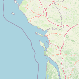
Map view of Réserve naturelle régionale du marais communal du Poiré-sur-Velluire

Use this park location map to pinpoint Réserve naturelle régionale du marais communal du Poiré-sur-Velluire in France, understand its exact geographic position, and read its mapped placement within the surrounding landscape more clearly.

Pigeon | © OpenStreetMap contributors

Location context for Réserve naturelle régionale du marais communal du Poiré-sur-Velluire

Pays de la Loire
Park atlas

Compare surrounding wetland reserves and regional protected landscapes across western France.

Other Parks and Protected Areas Near Réserve naturelle régionale du marais communal du Poiré-sur-Velluire

Browsing other protected areas near Réserve naturelle régionale du marais communal du Poiré-sur-Velluire reveals connected wetland corridors and lowland river systems. Comparing these neighboring habitats provides essential regional context for the wider Marais poitevin ecosystem.
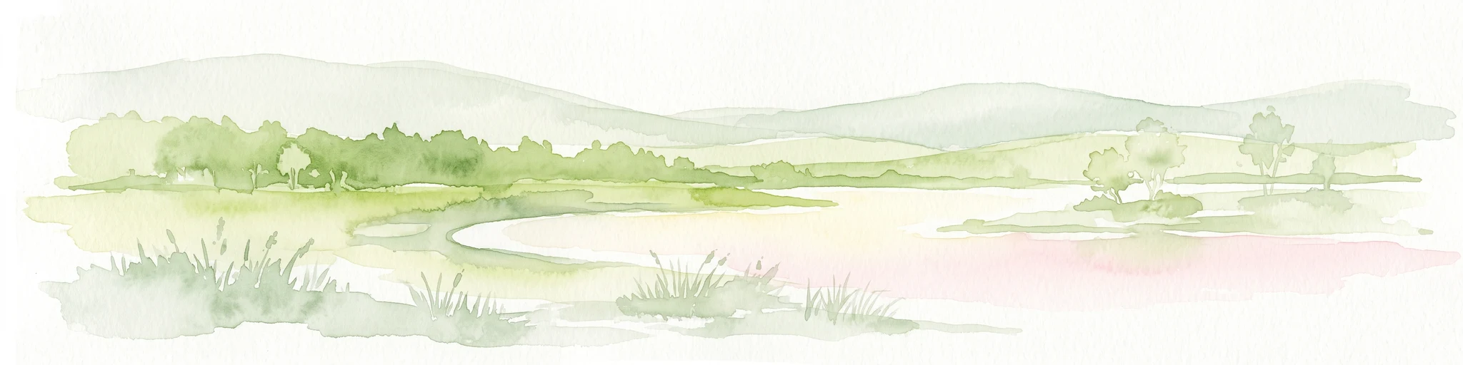
Watercolor painting of a wetland landscape featuring grassy banks, calm water, and soft rolling hills in the background.
Nature reservePays de la Loire
About 14 km away#1 closest

West

Réserve naturelle régionale du marais de la Vacherie: Protected Wetland Geography and Maps

Ecological mosaic of the Marais poitevin in Pays de la Loire

The Réserve naturelle régionale du marais de la Vacherie protects a high-quality fragment of historical marshland. Defined by flat terrain, winter-flooded depressions, and a complex system of drainage channels, the site serves as a crucial habitat for rare wetland flora and migratory waterbirds. This protected landscape offers insight into the sediment-rich, gently undulating terrain that characterizes the back-marsh zones of the Atlantic seaboard.

Area
1.81 km²
Established
2008
IUCN
IV
Relief
Lowland
Nature reservePays de la Loire
About 26 km away#2 closest

West

Réserve naturelle régionale de la ferme de Choisy: Marshland Protected Area and Regional Geography

Sub-brackish wet meadows of the Marais poitevin, Pays de la Loire.

Discover the unique ecological character of Réserve naturelle régionale de la ferme de Choisy, a vital wetland site in western France. This reserve showcases the intersection of traditional pastoral management and marshland conservation, hosting extensive bird populations and rare flora across its low-lying, reclaimed landscape.

Area
0.8 km²
Established
1991
IUCN
IV
Relief
Lowland
A horizontal watercolor painting depicting a winding river or lagoon flowing through rolling green hills and wetlands.
Nature reserveVendée
About 33 km away#3 closest

West

Réserve naturelle nationale de la casse de la Belle-Henriette: Geography and Protection

Coastal lagoon and dune habitat atlas in Vendée

Covering a narrow strip of the Atlantic coast, Réserve naturelle nationale de la casse de la Belle-Henriette protects essential marine lagoon and saltmarsh habitats. This data set explores the reserve's shifting dune morphology and its significance as a migratory bird corridor within the broader coastal geography of the Pays de la Loire region.

Area
3.37 km²
Established
2011
IUCN
IV
Relief
Lowland
Nature reserveNouvelle-Aquitaine
About 34 km away#4 closest

East

Réserve naturelle régionale du marais de Galuchet et des boucles de la Sèvre Niortaise Geography and Map

Urban protected wetland in the Nouvelle-Aquitaine region of France

This urban nature reserve protects 151 hectares of diverse wetland habitats along the Sèvre Niortaise. The landscape is defined by river meanders, wet meadows, and riparian corridors, making it a critical site for regional biodiversity and urban ecological connectivity in the Deux-Sèvres department.

Area
1.51 km²
Established
2025
IUCN
IV
Relief
Lowland
Nature reserveDeux-Sèvres
About 44 km away#5 closest

East

Réserve naturelle régionale du bocage des Antonins: Protected Landscape and Geographic Atlas

Detailed ecological mapping of the Gâtine armoricaine countryside

The Réserve naturelle régionale du bocage des Antonins occupies a distinct space in the Deux-Sèvres department. This protected area serves as a repository for the traditional bocage countryside, featuring a complex arrangement of pollarded trees, wet meadows, and the historic étang des Forges. The site offers a significant look at the structural history of rural western France through its preserved environmental matrix.

Area
0.226 km²
Established
2015
IUCN
IV
Relief
Lowland
Nature reserveNouvelle-Aquitaine
About 71 km away#6 closest

South

Réserve naturelle régionale de la Massonne: Geographic Atlas and Protected Area Map

Mapped ecosystems within the Nouvelle-Aquitaine marshlands

Réserve naturelle régionale de la Massonne serves as a significant ecological corridor in western France, defined by its abrupt transition from coastal Brouage marshes to acidic heath. This atlas entry provides essential data on the reserve boundaries, mapped terrain types, and the structural diversity of its protected wetlands and shrublands, highlighting its role as a sanctuary for diverse nocturnal fauna.

Area
2.023 km²
Established
1997
IUCN
IV
Relief
Lowland
Nature reserveNouvelle-Aquitaine
About 71 km away#7 closest

Southeast

Vallée de l'Antenne: A Protected River Valley and Alluvial Landscape in Nouvelle-Aquitaine

Mapping riparian ecosystems and rare wetland habitats

Trace the course of the Antenne river as it meanders through a finely textured mosaic of ash and alder forests, poplar plantations, and floodplains. As a designated Natura 2000 site, this nature reserve acts as a critical refuge for biodiversity in western France, offering a textbook example of a low-energy river system that descends gently through the landscape of the Charente departments.

Area
12.08 km²
Established
1999
Relief
Lowland
Climate
Mediterranean
Nature reserveNouvelle-Aquitaine
About 81 km away#8 closest

Northeast

Réserve naturelle régionale de la vallée du Pressoir: Protected Limestone Valley and Geoheritage

A rare natural and cultural mosaic in Nouvelle-Aquitaine

Trace the boundaries and natural features of the Réserve naturelle régionale de la vallée du Pressoir. This protected site in the Deux-Sèvres department is defined by thin calcareous soils, the historic Pommiers cascade, and fossil-rich limestone outcrops that form an unusual geoheritage landscape.

Area
0.56 km²
Established
2025
IUCN
IV
Visitors
10K annual

Common questions about visiting, size, designation, and location context for Réserve naturelle régionale du marais communal du Poiré-sur-Velluire

Réserve naturelle régionale du marais communal du Poiré-sur-Velluire FAQs for park facts, access, geography, and protected area context

Find quick answers about Réserve naturelle régionale du marais communal du Poiré-sur-Velluire, including protected-area facts, park geography, trail and visitor context, and how the park fits into its surrounding country and regional landscape.
MoriAtlas Explorer

Continue Your Protected Areas Search Across the Global Atlas

Deepen your exploration by continuing the structured search for national parks and protected areas worldwide. Utilize the comprehensive filtering capabilities to compare different conservation landscapes and refine your understanding of global park geography. Discover more about the distribution and characteristics of protected natural areas.

Global natural geography