
Mori Atlas logo
Nature reserveRohrbachtobel im Wirlinger Forst

A detailed geographic study of gorge geomorphology, molasse strata, and intact forest ecosystems

Rohrbachtobel im Wirlinger Forst: Exploring a Protected Nature Reserve in the Bavarian Foothills

Rohrbachtobel im Wirlinger Forst represents a compact yet ecologically significant protected area within the Allgäu region of Bavaria. This nature reserve preserves a deeply incised stream gorge carved into Lower Freshwater Molasse, supporting a distinct sequence of forest communities ranging from alder-ash riparian corridors to mature fir-beech woodland on the steep slopes. The site serves as a vital anchor for regional biodiversity, housing rare orchids and unique forest flora within its protected boundaries.

nature reservetobelstream gorgepre-Alpine forestmixed beech forestfir-beech woodland
A flat-style digital illustration of a multi-tiered waterfall cascading over rocky ledges into a pool, surrounded by a dense forest.

Rohrbachtobel im Wirlinger Forst

Nature reserve

Park overview

Structured park overview, official facts, and landscape profile for Rohrbachtobel im Wirlinger Forst

Rohrbachtobel im Wirlinger Forst park facts, protected area profile, and essential visitor context

Review the core facts for Rohrbachtobel im Wirlinger Forst, including designation, size, terrain, visitor scale, habitats, and operating context in one park-focused overview.

About Rohrbachtobel im Wirlinger Forst

Rohrbachtobel im Wirlinger Forst sits quietly within the forested hills south of Buchenberg and west of Waltenhofen, in Bavaria's Allgäu region. Although the area covers only about 14 hectares, it concentrates a striking range of features typical of the Iller foothills: deeply dissected valleys, molasse bedrock, mixed montane forests, and small mountain streams that have shaped the terrain over thousands of years.

The defining element of the reserve is the Rohrbachtobel itself, a classic tobel: a steep, narrow gorge with high, forested slopes flanking the Rohrbach stream. The valley was cut into layers of the Lower Freshwater Molasse, a sequence of soft sedimentary rocks deposited in the foreland of the Alps. The exposed rock faces, steep incline, and shaded humidity inside the gorge produce a microclimate distinctly different from the surrounding plateau, allowing plant communities that are more typical of deeper, cooler forest environments to persist at relatively modest elevation.

Legally protected as a nature reserve, or Naturschutzgebiet, since 1959, the site preserves a near-natural mosaic of forest vegetation that has been allowed to develop largely without intervention. The conservation purpose explicitly targets the gorge itself and its slopes, recognizing both their geological and ecological value. The result is one of the smaller, but botanically and structurally rich, protected forest sites in the Oberallgäu district, and a frequent reference point among the registered nature reserves of the Allgäu.

Quick facts and research context for Rohrbachtobel im Wirlinger Forst

Rohrbachtobel im Wirlinger Forst is a Bavarian nature reserve located in the Iller foothills of the Allgäu, between Buchenberg and Waltenhofen in the Oberallgäu district. Established 28 December 1959, it spans about 14 hectares on terrain between roughly 780 and 860 meters in elevation.

The protected site centers on a tobel, a steep-sided stream gorge carved into the Lower Freshwater Molasse, where near-natural forest has been preserved on the slopes. It is administered as part of Bavaria's protected-area system under nature reserve designation 700.09.

Protection and recognition

Detailed terrestrial protection metrics and official designation records

Rohrbachtobel im Wirlinger Forst Protection Status and Conservation Scope

Terrestrial protection status records outline the documented management scope and official designation framework established for Rohrbachtobel im Wirlinger Forst. Structured conservation data provides an authoritative overview of territorial safeguarding measures without assuming external recognition sources.

Protection details

Protection scope
Terrestrial
Park context

Deeper park guide and search-rich context for Rohrbachtobel im Wirlinger Forst

Rohrbachtobel im Wirlinger Forst history, landscape, wildlife, and travel context

Explore Rohrbachtobel im Wirlinger Forst through its history, landscape character, ecosystems, wildlife, conservation priorities, cultural context, and seasonal travel timing in a structured park guide built for atlas discovery and search intent.

Why Rohrbachtobel im Wirlinger Forst stands out

Rohrbachtobel im Wirlinger Forst is best known for its geomorphology: a narrow, deeply incised tobel formed where the Rohrbach stream has cut down through soft molasse sediments. The combination of steep rock exposures, sheltered microclimate, and undisturbed forest creates conditions that support rare woodland plants, including orchids and yew, within a very small area. The reserve also stands out as an example of how even a compact site in the pre-Alpine foothills can assemble a meaningful set of conservation-relevant habitats, from moisture-loving alder forests along the stream to fir-beech woodland on the slopes above.
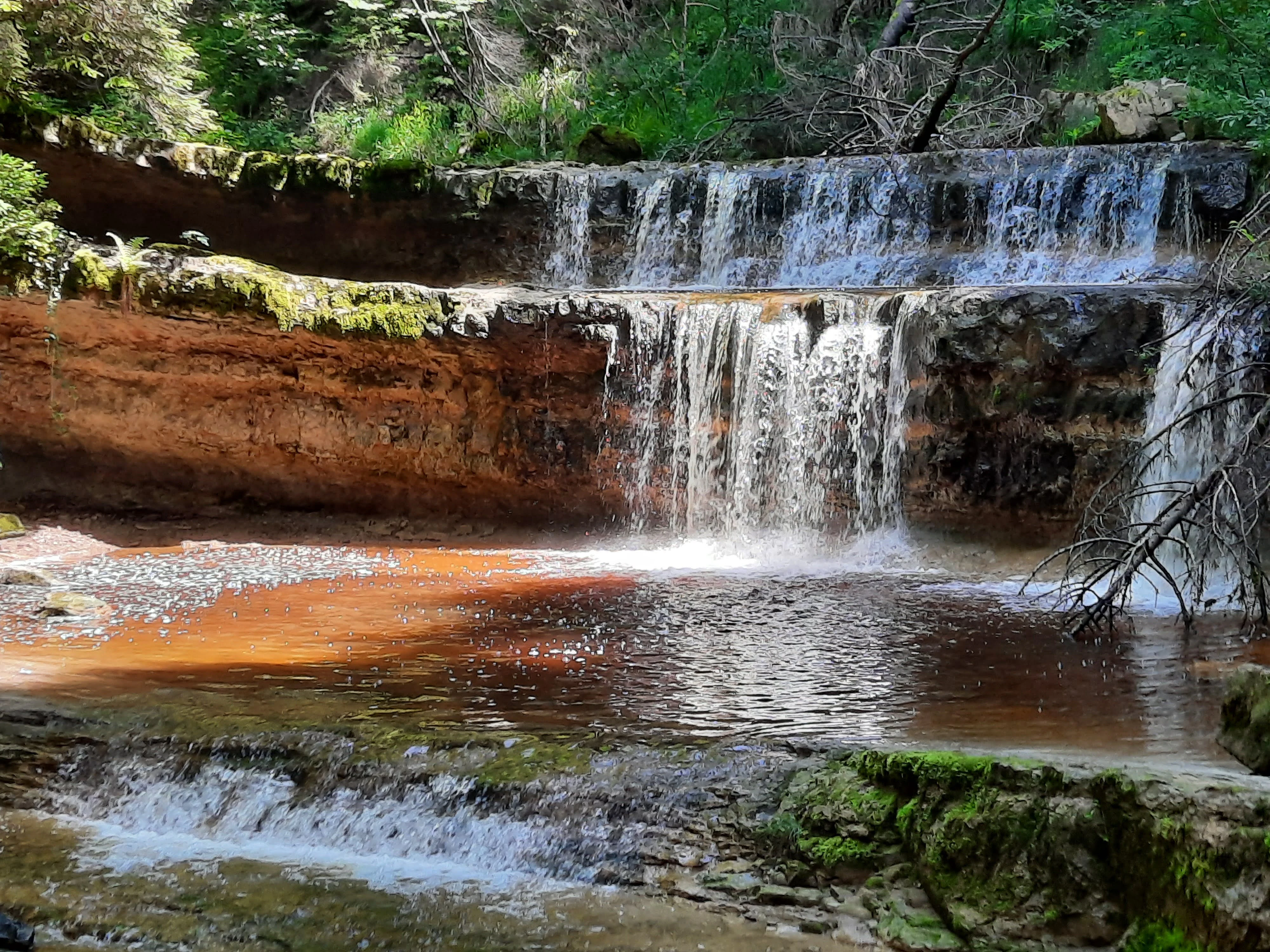
A multi-tiered waterfall cascading over reddish, layered rock formations into a calm, dark-bottomed pool, surrounded by lush green forest vegetation.
The terraced waterfalls of the Rohrbachtobel ravine, a nature reserve in Bavaria, Germany.

Rohrbachtobel im Wirlinger Forst history and protected-area timeline

Rohrbachtobel im Wirlinger Forst was formally designated as a Bavarian nature reserve through an ordinance issued on 28 December 1959. The decree established the protected status of the gorge and its forested slopes under the German Naturschutzgebiet framework, assigning it the registry number 700.09 in the Bavarian list of nature reserves.

The site's protection was motivated by the recognition that the tobel and its steep forested walls held a particularly intact and floristically valuable combination of forest communities and rock habitats. By the late 1950s, Bavarian conservation authorities were actively identifying such small but ecologically distinctive sites for formal safeguarding, and Rohrbachtobel fit this profile through its geomorphology, its near-natural forest structure, and its notable plant species. Since designation, the area has remained managed as a protected nature reserve within the administrative framework of the Oberallgäu district.

Rohrbachtobel im Wirlinger Forst landscape and geographic character

The landscape of Rohrbachtobel im Wirlinger Forst is dominated by a single dramatic feature: a deeply incised stream gorge. The Rohrbach, a small forest stream, has carved downward through the molasse bedrock to produce the characteristic tobel profile of narrow floor and steep, often near-vertical slopes. This kind of valley form is typical of the broader northern Alpine foothills, where rivers cut quickly into soft rock to leave behind sharply defined gullies.

Elevations within the reserve range roughly between 780 and 860 meters above sea level, placing it firmly within the pre-Alpine forest zone. The slopes above the stream bear mature, mixed montane forest, while the valley bottom retains the cooler, moister conditions associated with alder-dominated streamside woodland. Side views of the gorge reveal the layered structure of the Lower Freshwater Molasse, whose sedimentary bands are visible in the cut faces along the valley walls. Walking paths and small footbridges cross the stream, allowing close access to a landscape that otherwise appears little altered by human activity.
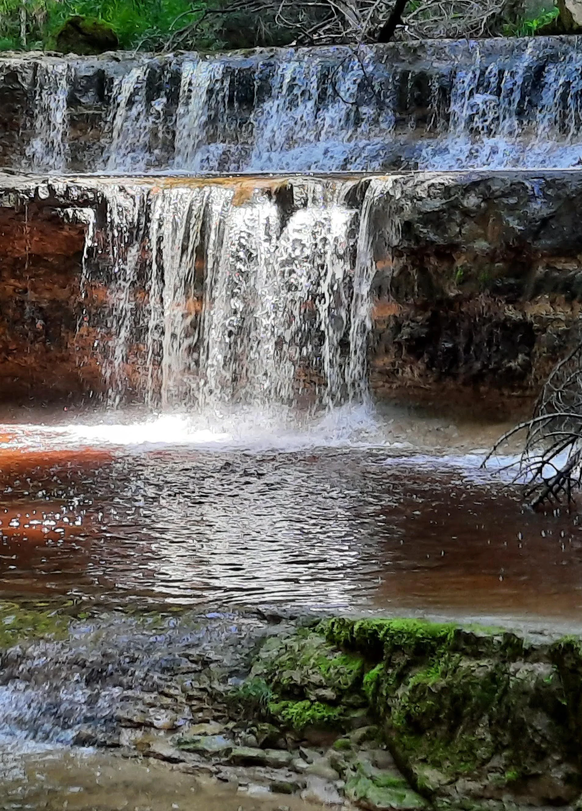
A small waterfall flowing over layered, reddish-brown rock formations into a calm, dark pool with mossy foreground rocks.
A small multi-tiered waterfall within the Rohrbachtobel nature reserve.

Rohrbachtobel im Wirlinger Forst ecosystems, habitats, and plant life

Ecologically, Rohrbachtobel im Wirlinger Forst is shaped by the contrast between the sheltered, humid gorge floor and the more exposed, drier forest of the surrounding slopes. This microclimatic gradient supports a layered vegetation mosaic within a very small area. Along the stream, the moister habitat favors alder and ash communities, including the Bach-Erlen-Eschenwald (creek alder-ash forest) and the more specialized Waldgeißbart-Erlen-Eschen-Wald (goatsbeard alder-ash forest), both of which are considered conservation-worthy vegetation units in the region.

On the slopes and upper reaches, the woodland transitions into communities more typical of the Allgäu's pre-Alpine forest zone, including Waldmeister-Tannen-Buchenwald, a woodruff-rich fir-beech forest type that integrates beech with silver fir and a rich herb layer. These mature, structurally diverse forests provide the conditions under which several notable rare plant species have managed to persist, including European yew and a striking assemblage of wild orchids. The combination of forest types, combined with the cool humidity and shaded rock faces of the gorge, gives the reserve an ecological profile that is unusually diverse for its size.
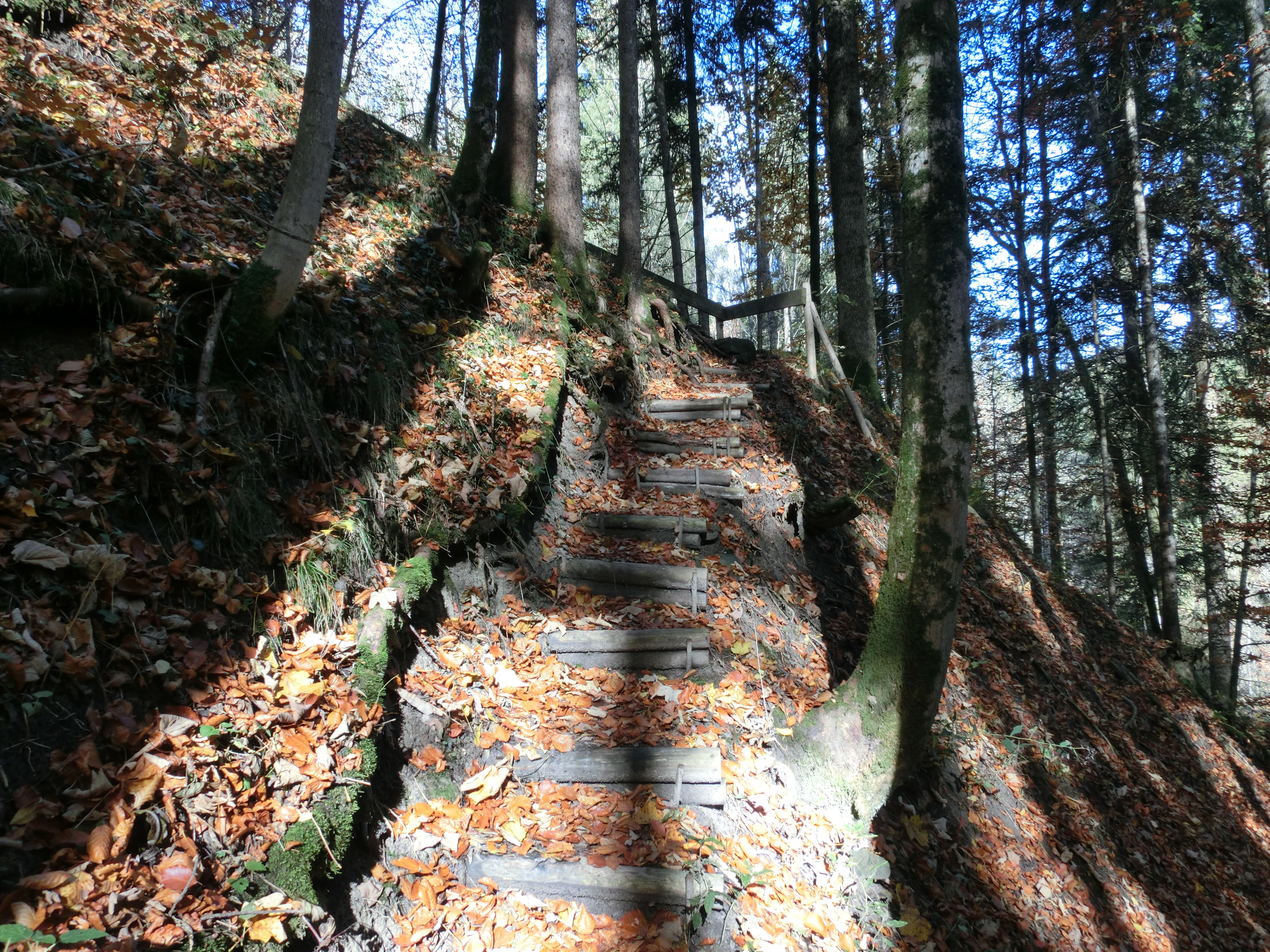
A steep wooden stairway built into the side of a forested ravine, covered in fallen autumn leaves.
A wooden staircase path winding through the autumn forest in Rohrbachtobel im Wirlinger Forst.

Rohrbachtobel im Wirlinger Forst wildlife and species highlights

The wildlife profile of the reserve mirrors its habitat mosaic. The shaded, humid valley and the stream corridor support a set of species associated with cool, forested gorge environments. The alpine salamander, a fully terrestrial black amphibian of the Central European mountains, finds refuge in the damp forest floor of the slopes and the valley bottom.

Birdlife is closely tied to the mature woodland and the flowing water. The black woodpecker drills into old trees within the fir-beech forest, while the great spotted woodpecker uses the same habitat for nesting and foraging. Along the stream, the white-throated dipper inhabits the rocky margins where it feeds on aquatic invertebrates, the grey wagtail patrols the gravel banks, and the Eurasian kingfisher, sometimes called the flying jewel, hunts small fish in the clearer stretches of the Rohrbach. In the water itself, the bullhead, a small, largely nocturnal benthic fish, inhabits the cool, well-oxygenated gravel of the stream bottom. Together, these species reflect a healthy, structurally diverse forest and stream ecosystem.
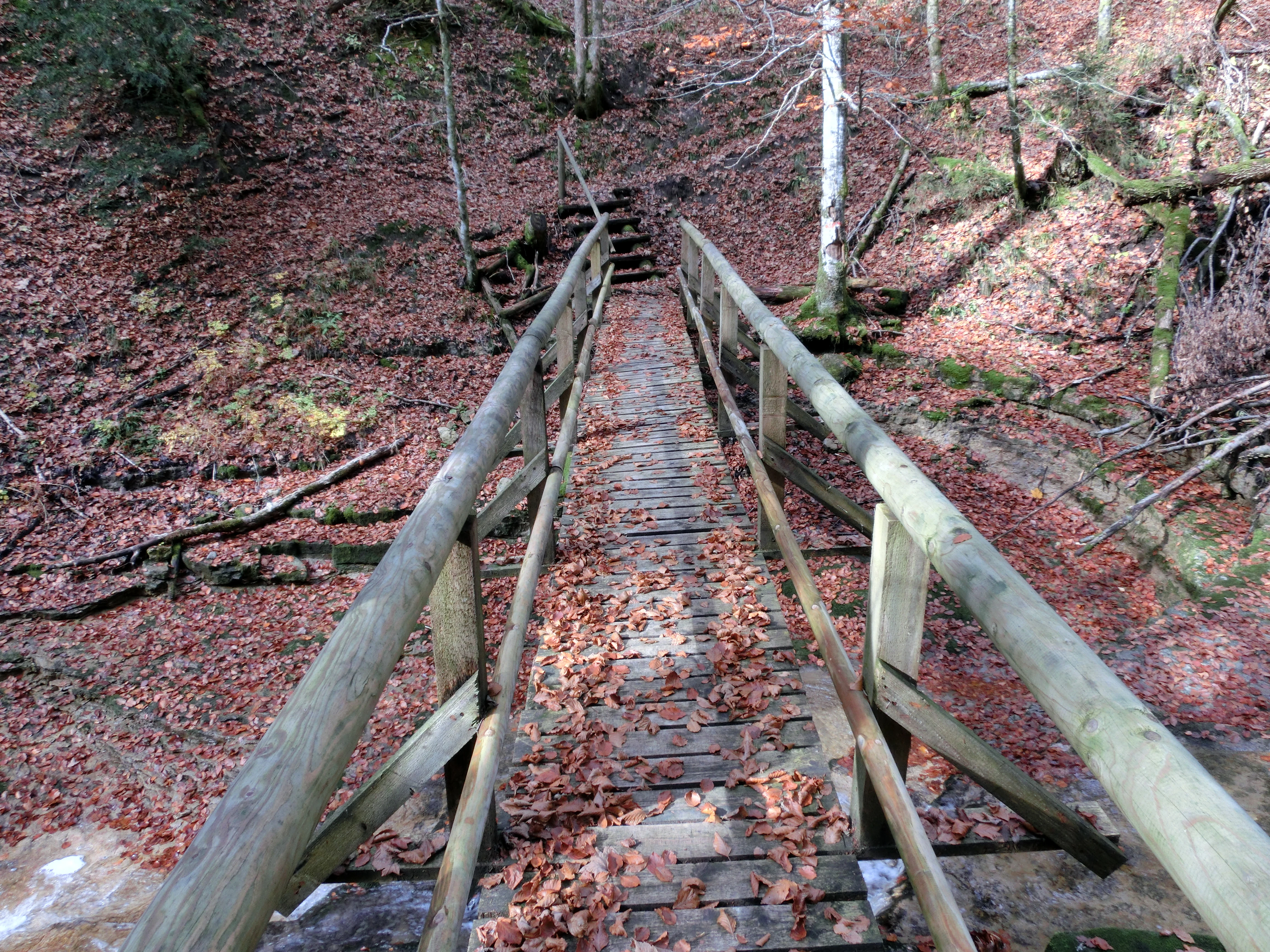
A narrow wooden footbridge leads across a small, forest-covered ravine, covered in fallen autumn leaves, leading to wooden steps on the opposite bank.
A wooden footbridge crossing a ravine in the Rohrbachtobel im Wirlinger Forst nature reserve.

Rohrbachtobel im Wirlinger Forst conservation status and protection priorities

The conservation significance of Rohrbachtobel im Wirlinger Forst lies in the intactness and concentration of its habitats. The reserve was explicitly created to preserve the gorge and its forested slopes because they hold a near-natural forest structure and a botanically meaningful set of plant communities. The small size of the protected area is offset by the rarity and quality of what it contains: old-growth tendencies in the mixed forest, undisturbed rocky terrain, and a stream corridor that retains its natural dynamics.

From a broader conservation perspective, the reserve contributes to habitat connectivity and species protection in the Iller foothills. Its orchid populations, yew stands, and specialized forest communities represent gene pools that are otherwise scarce across the surrounding agricultural and forested landscape. By keeping these features intact and buffered from logging and intensive land use, the reserve plays a targeted role in maintaining regional botanical diversity and in preserving the geomorphological character of a representative tobel landscape.

Top sights and standout views in Rohrbachtobel im Wirlinger Forst

Standout features of the reserve include the deeply cut tobel itself, the visible molasse stratigraphy along its walls, and the layered forest communities that range from stream-side alder stands to fir-beech woodland on the slopes. The area is also notable for its rare plant species: European yew, the fly orchid, the yellow lady's slipper orchid, the red helleborine, and the martagon lily.

The combination of a small protected footprint with a surprisingly complete set of habitats stands out as the reserve's defining quality. Few comparable sites in the Oberallgäu offer such a compact but undisturbed example of pre-Alpine gorge forest, accompanied by the supporting wildlife of cool mountain streams and mature woodland.
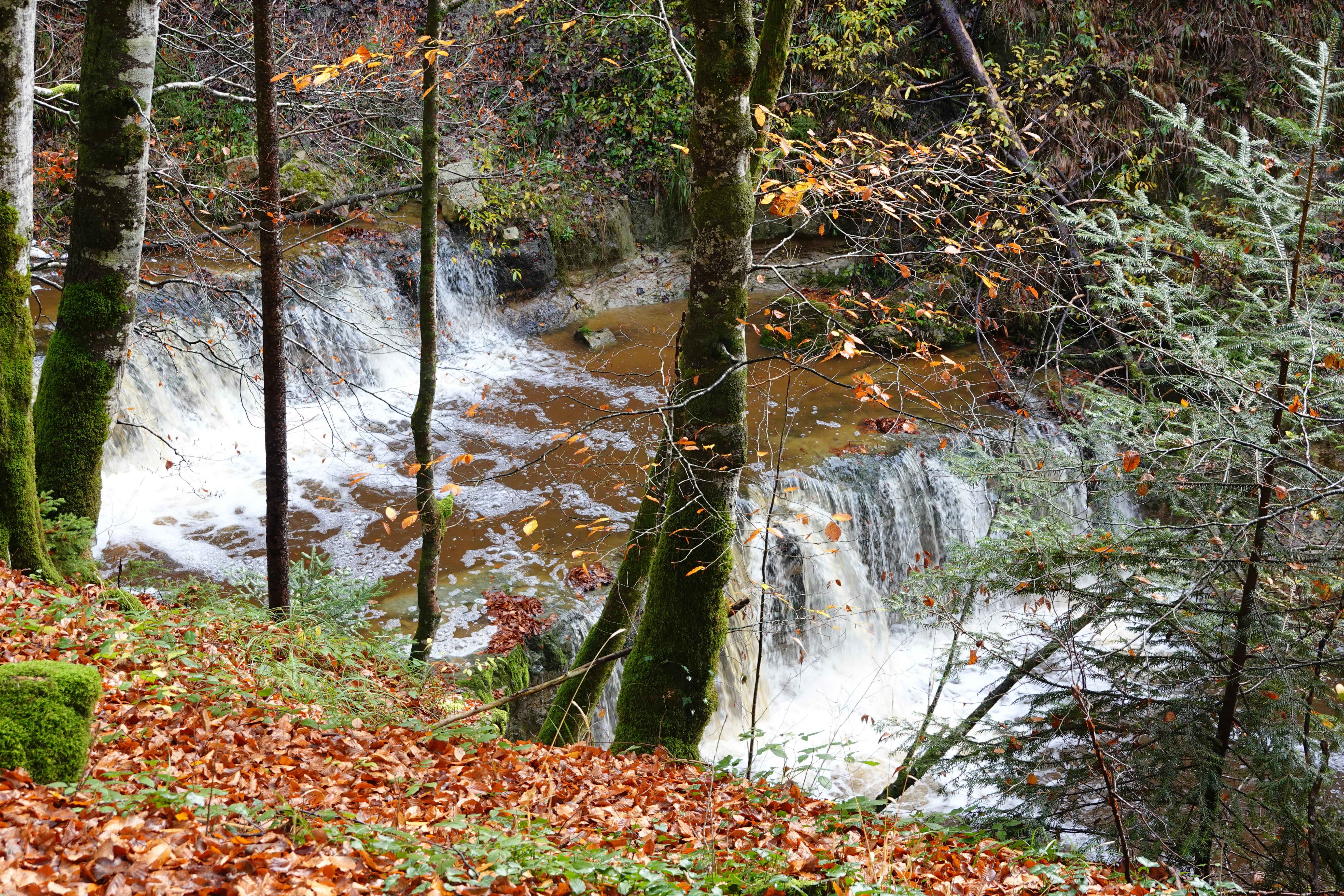
A small, multi-tiered waterfall flows through a forest ravine filled with autumn leaves and trees.
A small tiered waterfall flowing through the wooded gorge of Rohrbachtobel.

Best time to visit Rohrbachtobel im Wirlinger Forst

The reserve offers a relatively consistent character through the year, but late spring and early summer are particularly rewarding. By mid-May the forest floor reaches its richest display, with orchids in bloom and the herb layer of the beech and fir forests fully developed. Summer offers dense, lush gorge vegetation and the best chances to observe woodland birds along the stream corridors, though conditions in the narrow valley can feel sheltered and humid.

Autumn brings a quieter atmosphere, with lower visitor pressure and the visual shift of the mixed forest toward warmer foliage tones, while the structural interest of the exposed molasse rock faces remains visible year-round. Winter visits are possible for those prepared for short, steep paths along potentially icy sections, with the bare deciduous trees offering clearer views of the gorge geology.

Monthly climate preview

Long-term temperature ranges and monthly precipitation averages across the protected terrain

Climate Normals and Annual Weather Patterns for Rohrbachtobel im Wirlinger Forst

Representative coordinates track measured monthly temperature shifts and precipitation totals across the protected landscape from 1991 to 2020. Examining the complete twelve-month record clarifies long-term meteorological rhythms and baseline environmental conditions.
Annual mean7 °C
-3 °C16 °C
Jan-3°
Feb-2°
Mar
Apr
May11°
Jun14°
Jul16°
Aug16°
Sep12°
Oct
Nov
Dec-2°
Warmest month
July

16.2 °C

Coolest month
January

-2.8 °C

Wettest month
June

5.4 mm/day

Driest month
February

2.7 mm/day

Park location guide

Geography guide, regional context, and park location map for Rohrbachtobel im Wirlinger Forst

Rohrbachtobel im Wirlinger Forst park geography, regions, and map view in Germany

Understand where Rohrbachtobel im Wirlinger Forst sits in Germany through a broader geographic reading of the surrounding landscape, nearby location context, and its mapped position within the national park landscape.

How Rohrbachtobel im Wirlinger Forst fits into Germany

Germany is a federal republic in Western and Central Europe with a population of over 83 million across sixteen constituent states. It is Europe's largest economy by nominal GDP and a major global exporter and importer. The capital is Berlin, and the country borders Denmark, Poland, Czech Republic, Austria, Switzerland, France, Luxembourg, Belgium, and the Netherlands.

Wider geography shaping Rohrbachtobel im Wirlinger Forst in Germany

Germany is located in Western and Central Europe, spanning 357,022 km². It borders Denmark to the north, Poland and the Czech Republic to the east, Austria and Switzerland to the south, and France, Luxembourg, Belgium, and the Netherlands to the west. The country has coastlines on the Baltic Sea and North Sea to the north, with the Alps located in the southern region.

Map view of Rohrbachtobel im Wirlinger Forst

Use this park location map to pinpoint Rohrbachtobel im Wirlinger Forst in Germany, understand its exact geographic position, and read its mapped placement within the surrounding landscape more clearly.

Pigeon | © OpenStreetMap contributors

Location context for Rohrbachtobel im Wirlinger Forst

Bavaria

Examine the steep gorge terrain, stream habitats, and protected forest scenery.

Visual Exploration and Landscape Photography of Rohrbachtobel im Wirlinger Forst

Visual documentation captures the deeply incised molasse gorge and mature pre-Alpine forest communities characteristic of the protected valley. Examining these detailed landscape photographs provides clear insight into the geomorphology and rare botanical habitats preserved within the Bavarian reserve.

A multi-tiered waterfall cascading over reddish, layered rock formations into a calm, dark-bottomed pool, surrounded by lush green forest vegetation.

A green triangular nature reserve sign mounted on a post in a forest, with German text and a black eagle silhouette, set against a background of deciduous and coniferous trees on a slope covered in fallen leaves.

A small waterfall flowing over layered, reddish-brown rock formations into a calm, dark pool with mossy foreground rocks.

A steep wooden stairway built into the side of a forested ravine, covered in fallen autumn leaves.

A narrow wooden footbridge leads across a small, forest-covered ravine, covered in fallen autumn leaves, leading to wooden steps on the opposite bank.

A dirt forest path covered with fallen autumn leaves winds through a dense stand of trees with long shadows casting across the ground.

A small, multi-tiered waterfall flows through a forest ravine filled with autumn leaves and trees.

Park atlas

Compare nearby protected landscapes and pre-Alpine forest reserves across the region.

Explore Other Parks Near Rohrbachtobel im Wirlinger Forst and Surrounding Protected Areas

Discover related protected areas and surrounding regional reserves that share similar pre-Alpine geography and forest ecosystems. Comparing these nearby natural sites provides a broader perspective on the varied terrain found throughout the wider district.
A horizontal watercolor illustration depicting a soft, atmospheric landscape with marshy ground, scattered evergreen trees, and distant hills.
Nature reserveLandkreis Oberallgäu
About 2.4 km away#1 closest

West

Schönleitenmoos im Wierlinger Forst Protected Nature Reserve and Allgäu Bog Landscape

Raised bog geography on the Rhine-Danube watershed in Germany.

Schönleitenmoos im Wierlinger Forst is a compact nature reserve characterized by its well-preserved raised bog sequence and post-glacial origins. This site in the Oberallgäu district is essential for studying peatland vegetation zones and the rare occurrence of the rust-leaved alpine rose outside the high Alps, offering a detailed perspective on Bavarian landscape formation.

Area
0.23 km²
Established
1960
A soft watercolor painting showing rolling green hills and a forested ridgeline against a pale sky on a white background.
Nature reserveBaden-Württemberg
About 8.9 km away#2 closest

Northwest

Adelegg Nature Reserve: Geographic Profile of an Alpine-Influenced Forested Ridge in Baden-Württemberg

Mapping deep ravine terrain and protected forest mosaics in Germany

The Adelegg nature reserve represents a vital Natura 2000 site within the Westallgäu region. This protected area features a striking vertical relief composed of steep, forested slopes and high-elevation grasslands. Explore the geographic layout of this ridge, which includes a complex array of calcareous beech forests, rare orchid habitats, and diverse ravine ecosystems that define this rugged southwestern German landscape.

Area
6.33 km²
Established
2019
Relief
Mountain
Climate
Temperate
A watercolor painting showing a panoramic view of a wetland with coniferous trees, soft green forest lines, and reddish bog vegetation against a pale background.
Nature reserveBaden-Württemberg
About 13 km away#3 closest

West

Bodenmöser und Hengelesweiher Nature Reserve: Mapped Geography and Protected Wetland Atlas

A diverse mosaic of peatlands and lakes in Westallgäu

Bodenmöser und Hengelesweiher represents a significant conservation network in southwestern Germany. This detailed view covers the distribution of calcareous fens, raised bogs, and dark-water pools that characterize the pre-Alpine hill landscape. Learn about the geographic configuration of this protected site as it bridges nutrient-poor lake ecosystems with surrounding alder woodlands and wet meadow corridors near Isny im Allgäu.

Area
7.59 km²
Established
2019
Protected landscapeBaden-Württemberg
About 25 km away#4 closest

Northwest

Uferbewuchs der Eschach Protected Landscape and Riparian Corridor Map

Riparian conservation within the Riß-Aitrach-Platten of Baden-Württemberg

Tracing the protected linear riparian corridors of the Eschach stream, this area is a significant example of urban-edge conservation in Germany. It maintains continuous stream-bank vegetation through the Leutkirch municipal landscape, linking directly to broader floodplain habitats of the Aitrach river system through its glacial-plateau geographic setting.

Established
1953
IUCN
V
Nature reserveBavaria
About 25 km away#5 closest

Southwest

Nagelfluhkette Nature Park: Mapping the Alpine Ridges and Conglomerate Landscapes

A cross-border nature reserve in the Bavarian Alps.

Nagelfluhkette Nature Park is defined by its dramatic vertical transitions and unique Nagelfluh conglomerate geology. This protected area connects valley wetlands like the Großer Alpsee with steep mountain summits along the Hochgrat ridge. The region serves as an essential example of integrated conservation, linking forests, high-altitude moorlands, and traditional alpine agricultural landscapes across the Bavarian and Vorarlberg border.

Area
480 km²
Established
2008
Relief
Mountain
Climate
Alpine
A soft, panoramic watercolor painting featuring green, rolling hills and a winding river or stream through a forested landscape against a bright, hazy sky.
Nature reserveBaden-Württemberg
About 35 km away#6 closest

Northwest

Altdorfer Wald Nature Reserve: Geographic Atlas and Protected Landscape Overview

Mire, spring, and forest ecosystems in Baden-Württemberg

The Altdorfer Wald nature reserve consolidates a significant network of watercourses, peatlands, and old-growth forest stands across the Upper Swabian Pre-Alpine hills. This protected area stands as a primary focal point for understanding the interplay between hydrological richness, calcareous deposits, and diverse temperate forest habitats within the regional geography of Baden-Württemberg.

Area
13.71 km²
Established
2019
Relief
Upland
Climate
Temperate
A soft watercolor painting of a rolling landscape featuring a winding river, grassy plains, and distant hills in muted green, pink, and yellow tones.
Protected landscapeBodenseekreis
About 45 km away#7 closest

West

Spätwürmeiszeitliche Terrassen zwischen Burnau, Prestenberg, Vorderreute, Buch und Krumbach Geography

A protected landscape site in the Bodenseekreis district

Spätwürmeiszeitliche Terrassen zwischen Burnau, Prestenberg, Vorderreute, Buch und Krumbach is defined by its series of level river terraces resulting from Würm ice age glacial retreat. Spanning roughly 22 hectares near the Schwarzach river, the site remains a vital example of fluvioglacial geomorphology and regional landscape preservation within the pre-Alpine foreland.

Area
0.22 km²
Established
1963
Relief
Upland
Climate
Temperate
Watercolor painting of a tranquil wetland landscape with pine trees, grassy shorelines, and distant rolling hills against a soft background.
Nature reserveBaden-Württemberg
About 47 km away#8 closest

Northwest

Feuchtgebiete um Bad Schussenried: Protected Wetland Mosaic and Regional Geography

Nature reserve complex in the Upper Swabian hill country

Feuchtgebiete um Bad Schussenried is an essential European FFH site spanning seven protected sub-areas. The landscape encompasses a dense patchwork of lowland fens, alder forests, and kettle-hole lakes, representing the unique glacial terrain of Upper Swabia through its intricate peatland and spring mire systems.

Area
6.1 km²
Established
2019

Common questions about visiting, size, designation, and location context for Rohrbachtobel im Wirlinger Forst

Rohrbachtobel im Wirlinger Forst FAQs for park facts, access, geography, and protected area context

Find quick answers about Rohrbachtobel im Wirlinger Forst, including protected-area facts, park geography, trail and visitor context, and how the park fits into its surrounding country and regional landscape.
MoriAtlas Explorer

Continue Your Protected Areas Search Across the Global Atlas

Deepen your exploration by continuing the structured search for national parks and protected areas worldwide. Utilize the comprehensive filtering capabilities to compare different conservation landscapes and refine your understanding of global park geography. Discover more about the distribution and characteristics of protected natural areas.

Global natural geography