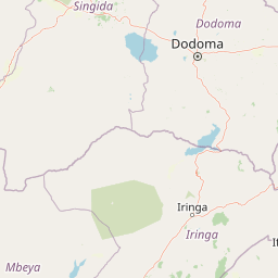
Why Ruaha National Park stands out
Ruaha National Park is renowned as one of Tanzania's premier lion conservation areas, having been designated a Lion Conservation Unit since 2005, and it harbors significant populations of other apex predators including African wild dogs, leopards, and cheetahs. The park is particularly famous for its dramatic elephant populations, though these have faced severe challenges in recent decades with numbers declining sharply from approximately 34,000 in 2009 to under 16,000 by 2015. The Great Ruaha River system, which defines the park's southeastern boundary, creates a vital riparian corridor that supports extraordinary wildlife concentrations during the dry season, making for exceptional game-viewing opportunities. The park also stands out for its exceptional bird diversity, with more than 571 species recorded, including numerous resident hornbill species and seasonal migratory visitors.
Ruaha National Park history and protected-area timeline
The protected area that would become Ruaha National Park has a colonial-era origin, with German colonial authorities establishing the Saba Game Reserve in 1910 during the period when what is now Tanzania was under German control as German East Africa. Following World War I and the transfer of the territory to British administration as Tanganyika, the colonial administration renamed the reserve to Rungwa Game Reserve in 1946, maintaining its status as a controlled hunting and wildlife protection area. The critical transformation came in 1964 when the southern portion of the reserve was excised and elevated to full national park status, creating the Ruaha National Park that exists today. A major expansion occurred in 2008 when the Usangu Game Reserve and adjacent important wetland areas were incorporated into the park, dramatically increasing its extent to approximately 20,226 square kilometers and linking it administratively with the broader ecosystem that includes the Rungwa Game Reserve, Kizigo Game Reserve, Muhesi Game Reserve, and the Mbomipa Wildlife Management Area. This expansion was particularly significant because it brought the productive Usangu wetlands under full protection, areas that serve as critical dry-season habitat for wildlife and which feed the Great Ruaha River system.
Ruaha National Park landscape and geographic character
The physical landscape of Ruaha National Park encompasses a remarkable diversity of terrain, ranging from rocky highlands in the western portions to the fertile river valley of the Great Ruaha River in the southeast. The park sits within the southern highlands of Tanzania, an area of elevated terrain that creates varied topography including hills, ridges, and rocky outcrops that break the horizon across the western and central sectors. The Great Ruaha River, from which the park takes its name, flows in a generally easterly direction along the southeastern boundary, its course marked by dense riparian vegetation including riverine forests that contrast dramatically with the surrounding woodlands. The park's vegetation reflects the transition between different ecological zones, with miombo woodland covering much of the interior areas, characterized by Brachystegia and Isoberlinia trees that create a seasonal spectacle of color when the trees flower. Rocky areas support more sparse vegetation and provide habitat for species adapted to rugged terrain, while the river corridor supports lush gallery forests that provide shade and water for wildlife throughout the year. The landscape creates a sense of vast emptiness and wildness that distinguishes Ruaha from more developed safari destinations, with long distances between waterholes and viewing points emphasizing the park's remote character.
Ruaha National Park ecosystems, habitats, and plant life
The ecological character of Ruaha National Park is defined by its position within the miombo woodland biome of southern Tanzania, a vegetation type characterized by deciduous hardwood trees that dominate much of the park's interior. The park lies within a transition zone where miombo woodland gives way to other habitat types, creating a mosaic of ecosystems that supports remarkable biodiversity. The Great Ruaha River and its associated wetlands represent the most ecologically productive areas, with permanent water supporting riparian forest and attracting wildlife concentrations that can be spectacular during the dry season from May through October. The Usangu wetlands, incorporated into the park in 2008, added critical habitat to the protected area, providing breeding grounds for waterbirds and dry-season refuge for large mammals. The park experiences a pronounced dry season during the winter months of May to October when rainfall is minimal and temperatures can climb to around 35 degrees Celsius during the day, creating challenging conditions for both wildlife and visitors, though this is precisely when wildlife viewing reaches its peak as animals concentrate around remaining water sources.
Ruaha National Park wildlife and species highlights
Ruaha National Park supports an impressive diversity of large mammals and is particularly significant for its populations of apex predators. The park has been recognized as a Lion Conservation Unit since 2005, reflecting its importance for the long-term survival of African lions in Tanzania, a country that holds significant lion populations across its protected areas. The predator assemblage includes East African cheetahs, African leopards, African wild dogs that roam the woodlands in packs, and spotted hyenas that maintain complex social structures across the park. Herbivore diversity is equally remarkable, with Masai giraffes browsing the woodland canopy, African buffalos gathering in herds, and various antelope species including greater kudu, lesser kudu, roan antelope, and sable antelope occupying different habitats throughout the park. Hippopotamuses crowd the pools of the Great Ruaha River, while elephants, once abundant, have faced significant population declines in recent decades. The birdlife is extraordinary, with more than 571 species recorded, including numerous hornbill species that are a conspicuous presence in the woodlands, along with both resident and migratory species that utilize the park at different times of year.
Ruaha National Park conservation status and protection priorities
Ruaha National Park plays a critical role in conservation across the larger Rungwa-Kizigo-Muhesi ecosystem, a vast landscape of approximately 45,000 square kilometers that represents one of the most important wildlife areas in Tanzania outside of the famous northern circuit parks. The park's designation as a Lion Conservation Unit reflects international recognition of its significance for this threatened species, and its inclusion in the broader ecosystem approach ensures that wildlife can move across connected protected areas, maintaining genetic flow between populations. However, the park faces significant conservation challenges, most notably the dramatic decline in elephant populations that have fallen from approximately 34,000 individuals in 2009 to fewer than 16,000 by 2015, reflecting broader trends of poaching and habitat loss across East Africa. The poisoning incident in 2018 that resulted in the deaths of six lions and 74 vultures highlighted the threat of human-wildlife conflict and intentional wildlife persecution that parks throughout the region must address. The expansion in 2008 to incorporate the Usangu Game Reserve and wetlands represented a major conservation achievement, bringing critical habitat under full protection and strengthening the integrity of the broader ecosystem.
Ruaha National Park cultural meaning and human context
Ruaha National Park exists within a region of Tanzania that has been inhabited by pastoralist and agro-pastoralist communities for generations, though the park itself has been protected for over a century in various forms since the establishment of the Saba Game Reserve in 1910. The land use patterns in the surrounding areas reflect traditional practices that have shaped the landscape, with grazing lands and seasonal movements by herders creating a buffer zone around the protected area. The park's relative remoteness has limited the extent of human settlement within its boundaries compared to more accessible protected areas, though local communities maintain connections to the land and resources beyond the park borders. The establishment of wildlife management areas adjacent to the park, such as the Mbomipa Wildlife Management Area, creates a framework for community-based conservation that allows local populations to benefit from wildlife protection while maintaining their traditional livelihoods.
Top sights and standout views in Ruaha National Park
The Great Ruaha River represents the park's most iconic feature, a permanent watercourse that draws wildlife throughout the dry season and creates the centerpiece of any visit, particularly dramatic where hippos congregate in pools and elephants come to drink. The predator watching is exceptional, with lions frequently encountered on hunts or resting in the shade, African wild dogs denning in the woodland areas, and leopards prowling the riverine forests at dawn and dusk. The birding opportunities rank among Tanzania's best, with the chance to observe over 571 species including the spectacular hornbills that feature prominently in the park's avifauna. The park offers a more remote and wild safari experience than the northern circuit, with vast landscapes where vehicles may travel for hours without encountering another tourist, creating a sense of exclusivity and connection with the African wilderness that more crowded parks cannot match.
Best time to visit Ruaha National Park
The optimal time to visit Ruaha National Park is during the dry season from May through October, when wildlife viewing reaches its peak as animals concentrate around the remaining water sources, particularly along the Great Ruaha River and its pools. This period offers the most reliable game viewing, with vegetation sparse and animals easier to spot as they move between waterholes. The dry season also corresponds with cooler temperatures at night, though daytime temperatures can remain very hot, often reaching 35 degrees Celsius. The wet season from November through April brings new growth and greener landscapes, but wildlife becomes more dispersed as water becomes available across the park, making viewing more challenging. The wet season does, however, bring migratory birds to the park and creates beautiful scenery as the woodland blooms. The shoulder months of April and November offer a compromise between seasons, though access on some roads may be limited during the heaviest rains.