
Mori Atlas logo
Natural monumentRybník Jíkavec

Mapping the distinctive pond chain and moist meadow habitats within central Bohemian countryside

Rybník Jíkavec Natural Monument: Protected Wetland Landscapes in the Královéhradecký Region

(Přírodní památka Rybník Jíkavec)

Rybník Jíkavec represents a vital natural monument within the Královéhradecký region, characterized by its preserved water bodies and surrounding marshy meadow habitats. This protected area, part of the wider Ostruženské rybníky pond network, provides a critical refuge for moisture-loving plant species in the rural landscape. Its geography offers a window into the traditional, pond-rich terrain typical of Czech inland wetlands near the broader landscape of the Bohemian countryside.

wetlandpondwet meadowsfishpond landscapenature monumentprotected area
A graphic illustration showing a tall waterfall falling down a pinkish-orange cliff face into a calm pond, framed by stylized pine and deciduous trees with tall grasses in the foreground.

Rybník Jíkavec

Natural monument

Park overview

Structured park overview, official facts, and landscape profile for Rybník Jíkavec

Rybník Jíkavec park facts, protected area profile, and essential visitor context

Review the core facts for Rybník Jíkavec, including designation, size, terrain, visitor scale, habitats, and operating context in one park-focused overview.

About Rybník Jíkavec

Rybník Jíkavec is a compact nature reserve in the Bohemian countryside of northeastern Czechia, situated in the Jičín district at the edge of the well-known Prachovské skály region. Although small in scale, the site carries meaningful ecological weight because it preserves one of the few remaining well-developed wetland complexes in an area otherwise dominated by farmland and managed fishpond landscapes.

The protected area comprises the Jíkavec pond and the neighbouring Rybník U Sv. Trojice, with both water bodies fed by the small stream Velký Porák. Together they form a humid mosaic of open water, sedge- and grass-rich margins, and true peat-influenced meadows. These wet meadows have historically been maintained through traditional low-intensity land use, which has allowed moisture-demanding flora to persist here long after many similar habitats elsewhere in Bohemia have disappeared.

The site is part of the larger Ostruženské rybníky system, a network of eight ponds that defines the character of the landscape around Ostružno. This pond system has shaped the local hydrology and ecological pattern for centuries, creating a patchwork of water surfaces, damp grasslands, and shoreline vegetation. The protected status of Rybník Jíkavec acknowledges that even within such a heavily shaped cultural landscape, certain pockets retain high biodiversity value.

In practical terms the area remains a working landscape rather than a strict nature reserve: the pond continues to be used for fish farming, while a recreational area at nearby Sklář (Ostružno u Prachovských skal), developed in the second half of the 20th century, sits close to the protected site. Marked hiking trails, including the yellow and red tourist routes, pass along or near the ponds, allowing visitors to experience this small wetland sanctuary within the broader Bohemian landscape.

Quick facts and research context for Rybník Jíkavec

Rybník Jíkavec is a Czech nature monument (IUCN Management Category IV, Habitat/Species Management Area) covering roughly 7.27 hectares at elevations of about 285 to 291 metres above sea level. It was declared a protected site on 1 September 1998 by the former District Office in Jičín and lies on the cadastral territory of Ohařice close to Ostružno. The protected zone encompasses two ponds, Jíkavec and U Sv. Trojice, both supplied by the Velký Porák stream and embedded in the larger system of eight Ostružno ponds.

Protection and recognition

Terrestrial conservation framework and verified administrative status

Rybník Jíkavec Protection Status and International Recognition Records

Rybník Jíkavec maintains a documented terrestrial protection scope within official conservation registries. Official records outline management jurisdiction and international recognition frameworks associated with the protected area.

Protection details

Protection scope
Terrestrial
Transboundary protection
No
Park context

Deeper park guide and search-rich context for Rybník Jíkavec

Rybník Jíkavec history, landscape, wildlife, and travel context

Explore Rybník Jíkavec through its history, landscape character, ecosystems, wildlife, conservation priorities, cultural context, and seasonal travel timing in a structured park guide built for atlas discovery and search intent.

Why Rybník Jíkavec stands out

Rybník Jíkavec is best known for its wet meadows and marshy habitats supporting moisture-loving plant species such as narrow-leaved cottongrass (Eriophorum angustifolium), northern bedstraw (Galium boreale), shining meadow-rue (Thalictrum lucidum), marsh valerian (Valeriana dioica), and marsh violet (Viola palustris). It is also notable as one of the protected ponds within the Ostruženské rybníky chain, where traditional pond management coexists with valuable wetland flora and fauna.
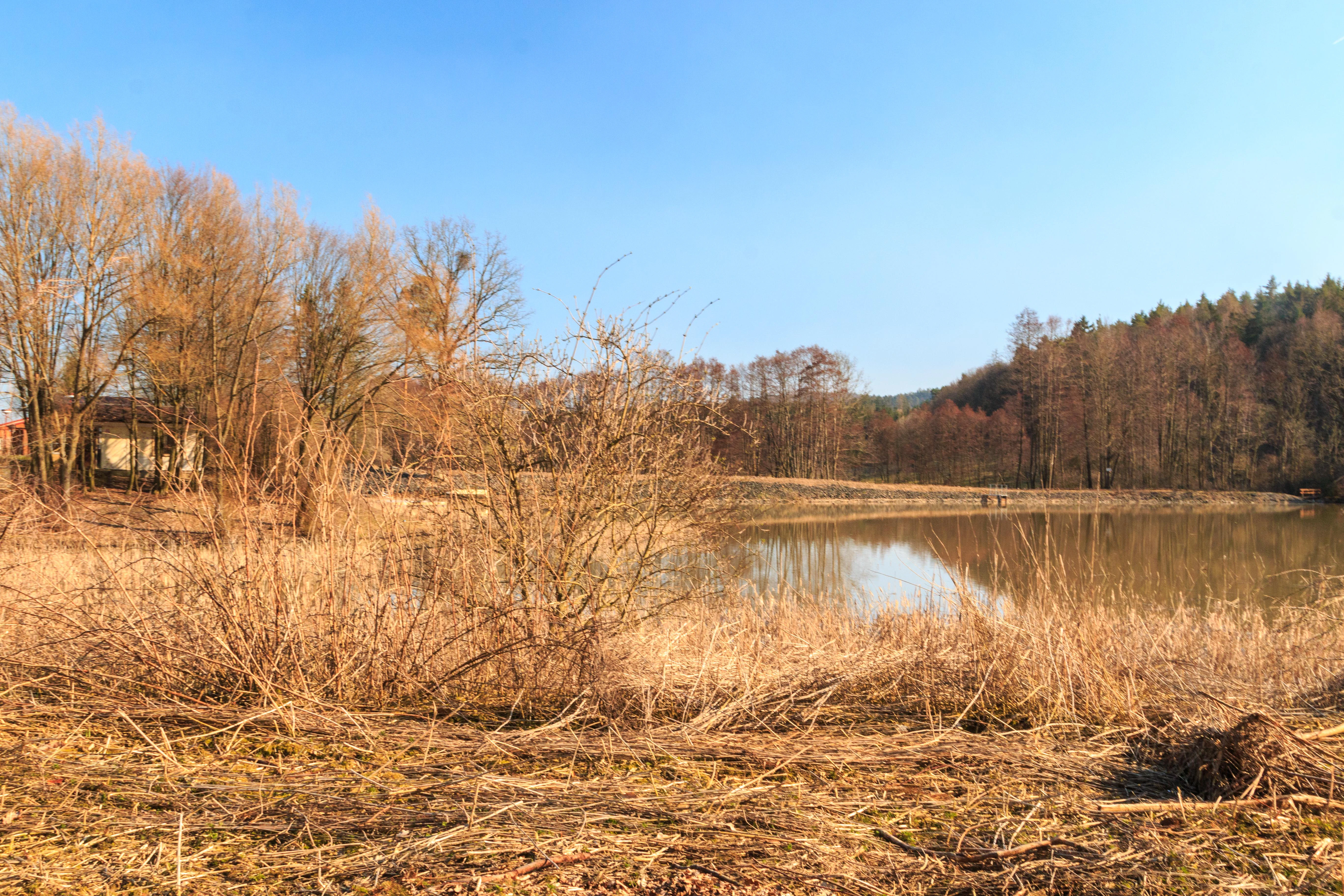
A calm, still pond surrounded by golden, dry grasses and leafless trees under a clear blue sky.
The landscape at Rybník Jíkavec, characterized by its pond and surrounding wetland vegetation.

Rybník Jíkavec history and protected-area timeline

Before receiving formal protection, Rybník Jíkavec existed for centuries as part of the traditional South Bohemian-style pond system of the Ostružno area, where artificial fishponds were established and managed as part of the regional water and fish economy. The site's path to conservation began in the late 1990s, when biodiversity surveys highlighted the exceptional value of its wet meadows.

On 1 September 1998, the District Office in Jičín (Okresní úřad Jičín) officially declared the area a přírodní památka, a national category for smaller protected sites in the Czech system, recognising both the Jíkavec pond and the adjacent Rybník U Sv. Trojice as part of the protected territory. The designation corresponded to IUCN Management Category IV, framing the area primarily as a habitat and species management zone rather than a strict wilderness reserve.

The formal recognition secured legal protection for the wet meadows and their rare plant species, while still allowing the continuation of established uses such as fish farming in the pond. This blend of protection and continued traditional land use reflects the broader Czech approach to small, culturally shaped natural monuments embedded in working agricultural landscapes.

Rybník Jíkavec landscape and geographic character

The landscape of Rybník Jíkavec is gentle and low-lying rather than dramatic, typical of the Bohemian pond country. The protected area lies between roughly 285 and 291 metres above sea level, situated in a slightly undulating terrain that gradually slopes towards the larger Prachovské skály region to the north. The defining landscape features are the open water surfaces of the two ponds and the surrounding strip of damp meadows and sedge-rich margins.

Water defines the character of the site. The Velký Porák stream supplies both ponds, ensuring that water levels remain relatively stable and that the adjacent meadows stay sufficiently moist to support their characteristic flora. The waters are framed by narrow belts of marshy vegetation, low shore grasses, and small transitions into peat-influenced wet meadows.

Beyond the protected core, the broader landscape is shaped by the Ostruženské rybníky, a network of eight interconnected ponds that create the rhythmic pond-and-meadow mosaic typical of Bohemian countryside. Quiet rural paths, fields, and the small settlements of Ohařice and Ostružno border the area, giving the protected site a strongly bucolic, traditionally managed feel.
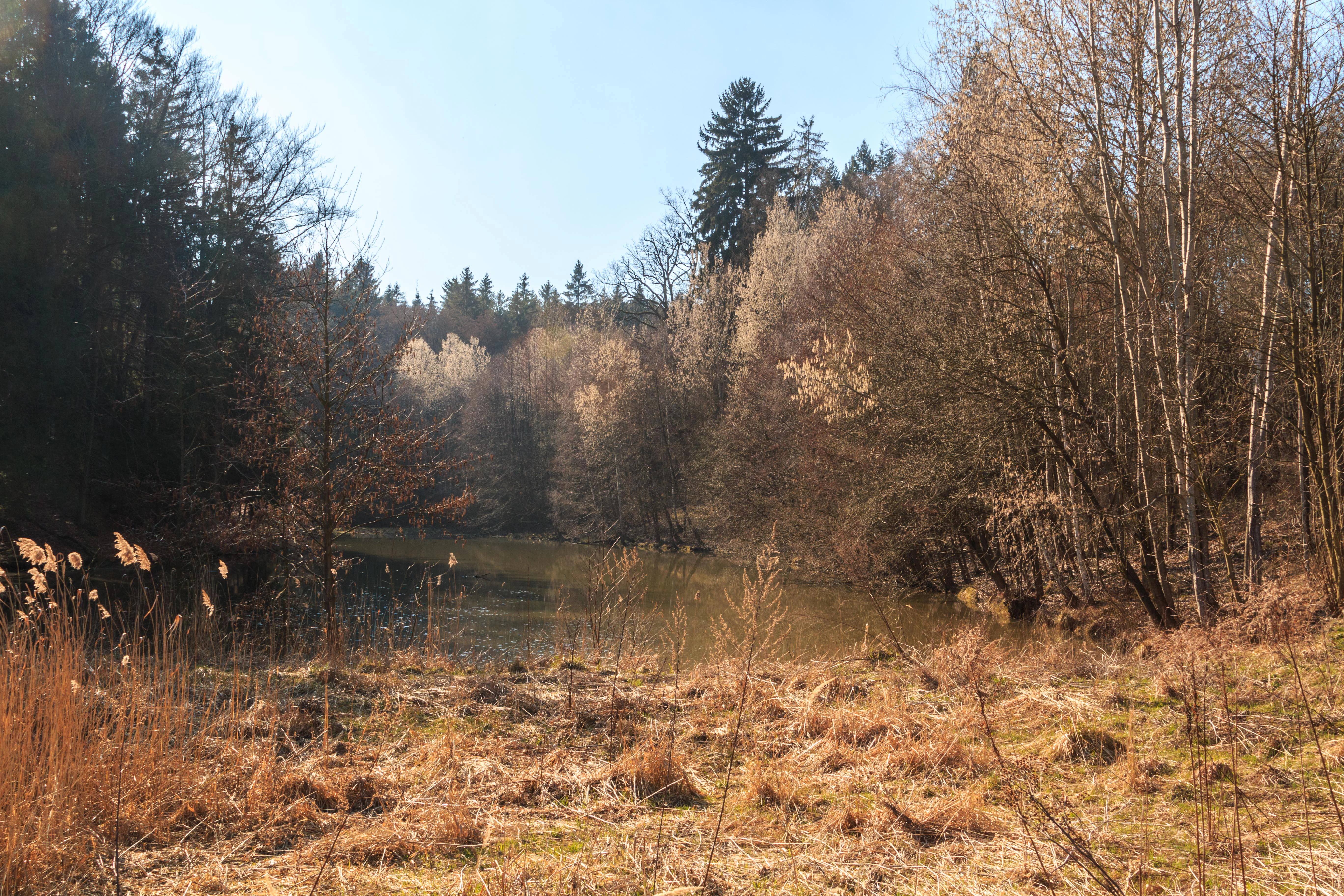
A peaceful pond nestled within a forest, surrounded by dry marshy meadows, leafless trees, and evergreens under a clear sky.
A view of the Jikavec Pond natural monument, showcasing the wetland surroundings and forested landscape.

Rybník Jíkavec ecosystems, habitats, and plant life

Ecologically, Rybník Jíkavec is defined by its wetland character rather than by forest or rocky terrain. Its habitats combine open pond water, shoreline marsh vegetation, and true wet meadows, including peat-influenced grassland communities that have become increasingly rare in the intensively farmed central Bohemian landscape.

The wet meadows, described as slatinné (alkaline/organic-rich fen-influenced) meadows in the Czech conservation record, are the heart of the site's biodiversity value. Their constant moisture and traditional low-intensity management have created conditions that allow moisture-loving plant species to persist alongside more general wetland flora. Together, the pond surfaces and meadows support a layered habitat mosaic, where aquatic vegetation in the ponds gives way to emergent shore plants, sedge communities, and finally to the higher, species-rich wet meadows.

Such a combination of still freshwater, marsh margin, and fen-influenced grassland is typical of traditional Central European pond landscapes and gives Rybník Jíkavec its particular ecological character. The site's protection aims primarily at maintaining the integrity of this habitat mosaic rather than at preserving any single dramatic feature.
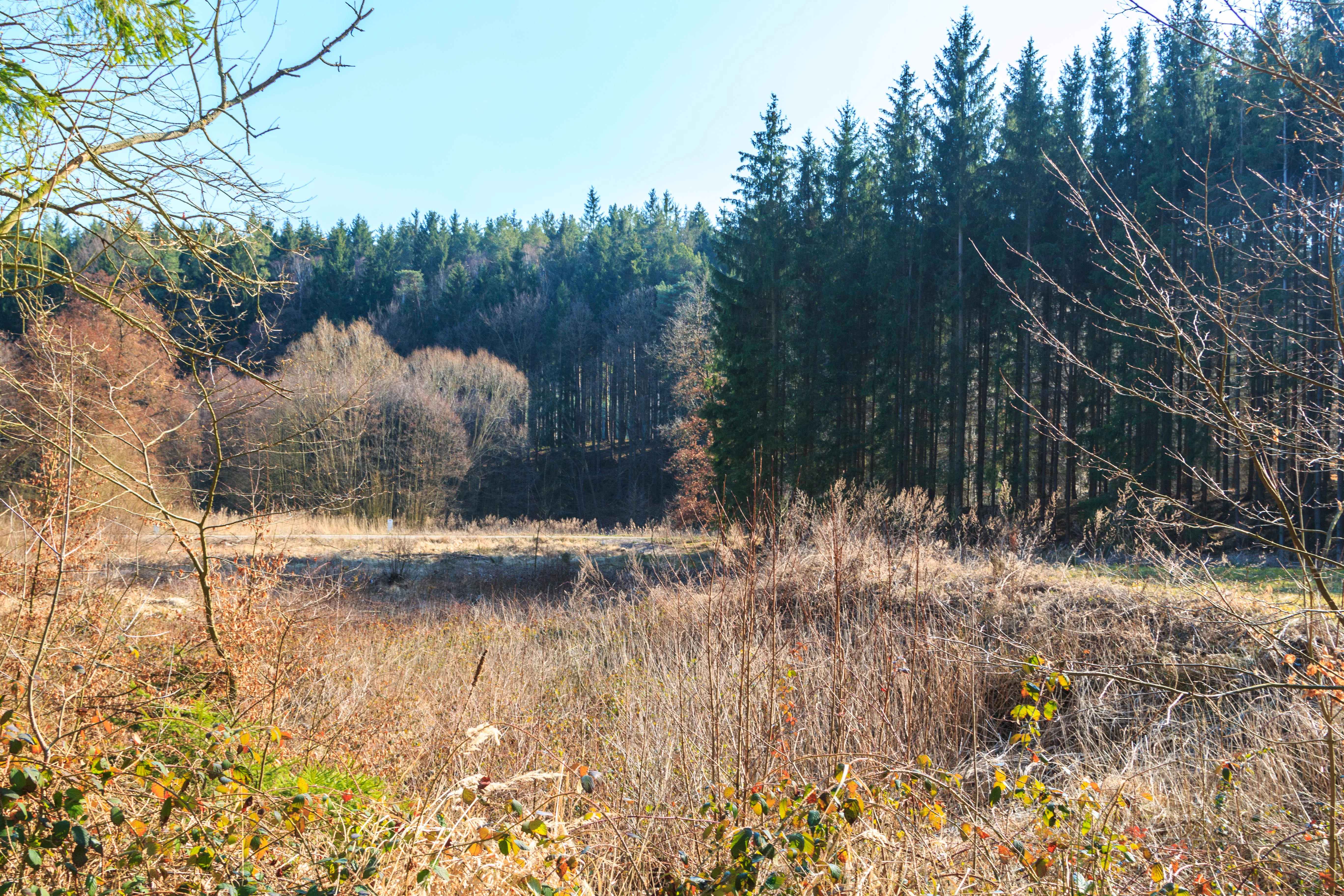
A landscape shot of a dry, brown field with patchy grasses leading to a dense wall of tall pine trees, captured in soft daylight.
A view of the landscape at Rybník Jíkavec nature monument, featuring dry meadow vegetation and a bordering coniferous forest.

Rybník Jíkavec wildlife and species highlights

While the biodiversity value of the site is most strongly framed around its flora, the wetland mosaic of Rybník Jíkavec also supports a characteristic wetland fauna. The combination of open water, marshy margins, and adjacent wet meadows creates habitats for amphibians, aquatic invertebrates, and the typical birdlife of Bohemian pond systems, including waterfowl and species associated with reed and sedge vegetation.

The ponds are actively managed for fish farming, which gives the aquatic ecosystem a particular character, with regular water-level management and seasonal use. This management does not detract from the site's value for wildlife; rather, traditional pond management in the Czech countryside has long been associated with high habitat diversity, including insects, amphibians, and birds attracted to the interface between open water, marsh, and meadow. The wider Ostruženské rybníky network further enhances this function by providing linked habitats across multiple ponds.
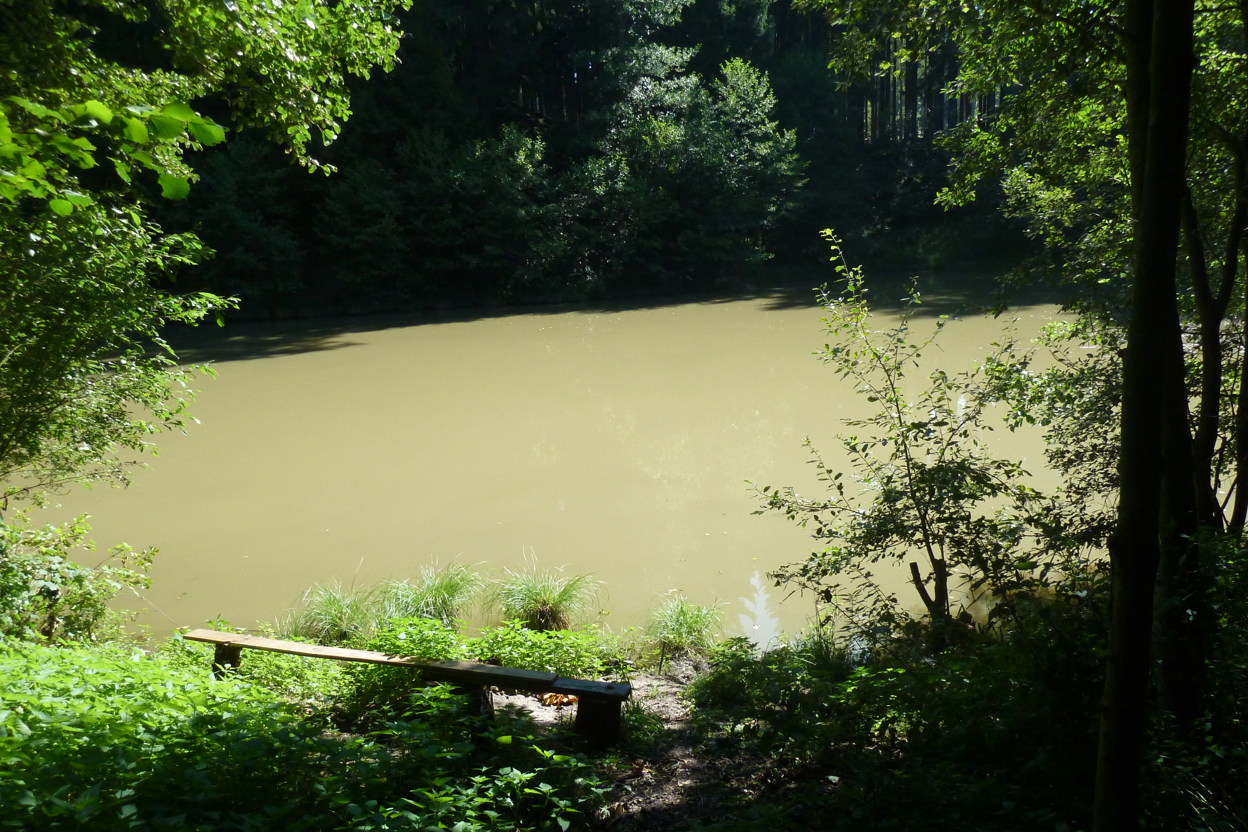
A wooden park bench sits in the shade of trees, overlooking a pond with murky, calm water surrounded by dense forest.
A wooden bench overlooking the calm waters of Rybník Jíkavec.

Rybník Jíkavec conservation status and protection priorities

Rybník Jíkavec is protected as a přírodní památka, a smaller-scale national category of protected area in the Czech Republic, equivalent to IUCN Category IV (Habitat/Species Management Area). The designation places the primary conservation emphasis on maintaining and improving conditions for the specific species and habitats that justified the protection, rather than on a broader wilderness preservation approach.

The site's principal conservation interest lies in the preservation of its wet meadows and associated rare plant species, which face pressure from drainage, intensification of land use, and abandonment of traditional management practices elsewhere in the region. By securing legal protection for these habitats, the site safeguards a piece of the regional botanical and ecological heritage.

The inclusion of the broader pond landscape within the Ostružno area also gives the site additional conservation significance. The Ostruženské rybníky system represents an interconnected habitat network where the protection of individual ponds contributes to maintaining ecological continuity across the wider countryside. This makes Rybník Jíkavec valuable not only as a stand-alone reserve but as one node within a larger functioning pond landscape.

Rybník Jíkavec cultural meaning and human context

Rybník Jíkavec sits in a rural Bohemian landscape shaped by centuries of fishpond management, an emblematic feature of Czech cultural and agricultural heritage. The region around Jičín is known for both its scenic countryside and its proximity to Prachovské skály, a popular natural area, and the Ostružno ponds have long been part of the everyday environment of villages such as Ostružno and Ohařice.

The protected area reflects a broader Czech pattern where small natural monuments coexist with traditional land uses. Fish farming in the pond has continued alongside formal nature protection, illustrating how cultural landscapes and conservation can overlap rather than conflict. The development of a recreational area at nearby Sklář (Ostružno u Prachovských skal) in the second half of the 20th century added a layer of leisure use to the area, without overshadowing the agricultural and ecological character of the site.

Top sights and standout views in Rybník Jíkavec

The site's strongest highlight is its preserved wet meadow habitat, a feature that has become increasingly scarce in the regional landscape. These meadows support moisture-loving plants such as Eriophorum angustifolium, Galium boreale, Thalictrum lucidum, Valeriana dioica, and Viola palustris.

Equally distinctive is the dual-pond structure of the protected area, anchored by Rybník Jíkavec and Rybník U Sv. Trojice, fed by the Velký Porák stream. Their integration into the larger Ostruženské rybníky chain, combined with marked hiking trails and proximity to the well-known Prachovské skály, makes the site a compact but ecologically rich point of interest within central Bohemian countryside.

Best time to visit Rybník Jíkavec

Rybník Jíkavec can be appreciated across much of the year, but late spring and early summer offer the most rewarding conditions. During this period the water levels in the ponds are typically stable, the wet meadows are at their most floristically expressive, and the broader Bohemian countryside around Prachovské skály is lush and green. Late summer and early autumn also bring attractive shorelines and active waterfowl presence. Winter visits are quieter and more subdued, with the ponds and meadows taking on a calmer, more austere character, but still accessible via the yellow and red tourist trails that pass along the site.

Monthly climate preview

Long-term representative point measurements tracking annual temperature and precipitation cycles

Rybník Jíkavec Climate Normals and Monthly Weather Patterns

Historical data records mean temperatures ranging from negative winter values to warm summer maximums alongside consistent monthly precipitation at the representative coordinate. Analyzing the complete twelve-month profile provides deeper insight into long-term climate behavior and seasonal rhythms across the protected area.
Annual mean8 °C
-3 °C19 °C
Jan-3°
Feb-2°
Mar
Apr
May13°
Jun17°
Jul19°
Aug18°
Sep13°
Oct
Nov
Dec-2°
Warmest month
July

18.7 °C

Coolest month
January

-3.1 °C

Wettest month
July

2.9 mm/day

Driest month
April

1.3 mm/day

Park location guide

Geography guide, regional context, and park location map for Rybník Jíkavec

Rybník Jíkavec park geography, regions, and map view in Czechia

Understand where Rybník Jíkavec sits in Czechia through a broader geographic reading of the surrounding landscape, nearby location context, and its mapped position within the national park landscape.

How Rybník Jíkavec fits into Czechia

Czech Republic is a landlocked Central European country with a population of approximately 10.9 million people. The nation was established as an independent state on January 1, 1993, following the dissolution of Czechoslovakia. Its capital and largest city is Prague, with other major urban centers including Brno, Ostrava, Plzeň, and Liberec.

Wider geography shaping Rybník Jíkavec in Czechia

The Czech Republic is a landlocked country in Central Europe. It is bordered by Germany to the west, Austria to the south, Poland to the northeast, and Slovakia to the southeast. The landscape is predominantly hilly, with the territory covering 78,871 square kilometers.

Map view of Rybník Jíkavec

Use this park location map to pinpoint Rybník Jíkavec in Czechia, understand its exact geographic position, and read its mapped placement within the surrounding landscape more clearly.

Pigeon | © OpenStreetMap contributors

Location context for Rybník Jíkavec

Královéhradecký

Explore the wetland habitats, pond morphology, and marsh vegetation of Czechia.

Rybník Jíkavec Photos and Landscape Scenery: Visual Protected Area Guide

Visual documentation captures the tranquil waters, damp sedge meadows, and low-lying terrain defining Rybník Jíkavec. Examining these environmental details reveals the ecological character of the protected Bohemian pond network more clearly than maps alone.

A calm, still pond surrounded by golden, dry grasses and leafless trees under a clear blue sky.

A wooden post holds a small sign featuring the Czech Republic's double-tailed lion emblem, located in a wooded area with a pond visible in the background.

A peaceful pond nestled within a forest, surrounded by dry marshy meadows, leafless trees, and evergreens under a clear sky.

A landscape shot of a dry, brown field with patchy grasses leading to a dense wall of tall pine trees, captured in soft daylight.

A wooden park bench sits in the shade of trees, overlooking a pond with murky, calm water surrounded by dense forest.

Park atlas

Compare surrounding wetland habitats, regional ponds, and protected natural areas.

Parks Near Rybník Jíkavec and Connected Protected Landscapes in Czechia

Browse other parks near Rybník Jíkavec to examine the wider network of wetland reserves and protected fishpond landscapes across the central Bohemian countryside. Comparing adjacent protected areas reveals broader ecological patterns, connected stream corridors, and regional variations in lowland marsh habitats.
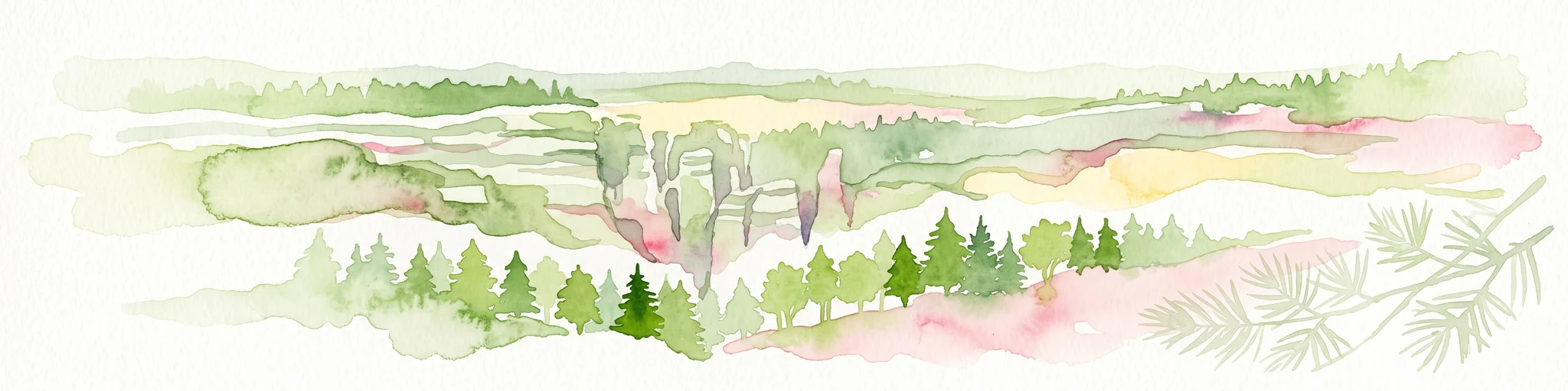
Watercolor illustration of sandstone rock towers and coniferous trees in a landscape setting with a light color palette.
Nature reserveKrálovéhradecký kraj
About 3.1 km away#1 closest

North

Prachovské skály Nature Reserve: Geologic Atlas of Bohemian Sandstone Formations

Mapped sandstone towers and protected forest terrain in Královéhradecký kraj

Prachovské skály consists of a concentrated sandstone massif characterized by towering pinnacles and labyrinthine gorges. This nature reserve serves as a prime example of sedimentary erosion in the Bohemian Paradise region, offering a distinct landscape profile that stands in sharp contrast to the surrounding agricultural plains of the Czech Republic.

Area
2.624 km²
Established
1928
IUCN
IV
Visitors
300K annual
A watercolor illustration of rolling hills with a treeline and meadow, featuring soft green and orange tones on a white background.
Natural monumentKrálovéhradecký kraj
About 8.5 km away#2 closest

North

Na víně Natural Monument: Protected Opoka Slopes and Botanical Geography in Královéhradecký kraj

Geographic atlas and ecological profile of a protected Czech natural monument

Na víně represents an essential, small-scale protected landscape in the Jičín District of Královéhradecký kraj. This site is defined by its characteristic calcareous opoka hill slopes and its role as a botanical refuge for rare, thermophilous species. By mapping the interaction between the underlying Cretaceous geology and the surviving dry grassland communities, this analysis highlights the importance of localized conservation within the broader Bohemian Cretaceous Basin.

Area
0.055 km²
Established
1990
IUCN
IV
Relief
Upland
Watercolor painting showing a river, grassy banks, scattered trees, and distant hills
Protected landscapeCzechia
About 11 km away#3 closest

Northwest

Bohemian Paradise Protected Landscape: Discover Czech Republic's Sandstone Geology and Park Boundaries

Mapped sandstone formations and historic regional geography.

Delve into Bohemian Paradise, a protected landscape in the Czech Republic celebrated for its dramatic sandstone rock formations and ancient castles. This detailed entry provides context on its unique geological character, the extent of its protected boundaries, and its significant position within the regional geography. Explore the mapped terrain and understand the atlas value of this historic protected area.

Area
181.17 km²
Established
1955
IUCN
V
Relief
Upland
Natural monumentKrálovéhradecký kraj
About 13 km away#4 closest

Northwest

Meziluží Natural Monument: Mapping Protected Landscape Geography in Královéhradecký Kraj

A study of sandstone terrain and historic conservation within the Bohemian Paradise

Meziluží provides a detailed look at the geography of small-scale protected sites in the Czech Republic. By analyzing its steep sandstone slopes and traditional orchard-pasture land use, users gain a clearer understanding of the complex relationship between regional geology and botanical conservation history in the Bohemian Paradise area.

Area
0.015 km²
Established
1997
Relief
Upland
Scope
Terrestrial
A horizontal watercolor painting depicting a soft landscape with green hills, light forest foliage, and a water body in a muted, warm color palette.
Protected landscapeMladá Boleslav District
About 15 km away#5 closest

West

Přírodní park Čížovky: Geographic Overview of the Protected Landscape in Mladá Boleslav District

Mapping wetlands, aquatic ecosystems, and rural terrain

Přírodní park Čížovky serves as a significant protected landscape in the Mladá Boleslav District. It features a dense mosaic of ponds, marshes, and orchards. Explore the mapped boundaries of this terrain, ranging from the Křesovský potok valley to the elevated Křemenice ridge, showcasing a classic Central Bohemian ecological heritage.

Area
386 km²
Established
1998
Relief
Upland
Climate
Temperate
Natural monumentStředočeský kraj
About 16 km away#6 closest

Northwest

V Dubech Natural Monument: Protected Wetland Landscapes and Geography in Czech Republic

A compact wetland mosaic in the Středočeský kraj region

V Dubech is a protected natural monument situated at the base of the Příhrazské skály sandstone formations in the Czech Republic. This site preserves a valuable wetland mosaic, including base-rich peat meadows and alder woodlands that support rare species. The park provides an essential look at the localized, water-dominated geography within the broader context of the Bohemian Paradise protected landscape.

Area
0.047 km²
Established
1998
IUCN
III
Relief
Lowland
Natural monumentSemily District
About 17 km away#7 closest

Northwest

Vústra Natural Monument: Mapping the Protected Wetland Landscapes of the Semily District

A concentrated botanical and geological sanctuary in the Bohemian Paradise

Vústra is a highly localized natural monument in the Semily District that preserves a vital wetland complex including a pond and calcareous fen. Surrounded by characteristic sandstone rock towers and alder-spruce forests, the site serves as a vital ecological anchor within the wider Bohemian landscape. This detail page traces the specific boundaries and topographical features that define this protected monument.

Area
0.023 km²
Established
1996
IUCN
IV
Relief
Lowland
Natural monumentKrálovéhradecký kraj
About 18 km away#8 closest

Southeast

Veselský háj Natural Monument: Geographic Boundaries and Protected Landscape Context

Lowland forest and wetland mosaic in the Czech Republic

Veselský háj stands as a key natural monument in the Královéhradecký kraj region; characterized by its well-preserved oak-hornbeam woodland and diverse botanical assemblages. The site offers a window into the structure of Bohemian lowland ecosystems, where rare species like the Siberian iris and violet helleborine thrive within a matrix of ancient forest and open water. Explore the boundaries and topographic features of this significant protected terrain.

Area
442.71 km²
Established
1998
IUCN
III
Relief
Lowland

Common questions about visiting, size, designation, and location context for Rybník Jíkavec

Rybník Jíkavec FAQs for park facts, access, geography, and protected area context

Find quick answers about Rybník Jíkavec, including protected-area facts, park geography, trail and visitor context, and how the park fits into its surrounding country and regional landscape.
MoriAtlas Explorer

Continue Your Protected Areas Search Across the Global Atlas

Deepen your exploration by continuing the structured search for national parks and protected areas worldwide. Utilize the comprehensive filtering capabilities to compare different conservation landscapes and refine your understanding of global park geography. Discover more about the distribution and characteristics of protected natural areas.

Global natural geography