Mori Atlas logo
Protected landscapeBohemian Paradise

Discover unique rock cities, medieval castles, and regional mapped landscapes.

Bohemian Paradise Protected Landscape: Sandstone Formations and Historic Geography in the Czech Republic

(Chráněná krajinná oblast Český ráj)

Bohemian Paradise, the Czech Republic's oldest protected area, is a renowned protected landscape defined by its extraordinary sandstone rock formations and a rich tapestry of historic castles. This atlas-focused page invites exploration of its unique geology, mapped boundaries, and the regional geography that makes this area a significant natural and cultural destination. Uncover the sculpted terrain and discover its place within the Czech landscape.

Sandstone formationsProtected landscape areaRock citiesUNESCO Global GeoparkHistoric castlesMedieval ruins

Bohemian Paradise

Protected landscape

Park overview

Structured park overview, official facts, and landscape profile for Bohemian Paradise

Bohemian Paradise park facts, protected area profile, and essential visitor context
Review the core facts for Bohemian Paradise, including designation, size, terrain, visitor scale, habitats, and operating context in one park-focused overview.

About Bohemian Paradise

Bohemian Paradise represents one of the Czech Republic’s most treasured natural and cultural landscapes, combining exceptional geological features with an extraordinary concentration of historical architecture. The protected landscape area encompasses three distinct but geographically related sections that together form a cohesive ecological and scenic unit. The region’s character is defined by its sandstone bedrock, which not only shapes the dramatic terrain but also forms the building material for many surrounding towns and villages. The park’s network of marked hiking trails and cycling routes allows visitors to explore its diverse landscapes, from the towering rock pillars and hidden caves of the sandstone cities to the peaceful valleys and ponds of the lower terrain. The cultural layer is equally impressive, with medieval castles, Renaissance chateaus, and folk architecture estates dotting the landscape. The town of Turnov, known historically for gem-cutting and stone-working crafts tied to the local volcanic geology, serves as the primary gateway and service center for the region. The park’s UNESCO Global Geopark status reflects its significance as an educational resource for understanding the region’s geological history, which spans from the Cretaceous period when the area lay on the margins of an ancient sea to more recent volcanic activity that produced the basalt formations visible today.

Quick facts and research context for Bohemian Paradise

Bohemian Paradise occupies 181 km² in the Central Bohemian, Hradec Králové, and Liberec regions of the Czech Republic. The protected landscape area was established in 1955 and expanded to its current size in 2002. It is classified as IUCN Category V, denoting a protected landscape. The main river flowing through the area is the Jizera. The region contains two national natural monuments, eleven natural reservations, and eleven natural monuments. Turnov serves as the administrative center and is traditionally considered the heart of Bohemian Paradise. The highest point is Kozákov mountain at 744 meters, which was once a volcanic site known for precious stone deposits.

Park context

Deeper park guide and search-rich context for Bohemian Paradise

Bohemian Paradise history, landscape, wildlife, and travel context
Explore Bohemian Paradise through its history, landscape character, ecosystems, wildlife, conservation priorities, cultural context, and seasonal travel timing in a structured park guide built for atlas discovery and search intent.

Why Bohemian Paradise stands out

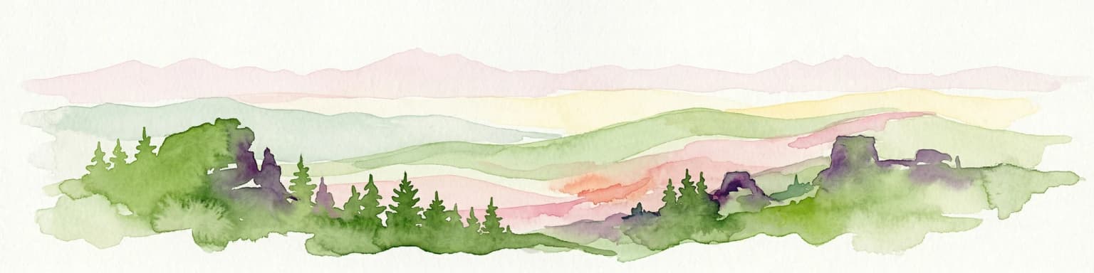
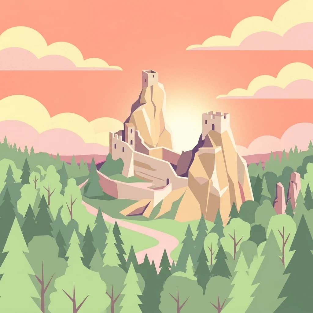
Bohemian Paradise is best known for its extraordinary sandstone rock formations that have been sculpted by wind, water, frost, and erosion into unique shapes over millions of years. The Prachov Rocks area, protected since 1933, features 60-million-year-old formations and has served as a filming location for major television and film productions. The Hrubá Skála rock town showcases volcanic sandstone pillars rising dramatically from the forest, while the Klokočské and Suché Rocks add to the region’s remarkable geological character. The twin towers of Trosky Castle, built on ancient volcanic plugs, have become the most recognizable symbol of the park. Beyond its geological wonders, the region is renowned for its density of medieval castles, including Kost Castle, Sychrov Castle, and numerous castle ruins scattered throughout the landscape.

Bohemian Paradise history and protected-area timeline

The protected status of Bohemian Paradise dates to 1955, making it the first large-scale nature reserve established in Czechoslovakia. At its founding, the protected area covered approximately 95 square kilometers. In 2002, the boundaries were expanded to the current 181.17 square kilometers, reflecting growing recognition of the region’s ecological and landscape values. The concept of Bohemian Paradise as a tourist and cultural region, however, originated much earlier in the second half of the 19th century. The name was initially used by spa guests visiting the Sedmihorky resort, with the first documented use appearing in 1886 by journalist Václav Durych. Originally, the name actually referred to the Litoměřicko region in northern Bohemia, now known as the Garden of Bohemia, but the contemporary usage for this particular area gradually took hold. The establishment of the protected landscape area ensured the preservation of the region’s unique combination of natural formations and historical structures, formalizing what had long been recognized as a special place within the Czech lands.

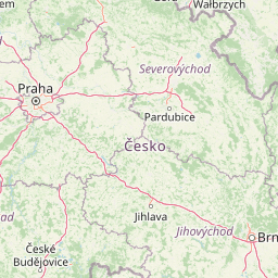
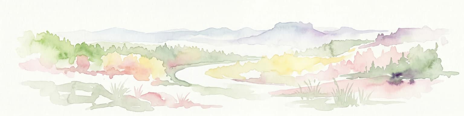
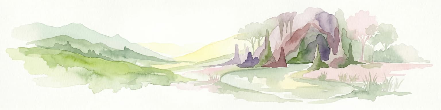
Bohemian Paradise landscape and geographic character

The landscape of Bohemian Paradise is dominated by its distinctive sandstone formations, created during the Cretaceous period when the area sat on the margins of an ancient sea. Over millions of years, these sedimentary rocks have been carved by natural forces into a remarkable variety of shapes, including towering pillars, natural arches, caves, and rock gates. The most spectacular examples include the Prachov Rocks, Hrubá Skála, Klokočské Rocks, and Příhrazské Rocks, each offering a different character and scale of formation. Between the rocky areas, the terrain consists of forested hills, managed meadows, and valley systems carved by small streams. The Jizera River, the main watercourse, flows through the western portion of the protected area. The landscape also features numerous ponds, particularly in the Podtrosecká valleys below Trosky Castle and in the areas surrounding Kost Castle. The highest point, Kozákov mountain at 744 meters, provides panoramic views over the entire region and is crowned by a tourist chalet and lookout tower. The contrast between the exposed sandstone ridges and the softer, vegetated valleys creates a visually diverse landscape that changes character dramatically as visitors move through different areas of the park.

Bohemian Paradise ecosystems, habitats, and plant life

The natural environment of Bohemian Paradise supports a variety of habitats that reflect the region’s position in the transition between different ecological zones. The sandstone rock formations provide specialized habitats for heat-loving plants and insects on the sun-exposed rock faces, while the surrounding forests and meadows support more typical Central European wildlife. The region’s vegetation includes mixed deciduous forests on the lower slopes, with coniferous forests appearing at higher elevations. The rocky areas host specialized plant communities adapted to the harsh conditions of sandstone pavements and cliff faces. The numerous ponds and small water bodies throughout the area support aquatic ecosystems and provide breeding habitat for amphibians. The caves, including the Bozkov dolomite caves with their underground lake, offer unique subterranean habitats. The protected area’s network of habitats is further reinforced by its designation as part of the European network of protected areas, with the protection framework encompassing not just the most scenic rock formations but also the broader ecological systems that connect them.

Bohemian Paradise wildlife and species highlights

The wildlife of Bohemian Paradise reflects the diversity of its habitats, from the rocky sandstone outcrops to the forested valleys and pond systems. The region provides habitat for a variety of bird species, with the rock formations and forest edges offering nesting sites and foraging areas. The mixed forests support common Central European species, while the open meadows and edges provide hunting grounds for raptors. The pond systems and wetlands attract waterfowl and support amphibian populations, with the Bozkov caves offering winter shelter for some species. The rock formations, while primarily known for their geological and scenic value, also provide habitat for specialized invertebrates and reptiles that thrive in the warm, sunny microclimates created by the south-facing sandstone faces. The broader landscape, with its combination of forest, meadow, and water features, supports a typical range of Central European wildlife without any particularly notable endemic species, though the protected status of the area helps maintain healthy populations within the regional ecosystem.

Bohemian Paradise conservation status and protection priorities

Bohemian Paradise holds significant conservation importance as the Czech Republic’s oldest large-scale protected landscape area, established in 1955 to preserve the region’s unique combination of geological, natural, and cultural values. The park’s IUCN Category V classification reflects its purpose of protecting a landscape where nature and human activity have interacted over centuries to create a distinctive cultural landscape. The designation as a UNESCO Global Geopark further emphasizes the region’s geological significance, providing a framework for education and sustainable tourism that connects visitors with the earth’s geological history. The conservation framework encompasses not only the dramatic rock formations but also the surrounding forests, meadows, ponds, and the historic structures that define the region’s character. The presence of two national natural monuments, eleven natural reservations, and eleven natural monuments within the protected area provides layered protection for the most sensitive features. The park’s management balances conservation objectives with public access, maintaining an extensive network of trails while protecting the most vulnerable geological and ecological features.

Bohemian Paradise cultural meaning and human context

The cultural landscape of Bohemian Paradise reflects centuries of human presence in this scenic region of Bohemia. The concentration of castles and chateaus is exceptional, with medieval fortifications like Trosky Castle and Kost Castle sitting atop the same dramatic rock formations that define the park’s geological character. Trosky Castle, with its two 14th-century towers perched on volcanic plugs, represents the most iconic visual element of the region. The area also includes Renaissance-era structures like the Hrubá Skála chateau, now operated as a hotel and spa, which was originally built in the 14th century and rebuilt in Renaissance style over subsequent centuries. Turnov, considered the heart of Bohemian Paradise, has a historical connection to gem-cutting and stone-working crafts, directly linked to the volcanic geology of Kozákov mountain which yields precious and semi-precious stones. The region also preserves examples of folk architecture, including the Dlaskův and Boučkův estates. The cultural layer extends to the present day with tourism as a major economic activity, with approximately 1.9 million visitors annually drawn to the region’s hiking trails, castles, and scenic landscapes.

Top sights and standout views in Bohemian Paradise

The sandstone rock cities of Bohemian Paradise stand as the park’s most distinctive feature, with the Prachov Rocks offering the most visited concentration of formations, including 60-million-year-old structures that have served as film locations. The twin towers of Trosky Castle on volcanic plugs represent perhaps the most recognizable single image associated with the region. The Hrubá Skála rock town with its volcanic sandstone pillars and the adjoining chateau-turned-hotel create a unique combination of natural and architectural heritage. Kozákov, the highest point in the park, provides both geological interest as a former volcano and panoramic views from its summit chalet and tower. The Bozkov dolomite caves contain the largest underground lake in the Czech Republic. The Golden Trail of Bohemian Paradise provides a long-distance hiking route connecting the region’s diverse attractions, while numerous castle ruins including Frýdštejn and Valdštejn add historical depth to the landscape.

Best time to visit Bohemian Paradise

Bohemian Paradise can be visited throughout the year, with each season offering a different perspective on the landscape. The spring months bring fresh greenery to the forests and meadows, while the rock formations are particularly striking when framed by new foliage. Summer offers the warmest conditions for hiking and the longest days for exploring, though this is also the busiest period for tourism. Autumn provides perhaps the most visually dramatic conditions, as the deciduous forests display their seasonal colors and the visitor crowds diminish. Winter transforms the landscape, with snow adding a new dimension to the rock formations though some facilities may have limited access. The rock formations themselves are accessible year-round, though certain trails may be slippery or closed during winter months. For those seeking to avoid the largest crowds, the shoulder seasons of spring and autumn offer pleasant conditions with fewer visitors while still providing full access to the main attractions.

Park location guide

Geography guide, regional context, and park location map for Bohemian Paradise

Bohemian Paradise park geography, regions, and map view in Czechia
Understand where Bohemian Paradise sits in Czechia through a broader geographic reading of the surrounding landscape, nearby location context, and its mapped position within the national park landscape.

How Bohemian Paradise fits into Czechia

Czech Republic is a landlocked Central European country with a population of approximately 10.9 million people. The nation was established as an independent state on January 1, 1993, following the dissolution of Czechoslovakia. Its capital and largest city is Prague, with other major urban centers including Brno, Ostrava, Plzeň, and Liberec.

Wider geography shaping Bohemian Paradise in Czechia

The Czech Republic is a landlocked country in Central Europe. It is bordered by Germany to the west, Austria to the south, Poland to the northeast, and Slovakia to the southeast. The landscape is predominantly hilly, with the territory covering 78,871 square kilometers.

Map view of Bohemian Paradise

Use this park location map to pinpoint Bohemian Paradise in Czechia, understand its exact geographic position, and read its mapped placement within the surrounding landscape more clearly.

Pigeon | © OpenStreetMap contributors

Location context for Bohemian Paradise

Central Bohemian RegionHradec Králové RegionLiberec Region
Park atlas

Map surrounding protected landscapes and compare regional park geography across Central Europe.

Explore Other National Parks and Protected Areas Near Bohemian Paradise, Czech Republic
Browse national parks and protected areas located in geographic proximity to Bohemian Paradise, tracing how diverse conservation landscapes extend beyond its distinctive sandstone formations. Compare regional park geography and protected sites across Central Europe to deepen your atlas knowledge of the broader area and its varied terrain.
National park

Bohemian Switzerland National Park: Czech Sandstone Protected Landscape and Map Exploration

Discover its unique terrain and protected area geography.

Bohemian Switzerland National Park is a protected area in the Czech Republic known for its exceptional sandstone geology. This national park showcases a dramatic landscape of towering rock formations, deep gorges, and striking canyons, forming a significant part of the Elbe Sandstone Mountains. Through MoriAtlas, users can explore its mapped protected boundaries, understand its regional geographic context, and appreciate its unique natural heritage.

Area
79 km²
Established
2000
IUCN
II
Relief
Mixed relief
Watercolor artwork depicting a landscape with green hills, distant mountains, and pastel sky
National parkLower Silesian Voivodeship

Stołowe Mountains National Park: Explore Poland's Sandstone Rock Cities and Protected Terrain

National Park in Lower Silesian Voivodeship: Geological Wonders.

Stołowe Mountains National Park is a protected national park in Poland celebrated for its unparalleled sandstone geological features. Within the Lower Silesian Voivodeship, the park showcases a dramatic landscape dominated by flat-topped rock plateaus, natural labyrinths, and vertical sandstone formations that create a visually stunning and geologically significant environment. Its protected status ensures the preservation of these unique landforms and the rare ecosystems, such as raised peat bogs, offering extensive opportunities for atlas exploration and understanding the region's distinct natural context.

Area
63.39 km²
Established
1993
IUCN
II
Visitors
1.3M annual
Watercolor painting showing a landscape with green hills, trees, and a river winding through the scene
National park

Saxon Switzerland National Park: Protected Area Geography and Map Exploration

Discover its mapped boundaries and regional landscape context.

Saxon Switzerland National Park, a protected national park in Germany, offers a distinct focus for geographic and atlas-based discovery. This page details the park's specific protected landscape, its mapped boundaries, and its contribution to the regional geography. MoriAtlas allows for in-depth exploration of such natural areas, providing essential context for understanding their place within broader natural systems and mapped terrains.

Area
93.5 km²
Established
1990
IUCN
II
Visitors
1.7M annual
Protected landscapeSouth Moravian Region

Moravian Karst Protected Landscape: Detailed Geographic and Cave System Atlas

Mapped protected boundaries and karst phenomena in the South Moravian Region.

Moravian Karst, designated a Protected Landscape Area, offers a profound look into complex karst geology within the South Moravian Region. This entry within MoriAtlas facilitates a structured discovery of its approximately 92 square kilometers, featuring an intricate network of over 1,100 caves and gorges. Users can explore the mapped extent of this geological treasure, understand its relationship with the surrounding regional geography, and appreciate the unique formations sculpted by underground water systems, including the iconic Macocha Abyss.

Area
92 km²
Scope
Terrestrial
Water
Minor water
National parkSouth Moravian Region

Podyjí National Park: Explore Czech Republic's Intact River Canyon Ecosystem

Mapped Boundaries and Protected Landscape of South Moravia

Podyjí National Park, situated in the South Moravian Region, offers a profound look into one of Central Europe's most ecologically preserved river valleys. This national park is defined by its dramatic 220-meter deep Dyje River canyon, featuring rocky cliffs, stone seas, and a rich mosaic of forest and steppe habitats. MoriAtlas provides structured geographic information to analyze its unique landscape context, biodiversity, and role as a protected natural area within the Czech atlas.

Area
63 km²
Established
1991
National park

Thayatal National Park: Austria's Smallest Protected Landscape and Dramatic River Valley

Explore the mapped geography of a breakthrough valley and its rich biodiversity.

Thayatal National Park, Austria's smallest national park, offers a concentrated study in protected landscape discovery. Its core feature is the spectacular Thaya River breakthrough valley, a deep gorge cutting through gneiss terrain with steep, forested slopes. This page provides context for its mapped protected area, highlighting its exceptional biodiversity and its role as a transboundary conservation zone with the adjacent Czech Podyjí National Park. Understand the geographic setting and unique landscape character of this significant natural region.

Area
13.3 km²
Established
2000
IUCN
II
Relief
Mountain
Watercolor painting showing mountains, forests, and valleys in a landscape.
National park

Bavarian Forest National Park: Protected Landscape and Regional Geography Atlas

Explore mapped terrain and protected park boundaries in Germany.

Dive into the specifics of Bavarian Forest National Park, a key protected area noted for its distinct landscape and geographic importance. This MoriAtlas entry details the park's mapped boundaries and its setting within the surrounding regional geography, offering a clear atlas-style view of its natural terrain. Understand its identity as a national park and discover its place in Germany's protected lands.

Area
242.45 km²
Established
1970
IUCN
II
Visitors
1.3M annual
National park

Wielkopolska National Park: Poland's Glacial Landscape and Lake District Protected Area

Explore the mapped terrain and protected landscape.

Wielkopolska National Park is a vital protected landscape in western Poland, notable for its characteristic post-glacial terrain. Featuring a landscape defined by numerous kettle lakes nestled within mixed forests and gently rolling hills, this national park offers a representative sample of the Greater Poland lake district's natural heritage. Its mapped boundaries delineate an area of ecological importance, providing valuable context for understanding regional geography and protected area distribution through structured atlas exploration.

Common questions about visiting, size, designation, and location context for Bohemian Paradise

Bohemian Paradise FAQs for park facts, access, geography, and protected area context
Find quick answers about Bohemian Paradise, including protected-area facts, park geography, trail and visitor context, and how the park fits into its surrounding country and regional landscape.
MoriAtlas Explorer

Continue Your Protected Areas Search Across the Global Atlas

Deepen your exploration by continuing the structured search for national parks and protected areas worldwide. Utilize the comprehensive filtering capabilities to compare different conservation landscapes and refine your understanding of global park geography. Discover more about the distribution and characteristics of protected natural areas.

Global natural geography