Mori Atlas logo
National parkStołowe Mountains National Park

Discover the mapped terrain and geological wonders of this national park in Lower Silesian Voivodeship.

Stołowe Mountains National Park: Poland's Unique Sandstone Rock Formations & Protected Landscape

(Park Narodowy Gór Stołowych)

Stołowe Mountains National Park, located in the Lower Silesian Voivodeship of Poland, preserves a truly distinctive natural environment. This national park is globally recognized for its exceptional sandstone formations, which create a landscape of flat-topped mesas, intricate rock cities, and dramatic vertical cliffs sculpted over millennia. As a key protected area, it offers a unique window into geological processes and the formation of rare raised peat bogs, providing rich context for map-based exploration and understanding the region's natural heritage.

sandstone formationsrock labyrinthstable mountainsCentral Sudetesraised peat bognational park
Illustration of large sandstone rock formations surrounded by green forest trees under a sky with light clouds

Stołowe Mountains National Park

National park

Park overview

Structured park overview, official facts, and landscape profile for Stołowe Mountains National Park

Stołowe Mountains National Park park facts, protected area profile, and essential visitor context
Review the core facts for Stołowe Mountains National Park, including designation, size, terrain, visitor scale, habitats, and operating context in one park-focused overview.

About Stołowe Mountains National Park

Stołowe Mountains National Park preserves one of Poland's most geologically distinctive landscapes. The Stołowe (Table) Mountains owe their unique character to a combination of geological processes spanning tens of millions of years. The range formed from horizontal sandstone layers deposited in a shallow sea during the Late Cretaceous period approximately 100 million years ago. Subsequent erosion, particularly during the Alpine orogeny, sculpted these sedimentary rocks into the remarkable table-topped formations visible today—flat summits capped by resistant sandstone, separated by deep fissures and enclosed rock corridors. The park encompasses the highest and most scenic portion of this range, including Szczeliniec Wielki, the principal peak at 919 meters, with its observation deck and panoramic views across the Sudetes. The southernwestern section of the park contains igneous rock formations including granodiorites at Krucza Kopa, adding geological diversity to the predominantly sandstone landscape. Beyond its geological significance, the park provides habitat for diverse ecosystems, from peat bogs and moist forests to rocky outcrops, though the original beech and fir forests were largely replaced by spruce monoculture in the 19th century.

Quick facts and research context for Stołowe Mountains National Park

Stołowe Mountains National Park occupies the Polish portion of the Stołowe range in the Central Sudetes, near the Czech border in Lower Silesia. The park was established in 1993 and covers 63.39 km², with forests comprising about 57.79 km². The highest points are Szczeliniec Wielki at 919 meters and Skalniak at 915 meters. Strict protection covers 3.76 km², while the park's buffer zone extends another 105 km². The park is known for its unique sandstone formations shaped by erosion into rock cities, labyrinths, and isolated pillars. The park is administered from Kudowa-Zdrój and is among Poland's most visited national parks, with visitor numbers exceeding one million annually.

Park context

Deeper park guide and search-rich context for Stołowe Mountains National Park

Stołowe Mountains National Park history, landscape, wildlife, and travel context
Explore Stołowe Mountains National Park through its history, landscape character, ecosystems, wildlife, conservation priorities, cultural context, and seasonal travel timing in a structured park guide built for atlas discovery and search intent.

Why Stołowe Mountains National Park stands out

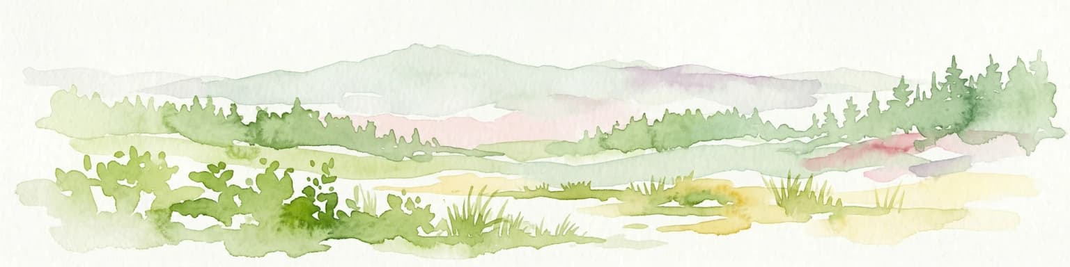
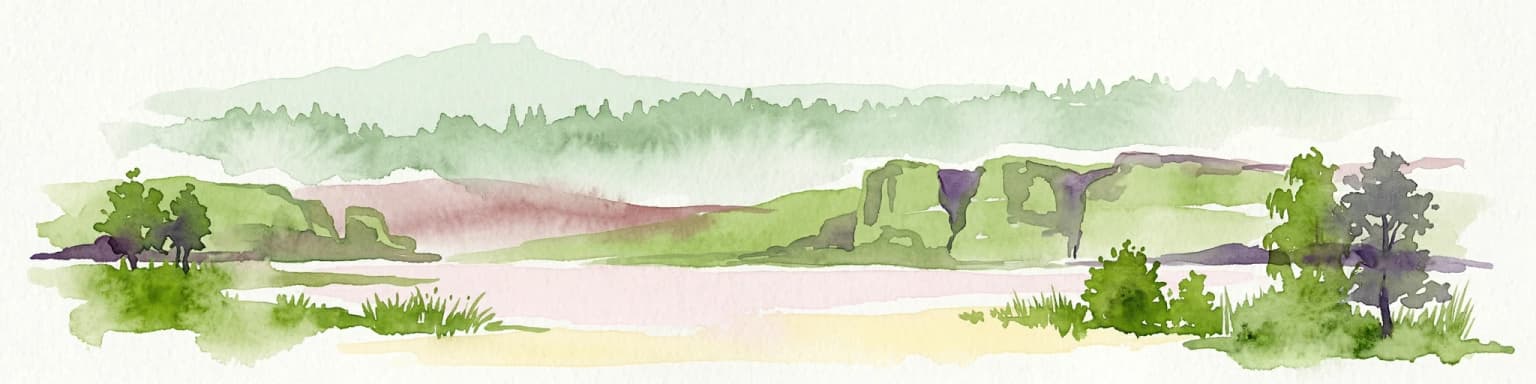
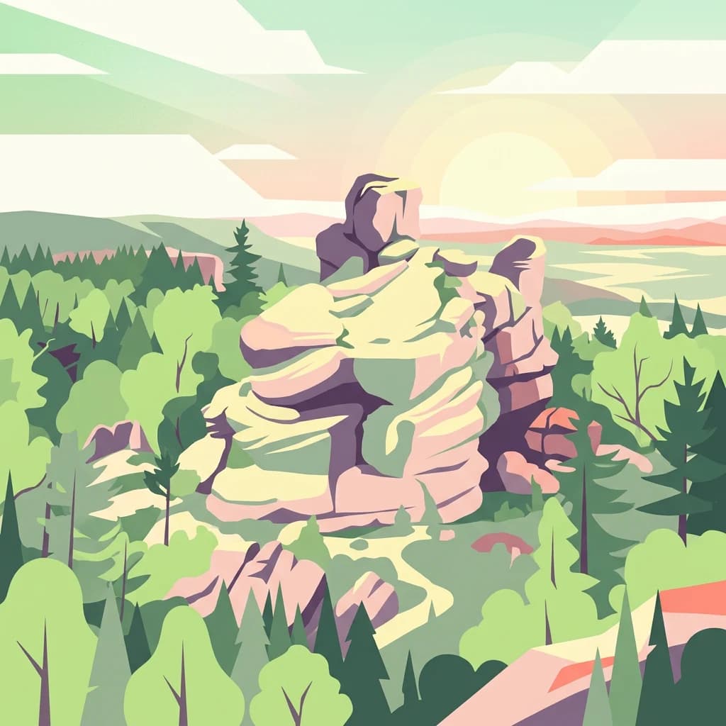
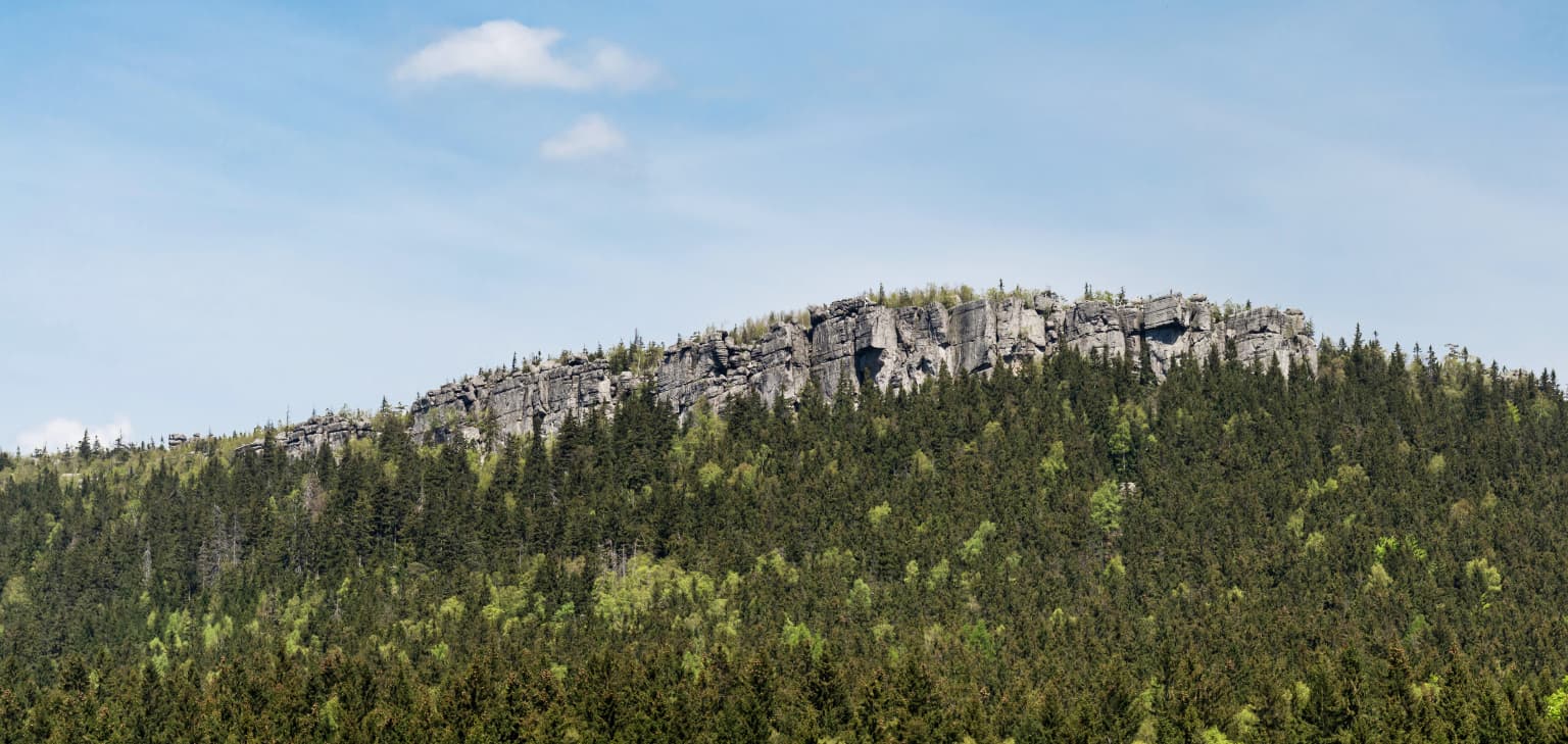
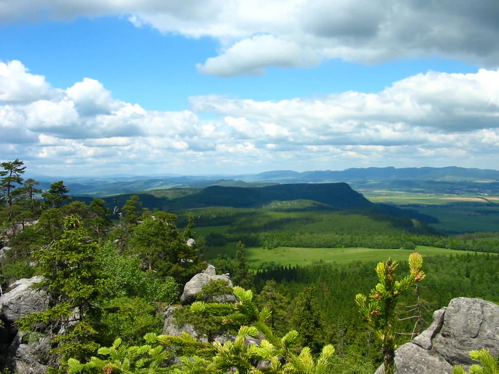
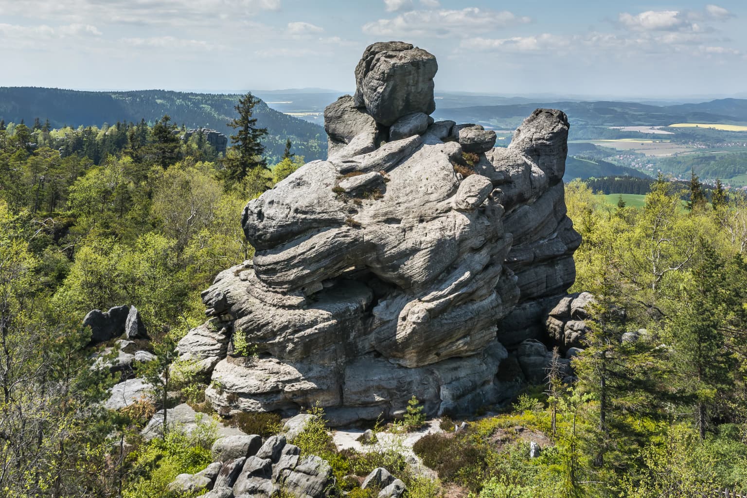
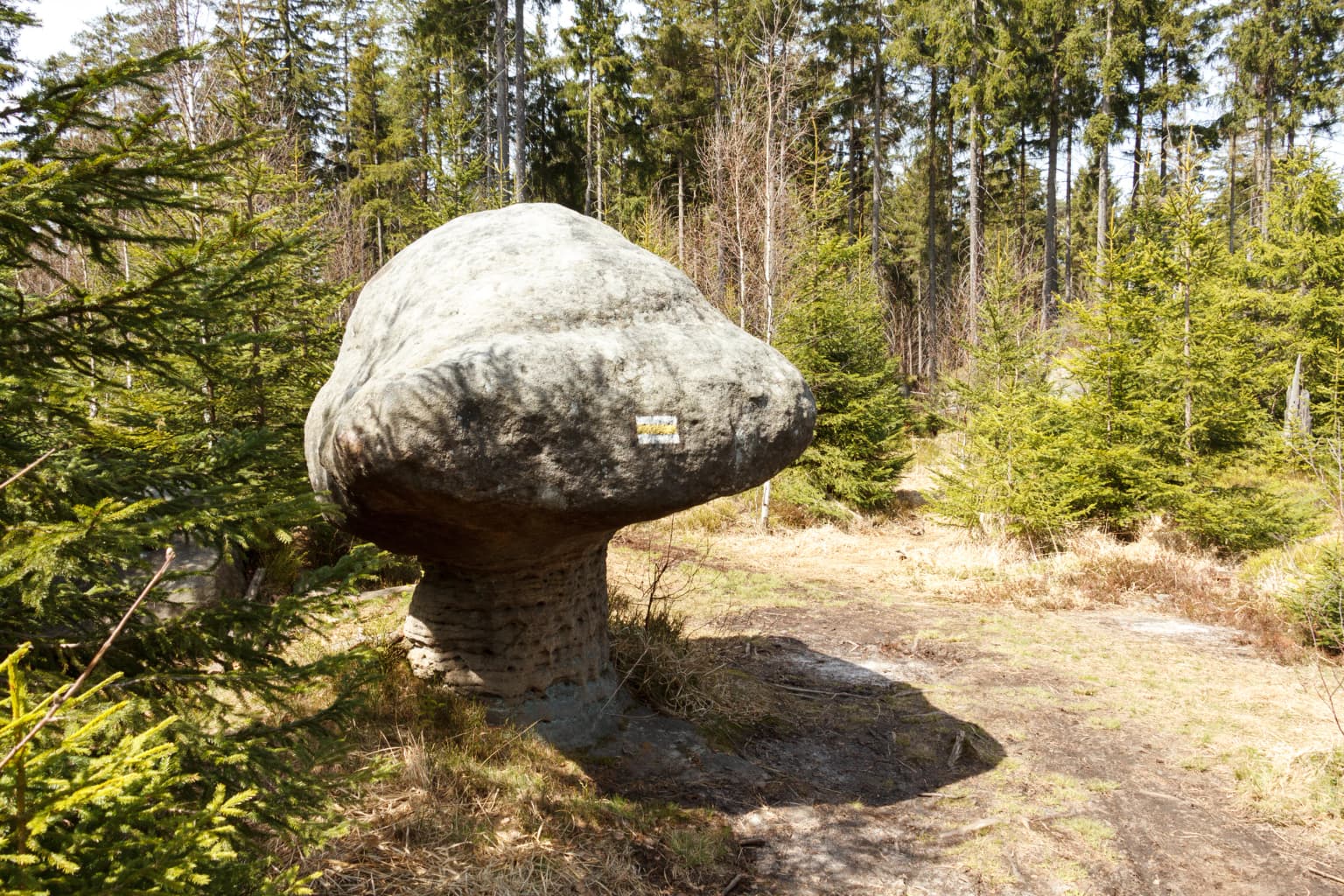
The park is renowned for its extraordinary sandstone rock formations, massive flat-topped mesas, vertical cliffs, and intricate systems of corridors and passages that form natural labyrinths. The Errant Rocks (Błędne Skały) and the rock cities of Szczeliniec Wielki represent some of the most distinctive geological features in Poland. The park also protects the Wielkie Torfowisko Batorowskie, one of Poland's few remaining raised peat bogs, subject to strict protection since 1958. The table-top mountain morphology, from which the range takes its name, is exceptionally rare in Central Europe and forms a striking landscape of bare rock platforms rising above forested slopes.

A wide landscape view of a rocky mountain summit with dense forest below under a clear blue sky
Summit of Szczeliniec Wielki within Stołowe Mountains National Park under clear blue sky

Stołowe Mountains National Park history and protected-area timeline

The protection of the Stołowe Mountains evolved over several decades before the park's formal establishment in 1993. Conservationists recognized early that the landscape protection status of the existing Stołowe Landscape Park was insufficient to safeguard the area's unique natural values, particularly as nearby spa towns of Kudowa-Zdrój and Duszniki-Zdrój expanded and mass tourism intensified. A scientific session in September 1983 in Radków brought together regional authorities, conservation organizations, and the League of Nature Protection to advocate for national park status. A subsequent session in June 1984, organized by the Voivodeship Committee for Nature Protection and the Polish Tourist and Country Lovers' Society, defined the park's proposed boundaries to include approximately 6,000 hectares of the most valuable natural areas, encompassing all existing nature reserves. These efforts culminated in the park's creation through a Council of Ministers regulation on September 16, 1993. The park's establishment followed decades of advocacy by conservation communities concerned about development pressures on this unique landscape.

Stołowe Mountains National Park landscape and geographic character

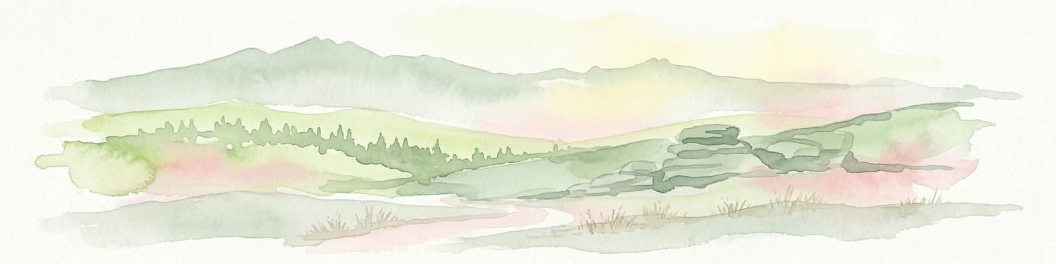
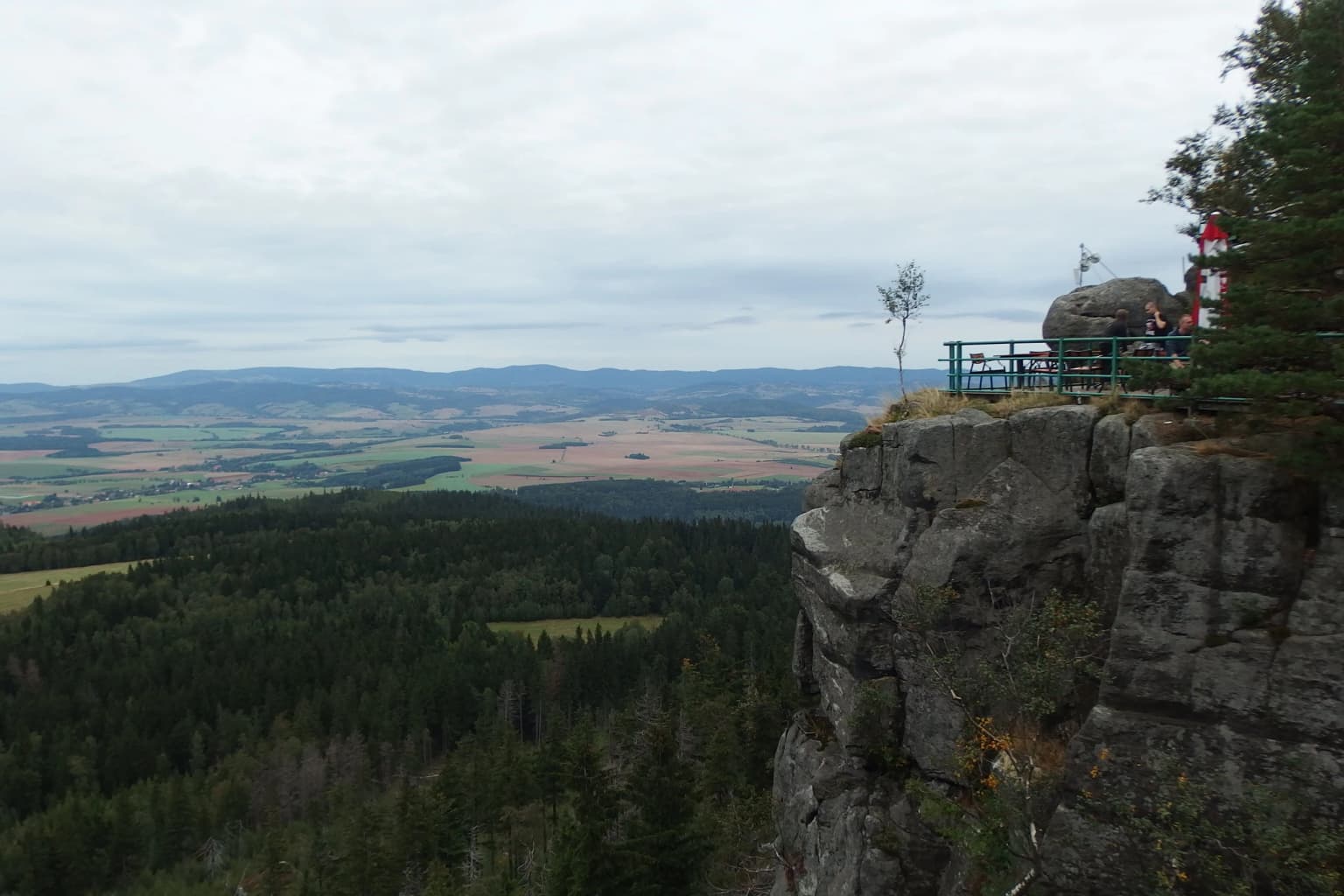
The Stołowe Mountains present a landscape of remarkable sculptural quality defined by horizontal sandstone plates forming table-topped summits and vertical cliff faces. The characteristic terrain consists of extensive plateau plains from which isolated rock bastions rise abruptly, their flat tops and steep walls creating a silhouette distinctive among Central European mountain ranges. Erosion has sculpted the sandstone into an extraordinary variety of forms—deep vertical fissures, enclosed corridors forming natural labyrinths, boulder fields, and isolated rock pillars with evocative shapes. Notable formations include Kwoka (Hen), Wielblad (Camel), and Glowa wielkoluda (Giant's Head), named for their resemblance to these forms. The Errant Rocks (Błędne Skały) formation comprises a system of corridors and chambers穿过a weathered sandstone ridge. The park's highest terrain centers on Szczeliniec Wielki, a massive sandstone plateau reaching 919 meters, while the lower southern areas feature igneous intrusions of granodiorite.

Wide landscape view showing rocky outcrops, dense forests, and a valley under a partly cloudy sky
Panoramic view of Stołowe Mountains National Park's distinctive rock formations and valley landscape

Stołowe Mountains National Park ecosystems, habitats, and plant life

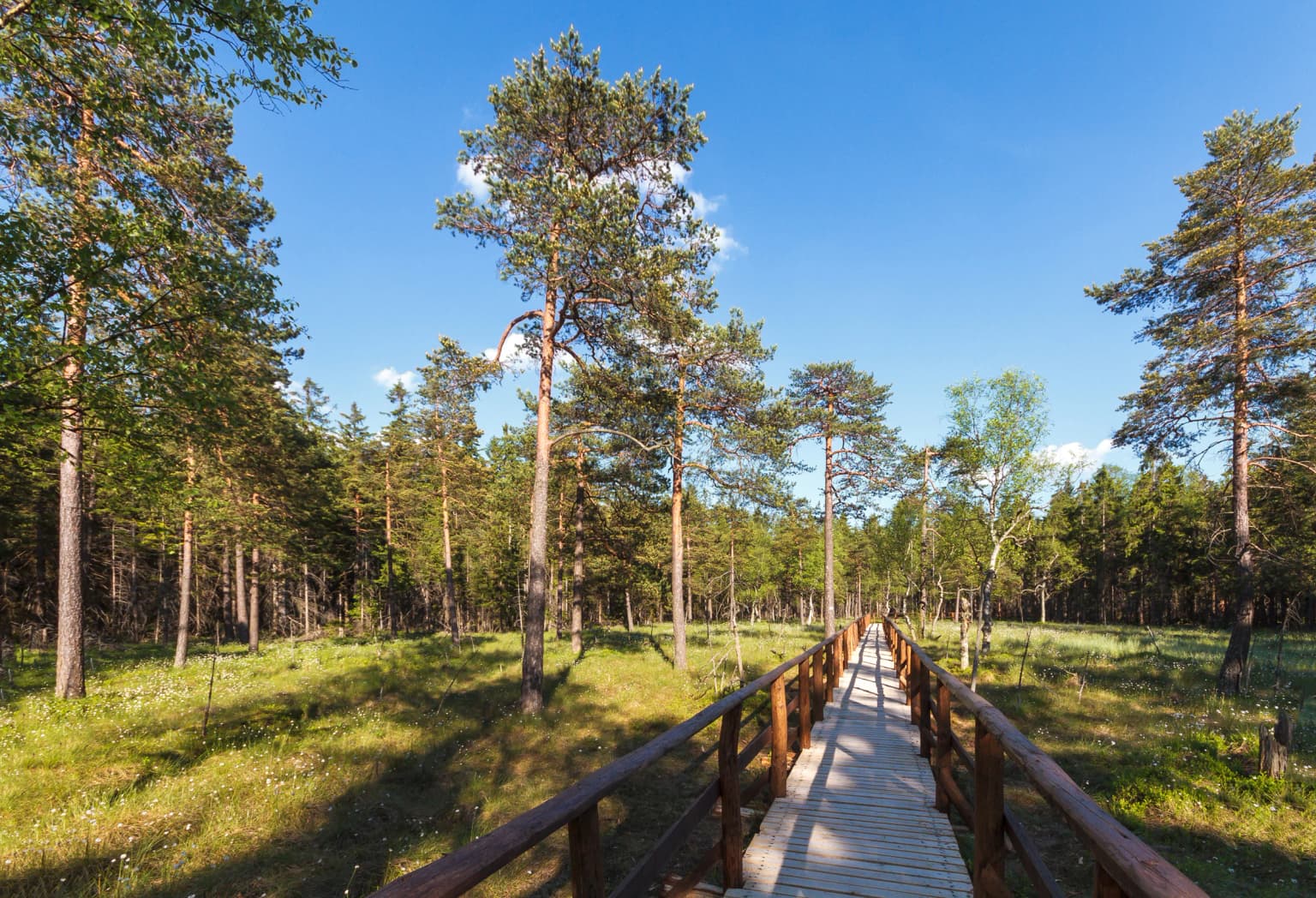
The park's ecological character reflects its position in the Central Sudetes and the legacy of human modification. Current forest cover, dominating approximately 91% of the park's area, consists primarily of planted spruce forests established in the 19th century to replace the original beech and fir woodlands, of which only about 3% remains in a natural state. The park protects several significant peat bogs, most notably the Wielkie Torfowisko Batorowskie, a raised peat bog representing one of the few such formations in Poland. This bog supports distinctive vegetation including marsh pine and bog heather, and has been under strict protection since 1958. The combination of rocky habitats, peat bogs, and planted forests creates a mosaic of environments supporting diverse species, though the ecological value of the extensive spruce plantations is lower than the original hardwood forests they replaced.

A large sandstone rock formation surrounded by green trees with a valley in the background under a partly cloudy sky
Szczeliniec Wielki rock formation in Stołowe Mountains National Park

Stołowe Mountains National Park wildlife and species highlights

The park supports characteristic Central European forest fauna across its varied habitats. Large mammals include red deer, roe deer, and wild boar, commonly encountered in the forest complexes. Smaller mammals include red fox, squirrel, and hedgehog, along with mustelids such as badger, pine marten, polecat, weasel, and stoat. The nocturnal small mammals include the edible dormouse, hazel dormouse, and yellow-necked mouse, inhabiting deciduous and mixed forest fragments. Shrews, including the common pygmy shrew and the more localized mountain shrew, occupy the understory. Bats roost in the crevices and fissures of the sandstone rock formations. The ornithological community includes various forest bird species, while reptilian fauna includes lizards and adders. The fish fauna of the park's streams is limited, with brown trout as the primary native species.

Wooden boardwalk trail through a forest with tall pine trees and clear blue sky
Wooden boardwalk trail through a sunlit forest in Stołowe Mountains National Park

Stołowe Mountains National Park conservation status and protection priorities

Stołowe Mountains National Park represents an important conservation designation for a landscape of exceptional geological significance in Poland. The park protects the most representative section of the Stołowe range and its unique table-top morphology, which cannot be found elsewhere in the country. The strict protection zone encompasses 3.76 km² of the most sensitive areas, including the Wielkie Torfowisko Batorowskie peat bog, which received protected status in 1959. The park's designation provides formal protection for geological features including the rock labyrinths, sandstone formations, and unique erosional structures that define the area's character. However, the park faces ongoing challenges from the ecological impacts of historical forest replacement and the pressure of high visitor numbers on sensitive geological and ecological resources.

Stołowe Mountains National Park cultural meaning and human context

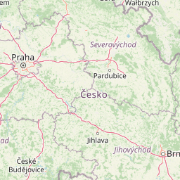
The Stołowe Mountains exist within the historic Kłodzko region, a borderland area between historical Silesia, Bohemia, and Moravia. The region's history, particularly following the Hussite wars of the 14th and 15th centuries, saw the area flourish and later become known for its spa towns. Kudowa-Zdrój, Duszniki-Zdrój, and Polanica-Zdrój developed as health resorts, with Duszniki particularly notable for hosting one of Europe's earliest paper mills established in 1605. Within the park's boundaries lie small settlements including Pasterka and Karłów, traditional mountain villages that predate the park's establishment. The landscape has also served as a filming location, most notably for the 2008 fantasy film The Chronicles of Narnia: Prince Caspian, with scenes shot at the Errant Rocks and Kamieńczyk Gorge.

Rocky sandstone cliff edge with metal railing and visitors, overlooking dense forested valleys and distant mountains under overcast sky
Panoramic view from Szczeliniec Wielki cliff overlooking forested valleys under overcast skies

Top sights and standout views in Stołowe Mountains National Park

The park's premier attraction is Szczeliniec Wielki, the highest and most visually striking sandstone plateau in the range, accessible via a maintained trail to an observation deck with sweeping views. The Errant Rocks (Błędne Skały) formation offers visitors the experience of navigating through a natural sandstone labyrinth of corridors and chambers. The Wielkie Torfowisko Batorowskie represents one of Poland's rarest raised peat bogs, accessible via educational trail but requiring visitors to remain on marked paths to protect sensitive bog ecology. The park's network of marked trails connects these highlights and the various rock formations scattered throughout the landscape, while the visitor center in Kudowa-Zdrój provides interpretive resources.

Large mushroom-shaped rock formation with a flat top and narrow base surrounded by evergreen trees in a forested area
Mushroom-shaped rock formation surrounded by coniferous forest

Best time to visit Stołowe Mountains National Park

The park is accessible throughout the year, with each season offering a different experience of the landscape. Spring and autumn bring fewer visitors and often atmospheric conditions among the rock formations, though weather can be changeable in the mountains. Summer months see the highest visitor numbers, particularly during warm weekends, when popular destinations like Szczeliniec Wielki can become crowded. Winter transforms the landscape significantly, with snow covering the sandstone plateaus and fewer visitors on the trails, though some routes may be more challenging or restricted. The park's high elevation and exposed terrain mean that weather conditions can shift rapidly regardless of season, and visitors should be prepared for changeable conditions.

Park location guide

Geography guide, regional context, and park location map for Stołowe Mountains National Park

Stołowe Mountains National Park park geography, regions, and map view in Poland
Understand where Stołowe Mountains National Park sits in Poland through a broader geographic reading of the surrounding landscape, nearby location context, and its mapped position within the national park landscape.

How Stołowe Mountains National Park fits into Poland

Poland, officially the Republic of Poland, is a Central European country spanning from the Baltic Sea in the north to the Carpathian Mountains in the south. It borders Germany, Czech Republic, Slovakia, Ukraine, Belarus, Lithuania, and Kaliningrad Oblast. The country has a temperate climate, diverse landscapes, and is known for its rich history, cultural heritage, and strong economic position within the EU.

Wider geography shaping Stołowe Mountains National Park in Poland

Poland occupies 312,696 km2 in Central Europe, extending from the Baltic Sea coast in the north to the Sudetes and Carpathian Mountains in the south. It borders Germany to the west, Czech Republic and Slovakia to the south, Ukraine and Belarus to the east, and Lithuania and Kaliningrad Oblast to the northeast. The landscape includes lowland plains, uplands, and mountain ranges.

Map view of Stołowe Mountains National Park

Use this park location map to pinpoint Stołowe Mountains National Park in Poland, understand its exact geographic position, and read its mapped placement within the surrounding landscape more clearly.

Pigeon | © OpenStreetMap contributors

Location context for Stołowe Mountains National Park

Lower Silesian Voivodeship

Visualizing Poland's Distinctive Table Mountains, Intricate Sandstone Formations, and Rare Protected Habitats

Stołowe Mountains National Park Photos: Explore Unique Sandstone Landscapes and Protected Scenery
Explore a visual atlas of Stołowe Mountains National Park through detailed imagery showcasing its iconic sandstone formations, dramatic table-top terrain, and expansive forest ecosystems. These photos provide essential context for understanding the park's unique geological heritage, the sculptural quality of its rock cities, and the specific character of its protected natural environment within the Sudetes.

A wide landscape view of a rocky mountain summit with dense forest below under a clear blue sky

A forested area with large sandstone rocks, green vegetation, and tall trees under a clear blue sky

Wide landscape view showing rocky outcrops, dense forests, and a valley under a partly cloudy sky

A large sandstone rock formation surrounded by green trees with a valley in the background under a partly cloudy sky

Wooden boardwalk trail through a forest with tall pine trees and clear blue sky

Green grassy field extending toward forested mountain with blue sky and clouds

Rocky sandstone cliff edge with metal railing and visitors, overlooking dense forested valleys and distant mountains under overcast sky

Large mushroom-shaped rock formation with a flat top and narrow base surrounded by evergreen trees in a forested area

Rock formation shaped like a monkey's face overlooking a valley with trees and distant mountains under clear blue sky

A tree with exposed roots growing over a large boulder in a forest

Person hiking on wooden pathway between rocky cliffs with a stream below

Sandstone rock formations with narrow passages and a wooden walkway in a natural park setting

Large rock formations with an illuminated pathway through a snow-covered forest at night

Rocky viewpoint terrace with several people standing on the edge, overlooking a dense forest below

Park atlas

Trace the regional park geography to compare protected landscapes surrounding Stołowe Mountains National Park.

Explore Nearby Protected Areas and National Parks Beyond Stołowe Mountains National Park
Browse an atlas of national parks and protected areas geographically connected to Stołowe Mountains National Park, covering distinct mountain and borderland landscapes. This contextual view helps you trace the spread of conservation efforts, compare geological features, and understand the wider regional park geography.
Protected landscape

Bohemian Paradise Protected Landscape: Discover Czech Republic's Sandstone Geology and Park Boundaries

Mapped sandstone formations and historic regional geography.

Delve into Bohemian Paradise, a protected landscape in the Czech Republic celebrated for its dramatic sandstone rock formations and ancient castles. This detailed entry provides context on its unique geological character, the extent of its protected boundaries, and its significant position within the regional geography. Explore the mapped terrain and understand the atlas value of this historic protected area.

Area
181.17 km²
Established
1955
IUCN
V
Relief
Upland
Protected landscapeSouth Moravian Region

Moravian Karst Protected Landscape: Detailed Geographic and Cave System Atlas

Mapped protected boundaries and karst phenomena in the South Moravian Region.

Moravian Karst, designated a Protected Landscape Area, offers a profound look into complex karst geology within the South Moravian Region. This entry within MoriAtlas facilitates a structured discovery of its approximately 92 square kilometers, featuring an intricate network of over 1,100 caves and gorges. Users can explore the mapped extent of this geological treasure, understand its relationship with the surrounding regional geography, and appreciate the unique formations sculpted by underground water systems, including the iconic Macocha Abyss.

Area
92 km²
Scope
Terrestrial
Water
Minor water
National park

Bohemian Switzerland National Park: Czech Sandstone Protected Landscape and Map Exploration

Discover its unique terrain and protected area geography.

Bohemian Switzerland National Park is a protected area in the Czech Republic known for its exceptional sandstone geology. This national park showcases a dramatic landscape of towering rock formations, deep gorges, and striking canyons, forming a significant part of the Elbe Sandstone Mountains. Through MoriAtlas, users can explore its mapped protected boundaries, understand its regional geographic context, and appreciate its unique natural heritage.

Area
79 km²
Established
2000
IUCN
II
Relief
Mixed relief
Watercolor painting showing a landscape with green hills, trees, and a river winding through the scene
National park

Saxon Switzerland National Park: Protected Area Geography and Map Exploration

Discover its mapped boundaries and regional landscape context.

Saxon Switzerland National Park, a protected national park in Germany, offers a distinct focus for geographic and atlas-based discovery. This page details the park's specific protected landscape, its mapped boundaries, and its contribution to the regional geography. MoriAtlas allows for in-depth exploration of such natural areas, providing essential context for understanding their place within broader natural systems and mapped terrains.

Area
93.5 km²
Established
1990
IUCN
II
Visitors
1.7M annual
National parkSouth Moravian Region

Podyjí National Park: Explore Czech Republic's Intact River Canyon Ecosystem

Mapped Boundaries and Protected Landscape of South Moravia

Podyjí National Park, situated in the South Moravian Region, offers a profound look into one of Central Europe's most ecologically preserved river valleys. This national park is defined by its dramatic 220-meter deep Dyje River canyon, featuring rocky cliffs, stone seas, and a rich mosaic of forest and steppe habitats. MoriAtlas provides structured geographic information to analyze its unique landscape context, biodiversity, and role as a protected natural area within the Czech atlas.

Area
63 km²
Established
1991
National park

Thayatal National Park: Austria's Smallest Protected Landscape and Dramatic River Valley

Explore the mapped geography of a breakthrough valley and its rich biodiversity.

Thayatal National Park, Austria's smallest national park, offers a concentrated study in protected landscape discovery. Its core feature is the spectacular Thaya River breakthrough valley, a deep gorge cutting through gneiss terrain with steep, forested slopes. This page provides context for its mapped protected area, highlighting its exceptional biodiversity and its role as a transboundary conservation zone with the adjacent Czech Podyjí National Park. Understand the geographic setting and unique landscape character of this significant natural region.

Area
13.3 km²
Established
2000
IUCN
II
Relief
Mountain
National park

Wielkopolska National Park: Poland's Glacial Landscape and Lake District Protected Area

Explore the mapped terrain and protected landscape.

Wielkopolska National Park is a vital protected landscape in western Poland, notable for its characteristic post-glacial terrain. Featuring a landscape defined by numerous kettle lakes nestled within mixed forests and gently rolling hills, this national park offers a representative sample of the Greater Poland lake district's natural heritage. Its mapped boundaries delineate an area of ecological importance, providing valuable context for understanding regional geography and protected area distribution through structured atlas exploration.

National park

Malá Fatra National Park National Park: Geographic Context and Protected Area Mapping

Explore the mapped terrain and regional geography.

Malá Fatra National Park serves as a cornerstone for understanding Slovakia's protected landscapes. This dedicated park page provides crucial geographic context, detailing its national park designation and the extent of its protected area boundaries. Users can leverage MoriAtlas to visualize the park's location within the broader regional geography, facilitating a structured approach to discovering its natural landscape and terrain through map-based exploration.

Area
226.3 km²
Established
1988
IUCN
II
Relief
Mountain

Common questions about visiting, size, designation, and location context for Stołowe Mountains National Park

Stołowe Mountains National Park FAQs for park facts, access, geography, and protected area context
Find quick answers about Stołowe Mountains National Park, including protected-area facts, park geography, trail and visitor context, and how the park fits into its surrounding country and regional landscape.
MoriAtlas Explorer

Continue Your Protected Areas Search Across the Global Atlas

Deepen your exploration by continuing the structured search for national parks and protected areas worldwide. Utilize the comprehensive filtering capabilities to compare different conservation landscapes and refine your understanding of global park geography. Discover more about the distribution and characteristics of protected natural areas.

Global natural geography