Mori Atlas logo
National parkKarkonosze National Park

Discover the unique alpine terrain and glacial formations of the Giant Mountains.

Karkonosze National Park: Exploring Poland's Dramatic Glacial Mountain Landscapes

(Karkonoski Park Narodowy)

Karkonosze National Park, situated in Poland's Sudetes mountain system, protects the highest peaks of the Giant Mountains and showcases a landscape profoundly shaped by Pleistocene glacial activity. This national park offers an exceptional opportunity to explore dramatic U-shaped valleys, distinct glacial cirques, and a vertically stratified terrain that transitions from montane forests to alpine meadows. Its mapped boundaries encompass a critical conservation area for Central European mountain ecosystems, providing a unique geographic context for atlas-based discovery.

Alpine MountainsGlacial LandscapeNational ParkTransboundary Protected AreaMountain Nature ReserveCentral Europe
Stylized illustration of a waterfall between rocky mountains, with pine trees in the foreground and a lake below, under a sunlit sky with clouds

Karkonosze National Park

National park

Park overview

Structured park overview, official facts, and landscape profile for Karkonosze National Park

Karkonosze National Park park facts, protected area profile, and essential visitor context
Review the core facts for Karkonosze National Park, including designation, size, terrain, visitor scale, habitats, and operating context in one park-focused overview.

About Karkonosze National Park

Karkonosze National Park was established to protect one of Central Europe's most distinctive mountain landscapes. The Giant Mountains, known as Krkonoše in Czech and Karkonosze in Polish, form a natural border between the two countries and represent the highest and most scenic portion of the Sudetes mountain range. The park's establishment reflects the ecological significance of this transboundary mountain system, which supports species and habitats that are found nowhere else in Poland. The management of the park balances conservation objectives with the long traditions of human activity in the mountains, including seasonal pastoral practices that have shaped the landscape for centuries. Visitors to the park encounter a landscape of outstanding natural beauty, with panoramic views from the ridge trails, cascading mountain streams, and the haunting beauty of the cloud forests that occupy the upper montane zones. The park serves as an outdoor laboratory for scientific research into mountain ecology, climate change impacts on alpine ecosystems, and the restoration of degraded habitats.

Quick facts and research context for Karkonosze National Park

Karkonosze National Park is situated in the Lower Silesian Voivodeship of southwestern Poland, protecting the Polish segment of the Giant Mountains that straddle the border with the Czech Republic. The park's landscape is characterized by extensive granite formations, glacial valleys, and the distinctive Smogorny ridge, which represents the highest terrain on the Polish side. The protected area supports a unique blend of Central European and alpine biodiversity, with vegetation zones that shift dramatically with elevation. The park contains remnants of historical mining activity and remains a significant area for traditional mountain agriculture, including seasonal grazing practices that maintain the characteristic alpine meadows.

Park context

Deeper park guide and search-rich context for Karkonosze National Park

Karkonosze National Park history, landscape, wildlife, and travel context
Explore Karkonosze National Park through its history, landscape character, ecosystems, wildlife, conservation priorities, cultural context, and seasonal travel timing in a structured park guide built for atlas discovery and search intent.

Why Karkonosze National Park stands out

Karkonosze National Park is best known for its dramatic alpine terrain and the distinctive glacial landscape of the Giant Mountains. The park features the highest peaks in the Polish Sudetes, including Śnieżka, which stands as the tallest mountain in the entire Czech-Polish border region. The park's famous glacial cirques, particularly those on the northern slopes, represent some of the finest examples of Pleistocene glaciation in Central Europe. The unique subalpine and alpine ecosystems, including the rare Krkonoše alpine meadows and the distinctive mountain pine communities, distinguish this park from other protected areas in the region. Winter sports infrastructure around Karpacz has also made the park area a well-known destination for skiing and mountaineering.

Stacked rock formations with moss-covered surfaces on a mountain ridge under a partly cloudy sky
Rock formations known as Silesian Stones (Dívčí Kameny) in Karkonosze National Park

Karkonosze National Park history and protected-area timeline

The history of formal protection in the Karkonosze mountains began in the early twentieth century, when growing concern about deforestation and resource exploitation led to initial conservation efforts. The park was formally established in 1979, consolidating earlier protected designations that had sought to preserve the most ecologically significant portions of the mountain range. The establishment came during a period of increased environmental awareness in Poland and reflected recognition that the unique alpine ecosystems of the Sudetes required dedicated protection. Since its creation, the park has faced challenges related to air pollution, particularly from industrial sources in the neighboring Czech Republic and Germany, which affected the health of the mountain forests during the late twentieth century. Ongoing management efforts have focused on restoring damaged ecosystems and mitigating the impacts of recreational use. The park also maintains the cultural heritage of the region, preserving evidence of historical mining operations, traditional settlement patterns, and the mountain farming practices that have shaped the landscape over generations.

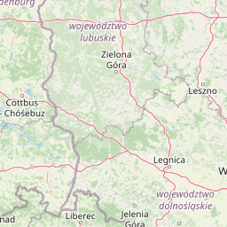
Karkonosze National Park landscape and geographic character

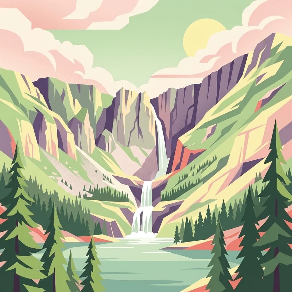
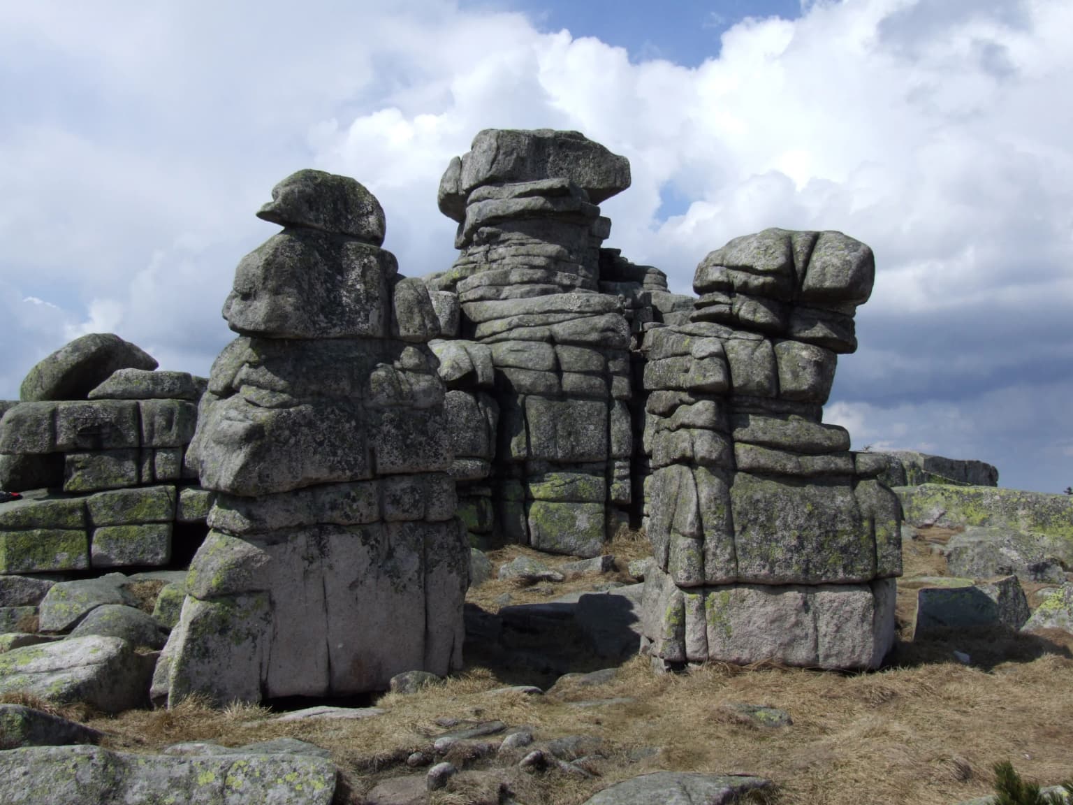
The landscape of Karkonosze National Park is defined by its alpine character and the legacy of glacial processes that shaped the Giant Mountains during the Pleistocene epoch. The terrain features classic U-shaped valleys, terminal and lateral moraines, and dramatic glacial cirques that create a landscape of exceptional scenic value. The granite bedrock, exposed in numerous tors and rock formations, gives the mountains their distinctive appearance and provides important habitat for specialized rock-dwelling species. The park's highest terrain follows the main ridge, which forms the watershed between the Elbe and Oder river basins. Elevations range from approximately 400 meters in the lower valleys to over 1,600 meters at Śnieżka, creating a substantial vertical relief that contributes to the park's ecological diversity. The northern slopes tend to be steeper and more rugged, while the southern approaches feature more gentle gradients. Characteristic features include the string of glacial lakes known as the Karkonosze Lakes, the peat bogs that occupy depressions in the high terrain, and the distinctive snow beds that persist well into the summer in sheltered locations.

Waterfall flowing over rocky cliffs surrounded by forest with stone pathway in foreground
Kamieńczyk Waterfall in Karkonosze National Park

Karkonosze National Park ecosystems, habitats, and plant life

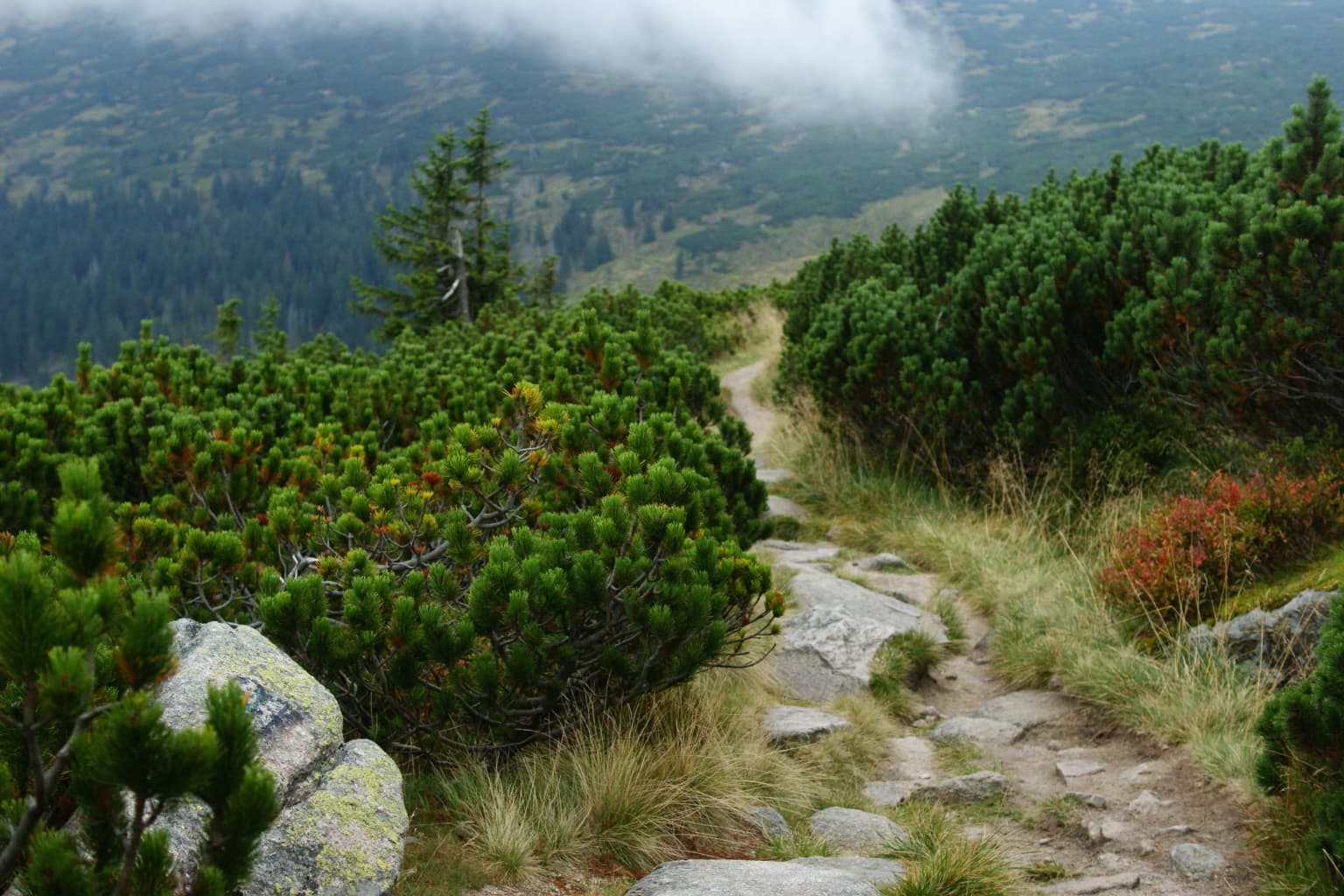
The nature of Karkonosze National Park is distinguished by its vertical zonation of habitats, which creates a remarkable diversity of ecological communities within a relatively limited area. The forest zone, which occupies the lower and middle elevations, consists primarily of mixed deciduous and coniferous forests with species such as Norway spruce, European beech, and silver fir. As elevation increases, the forests give way to subalpine communities dominated by mountain pine and Norway spruce, which often assume stunted forms due to exposure to harsh weather conditions. The alpine zone, found only at the highest elevations, features characteristic open communities of low-growing plants adapted to extreme conditions, including various dwarf shrubs, herbaceous plants, and specialized grasses. The park's position at the meeting point of different climatic influences contributes to its botanical diversity, with species arriving from both the Alps and the Carpathians. Peat bogs and mountain streams add further ecological complexity, supporting specialized aquatic and wetland communities.

Wooden footbridge with railings crossing over a stream in a forested area
Wooden footbridge on a trail within Karkonosze National Park

Karkonosze National Park wildlife and species highlights

The wildlife of Karkonosze National Park reflects the park's position at the crossroads of different biogeographical regions and its diverse habitat structure. The forests support populations of roe deer and red deer, though larger mammals such as lynx and wolves are present in lower densities and tend to inhabit the more remote areas. The park is notable for its bird fauna, with species such as the golden eagle and peregrine falcon nesting in the rocky terrain, while forest-dwelling species including various tit species, woodpeckers, and thrushes occupy the woodland zones. The high-altitude meadows provide breeding habitat for several species of Alpine accentor and the Krkonoše subspecies of the dotterel. The park's streams and lakes support populations of brown trout and other cold-water fish, while the invertebrate fauna includes several species of butterflies and other insects that are characteristic of mountain habitats. The relatively harsh climate and short growing season limit the overall diversity of wildlife compared to lower-elevation areas, but the species that occur here are often highly specialized and of conservation significance.

Narrow stone path through dense green dwarf pine vegetation with rocky outcrops and mountainous landscape in background
A stone path winding through dense dwarf pine forests near Sniezka peak in Karkonosze National Park

Karkonosze National Park conservation status and protection priorities

Karkonosze National Park represents one of the most important conservation areas in the Polish Sudetes, protecting a mountain landscape that has been significantly modified by human activity in surrounding areas. The park's conservation significance derives from its role as a refuge for alpine species that have been displaced from lower elevations and its function as a corridor for species migration along the mountain chain. The protected area forms part of a transboundary conservation network that includes Krkonoše National Park on the Czech side, enabling coordination in managing shared ecosystems and populations. Conservation challenges include managing the impacts of tourism and recreation, particularly in the popular Karpacz area, addressing the legacy of historical pollution that damaged forest health, and monitoring the effects of climate change on alpine ecosystems. The park's management also addresses the maintenance of traditional pastoral practices that help preserve the open character of the alpine meadows, which would otherwise succeed to forest without active management.

Karkonosze National Park cultural meaning and human context

The cultural context of Karkonosze National Park reflects centuries of human presence in the Giant Mountains, where communities developed distinctive traditions adapted to the challenging mountain environment. The area has a history of mining, particularly for iron ore and precious metals, with abandoned mine workings still visible in some locations. Traditional mountain farming practices, including seasonal grazing of sheep and cattle in the high meadows, have shaped the landscape over generations and continue to influence park management. The villages surrounding the park, including Karpacz and Szklarska Poręba, have developed as tourist destinations since the late nineteenth century, establishing a tradition of mountain recreation that remains important to the regional economy. The mountain communities have also preserved folk traditions, including distinctive architectural styles and cultural practices that distinguish the region from the surrounding lowlands. The park contains several heritage sites that document this human history, though the primary focus of conservation remains on the natural values of the mountain landscape.

Waterfall cascading over moss-covered rocks with surrounding forest
Szklarki Waterfall in Karkonosze National Park

Top sights and standout views in Karkonosze National Park

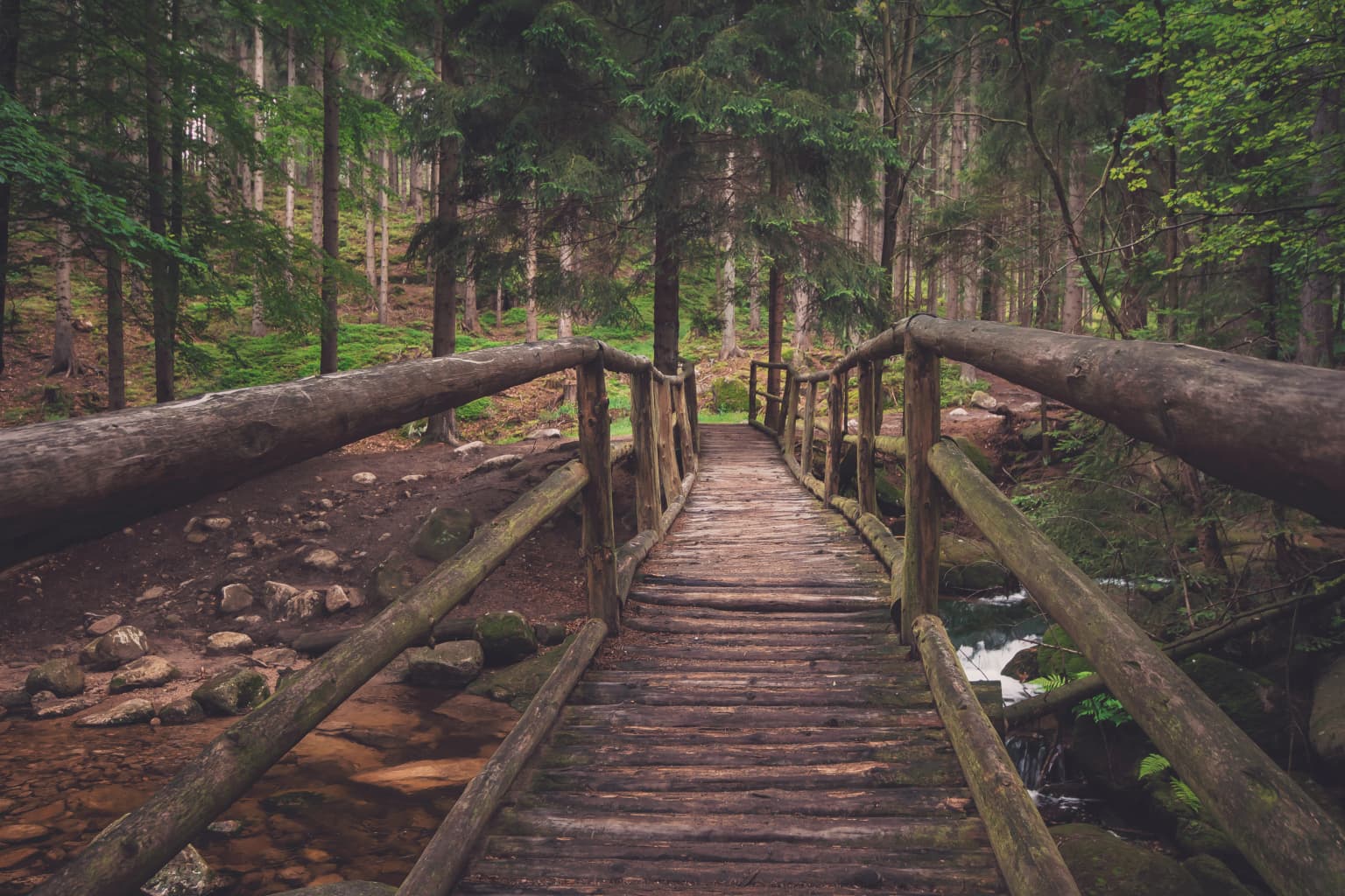
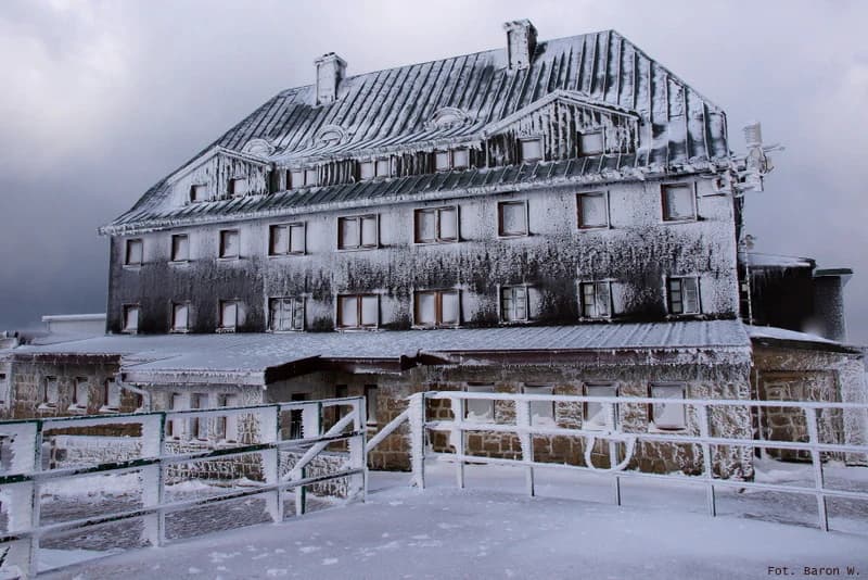
The highlights of Karkonosze National Park include the dramatic summit of Śnieżka, which offers panoramic views across the entire Giant Mountains range and into the surrounding Czech and Polish landscapes. The glacial cirques on the northern slopes, particularly those visible from the main ridge trail, represent some of the most spectacular glacial terrain in Central Europe. The mountain lakes and peat bogs of the high terrain provide distinctive wetland scenery and support unique ecological communities. The distinctive Krkonoše alpine meadows, with their characteristic flora and the traditional pastoral practices that maintain them, represent a cultural landscape of high conservation value. Visitors can explore the network of marked trails that traverse the park, including routes through the dramatic Kocioł Łomniczki valley and along the main ridge connecting the Polish and Czech sections of the range. The winter landscape, with its deep snow cover and excellent skiing conditions, offers another dimension of the park's appeal.

Snow-covered stone mountain refuge building with multiple windows and metal railing, set against a cloudy sky
Snow-covered mountain refuge on Szrenica summit in Karkonosze National Park

Best time to visit Karkonosze National Park

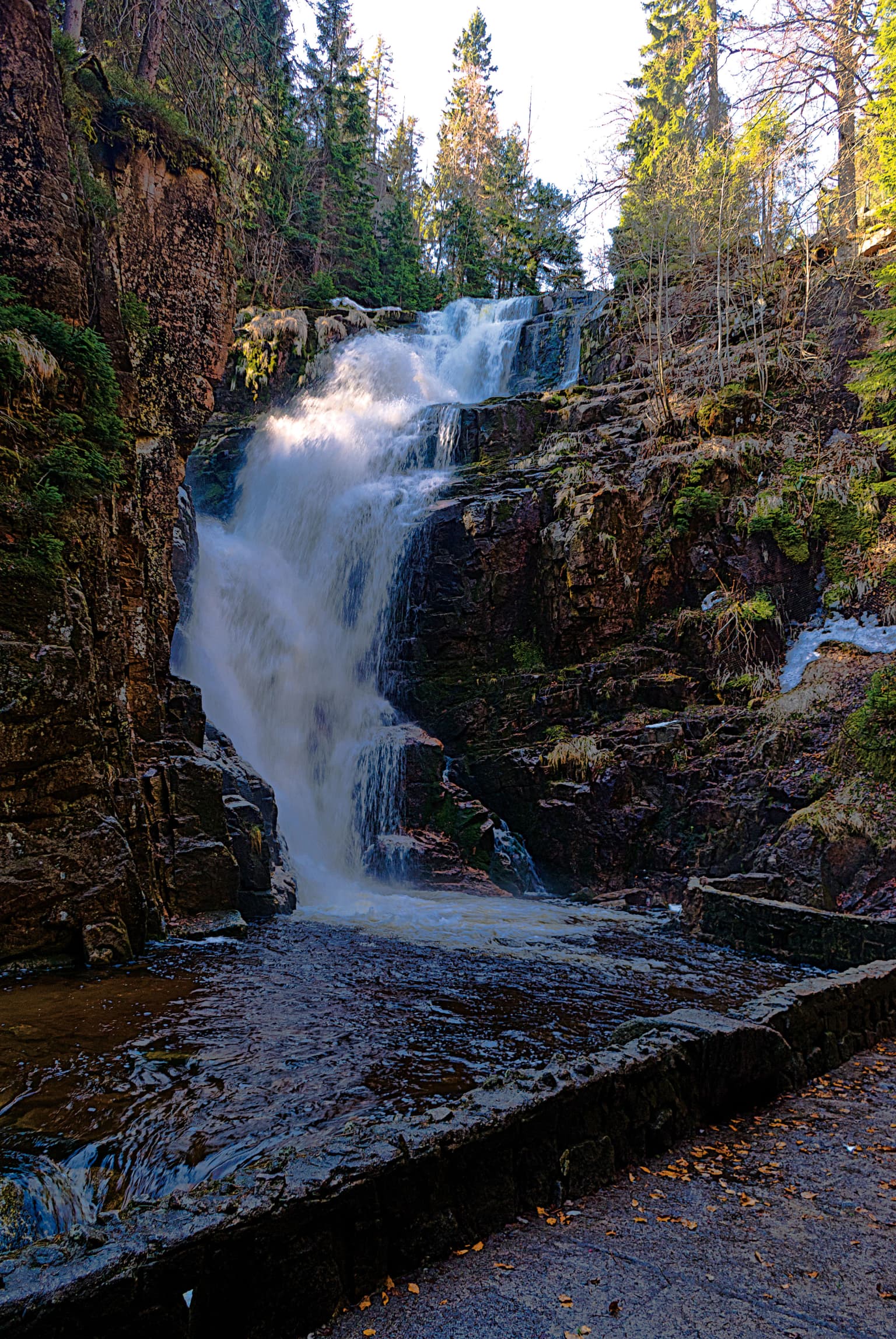
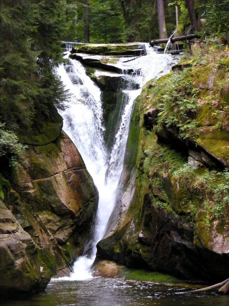
The best time to visit Karkonosze National Park depends on the type of experience visitors seek. Summer months, from June through September, offer the most accessible conditions for hiking and feature the characteristic alpine meadows in full flower, with rich displays of mountain flora at higher elevations. The main tourist season coincides with this period, particularly in August when school holidays attract large numbers of visitors. Autumn, particularly September and early October, brings fewer crowds and offers the opportunity to experience the mountain forests as they display their autumn colors, though weather conditions become more variable. Winter transforms the park into a popular skiing destination, with conditions suitable for winter sports from December through March, though the high elevations can experience severe winter conditions that require appropriate equipment. Spring tends to be a quieter period, though snow linger on the higher trails well into May, and the melting snow feeds the streams and waterfalls that are particularly impressive in late spring. Shoulder seasons offer the advantage of fewer visitors but require preparation for changeable mountain weather.

Park location guide

Geography guide, regional context, and park location map for Karkonosze National Park

Karkonosze National Park park geography, regions, and map view in Poland
Understand where Karkonosze National Park sits in Poland through a broader geographic reading of the surrounding landscape, nearby location context, and its mapped position within the national park landscape.

How Karkonosze National Park fits into Poland

Poland, officially the Republic of Poland, is a Central European country spanning from the Baltic Sea in the north to the Carpathian Mountains in the south. It borders Germany, Czech Republic, Slovakia, Ukraine, Belarus, Lithuania, and Kaliningrad Oblast. The country has a temperate climate, diverse landscapes, and is known for its rich history, cultural heritage, and strong economic position within the EU.

Wider geography shaping Karkonosze National Park in Poland

Poland occupies 312,696 km2 in Central Europe, extending from the Baltic Sea coast in the north to the Sudetes and Carpathian Mountains in the south. It borders Germany to the west, Czech Republic and Slovakia to the south, Ukraine and Belarus to the east, and Lithuania and Kaliningrad Oblast to the northeast. The landscape includes lowland plains, uplands, and mountain ranges.

Map view of Karkonosze National Park

Use this park location map to pinpoint Karkonosze National Park in Poland, understand its exact geographic position, and read its mapped placement within the surrounding landscape more clearly.

Pigeon | © OpenStreetMap contributors

Location context for Karkonosze National Park

Lower Silesian Voivodeship

Visualizing the Dramatic Glacial Terrain and Diverse Mountain Habitats of the Giant Mountains Protected Area

Karkonosze National Park Photos: Explore Alpine Landscapes, Glacial Cirques, and Mountain Scenery
Explore the striking visual geography of Karkonosze National Park, revealing its distinctive alpine landscapes, prominent glacial cirques, and diverse mountain environments. Understanding the park's terrain, habitats, and protected-area character through rich photography enhances geographic comprehension and detailed park discovery.

Stacked rock formations with moss-covered surfaces on a mountain ridge under a partly cloudy sky

Aerial view of a mountain lake surrounded by forests and hills with a mountain hut and dirt paths nearby

Waterfall flowing over rocky cliffs surrounded by forest with stone pathway in foreground

Wooden footbridge with railings crossing over a stream in a forested area

Narrow stone path through dense green dwarf pine vegetation with rocky outcrops and mountainous landscape in background

Mountain landscape with rocky outcrops, forested hills, and blue sky with clouds

Waterfall cascading over moss-covered rocks with surrounding forest

Snow-covered stone mountain refuge building with multiple windows and metal railing, set against a cloudy sky

Mountain landscape with patches of snow on rocky terrain, surrounded by evergreen trees, with snow-capped mountains in the background under a clear blue sky

Hikers walking on a cobblestone trail leading toward a mountain peak under a clear blue sky

Mountain lake with rocky shore, tall rock formation, green forested slopes, and rocky peaks under partly cloudy sky

Dark wooden mountain lodge building with solar panels on roof, stone path leading to entrance, people walking on path, mountains and body of water in background

Park atlas

Explore connected mountain landscapes and transboundary protected areas in the Sudetes region.

Discover Other National Parks and Protected Areas Near Karkonosze National Park
Continue your geographic exploration beyond Karkonosze National Park by browsing other national parks and protected areas across the surrounding Sudetes mountain system. Compare their diverse alpine and glacial landscapes, gaining broader regional context for Central European mountain conservation efforts and ecological zones.
Watercolor painting showing green forests, a valley, and distant mountains under a soft sky
National parkLiberec Region

Krkonoše National Park: Central European Alpine Protected Area and Map Context

Discover glacial landforms and unique ecosystems in the Giant Mountains.

Krkonoše National Park, situated in the Liberec Region, is a premier example of a protected alpine landscape in Central Europe. This page facilitates exploration of its significant glacial geography, including distinct cirques, rockfields, and valleys, providing vital context for understanding its protected area status. Engage with the mapped terrain and discover the unique ecological features that make this national park a cornerstone of conservation and geographic study within the Czech Republic.

Area
363.52 km²
Established
1963
IUCN
II
Visitors
12.1M annual
Watercolor painting showing a river, grassy banks, scattered trees, and distant hills
Protected landscape

Bohemian Paradise Protected Landscape: Discover Czech Republic's Sandstone Geology and Park Boundaries

Mapped sandstone formations and historic regional geography.

Delve into Bohemian Paradise, a protected landscape in the Czech Republic celebrated for its dramatic sandstone rock formations and ancient castles. This detailed entry provides context on its unique geological character, the extent of its protected boundaries, and its significant position within the regional geography. Explore the mapped terrain and understand the atlas value of this historic protected area.

Area
181.17 km²
Established
1955
IUCN
V
Relief
Upland
Watercolor artwork depicting a landscape with green hills, distant mountains, and pastel sky
National parkLower Silesian Voivodeship

Stołowe Mountains National Park: Explore Poland's Sandstone Rock Cities and Protected Terrain

National Park in Lower Silesian Voivodeship: Geological Wonders.

Stołowe Mountains National Park is a protected national park in Poland celebrated for its unparalleled sandstone geological features. Within the Lower Silesian Voivodeship, the park showcases a dramatic landscape dominated by flat-topped rock plateaus, natural labyrinths, and vertical sandstone formations that create a visually stunning and geologically significant environment. Its protected status ensures the preservation of these unique landforms and the rare ecosystems, such as raised peat bogs, offering extensive opportunities for atlas exploration and understanding the region's distinct natural context.

Area
63.39 km²
Established
1993
IUCN
II
Visitors
1.3M annual
Watercolor painting showing a landscape with green hills, trees, and a river winding through the scene
National park

Saxon Switzerland National Park: Protected Area Geography and Map Exploration

Discover its mapped boundaries and regional landscape context.

Saxon Switzerland National Park, a protected national park in Germany, offers a distinct focus for geographic and atlas-based discovery. This page details the park's specific protected landscape, its mapped boundaries, and its contribution to the regional geography. MoriAtlas allows for in-depth exploration of such natural areas, providing essential context for understanding their place within broader natural systems and mapped terrains.

Area
93.5 km²
Established
1990
IUCN
II
Visitors
1.7M annual
Watercolor illustration of rolling green hills, forests, and distant mountains
National park

Bohemian Switzerland National Park: Czech Sandstone Protected Landscape and Map Exploration

Discover its unique terrain and protected area geography.

Bohemian Switzerland National Park is a protected area in the Czech Republic known for its exceptional sandstone geology. This national park showcases a dramatic landscape of towering rock formations, deep gorges, and striking canyons, forming a significant part of the Elbe Sandstone Mountains. Through MoriAtlas, users can explore its mapped protected boundaries, understand its regional geographic context, and appreciate its unique natural heritage.

Area
79 km²
Established
2000
IUCN
II
Relief
Mixed relief
Watercolor painting of a landscape with hills, a lake, and forested areas
National park

Wielkopolska National Park: Poland's Glacial Landscape and Lake District Protected Area

Explore the mapped terrain and protected landscape.

Wielkopolska National Park is a vital protected landscape in western Poland, notable for its characteristic post-glacial terrain. Featuring a landscape defined by numerous kettle lakes nestled within mixed forests and gently rolling hills, this national park offers a representative sample of the Greater Poland lake district's natural heritage. Its mapped boundaries delineate an area of ecological importance, providing valuable context for understanding regional geography and protected area distribution through structured atlas exploration.

IUCN
II
Watercolor illustration of a karst landscape featuring hills, a lake, and cave-like rock formations with green vegetation
Protected landscapeSouth Moravian Region

Moravian Karst Protected Landscape: Detailed Geographic and Cave System Atlas

Mapped protected boundaries and karst phenomena in the South Moravian Region.

Moravian Karst, designated a Protected Landscape Area, offers a profound look into complex karst geology within the South Moravian Region. This entry within MoriAtlas facilitates a structured discovery of its approximately 92 square kilometers, featuring an intricate network of over 1,100 caves and gorges. Users can explore the mapped extent of this geological treasure, understand its relationship with the surrounding regional geography, and appreciate the unique formations sculpted by underground water systems, including the iconic Macocha Abyss.

Area
92 km²
IUCN
V
Scope
Terrestrial
Water
Minor water
Watercolor illustration showing a river winding through rolling green hills with sparse vegetation
National parkLubusz Voivodeship

Warta Mouth National Park: A National Park Protecting Vital European Wetlands

Explore mapped protected areas and bird habitats in Lubusz Voivodeship.

Warta Mouth National Park, located in Poland's Lubusz Voivodeship, is a significant protected landscape safeguarding the ecologically rich confluence of the Warta and Oder rivers. As the nation's most recently established national park, it provides critical habitat for a vast array of migratory and breeding bird species within its extensive marshlands and floodplains. This park offers a unique opportunity for atlas-driven exploration of Central European wetland geography and the mapped boundaries of a vital conservation area.

Area
80.38 km²
Established
2001
IUCN
II
Visitors
52K annual

Common questions about visiting, size, designation, and location context for Karkonosze National Park

Karkonosze National Park FAQs for park facts, access, geography, and protected area context
Find quick answers about Karkonosze National Park, including protected-area facts, park geography, trail and visitor context, and how the park fits into its surrounding country and regional landscape.
MoriAtlas Explorer

Continue Your Protected Areas Search Across the Global Atlas

Deepen your exploration by continuing the structured search for national parks and protected areas worldwide. Utilize the comprehensive filtering capabilities to compare different conservation landscapes and refine your understanding of global park geography. Discover more about the distribution and characteristics of protected natural areas.

Global natural geography