Mori Atlas logo
National parkWarta Mouth National Park

Explore the mapped boundaries and protected landscape of a critical Central European ecosystem.

Warta Mouth National Park: Poland's Premier Wetland and Bird Sanctuary Atlas

(Park Narodowy Ujście Warty)

Warta Mouth National Park represents a pivotal protected area within Lubusz Voivodeship, Poland, recognized for its expansive river valley wetlands where the Warta and Oder rivers converge. Established as Poland's youngest national park, it safeguards a crucial ecosystem characterized by floodplains, marshes, and seasonally inundated meadows vital for Central European biodiversity. This park is a cornerstone for understanding mapped protected lands, offering a unique vantage point for exploring Poland's natural geography and the dynamic interplay of riverine landscapes.

wetlandsbirdwatchingmigratory birdsRamsar sitefloodplaincentral Europe
Illustration of a river flowing through grassy wetlands with trees and hills under a partly cloudy sky

Warta Mouth National Park

National park

Park overview

Structured park overview, official facts, and landscape profile for Warta Mouth National Park

Warta Mouth National Park park facts, protected area profile, and essential visitor context
Review the core facts for Warta Mouth National Park, including designation, size, terrain, visitor scale, habitats, and operating context in one park-focused overview.

About Warta Mouth National Park

Warta Mouth National Park protects a remarkable wetland ecosystem in western Poland where the Warta River completes its journey before joining the Oder, which marks the Polish-German border. This young protected area, created in 2001, preserves one of Central Europe's few remaining largely unmodified river valley landscapes. The park's territory divides naturally into two distinct sections: the southern area encompassing the former Słońsk Nature Reserve, where annual water level fluctuations can reach four meters, creating extensive seasonal lakes and flooding that provides critical habitat for nesting and migrating birds; and the northern section, known as the Northern Polder, characterized by an intricate system of canals and separated from the main river by protective levees. The park sits within the Kotlina Gorzowska (Gorzów Basin) and Kotlina Freienwaldzka (Friedenwald Basin) mesoregions, comprising swampy, low-lying terrain shaped by the Warta and its tributaries, particularly the Postomia River, which contributes significantly to the floodplain's character. Beyond its ecological importance, the park offers visitors walking and cycling trails, including the Ptasim szlakiem (Along Birds' Trail) nature walks that traverse the most valuable sections of the former Słońsk reserve. A natural education center in Chyrzno has operated since 1996, providing educational programs for school groups and students, including ornithology camps and ecology workshops.

Quick facts and research context for Warta Mouth National Park

Warta Mouth National Park spans roughly 80 square kilometers in western Poland's Lubusz Voivodeship, situated at the confluence of the Warta and Oder rivers near the German border. The park was established in 2001 on the former Słońsk Nature Reserve (established 1977) and parts of the Ujście Warty Landscape Park, making it the youngest of Poland's 23 national parks. The park headquarters are located in the village of Chyrzyno near Kostrzyn nad Odrą. The area features a complex network of canals in the northern section, separated from the Warta by levees, while the southern section experiences dramatic seasonal water level fluctuations of up to four meters, creating extensive seasonal flooding that functions as a natural water retention basin.

Park context

Deeper park guide and search-rich context for Warta Mouth National Park

Warta Mouth National Park history, landscape, wildlife, and travel context
Explore Warta Mouth National Park through its history, landscape character, ecosystems, wildlife, conservation priorities, cultural context, and seasonal travel timing in a structured park guide built for atlas discovery and search intent.

Why Warta Mouth National Park stands out

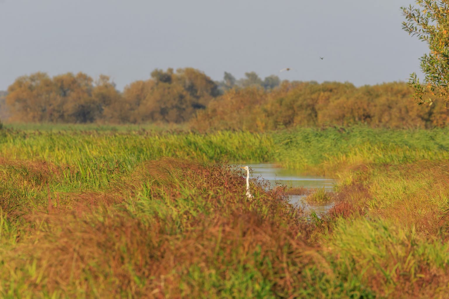
Warta Mouth National Park is best known as one of Poland's most important bird habitats, hosting 245 recorded bird species including 160 breeding species. The wetlands support 26 globally threatened species listed by BirdLife International, including the aquatic warbler, corn crake, black-tailed godwit, common crane, bittern, little bittern, and black tern. The park serves as a major staging area for migratory waterfowl, with tens of thousands of geese passing through during migration. It holds Poland's largest wintering population of the Bewick's swan and supports approximately 30 white-tailed eagles attracted by abundant wintering waterfowl. The park also protects significant populations of mammals including otters and beavers within its marshland habitats.

Aerial view of waterways and wetlands in a national park
Aerial view of Warta Mouth National Park showing the river confluence and wetlands

Warta Mouth National Park history and protected-area timeline

Warta Mouth National Park was established on June 19, 2001 (officially July 1, 2001) through the merger of the Słońsk Nature Reserve, which had protected the area since 1977, and portions of the Ujście Warty Landscape Park. The creation of this newest of Poland's 23 national parks consolidated protection for one of the country's most ecologically significant wetland complexes. Prior to national park status, the core area received international recognition when the Słońsk reserve was designated as a Ramsar Wetland of International Importance on January 3, 1984, acknowledging its outstanding universal value as a wetland habitat. The park's administration is overseen by the Ministry of Climate and Environment, with headquarters situated in Chyrzyno near Kostrzyn nad Odrą. Since 1996, the Centre of Natural Education at Chyrzno has played a key role in environmental education, organizing courses, field trips, and ornithology camps for students. Notably, the park's official symbol was updated in April 2020, changing from the white-fronted goose to the tundra bean goose, reflecting taxonomic revisions and the fact that the latter species constitutes approximately 90 percent of the geese recorded at the site.

Warta Mouth National Park landscape and geographic character

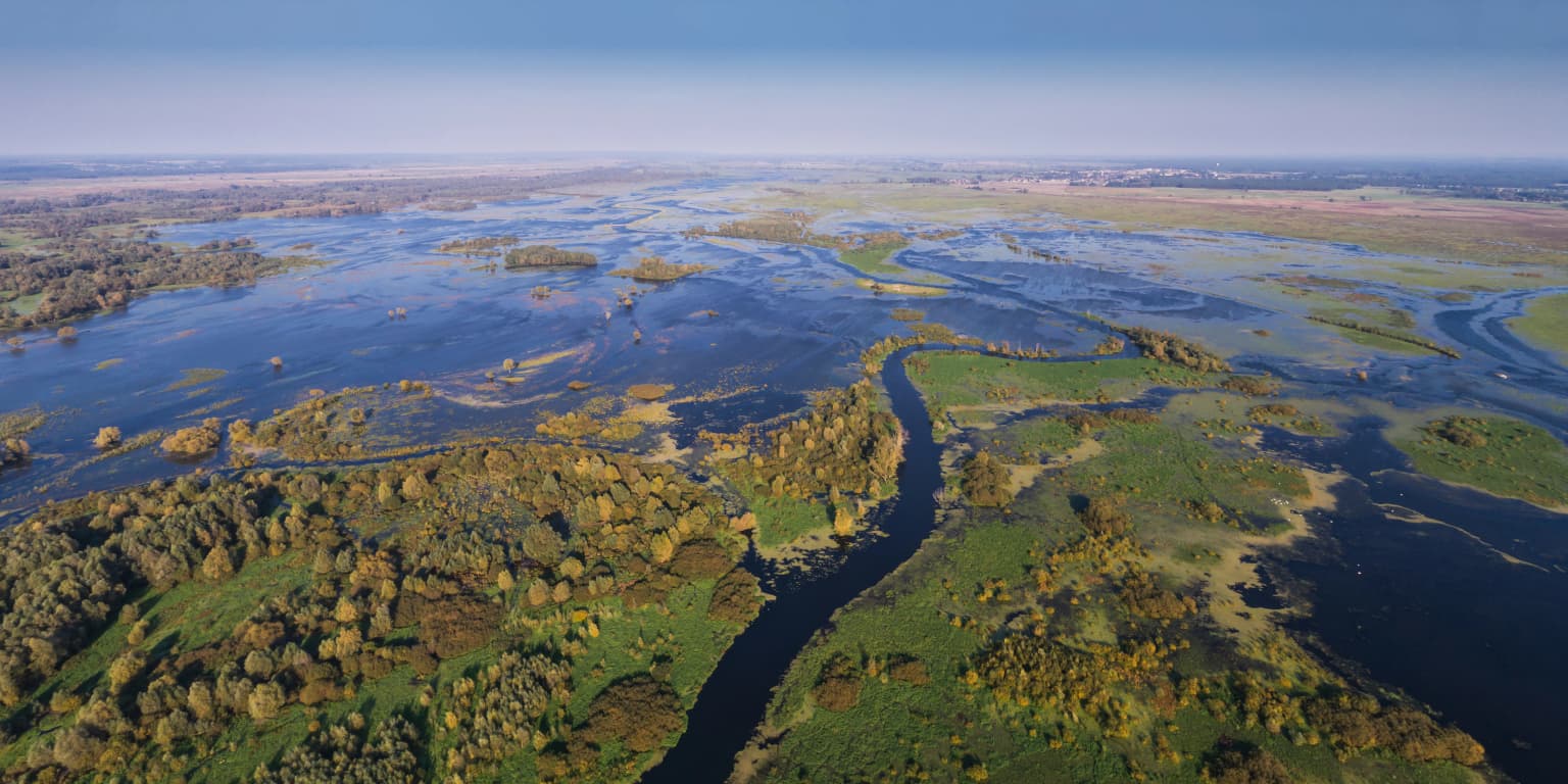
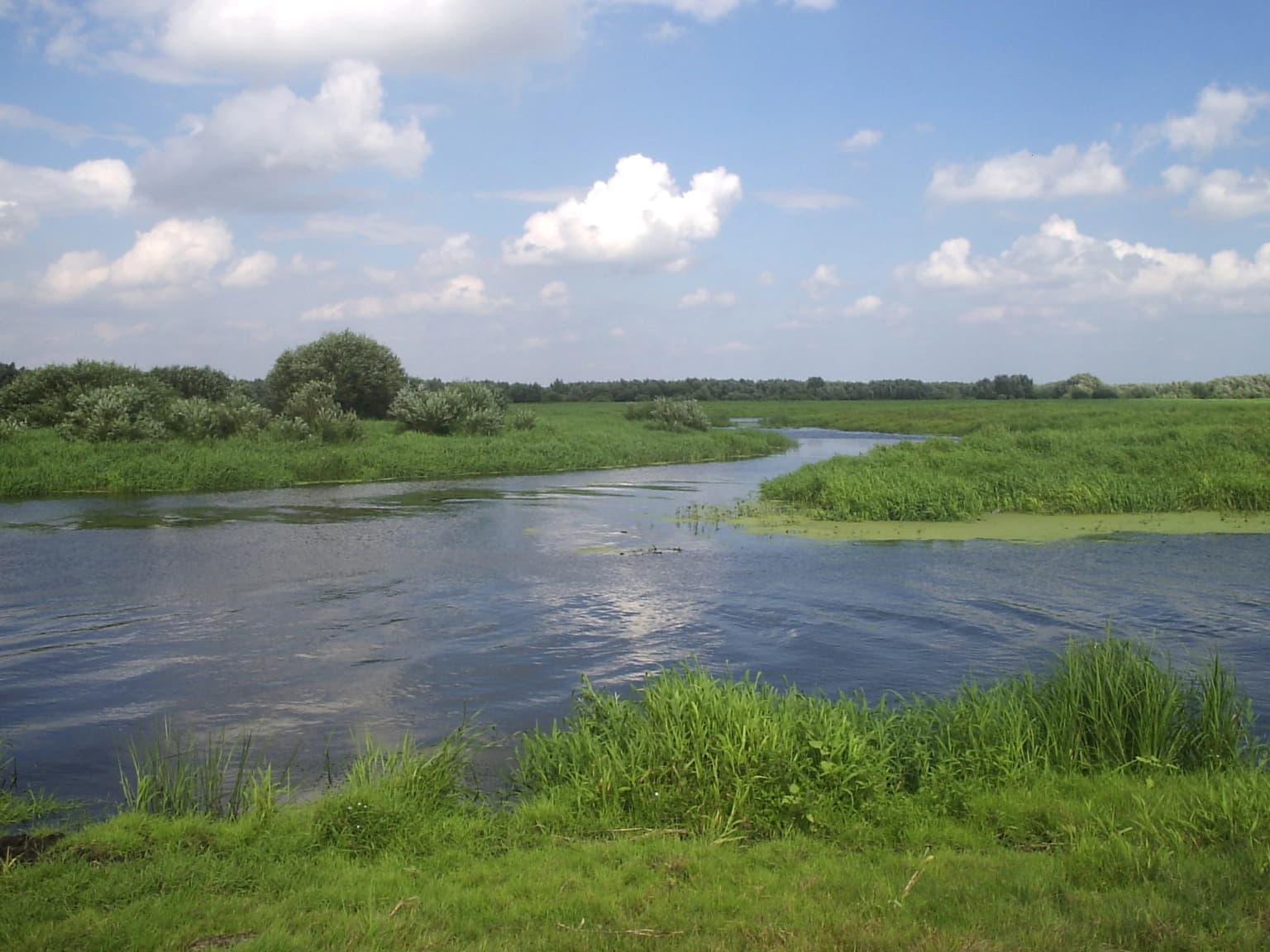
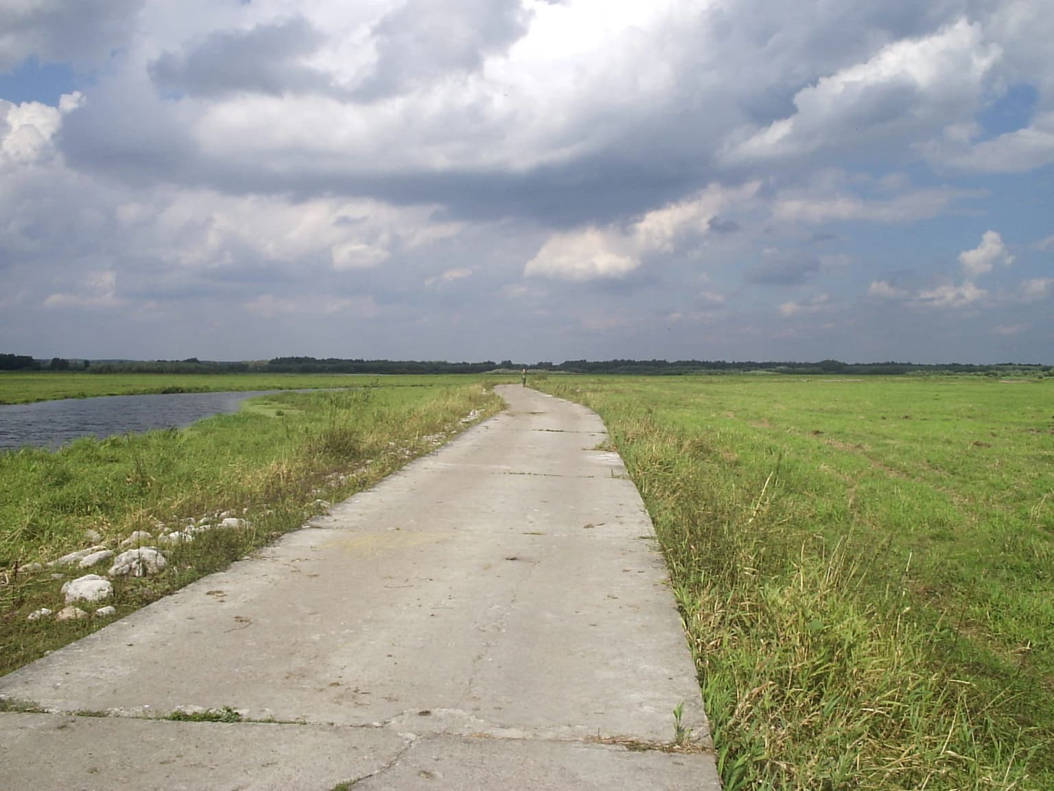
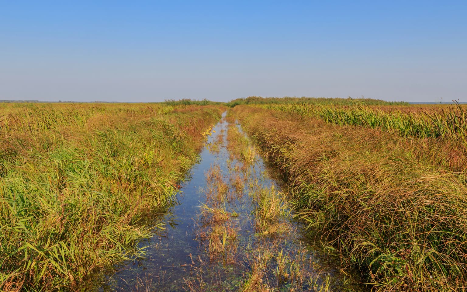
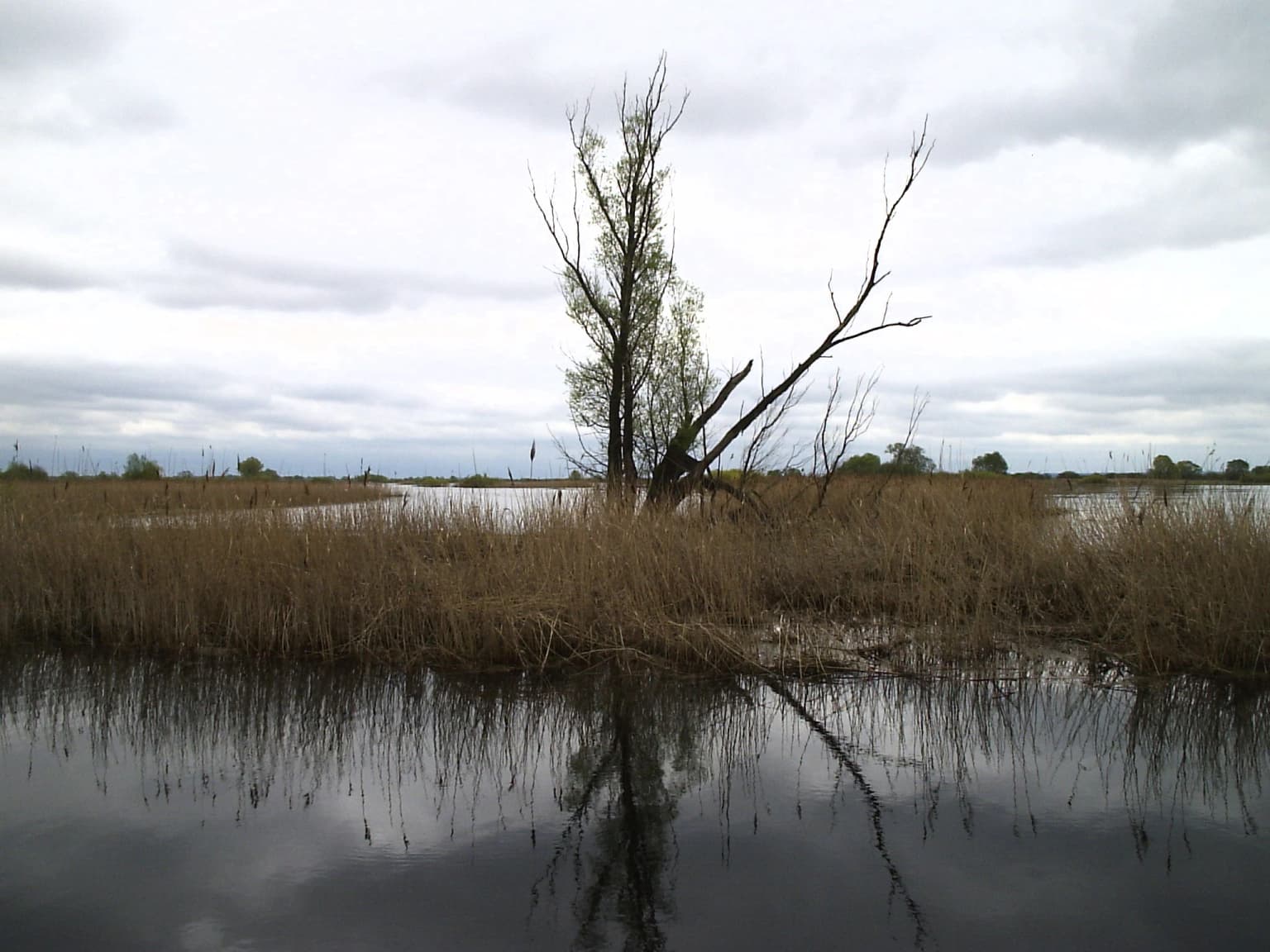
The park occupies low-lying terrain within the Warta River valley as it approaches its confluence with the Oder, forming part of the broader Gorzów Basin and Friedenwald Basin. The landscape is dominated by extensive floodplains, marshy wetlands, and seasonally flooded meadows that create a dynamic mosaic of aquatic and terrestrial habitats. The southern section, centered on the former Słońsk reserve, features expansive wetlands where the Warta's water levels fluctuate dramatically throughout the year, reaching differences of up to four meters between seasons. This section functions as a natural retention basin, holding excessive waters during the wetter periods, particularly in spring (March to April) when water levels peak. The northern section, called the Northern Polder, presents a different character with its network of canals, drainage channels, and man-made structures including levees that separate it from the main river channel. The Postomia River, a tributary of the Warta, plays a significant role in creating the floodplain conditions that define much of the park's wetland character. The terrain is predominantly flat with minimal elevation change, typical of river valley landscapes in this region of Poland.

Tall reeds and grasses in a wetland area with a narrow water channel, surrounded by trees in the background
Warta Mouth National Park wetland landscape with reeds and water channel

Warta Mouth National Park ecosystems, habitats, and plant life

The park protects one of Poland's most significant wetland ecosystems, characterized by heterogeneous plant communities that are largely natural despite centuries of human activity in the surrounding region. The meadows and pastures of the floodplain represent one of the most important habitats for waterbirds and marsh birds in Poland, supporting exceptional biodiversity in what remains of Europe's largely human-modified river valleys. The wetland habitats include extensive reed beds, marshy grasslands, and seasonal pools that provide crucial breeding, nesting, and foraging grounds for diverse bird communities. The floodplain's ecological significance stems from its relatively unmodified character compared to most major European river valleys, which have been heavily altered by human activities. The area's natural hydrological processes, including the dramatic seasonal water level fluctuations, maintain the dynamic conditions essential for the wetland-dependent species that define this protected area's conservation value.

Wide view of a river flowing through lush green wetlands with scattered trees under a partly cloudy sky
River confluence at Warta Mouth National Park in Poland

Warta Mouth National Park wildlife and species highlights

Warta Mouth National Park supports extraordinary bird diversity, with 245 species recorded within its boundaries and 160 species confirmed as breeding residents. The wetlands provide critical habitat for seven to eight duck species and support populations of 26 bird species considered endangered according to the BirdLife International list. Notable species include the aquatic warbler (Acrocephalus paludicola), corn crake (Crex crex), black-tailed godwit (Limosa limosa), common crane (Grus grus), bittern (Botaurus stellaris), little bittern (Ixobrychus minutus), and black tern (Chlidonias niger). The park serves as a major migratory route and staging area, with tens of thousands of geese—including tundra bean geese, white-fronted geese, greylag geese, and lesser white-fronted geese—passing through seasonally. The park holds Poland's largest wintering population of Bewick's swan, and the abundance of wintering waterfowl attracts approximately 30 white-tailed eagles. Mammal populations include 34 species, notably the European otter (Lutra lutra) and European beaver (Castor fiber). The primary ecological threat involves the succession of woody vegetation into the delicate meadow and pasture ecosystems, which would degrade the open habitats essential for ground-nesting bird species.

Concrete path running through grassy fields with a body of water on the left and cloudy sky above
Concrete path through grassy fields at Warta Mouth National Park

Warta Mouth National Park conservation status and protection priorities

The park represents one of Poland's most important conservation areas, recognized internationally as a Ramsar Wetland of International Importance since 1984. The protected status acknowledges the wetland's outstanding universal value and the critical role it plays in supporting global bird populations through migration routes. The park protects a remarkable concentration of globally threatened bird species, with 26 species on the BirdLife International endangered list, making it a biodiversity hotspot of European significance. The conservation challenge involves maintaining the open wetland character against natural succession, as the return of taller vegetation to meadows and pastures threatens the ground-nesting bird species that depend on these habitats. Active management through grazing, mowing, and controlled burning helps maintain the ecological conditions necessary for the park's bird communities. The park's designation as a national park provides the highest level of protection in Poland's protected area system, while the surrounding buffer zone extends conservation influence across a broader landscape.

Warta Mouth National Park cultural meaning and human context

While Warta Mouth National Park is primarily valued for its ecological significance, the protected area encompasses cultural landscape elements shaped by traditional agricultural practices. The extensive meadows and pastures that characterize much of the park reflect centuries of human use that created and maintained the open wetland habitats now valued for conservation. The presence of horses, visible in the park's imagery and noted in Polish sources, reflects the continued agricultural character of the region. The park lies within a boundary region historically influenced by both Polish and German cultural spheres given its proximity to the border, though the primary focus of protection remains ecological rather than cultural-historical. The village of Chyrzyno serves as the administrative center, providing a human settlement context within this wetland landscape.

A narrow water channel flowing through tall reeds and grasses under a clear blue sky
Wetland water channel flanked by tall reeds in Warta Mouth National Park, Poland

Top sights and standout views in Warta Mouth National Park

Warta Mouth National Park stands as Poland's premier wetland bird sanctuary, protecting the last unmodified section of a major European river valley. The park's Ramsar designation, its 245 bird species including 26 globally threatened species, and its role as Poland's largest Bewick's swan wintering ground define its exceptional conservation significance. The dramatic seasonal flooding in the southern section creates one of Central Europe's most dynamic wetland landscapes, while the northern polder's canal system offers different wetland character. The park's educational facilities, including the Centre of Natural Education and nature trails like Ptasim szlakiem, provide visitor engagement with the wetland environment. The recent symbol change to the tundra bean goose reflects ongoing ecological research and taxonomic refinement at this important migratory bird site.

Wetland area with tall reeds, calm water reflecting a leafless tree under overcast sky
Warta Mouth National Park wetlands with tall reeds and water reflections

Best time to visit Warta Mouth National Park

The park offers year-round interest, though spring and autumn represent the most dynamic seasons for wildlife observation. Spring (March to April) brings the highest water levels as snowmelt and rainfall swell the Warta, creating extensive flooded areas that attract nesting birds and migratory species. This period offers excellent opportunities to observe the spring migration of waterfowl and cranes. Autumn migration (September to November) brings large flocks of geese moving southward, with tens of thousands of birds passing through the wetlands. Summer provides access to breeding bird activity and supports the park's walking and cycling trails, though mosquitoes and midges are prevalent in wetland areas. Winter, while less comfortable for extended outdoor visits, offers the unique spectacle of large swan and waterfowl flocks wintering in the relatively ice-free channels, and provides good conditions for observing white-tailed eagles that congregate to feed on waterfowl. The park's accessibility via trails makes it suitable for visits during milder winter periods as well.

Park location guide

Geography guide, regional context, and park location map for Warta Mouth National Park

Warta Mouth National Park park geography, regions, and map view in Poland
Understand where Warta Mouth National Park sits in Poland through a broader geographic reading of the surrounding landscape, nearby location context, and its mapped position within the national park landscape.

How Warta Mouth National Park fits into Poland

Poland, officially the Republic of Poland, is a Central European country spanning from the Baltic Sea in the north to the Carpathian Mountains in the south. It borders Germany, Czech Republic, Slovakia, Ukraine, Belarus, Lithuania, and Kaliningrad Oblast. The country has a temperate climate, diverse landscapes, and is known for its rich history, cultural heritage, and strong economic position within the EU.

Wider geography shaping Warta Mouth National Park in Poland

Poland occupies 312,696 km2 in Central Europe, extending from the Baltic Sea coast in the north to the Sudetes and Carpathian Mountains in the south. It borders Germany to the west, Czech Republic and Slovakia to the south, Ukraine and Belarus to the east, and Lithuania and Kaliningrad Oblast to the northeast. The landscape includes lowland plains, uplands, and mountain ranges.

Map view of Warta Mouth National Park

Use this park location map to pinpoint Warta Mouth National Park in Poland, understand its exact geographic position, and read its mapped placement within the surrounding landscape more clearly.

Pigeon | © OpenStreetMap contributors

Location context for Warta Mouth National Park

Lubusz Voivodeship

Trace the park's expansive wetland habitats, dynamic river floodplains, and crucial bird conservation landscapes through detailed imagery.

Warta Mouth National Park: Visual Guide to Wetland Landscapes, Bird Habitats, and River Scenery
The gallery offers a visual understanding of Warta Mouth National Park's expansive wetland landscapes, illustrating its dynamic floodplains, marshy terrain, and unique river valley habitats. Explore these detailed images to grasp the park's vital role as a waterbird sanctuary and to appreciate the intricate environmental features that support its diverse protected area character.

Aerial view of waterways and wetlands in a national park

Wooden sign with text 'Park Narodowy Ujście Warty' and 'Witamy!' standing in shallow water near a boardwalk

Tall reeds and grasses in a wetland area with a narrow water channel, surrounded by trees in the background

Wide view of a river flowing through lush green wetlands with scattered trees under a partly cloudy sky

Concrete path running through grassy fields with a body of water on the left and cloudy sky above

Misty river at dawn with wooden observation tower, reeds, and trees under colorful sky

A narrow water channel flowing through tall reeds and grasses under a clear blue sky

Wetland area with tall reeds, calm water reflecting a leafless tree under overcast sky

Wooden signboard with text and bird illustrations, situated near a river with grassy fields under a partly cloudy sky

Three swans resting on green grassy bank next to a body of water with reeds and reflections

Wide view of Warta Mouth National Park featuring flooded wetlands, trees, a bridge, and distant river channels under cloudy skies

Shallow water wetland with patches of grass and reeds under overcast sky

A group of horses standing on a muddy patch in a grassy field with distant trees under a cloudy sky

Park atlas

Browse the Wider Regional Spread of Central European Wetland Protected Areas and River Valley Landscapes

Discover National Parks and Protected Areas Near Warta Mouth National Park in the Warta-Oder River Wetlands
After exploring Warta Mouth National Park, continue your geographic discovery by browsing other national parks and protected areas located in the surrounding Central European wetland regions and river valleys. This atlas view helps compare protected landscapes with similar floodplain ecosystems and waterbird habitats, offering broader context for Poland's significant conservation efforts.
Watercolor painting depicting a river flowing through a valley with green vegetation and distant mountains
National parkBrandenburg

Lower Oder Valley National Park: Unique Polder Landscape and Bird Sanctuary

Discover protected area maps and regional geography in Brandenburg

Delve into the Lower Oder Valley National Park, a national park recognized for its extraordinary polder landscape and extensive wetland ecosystems. This page provides detailed geographic context, highlighting the park's unique engineered floodplain, its role as a sanctuary for numerous bird species, and its position within the regional geography of Brandenburg. Understand the mapped boundaries and ecological importance of this exceptional protected area.

Area
103.23 km²
Established
1995
IUCN
II
Visitors
150K annual
Watercolor painting depicting a river flowing through a forested landscape with hills in the background
National parkWest Pomeranian Voivodeship

Drawa National Park: Protected Landscape and River Geography in West Pomeranian Voivodeship

Explore Poland's unique lowland river and ancient forest protected area.

Drawa National Park stands as a vital protected area within West Pomeranian Voivodeship, Poland, celebrated for its exceptional natural geography. The park's core feature is the Drawa River, which carves a distinctive path with fast-flowing currents and deep valleys, presenting a landscape more akin to mountain streams than typical lowland waterways. This area protects one of Poland's most valuable lowland river corridors, featuring ancient beech and oak forests, the rare meromictic Lake Czarne, and diverse wetland habitats. MoriAtlas facilitates structured exploration of Drawa National Park's mapped terrain and protected landscape identity.

Area
115.36 km²
Established
1990
IUCN
II
Visitors
27K annual
National park

Wielkopolska National Park: Poland's Glacial Landscape and Lake District Protected Area

Explore the mapped terrain and protected landscape.

Wielkopolska National Park is a vital protected landscape in western Poland, notable for its characteristic post-glacial terrain. Featuring a landscape defined by numerous kettle lakes nestled within mixed forests and gently rolling hills, this national park offers a representative sample of the Greater Poland lake district's natural heritage. Its mapped boundaries delineate an area of ecological importance, providing valuable context for understanding regional geography and protected area distribution through structured atlas exploration.

Watercolor painting depicting mountains, rivers, and green terrain
National parkWest Pomeranian Voivodeship

Wolin National Park: Coastal Protected Landscape and Glacial Terrain in West Pomeranian Voivodeship

Explore Poland's first marine national park and its dynamic geography.

Wolin National Park offers a profound look into Poland's protected coastal geography. This national park in the West Pomeranian Voivodeship is distinguished by its high sea cliffs, inclusion of Baltic Sea and Szczecin Lagoon waters as Poland's first marine protected area, and a landscape sculpted by glacial moraines. Discover the park's complex delta systems, ancient forests, and the mapped terrain that supports significant bird migration, providing a rich focus for atlas exploration.

Area
109.37 km²
Established
1960
IUCN
II
Visitors
1.5M annual
Watercolor painting of a landscape with a lake, trees, and distant hills
National parkMecklenburg-Vorpommern

Müritz National Park: Explore Protected Beech Forests and Glacial Lakelands in Mecklenburg-Vorpommern

Germany's largest national park: mapped boundaries and terrain.

Müritz National Park represents a significant protected landscape within northeastern Germany's Mecklenburg-Vorpommern region. Its expansive territory encompasses not only Germany's largest lake, Müritz, but also substantial tracts of ancient beech forests awarded UNESCO World Heritage status. Users can explore the park's glacial terrain, its intricate network of lakes and wetlands, and understand its position within the regional geography, making it a key destination for structured atlas-based discovery of German protected areas.

Area
318 km²
Established
1990
IUCN
II
Watercolor painting showing a landscape with green hills, trees, and a river winding through the scene
National park

Saxon Switzerland National Park: Protected Area Geography and Map Exploration

Discover its mapped boundaries and regional landscape context.

Saxon Switzerland National Park, a protected national park in Germany, offers a distinct focus for geographic and atlas-based discovery. This page details the park's specific protected landscape, its mapped boundaries, and its contribution to the regional geography. MoriAtlas allows for in-depth exploration of such natural areas, providing essential context for understanding their place within broader natural systems and mapped terrains.

Area
93.5 km²
Established
1990
IUCN
II
Visitors
1.7M annual
National park

Bohemian Switzerland National Park: Czech Sandstone Protected Landscape and Map Exploration

Discover its unique terrain and protected area geography.

Bohemian Switzerland National Park is a protected area in the Czech Republic known for its exceptional sandstone geology. This national park showcases a dramatic landscape of towering rock formations, deep gorges, and striking canyons, forming a significant part of the Elbe Sandstone Mountains. Through MoriAtlas, users can explore its mapped protected boundaries, understand its regional geographic context, and appreciate its unique natural heritage.

Area
79 km²
Established
2000
IUCN
II
Relief
Mixed relief
Watercolor painting of a river flowing through a forested area with colorful fields
National parkPomeranian Voivodeship

Tuchola Forest National Park: Explore Poland's Largest Protected Woodland and Glacial Lakes

Detailed maps and geographic context of unique forest ecosystems and terrain.

MoriAtlas offers a comprehensive geographic overview of Tuchola Forest National Park, a vital protected area in Pomeranian Voivodeship, Poland. This page delves into the park's identity as Poland's largest contiguous forest, distinguished by its post-glacial landscape. Users can explore the mapped boundaries of its extensive coniferous forests, numerous interconnected glacial lakes, dynamic dunes, and ecologically rich peatlands. It serves as a key entry point for understanding the park's unique terrain and its significant place within the broader regional geography and protected lands atlas.

Area
46.13 km²
Established
1996
IUCN
II
Visitors
33K annual

Common questions about visiting, size, designation, and location context for Warta Mouth National Park

Warta Mouth National Park FAQs for park facts, access, geography, and protected area context
Find quick answers about Warta Mouth National Park, including protected-area facts, park geography, trail and visitor context, and how the park fits into its surrounding country and regional landscape.
MoriAtlas Explorer

Continue Your Protected Areas Search Across the Global Atlas

Deepen your exploration by continuing the structured search for national parks and protected areas worldwide. Utilize the comprehensive filtering capabilities to compare different conservation landscapes and refine your understanding of global park geography. Discover more about the distribution and characteristics of protected natural areas.

Global natural geography