Mori Atlas logo
National parkTuchola Forest National Park

Navigate the mapped boundaries of Poland's largest forest ecosystem and its unique glacial terrain.

Tuchola Forest National Park: Vast Protected Woodland & Glacial Landscape in Pomeranian Voivodeship

(Park Narodowy Bory Tucholskie)

MoriAtlas provides a detailed geographic exploration of Tuchola Forest National Park, a significant protected area within Pomeranian Voivodeship, Poland. This national park showcases one of Poland's most expansive woodland ecosystems, shaped by ancient glaciers into a landscape of rolling dunes, numerous pristine lakes, and vital peatlands. Engage with the park's specific mapped boundaries and its distinctive terrain, offering a deep dive into its ecological and geographic significance for atlas-based discovery.

National ParkForest ReserveGlacial LakesPeatlandsBirdwatchingLowland Forest
Stylized illustration of a mountainous landscape with waterfall, winding river, and evergreen trees

Tuchola Forest National Park

National park

Park overview

Structured park overview, official facts, and landscape profile for Tuchola Forest National Park

Tuchola Forest National Park park facts, protected area profile, and essential visitor context
Review the core facts for Tuchola Forest National Park, including designation, size, terrain, visitor scale, habitats, and operating context in one park-focused overview.

About Tuchola Forest National Park

Tuchola Forest National Park protects one of Poland's most significant forest wilderness areas in the northern part of the country. The park lies within the Tuchola Forest, an extensive woodland complex that represents the largest forest area in Poland. The landscape was shaped during the last Ice Age by the Scandinavian Glacier, which left behind a terrain of sandy plains interspersed with dunes and a series of long, narrow glacial lakes. These lakes are connected by channels, with the most notable being the Seven Lakes Stream (Struga Siedmiu Jezior), a chain of seven interconnected lakes stretching approximately 13.9 kilometers. The park's soils are predominantly poor and acidic, supporting primarily coniferous forest communities that dominate nearly 83% of the park's area. Water bodies cover about 11.5% of the park's surface, with 21 lakes including the largest, Lake Ostrowite, at 272 hectares. The park is surrounded by Zaborski Landscape Park, which serves as a buffer zone and complementary protected area, and together these form the Tuchola Forest Biosphere Reserve recognized by UNESCO in 2010. The protected area provides habitat for numerous species and serves as a showcase for Poland's lowland forest conservation efforts.

Quick facts and research context for Tuchola Forest National Park

Tuchola Forest National Park covers 46.13 km² in northern Poland's Pomeranian Voivodeship, within the Tuchola Forest—the country's largest woodland. The park contains over 20 lakes, including a chain of seven interconnected lakes known as Struga Siedmiu Jezior, which forms a 13.9 km watercourse. The landscape features sandy plains shaped by glacial activity, dotted with dunes and clear oligotrophic lakes. The park is IUCN category II and forms the core of a UNESCO Biosphere Reserve. It has a buffer zone of approximately 130 km² and receives around 33,000 visitors annually.

Park context

Deeper park guide and search-rich context for Tuchola Forest National Park

Tuchola Forest National Park history, landscape, wildlife, and travel context
Explore Tuchola Forest National Park through its history, landscape character, ecosystems, wildlife, conservation priorities, cultural context, and seasonal travel timing in a structured park guide built for atlas discovery and search intent.

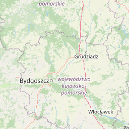
Why Tuchola Forest National Park stands out

Tuchola Forest is best known for its extensive coniferous forest ecosystem set within a landscape of glacial lakes, dunes, and peatlands. The park protects a chain of seven lakes connected by the Struga Siedmiu Jezior waterway, as well as several rare lobelia lakes, oligotrophic水体 characterized by the presence of lake lobelia. The area supports exceptional biodiversity, particularly in birds, with over 130 species recorded including cranes, eagle owls, and numerous waterfowl. The park symbol is the western capercaillie (wood grouse), a species that once thrived here but has been extirpated and is now the focus of reintroduction efforts.

A dirt path through a forest with tall pine trees and green undergrowth
Dirt trail winding through dense pine forest in Tuchola Forest National Park

Tuchola Forest National Park history and protected-area timeline

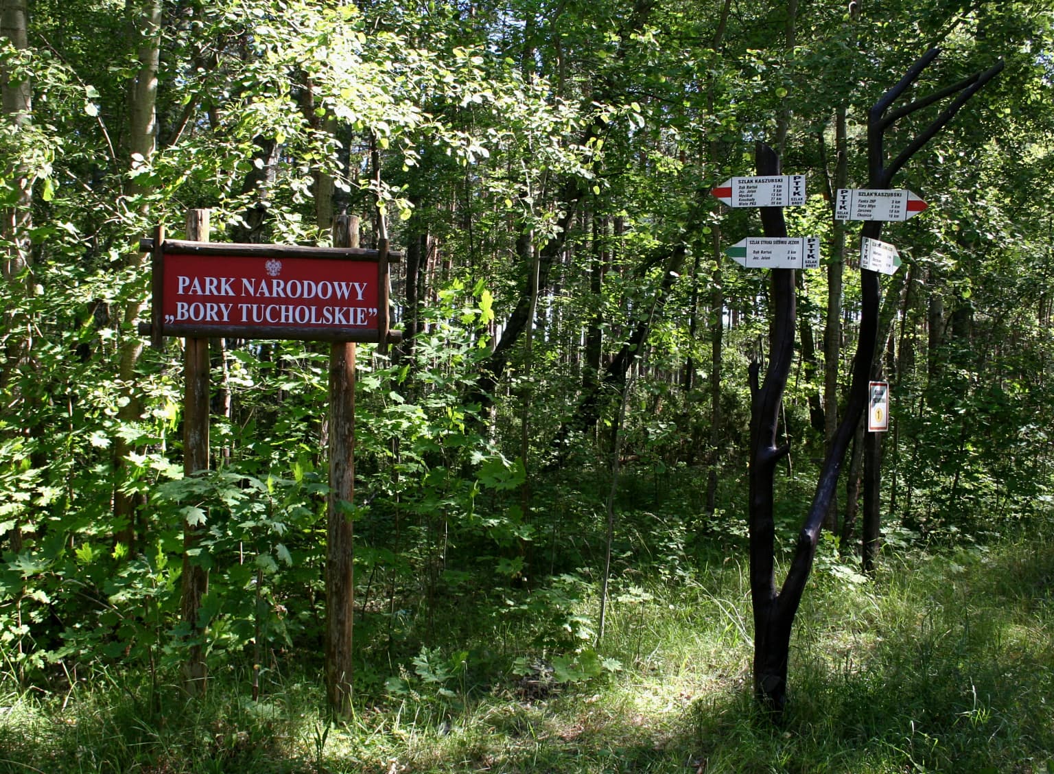
Tuchola Forest National Park was established on July 1, 1996, following years of discussion and planning. The initial proposal called for a much larger protected area of approximately 130 square kilometers, but after negotiations with local authorities, the final boundaries were reduced to encompass only the area around the Seven Lakes Stream. All land within the national park was state-owned rather than private, comprising forests, meadows, and peatlands that had previously been part of the Forest Preserve Rytel, with the lakes administered by the State Agency of Agricultural Land. The creation of the park reflected growing recognition of the Tuchola Forest's ecological significance and the need to protect its unique glacial landscape and forest ecosystems. The park was later incorporated into the Tuchola Forest Biosphere Reserve, designated by UNESCO in 2010, which expanded the conservation framework to include the broader landscape and surrounding communities.

Tuchola Forest National Park landscape and geographic character

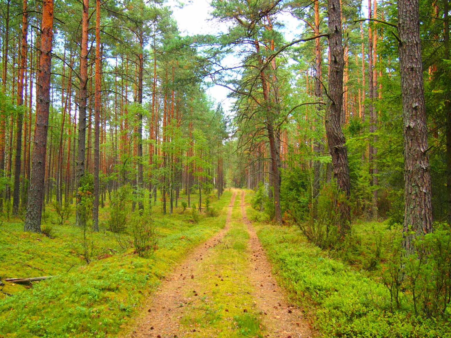
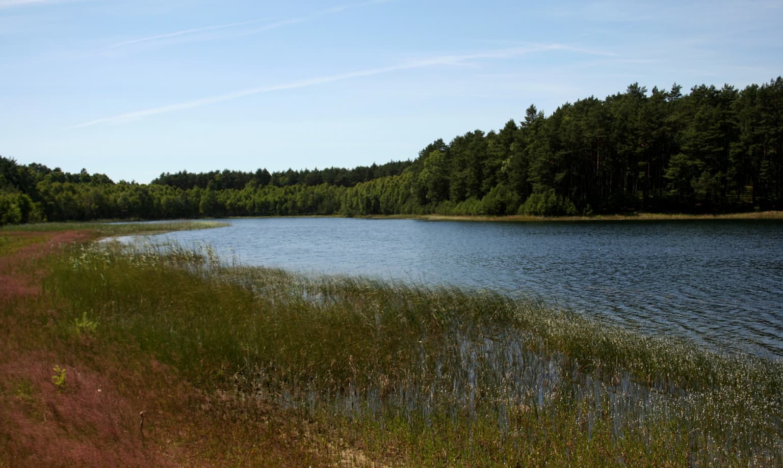
The landscape of Tuchola Forest National Park is defined by its glacial origins. The Scandinavian Glacier sculpted the terrain during the last Ice Age, leaving behind undulating sandy plains that dominate the area. These plains are interspersed with dunes and numerous lakes, creating a distinctive mosaic of forest, water, and open terrain. The lakes are characteristically long and narrow, carved by glacial processes, and connected by channels that form the distinctive Seven Lakes Stream system stretching over 17 kilometers in total length. The park's lakes include several of particular ecological interest—the lobelia lakes of Wielkie Gacno, Małe Gacno, Nierybno, and Głuche are oligotrophic bodies of exceptional clarity. Peatlands and meadows dot the landscape between the lakes and forest stands, adding to the diversity of habitats. The overall character is one of remote wilderness, with poor, acidic soils and a relatively flat to gently rolling terrain.

Red sign reading 'PARK NARODOWY BORY TUCHOLSKIE' surrounded by dense forest with directional signs attached to a tree
Entrance sign for Tuchola Forest National Park

Tuchola Forest National Park ecosystems, habitats, and plant life

The nature of Tuchola Forest National Park reflects its position within Poland's largest forest complex and its glacial landscape. Coniferous forests dominate the park, covering nearly 83% of its area on poor, acidic sandy soils. Despite the relatively uniform habitat conditions, the park supports remarkable biodiversity across multiple taxonomic groups. The flora includes approximately 634 species of vascular plants representing 96 families, with mosses, liverworts, and lichens also exceptionally well-represented—the park contains about 22% of all Polish moss species, 11% of liverworts, and 33% of the country's lichen species. The lakes support distinctive aquatic vegetation including lake lobelia and water lobelia, species associated with oligotrophic waters. Glacial relict plants such as common heather, bog blueberry, black crowberry, and northern greenweed persist in the park. The varied habitats—forest, lakes, peatlands, meadows, and dunes—create a complex ecological mosaic that supports diverse communities from aquatic organisms to forest-dwelling species.

Lake shore with tall grasses and reeds, bordered by a forested area under a clear blue sky
Shore of Wielkie Gacno Lake in Tuchola Forest National Park

Tuchola Forest National Park wildlife and species highlights

Tuchola Forest National Park supports a rich wildlife community, with particular significance for birds. Over 130 bird species have been recorded in the park, of which approximately 98 are breeding species. The bird community includes waterfowl such as whooper swan, teal, bean goose, and merganser; wading birds including snipe, greenshank, and herring gull; and birds of prey such as white-tailed eagle and marsh harrier. Notable species include common crane and eagle owl. The park also supports a diversity of bats, with several species thriving in the forest environment. Fish populations in the connected lake system include about 28 species, with European eel, pike, tench, perch, bream, and roach present in every lake. The park was once home to the western capercaillie (wood grouse), the park's symbolic species, but this bird has been extirpated from the area—likely since the 1970s—and reintroduction is planned. Mammals include elk (moose), common shrew, and hare, while the invertebrate community includes 42 butterfly species, 17 ant species, 45 dragonfly species, and over 100 bee species.

Tuchola Forest National Park conservation status and protection priorities

Tuchola Forest National Park represents an important conservation area within Poland's lowland forest ecosystem. The park is categorized as IUCN protected area category II and forms the core of the Tuchola Forest Biosphere Reserve, designated by UNESCO in 2010, which extends conservation framing to the broader landscape. Strict protection covers about 7% of the park's area across ten strict nature reserves, with only two (Małe Gacno and Kacze Oko) open to visitors. The conservation significance lies in the protection of Poland's largest forest complex, its glacial lake systems including rare lobelia lakes, and the biodiversity they support. The park protects significant populations of legally protected species—over 120 bird species have protected status, and 43 vascular plant species are protected under Polish law. The coniferous forest ecosystem, though numerically dominant, represents a relatively rare habitat type in Poland's lowlands. The park also plays a role in protecting water quality in its lake systems and serves as a reference area for understanding lowland forest ecology.

Tuchola Forest National Park cultural meaning and human context

The Tuchola Forest area has historical significance in Polish culture and recreation. The village of Charzykowy, which serves as the park's administrative headquarters located about 3 kilometers from Chojnice, is known as the birthplace of Polish inland yachting. Lake Charzykowy remains a destination for sailing in both summer and winter months. The park area has been traditionally used for forestry and agriculture, with the landscape shaped by centuries of human interaction with the forest. The name 'Bory Tucholskie' refers to the broader forest region, which has long been known for its timber resources and as a settlement area. Agro-tourism has developed in nearby villages such as Swornegacie, offering visitors a chance to experience the regional culture while exploring the park.

Top sights and standout views in Tuchola Forest National Park

Tuchola Forest National Park offers visitors access to Poland's largest forest wilderness with its distinctive glacial landscape. The Seven Lakes Stream (Struga Siedmiu Jezior) provides a unique paddling opportunity through a chain of interconnected lakes. The park supports exceptional biodiversity with over 130 bird species and significant populations of protected flora and fauna. The lobelia lakes, with their clear oligotrophic waters and specialized vegetation, represent a rare habitat type. Cycling and hiking trails, including the Kaszubski Trail, traverse the forest allowing visitors to explore its landscapes. The area serves as a base for experiencing the broader Tuchola Forest region, with nearby Charzykowy offering sailing opportunities on Lake Charzykowy.

Best time to visit Tuchola Forest National Park

The best time to visit Tuchola Forest National Park depends on the experience sought. Spring and early summer bring active wildlife, breeding birds, and the park's forests in fresh leaf. The lakes are accessible for kayaking during the warmer months, with the Seven Lakes Stream offering a popular paddling route. Autumn offers the characteristic atmosphere of the forest with fall colors, and fewer visitors. Winter provides a different character, with Charzykowy known for winter sailing. The park can be explored year-round, though summer months see the highest visitation. The shoulder seasons of spring and autumn offer good conditions for hiking and wildlife observation while avoiding peak crowds.

Park location guide

Geography guide, regional context, and park location map for Tuchola Forest National Park

Tuchola Forest National Park park geography, regions, and map view in Poland
Understand where Tuchola Forest National Park sits in Poland through a broader geographic reading of the surrounding landscape, nearby location context, and its mapped position within the national park landscape.

How Tuchola Forest National Park fits into Poland

Poland, officially the Republic of Poland, is a Central European country spanning from the Baltic Sea in the north to the Carpathian Mountains in the south. It borders Germany, Czech Republic, Slovakia, Ukraine, Belarus, Lithuania, and Kaliningrad Oblast. The country has a temperate climate, diverse landscapes, and is known for its rich history, cultural heritage, and strong economic position within the EU.

Wider geography shaping Tuchola Forest National Park in Poland

Poland occupies 312,696 km2 in Central Europe, extending from the Baltic Sea coast in the north to the Sudetes and Carpathian Mountains in the south. It borders Germany to the west, Czech Republic and Slovakia to the south, Ukraine and Belarus to the east, and Lithuania and Kaliningrad Oblast to the northeast. The landscape includes lowland plains, uplands, and mountain ranges.

Map view of Tuchola Forest National Park

Use this park location map to pinpoint Tuchola Forest National Park in Poland, understand its exact geographic position, and read its mapped placement within the surrounding landscape more clearly.

Pigeon | © OpenStreetMap contributors

Location context for Tuchola Forest National Park

Pomeranian Voivodeship

Discover the unique glacial terrain, dense coniferous forests, and pristine lobelia lakes that define Tuchola Forest National Park's diverse habitats.

Visual Exploration: Tuchola Forest National Park Landscapes, Scenery, and Protected-Area Views
Explore a curated gallery of images to visually understand Tuchola Forest National Park's distinctive environments, from its vast coniferous woodlands to the serene glacial lakes and peatlands. These photographs serve as an essential visual guide for grasping the park's unique protected landscape character and the diverse ecosystems shaped by ancient glaciers.

A dirt path through a forest with tall pine trees and green undergrowth

Wooden boardwalk extending over a calm lake surrounded by forest under a clear blue sky.

Red sign reading 'PARK NARODOWY BORY TUCHOLSKIE' surrounded by dense forest with directional signs attached to a tree

Lake shore with tall grasses and reeds, bordered by a forested area under a clear blue sky

Park atlas

Compare the unique glacial landscapes and extensive forest ecosystems of Poland's Pomeranian Voivodeship.

Explore Nearby National Parks and Protected Areas Beyond Tuchola Forest National Park
Browse a curated list of national parks and protected areas geographically connected to Tuchola Forest National Park, tracing similar glacial origins and lowland forest ecosystems. Use this regional overview to compare diverse conservation landscapes, map their spread across the Pomeranian Voivodeship, and deepen your understanding of Poland's natural heritage.
Watercolor painting depicting a river flowing through a forested landscape with hills in the background
National parkWest Pomeranian Voivodeship

Drawa National Park: Protected Landscape and River Geography in West Pomeranian Voivodeship

Explore Poland's unique lowland river and ancient forest protected area.

Drawa National Park stands as a vital protected area within West Pomeranian Voivodeship, Poland, celebrated for its exceptional natural geography. The park's core feature is the Drawa River, which carves a distinctive path with fast-flowing currents and deep valleys, presenting a landscape more akin to mountain streams than typical lowland waterways. This area protects one of Poland's most valuable lowland river corridors, featuring ancient beech and oak forests, the rare meromictic Lake Czarne, and diverse wetland habitats. MoriAtlas facilitates structured exploration of Drawa National Park's mapped terrain and protected landscape identity.

Area
115.36 km²
Established
1990
IUCN
II
Visitors
27K annual
National park

Wielkopolska National Park: Poland's Glacial Landscape and Lake District Protected Area

Explore the mapped terrain and protected landscape.

Wielkopolska National Park is a vital protected landscape in western Poland, notable for its characteristic post-glacial terrain. Featuring a landscape defined by numerous kettle lakes nestled within mixed forests and gently rolling hills, this national park offers a representative sample of the Greater Poland lake district's natural heritage. Its mapped boundaries delineate an area of ecological importance, providing valuable context for understanding regional geography and protected area distribution through structured atlas exploration.

National parkPomeranian Voivodeship

Slovincian National Park: Moving Dunes and Baltic Coast Protected Landscape Exploration

Discover its unique geography and mapped terrain.

Slovincian National Park is a protected area in Pomeranian Voivodeship, Poland, celebrated for its impressive moving sand dunes and coastal wetland ecosystems. These dynamic dunes, some reaching 30 meters high, migrate inland, creating an ever-changing landscape. The park also features large shallow lakes like Łebsko and Gardno, vital for migratory birds. Explore the mapped boundaries and geographic context of this significant protected area, a Ramsar site and UNESCO biosphere reserve.

Area
186.18 km²
Established
1967
IUCN
II
Visitors
319K annual
Watercolor painting depicting mountains, rivers, and green terrain
National parkWest Pomeranian Voivodeship

Wolin National Park: Coastal Protected Landscape and Glacial Terrain in West Pomeranian Voivodeship

Explore Poland's first marine national park and its dynamic geography.

Wolin National Park offers a profound look into Poland's protected coastal geography. This national park in the West Pomeranian Voivodeship is distinguished by its high sea cliffs, inclusion of Baltic Sea and Szczecin Lagoon waters as Poland's first marine protected area, and a landscape sculpted by glacial moraines. Discover the park's complex delta systems, ancient forests, and the mapped terrain that supports significant bird migration, providing a rich focus for atlas exploration.

Area
109.37 km²
Established
1960
IUCN
II
Visitors
1.5M annual
Watercolor illustration showing a river winding through rolling green hills with sparse vegetation
National parkLubusz Voivodeship

Warta Mouth National Park: A National Park Protecting Vital European Wetlands

Explore mapped protected areas and bird habitats in Lubusz Voivodeship.

Warta Mouth National Park, located in Poland's Lubusz Voivodeship, is a significant protected landscape safeguarding the ecologically rich confluence of the Warta and Oder rivers. As the nation's most recently established national park, it provides critical habitat for a vast array of migratory and breeding bird species within its extensive marshlands and floodplains. This park offers a unique opportunity for atlas-driven exploration of Central European wetland geography and the mapped boundaries of a vital conservation area.

Area
80.38 km²
Established
2001
IUCN
II
Visitors
52K annual
Watercolor painting depicting a river flowing through a valley with green vegetation and distant mountains
National parkBrandenburg

Lower Oder Valley National Park: Unique Polder Landscape and Bird Sanctuary

Discover protected area maps and regional geography in Brandenburg

Delve into the Lower Oder Valley National Park, a national park recognized for its extraordinary polder landscape and extensive wetland ecosystems. This page provides detailed geographic context, highlighting the park's unique engineered floodplain, its role as a sanctuary for numerous bird species, and its position within the regional geography of Brandenburg. Understand the mapped boundaries and ecological importance of this exceptional protected area.

Area
103.23 km²
Established
1995
IUCN
II
Visitors
150K annual
National parkMasovian Voivodeship

Kampinos National Park: Mapped Protected Landscape of Inland Sand Dunes

Discover Masovian Voivodeship's unique geography and park boundaries.

Kampinos National Park is a nationally significant protected area within the Masovian Voivodeship, celebrated for its extensive and well-preserved inland sand dune formations, a rarity in European geography. This park offers a distinct mapped landscape where pine-covered dunes intermingle with wetland ecosystems, supporting a unique biodiversity that includes a notable moose population. Explore the park's protected boundaries and understand its position as a vital natural and historical asset with detailed geographic context.

Area
385.44 km²
Established
1959
IUCN
II
Relief
Lowland
Watercolor painting showing chalk cliffs along a coastline with calm water and distant hills
National parkMecklenburg-Vorpommern

Jasmund National Park: Germany's Coastal Chalk Cliffs and Primeval Forest Landscape

Explore the protected geography of Mecklenburg-Vorpommern's Rügen island.

Jasmund National Park showcases one of Northern Europe's most dramatic natural formations, defined by its striking white chalk cliffs plunging into the Baltic Sea and its UNESCO-recognized primeval beech forests. This protected area offers a profound look into geological heritage and undisturbed forest ecosystems. Navigate its mapped boundaries and understand its unique landscape context within the Mecklenburg-Vorpommern region through detailed atlas exploration on MoriAtlas.

Area
30 km²
Established
1990
IUCN
II
Visitors
300K annual

Common questions about visiting, size, designation, and location context for Tuchola Forest National Park

Tuchola Forest National Park FAQs for park facts, access, geography, and protected area context
Find quick answers about Tuchola Forest National Park, including protected-area facts, park geography, trail and visitor context, and how the park fits into its surrounding country and regional landscape.
MoriAtlas Explorer

Continue Your Protected Areas Search Across the Global Atlas

Deepen your exploration by continuing the structured search for national parks and protected areas worldwide. Utilize the comprehensive filtering capabilities to compare different conservation landscapes and refine your understanding of global park geography. Discover more about the distribution and characteristics of protected natural areas.

Global natural geography