Mori Atlas logo
National parkSlovincian National Park

Discover the protected area's unique geography and mapped terrain within Pomeranian Voivodeship.

Slovincian National Park: Dynamic Moving Dunes and Baltic Coastal Landscape Atlas

(Słowiński Park Narodowy)

Slovincian National Park, located in Poland's Pomeranian Voivodeship, stands as a remarkable protected landscape along the Baltic coast. This national park is globally recognized for its extraordinary system of moving sand dunes, some reaching up to 30 meters in height, which continuously reshape the shoreline. Beyond the iconic dunes, the park encompasses a rich mosaic of coastal lakes, extensive wetlands, and dense pine forests, forming a vital ecosystem that supports significant biodiversity and migratory bird populations.

coastal duneswetlandsmigratory birdsBaltic coastbiosphere reserveRamsar site

Slovincian National Park

National park

Park overview

Structured park overview, official facts, and landscape profile for Slovincian National Park

Slovincian National Park park facts, protected area profile, and essential visitor context
Review the core facts for Slovincian National Park, including designation, size, terrain, visitor scale, habitats, and operating context in one park-focused overview.

About Slovincian National Park

Slovincian National Park occupies a remarkable position along Poland's northern Baltic coast, protecting a landscape shaped by the interplay of wind, waves, and sand over millennia. The park's territory was historically a coastal bay of the Baltic Sea, but the gradual formation of sand bars and moving dunes separated these waters from the open sea, transforming them into the chain of coastal lakes that characterize the region today. This ongoing geological process continues to reshape the landscape, with dunes migrating inland at measurable rates and periodically exposing ancient forests buried beneath the sand for thousands of years.

The park encompasses several distinct landscape zones: the coastal sandbar with its moving dunes, the Gardno-Łebska lowland with its shallow lakes and wetlands, and fragments of terminal moraine from the last glaciation. The largest lakes, Łebsko and Gardno, are shallow bodies of water with maximum depths of only 6.3 meters and 2.6 meters respectively, supporting extensive reed beds and aquatic vegetation. Seven rivers traverse the park, with the Łeba and Łupawa being the most significant, carrying water from the hinterland to the coastal lagoon system.

Forests within the park are predominantly pine woodlands, covering approximately 80 percent of wooded areas, interspersed with peat bogs of various types. This combination of coastal dune, lake, wetland, and forest habitats creates a mosaic of environments supporting remarkable biodiversity. The park's strict protection zone covers over 53 square kilometers, preserving the most ecologically sensitive areas with limited human access.

Quick facts and research context for Slovincian National Park

Slovincian National Park protects a dynamic coastal landscape on Poland's Baltic shore in the Pomeranian Voivodeship. The park is centered on the Łebska sandbar, a barrier peninsula separating a chain of coastal lakes from the open sea. Its signature feature is the system of moving sand dunes, among the most impressive in Europe, which migrate slowly across the landscape and have buried ancient forests over thousands of years. The park contains over 55 percent water by area, including the large shallow lakes Łebsko and Gardno, along with extensive peat bogs and marshes. Since 1977, the park has functioned as a UNESCO biosphere reserve under the Man and the Biosphere Programme, recognizing its importance for both ecological conservation and sustainable research.

Park context

Deeper park guide and search-rich context for Slovincian National Park

Slovincian National Park history, landscape, wildlife, and travel context
Explore Slovincian National Park through its history, landscape character, ecosystems, wildlife, conservation priorities, cultural context, and seasonal travel timing in a structured park guide built for atlas discovery and search intent.

Why Slovincian National Park stands out

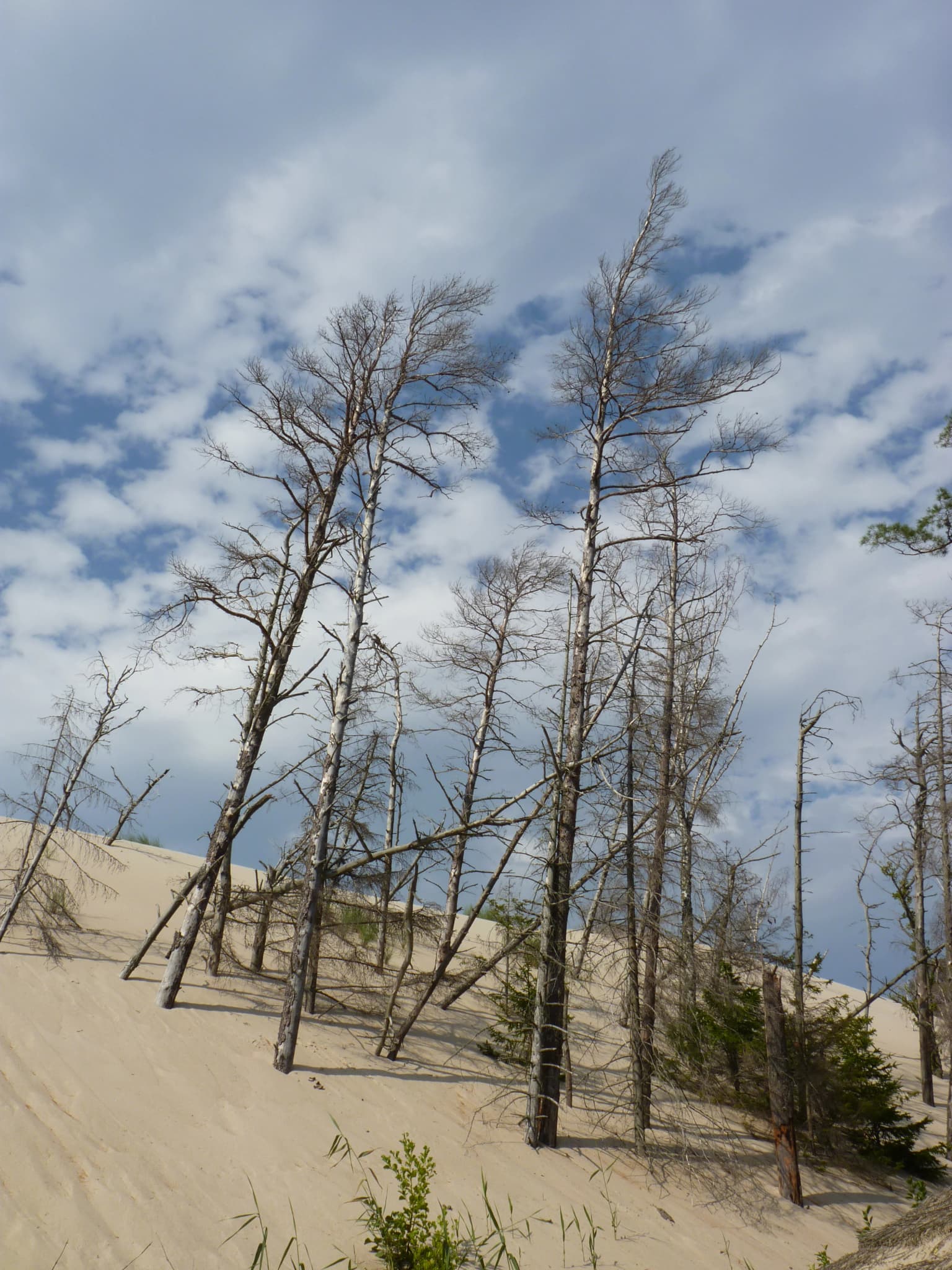
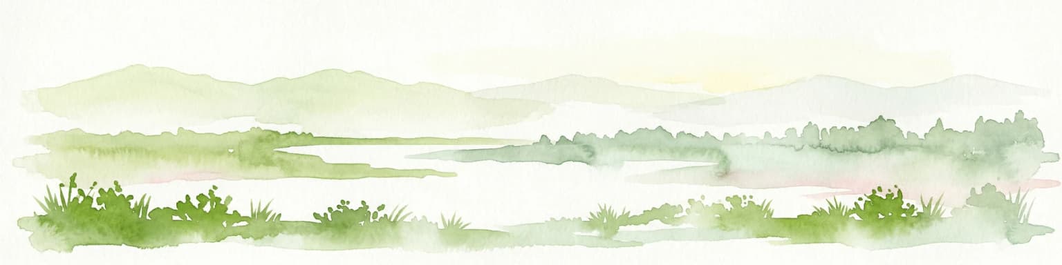
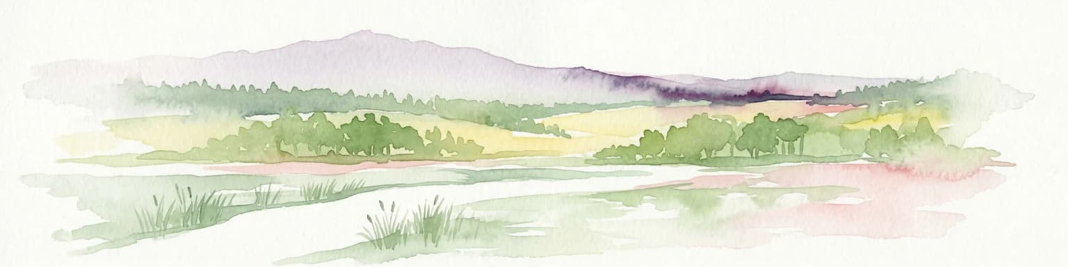
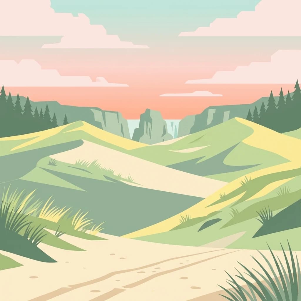
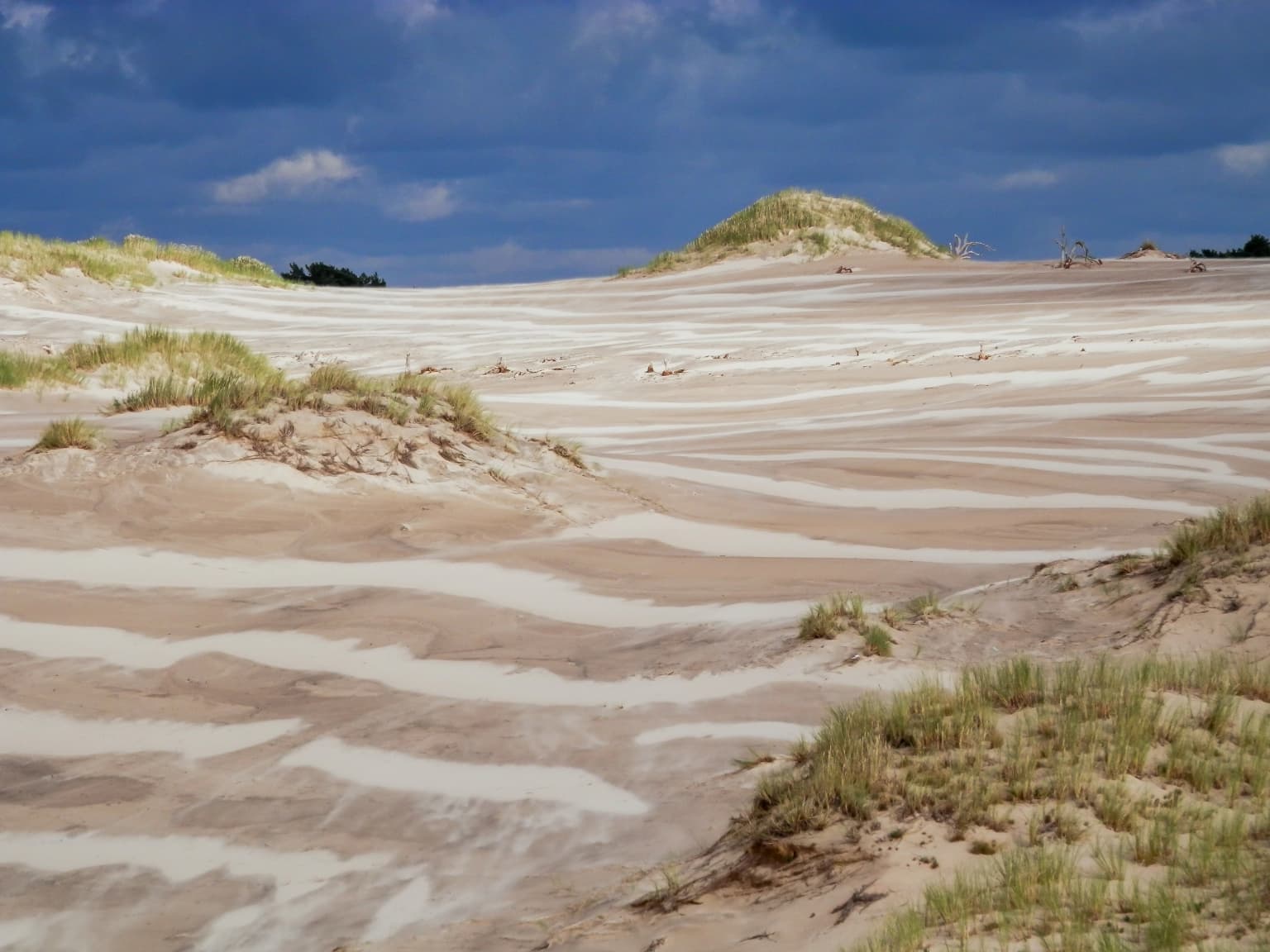
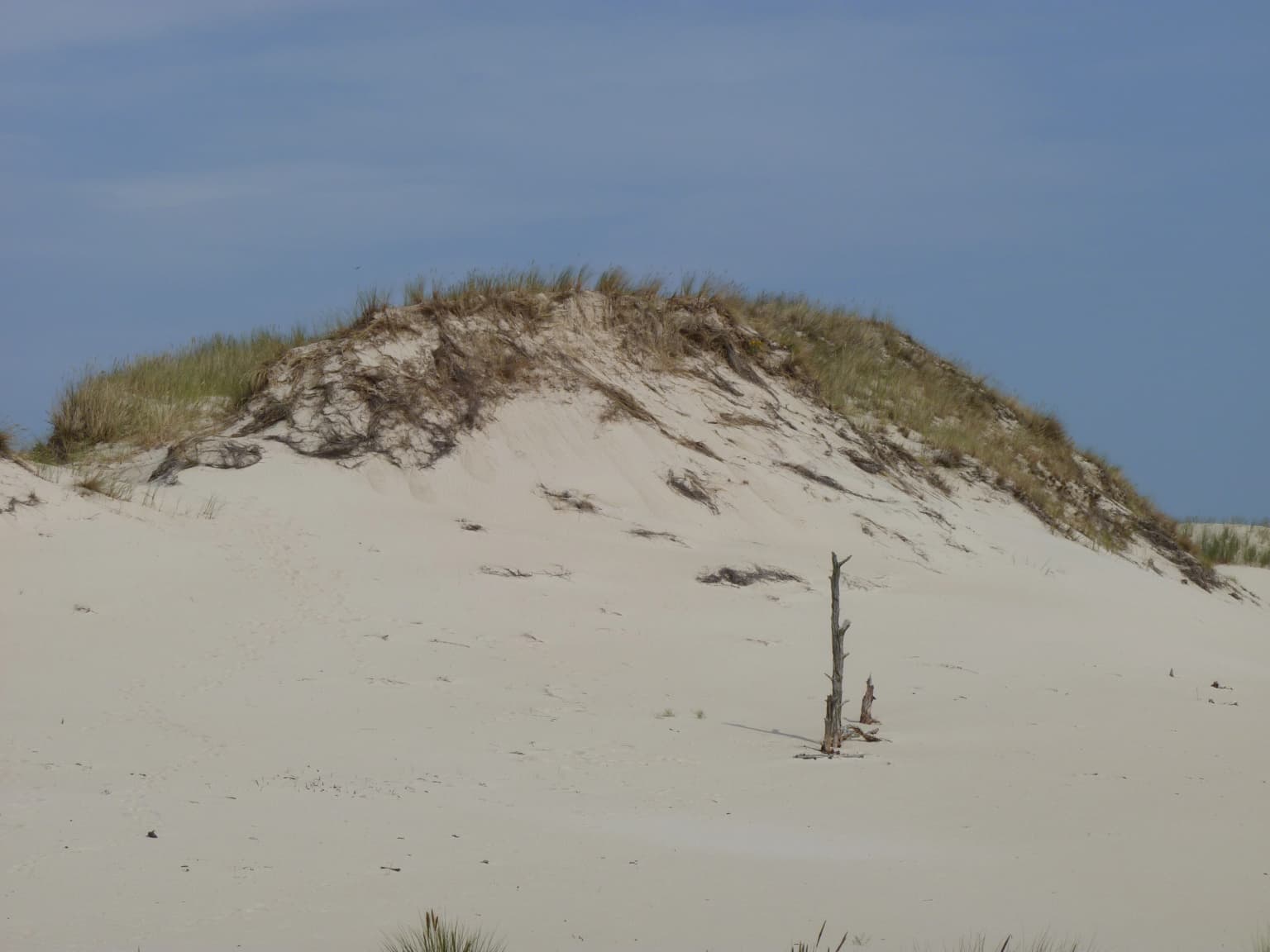
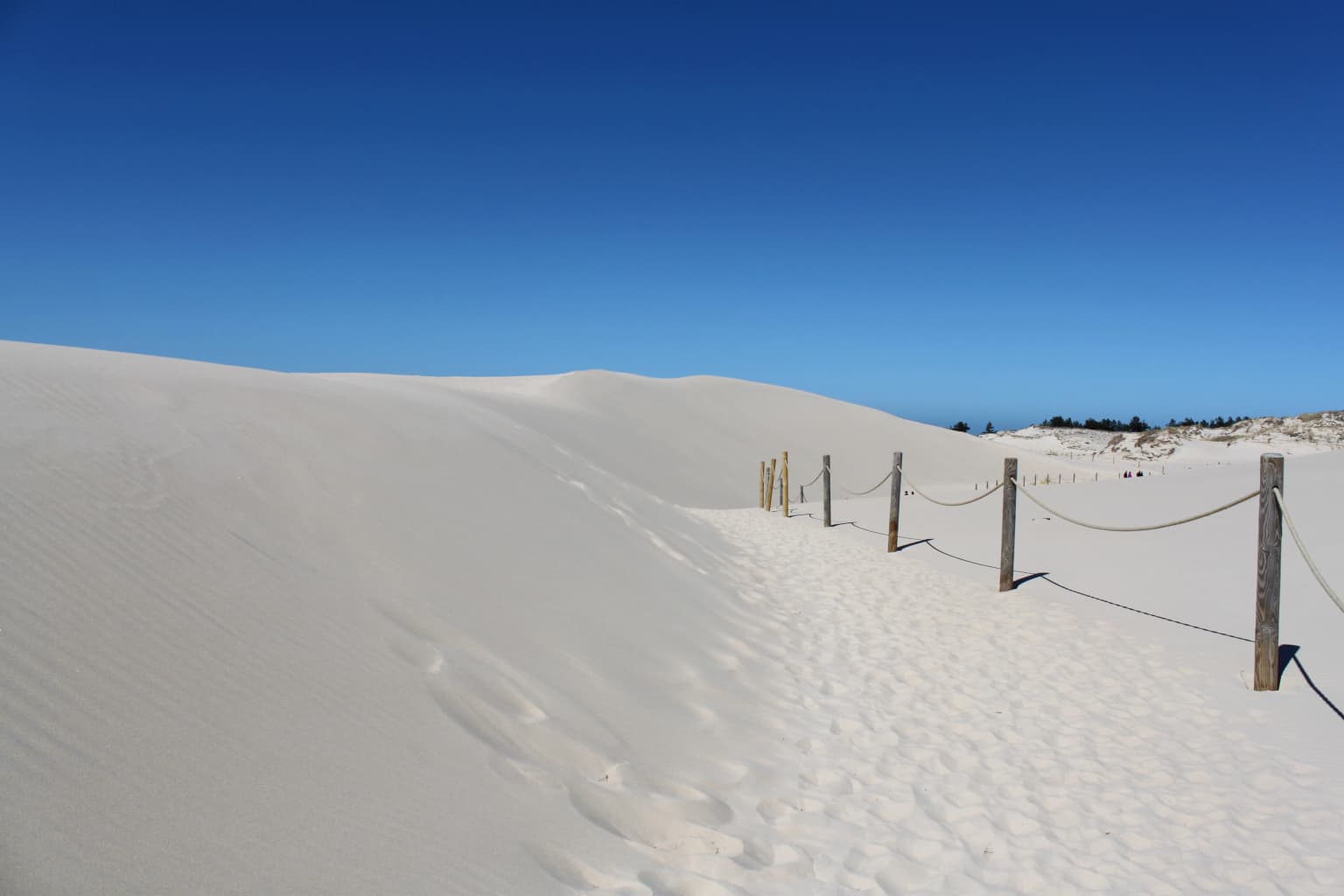
Slovincian National Park is best known for its extraordinary moving sand dunes, a natural phenomenon of European significance. The dunes, some reaching up to 30 meters in height, continuously shift inland across the coastal landscape, creating a dynamic and evolving terrain. The highest point in the park, Rowokół at 115 meters above sea level, offers panoramic views over this unique dune landscape and serves as a sacred site in Kashubian culture. The park is also renowned as a critical migratory bird corridor, hosting over 270 bird species during seasonal migrations across the Baltic Flyway. Its extensive wetlands, including the lakes Łebsko and Gardno, support exceptional biodiversity and provide essential habitat for waterfowl, wading birds, and rare raptor species.

Slovincian National Park history and protected-area timeline

The concept of protecting this coastal landscape emerged in 1946 during a scientific conference held in Łeba, attended by researchers from Poznań and Gdańsk who recognized the exceptional natural value of the region. However, it took another two decades before formal protection was established, with Slovincian National Park officially created on January 1, 1967, covering an initial area of 180.69 square kilometers. The park was named after the Slovincians, a West Slavic people who historically inhabited this remote, swampy region at the edge of Lake Łebsko and whose traditional culture was closely tied to the harsh coastal environment.

In 1977, UNESCO designated the park a biosphere reserve under its Programme on Man and the Biosphere, recognizing its significance for ecological conservation and environmental research. The wetlands received additional international protection in 1995 when they were inscribed as a Ramsar site, acknowledging their importance as a coastal wetland ecosystem of international significance. A major expansion occurred in 2004 when the park grew by 14,675 hectares, including approximately 11,000 hectares of Baltic Sea waters, bringing the total area to 327.44 square kilometers.

Within the park, the village of Kluki preserves elements of Slovincian cultural heritage through an open-air museum showcasing traditional life and customs of this historically marginalized community. The park's administrative headquarters are located in Smołdzino, from which management and conservation activities are coordinated.

Slovincian National Park landscape and geographic character

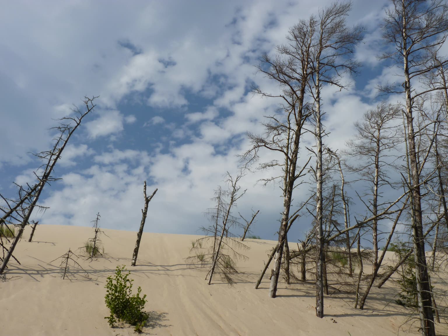
The physical landscape of Slovincian National Park is defined by the dynamic interaction between the Baltic Sea and the coastal mainland, creating a terrain of exceptional geological and visual interest. The most striking feature is the system of moving sand dunes along the Łebska sandbar, a narrow barrier peninsula that separates the chain of coastal lakes from the open sea. These dunes, some reaching heights of 30 meters, are among the tallest and most active in Europe, continuously reshaping the coastline as winds carry sand inland.

The dunes migrate at speeds of 3 to 10 meters annually, occasionally burying vegetation and exposing ancient forest remnants that have been hidden beneath the sand for millennia. In spring 2016, for example, a buried forest several thousand years old was revealed as the dunes shifted, providing researchers with valuable insights into the landscape's ecological history. The highest peak within the park, Rowokół at 115 meters above sea level, rises from the terminal moraine and provides commanding views over the entire park landscape.

The park's hydrological system centers on the coastal lakes Łebsko and Gardno, which together cover over 96 square kilometers and represent the remnants of what were once open bays connected to the Baltic Sea. These shallow, nutrient-rich lakes support extensive wetland communities and serve as critical habitat for waterfowl and migratory birds.

Slovincian National Park ecosystems, habitats, and plant life

The ecological character of Slovincian National Park is defined by the convergence of coastal, wetland, and forest ecosystems within a dynamic landscape shaped by ongoing geological processes. The park protects an exceptional diversity of habitats, from the shifting sands of the coastal dunes through peat bogs, marshes, and meadows to the pine forests that dominate the terrestrial portions of the reserve. This habitat mosaic supports approximately 920 species of vascular plants, 165 species of mosses, 500 species of algae, and 424 species of fungi, with dozens of species receiving strict or partial legal protection.

The wetland environments are particularly significant, with the park's lakes, marshes, and peat bogs forming one of the most important coastal wetland complexes in Poland. The succession of plant communities is clearly visible, from pioneer species on fresh beach sand through dune grasslands to the distinctive coastal pine forests known as Baltic pinewoods. Rare plant species include the marsh grass (Suaeda), Lapland rose, Arctic starflower, round-leaved sundew, and the glacially relict cloudberry, a species that survives in the park as a reminder of the post-glacial period.

Slovincian National Park wildlife and species highlights

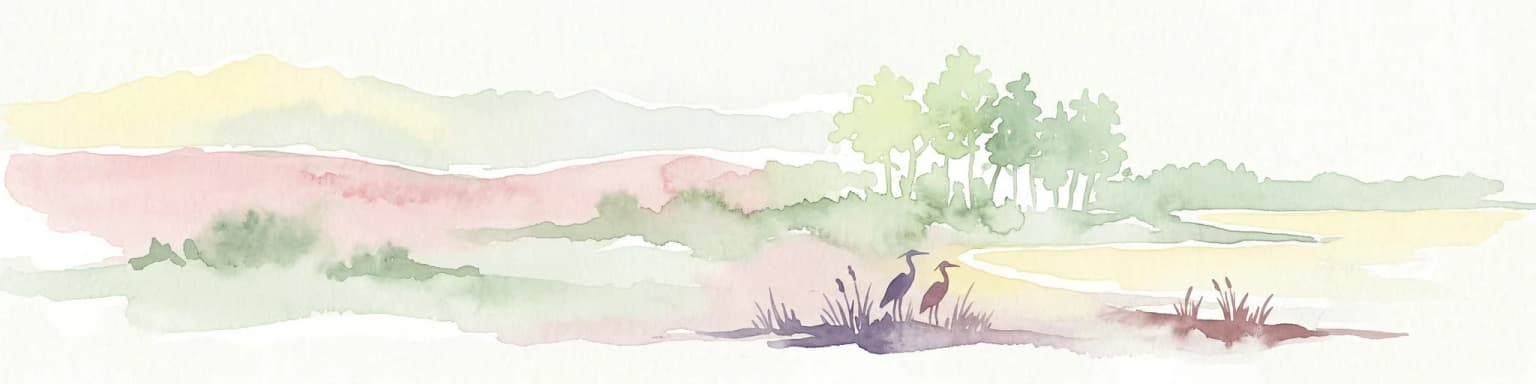
Slovincian National Park is renowned for its exceptional birdlife, with approximately 274 species recorded within its boundaries, of which around 160 species nest locally while others use the area during migration or winter. The park lies along a major migratory flyway, with vast numbers of waterfowl and wading birds passing through during spring and autumn migrations. The shallow coastal lakes and surrounding wetlands provide crucial staging and feeding areas for species traveling between northern breeding grounds and southern wintering areas.

Notable bird species include the white-tailed eagle, eagle owl, whooper swan, and various duck species, with the park supporting important populations of globally significant species such as the red knot during migration. The wet meadows and marshes harbor breeding populations of species including the black-tailed godwit, common redshank, spotted redshank, pintail, and white-fronted goose, while the forests provide habitat for raptors including the golden eagle, lesser spotted eagle, and honey buzzard.

Mammal populations include red deer, wild boar, and hare in the forested areas, with more specialized species such as European beaver and Eurasian otter inhabiting the wetland environments. The park also supports populations of bats, including several rare species, as well as the harbor porpoise and grey seal in the coastal waters.

Slovincian National Park conservation status and protection priorities

Slovincian National Park represents one of Poland's most significant coastal conservation areas, protected through multiple layers of international and national designations. The UNESCO biosphere reserve status, awarded in 1977, recognizes the park's importance as a model area for integrating conservation with sustainable development and environmental education. The Ramsar designation in 1995 specifically acknowledges the international significance of the park's wetlands as habitat for waterfowl and as a coastal ecosystem of exceptional biodiversity value.

The park implements a zoned approach to conservation, with strict protection applied to 13 designated areas covering 53.92 square kilometers where human activity is severely restricted to allow natural processes to proceed without interference. An additional buffer zone (otulina) of approximately 302 square kilometers surrounds the core protected area, providing transitional habitat and allowing for compatible human activities. The park's management focuses on maintaining the natural dynamics of the dune system, preserving wetland hydrology, and protecting the critical migratory bird habitats that make this coastal ecosystem internationally significant.

Slovincian National Park cultural meaning and human context

The park preserves evidence of human presence in this coastal landscape, most notably through its association with the Slovincians, a West Slavic people who historically inhabited the marshy regions around Lake Łebsko. Known also as the Slowincians, this community maintained a distinct cultural identity in this isolated and challenging environment, practicing forms of subsistence based on fishing, small-scale agriculture, and exploitation of the coastal resources. The community was later Germanized but the cultural memory is preserved in the park's name.

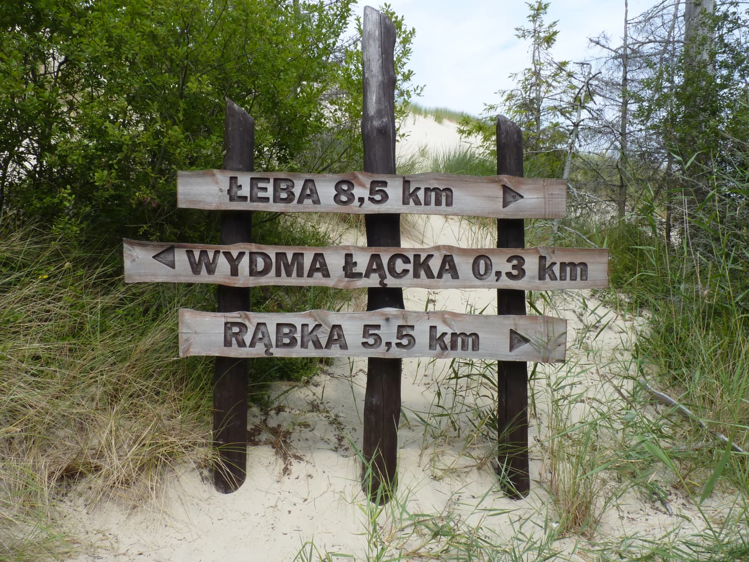
The village of Kluki within the park boundaries houses an open-air museum, the Museum of the Slovincian Village, which showcases traditional architecture, tools, and customs of this historical community. The park also contains the Rowokół hill at 115 meters, which holds cultural significance as a sacred mountain in Kashubian tradition, offering panoramic views over the coastal landscape. Remnants of German military installations from World War II, particularly in the Łebska sandbar area near Rąbka, provide evidence of more recent human activity in this strategic coastal location.

Top sights and standout views in Slovincian National Park

The moving sand dunes of Slovincian National Park are its most distinctive feature, representing one of the most impressive examples of this natural phenomenon in Europe and attracting visitors fascinated by the sight of sand masses slowly migrating across the landscape. The park's wetlands support extraordinary bird diversity during migration seasons, with the coastal lakes and marshes providing essential habitat for species traveling the Baltic Flyway between northern breeding grounds and southern wintering areas. The Rowokół observation point offers one of the most panoramic views in northern Poland, extending over the complex of lakes, dunes, and forest to the Baltic Sea. The park's cultural heritage is preserved through the open-air museum in Kluki, which demonstrates the traditional life of the Slovincian people who gave the park its name.

Park location guide

Geography guide, regional context, and park location map for Slovincian National Park

Slovincian National Park park geography, regions, and map view in Poland
Understand where Slovincian National Park sits in Poland through a broader geographic reading of the surrounding landscape, nearby location context, and its mapped position within the national park landscape.

How Slovincian National Park fits into Poland

Poland, officially the Republic of Poland, is a Central European country spanning from the Baltic Sea in the north to the Carpathian Mountains in the south. It borders Germany, Czech Republic, Slovakia, Ukraine, Belarus, Lithuania, and Kaliningrad Oblast. The country has a temperate climate, diverse landscapes, and is known for its rich history, cultural heritage, and strong economic position within the EU.

Wider geography shaping Slovincian National Park in Poland

Poland occupies 312,696 km2 in Central Europe, extending from the Baltic Sea coast in the north to the Sudetes and Carpathian Mountains in the south. It borders Germany to the west, Czech Republic and Slovakia to the south, Ukraine and Belarus to the east, and Lithuania and Kaliningrad Oblast to the northeast. The landscape includes lowland plains, uplands, and mountain ranges.

Map view of Slovincian National Park

Use this park location map to pinpoint Slovincian National Park in Poland, understand its exact geographic position, and read its mapped placement within the surrounding landscape more clearly.

Pigeon | © OpenStreetMap contributors

Location context for Slovincian National Park

Pomeranian Voivodeship
Park atlas

Trace the Regional Spread of Coastal Dunes, Wetlands, and Forest Reserves Across Northern Poland

Discover More Protected Areas and National Parks Near Slovincian National Park in Coastal Poland
Browse national parks and protected areas located near Slovincian National Park, enabling comparative exploration of similar coastal dunes, extensive wetlands, and rich pine forest ecosystems. This curated atlas view offers essential geographic context for understanding regional conservation efforts and tracing the spread of protected landscapes across Poland's Baltic coast.
Watercolor painting of a river flowing through a forested area with colorful fields
National parkPomeranian Voivodeship

Tuchola Forest National Park: Explore Poland's Largest Protected Woodland and Glacial Lakes

Detailed maps and geographic context of unique forest ecosystems and terrain.

MoriAtlas offers a comprehensive geographic overview of Tuchola Forest National Park, a vital protected area in Pomeranian Voivodeship, Poland. This page delves into the park's identity as Poland's largest contiguous forest, distinguished by its post-glacial landscape. Users can explore the mapped boundaries of its extensive coniferous forests, numerous interconnected glacial lakes, dynamic dunes, and ecologically rich peatlands. It serves as a key entry point for understanding the park's unique terrain and its significant place within the broader regional geography and protected lands atlas.

Area
46.13 km²
Established
1996
IUCN
II
Visitors
33K annual
Watercolor painting depicting mountains, rivers, and green terrain
National parkWest Pomeranian Voivodeship

Wolin National Park: Coastal Protected Landscape and Glacial Terrain in West Pomeranian Voivodeship

Explore Poland's first marine national park and its dynamic geography.

Wolin National Park offers a profound look into Poland's protected coastal geography. This national park in the West Pomeranian Voivodeship is distinguished by its high sea cliffs, inclusion of Baltic Sea and Szczecin Lagoon waters as Poland's first marine protected area, and a landscape sculpted by glacial moraines. Discover the park's complex delta systems, ancient forests, and the mapped terrain that supports significant bird migration, providing a rich focus for atlas exploration.

Area
109.37 km²
Established
1960
IUCN
II
Visitors
1.5M annual
Watercolor painting depicting a river flowing through a forested landscape with hills in the background
National parkWest Pomeranian Voivodeship

Drawa National Park: Protected Landscape and River Geography in West Pomeranian Voivodeship

Explore Poland's unique lowland river and ancient forest protected area.

Drawa National Park stands as a vital protected area within West Pomeranian Voivodeship, Poland, celebrated for its exceptional natural geography. The park's core feature is the Drawa River, which carves a distinctive path with fast-flowing currents and deep valleys, presenting a landscape more akin to mountain streams than typical lowland waterways. This area protects one of Poland's most valuable lowland river corridors, featuring ancient beech and oak forests, the rare meromictic Lake Czarne, and diverse wetland habitats. MoriAtlas facilitates structured exploration of Drawa National Park's mapped terrain and protected landscape identity.

Area
115.36 km²
Established
1990
IUCN
II
Visitors
27K annual
National parkSkåne County

Stenshuvud National Park: Discover Skåne County's Distinctive Baltic Headland National Park

Explore broadleaf forests, heathlands, and panoramic coastal geography.

Stenshuvud National Park is a notable national park in Sweden's Skåne County, characterized by a prominent hill that rises 97 meters above the Baltic Sea. This protected landscape offers a rich diversity of habitats within a small area, including dense broadleaf forests, open heathlands, and coastal terrains. Its unique geographic position and varied ecosystems make it a key destination for exploring protected natural areas, mapped terrain, and regional landscape context within the MoriAtlas platform.

Area
3.9 km²
Established
1986
IUCN
II
Relief
Lowland
Watercolor painting of a coastal landscape featuring trees, birds, and soft pastel-colored hills
National parkKaliningrad Oblast

Curonian Spit National Park: Coastal Dunes and Baltic Protected Landscape

Explore a UNESCO World Heritage sand spit with unique terrain.

Curonian Spit National Park offers a remarkable study in coastal geography and protected landscapes, situated on one of the longest sand spits globally. This protected area within Russia's Kaliningrad Oblast features dynamic dune systems, distinctive forest formations, and serves as a vital corridor for migratory birds. Its UNESCO status underscores its international significance for natural heritage and landscape exploration, providing rich context for regional geography within the MoriAtlas platform.

Area
66 km²
Established
1987
Relief
Lowland
Climate
Temperate
Watercolor painting showing chalk cliffs along a coastline with calm water and distant hills
National parkMecklenburg-Vorpommern

Jasmund National Park: Germany's Coastal Chalk Cliffs and Primeval Forest Landscape

Explore the protected geography of Mecklenburg-Vorpommern's Rügen island.

Jasmund National Park showcases one of Northern Europe's most dramatic natural formations, defined by its striking white chalk cliffs plunging into the Baltic Sea and its UNESCO-recognized primeval beech forests. This protected area offers a profound look into geological heritage and undisturbed forest ecosystems. Navigate its mapped boundaries and understand its unique landscape context within the Mecklenburg-Vorpommern region through detailed atlas exploration on MoriAtlas.

Area
30 km²
Established
1990
IUCN
II
Visitors
300K annual
Watercolor painting of a landscape with a river flowing through grassy fields, trees, and mountains in the background
National park

Curonian Spit National Park: Mapped Sand Dunes and Baltic Protected Landscape

Explore the unique geography of this Baltic national park.

Curonian Spit National Park represents a remarkable synthesis of natural processes and cultural heritage along the Lithuanian coast. Dominated by dramatic sand dunes, including the famed grey dunes of Nagliai and active dunes at Parnidžio, this national park showcases dynamic landscape evolution. Its designation as a UNESCO World Heritage site underscores its global importance as a protected area safeguarding unique coastal ecosystems and migratory bird pathways. MoriAtlas provides detailed mapping context for this exceptional protected landscape, enabling structured exploration of its geographic features and ecological significance.

Area
264.74 km²
Established
1991
IUCN
II
Visitors
400K annual
Watercolor painting depicting a river flowing through a valley with green vegetation and distant mountains
National parkBrandenburg

Lower Oder Valley National Park: Unique Polder Landscape and Bird Sanctuary

Discover protected area maps and regional geography in Brandenburg

Delve into the Lower Oder Valley National Park, a national park recognized for its extraordinary polder landscape and extensive wetland ecosystems. This page provides detailed geographic context, highlighting the park's unique engineered floodplain, its role as a sanctuary for numerous bird species, and its position within the regional geography of Brandenburg. Understand the mapped boundaries and ecological importance of this exceptional protected area.

Area
103.23 km²
Established
1995
IUCN
II
Visitors
150K annual

Common questions about visiting, size, designation, and location context for Slovincian National Park

Slovincian National Park FAQs for park facts, access, geography, and protected area context
Find quick answers about Slovincian National Park, including protected-area facts, park geography, trail and visitor context, and how the park fits into its surrounding country and regional landscape.
MoriAtlas Explorer

Continue Your Protected Areas Search Across the Global Atlas

Deepen your exploration by continuing the structured search for national parks and protected areas worldwide. Utilize the comprehensive filtering capabilities to compare different conservation landscapes and refine your understanding of global park geography. Discover more about the distribution and characteristics of protected natural areas.

Global natural geography