Mori Atlas logo
National parkLower Oder Valley National Park

Explore the mapped protected area and distinct geography of Brandenburg's vital wetland

Lower Oder Valley National Park: Germany's Unique Engineered Floodplain Landscape

(Nationalpark Unteres Odertal)

Lower Oder Valley National Park represents Germany's sole remaining intact polder landscape, a remarkable engineered floodplain system shaped by centuries of human intervention along the Oder River. This national park, situated in Brandenburg, offers a unique geographic context for understanding wetland conservation and hydrological dynamics through its meticulously mapped dikes and seasonally flooded meadows. It serves as a critical hub for biodiversity and a key site for exploring the intersection of protected lands and regional geography within Central Europe.

floodplain wetlandscross-border protected areabirdwatchingpolder landscapeNatura 2000riparian ecosystems
Winding river flowing through a floodplain valley with grassy fields, scattered trees, and a sky with pink and orange clouds during sunset

Lower Oder Valley National Park

National park

Park overview

Structured park overview, official facts, and landscape profile for Lower Oder Valley National Park

Lower Oder Valley National Park park facts, protected area profile, and essential visitor context
Review the core facts for Lower Oder Valley National Park, including designation, size, terrain, visitor scale, habitats, and operating context in one park-focused overview.

About Lower Oder Valley National Park

Lower Oder Valley National Park protects one of Germany's most ecologically significant floodplain landscapes where the Oder River forms part of the border between Germany and Poland. The park was established in 1997 as the German component of the larger Lower Oder Valley International Park, a transboundary conservation initiative that emerged from German-Polish environmental cooperation beginning in 1992. The landscape represents a unique hydro-engineered system where a network of winter and summer dikes controls flooding, creating a dynamic wetland that mimics natural flood pulses while maintaining agricultural use of the meadows.

The park extends two to eight kilometers in width along the German bank of the Oder, with the steep eastern Polish bank rising sharply to elevations of around 100 meters above sea level. The western shore features a flat terrain of former river channels, floodplains, and engineered polder basins that are deliberately flooded during winter and spring months. This flooding regime sustains the ecological character of the meadows and provides critical habitat for breeding and migrating birds. The park includes approximately 200 kilometers of marked trails, three educational paths, and observation towers including one at Stützkow and another at Mescherin.

The transboundary character of the reserve is essential to its ecological function. Together with the Polish Lower Odra Valley Landscape Park and adjacent nature reserves on both sides, the protected area forms a contiguous ecological corridor spanning roughly 60 kilometers along the river and covering over 1,170 square kilometers in total. This cross-border cooperation enables the movement of wildlife and maintains ecological connectivity across what would otherwise be a barriers created by national boundaries.

Quick facts and research context for Lower Oder Valley National Park

Located in the Uckermark district of Brandenburg, Germany, and the Gryfino and Police counties of Poland, Lower Oder Valley National Park protects Germany's only intact polder system. The park was established in 1997 and covers 165 square kilometers total, with the German portion spanning approximately 105 square kilometers. The park is part of a larger 1,172 square kilometer cross-border nature reserve created through German-Polish cooperation in 1992. The area features a unique flooding regime where winter dikes are opened to flood the polder meadows from December through April, creating vital habitat for migratory waterbirds. The park's visitor center is located in Criewen, near Schwedt, and the area supports sustainable agriculture with about 30 farming operations practicing nature-friendly grassland management.

Park context

Deeper park guide and search-rich context for Lower Oder Valley National Park

Lower Oder Valley National Park history, landscape, wildlife, and travel context
Explore Lower Oder Valley National Park through its history, landscape character, ecosystems, wildlife, conservation priorities, cultural context, and seasonal travel timing in a structured park guide built for atlas discovery and search intent.

Why Lower Oder Valley National Park stands out

Lower Oder Valley National Park is best known for being Germany's only remaining intact polder landscape, a Dutch-style engineered floodplain system that has no parallel elsewhere in the country. The park is renowned as a premier birdwatching destination, hosting the largest breeding colony of the black tern in Germany and significant populations of species such as the black stork, corn crake, and aquatic warbler. The seasonal flooding creates one of Central Europe's most important staging areas for migratory waterbirds, with thousands of cranes and swans gathering here during autumn migration. The park also features rare Mediterranean vegetation including the pubescent oak at the northern edge of its range, and supports populations of European otters and beavers in its waterways.

Wide landscape of the Oder River with a gravel path along the riverbank, green fields, and distant tree-lined hills under a clear blue sky
Scenic view of the Oder River flowing through Lower Oder Valley National Park

Lower Oder Valley National Park history and protected-area timeline

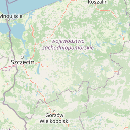
The Lower Oder Valley's protection evolved from growing recognition of the area's ecological significance and the need for transboundary conservation between Germany and Poland. Following the reunification of Germany and the improvement of relations with Poland in the early 1990s, the German-Polish Environmental Council initiated discussions in 1992 about establishing a joint nature reserve covering the lower Oder valley. Environment ministers from both countries, along with the Brandenburg state government and the voivode of Szczecin, created the Lower Oder Valley International Park as a framework for coordinated conservation across the border.

The German portion was formally established as Nationalpark Unteres Odertal in 1995 and officially opened in September of that year, with the legal framework finalized through the National Park Act of 1995 (NatPUOG). The park was later expanded and its management framework modified through a legislative revision in 2006, which adjusted the timeline for establishing fully protected zones and set a target of 50.1 percent of the area as strictly protected total reserves. The park administration is based at the National Park Center in Criewen, located on the grounds of a historic manor. The area had historically been used for agriculture and as flood protection zones, with the polder system dating back to Dutch-style engineering interventions that transformed the floodplain over centuries.

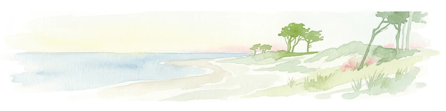
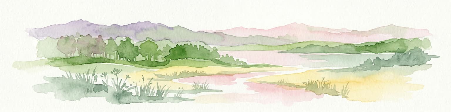
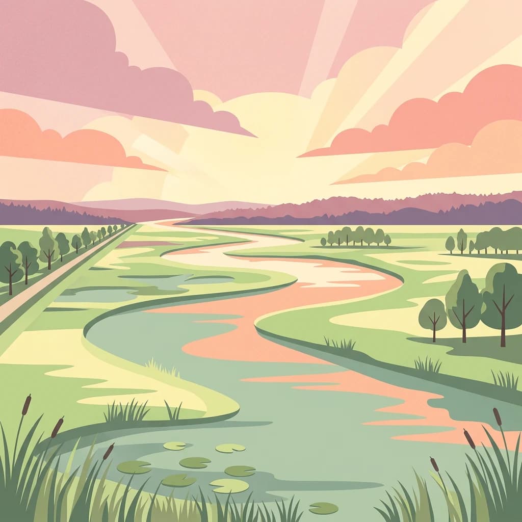
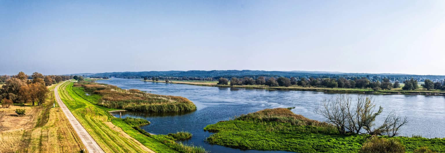
Lower Oder Valley National Park landscape and geographic character

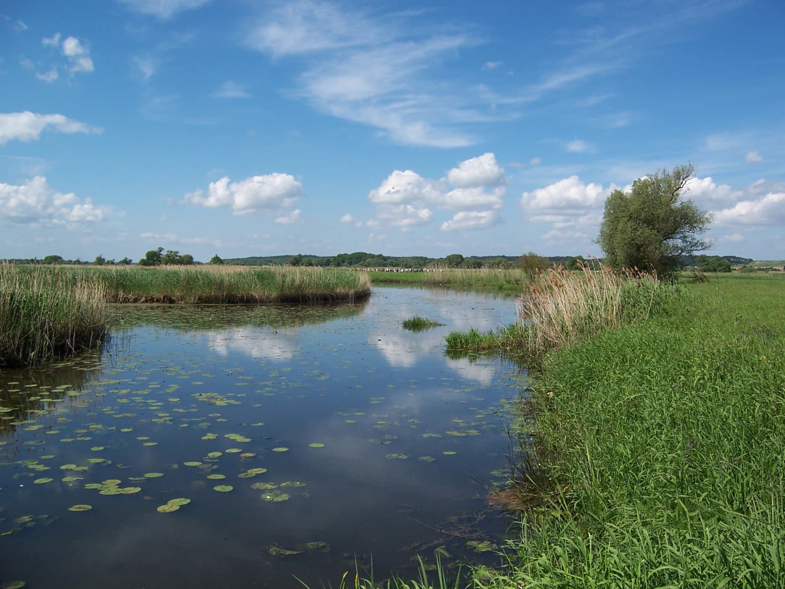
The physical landscape of Lower Oder Valley National Park is defined by the Oder River's floodplain and the engineered polder system that characterizes the German bank. The western side of the river features a nearly flat terrain of alluvial meadows, former river channels, and low-lying basins protected by a system of winter dikes running along the valley edge and summer dikes closer to the river channel. This polder landscape, modeled on Dutch drainage techniques, is unique in Germany and represents one of the last remaining intact systems of its kind in Central Europe.

The eastern bank in Poland rises more steeply, with bluffs and slopes reaching elevations around 100 meters above sea level. These steeper slopes support different ecological communities including remnants of original oak forests on particularly rugged terrain. The transition between the flat floodplain and the rising uplands creates a visually distinct landscape that defines the valley's character. The park also incorporates the Hohensaaten-Friedrichsthaler Wasserstraße, a parallel navigation canal that influences the hydrology of the western shore. The overall impression is one of expansive open wetland scenery, with distant horizons broken only by the line of dikes, scattered farmsteads, and the occasional observation tower.

River floodplain with calm water reflecting clouds, surrounded by tall reeds and green vegetation under a blue sky
River floodplain with reeds and water lilies in Lower Oder Valley National Park

Lower Oder Valley National Park ecosystems, habitats, and plant life

The ecological character of Lower Oder Valley National Park centers on its dynamic floodplain ecosystem, which operates under a managed flooding regime that mimics natural pulse dynamics. The winter flooding of the polder meadows from December through April creates extensive shallow water habitat that attracts large numbers of migratory birds and supports breeding populations of wetland species. The subsequent drainage in spring allows the meadows to be used for hay production and livestock grazing during summer and autumn, maintaining the traditional open grassland character of the landscape.

The park contains important habitats for numerous species listed under European conservation directives. The meadows serve as breeding grounds for the aquatic warbler, corn crake, and black stork, while the riparian woodlands and forest patches on the valley slopes provide nesting habitat for species including the golden oriole. The aquatic environment supports populations of European otters and beavers, both of which have recovered from historical persecution. The presence of the pubescent oak on the valley slopes represents a notable botanical feature, as this Mediterranean species reaches near its northern limit here. The overall ecosystem represents a mosaic of floodplain wetlands, grasslands, riparian forests, and slope woodlands that supports high biodiversity within a relatively small area.

Wet meadow with patches of water reflecting sky, surrounded by grassy areas and a tree on the left
Wet meadow with shallow water and grassy vegetation under a partly cloudy sky

Lower Oder Valley National Park wildlife and species highlights

Lower Oder Valley National Park supports an exceptional concentration of birdlife, particularly during migration periods when the flooded meadows provide critical staging habitat for waterfowl and waders. The park is designated as a Special Protection Area under European law due to its importance for breeding and migratory birds. Notable species include the black stork, which breeds in the woodland patches on the valley slopes, and the aquatic warbler, a globally threatened songbird that nests in the reed beds and wet meadows. The corn crake, another species of conservation concern, breeds in the tall grassland of the floodplains.

The park hosts the largest breeding colony of black terns in Germany and supports significant populations of species including the common snipe, redshank, and lapwing. During autumn migration, thousands of cranes gather in the park before their journey south, and whooper and Bewick's swans stage here in large numbers. Among the mammals, the European otter and European beaver have established sustainable populations in the river and canal systems. The park has also documented occasional visits from migrating elk. A reintroduction program for Atlantic sturgeon has been ongoing since 2006, with juvenile fish released into the Oder to restore this historically extirpated species.

Flooded wetland with leafless trees reflecting in calm water under clear blue sky
Flooded polder landscape in winter at Lower Oder Valley National Park

Lower Oder Valley National Park conservation status and protection priorities

Lower Oder Valley National Park plays a significant role in European conservation as part of the Natura 2000 network and as the German component of a transboundary protected area spanning the German-Polish border. The park's conservation value derives primarily from its floodplain ecosystem, which provides habitat for numerous species protected under the EU Birds and Habitats Directives. The managed flooding regime, while artificially maintained through the dike system, successfully replicates the ecological functions of natural floodplains that have been lost in most of Central Europe.

The park faces ongoing challenges related to its dual function as a nature reserve and an agricultural landscape. Approximately 4,700 hectares of grassland within the park remain under agricultural use, with about 30 farming operations maintaining around 2,500 mother cows, 550 dairy cows, and 3,500 sheep. These operations receive funding through contractual nature conservation agreements that support measures such as breeding bird protection, dry grassland management, and restrictions on fertilizer use. The 2022 environmental disaster involving mass fish deaths in the Oder, caused by harmful algal blooms likely related to industrial pollution, demonstrated the vulnerability of the park's aquatic ecosystems to external threats and underscored the importance of cross-border water quality cooperation.

Lower Oder Valley National Park cultural meaning and human context

The Lower Oder Valley has a long history of human settlement and agricultural use that has shaped the landscape over centuries. The polder system represents a tradition of floodplain management inherited from Dutch engineering practices that transformed the wetland into productive meadows. The valley has historically served as a transportation corridor and boundary region between German and Polish territories, a role reflected in the transboundary nature of the contemporary protected area.

The village of Criewen, where the National Park Center is located, preserves elements of rural heritage associated with the floodplain's agricultural history. The ruins of Stolpe Castle on a hill south of Schwedt offer cultural interest and provide panoramic views over the valley. The Oder-Neiße cycle path, which follows the course of the river and the park's dike system, passes through the area, connecting the landscape to the broader context of German-Polish reconciliation and cooperation that followed World War II and the normalization of relations between the two countries.

Wooden observation tower with multiple viewing platforms and a staircase, surrounded by trees under a clear blue sky
Observation tower Mescherin in Lower Oder Valley National Park

Top sights and standout views in Lower Oder Valley National Park

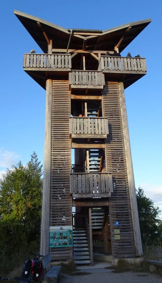
The park's most distinctive feature is its unique polder system, Germany's only intact engineered floodplain landscape where seasonal flooding creates exceptional bird habitat. The observation tower at Mescherin provides one of the best vantage points for observing the autumn crane migration, when thousands of birds gather in the wetlands before heading south. The park supports breeding populations of several globally threatened bird species, including the aquatic warbler and black stork, making it a destination of international importance for ornithologists. The transboundary cooperation between Germany and Poland, represented by the broader International Park, demonstrates how shared ecosystems can be protected through coordinated international management.

Four panels showing flooded polder landscapes with trees, water reflections, and varying vegetation across seasons
Four seasonal views of the Oder Polder within Lower Oder Valley National Park

Best time to visit Lower Oder Valley National Park

The Lower Oder Valley offers distinct seasonal experiences throughout the year. Spring and early summer, from April through June, are ideal for observing breeding birds including black terns, black storks, and corn crakes in the meadows and wetlands. The autumn months of September and October bring the spectacular crane migration, when thousands of birds gather in the flooded areas and can be observed from the observation towers, particularly around the time of the regular crane weeks held in the park. Winter, when the polder meadows are flooded, transforms the landscape and provides excellent opportunities for birdwatching as waterfowl congregate in the shallow wetlands. The summer months allow for walking and cycling on the extensive trail network when the meadows have been drained and the grass is available for recreational use.

Park location guide

Geography guide, regional context, and park location map for Lower Oder Valley National Park

Lower Oder Valley National Park park geography, regions, and map view in Germany
Understand where Lower Oder Valley National Park sits in Germany through a broader geographic reading of the surrounding landscape, nearby location context, and its mapped position within the national park landscape.

How Lower Oder Valley National Park fits into Germany

Germany is a federal republic in Western and Central Europe with a population of over 83 million across sixteen constituent states. It is Europe's largest economy by nominal GDP and a major global exporter and importer. The capital is Berlin, and the country borders Denmark, Poland, Czech Republic, Austria, Switzerland, France, Luxembourg, Belgium, and the Netherlands.

Wider geography shaping Lower Oder Valley National Park in Germany

Germany is located in Western and Central Europe, spanning 357,022 km². It borders Denmark to the north, Poland and the Czech Republic to the east, Austria and Switzerland to the south, and France, Luxembourg, Belgium, and the Netherlands to the west. The country has coastlines on the Baltic Sea and North Sea to the north, with the Alps located in the southern region.

Map view of Lower Oder Valley National Park

Use this park location map to pinpoint Lower Oder Valley National Park in Germany, understand its exact geographic position, and read its mapped placement within the surrounding landscape more clearly.

Pigeon | © OpenStreetMap contributors

Location context for Lower Oder Valley National Park

Brandenburg

Uncover the unique floodplain ecosystems, engineered polder systems, and diverse wetland habitats through compelling park imagery

Lower Oder Valley National Park: Visualizing the Polder Landscape and Wetland Scenery
Browse a visual gallery showcasing the distinctive landscapes of Lower Oder Valley National Park, including its unique polder system, expansive floodplain wetlands, and crucial bird habitats along the Oder River. These park images offer essential insight into the protected area's engineered terrain, diverse ecosystems, and the seasonal character of its water-rich environment.

Wide landscape of the Oder River with a gravel path along the riverbank, green fields, and distant tree-lined hills under a clear blue sky

Aerial view of green meadows with winding rivers and small lakes under a clear blue sky

River floodplain with calm water reflecting clouds, surrounded by tall reeds and green vegetation under a blue sky

Wet meadow with patches of water reflecting sky, surrounded by grassy areas and a tree on the left

Flooded wetland with leafless trees reflecting in calm water under clear blue sky

Misty field with two prominent trees under a pale orange sky

Wooden observation tower with multiple viewing platforms and a staircase, surrounded by trees under a clear blue sky

Four panels showing flooded polder landscapes with trees, water reflections, and varying vegetation across seasons

Three Heck cattle with large horns grazing in a tall grassy meadow with wildflowers

Calm river reflecting trees and sky, surrounded by green vegetation and trees

River Oder with snow-covered bank, grassy shoreline, and distant hills under a clear sky

Flooded landscape at sunrise with bare trees partially submerged in water, reflecting sunlight

Concrete slab path surrounded by flooded wetland with patches of grass and water under overcast sky

Wide landscape view of the Oder River flowing through lush green floodplain with rolling hills under a partly cloudy sky.

Grass field extending to a frozen water body with sparse trees and distant forest under cloudy sky

Park atlas

Trace the regional spread of protected wetlands and floodplain ecosystems across Germany and Poland

Explore National Parks and Protected Areas Near Lower Oder Valley National Park, Germany, and Bordering Regions
After exploring Lower Oder Valley National Park, browse other national parks and protected areas across Germany's Brandenburg region and the bordering Polish landscapes. Compare diverse floodplain wetlands, riparian ecosystems, and cross-border conservation efforts to understand the broader regional spread of protected geography.
Watercolor illustration showing a river winding through rolling green hills with sparse vegetation
National parkLubusz Voivodeship

Warta Mouth National Park: A National Park Protecting Vital European Wetlands

Explore mapped protected areas and bird habitats in Lubusz Voivodeship.

Warta Mouth National Park, located in Poland's Lubusz Voivodeship, is a significant protected landscape safeguarding the ecologically rich confluence of the Warta and Oder rivers. As the nation's most recently established national park, it provides critical habitat for a vast array of migratory and breeding bird species within its extensive marshlands and floodplains. This park offers a unique opportunity for atlas-driven exploration of Central European wetland geography and the mapped boundaries of a vital conservation area.

Area
80.38 km²
Established
2001
IUCN
II
Visitors
52K annual
Watercolor painting depicting a river flowing through a forested landscape with hills in the background
National parkWest Pomeranian Voivodeship

Drawa National Park: Protected Landscape and River Geography in West Pomeranian Voivodeship

Explore Poland's unique lowland river and ancient forest protected area.

Drawa National Park stands as a vital protected area within West Pomeranian Voivodeship, Poland, celebrated for its exceptional natural geography. The park's core feature is the Drawa River, which carves a distinctive path with fast-flowing currents and deep valleys, presenting a landscape more akin to mountain streams than typical lowland waterways. This area protects one of Poland's most valuable lowland river corridors, featuring ancient beech and oak forests, the rare meromictic Lake Czarne, and diverse wetland habitats. MoriAtlas facilitates structured exploration of Drawa National Park's mapped terrain and protected landscape identity.

Area
115.36 km²
Established
1990
IUCN
II
Visitors
27K annual
Watercolor painting depicting mountains, rivers, and green terrain
National parkWest Pomeranian Voivodeship

Wolin National Park: Coastal Protected Landscape and Glacial Terrain in West Pomeranian Voivodeship

Explore Poland's first marine national park and its dynamic geography.

Wolin National Park offers a profound look into Poland's protected coastal geography. This national park in the West Pomeranian Voivodeship is distinguished by its high sea cliffs, inclusion of Baltic Sea and Szczecin Lagoon waters as Poland's first marine protected area, and a landscape sculpted by glacial moraines. Discover the park's complex delta systems, ancient forests, and the mapped terrain that supports significant bird migration, providing a rich focus for atlas exploration.

Area
109.37 km²
Established
1960
IUCN
II
Visitors
1.5M annual
Watercolor painting of a landscape with a lake, trees, and distant hills
National parkMecklenburg-Vorpommern

Müritz National Park: Explore Protected Beech Forests and Glacial Lakelands in Mecklenburg-Vorpommern

Germany's largest national park: mapped boundaries and terrain.

Müritz National Park represents a significant protected landscape within northeastern Germany's Mecklenburg-Vorpommern region. Its expansive territory encompasses not only Germany's largest lake, Müritz, but also substantial tracts of ancient beech forests awarded UNESCO World Heritage status. Users can explore the park's glacial terrain, its intricate network of lakes and wetlands, and understand its position within the regional geography, making it a key destination for structured atlas-based discovery of German protected areas.

Area
318 km²
Established
1990
IUCN
II
Watercolor painting showing chalk cliffs along a coastline with calm water and distant hills
National parkMecklenburg-Vorpommern

Jasmund National Park: Germany's Coastal Chalk Cliffs and Primeval Forest Landscape

Explore the protected geography of Mecklenburg-Vorpommern's Rügen island.

Jasmund National Park showcases one of Northern Europe's most dramatic natural formations, defined by its striking white chalk cliffs plunging into the Baltic Sea and its UNESCO-recognized primeval beech forests. This protected area offers a profound look into geological heritage and undisturbed forest ecosystems. Navigate its mapped boundaries and understand its unique landscape context within the Mecklenburg-Vorpommern region through detailed atlas exploration on MoriAtlas.

Area
30 km²
Established
1990
IUCN
II
Visitors
300K annual
Watercolor illustration showing a coastal lagoon with sandy shoreline, calm water, sand dunes, and sparse vegetation including trees and grasses
National parkMecklenburg-Vorpommern

Western Pomerania Lagoon Area National Park: Detailed Geographic and Protected Landscape Context

Explore its mapped boundaries and unique Baltic Sea coastal geography.

Western Pomerania Lagoon Area National Park is a vital protected landscape in Mecklenburg-Vorpommern, renowned for its complex network of peninsulas, islands, and extremely shallow brackish 'bodden' waters. This page serves as an atlas entry, detailing the park's geographic features, its distinctive wind-driven water level fluctuations, and its ecological importance as a major migratory bird staging area. Users can investigate the mapped extent of this significant German national park and understand its unique place within the regional geography.

Area
805 km²
Established
1990
IUCN
II
Relief
Lowland
National park

Wielkopolska National Park: Poland's Glacial Landscape and Lake District Protected Area

Explore the mapped terrain and protected landscape.

Wielkopolska National Park is a vital protected landscape in western Poland, notable for its characteristic post-glacial terrain. Featuring a landscape defined by numerous kettle lakes nestled within mixed forests and gently rolling hills, this national park offers a representative sample of the Greater Poland lake district's natural heritage. Its mapped boundaries delineate an area of ecological importance, providing valuable context for understanding regional geography and protected area distribution through structured atlas exploration.

Watercolor painting of a river flowing through a forested area with colorful fields
National parkPomeranian Voivodeship

Tuchola Forest National Park: Explore Poland's Largest Protected Woodland and Glacial Lakes

Detailed maps and geographic context of unique forest ecosystems and terrain.

MoriAtlas offers a comprehensive geographic overview of Tuchola Forest National Park, a vital protected area in Pomeranian Voivodeship, Poland. This page delves into the park's identity as Poland's largest contiguous forest, distinguished by its post-glacial landscape. Users can explore the mapped boundaries of its extensive coniferous forests, numerous interconnected glacial lakes, dynamic dunes, and ecologically rich peatlands. It serves as a key entry point for understanding the park's unique terrain and its significant place within the broader regional geography and protected lands atlas.

Area
46.13 km²
Established
1996
IUCN
II
Visitors
33K annual

Common questions about visiting, size, designation, and location context for Lower Oder Valley National Park

Lower Oder Valley National Park FAQs for park facts, access, geography, and protected area context
Find quick answers about Lower Oder Valley National Park, including protected-area facts, park geography, trail and visitor context, and how the park fits into its surrounding country and regional landscape.
MoriAtlas Explorer

Continue Your Protected Areas Search Across the Global Atlas

Deepen your exploration by continuing the structured search for national parks and protected areas worldwide. Utilize the comprehensive filtering capabilities to compare different conservation landscapes and refine your understanding of global park geography. Discover more about the distribution and characteristics of protected natural areas.

Global natural geography