Mori Atlas logo
National parkWestern Pomerania Lagoon Area National Park

Discover the unique coastal geography, bodden waters, and migratory bird staging grounds.

Western Pomerania Lagoon Area National Park: A Mapped Protected Landscape in Mecklenburg-Vorpommern

(Nationalpark Vorpommersche Boddenlandschaft)

Western Pomerania Lagoon Area National Park represents a significant protected landscape along Germany's Baltic Sea coast, within the state of Mecklenburg-Vorpommern. This national park offers a distinctive geographic profile characterized by intricate coastal formations, shallow brackish lagoon systems known as 'bodden waters,' and extensive shallow marine zones. As a key component of MoriAtlas's geographic exploration platform, this page provides detailed insight into the park's mapped boundaries, its unique wind-driven tidal dynamics, and its critical role as a resting and feeding area for migratory birds.

national parksBaltic Seacoastal lagoonsmigratory birdscrankswetlands
Illustration of coastal beach with sand dunes, green trees, and calm sea under partly cloudy sky

Western Pomerania Lagoon Area National Park

National park

Park overview

Structured park overview, official facts, and landscape profile for Western Pomerania Lagoon Area National Park

Western Pomerania Lagoon Area National Park park facts, protected area profile, and essential visitor context
Review the core facts for Western Pomerania Lagoon Area National Park, including designation, size, terrain, visitor scale, habitats, and operating context in one park-focused overview.

About Western Pomerania Lagoon Area National Park

Western Pomerania Lagoon Area National Park represents one of Germany's most significant coastal protection areas, established in 1990 as part of the German Democratic Republic's national park program. The park spans a remarkable diversity of coastal ecosystems, from open Baltic Sea waters to the sheltered, shallow lagoon systems known as bodden that characterize this section of the German coastline. The complex geography includes several peninsulas extending into the Baltic Sea, multiple islands of varying sizes, and the intricate network of lagoons that separate and connect these landmasses.

The park's ecological significance stems largely from its role as a transitional zone between freshwater and marine environments. The bodden lagoons maintain brackish water conditions with variable salinity levels that support specialized plant and animal communities. This ecological diversity is further enhanced by the park's position along the East Atlantic Flyway, making it a critical waystation for millions of migratory birds traveling between their breeding grounds in northern Europe and wintering areas in southern Europe and beyond.

Visitors to the park encounter a landscape shaped by the dynamic forces of wind, water, and coastal processes. The eastern coastline features dramatic cliff formations, particularly on Hiddensee, while western shores present more open, sandy beaches. The inland areas include extensive forests, coastal wetlands, and former agricultural lands now undergoing ecological restoration. The park's management approach emphasizes allowing natural processes to continue with minimal human intervention, recognizing that the dynamic coastal environment is itself a essential component of the ecosystem's ecological integrity.

Quick facts and research context for Western Pomerania Lagoon Area National Park

Western Pomerania Lagoon Area National Park is located in the Vorpommern-Rügen district of Mecklenburg-Vorpommern, Germany, with nearby cities including Rostock and Stralsund. Established on October 1, 1990 as part of the former East Germany's national park program, it protects approximately 805 square kilometers of coastal landscape. The park encompasses roughly half open Baltic Sea waters and just over a quarter lagoon systems, with the remaining area consisting of peninsular and island landmasses. The brackish water environments support distinctive biodiversity adapted to variable salinity, while the wind-driven water level fluctuations known as "Windwatten" create critical feeding grounds for migratory waterfowl. The park contains the Darß Forest and other woodland areas dominated by pine and beech species.

Park context

Deeper park guide and search-rich context for Western Pomerania Lagoon Area National Park

Western Pomerania Lagoon Area National Park history, landscape, wildlife, and travel context
Explore Western Pomerania Lagoon Area National Park through its history, landscape character, ecosystems, wildlife, conservation priorities, cultural context, and seasonal travel timing in a structured park guide built for atlas discovery and search intent.

Why Western Pomerania Lagoon Area National Park stands out

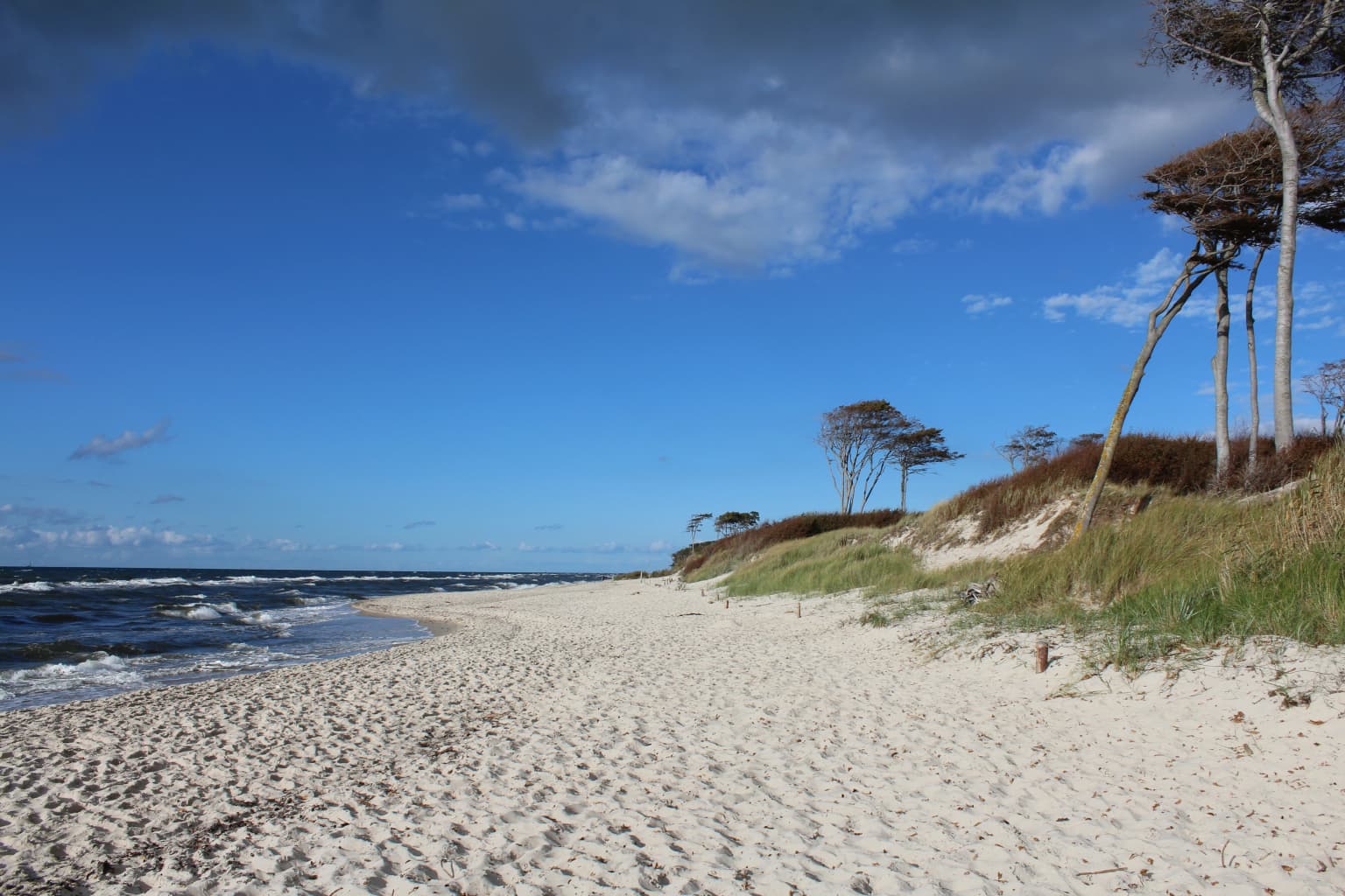
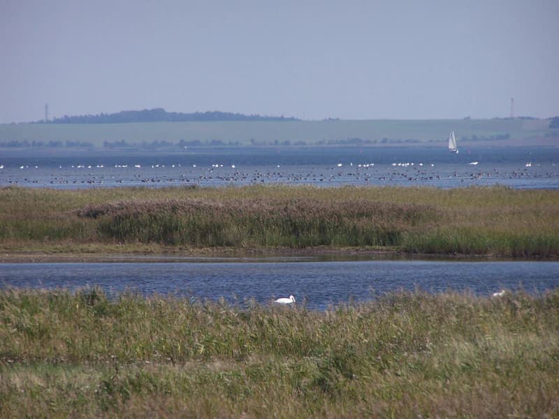
The park is especially renowned as one of Western Europe's most important autumn staging areas for migratory cranes. Each year, approximately 60,000 grey cranes stop in the lagoon areas between September and November, using the shallow waters and adjacent mudflats as crucial resting and feeding grounds. The park's unique wind-driven tidal system, known as "Windwatten," distinguishes it from the tide-dominated Wadden Sea of the North Sea coast. These wind-induced water level changes can fluctuate by several meters, periodically exposing extensive mudflats that provide rich feeding areas for migratory birds. The park also protects significant breeding populations of wading birds and waterfowl, with 163 bird species documented as breeding within the park, of which 67 appear on Germany's red list. The diverse coastal landscapes, from the wild western beaches near Darßer Ort to the steep cliffs of Hiddensee, further define the park's distinctive character.

Sandy beach with gentle waves, coastal dunes, and scattered trees under a partly cloudy sky
Sandy beach shoreline 2km south of Darßer Ort with coastal dunes and scattered trees under a partly cloudy sky

Western Pomerania Lagoon Area National Park history and protected-area timeline

Western Pomerania Lagoon Area National Park was established on October 1, 1990, emerging from the national park program of the former German Democratic Republic. This creation represented a significant commitment to environmental protection in the recently reunified Germany, preserving a coastal landscape that had already been recognized for its ecological importance. The establishment followed years of increasing scientific attention to the region's biodiversity and growing awareness of the need to protect the unique coastal ecosystems of the Baltic Sea.

Following German reunification, the park became part of Germany's unified system of protected areas and has since undergone various management adjustments. In 2006, the Forest Stewardship Council withdrew the park's FSC certification due to concerns about forest management practices, including historically inappropriate logging and replanting with non-native species. The park administration subsequently implemented significant changes to its forestry approach, ending clear-cutting and foreign species planting, and since 2017 all tree removal has been limited to safety and ecological management purposes rather than commercial harvest. The park remains one of Mecklenburg-Vorpommern's most important natural heritage sites and a significant destination for environmental education and nature-based tourism in northeastern Germany.

Western Pomerania Lagoon Area National Park landscape and geographic character

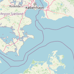
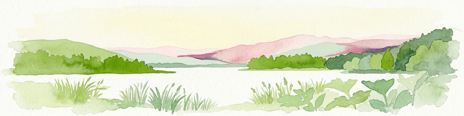
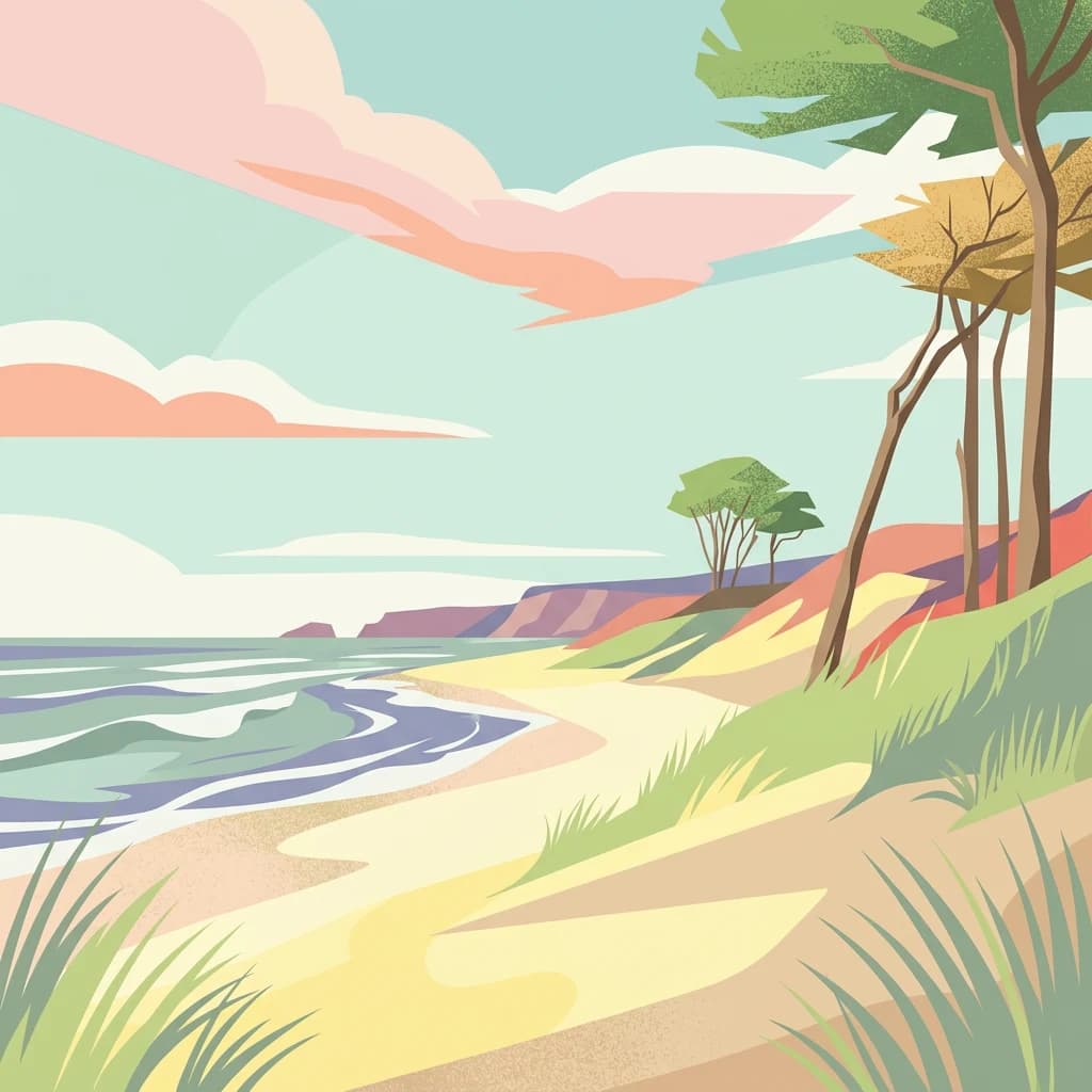
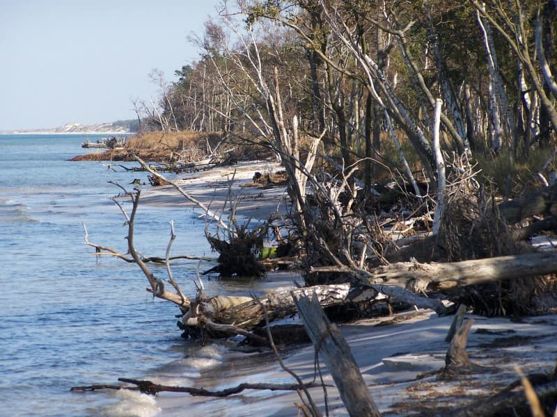
The landscape of Western Pomerania Lagoon Area National Park is defined by its complex coastal geography, where peninsulas, islands, and lagoon systems create an intricate mosaic of terrestrial and marine environments. The Darß peninsula forms a prominent land projection into the Baltic Sea, its western coastline characterized by exposed sandy beaches and dynamic dune formations. The peninsula connects to the narrower Zingst peninsula, which extends eastward and encloses the bodden lagoon system from the open sea.

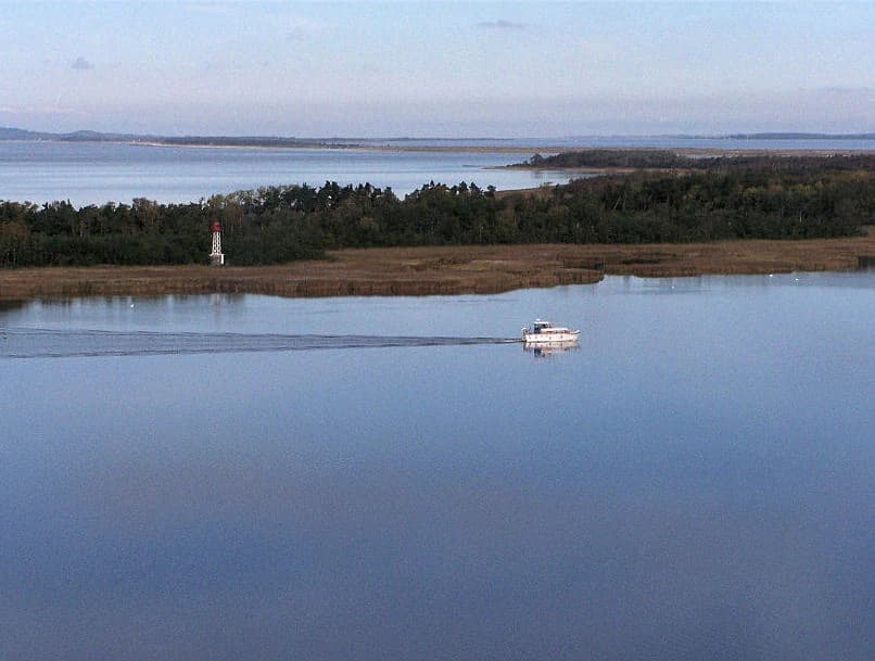
The island of Hiddensee, lying southwest of Rügen, presents a distinctive landscape of heathlands, dunes, and dramatic steep cliffs along its eastern shore. The smaller island of Ummanz lies to the north of Hiddensee, while numerous tiny islets and sandbanks dot the waters between the larger islands. The bodden lagoons themselves are extremely shallow, typically only a few meters deep, and their water levels respond to wind conditions rather than traditional tidal patterns. When offshore winds prevail, water levels can drop dramatically, exposing extensive mudflats and sandbars that constitute the "Windwatt" phenomenon unique to this Baltic coast.

On land, the park encompasses both forested and open landscapes. Pine and beech forests, such as the Darß Forest, cover substantial portions of the peninsulas and islands. In lower-lying areas and former wetlands, coastal bogs have developed in response to historical flooding patterns. The overall impression is one of relatively low-lying terrain with subtle elevation changes, where the horizontal lines of water, sky, and horizon dominate the visual experience.

A white boat on calm blue water with a lighthouse on a distant shore and forested coastline
Boat traveling through calm waters of Western Pomerania Lagoon Area National Park with lighthouse visible on shoreline

Western Pomerania Lagoon Area National Park ecosystems, habitats, and plant life

The nature of Western Pomerania Lagoon Area National Park centers on its distinctive coastal and lagoon ecosystems that support remarkable biodiversity despite the relatively shallow and dynamic nature of the aquatic environments. The bodden lagoons represent a specialized habitat type found primarily along the southern Baltic coast, characterized by brackish water with variable salinity that fluctuates both seasonally and in response to weather patterns. This environmental variability has produced a unique assemblage of species adapted to brackish conditions.

The park protects extensive shallow water areas where the boundary with the open Baltic Sea follows the ten-meter depth contour, preserving underwater environments that would otherwise face development pressure. The submerged vegetation includes important communities of aquatic plants, though nutrient pollution from agricultural runoff has historically affected water clarity and plant community composition. Restoration efforts have shown progress, with populations of charophyte algae (Armleuchteralgen) returning to portions of the lagoon system after decades of absence.

The diverse habitats range from open water and mudflats to coastal forests, heathlands, and wetlands, creating a mosaic that supports numerous species. The forest communities, dominated by pine and beech, provide terrestrial habitat while the adjacent waters support fish, invertebrates, and marine mammals. This combination of habitats within a relatively compact area contributes to the park's ecological significance.

Coastal scene with shallow blue water, sandy beach with driftwood logs, and forest edge with bare and leafy trees
Coastal shoreline with driftwood and forest edge at Western Pomerania Lagoon Area National Park

Western Pomerania Lagoon Area National Park wildlife and species highlights

The wildlife of Western Pomerania Lagoon Area National Park is notable for both its diversity and the seasonal movements that bring extraordinary concentrations of migratory birds to the area. The park's international significance is most dramatically demonstrated during autumn migration, when approximately 60,000 grey cranes pass through the region between September and November. These birds utilize the shallow bodden waters and exposed mudflats as critical resting and feeding areas, making the park one of the most important crane staging areas in Western Europe.

The avifauna of the park is exceptionally rich, with 163 bird species breeding within its boundaries, including 67 species that appear on Germany's red list of threatened species. The lagoons and coastal areas support diverse communities of waterfowl, waders, and seabirds throughout the year. Fish populations include at least 48 species, with common species including bream, roach, European eel, sticklebacks, perch, pike-perch, and pike.

Marine mammals present in the park include harbour seals and grey seals, which regularly haul out on islands and sandbanks, though they do not breed within the park. Harbour porpoises occur occasionally. The terrestrial mammals include roe deer, wild boar, red deer, and fallow deer, particularly in the Zingst area, while Hiddensee supports a small population of mouflon. European otters inhabit the water bodies, and various small mammals and bat species complete the mammalian fauna.

A wide view of a lagoon with tall reeds in the foreground, open water in the middle ground, and distant birds on the horizon under a clear sky
Pramort landscape with lagoon, reeds, and birds in Western Pomerania Lagoon Area National Park

Western Pomerania Lagoon Area National Park conservation status and protection priorities

Western Pomerania Lagoon Area National Park serves as a critical conservation area for Germany's Baltic coast ecosystems, protecting habitats that face multiple pressures from human activities and environmental changes. The park's conservation objectives emphasize preserving the natural dynamics of the coastal landscape, including the ongoing processes of erosion and deposition that continuously reshape shorelines. At locations like Darßer Ort and the Bessin on Hiddensee, land accumulation continues to expand coastal areas, demonstrating the dynamic nature of this coast.

The park addresses several significant conservation challenges, including water quality concerns stemming from agricultural nutrient runoff that has historically affected lagoon clarity and submerged vegetation. Efforts to restore drained peatlands and reduce nutrient inputs are ongoing, with projects such as the renaturation of the Osterwald area working to improve ecosystem health. The recovery of charophyte algae populations in recent decades represents a positive indicator of improving water quality.

Forest management has also evolved significantly, with the park administration moving away from commercial timber extraction toward approaches that prioritize natural forest development. The loss of FSC certification in 2006 prompted substantial reforms, and current management prohibits clear-cutting and planting of non-native species. Conservation work also focuses on maintaining viable populations of species dependent on the park's habitats, from migratory birds to fish and marine mammals.

Western Pomerania Lagoon Area National Park cultural meaning and human context

The cultural context of Western Pomerania Lagoon Area National Park reflects the long human history of the Baltic coast region. The landscape has been shaped by centuries of human activity, from medieval settlement patterns to the development of fishing communities and coastal agriculture. The islands and peninsulas within the park have supported rural communities whose livelihoods were closely tied to the sea, fishing, and agriculture.

Hiddensee in particular has cultural significance beyond its ecological value, having been an artists' retreat and summer destination since the late 19th century. The island's landscape of heath, dunes, and dramatic coastline attracted painters, writers, and holidaymakers, creating a cultural heritage that coexists with the island's ecological importance.

The region bears the imprint of both German and more broadly Baltic cultural traditions. Place names reflect the historical German settlement of the area, while the broader cultural landscape includes elements from the Hanseatic period when cities like Stralsund and Ribnitz-Damgarten (now nearby to the park) were important trading centers. The park's establishment in 1990 marked a new chapter in the relationship between local communities and their environment, as protection priorities shifted from economic utilization toward conservation and ecological restoration.

Brick building with 'National Park Museum Darsser Arche' sign, bicycles parked outside, grassy area, and paved pathway
National Park Museum Darsser Arche in Wieck a. Darß, Germany

Top sights and standout views in Western Pomerania Lagoon Area National Park

The Western Pomerania Lagoon Area National Park offers several standout features that distinguish it within Germany's protected area network. The autumn crane migration, with tens of thousands of birds staging in the shallow waters, represents one of Europe's most spectacular wildlife spectacles and draws significant visitor interest. The park's unique "Windwatt" system, where wind-driven water fluctuations replace traditional tides, creates dynamic conditions that shape the entire ecosystem and differentiate this Baltic coast from the better-known Wadden Sea of the North Sea.

The combination of protected coastal waters, lagoon systems, islands, and forests within a single park creates remarkable habitat diversity. The dramatic contrast between the steep cliffs of Hiddensee and the wild western beaches near Darßer Ort exemplifies the landscape variety found within the park boundaries. The third-largest national park in Germany, it represents the most extensive protected coastal landscape in Mecklenburg-Vorpommern and one of the most significant conservation areas along the southern Baltic coast.

Best time to visit Western Pomerania Lagoon Area National Park

The park offers distinctive experiences across seasons, though autumn provides the most dramatic wildlife viewing opportunities when thousands of cranes pass through the area. September through November brings the peak crane migration, with large flocks resting and feeding in the shallow waters and mudflats, creating extraordinary birdwatching conditions. This autumn period coincides with often atmospheric coastal weather, with fog and mist common and adding to the dramatic landscape atmosphere.

Spring and early summer support breeding bird activity and offer milder conditions for exploring the park's trails and coastal areas. The landscape green with new vegetation, this season provides pleasant conditions for walking and cycling through the forested areas and along the coast. Summer brings the warmest weather and longest days, though this is also the peak visitor season. The dynamic character of the park's waters means that conditions can vary significantly depending on wind patterns, creating different experiences even within the same season.

Park location guide

Geography guide, regional context, and park location map for Western Pomerania Lagoon Area National Park

Western Pomerania Lagoon Area National Park park geography, regions, and map view in Germany
Understand where Western Pomerania Lagoon Area National Park sits in Germany through a broader geographic reading of the surrounding landscape, nearby location context, and its mapped position within the national park landscape.

How Western Pomerania Lagoon Area National Park fits into Germany

Germany is a federal republic in Western and Central Europe with a population of over 83 million across sixteen constituent states. It is Europe's largest economy by nominal GDP and a major global exporter and importer. The capital is Berlin, and the country borders Denmark, Poland, Czech Republic, Austria, Switzerland, France, Luxembourg, Belgium, and the Netherlands.

Wider geography shaping Western Pomerania Lagoon Area National Park in Germany

Germany is located in Western and Central Europe, spanning 357,022 km². It borders Denmark to the north, Poland and the Czech Republic to the east, Austria and Switzerland to the south, and France, Luxembourg, Belgium, and the Netherlands to the west. The country has coastlines on the Baltic Sea and North Sea to the north, with the Alps located in the southern region.

Map view of Western Pomerania Lagoon Area National Park

Use this park location map to pinpoint Western Pomerania Lagoon Area National Park in Germany, understand its exact geographic position, and read its mapped placement within the surrounding landscape more clearly.

Pigeon | © OpenStreetMap contributors

Location context for Western Pomerania Lagoon Area National Park

Mecklenburg-Vorpommern

Explore the intricate coastal geography, unique Windwatten system, and diverse habitats of this German protected area.

Western Pomerania Lagoon Area National Park Photos: Visual Atlas of Baltic Coastline and Protected Landscapes
Explore a curated collection of imagery revealing the distinctive coastal landscapes, shallow lagoon systems, and crucial wildlife habitats within Western Pomerania Lagoon Area National Park. These visuals provide an essential atlas-style reference for understanding the park's unique Windwatten phenomenon, forested islands, and its role in protecting vital migratory bird populations.

Sandy beach with gentle waves, coastal dunes, and scattered trees under a partly cloudy sky

Coastal landscape featuring sandy beach, grassy dunes, and the Baltic Sea under a clear sky

A white boat on calm blue water with a lighthouse on a distant shore and forested coastline

Coastal scene with shallow blue water, sandy beach with driftwood logs, and forest edge with bare and leafy trees

A wide view of a lagoon with tall reeds in the foreground, open water in the middle ground, and distant birds on the horizon under a clear sky

Sandy cliffside, pebbly beach, and Baltic Sea waves under overcast sky

Brick building with 'National Park Museum Darsser Arche' sign, bicycles parked outside, grassy area, and paved pathway

Park atlas

Map the diverse coastal and lagoon protected areas, comparing their unique geography within the broader Baltic Sea region.

Continue Your Park Discovery: Explore National Parks and Protected Areas Near Western Pomerania Lagoon Area National Park
After exploring Western Pomerania Lagoon Area National Park, discover other national parks and protected areas along Germany's Baltic Sea coast, encompassing diverse coastal landscapes, island ecosystems, and vital bird migration sites. Use these park comparisons to understand shared brackish water habitats, unique wind-driven systems, and broader regional protected area geography.
Watercolor painting showing chalk cliffs along a coastline with calm water and distant hills
National parkMecklenburg-Vorpommern

Jasmund National Park: Germany's Coastal Chalk Cliffs and Primeval Forest Landscape

Explore the protected geography of Mecklenburg-Vorpommern's Rügen island.

Jasmund National Park showcases one of Northern Europe's most dramatic natural formations, defined by its striking white chalk cliffs plunging into the Baltic Sea and its UNESCO-recognized primeval beech forests. This protected area offers a profound look into geological heritage and undisturbed forest ecosystems. Navigate its mapped boundaries and understand its unique landscape context within the Mecklenburg-Vorpommern region through detailed atlas exploration on MoriAtlas.

Area
30 km²
Established
1990
IUCN
II
Visitors
300K annual
Watercolor painting of a landscape with a lake, trees, and distant hills
National parkMecklenburg-Vorpommern

Müritz National Park: Explore Protected Beech Forests and Glacial Lakelands in Mecklenburg-Vorpommern

Germany's largest national park: mapped boundaries and terrain.

Müritz National Park represents a significant protected landscape within northeastern Germany's Mecklenburg-Vorpommern region. Its expansive territory encompasses not only Germany's largest lake, Müritz, but also substantial tracts of ancient beech forests awarded UNESCO World Heritage status. Users can explore the park's glacial terrain, its intricate network of lakes and wetlands, and understand its position within the regional geography, making it a key destination for structured atlas-based discovery of German protected areas.

Area
318 km²
Established
1990
IUCN
II
Watercolor painting depicting mountains, rivers, and green terrain
National parkWest Pomeranian Voivodeship

Wolin National Park: Coastal Protected Landscape and Glacial Terrain in West Pomeranian Voivodeship

Explore Poland's first marine national park and its dynamic geography.

Wolin National Park offers a profound look into Poland's protected coastal geography. This national park in the West Pomeranian Voivodeship is distinguished by its high sea cliffs, inclusion of Baltic Sea and Szczecin Lagoon waters as Poland's first marine protected area, and a landscape sculpted by glacial moraines. Discover the park's complex delta systems, ancient forests, and the mapped terrain that supports significant bird migration, providing a rich focus for atlas exploration.

Area
109.37 km²
Established
1960
IUCN
II
Visitors
1.5M annual
Watercolor painting of green trees on rolling hills under a pink and orange sunset
National park

Dalby Söderskog National Park: Explore Southern Sweden's Smallest Protected Deciduous Forest

Unique limestone geology, spring flowers, and mapped terrain.

Dalby Söderskog National Park, though only 36 hectares, offers exceptional botanical discovery rooted in its fertile limestone soils. This protected area in Scania, Sweden, showcases a dense deciduous forest ecosystem with remarkable diversity, particularly evident in its vibrant spring wildflower displays. Use MoriAtlas to explore the park's mapped boundaries and understand its significant role within the regional geography and broader protected landscape atlas.

Area
0.36 km²
Established
1918
IUCN
II
Relief
Lowland
National parkSkåne County

Stenshuvud National Park: Discover Skåne County's Distinctive Baltic Headland National Park

Explore broadleaf forests, heathlands, and panoramic coastal geography.

Stenshuvud National Park is a notable national park in Sweden's Skåne County, characterized by a prominent hill that rises 97 meters above the Baltic Sea. This protected landscape offers a rich diversity of habitats within a small area, including dense broadleaf forests, open heathlands, and coastal terrains. Its unique geographic position and varied ecosystems make it a key destination for exploring protected natural areas, mapped terrain, and regional landscape context within the MoriAtlas platform.

Area
3.9 km²
Established
1986
IUCN
II
Relief
Lowland
Watercolor painting depicting a river flowing through a valley with green vegetation and distant mountains
National parkBrandenburg

Lower Oder Valley National Park: Unique Polder Landscape and Bird Sanctuary

Discover protected area maps and regional geography in Brandenburg

Delve into the Lower Oder Valley National Park, a national park recognized for its extraordinary polder landscape and extensive wetland ecosystems. This page provides detailed geographic context, highlighting the park's unique engineered floodplain, its role as a sanctuary for numerous bird species, and its position within the regional geography of Brandenburg. Understand the mapped boundaries and ecological importance of this exceptional protected area.

Area
103.23 km²
Established
1995
IUCN
II
Visitors
150K annual
National park

Kongernes Nordsjælland National Park: Protected Landscape Geography and Map Context

Explore North Zealand's protected natural terrain.

Delve into the protected landscape of Kongernes Nordsjælland National Park, a significant national park in Denmark's North Zealand region. This section provides a structured overview of its mapped boundaries and geographic setting, allowing for a detailed atlas-style discovery of its natural terrain. Understand how this protected area contributes to the region's conservation landscape and mapped geography.

Watercolor painting depicting a river flowing through a forested landscape with hills in the background
National parkWest Pomeranian Voivodeship

Drawa National Park: Protected Landscape and River Geography in West Pomeranian Voivodeship

Explore Poland's unique lowland river and ancient forest protected area.

Drawa National Park stands as a vital protected area within West Pomeranian Voivodeship, Poland, celebrated for its exceptional natural geography. The park's core feature is the Drawa River, which carves a distinctive path with fast-flowing currents and deep valleys, presenting a landscape more akin to mountain streams than typical lowland waterways. This area protects one of Poland's most valuable lowland river corridors, featuring ancient beech and oak forests, the rare meromictic Lake Czarne, and diverse wetland habitats. MoriAtlas facilitates structured exploration of Drawa National Park's mapped terrain and protected landscape identity.

Area
115.36 km²
Established
1990
IUCN
II
Visitors
27K annual

Common questions about visiting, size, designation, and location context for Western Pomerania Lagoon Area National Park

Western Pomerania Lagoon Area National Park FAQs for park facts, access, geography, and protected area context
Find quick answers about Western Pomerania Lagoon Area National Park, including protected-area facts, park geography, trail and visitor context, and how the park fits into its surrounding country and regional landscape.
MoriAtlas Explorer

Continue Your Protected Areas Search Across the Global Atlas

Deepen your exploration by continuing the structured search for national parks and protected areas worldwide. Utilize the comprehensive filtering capabilities to compare different conservation landscapes and refine your understanding of global park geography. Discover more about the distribution and characteristics of protected natural areas.

Global natural geography