Mori Atlas logo
National parkCuronian Spit National Park

Discover one of Europe's most distinctive sand dune systems and a vital bird migration corridor.

Curonian Spit National Park: Coastal Dune Protected Landscape & Baltic Geography

Curonian Spit National Park is a protected national park in Lithuania, renowned for its extraordinary sand dune landscapes and its strategic location between the Curonian Lagoon and the Baltic Sea. This narrow peninsula is a dynamic natural environment, featuring vast, wind-shaped dunes, coastal forests, and crucial wetlands that support significant biodiversity. As a UNESCO World Heritage Site, the park offers a unique lens through which to explore mapped protected areas and understand the interplay of geology, ecology, and human history along the Baltic coast.

sand dunescoastal ecosystemsUNESCO World Heritage SiteNatura 2000bird migrationBaltic Sea

Curonian Spit National Park

National park

Park overview

Structured park overview, official facts, and landscape profile for Curonian Spit National Park

Curonian Spit National Park park facts, protected area profile, and essential visitor context
Review the core facts for Curonian Spit National Park, including designation, size, terrain, visitor scale, habitats, and operating context in one park-focused overview.

About Curonian Spit National Park

Curonian Spit National Park protects one of the Baltic region's most remarkable natural treasures—a long, narrow peninsula of sand dunes and coastal ecosystems that separates the Curonian Lagoon from the open Baltic Sea. The spit extends from the Lithuanian coast northward toward the Russian exclave of Kaliningrad, with the national park covering the Lithuanian portion. The landscape here is fundamentally shaped by wind and water, with sand transported by ocean currents forming the foundation of this dynamic terrain. Over centuries, winds have sculpted the sand into dramatic dune formations, some of which remain active and migrating while others have become stabilized by vegetation, creating the characteristic grey or "dead" dunes that are now among the park's most protected features. The park's establishment in 1991 reflected Lithuania's commitment to preserving this unique coastal ecosystem, which had long been recognized for its exceptional natural value and its unusual combination of wild dune landscapes with centuries of human settlement and use.

Quick facts and research context for Curonian Spit National Park

Curonian Spit National Park occupies a unique geographic position on Lithuania's western Baltic coast, spanning approximately 264 square kilometers including land, lagoon, and marine areas. The park was established in 1991 under Lithuanian protected area legislation and holds IUCN Category II status. Its landscape is dominated by the Curonian Spit's characteristic dune systems, including both active migrating dunes and the famous grey or "dead" dunes that have become stabilized over time. The park protects significant biodiversity with approximately 632 plant species, 48 mammal species, and over 240 breeding bird species, making it one of Lithuania's most ecologically significant protected areas.

Park context

Deeper park guide and search-rich context for Curonian Spit National Park

Curonian Spit National Park history, landscape, wildlife, and travel context
Explore Curonian Spit National Park through its history, landscape character, ecosystems, wildlife, conservation priorities, cultural context, and seasonal travel timing in a structured park guide built for atlas discovery and search intent.

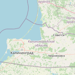
Why Curonian Spit National Park stands out

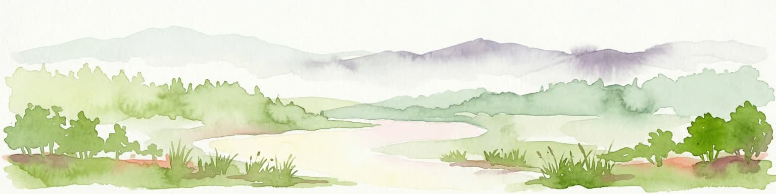
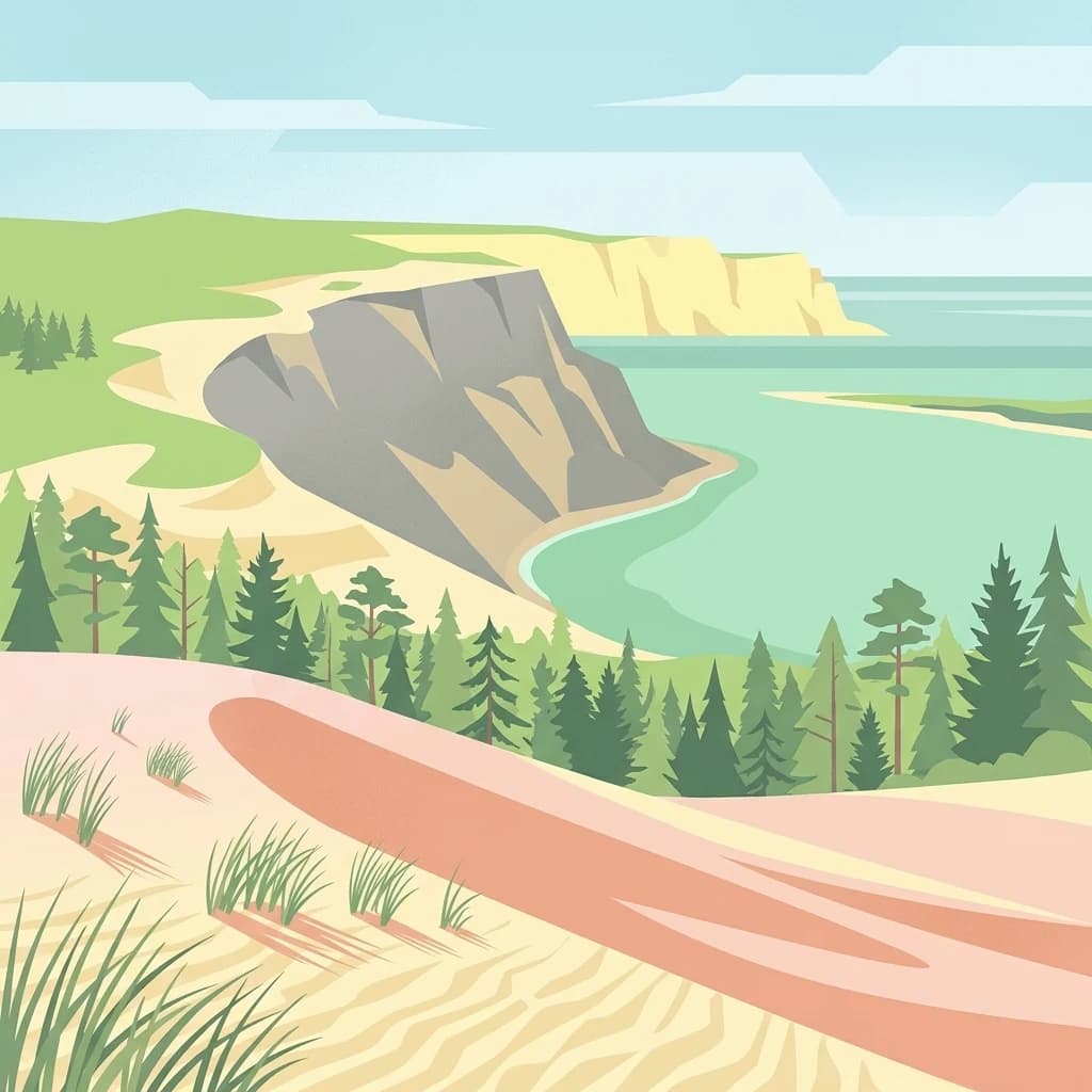
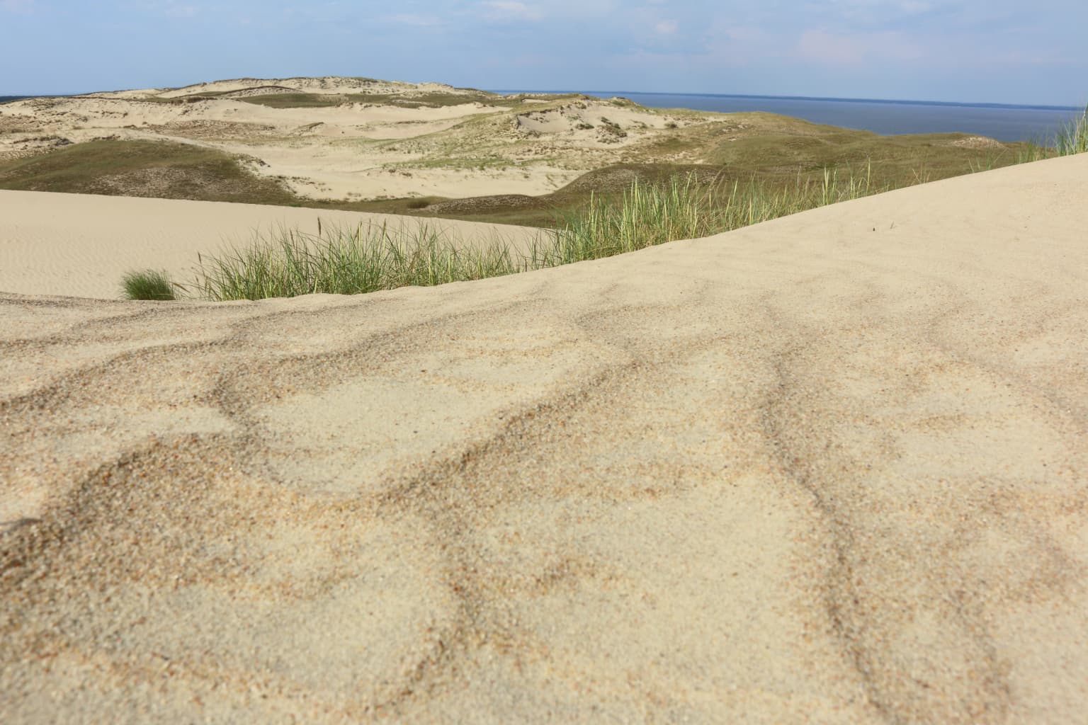
The park is most famous for its extraordinary sand dune landscapes, a defining feature that makes the Curonian Spit unique among European coastal protected areas. The grey (dead) dunes near Nagliai represent one of the most impressive examples of stabilized dune systems on the continent, while the active dunes at Parnidžio continue the dynamic processes that shaped this entire landscape. The park's location along a major bird migration route between the Baltic Sea and the White Sea creates spectacular seasonal movements, with roughly 15 million birds passing through twice annually. The Nagliai nature reserve preserves not only these geological wonders but also the buried remains of four villages that were lost to sand between 1675 and 1854, a poignant reminder of the landscape's power.

Overview image of Curonian Spit National Park showing what the park is best known for
Visual overview of what makes Curonian Spit National Park a notable national park destination.

Curonian Spit National Park history and protected-area timeline

The Curonian Spit's human history is intimately connected to its challenging and dynamic landscape. The spit has been inhabited by fishing communities for centuries, with villages like Nida, Juodkrantė, Preila, and Pervalka developing as small coastal settlements that adapted to the harsh coastal environment. The park's cultural layer extends beneath the sand, preserving evidence of abandoned settlements that were overwhelmed by moving dunes. Between 1675 and 1854, four villages in the Nagliai area were buried entirely by shifting sand—a dramatic demonstration of the landscape's power and the precarious relationship between human settlement and this dynamic environment. The establishment of the national park in 1991 marked a new chapter in the spit's protection, building on earlier conservation efforts to preserve both the natural dune systems and the cultural heritage of the coastal communities. In 2000, the Curonian Spit achieved international recognition when it was inscribed on the UNESCO World Heritage List as a cultural landscape of outstanding universal value.

Curonian Spit National Park landscape and geographic character

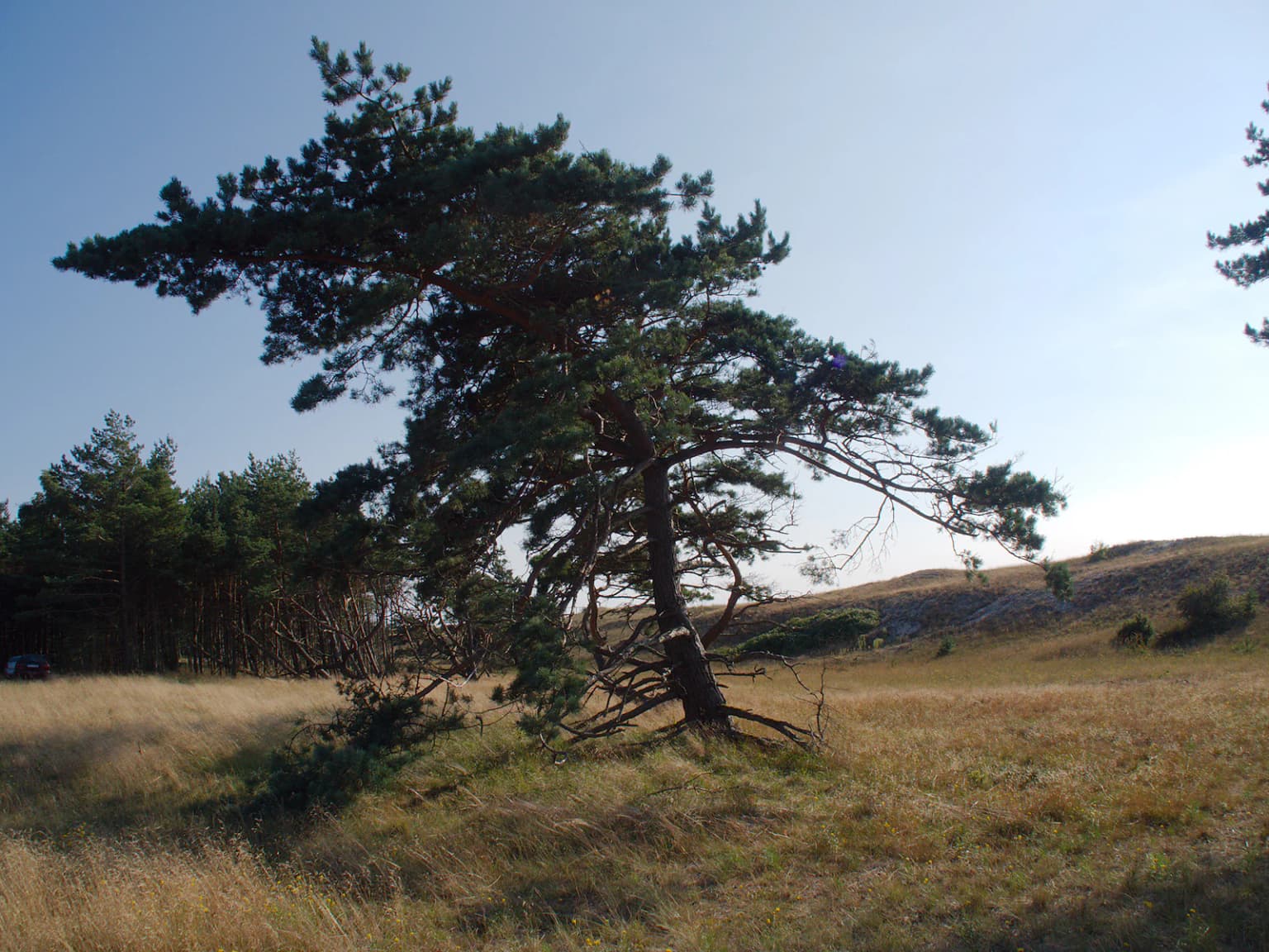
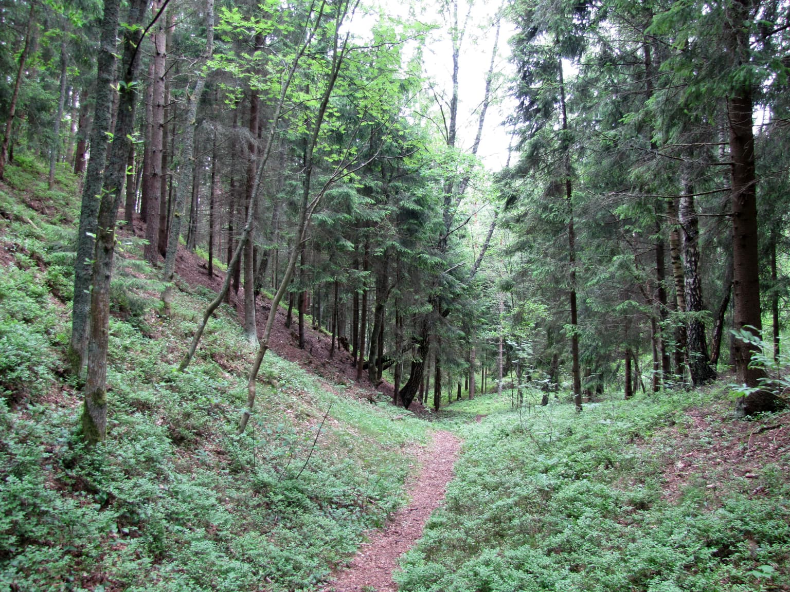
The physical landscape of Curonian Spit National Park is defined by the interplay between sand, wind, and water along this narrow Baltic coastline. The peninsula's foundation is entirely sandy, with sediments deposited by ocean currents over thousands of years creating the substrate for this dynamic environment. The most striking landscape features are the various dune formations, ranging from the massive parabolic dunes near Juodkrantė to the active migrating dunes of Parnidžio and the stabilized grey dunes of the Nagliai nature reserve. The grey dunes represent an intermediate stage—former migrating dunes that have become stabilized by vegetation, their steep faces and hollows creating a distinctive dune morphology now preserved within the reserve. Between the dunes, low-lying wetland areas known as palvės provide habitat diversity, while the narrow strip of beach along the Baltic Sea and the sheltered waters of the Curonian Lagoon complete the coastal setting. The forest cover, primarily coniferous, has developed largely through human intervention as efforts to stabilize the sand began in the 19th century, with old wind-shaped pines creating a characteristic landscape of tilted and gnarled trees near the coast.

European Otter with brown fur and white underbelly resting on a mossy tree trunk
European Otter (Lutra lutra) resting on a moss-covered tree trunk

Curonian Spit National Park ecosystems, habitats, and plant life

The ecosystems within Curonian Spit National Park reflect the harsh yet productive conditions of this Baltic coastal environment. Forest cover dominates the land area, reaching approximately 73% of the terrestrial territory, with coniferous species—particularly Scots pine—forming the predominant tree cover. Some forest patches represent old-growth remnants, with individual trees reaching ages of around 200 years. The park's vegetation includes approximately 632 plant species, with 24 of these protected in Lithuania's Red Book and 16 found exclusively in open sandy and meadow habitats. The flora includes several species characteristic of Baltic coastal environments, including maritime sea-holly and cross-leaved heath, along with species at the eastern or southern limits of their distribution in the Baltic region. The dune systems support distinctive plant communities adapted to sandy, nutrient-poor conditions, while the wetland areas provide habitat for entirely different plant assemblages. The park also protects significant marine and lagoon ecosystems, with the waters of both the Baltic Sea and Curonian Lagoon included within the protected area.

Sand dunes with visible patterns and textures, patches of grass on dunes, distant body of water, clear sky
Sand dunes with grass patches on the Curonian Spit National Park

Curonian Spit National Park wildlife and species highlights

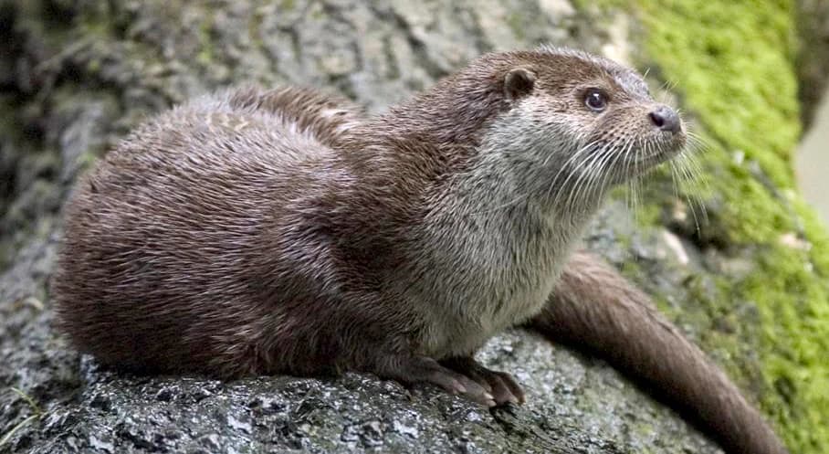
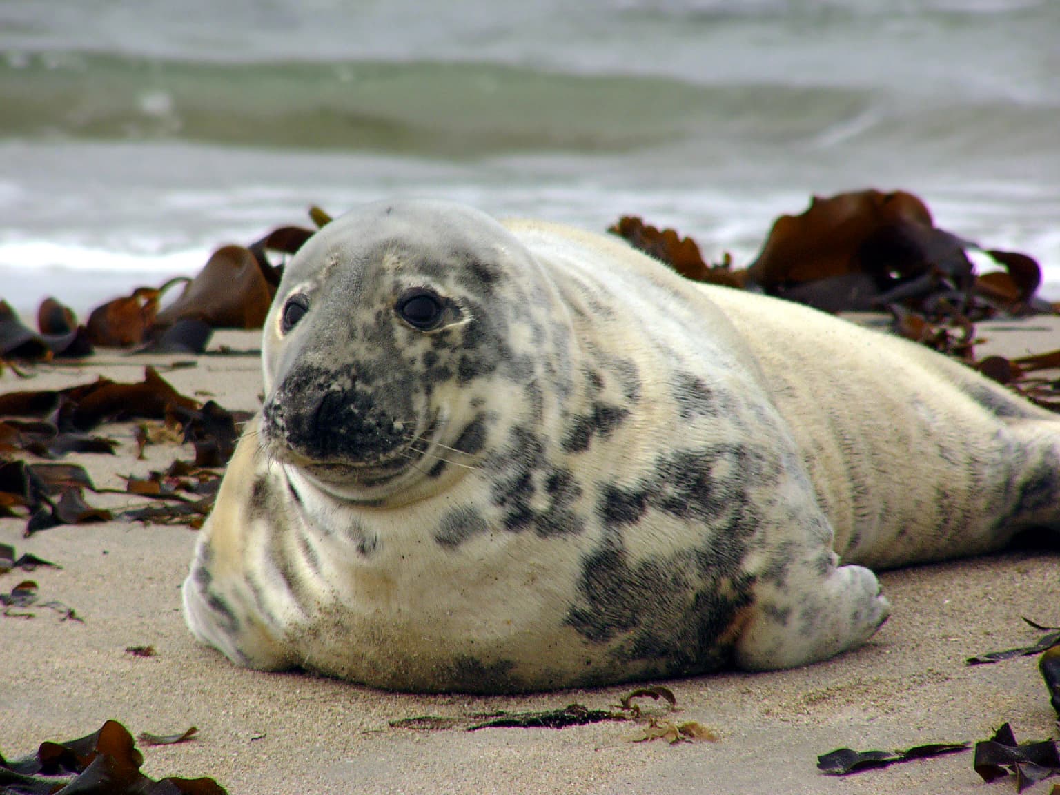
The wildlife of Curonian Spit National Park benefits from the diverse habitats found within this narrow peninsula, from active dunes to coastal forests and wetland areas. Mammal populations include approximately 48 species, with nine protected in Lithuania's Red Book and 15 protected under European Union legislation. Bats represent the most diverse group, with 14 species recorded within the park—nearly the entire Lithuanian bat fauna. Larger mammals include elk, wild boar, roe deer, red fox, and European badger, while European river otter and Eurasian beaver are found in wetland areas. The bird life is particularly significant, with around 240 species breeding in summer and up to 300 species recorded during migration periods. A major bird migration route passes over the spit, carrying approximately 15 million birds of various species during spring and autumn movements. Notable breeding colonies include mixed colonies of great cormorant and grey heron near Juodkrantė, and the park supports breeding populations of white-tailed eagle. The Curonian Lagoon provides habitat for 74 fish species, five of which along with one lamprey species are protected under EU habitat directives.

Wooden boardwalk traversing sandy dunes with sparse vegetation under clear blue sky
Wooden boardwalk winding through sandy dunes under clear blue sky

Curonian Spit National Park conservation status and protection priorities

Curonian Spit National Park represents one of Lithuania's most significant conservation achievements, protecting a landscape that is unique within the Baltic region and indeed all of Europe. The park's inclusion in the Natura 2000 network and its designation as a UNESCO World Heritage Site reflect the international recognition of its outstanding universal value. The protection of the dune systems—both active migrating dunes and stabilized grey dunes—is particularly important, as these represent rare and threatened habitat types across Europe. The Nagliai nature reserve, which protects the most significant grey dune formations, prohibits all human activity except scientific observation, ensuring the preservation of these sensitive geological and ecological features. The park also protects cultural heritage sites, including the historic fisherman settlements and their traditional architecture, recognizing that the cultural landscape cannot be separated from its natural elements. Management challenges include balancing visitor access with conservation needs, addressing invasive species that threaten native biodiversity, and maintaining the ecological processes that have shaped this dynamic landscape.

Curonian Spit National Park cultural meaning and human context

The cultural heritage of Curonian Spit National Park is inseparable from its natural landscape, with centuries of human settlement creating a distinctive coastal culture that remains visible in the park's villages and traditional architecture. The fishing villages of Nida, Juodkrantė, Preila, Pervalka, and Smiltynė preserve elements of traditional wooden architecture, particularly the characteristic fisherman homesteads that have defined the spit's coastal settlements. The park contains several cultural heritage sites, including the Thomas Mann House-Museum in Nida, commemorating the German author's residence here during the 1930s, and the Lutheran churches in Nida and Juodkrantė that reflect the region's historical connections to German cultural influence. The traditional livelihoods of fishing and small-scale agriculture shaped both the built environment and the cultural practices of these communities. The landscape also contains buried cultural layers from settlements that were lost to shifting sand, representing an archaeological record of human adaptation to this challenging environment.

White-tailed eagle in flight with yellow beak and talons extended over water, grasping a fish, with tall green vegetation in background
White-tailed eagle (Haliaeetus albicilla) capturing fish in Curonian Spit National Park wetlands

Top sights and standout views in Curonian Spit National Park

The Curonian Spit's combination of natural and cultural values makes it one of the Baltic region's premier protected areas. The shifting sand dunes—whether the active dunes of Parnidžio or the stabilized grey dunes of the Nagliai reserve—represent a landscape process that has shaped the entire peninsula and continues to fascinate visitors with its dynamic character. The annual bird migration, with millions of birds passing over the narrow land bridge between two seas, creates one of Europe's most impressive wildlife spectacles. The historic fishing villages, with their traditional architecture and cultural traditions, offer a window into a coastal way of life that has persisted for centuries. The 53-kilometer cycling path that traverses the peninsula provides excellent opportunities to experience both the natural and cultural landscapes, while the sailing conditions in both the lagoon and the Baltic Sea attract water enthusiasts to the area.

Wind-bent pine tree on a grassy hillside with other trees in the background under a clear blue sky
Wind-blown pine tree on a grassy hillside with distant trees under a clear sky

Best time to visit Curonian Spit National Park

The Curonian Spit offers distinct seasonal experiences throughout the year, though the summer months of June through August bring the largest visitor numbers and the warmest conditions for beach activities and outdoor exploration. Spring and autumn offer particularly compelling reasons to visit, as the bird migrations transform the peninsula into a major wildlife observation destination, with spring bringing northward-moving flocks and autumn delivering the southward return passage. The changing seasons also affect the landscape itself—winter brings a quieter, more austere atmosphere to the dune landscapes, while the warm months see the vegetation at its most lush. The park's popularity means that peak summer periods can be busy, particularly in the villages, while the shoulder seasons offer a more contemplative experience of this distinctive landscape. The park's visitor facilities operate primarily during the warm season, so those planning visits outside of summer should check availability in advance.

Park location guide

Geography guide, regional context, and park location map for Curonian Spit National Park

Curonian Spit National Park park geography, regions, and map view in Lithuania
Understand where Curonian Spit National Park sits in Lithuania through a broader geographic reading of the surrounding landscape, nearby location context, and its mapped position within the national park landscape.

How Curonian Spit National Park fits into Lithuania

Lithuania is a unitary semi-presidential republic and one of three Baltic states in Northern Europe. It lies on the eastern coast of the Baltic Sea, with Vilnius as its capital and largest city. The country regained independence in 1990 after Soviet occupation and joined the European Union in 2004. Lithuania has a population of about 2.9 million and covers an area of 65,300 km².

Wider geography shaping Curonian Spit National Park in Lithuania

Lithuania is situated on the eastern shore of the Baltic Sea in Northern Europe. It borders Latvia to the north, Belarus to the east and south, Poland to the south, and Russia's Kaliningrad Oblast to the southwest. The country also has a maritime border with Sweden to the west. The terrain is largely flat with rolling hills, numerous lakes, and rivers. The Nemunas River is the longest river in the country.

Map view of Curonian Spit National Park

Use this park location map to pinpoint Curonian Spit National Park in Lithuania, understand its exact geographic position, and read its mapped placement within the surrounding landscape more clearly.

Pigeon | © OpenStreetMap contributors

Explore striking sand dunes, coastal forests, and unique protected-area habitats along this UNESCO World Heritage Site.

Curonian Spit National Park Photos: Visual Guide to Baltic Sea Landscapes and Dune Scenery
Visually explore the diverse landscapes of Curonian Spit National Park, showcasing its distinctive sand dunes, extensive coastal forests, and unique Baltic Sea habitats. This image gallery provides essential context for understanding the park's protected status and its dynamic, wind-shaped environment as a UNESCO World Heritage site.

Curonian Spit National Park

European Otter with brown fur and white underbelly resting on a mossy tree trunk

Sand dunes with visible patterns and textures, patches of grass on dunes, distant body of water, clear sky

Wooden boardwalk traversing sandy dunes with sparse vegetation under clear blue sky

Sand dunes with sparse vegetation, a forested area in the midground, and the Baltic Sea under a partly cloudy sky

White-tailed eagle in flight with yellow beak and talons extended over water, grasping a fish, with tall green vegetation in background

Wind-bent pine tree on a grassy hillside with other trees in the background under a clear blue sky

Close-up of a juvenile Natterjack toad with dark spots and a light stripe on its back, resting on dry grass and moss

Large sand dune with wind-swept ridges slopes toward calm Curonian Lagoon water with distant shoreline vegetation

Sandy dunes with scattered grasses and a winding trail in the background

White sandy beach along the Baltic Sea with grass-covered dunes, people, and a clear blue sky

Wooden signpost with text on sandy dunes featuring a boardwalk path extending into the distance under a clear blue sky.

Forest trail surrounded by tall trees and green vegetation, showing a natural pathway through a forested area.

Grey Seal with spotted fur lying on sandy beach surrounded by brown seaweed with ocean waves in background

Sea Holly plant with blue-purple spiky flower heads and spiky blue-green leaves on sandy ground

Park atlas

Browse the geographic spread and compare unique coastal protected areas throughout the Baltic Sea region.

Explore Related National Parks and Protected Areas: Curonian Spit National Park and Surrounding Landscapes
After exploring Curonian Spit National Park, discover other national parks and protected areas featuring similar coastal ecosystems, dramatic sand dunes, and significant bird migration routes. Compare these diverse protected landscapes within their regional context, enhancing your understanding of Baltic Sea conservation geography.
Watercolor painting of a coastal landscape featuring trees, birds, and soft pastel-colored hills
National parkKaliningrad Oblast

Curonian Spit National Park: Coastal Dunes and Baltic Protected Landscape

Explore a UNESCO World Heritage sand spit with unique terrain.

Curonian Spit National Park offers a remarkable study in coastal geography and protected landscapes, situated on one of the longest sand spits globally. This protected area within Russia's Kaliningrad Oblast features dynamic dune systems, distinctive forest formations, and serves as a vital corridor for migratory birds. Its UNESCO status underscores its international significance for natural heritage and landscape exploration, providing rich context for regional geography within the MoriAtlas platform.

Area
66 km²
Established
1987
Relief
Lowland
Climate
Temperate
Watercolor painting showing rolling hills, a lake, and green forests under a soft sky
National park

Žemaitija National Park: Mapped Glacial Terrain and Samogitian Protected Landscape

Explore protected areas and natural geography in Northwestern Lithuania.

Žemaitija National Park is a protected natural reserve in Lithuania, defined by its distinctive glacially sculpted landscape. This park preserves over 217 square kilometers of hilly terrain, featuring significant lake systems like Lake Plateliai and substantial forest cover interspersed with wetlands. Users can explore the park's unique topographic character, its mapped geographic features, and its role as a vital protected area within the Samogitian region, offering a rich context for atlas-based discovery.

Area
217.54 km²
Established
1991
IUCN
II
Relief
Highland
Watercolor illustration showing lakes, green vegetation, and hills in the background
National parkPodlaskie Voivodeship

Wigry National Park: Protected Area Atlas of Poland's Glacial Lake District

Explore mapped landscapes and wetland ecosystems in Podlaskie Voivodeship

Delve into the geography of Wigry National Park, a national park situated in the Podlaskie Voivodeship of northeastern Poland. This protected area is defined by its glacial landscape, featuring 42 lakes including the expansive Lake Wigry, alongside critical wetland habitats and significant peat bogs. Discover the mapped boundaries and ecological importance of Wigry National Park, renowned as a prime location for beaver populations and a vital component of Poland's protected lands atlas.

Area
150.86 km²
Established
1989
IUCN
II
Visitors
110K annual
National park

Ķemeri National Park: Discover Latvia's Iconic Protected Bog and Wetland Geography

Explore a unique protected landscape with mapped bog ecosystems and regional natural terrain.

Ķemeri National Park in Latvia is a remarkable protected area, celebrated for its expansive and ecologically significant raised bog systems, particularly the Great Ķemeri Bog. This national park showcases a unique geographical character, featuring natural sulfur springs, therapeutic muds, and a series of ancient lagoon lakes that support rich birdlife. Its diverse wetland habitats and distinct peatland landscapes offer a compelling focus for atlas-based discovery and understanding the regional geography of the Latvian coast.

Area
381.65 km²
Established
1997
IUCN
II
Relief
Lowland
National park

Trakai National Historic Park: Medieval Heritage and Lake District Protected Landscape

Explore Lithuania's historic park and its mapped geographic context.

Trakai National Historic Park offers a rich tapestry of medieval history intertwined with a captivating lake district landscape. As a protected area in southeastern Lithuania, it preserves significant architectural monuments, including the iconic Trakai Castle, set against a backdrop of interconnected lakes, forests, and wetlands. MoriAtlas provides a structured overview of its geographic boundaries and regional setting, facilitating atlas-style exploration of this historically significant protected landscape.

Access
Moderate access
Scope
Mixed
Watercolor painting showing a wetland scene with reeds, patches of water, and trees under a light sky
National parkPodlaskie Voivodeship

Biebrza National Park: Poland's Largest National Park and European Wetland Atlas

Explore the mapped geography of its vast protected fenlands.

Biebrza National Park represents a critical protected landscape in northeastern Poland, famed for its vast, intact Biebrza Marshes, the largest lowland peat bog complex in Europe. This national park page offers detailed geographic context, highlighting the unique fenland terrain, marshland ecosystems, and protected area boundaries. Discover why this region is internationally recognized for its biodiversity and its significance within the broader atlas of European protected lands.

Area
592.23 km²
Established
1993
IUCN
II
Watercolor illustration of a river flowing through a forested landscape with mountains in the background
National park

Slītere National Park: Latvia's Protected Coastal Landscape with Blue Hills and Bird Flyways

Explore the unique terrain and protected geography of this Baltic national park.

Slītere National Park represents a distinctive protected landscape on Latvia's Courland Peninsula, celebrated for its ancient geological formations like the Blue Hills (Zilie Kalni) and its role as a crucial bird migration corridor. The park's geography encompasses varied dune systems, wetland habitats, and rich broadleaf forests, offering a unique mapped environment. Discover the park's protected area boundaries and its significance within the regional Baltic geography, highlighting its unique ecosystem features and landscape context.

Area
164.14 km²
Established
2000
IUCN
II
Relief
Mixed relief
National parkPomeranian Voivodeship

Slovincian National Park: Moving Dunes and Baltic Coast Protected Landscape Exploration

Discover its unique geography and mapped terrain.

Slovincian National Park is a protected area in Pomeranian Voivodeship, Poland, celebrated for its impressive moving sand dunes and coastal wetland ecosystems. These dynamic dunes, some reaching 30 meters high, migrate inland, creating an ever-changing landscape. The park also features large shallow lakes like Łebsko and Gardno, vital for migratory birds. Explore the mapped boundaries and geographic context of this significant protected area, a Ramsar site and UNESCO biosphere reserve.

Area
186.18 km²
Established
1967
IUCN
II
Visitors
319K annual

Common questions about visiting, size, designation, and location context for Curonian Spit National Park

Curonian Spit National Park FAQs for park facts, access, geography, and protected area context
Find quick answers about Curonian Spit National Park, including protected-area facts, park geography, trail and visitor context, and how the park fits into its surrounding country and regional landscape.
MoriAtlas Explorer

Continue Your Protected Areas Search Across the Global Atlas

Deepen your exploration by continuing the structured search for national parks and protected areas worldwide. Utilize the comprehensive filtering capabilities to compare different conservation landscapes and refine your understanding of global park geography. Discover more about the distribution and characteristics of protected natural areas.

Global natural geography