Mori Atlas logo
National parkBiebrza National Park

Discover the vast Biebrza Marshes, a protected landscape rich in biodiversity.

Biebrza National Park: Poland's Premier National Park & Intact Fenland Atlas

(Biebrzański Park Narodowy)

Biebrza National Park, situated in Poland's Podlaskie Voivodeship, stands as a monumental protected landscape and the nation's largest national park. This page offers an atlas-focused exploration of its expansive fenlands, marshes, and meadows, representing one of Europe's most significant and intact wetland ecosystems. Users can delve into the unique geography of the Biebrza Marshes, understand the park's protected area status, and discover its critical role in regional and continental natural heritage.

wetlandsnational parkbirdwatchingfenlandsPolandbogs
Stylized illustration of a river flowing through a forested landscape with a canyon in the background.

Biebrza National Park

National park

Park overview

Structured park overview, official facts, and landscape profile for Biebrza National Park

Biebrza National Park park facts, protected area profile, and essential visitor context
Review the core facts for Biebrza National Park, including designation, size, terrain, visitor scale, habitats, and operating context in one park-focused overview.

About Biebrza National Park

Biebrza National Park occupies the Biebrza River basin in northeastern Poland, protecting one of Central Europe's last great wetland wilderness areas. The park's landscape is defined by the meandering Biebrza River and its extensive floodplain, which has created a complex mosaic of marshes, peat bogs, meadows, and forest corridors. Unlike many European wetlands that have been heavily modified or destroyed by drainage and agriculture, the Biebrza wetlands remain relatively intact, preserving natural hydrological processes and ecological communities that have largely disappeared elsewhere on the continent. The park lies within the Biebrza Basin (Kotlina Biebrzańska), a geological depression that has accumulated thick peat deposits over thousands of years, creating the foundation for the extraordinary biodiversity found here today. The protection of this area began in the interwar period when two nature reserves were established—Czerwone Bagno and Grzędy—preserving core areas of the marshland. The park's administrative headquarters are located at Osowiec-Twierdza, a village built around the historic 19th-century Osowiec Fortress, adding historical dimension to the natural landscape.

Quick facts and research context for Biebrza National Park

Biebrza National Park covers 592.23 km² in northeastern Poland, making it the largest of Poland's 23 national parks. The protected area includes approximately 155 km² of forests, 181 km² of fields and meadows, and 255 km² of marshes and wetlands. The park was established on September 9, 1993, and was designated a Ramsar Wetland Site in 1995. The park protects the Biebrza River valley from its source near the confluence with the Niedźwiedzica stream to its confluence with the Narew River, covering nearly the entire 155 km course of the Biebrza within Poland. The headquarters are located at Osowiec-Twierdza village within the historic Osowiec Fortress grounds.

Park context

Deeper park guide and search-rich context for Biebrza National Park

Biebrza National Park history, landscape, wildlife, and travel context
Explore Biebrza National Park through its history, landscape character, ecosystems, wildlife, conservation priorities, cultural context, and seasonal travel timing in a structured park guide built for atlas discovery and search intent.

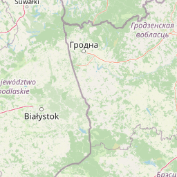
Why Biebrza National Park stands out

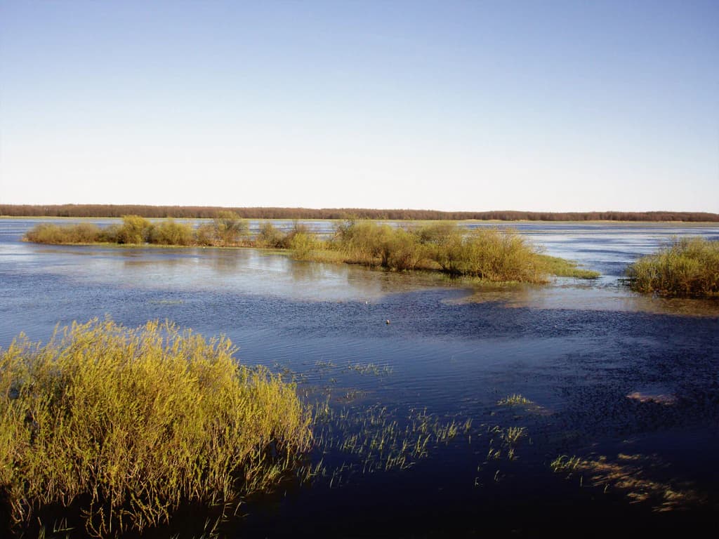
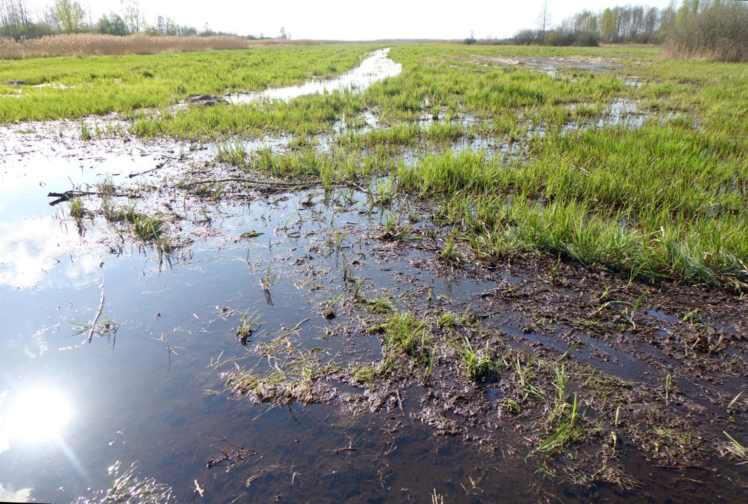
Biebrza National Park is best known for its extraordinary Biebrza Marshes, the largest and most intact lowland peat bog complex in Poland and one of the most significant in Europe. The park protects vast, relatively untouched fenlands hosting unique plant communities including rare moss bog associations with species like dwarf birch and Lapland willow. It is internationally renowned as a crucial bird habitat, particularly for snipe, ruff, black-tailed godwit, and the corncrake. The park also contains Poland's largest moose population, with approximately 400 individuals, and serves as an important European site for wading birds during migration. The Red Marsh (Czerwone Bagno) nature reserve represents the most strictly protected area within the park.

Wooden observation tower on stilts with a boardwalk leading to it, surrounded by wetland vegetation under a clear blue sky
Observation tower on a boardwalk trail in Biebrza National Park wetlands

Biebrza National Park history and protected-area timeline

The protection of Biebrza's wetlands began in the interwar period when the first nature reserves were established. Czerwone Bagno (Red Marsh) was created as a strict protection reserve in its original boundaries, which continue to exist today, along with the Grzędy reserve. These early protected areas preserved the most valuable sections of the marshland from agricultural expansion and drainage. In 1989, following efforts by the Biebrza Society (Towarzystwo Biebrzańskie), the Biebrza Landscape Park was established, covering the middle and lower basins of the Biebrza River. This landscape park status provided initial institutional recognition of the region's ecological significance while paving the way for stricter protection. On September 9, 1993, the landscape park was transformed into Biebrza National Park, elevating the protection status and bringing additional resources for conservation management. In 1995, the park was designated as a Ramsar Wetland Site under the Ramsar Convention, recognizing its international importance as a wetland of significance. The park was fully incorporated into the Important Bird Areas (IBA) inventory maintained by BirdLife International in 2010. In April 2020, a devastating fire destroyed approximately 6,000 hectares of grassland and woodland—the most destructive fire since 1992—caused by illegal grass burning during a period of low water levels. The park marked its 30th anniversary in 2023 under the theme "Year of Biebrza National Park," promoting awareness of its history, natural values, and cultural heritage.

Biebrza National Park landscape and geographic character

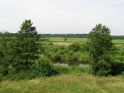
The Biebrza National Park landscape is dominated by the flat, marshy valley of the Biebrza River, set within the broader Biebrza Basin. The terrain is remarkably flat, with minimal elevation variation across the park's extensive wetlands. The Biebrza River meanders through the landscape in a typically low-gradient pattern, creating numerous side channels, oxbow lakes, and floodplain wetlands. The peat deposits in the basin reach significant depths, supporting the extensive fens and bogs that define the park's character. Areas of higher ground within the park support forests—primarily alder carrs (olsy), birch birchwoods (brzeziny), and riparian alder-ash forests (łęgi). The landscape also includes distinctive elevated dunes in some areas, providing micro-relief variation within the predominantly flat terrain. The Red Marsh (Czerwone Bagno) represents the most ecologically significant landscape unit, with its pristine peat bog ecosystems remaining largely untouched by human modification.

Grassy field with two trees, a river, and distant forest under a partly cloudy sky
Wetland landscape of Biebrza National Park with river and grassy fields

Biebrza National Park ecosystems, habitats, and plant life

The ecological character of Biebrza National Park centers on its extensive peat bog and fen communities, which represent the largest and most intact lowland wetlands in Poland and among the most significant in Europe. The park's vegetation includes diverse wetland communities: reed beds and sedge marshes, floating bog vegetation, and unique moss bog communities containing rare relict species such as dwarf birch and Lapland willow that have disappeared from most other parts of Poland. The park supports extraordinarily high biodiversity, with 49 mammal species, 271 bird species, 36 fish species, 12 amphibian species, and 5 reptile species documented within its boundaries. Invertebrate diversity is particularly remarkable, with over 700 butterfly species, 448 spider species, over 500 beetle species, 19 leech species, and 42 caddisfly species recorded. The vascular plant flora includes numerous rare orchids such as the early spider orchid, narrow-leaved helleborine, greater butterfly orchid, and lady's slipper, as well as carnivorous plants like the round-leaved sundew and long-leaved sundew. The park's position at the crossroads of European biogeographic regions makes it crucial for species at the limits of their ranges, particularly boreal species reaching their southernmost European strongholds here.

Wide view of a wetland area with calm water, scattered patches of vegetation and reeds, and a distant tree line under a clear blue sky
Wide view of Biebrza National Park's marshes with scattered vegetation islands

Biebrza National Park wildlife and species highlights

Biebrza National Park is renowned for its exceptional birdlife, particularly wading birds and marsh-dwelling species that depend on the extensive wetland habitats. The Biebrza Marshes support some of the most important breeding populations of wetland birds in Central Europe, with the ruff—the park's emblematic species—being particularly celebrated. Other characteristic breeding birds include the great snipe, black-tailed godwit, corncrake, black-winged stilt, white-winged tern, and whiskered tern. The area serves as a critical staging ground for migratory birds, with the Biebrza Basin providing essential feeding and resting habitat for large numbers of shorebirds during their annual journeys. The park also supports significant populations of birds of prey, including the eagle owl and the lesser spotted eagle. Mammals are well represented, with the moose being the most characteristic large mammal—the park holds Poland's largest population of approximately 400 individuals, making it the most important moose habitat in the country. European beaver populations thrive throughout the wetland system, and the park provides habitat for other notable mammals including otter, lynx, and wolf. The wetlands support diverse fish communities and invertebrate populations that form the base of the food web supporting the park's vertebrate fauna.

Light-colored multi-story building with dark roof, multiple windows, and a sign reading 'Biebrzański Park Narodowy' with parked cars in front
Biebrza National Park headquarters and museum building with parking lot

Biebrza National Park conservation status and protection priorities

Biebrza National Park represents one of Europe's most important conservation sites, protecting wetland ecosystems that have been largely destroyed elsewhere on the continent. The designation as a Ramsar Wetland Site in 1995 recognized the park's outstanding universal value as a wetland ecosystem of international importance. The park's strict protection regime covers 7,494 hectares, with the Red Marsh (Czerwone Bagno) receiving the highest level of protection as a core conservation area. An additional 27,699 hectares are under active management conservation, while 24,030 hectares are designated as landscape protection zones. The park is fully recognized as an Important Bird Area by BirdLife International, confirming its critical role in protecting European bird biodiversity. The conservation challenges facing the park include managing water levels to maintain wetland hydrology, controlling invasive species, and addressing the impacts of climate change on peatland ecosystems. The devastating 2020 fire, which destroyed approximately 6,000 hectares, demonstrated the vulnerability of these ecosystems to drought and highlighted the importance of adaptive management strategies. Conservation efforts also focus on maintaining traditional pastoral practices that help preserve open wetland habitats crucial for breeding wading birds.

Biebrza National Park cultural meaning and human context

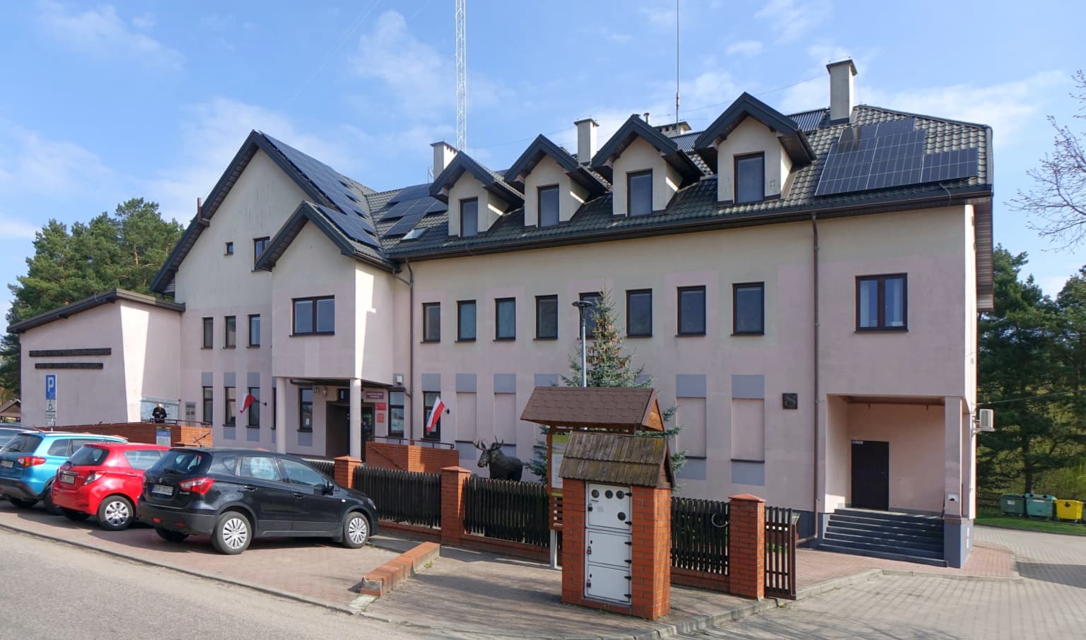
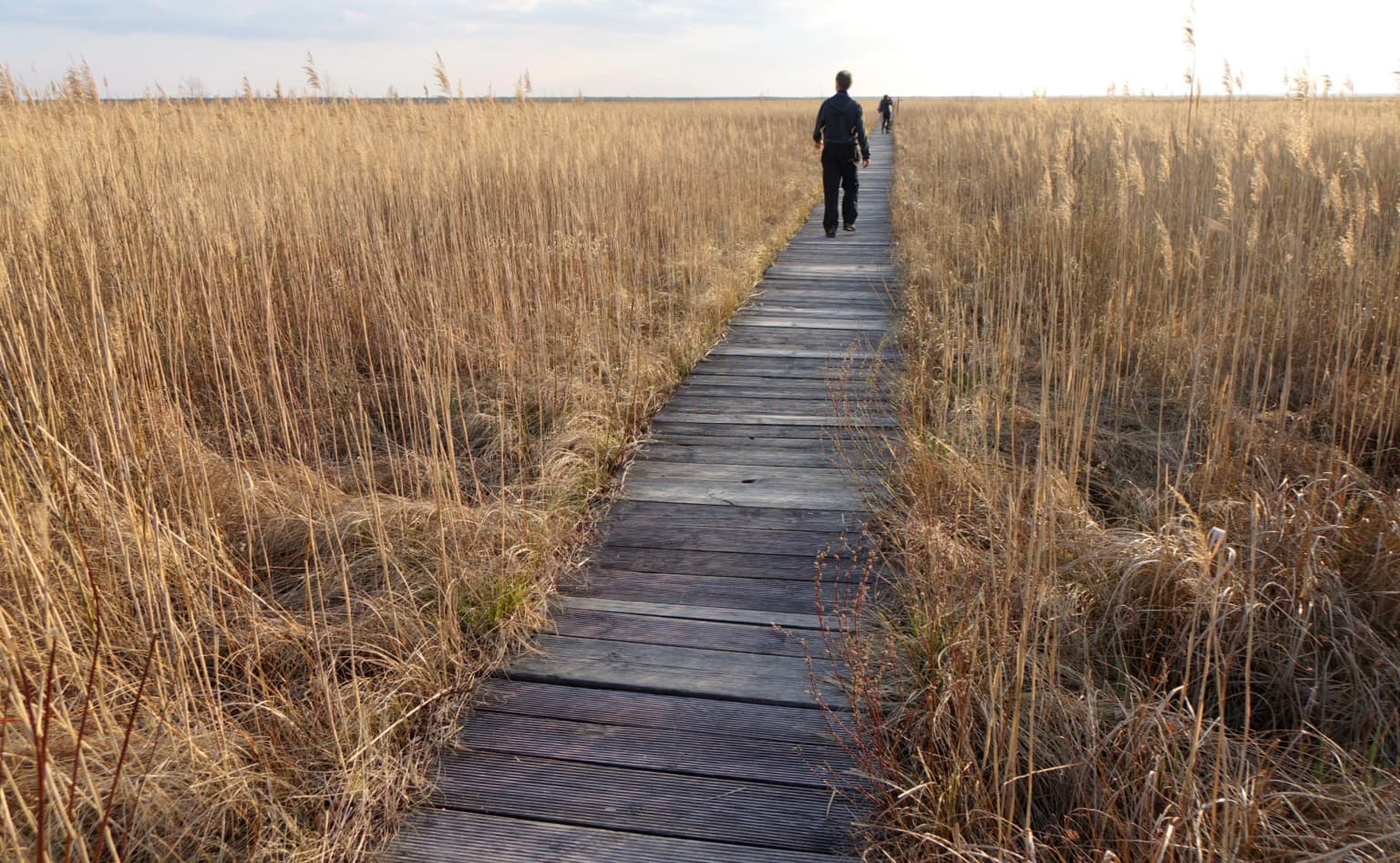
The Biebrza wetlands have been inhabited and used by human communities for centuries, with the landscape shaped by traditional agricultural practices including mowing and grazing that maintained the open marshland habitats. The park contains the historic Osowiec Fortress from the 19th century, a significant military fortification whose grounds now host the park's headquarters at Osowiec-Twierdza village. This cultural heritage element adds historical depth to the natural landscape, with the fortress complex offering educational trails and interpretation of the site's military history. The region has traditionally been inhabited by local communities whose livelihoods were closely tied to the wetland environment, with fishing, reed harvesting, and extensive pastoralism forming the basis of the cultural landscape. The park's tourist infrastructure includes educational trails that combine natural and cultural interpretation, such as the historical-nature trail at Góra Skobla and the trail around Fort IV of the Osowiec Fortress.

Wetland area with patches of water and green grasses under a bright sun
Sunlit wetland landscape in Biebrza National Park

Top sights and standout views in Biebrza National Park

The Biebrza Marshes represent the crown jewel of this protected area—the largest and most intact lowland fen complex in Europe, home to extraordinary biodiversity and critical for migrating birds. The park's population of approximately 400 moose makes it Poland's most important habitat for this largest European deer species. The Red Marsh (Czerwone Bagno) strict nature reserve protects pristine peat bog communities with rare relict plant species found nowhere else in Poland. The park's designation as a Ramsar site and its status as an Important Bird Area confirm its international conservation significance. The historic Osowiec Fortress provides a unique cultural dimension, with the park headquarters located within this 19th-century fortification complex. The ruff, depicted in the park's emblem, symbolizes the exceptional ornithological importance of the Biebrza wetlands for breeding wading birds.

Wooden boardwalk extending through tall golden reeds in a wetland area with two people walking away from the camera
Boardwalk of the Długa Luka educational trail in Biebrza National Park, Poland

Best time to visit Biebrza National Park

The best time to visit Biebrza National Park depends on the desired experience, though late spring and early summer (May through June) offer optimal conditions for observing breeding birds and experiencing the wetlands at their most vibrant. During this period, the marshland is alive with displaying ruffs, nesting waders, and the distinctive calls of corncrakes. The spring flooding creates extensive water bodies that attract migrating birds, making this prime season for birdwatching. Autumn (September and October) offers a different experience as the wetlands take on golden hues and large numbers of migratory birds pass through the basin. Winter reveals a stark, atmospheric landscape, though many access routes may be difficult and some facilities limited. The summer months can be hot and buggy, while winter conditions can be harsh in this northeastern region of Poland. Visitors interested in canoeing the Biebrza River will find the highest water levels in spring and early summer.

Park location guide

Geography guide, regional context, and park location map for Biebrza National Park

Biebrza National Park park geography, regions, and map view in Poland
Understand where Biebrza National Park sits in Poland through a broader geographic reading of the surrounding landscape, nearby location context, and its mapped position within the national park landscape.

How Biebrza National Park fits into Poland

Poland, officially the Republic of Poland, is a Central European country spanning from the Baltic Sea in the north to the Carpathian Mountains in the south. It borders Germany, Czech Republic, Slovakia, Ukraine, Belarus, Lithuania, and Kaliningrad Oblast. The country has a temperate climate, diverse landscapes, and is known for its rich history, cultural heritage, and strong economic position within the EU.

Wider geography shaping Biebrza National Park in Poland

Poland occupies 312,696 km2 in Central Europe, extending from the Baltic Sea coast in the north to the Sudetes and Carpathian Mountains in the south. It borders Germany to the west, Czech Republic and Slovakia to the south, Ukraine and Belarus to the east, and Lithuania and Kaliningrad Oblast to the northeast. The landscape includes lowland plains, uplands, and mountain ranges.

Map view of Biebrza National Park

Use this park location map to pinpoint Biebrza National Park in Poland, understand its exact geographic position, and read its mapped placement within the surrounding landscape more clearly.

Pigeon | © OpenStreetMap contributors

Location context for Biebrza National Park

Podlaskie Voivodeship

Visualizing the vast Biebrza Marshes, river valleys, and unique peat bog ecosystems of Poland's largest national park

Biebrza National Park Photos: Explore Wetland Landscapes, Scenery, and Protected Habitats
Browse a curated gallery of Biebrza National Park images to visually understand its expansive wetlands, meandering river landscape, and crucial bird habitats. These protected area views offer essential insight into the park's distinct ecological character, vast fenlands, and significant conservation importance.

Wooden observation tower on stilts with a boardwalk leading to it, surrounded by wetland vegetation under a clear blue sky

Panoramic landscape of Biebrza National Park showing a river, wetlands, and distant fields under a partly cloudy sky

Grassy field with two trees, a river, and distant forest under a partly cloudy sky

Wide view of a wetland area with calm water, scattered patches of vegetation and reeds, and a distant tree line under a clear blue sky

Light-colored multi-story building with dark roof, multiple windows, and a sign reading 'Biebrzański Park Narodowy' with parked cars in front

A gravel road stretches through a forested area with leafless trees and patches of snow under a clear blue sky

Wetland area with patches of water and green grasses under a bright sun

Wooden boardwalk extending through tall golden reeds in a wetland area with two people walking away from the camera

White-winged tern with black head and body, white wings, and orange legs standing in shallow water with reflection

Calm wetland reflecting tall trees surrounded by forest vegetation with aquatic plants

Aerial view of a vast wetland with patches of water, grasses, and low vegetation extending toward the horizon with a distant tree line

Wide view of Biebrza river with wetland marshes, a person standing on a small wooden platform in the water, and leafless trees in foreground

Green metal platform on a river with wooden docks, connected by ropes, surrounded by reeds and forest in the background

Wooden boardwalk trail with informational signboard in a forested wetland area

Park atlas

Compare surrounding wetland ecosystems and trace connected conservation landscapes across northeastern Poland.

Explore Other National Parks and Protected Areas Near Biebrza National Park in Podlaskie Voivodeship
Explore nearby national parks and protected areas that share geographic context with Biebrza National Park within Poland's Podlaskie Voivodeship. Compare distinct wetland ecosystems, forest reserves, and significant conservation landscapes to understand their regional distribution and ecological value.
Watercolor painting showing a winding river through marshy fields with distant hills
National parkPodlaskie Voivodeship

Narew National Park: Discover Poland's Premier Wetland National Park with Unique River Geography

Explore its mapped boundaries and rich protected landscape.

Narew National Park represents a significant protected area within the Podlaskie Voivodeship, distinguished by its one-of-a-kind anastomosing river system where the Narew River splits into numerous interconnected channels. This dynamic wetland environment provides critical habitat and showcases a complex interplay of water, land, and diverse ecosystems. Users can explore the park's geographic features, understand its protected landscape status, and appreciate its vital role within the regional atlas through detailed mapping and factual context.

Area
73.5 km²
Established
1996
IUCN
II
Relief
Lowland
Watercolor illustration showing lakes, green vegetation, and hills in the background
National parkPodlaskie Voivodeship

Wigry National Park: Protected Area Atlas of Poland's Glacial Lake District

Explore mapped landscapes and wetland ecosystems in Podlaskie Voivodeship

Delve into the geography of Wigry National Park, a national park situated in the Podlaskie Voivodeship of northeastern Poland. This protected area is defined by its glacial landscape, featuring 42 lakes including the expansive Lake Wigry, alongside critical wetland habitats and significant peat bogs. Discover the mapped boundaries and ecological importance of Wigry National Park, renowned as a prime location for beaver populations and a vital component of Poland's protected lands atlas.

Area
150.86 km²
Established
1989
IUCN
II
Visitors
110K annual
Watercolor illustration of a river flowing through grassy terrain with rolling hills in the background
National parkPodlaskie Voivodeship

Białowieża National Park: Europe's Last Unmodified Primeval Forest and Bison Habitat

Mapped protected landscape and regional geography in Podlaskie Voivodeship.

As Poland's most vital natural heritage site, Białowieża National Park protects an exceptionally rare example of an ancient temperate primeval forest. This national park, located within the Podlaskie Voivodeship, serves as a living ecological laboratory, showcasing natural processes in unmodified woodland habitats. Its significance extends to being a critical sanctuary for the European bison, housing the world's largest free-ranging population. MoriAtlas provides detailed map context and geographic insights into this globally important protected area and its unique landscape.

Area
105.17 km²
Established
1932
IUCN
II
Visitors
140K annual
Watercolor painting showing a river flowing through a forested landscape with green hills, distant mountains, and a pink and yellow sky
National park

Belavezhskaya Pushcha National Park: Ancient Primeval Forest & European Bison Sanctuary

Explore mapped protected areas and regional geography.

Belavezhskaya Pushcha National Park stands as a testament to Europe's ancient woodland heritage, a protected landscape of immense ecological value. This primeval forest, a sanctuary for the European bison, offers a unique glimpse into an ecosystem preserved for millennia. The park's mapped boundaries and geographic context provide essential detail for understanding its role as a critical natural monument and a cornerstone of regional protected areas.

Area
1,500.69 km²
Established
1932
IUCN
II
Visitors
300K annual
National park

Dzūkija National Park: Explore Lithuania's Largest Protected Forest and Inland Dune Landscapes

Mapped protected area geography and natural terrain of the Dainava region.

Delve into the protected landscape of Dzūkija National Park, Lithuania's expansive national park renowned for its vast primeval pine forests and extraordinary inland dune formations. This page provides a detailed atlas-style view of the park's mapped boundaries, diverse terrain, and significant natural features, offering insight into its protected territory and regional geographic importance. Examine the unique wetland systems and forest ecosystems that make this a crucial area for protected land discovery.

Area
584.53 km²
Established
1991
IUCN
II
Visitors
30K annual
National park

Trakai National Historic Park: Medieval Heritage and Lake District Protected Landscape

Explore Lithuania's historic park and its mapped geographic context.

Trakai National Historic Park offers a rich tapestry of medieval history intertwined with a captivating lake district landscape. As a protected area in southeastern Lithuania, it preserves significant architectural monuments, including the iconic Trakai Castle, set against a backdrop of interconnected lakes, forests, and wetlands. MoriAtlas provides a structured overview of its geographic boundaries and regional setting, facilitating atlas-style exploration of this historically significant protected landscape.

Access
Moderate access
Scope
Mixed
National parkMasovian Voivodeship

Kampinos National Park: Mapped Protected Landscape of Inland Sand Dunes

Discover Masovian Voivodeship's unique geography and park boundaries.

Kampinos National Park is a nationally significant protected area within the Masovian Voivodeship, celebrated for its extensive and well-preserved inland sand dune formations, a rarity in European geography. This park offers a distinct mapped landscape where pine-covered dunes intermingle with wetland ecosystems, supporting a unique biodiversity that includes a notable moose population. Explore the park's protected boundaries and understand its position as a vital natural and historical asset with detailed geographic context.

Area
385.44 km²
Established
1959
IUCN
II
Relief
Lowland
Watercolor painting of a coastal landscape featuring trees, birds, and soft pastel-colored hills
National parkKaliningrad Oblast

Curonian Spit National Park: Coastal Dunes and Baltic Protected Landscape

Explore a UNESCO World Heritage sand spit with unique terrain.

Curonian Spit National Park offers a remarkable study in coastal geography and protected landscapes, situated on one of the longest sand spits globally. This protected area within Russia's Kaliningrad Oblast features dynamic dune systems, distinctive forest formations, and serves as a vital corridor for migratory birds. Its UNESCO status underscores its international significance for natural heritage and landscape exploration, providing rich context for regional geography within the MoriAtlas platform.

Area
66 km²
Established
1987
Relief
Lowland
Climate
Temperate

Common questions about visiting, size, designation, and location context for Biebrza National Park

Biebrza National Park FAQs for park facts, access, geography, and protected area context
Find quick answers about Biebrza National Park, including protected-area facts, park geography, trail and visitor context, and how the park fits into its surrounding country and regional landscape.
MoriAtlas Explorer

Continue Your Protected Areas Search Across the Global Atlas

Deepen your exploration by continuing the structured search for national parks and protected areas worldwide. Utilize the comprehensive filtering capabilities to compare different conservation landscapes and refine your understanding of global park geography. Discover more about the distribution and characteristics of protected natural areas.

Global natural geography