Mori Atlas logo
National parkBelavezhskaya Pushcha National Park

Discover the mapped boundaries and ancient landscape of Europe's last remaining primeval woodland.

Belavezhskaya Pushcha National Park: Belarus's Primeval Forest and European Bison Sanctuary

(National Park Belavezhskaya Pushcha)

Belavezhskaya Pushcha National Park represents a remarkable fragment of the vast primeval forests that once spanned the European Plain. This protected landscape, straddling the Belarusian and Polish border, preserves an ancient woodland ecosystem with minimal human interference. As a UNESCO World Heritage site and primary sanctuary for the iconic European bison, the park offers unparalleled opportunities for exploring its unique geography and ecological significance through detailed mapping and atlas context.

primeval forestEuropean bisonUNESCO World Heritage Sitetransboundary parkold-growth forestEastern Europe
Stylized illustration showing a forested valley with mountains, a waterfall, and a river under a sunlit sky

Belavezhskaya Pushcha National Park

National park

Park overview

Structured park overview, official facts, and landscape profile for Belavezhskaya Pushcha National Park

Belavezhskaya Pushcha National Park park facts, protected area profile, and essential visitor context
Review the core facts for Belavezhskaya Pushcha National Park, including designation, size, terrain, visitor scale, habitats, and operating context in one park-focused overview.

About Belavezhskaya Pushcha National Park

Belavezhskaya Pushcha National Park represents one of Europe's most significant natural treasures,保护着跨越国界的原始森林遗迹. The Belarusian portion of the Białowieża Forest encompasses approximately 150,000 hectares of woodland that has never been subjected to large-scale commercial forestry or agricultural conversion. This extraordinary preservation makes the forest a living laboratory where scientists can study natural forest dynamics, including tree mortality, regeneration, and the complex interactions between species that have shaped European woodlands for thousands of years. The forest's ecological importance is amplified by its position at the boundary between western and eastern European biogeographic regions, creating a unique mix of species from different origins. The park's management focuses on maintaining the forest's natural processes while providing controlled visitor access to understand and appreciate this irreplaceable ecosystem. The nearby village of Kamieniuki serves as the park's administrative center and hosts the Eco Education Center and Museum of Nature, offering visitors context for understanding the forest's ecological and cultural significance.

Quick facts and research context for Belavezhskaya Pushcha National Park

Belavezhskaya Pushcha National Park covers approximately 1,500 square kilometers of the Białowieża Forest in southwestern Belarus, making it one of the largest and most ecologically significant protected areas in Europe. The forest sits on gently undulating terrain with elevations ranging from 144 to 243 meters above sea level, characterized by a mix of flat plains, isolated hills, and extensive wetland areas. The park's location 70 kilometers north of Brest places it within the broader Pripyat marshes region, with several rivers including the Pravaya Lesnaya, Narau, and Narauka flowing through the park's territory. As part of the transboundary Białowieża Forest, the park shares its border with Poland's Białowieża National Park, and visitors can cross between the two countries at designated points within the forest. The park also holds the distinction of being a UNESCO Biosphere Reserve since 1993, recognizing its importance for both conservation and sustainable management.

Park context

Deeper park guide and search-rich context for Belavezhskaya Pushcha National Park

Belavezhskaya Pushcha National Park history, landscape, wildlife, and travel context
Explore Belavezhskaya Pushcha National Park through its history, landscape character, ecosystems, wildlife, conservation priorities, cultural context, and seasonal travel timing in a structured park guide built for atlas discovery and search intent.

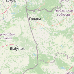
Why Belavezhskaya Pushcha National Park stands out

Belavezhskaya Pushcha is best known as the Belarusian portion of Europe's last primeval forest and as the primary sanctuary for the European bison (wisent), the continent's heaviest land animal. The forest represents an extraordinarily rare ecological time capsule, preserving the woodland ecosystem that once covered the entire European Plain before widespread deforestation. Visitors come to witness the dense old-growth forest with its towering oaks, hornbeam, and pine stands that have never been logged or significantly altered by human activity. The park's significance extends to its bird populations, with the forest serving as a crucial habitat for black and white storks, Eurasian eagle-owls, and both lesser and greater spotted eagles, earning it Important Bird Area designation by BirdLife International.

A forest path covered in fallen leaves with tall trees and dappled sunlight filtering through the canopy.
A forest path winding through the primeval woodland of Belavezhskaya Pushcha National Park.

Belavezhskaya Pushcha National Park history and protected-area timeline

The protected status of Belavezhskaya Pushcha traces back to medieval times when the forest served as the royal hunting grounds of Polish kings beginning in the 15th century and later Russian tsars from the 18th century through the early 20th century. This royal protection effectively preserved the forest from commercial exploitation for centuries, creating the conditions for its survival into the modern era. In 1932, during the Second Polish Republic, most of the Białowieża Forest was declared a national park, establishing formal protection that would persist through subsequent political changes. Following World War II, the forest was divided between Poland and the Byelorussian Soviet Socialist Republic according to the Polish-Soviet border agreement of August 1945, creating the current transboundary situation. The Belarusian section received a new status in 1957 as the State Reserve-Hunting Farm, serving as an exclusive recreation area for top Soviet leadership and their foreign guests. In 1991, the forest acquired its current status as a state national park, opening to broader public access while maintaining strict conservation protection. The year 2009 marked the 600th anniversary of the forest's reserve status, a testament to its enduring significance across centuries of changing political regimes and borders.

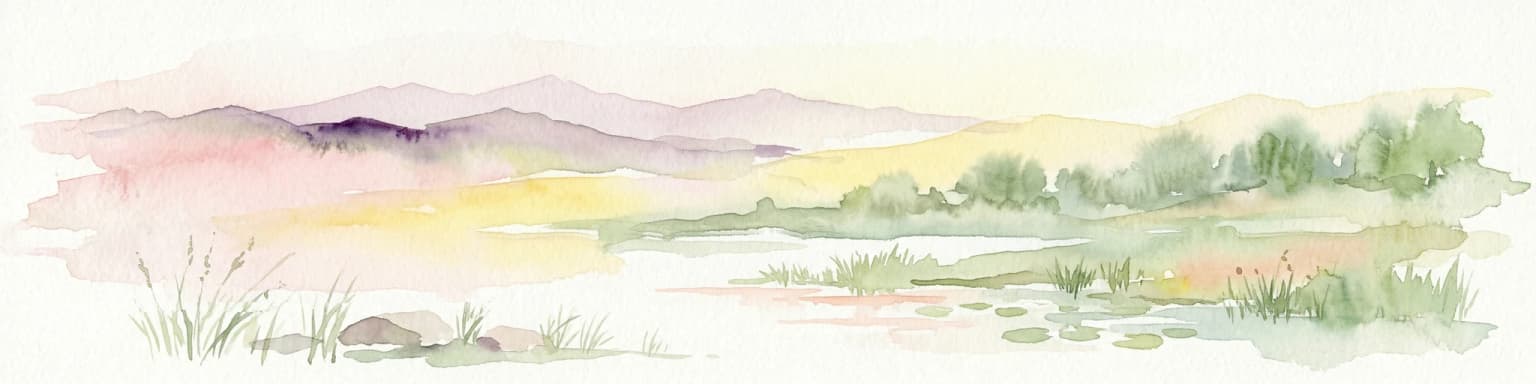
Belavezhskaya Pushcha National Park landscape and geographic character

The landscape of Belavezhskaya Pushcha is characterized by a gently undulating plain with elevations ranging from approximately 144 meters in river valleys to 243 meters at the highest point near the village of Porazava. The terrain consists of flat areas interspersed with isolated ridges and depressions, creating a subtle but varied topography across the forest. The park sits within the basin of the Western Bug river system, with most streams flowing in an eastward to westward direction, draining into the Baltic Sea. The forest contains extensive wetland areas, most notably the Dzikie Boge (Wild Bog), one of Europe's largest lowland peat bogs of mesotrophic type, located near the northeastern edge of the forest. Unlike many forest regions, Belavezhskaya Pushcha contains virtually no natural lakes, though more than ten artificial reservoirs have been created, primarily in the southern portion of the park. The largest of these artificial water bodies include the Ledskoye and Khmyolevskoye reservoirs, created by flooding former peat bog areas.

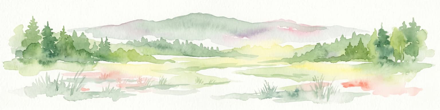
Belavezhskaya Pushcha National Park ecosystems, habitats, and plant life

The ecological character of Belavezhskaya Pushcha reflects its position as a remnant of the primeval forests that once dominated the European Plain. The forest supports a diverse mix of tree species including oak, hornbeam, pine, spruce, birch, and alder, with some oak trees estimated to be over 500 years old. The forest structure differs dramatically from managed woodlands, featuring a complex three-layer canopy, abundant deadwood in various stages of decomposition, and natural gaps created by fallen trees. The park is divided into transition, buffer, and core zones within the broader 216,200-hectare Biosphere Reserve, with the core areas receiving the highest level of protection to preserve unmodified natural processes. The wetland components of the forest, including the extensive peat bogs and riparian areas along the rivers, support specialized plant communities distinct from the dominant woodland areas. Climate conditions in the region show moderate continental characteristics with average annual temperatures ranging from 5.1 to 8.5 degrees Celsius and annual precipitation of approximately 653 millimeters, with two-thirds falling during the warm season.

Belavezhskaya Pushcha National Park wildlife and species highlights

Belavezhskaya Pushcha harbors one of Europe's most significant wildlife populations, most famously serving as the primary stronghold for the European bison, the continent's heaviest land mammal. Reintroduction programs from Belavezhskaya Pushcha have repopulated other European countries with this iconic species, making the park central to the species' recovery from near extinction. The bird fauna of the forest is equally remarkable, with the park designated as an Important Bird Area by BirdLife International due to its significant populations of black storks, white storks, Eurasian eagle-owls, European honey-buzzards, lesser spotted eagles, and greater spotted eagles. The forest provides habitat for numerous other mammal species including red deer, roe deer, wild boar, lynx, wolf, and beaver, maintaining a full complement of European forest wildlife. The complex forest structure with its old trees, deadwood, and diverse habitats supports an extraordinary diversity of invertebrates, fungi, and smaller organisms that form the foundation of the ecosystem's functioning.

Belavezhskaya Pushcha National Park conservation status and protection priorities

Belavezhskaya Pushcha holds exceptional conservation significance as the last substantial fragment of the primeval forest that once stretched across the European Plain. Its inscription as a UNESCO World Heritage Site in 1992 (with extension in 2014) recognizes the forest as a natural site of outstanding universal value, while its designation as a Biosphere Reserve in 1993 acknowledges its role in balancing conservation with sustainable use. The park represents a critical refuge for species that have been eliminated from most of their historical range across Europe, particularly the European bison whose survival depends on protected populations like this forest. Conservation efforts focus on maintaining natural forest dynamics without active management, allowing processes like tree death, regeneration, and predator-prey relationships to proceed naturally. The transboundary nature of the forest creates both challenges and opportunities for conservation, requiring international cooperation to protect the ecosystem as a whole while acknowledging the different management approaches on the Polish and Belarusian sides.

Belavezhskaya Pushcha National Park cultural meaning and human context

The forest has a rich cultural heritage spanning centuries of human interaction, serving as the exclusive hunting grounds of Polish monarchs from the 15th century onward and later Russian imperial rulers through the early 20th century. This royal protection, while primarily intended to preserve game animals for aristocratic hunting, had the unintended but crucial effect of protecting the forest ecosystem from the deforestation that transformed much of Europe. The forest appears in numerous historical documents and cultural references from the medieval period onward, establishing its status as a landmark natural feature of Eastern Europe. Local communities in the surrounding region have traditional connections to the forest, though the protected status has limited human settlement within the park boundaries. The administrative center at Kamieniuki represents a purpose-built settlement designed to support park operations and visitor services while minimizing impact on the forest environment.

Top sights and standout views in Belavezhskaya Pushcha National Park

The extraordinary antiquity of the forest ecosystem, with trees and ecological processes that have continued uninterrupted for millennia, makes Belavezhskaya Pushcha a unique natural monument in Europe. The European bison population represents both a conservation success story and the park's most iconic wildlife attraction, offering visitors the chance to observe these massive animals in their natural forest habitat. The transboundary hiking and cycling routes between Belarus and Poland, accessible visa-free since 2015, provide a rare opportunity to experience international wilderness travel within a UNESCO World Heritage site. The park's Eco Education Center and Museum of Nature at Kamieniuki offer valuable interpretive context for understanding the forest's ecological significance and the conservation challenges facing this remarkable ecosystem.

Best time to visit Belavezhskaya Pushcha National Park

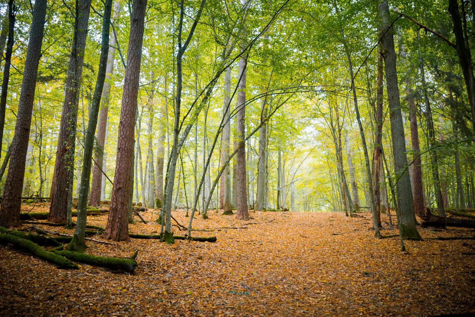
The forest can be visited throughout the year, with each season offering a distinct perspective on this ancient woodland. Spring brings the awakening of the forest with migratory birds returning, flowering plants, and the distinctive green of new leaves contrasting with the dark evergreen species. Summer offers the fullest leaf canopy and best conditions for wildlife viewing, though this is also the most popular season for visitors. Autumn transforms the forest with spectacular color changes as deciduous trees lose their leaves, and the mushroom season attracts both visitors and forest dwellers. Winter reveals the forest's structure more clearly without foliage and offers the best chances to observe European bison and other wildlife as they become more visible in the relatively open winter landscape. The cold months also bring fewer visitors to the park, providing a more solitary wilderness experience.

Park location guide

Geography guide, regional context, and park location map for Belavezhskaya Pushcha National Park

Belavezhskaya Pushcha National Park park geography, regions, and map view in Belarus
Understand where Belavezhskaya Pushcha National Park sits in Belarus through a broader geographic reading of the surrounding landscape, nearby location context, and its mapped position within the national park landscape.

How Belavezhskaya Pushcha National Park fits into Belarus

Belarus is a landlocked Eastern European country spanning 207,600 km² with a population of about 9.1 million. Formerly part of the Soviet Union, it declared independence in 1991 and is now a unitary semi-presidential republic. The nation shares borders with Russia, Ukraine, Poland, Lithuania, and Latvia, and is administratively divided into six regions.

Wider geography shaping Belavezhskaya Pushcha National Park in Belarus

Belarus is a landlocked country in Eastern Europe, bordered by Russia to the east and northeast, Ukraine to the south, Poland to the west, and Lithuania and Latvia to the northwest. The terrain consists largely of flatland and rolling hills with many rivers, lakes, and forests. The country spans 207,600 km² and is administratively divided into six regions.

Map view of Belavezhskaya Pushcha National Park

Use this park location map to pinpoint Belavezhskaya Pushcha National Park in Belarus, understand its exact geographic position, and read its mapped placement within the surrounding landscape more clearly.

Pigeon | © OpenStreetMap contributors

Location context for Belavezhskaya Pushcha National Park

Brest RegionGrodno Region

A Visual Journey Through Europe's Last Ancient Woodlands, Documenting Unique Habitats and Protected-Area Terrain

Explore Belavezhskaya Pushcha National Park: Primeval Forest Landscapes and European Bison Scenery
Browse compelling imagery showcasing the distinct primeval forest landscapes and the iconic European bison within Belavezhskaya Pushcha National Park, revealing its ancient woodland character. These visual resources offer deep insight into the park's varied terrain, wetland ecosystems, and the overall protected-area environment, essential for a comprehensive geographic understanding.

A forest path covered in fallen leaves with tall trees and dappled sunlight filtering through the canopy.

Tall coniferous trees in a forest with green undergrowth and a fallen tree trunk

Park atlas

Map the surrounding protected landscapes, tracing how primeval forest ecosystems connect with diverse conservation zones across Eastern Europe.

Explore Nearby National Parks and Protected Areas Beyond Belavezhskaya Pushcha National Park
Browse national parks and protected areas geographically relevant to Belavezhskaya Pushcha National Park, including significant transboundary forests and vital wetland ecosystems. Compare adjacent protected landscapes, understand their regional spread, and trace conservation efforts across this unique European primeval forest zone.
Watercolor illustration of a river flowing through grassy terrain with rolling hills in the background
National parkPodlaskie Voivodeship

Białowieża National Park: Europe's Last Unmodified Primeval Forest and Bison Habitat

Mapped protected landscape and regional geography in Podlaskie Voivodeship.

As Poland's most vital natural heritage site, Białowieża National Park protects an exceptionally rare example of an ancient temperate primeval forest. This national park, located within the Podlaskie Voivodeship, serves as a living ecological laboratory, showcasing natural processes in unmodified woodland habitats. Its significance extends to being a critical sanctuary for the European bison, housing the world's largest free-ranging population. MoriAtlas provides detailed map context and geographic insights into this globally important protected area and its unique landscape.

Area
105.17 km²
Established
1932
IUCN
II
Visitors
140K annual
Watercolor painting showing a winding river through marshy fields with distant hills
National parkPodlaskie Voivodeship

Narew National Park: Discover Poland's Premier Wetland National Park with Unique River Geography

Explore its mapped boundaries and rich protected landscape.

Narew National Park represents a significant protected area within the Podlaskie Voivodeship, distinguished by its one-of-a-kind anastomosing river system where the Narew River splits into numerous interconnected channels. This dynamic wetland environment provides critical habitat and showcases a complex interplay of water, land, and diverse ecosystems. Users can explore the park's geographic features, understand its protected landscape status, and appreciate its vital role within the regional atlas through detailed mapping and factual context.

Area
73.5 km²
Established
1996
IUCN
II
Relief
Lowland
Watercolor depiction of a lake with reeds, forested shoreline, and distant mountains
National parkUkraine

Shatsk National Natural Park: Ukraine's Deepest Lake and Wetland Protected Area Atlas

Mapped landscape and protected geography of a premier Ukrainian national park.

Shatsk National Natural Park in Ukraine is a significant protected area featuring a remarkable cluster of over thirty lakes, most notably Svitiaz Lake, the nation's deepest. This park protects vital wetland and forest ecosystems within the Polissia region, offering a rich geographic context for atlas exploration. Understanding its mapped boundaries and terrain provides insight into its importance as a Ramsar site and a key corridor for migratory birds, making it a cornerstone of conservation geography in Eastern Europe.

Area
489.77 km²
Established
1983
Relief
Lowland
Climate
Temperate
National parkUkraine

Prypiat, Stokhid National Nature Park: National Park Geography & Protected Landscape

Mapped boundaries and regional natural context in Ukraine.

Gain structured insight into Prypiat, Stokhid National Nature Park, a protected national park in Ukraine. This entry details its geographic footprint and landscape features, offering a foundation for understanding its role within the broader atlas of protected areas. Explore the mapped terrain and regional context that defines this significant natural landscape.

Area
393.155 km²
Established
2007
IUCN
II
Relief
Lowland
Watercolor painting showing a wetland scene with reeds, patches of water, and trees under a light sky
National parkPodlaskie Voivodeship

Biebrza National Park: Poland's Largest National Park and European Wetland Atlas

Explore the mapped geography of its vast protected fenlands.

Biebrza National Park represents a critical protected landscape in northeastern Poland, famed for its vast, intact Biebrza Marshes, the largest lowland peat bog complex in Europe. This national park page offers detailed geographic context, highlighting the unique fenland terrain, marshland ecosystems, and protected area boundaries. Discover why this region is internationally recognized for its biodiversity and its significance within the broader atlas of European protected lands.

Area
592.23 km²
Established
1993
IUCN
II
National park

Polesie National Park: Protected National Park in Poland's Eastern Lowlands

Explore its mapped wetland geography and unique glacial terrain.

Polesie National Park represents a key protected landscape within eastern Poland, notable for its vast wetland complexes, including extensive peat bogs and marshes interspersed with pine forests on sandy dunes. This national park showcases a distinct geography shaped by glacial processes, offering a unique perspective on lowland ecosystems and their conservation. MoriAtlas allows for a structured discovery of its protected boundaries and the surrounding regional context, providing an atlas-driven understanding of this vital natural territory.

Area
97.52 km²
Established
1979
IUCN
II
Watercolor illustration showing lakes, green vegetation, and hills in the background
National parkPodlaskie Voivodeship

Wigry National Park: Protected Area Atlas of Poland's Glacial Lake District

Explore mapped landscapes and wetland ecosystems in Podlaskie Voivodeship

Delve into the geography of Wigry National Park, a national park situated in the Podlaskie Voivodeship of northeastern Poland. This protected area is defined by its glacial landscape, featuring 42 lakes including the expansive Lake Wigry, alongside critical wetland habitats and significant peat bogs. Discover the mapped boundaries and ecological importance of Wigry National Park, renowned as a prime location for beaver populations and a vital component of Poland's protected lands atlas.

Area
150.86 km²
Established
1989
IUCN
II
Visitors
110K annual
National park

Dzūkija National Park: Explore Lithuania's Largest Protected Forest and Inland Dune Landscapes

Mapped protected area geography and natural terrain of the Dainava region.

Delve into the protected landscape of Dzūkija National Park, Lithuania's expansive national park renowned for its vast primeval pine forests and extraordinary inland dune formations. This page provides a detailed atlas-style view of the park's mapped boundaries, diverse terrain, and significant natural features, offering insight into its protected territory and regional geographic importance. Examine the unique wetland systems and forest ecosystems that make this a crucial area for protected land discovery.

Area
584.53 km²
Established
1991
IUCN
II
Visitors
30K annual

Common questions about visiting, size, designation, and location context for Belavezhskaya Pushcha National Park

Belavezhskaya Pushcha National Park FAQs for park facts, access, geography, and protected area context
Find quick answers about Belavezhskaya Pushcha National Park, including protected-area facts, park geography, trail and visitor context, and how the park fits into its surrounding country and regional landscape.
MoriAtlas Explorer

Continue Your Protected Areas Search Across the Global Atlas

Deepen your exploration by continuing the structured search for national parks and protected areas worldwide. Utilize the comprehensive filtering capabilities to compare different conservation landscapes and refine your understanding of global park geography. Discover more about the distribution and characteristics of protected natural areas.

Global natural geography