Mori Atlas logo
National parkPrypiat–Stokhid National Nature Park

Understanding the mapped boundaries and regional context of this Ukrainian national park.

Prypiat–Stokhid National Nature Park: Protected Landscape & Geographic Atlas Entry

This page provides a detailed atlas-level view of Prypiat–Stokhid National Nature Park, a designated national park within Ukraine. Explore its specific geographic setting and the mapped context of its protected lands. Discover how this park contributes to the regional landscape and protected area network of Eastern Europe.

WetlandsRamsar SiteBird MigrationIUCN Category IIPolissia RegionRiver Floodplain

Prypiat–Stokhid National Nature Park

National park

Park overview

Structured park overview, official facts, and landscape profile for Prypiat, Stokhid National Nature Park

Prypiat, Stokhid National Nature Park park facts, protected area profile, and essential visitor context
Review the core facts for Prypiat, Stokhid National Nature Park, including designation, size, terrain, visitor scale, habitats, and operating context in one park-focused overview.

About Prypiat, Stokhid National Nature Park

Prypiat–Stokhid National Nature Park occupies a distinctive position in Ukraine's protected area network as a guardian of the Polissia region's wetland heritage. The park was created in 2007 to protect and unify the natural complexes of the Prypiat and Stokhid river valleys, preserving habitats that have been shaped by centuries of natural hydrological processes. The flat topography of the area, particularly along the Stokhid River with its numerous channels and oxbow lakes, creates a complex mosaic of wetlands that supports extraordinary biological diversity. The park provides essential ecosystem services, including water filtration and flood regulation, with its filtered waters eventually feeding into the Dnieper River and flowing through central Ukraine. Beyond its ecological significance, the park offers visitor opportunities for exploration through an extensive network of bicycle routes, hiking trails, and water-based tours in kayaks and small boats, while also promoting sustainable rural tourism that connects visitors with traditional village life in the surrounding area.

Quick facts and research context for Prypiat, Stokhid National Nature Park

Prypiat–Stokhid National Nature Park spans 39,315.5 hectares along the Ukrainian-Belarusian border in Volyn Oblast. The protected area was established in 2007 under the management of Ukraine's Ministry of Ecology and Natural Resources. The landscape is defined by the flat wetlands of the Prypiat and Stokhid rivers, with the park stretching roughly 50 kilometers west-to-east and averaging 10 kilometers north-to-south. The park falls within the Central European mixed forests ecoregion and experiences a humid continental climate with warm summers. It holds IUCN Category II status as a national park.

Park context

Deeper park guide and search-rich context for Prypiat, Stokhid National Nature Park

Prypiat, Stokhid National Nature Park history, landscape, wildlife, and travel context
Explore Prypiat, Stokhid National Nature Park through its history, landscape character, ecosystems, wildlife, conservation priorities, cultural context, and seasonal travel timing in a structured park guide built for atlas discovery and search intent.

Why Prypiat, Stokhid National Nature Park stands out

Prypiat, Stokhid is best known for its extensive wetland complexes and its role as a critical habitat for migratory waterfowl. The park protects two Ramsar wetlands of international importance, which form a connected transboundary Ramsar site spanning into Belarus. The name Stokhid, meaning 'river of one hundred moves,' reflects the character of the meandering river channels that traverse the flat terrain. The annual migration sees over 150,000 waterfowl passing through the area, making it one of the most significant bird migration corridors in the region. The park also preserves representative examples of the Polissia biosphere region's meadows and wetlands.

Prypiat, Stokhid National Nature Park history and protected-area timeline

Prypiat–Stokhid National Nature Park was established in 2007 through Ukrainian legislation aimed at protecting the natural heritage of the Polissia region. The creation of the park represented a recognition of the ecological importance of the Prypiat and Stokhid river valleys, which had previously lacked comprehensive protected status despite their significant biodiversity and wetland values. The park was designed to serve multiple functions: protecting natural ecosystems, providing areas for scientific research, and offering recreational opportunities for visitors. The selection of 2007 as the establishment year reflects a period of expanded protected area designation in Ukraine during the early 2000s. The park falls under the governance of the Ministry of Ecology and Natural Resources, which oversees its management and development.

Prypiat, Stokhid National Nature Park landscape and geographic character

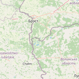
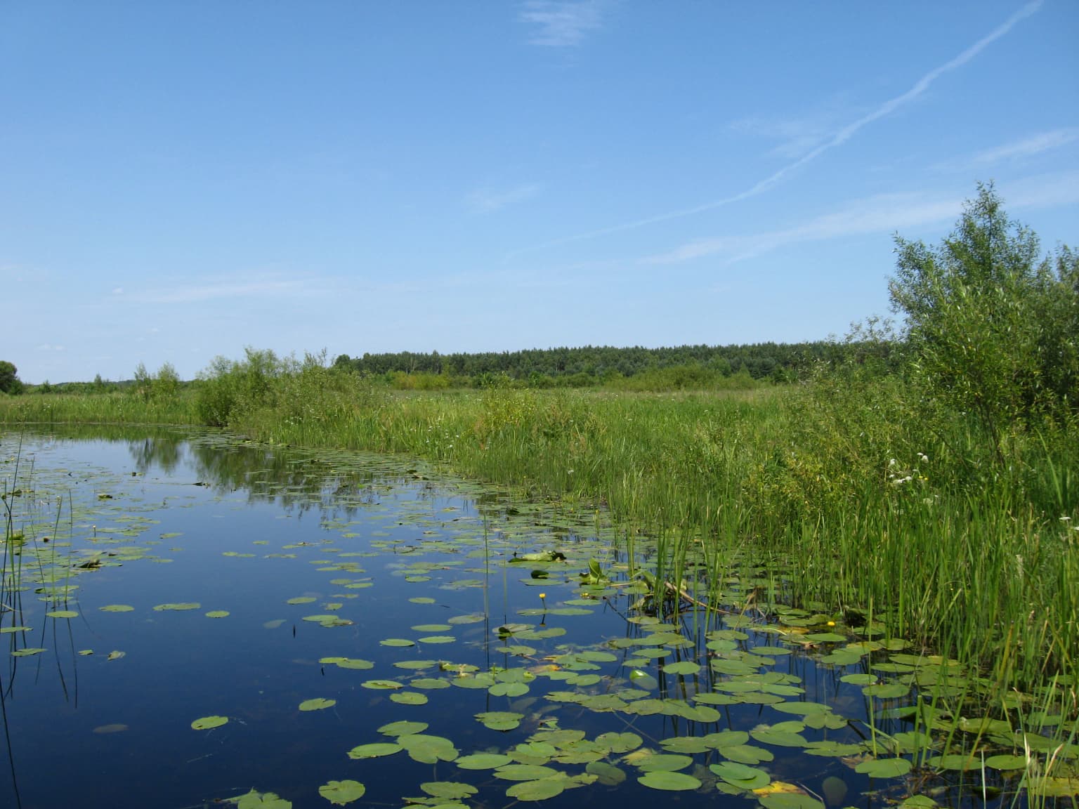
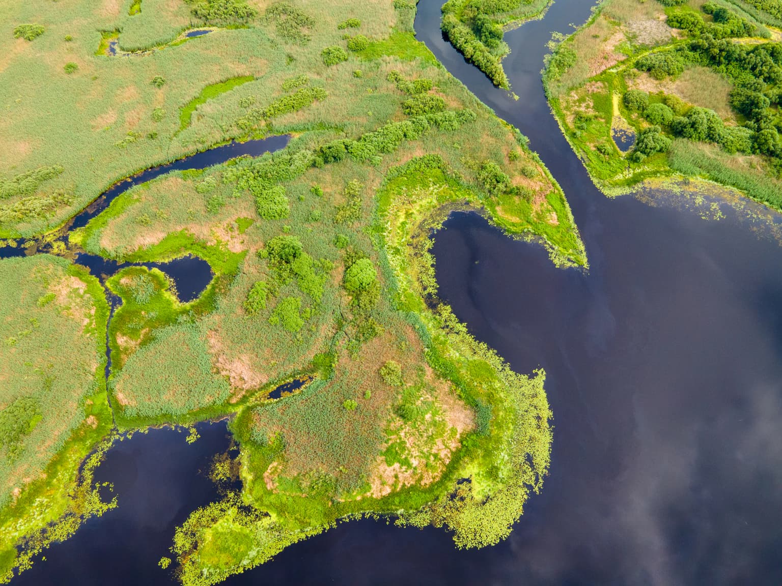
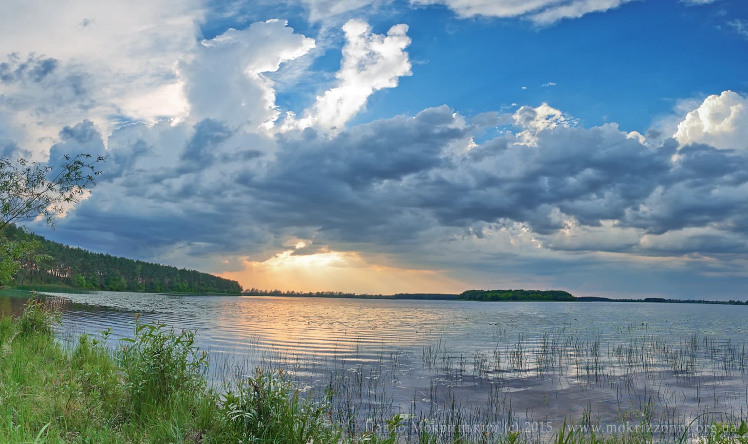
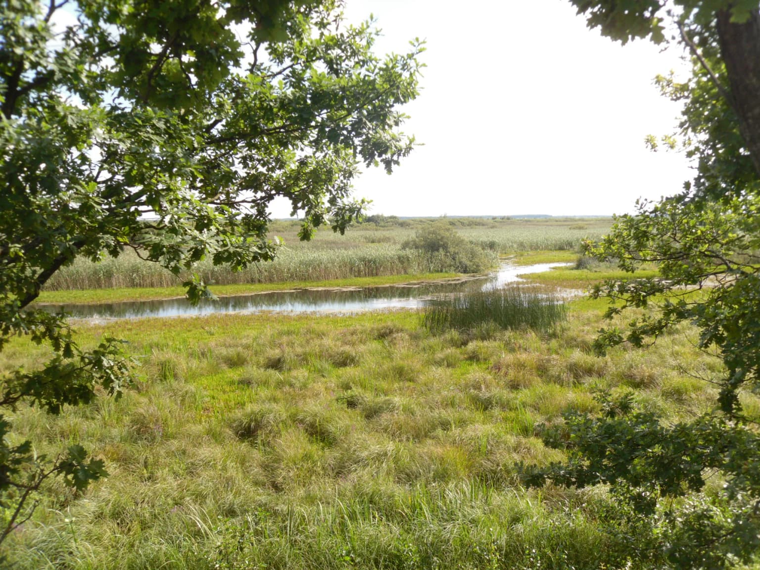
The landscape of Prypiat–Stokhid is defined by its flat wetland character, with the terrain barely rising above the surrounding river valleys. The Prypiat and Stokhid rivers wind through the area in complex patterns, with the Stokhid River particularly known for its meandering course that gives the park its name, as Stokhid translates to 'river of one hundred moves.' The park's outer boundaries form an elongated shape stretching approximately 50 kilometers from west to east, with a north-south width averaging around 10 kilometers. The area includes river floodplains, oxbow lakes, peatlands, and marshy meadows that create a dynamic and varied terrain. The park runs along the border with Belarus to the north, with the filtered waters from this wetland complex ultimately feeding into the Dnieper River system downstream.

Prypiat, Stokhid National Nature Park ecosystems, habitats, and plant life

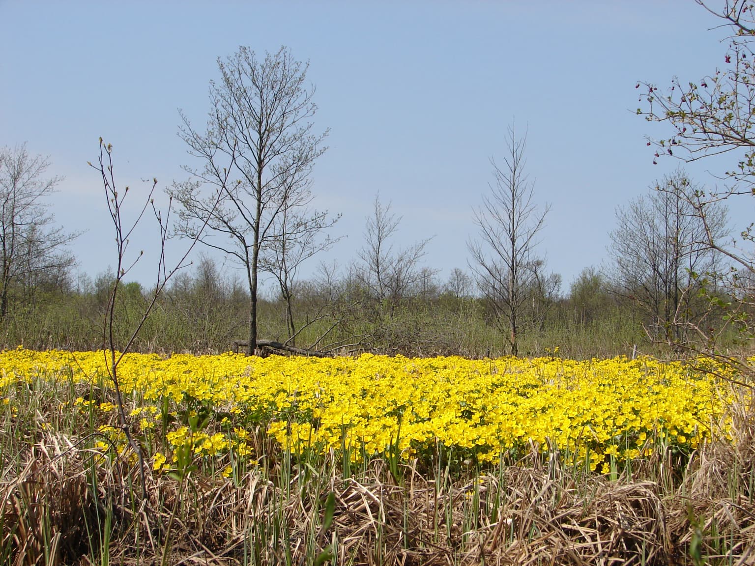
The nature of Prypiat–Stokhid reflects the rich ecological diversity of the Polissia region's wetland habitats. The park's habitat composition includes bogs covering 43% of the area, forests and bottom land at 35%, shrub land at 16%, and water features comprising 6%. This mosaic of wetlands, swamps, bogs, peatlands, and riverine islands creates extraordinarily diverse ecological conditions. The park is situated within the Central European mixed forests ecoregion, a temperate hardwood forest ecosystem that spans much of northeastern Europe. The climate is classified as humid continental with warm summers, characterized by large seasonal temperature variations and approximately 600 millimeters of annual precipitation. The combination of wetland habitats, forest patches, and the river corridors supports remarkable botanical diversity, with over 800 species of higher plants recorded within the park boundaries.

Prypiat, Stokhid National Nature Park wildlife and species highlights

Prypiat–Stokhid supports impressive wildlife diversity, with 220 vertebrate species documented including 60 mammal species and 220 bird species. The park is particularly significant for its waterfowl populations, with over 150,000 waterfowl recorded during the annual migration period. The wetland habitats provide critical breeding, feeding, and resting areas for numerous bird species, making the park a major bird migration corridor in Eastern Europe. The diverse habitats, ranging from open water and marsh to forested wetlands and peatlands, support a range of mammalian species adapted to wetland environments. The combination of protected status and the connectivity of wetland habitats creates conditions that support both resident wildlife populations and migratory species that depend on the area seasonally.

Prypiat, Stokhid National Nature Park conservation status and protection priorities

Prypiat–Stokhid holds significant conservation importance as a protected area preserving the wetland ecosystems of the Polissia region. The park contains two Ramsar wetlands of international importance, recognizing its global significance for waterbird habitats and wetland conservation. These Ramsar sites are connected to a transboundary Ramsar wetland that extends across the border into Belarus, highlighting the international conservation value of this wetland complex. The park is designated under IUCN Category II as a national park, reflecting its role in protecting natural landscapes and ecological processes. The conservation of this wetland area is particularly important given the extensive drainage and agricultural conversion that has affected much of the Polissia region's original wetland ecosystems. The park serves as a refuge for biodiversity and a representative example of the region's natural heritage.

Prypiat, Stokhid National Nature Park cultural meaning and human context

The cultural context of Prypiat–Stokhid relates to the traditional rural landscapes of the Polissia region that surround the protected area. The park's location in Volyn Oblast places it within a region with deep historical ties to traditional agricultural and fishing communities. The park's approach to visitor engagement includes 'green rural tourism,' which allows visitors to experience traditional village life, visit rural settlements, and even rent farm accommodations. This reflects the historical relationship between local communities and the land, where the wetland environments have historically supported fishing, reed harvesting, and traditional pastoral activities. The park's proximity to the Belarus border also places it within a cross-border regional context that has shaped both human settlement patterns and ecological connections.

Top sights and standout views in Prypiat, Stokhid National Nature Park

The most distinctive highlights of Prypiat–Stokhid include its extensive Ramsar-protected wetlands, the spectacular waterfowl migrations numbering over 150,000 birds, and the unique character of the Stokhid River with its complex, meandering channel system. The park's elongated shape along the border creates a distinctive landscape experience, while the variety of habitats from bogs to river forests offers ecological variety. The network of cycling routes spanning 1 to 5 day journeys provides a distinctive way to explore the park, while water-based tours in kayaks allow access to the riverine environments. The combination of natural protection, scientific research functions, and sustainable tourism makes this park a comprehensive example of modern protected area management in Ukraine.

Best time to visit Prypiat, Stokhid National Nature Park

The best time to visit Prypiat–Stokhid National Nature Park is during the warmer months from late spring through early autumn, when the full range of outdoor activities is available and the wetland landscapes are at their most accessible. The summer months offer warm conditions ideal for hiking, cycling, and water-based tours, while also coinciding with the breeding season for many bird species. Spring and autumn bring the dramatic waterfowl migrations, with spring particularly notable for the arrival of migratory birds that stop to rest and feed in the wetland habitats. The park's climate features warm summers with at least four months averaging above 10°C, making extended outdoor exploration comfortable during the May through September period.

Park location guide

Geography guide, regional context, and park location map for Prypiat, Stokhid National Nature Park

Prypiat, Stokhid National Nature Park park geography, regions, and map view in Ukraine
Understand where Prypiat, Stokhid National Nature Park sits in Ukraine through a broader geographic reading of the surrounding landscape, nearby location context, and its mapped position within the national park landscape.

How Prypiat, Stokhid National Nature Park fits into Ukraine

Ukraine is a sovereign nation in Eastern Europe, bordered by Russia, Belarus, Poland, Slovakia, Hungary, Romania, Moldova, and the Black Sea. It is the second-largest country in Europe by area. Kyiv is the capital and largest city, followed by Kharkiv, Odesa, and Dnipro. The official language is Ukrainian. Ukraine has a population of approximately 32.9 million and operates as a unitary semi-presidential republic.

Wider geography shaping Prypiat, Stokhid National Nature Park in Ukraine

Ukraine occupies 603,628 km² in Eastern Europe, making it the second-largest country in Europe. It shares borders with Russia, Belarus, Poland, Slovakia, Hungary, Romania, and Moldova. The country has a southern coastline along the Black Sea and Sea of Azov. The terrain includes plains, steppes, and the Carpathian Mountains in the west.

Map view of Prypiat, Stokhid National Nature Park

Use this park location map to pinpoint Prypiat, Stokhid National Nature Park in Ukraine, understand its exact geographic position, and read its mapped placement within the surrounding landscape more clearly.

Pigeon | © OpenStreetMap contributors

Location context for Prypiat, Stokhid National Nature Park

Liubeshiv RaionVolyn Oblast
Park atlas

Compare other protected areas and map the wetland geography surrounding Prypiat–Stokhid National Nature Park, revealing regional conservation patterns.

Explore Nearby Protected Wetlands and Nature Parks Around Prypiat–Stokhid National Nature Park
Browse other national parks and protected areas near Prypiat–Stokhid National Nature Park, focusing on the Polissia region's wetland ecosystems and river floodplains. Compare these conservation landscapes to understand regional protected area patterns, map contiguous habitats, and extend your geographic discovery.
Watercolor depiction of a lake with reeds, forested shoreline, and distant mountains
National parkUkraine

Shatsk National Natural Park: Ukraine's Deepest Lake and Wetland Protected Area Atlas

Mapped landscape and protected geography of a premier Ukrainian national park.

Shatsk National Natural Park in Ukraine is a significant protected area featuring a remarkable cluster of over thirty lakes, most notably Svitiaz Lake, the nation's deepest. This park protects vital wetland and forest ecosystems within the Polissia region, offering a rich geographic context for atlas exploration. Understanding its mapped boundaries and terrain provides insight into its importance as a Ramsar site and a key corridor for migratory birds, making it a cornerstone of conservation geography in Eastern Europe.

Area
489.77 km²
Established
1983
Relief
Lowland
Climate
Temperate
National parkVolyn Oblast

Tsumanska Pushcha National Nature Park: Protected Landscape and Regional Geography in Volyn Oblast

UA National Park with Mapped Boundaries and Terrain Context

Delve into Tsumanska Pushcha National Nature Park, a designated national park in Volyn Oblast, Ukraine. This entry provides detailed atlas-style information on the park's protected landscape identity, its mapped geographic setting, and its significance within the regional geography of Northwestern Ukraine. Understand the park's boundaries and its place in the natural terrain.

Area
334.75 km²
Established
2010
IUCN
II
Relief
Lowland
Watercolor painting showing a river flowing through a forested landscape with green hills, distant mountains, and a pink and yellow sky
National park

Belavezhskaya Pushcha National Park: Ancient Primeval Forest & European Bison Sanctuary

Explore mapped protected areas and regional geography.

Belavezhskaya Pushcha National Park stands as a testament to Europe's ancient woodland heritage, a protected landscape of immense ecological value. This primeval forest, a sanctuary for the European bison, offers a unique glimpse into an ecosystem preserved for millennia. The park's mapped boundaries and geographic context provide essential detail for understanding its role as a critical natural monument and a cornerstone of regional protected areas.

Area
1,500.69 km²
Established
1932
IUCN
II
Visitors
300K annual
Watercolor illustration of a river flowing through grassy terrain with rolling hills in the background
National parkPodlaskie Voivodeship

Białowieża National Park: Europe's Last Unmodified Primeval Forest and Bison Habitat

Mapped protected landscape and regional geography in Podlaskie Voivodeship.

As Poland's most vital natural heritage site, Białowieża National Park protects an exceptionally rare example of an ancient temperate primeval forest. This national park, located within the Podlaskie Voivodeship, serves as a living ecological laboratory, showcasing natural processes in unmodified woodland habitats. Its significance extends to being a critical sanctuary for the European bison, housing the world's largest free-ranging population. MoriAtlas provides detailed map context and geographic insights into this globally important protected area and its unique landscape.

Area
105.17 km²
Established
1932
IUCN
II
Visitors
140K annual
National park

Polesie National Park: Protected National Park in Poland's Eastern Lowlands

Explore its mapped wetland geography and unique glacial terrain.

Polesie National Park represents a key protected landscape within eastern Poland, notable for its vast wetland complexes, including extensive peat bogs and marshes interspersed with pine forests on sandy dunes. This national park showcases a distinct geography shaped by glacial processes, offering a unique perspective on lowland ecosystems and their conservation. MoriAtlas allows for a structured discovery of its protected boundaries and the surrounding regional context, providing an atlas-driven understanding of this vital natural territory.

Area
97.52 km²
Established
1979
IUCN
II
National parkRivne Oblast

Derman, Ostroh National Nature Park: Geographic Atlas of a Ukrainian National Park

Explore its protected boundaries and landscape context.

Delve into the detailed atlas information for Derman, Ostroh National Nature Park, a designated national nature park located in Ukraine's Rivne Oblast. This resource illuminates the park's specific geographic footprint, its protected land status, and its contribution to the regional landscape. Understand its terrain and mapped features, offering a clear point of discovery for those interested in the geography of Ukrainian protected areas.

Area
16 km²
Established
2009
IUCN
II
Relief
Mixed relief
Watercolor illustration of a landscape with rolling hills, a river, scattered trees, and distant mountains.
National parkTernopil Oblast

Kremenets Mountains National Nature Park National Park: Geographic and Protected Landscape Atlas

Mapped boundaries and regional natural terrain context.

Delve into the specifics of Kremenets Mountains National Nature Park, a protected area designated as a national park in Ukraine's Ternopil Oblast. This MoriAtlas entry focuses on its role as a distinct geographic entity, providing mapped boundaries and context within the regional landscape. Understand its protected status and how it contributes to the natural geography of western Ukraine, offering a structured point for atlas-based discovery.

Area
162 km²
Established
1999
IUCN
II
Relief
Mixed relief
Watercolor painting showing a lake surrounded by trees with distant hills under a colorful sky
National parkUkraine

Lower Polissia National Nature Park: Ukraine's Mapped Protected Wetland Landscape

National Park in Ukraine's Polissia region.

The Lower Polissia National Nature Park is a crucial protected area covering 8,762 hectares in western Ukraine. This park offers a detailed geographic profile, showcasing its extensive wetland habitats, forest complexes, and the Horyn, Viliia, and Hnylyi Rih river valleys. As a key component of the Polissia landscape zone, the park provides essential context for understanding the protected natural terrain and regional ecology of Eastern Europe through structured map exploration.

Area
87.62 km²
Established
2013
IUCN
II
Relief
Lowland

Common questions about visiting, size, designation, and location context for Prypiat, Stokhid National Nature Park

Prypiat, Stokhid National Nature Park FAQs for park facts, access, geography, and protected area context
Find quick answers about Prypiat, Stokhid National Nature Park, including protected-area facts, park geography, trail and visitor context, and how the park fits into its surrounding country and regional landscape.
MoriAtlas Explorer

Continue Your Protected Areas Search Across the Global Atlas

Deepen your exploration by continuing the structured search for national parks and protected areas worldwide. Utilize the comprehensive filtering capabilities to compare different conservation landscapes and refine your understanding of global park geography. Discover more about the distribution and characteristics of protected natural areas.

Global natural geography