Mori Atlas logo
National parkDerman–Ostroh National Nature Park

Understand the geographic context and park boundaries of this Ukrainian National Park.

Derman–Ostroh National Nature Park: A Mapped Protected Landscape in Rivne Oblast

Derman–Ostroh National Nature Park represents a significant protected natural area within Ukraine's Rivne Oblast. This atlas-focused entry provides detailed geographic information, allowing for a clear understanding of its mapped boundaries and regional landscape context. Explore the park's identity as a national nature park and discover how it fits into the broader geographic tapestry of protected lands. MoriAtlas offers a structured lens for appreciating the natural terrain and conservation significance of Derman–Ostroh National Nature Park.

national parkriver valleywetlandmixed forestcarbonate marshEastern Europe

Derman–Ostroh National Nature Park

National park

Park overview

Structured park overview, official facts, and landscape profile for Derman, Ostroh National Nature Park

Derman, Ostroh National Nature Park park facts, protected area profile, and essential visitor context
Review the core facts for Derman, Ostroh National Nature Park, including designation, size, terrain, visitor scale, habitats, and operating context in one park-focused overview.

About Derman, Ostroh National Nature Park

Derman–Ostroh National Nature Park occupies a distinctive geographic setting in northwestern Ukraine, where the broad sweep of the Polesian Lowland gives way to the higher ground of the Podolian Upland. The Zbytynka River flows through the valley from west to east, carving a passage between the Mizotsky Ridge to the north and the foothills of the Kremenets Mountains to the south. This river valley, only a few kilometers wide at most points, contains an intricate patchwork of floodplain wetlands, first terraces, and remnant sandy dunes that create microhabitats supporting different plant communities. The park is organized into 22 separate sectors distributed along this valley corridor, each protecting different ecological features. The Bushchansky Reserve protects complex alder and pine forests alongside reed-sedge swamps, while the Zbitensky Ornithological Reserve provides protected wetland breeding habitat for birds. The Mizotsky Ridge sector preserves geological features, and the Zbytenka River floodplain contains botanical reserves of local cultural significance. The park sits just northeast of the larger Kremenets Mountains National Nature Park and approximately 5 kilometers west of Ostroh, placing it within a broader network of protected areas in this region of Ukraine.

Quick facts and research context for Derman, Ostroh National Nature Park

The park spans 1,647.6 hectares along the Zbytynka River valley in Rivne Oblast, Ukraine. Established in 2009, it is classified as an IUCN Category II protected area managed by the Ministry of Ecology and Natural Resources. The valley sits between the Mizotsky Ridge to the north (part of the Volhynian Upland) and the Kremenets Mountains to the south. Approximately 50% of the park area is covered in forest, predominantly pine and oak with occasional beech and spruce. The climate is humid continental with warm summers and cold, snowy winters, placing the entire park within the Central European mixed forests ecoregion.

Park context

Deeper park guide and search-rich context for Derman, Ostroh National Nature Park

Derman, Ostroh National Nature Park history, landscape, wildlife, and travel context
Explore Derman, Ostroh National Nature Park through its history, landscape character, ecosystems, wildlife, conservation priorities, cultural context, and seasonal travel timing in a structured park guide built for atlas discovery and search intent.

Why Derman, Ostroh National Nature Park stands out

Derman, Ostroh is notable for its transitional ecological position between two major European landscape zones, creating a diversity of habitats uncommon in such a relatively compact protected area. The park contains the Bushchansky bog, one of the easternmost Middle European carbonate marshes, representing a rare wetland type in the region. It also protects significant old-growth forest stands, including a 400-year-old chestnut tree and a 300-year-old linden tree within the "Turova's grave" monument area. The park's valley location and proximity to the Kremenets Mountains create varied topography that supports botanical reserves, ornithological protection areas, and geological features.

Derman, Ostroh National Nature Park history and protected-area timeline

Derman–Ostroh National Nature Park was established in 2009 through official decree, designating this valley landscape in Rivne Oblast as a protected area of national significance. The creation of the park reflected growing recognition in Ukraine of the ecological importance of the transition zone between the Polesian and Podolian landscapes, where forest and wetland habitats intermingle in ways not found elsewhere in the country. Prior to national park designation, the area had existing nature reserves and protected zones, including the Bushchansky Reserve and various botanical and ornithological preserves that were integrated into the new park structure. The park is governed by the Ministry of Ecology and Natural Resources of Ukraine, which oversees its management and conservation programs. The establishment also aimed to support sustainable ecotourism in the region, providing educational opportunities about the park's unique blend of habitats and the ecological processes that shape this transitional landscape.

Derman, Ostroh National Nature Park landscape and geographic character

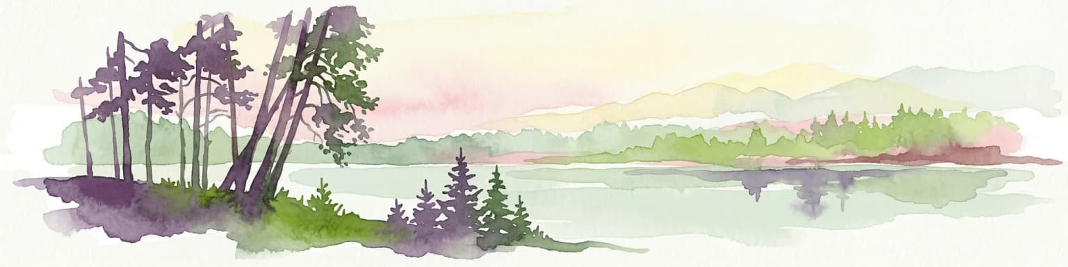
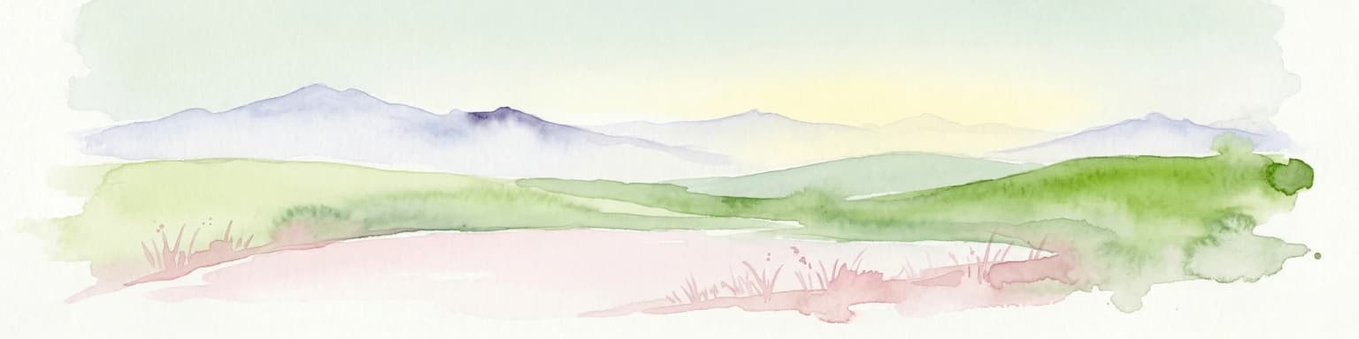
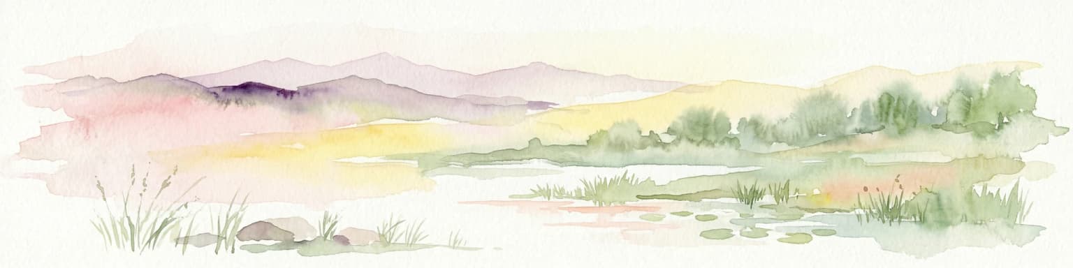
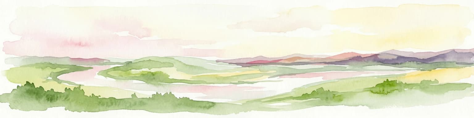
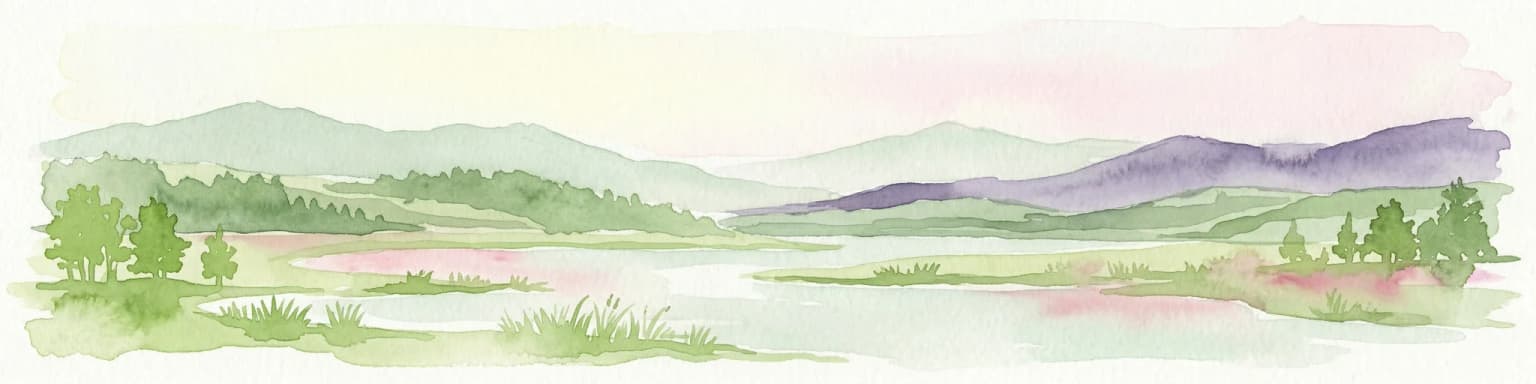
The physical landscape of Derman–Ostroh is defined by the Zbytynka River valley, a relatively narrow corridor of lowland that separates two distinct upland regions. To the north, the Mizotsky Ridge forms part of the Volhynian Upland, while to the south, the Kremenets Mountains rise as a prominent landscape feature. The valley floor itself ranges from waterlogged floodplain to sandy terrace remnants, with the immediate surrounding heights rising only a few hundred meters above the valley floor. This modest elevation difference nonetheless creates meaningful changes in moisture regimes, soil conditions, and vegetation communities across short distances. The park's scattered sector arrangement reflects the valley's irregular shape and the way different ecological features occur in pockets along the river corridor. The landscape includes alder and pine forest complexes in wetter areas, mixed conifer and deciduous stands on drier ground, and open wetland areas where sedge and reed communities dominate.

Derman, Ostroh National Nature Park ecosystems, habitats, and plant life

The ecological character of Derman–Ostroh reflects its position at the junction of two major European landscape zones, creating a blend of habitats that would not occur in either region alone. The park lies entirely within the Central European mixed forests ecoregion, characterized by deciduous and mixed forest communities typical of temperate Europe. Approximately half of the park area is covered in forest, with pine and oak as the dominant tree species, while beech and spruce occur in smaller patches. The climate is humid continental with a warm summer subtype (Dfb), featuring significant seasonal temperature variation, mild summers, and cold winters with substantial snowfall. Of particular ecological significance is the Bushchansky bog, a lowland marsh representing one of the easternmost examples of Middle European carbonate marshes. This wetland type is rare in eastern Europe and supports specialized plant communities adapted to alkaline conditions. The combination of forest, wetland, and valley habitats creates a mosaic that supports diverse ecological communities.

Derman, Ostroh National Nature Park wildlife and species highlights

The wildlife of Derman–Ostroh benefits from the diversity of habitats created by the valley landscape and forest-wetland mixture. The park's forest communities, dominated by pine and oak with some beech and spruce, provide habitat for typical Central European forest species. The wetland areas, particularly the Bushchansky bog and the Zbitensky Ornithological Reserve, support waterfowl and bird species associated with marsh and riparian environments. The Zbytynka River floodplain and surrounding wetlands create breeding habitat for various bird species, which the ornithological reserve specifically protects. The old-growth forest elements, including the ancient chestnut and linden trees in the "Turova's grave" section, provide habitat for species that depend on veteran trees for nesting or foraging. While the Wikipedia source does not detail specific wildlife species, the habitat diversity suggests support for both forest-dwelling and wetland-dependent animal communities.

Derman, Ostroh National Nature Park conservation status and protection priorities

Derman–Ostroh National Nature Park serves important conservation functions within Ukraine's protected area network. The park protects a rare example of the transition between the Polesian Lowland and Podolian Upland ecosystems, preserving ecological processes and species assemblages that depend on this geographic boundary. The Bushchansky bog represents a particularly significant conservation priority as one of the easternmost carbonate marshes in Middle Europe, a wetland type that has been lost or degraded across much of its historic range. The park's multiple reserve sectors protect different ecological features, from geological formations on the Mizotsky Ridge to botanical areas in the river floodplain and ornithological protection for breeding wetlands. As an IUCN Category II national park, the designation provides a framework for both habitat protection and sustainable public use, allowing visitors to experience the park's natural values while maintaining conservation objectives.

Derman, Ostroh National Nature Park cultural meaning and human context

The Derman–Ostroh area has historical connections to the broader Ostroh region, a territory with centuries of human presence in northwestern Ukraine. The Zbytenka River floodplain reserve holds local cultural importance beyond its botanical significance, reflecting the long relationship between local communities and this landscape. The park's proximity to Ostroh, a historic town in Rivne Oblast, connects the protected area to regional heritage and provides a context for understanding how human settlement patterns have interacted with the valley environment over time. While the park's primary focus is on natural landscape protection, the cultural dimension is acknowledged through the inclusion of areas with local cultural significance within the reserve structure.

Top sights and standout views in Derman, Ostroh National Nature Park

The park's defining highlights include its transitional position between two major European landscapes, the rare carbonate marsh at Bushchansky, and the combination of forest and wetland habitats in a relatively compact valley setting. The presence of ancient trees, including a 400-year-old chestnut and 300-year-old linden, provides tangible connections to the landscape's long ecological history. The network of 22 protected sectors, each preserving different features from geological outcrops to ornithological wetlands, creates a comprehensive protection framework. The park offers outdoor recreation through its 6.5-kilometer educational ecological trail, 38-kilometer ecotrail along the river, and 65-kilometer bicycle trail encircling the area.

Best time to visit Derman, Ostroh National Nature Park

The best time to visit Derman–Ostroh depends on the experience sought. The summer months of June through August offer warm conditions suitable for hiking the various trails, with the valley's wetlands and forests displaying full vegetation. The spring months of April and May bring bird migration and the awakening of wetland communities, making this period particularly interesting for ornithological interest. Autumn provides the opportunity to experience the forest in fall coloration and generally stable weather conditions. Winter visits offer a different perspective of the valley landscape, though the cold continental climate means snowy conditions and reduced trail accessibility. The park's proximity to Ostroh and available nearby accommodations support visits throughout the year.

Park location guide

Geography guide, regional context, and park location map for Derman, Ostroh National Nature Park

Derman, Ostroh National Nature Park park geography, regions, and map view in Ukraine
Understand where Derman, Ostroh National Nature Park sits in Ukraine through a broader geographic reading of the surrounding landscape, nearby location context, and its mapped position within the national park landscape.

How Derman, Ostroh National Nature Park fits into Ukraine

Ukraine is a sovereign nation in Eastern Europe, bordered by Russia, Belarus, Poland, Slovakia, Hungary, Romania, Moldova, and the Black Sea. It is the second-largest country in Europe by area. Kyiv is the capital and largest city, followed by Kharkiv, Odesa, and Dnipro. The official language is Ukrainian. Ukraine has a population of approximately 32.9 million and operates as a unitary semi-presidential republic.

Wider geography shaping Derman, Ostroh National Nature Park in Ukraine

Ukraine occupies 603,628 km² in Eastern Europe, making it the second-largest country in Europe. It shares borders with Russia, Belarus, Poland, Slovakia, Hungary, Romania, and Moldova. The country has a southern coastline along the Black Sea and Sea of Azov. The terrain includes plains, steppes, and the Carpathian Mountains in the west.

Map view of Derman, Ostroh National Nature Park

Use this park location map to pinpoint Derman, Ostroh National Nature Park in Ukraine, understand its exact geographic position, and read its mapped placement within the surrounding landscape more clearly.

Pigeon | © OpenStreetMap contributors

Location context for Derman, Ostroh National Nature Park

Rivne Oblast
Park atlas

Compare the unique protected areas and conservation landscapes within Rivne Oblast, Ukraine.

Discover More National Parks and Protected Areas Near Derman–Ostroh National Nature Park
After exploring Derman–Ostroh National Nature Park, you can continue to browse other national parks and protected areas across Rivne Oblast and the broader Ukrainian landscape. This curated selection allows for direct comparison of regional park geography, conservation priorities, and diverse natural terrain.
Watercolor painting showing a lake surrounded by trees with distant hills under a colorful sky
National parkUkraine

Lower Polissia National Nature Park: Ukraine's Mapped Protected Wetland Landscape

National Park in Ukraine's Polissia region.

The Lower Polissia National Nature Park is a crucial protected area covering 8,762 hectares in western Ukraine. This park offers a detailed geographic profile, showcasing its extensive wetland habitats, forest complexes, and the Horyn, Viliia, and Hnylyi Rih river valleys. As a key component of the Polissia landscape zone, the park provides essential context for understanding the protected natural terrain and regional ecology of Eastern Europe through structured map exploration.

Area
87.62 km²
Established
2013
IUCN
II
Relief
Lowland
Watercolor illustration of a landscape with rolling hills, a river, scattered trees, and distant mountains.
National parkTernopil Oblast

Kremenets Mountains National Nature Park National Park: Geographic and Protected Landscape Atlas

Mapped boundaries and regional natural terrain context.

Delve into the specifics of Kremenets Mountains National Nature Park, a protected area designated as a national park in Ukraine's Ternopil Oblast. This MoriAtlas entry focuses on its role as a distinct geographic entity, providing mapped boundaries and context within the regional landscape. Understand its protected status and how it contributes to the natural geography of western Ukraine, offering a structured point for atlas-based discovery.

Area
162 km²
Established
1999
IUCN
II
Relief
Mixed relief
National parkVolyn Oblast

Tsumanska Pushcha National Nature Park: Protected Landscape and Regional Geography in Volyn Oblast

UA National Park with Mapped Boundaries and Terrain Context

Delve into Tsumanska Pushcha National Nature Park, a designated national park in Volyn Oblast, Ukraine. This entry provides detailed atlas-style information on the park's protected landscape identity, its mapped geographic setting, and its significance within the regional geography of Northwestern Ukraine. Understand the park's boundaries and its place in the natural terrain.

Area
334.75 km²
Established
2010
IUCN
II
Relief
Lowland
Watercolor painting showing green hills, pink fields, and purple mountains under a pale sky
National parkLviv Oblast

Northern Podillia National Nature Park: Protected Area Mapping and Regional Geography

Explore unique karst features and ancient forests in Lviv Oblast.

Northern Podillia National Nature Park is a protected national park in Lviv Oblast, Ukraine, safeguarding a significant area of the Podolian Upland. The park is distinguished by its ancient beech forests, rare karst lakes known as the Blue Windows, and geological formations reflecting ancient sea reefs. This page serves as a dedicated atlas entry for understanding the park's mapped boundaries, its ecological significance, and its place within the regional geography of western Ukraine.

Area
156 km²
Established
2009
IUCN
II
Relief
Highland
National parkIvano-Frankivsk Oblast

Halych National Nature Park: Ivano-Frankivsk Oblast National Park Atlas & Geography

Mapped protected boundaries and landscape context.

Halych National Nature Park is a vital protected area situated in the Ivano-Frankivsk Oblast of Ukraine, characterized by its transitional landscape where Carpathian foothills merge with the East European Plain. This national park offers a rich tapestry of environments, including oak-hornbeam and oak-beech forests, vital wetlands, and scarce steppe remnants, creating a mosaic of habitats mapped meticulously within the MoriAtlas platform. Explore the park's geographic identity, its diverse terrain, and its significance as a conservation landscape for understanding regional biodiversity.

Area
147 km²
Established
2004
IUCN
II
Relief
Lowland
National parkUkraine

Prypiat, Stokhid National Nature Park: National Park Geography & Protected Landscape

Mapped boundaries and regional natural context in Ukraine.

Gain structured insight into Prypiat, Stokhid National Nature Park, a protected national park in Ukraine. This entry details its geographic footprint and landscape features, offering a foundation for understanding its role within the broader atlas of protected areas. Explore the mapped terrain and regional context that defines this significant natural landscape.

Area
393.155 km²
Established
2007
IUCN
II
Relief
Lowland
Watercolor illustration of a winding river through rolling green hills with distant mountains under a soft sky
National parkTernopil Oblast

Dniester Canyon National Nature Park: National Park Protected Landscape and Geographic Context

Mapped boundaries and regional geography in Ternopil Oblast

Delve into the protected landscape of Dniester Canyon National Nature Park, a designated national park in Ukraine. This entry offers a structured view of the park's geographic setting within Ternopil Oblast, focusing on its mapped boundaries and its role as a significant protected natural area. Understand its placement within the broader atlas of Ukrainian natural landscapes and regional geography, offering a factual basis for exploration.

Area
108 km²
Established
2010
IUCN
II
Relief
Mixed relief
National parkLviv Oblast

Yavoriv National Nature Park: Protected Landscape and Regional Geography in Lviv Oblast

Mapped protected area boundaries and natural terrain context.

Yavoriv National Nature Park is a designated national park within Lviv Oblast, Ukraine. This page provides detailed geographic information, focusing on the park's protected landscape identity and its mapped terrain. Understanding its location in Western Ukraine, near the Carpathian gateway, offers valuable context for atlas-based exploration of protected areas and natural features within the region.

Area
71.08 km²
Established
1998
IUCN
II
Relief
Highland

Common questions about visiting, size, designation, and location context for Derman, Ostroh National Nature Park

Derman, Ostroh National Nature Park FAQs for park facts, access, geography, and protected area context
Find quick answers about Derman, Ostroh National Nature Park, including protected-area facts, park geography, trail and visitor context, and how the park fits into its surrounding country and regional landscape.
MoriAtlas Explorer

Continue Your Protected Areas Search Across the Global Atlas

Deepen your exploration by continuing the structured search for national parks and protected areas worldwide. Utilize the comprehensive filtering capabilities to compare different conservation landscapes and refine your understanding of global park geography. Discover more about the distribution and characteristics of protected natural areas.

Global natural geography