Mori Atlas logo
National parkLower Polissia National Nature Park

Discover Ukraine's diverse wetlands and forest complexes within this National Park.

Lower Polissia National Nature Park: Mapped Protected Landscape in Ukraine

(National Nature Park Male Polissia)

Lower Polissia National Nature Park represents a significant protected area within Ukraine's Polissia region. This national park, encompassing approximately 8,762 hectares, offers a detailed look at the diverse natural landscapes characteristic of its geographic setting. Users can explore the mapped boundaries of its forest complexes, wetland areas, lakes, and river valleys, gaining insight into the park's ecological importance and its role within the regional geography of Eastern Europe.

National parksWetlandsForest protected areasBirdwatchingEastern EuropeProtected areas
Stylized illustration of a mountain landscape with a waterfall, river, evergreen trees, and colorful sky with sun

Lower Polissia National Nature Park

National park

Park overview

Structured park overview, official facts, and landscape profile for Lower Polissia National Nature Park

Lower Polissia National Nature Park park facts, protected area profile, and essential visitor context
Review the core facts for Lower Polissia National Nature Park, including designation, size, terrain, visitor scale, habitats, and operating context in one park-focused overview.

About Lower Polissia National Nature Park

Lower Polissia National Nature Park represents an important protected area in western Ukraine's Polissia ecological zone. The park was established in 2013 through a presidential decree, following several years of development and approval processes that began with a 2008 presidential decree expanding Ukraine's network of national parks. The protected area encompasses nearly 8,800 hectares of land combining forest massifs from the former Iziaslav and Slavutsky forestry enterprises with significant wetland areas. The park's landscape includes several lakes, extensive marshland, and the river valleys of the Horyn, Viliia, and Hnylyi Rih rivers. These water systems and their associated wetlands create a diverse habitat matrix supporting both forest-dwelling and water-dependent species. The park lies within the broader Polissia region, an area characterized by mixed forests, wetlands, and river systems that extends across parts of Ukraine, Belarus, and Poland.

Quick facts and research context for Lower Polissia National Nature Park

Lower Polissia National Nature Park covers 8,762 hectares in Shepetivka District, Khmelnytskyi Oblast, western Ukraine. Established in 2013, the park protects forest and wetland ecosystems in the Polissia region. The protected area includes several lakes and portions of three river valleys. Management falls under Ukraine's State Forest Agency with regional offices in Khmelnytskyi. The park contains significant biodiversity with over 200 vertebrate species documented.

Park context

Deeper park guide and search-rich context for Lower Polissia National Nature Park

Lower Polissia National Nature Park history, landscape, wildlife, and travel context
Explore Lower Polissia National Nature Park through its history, landscape character, ecosystems, wildlife, conservation priorities, cultural context, and seasonal travel timing in a structured park guide built for atlas discovery and search intent.

Why Lower Polissia National Nature Park stands out

Lower Polissia National Nature Park is best known for its combination of forest ecosystems and wetland habitats within the Polissia region. The park protects important bird populations, with 186 documented bird species making it significant for avian conservation in western Ukraine. The wetland complexes, including marshland areas and lake systems, support diverse communities of waterfowl, migratory birds, and amphibians. The river valley sections through the park provide ecological connectivity across the landscape.

Calm lake reflecting tall pine trees with grassy shoreline and distant forest under clear sky
Holy Lake surrounded by tall pine trees in Lower Polissia National Nature Park

Lower Polissia National Nature Park history and protected-area timeline

The establishment of Lower Polissia National Nature Park emerged from Ukraine's broader initiative to expand its network of protected areas. The concept was first mentioned in a December 2008 presidential decree titled "On Expanding the Network and Territories of National Nature Parks and Other Nature Reserves." This initial policy directive set the stage for further development of protected area designations across the country. The subsequent phase involved a formal order from the Head of Khmelnytskyi Regional State Administration in June 2011, which approved the creation of the Small Polissia National Nature Park and initiated the project development and approval process among various government agencies. After years of coordination and land allocation procedures, the final presidential decree establishing the park was issued on August 2, 2013. This decree formalized the inclusion of 8,762.7 hectares of state-owned land into the national park, comprising both lands transferred from existing forestry enterprises and areas incorporated without removal from current land users. The park incorporated 2,764 hectares from the Iziaslav Forestry Enterprise and 2,507 hectares from the Slavutsky Forestry Enterprise, along with additional areas to complete the protected landscape.

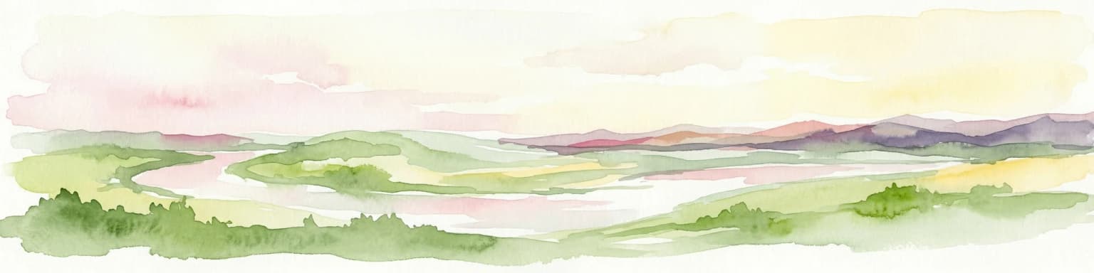
Lower Polissia National Nature Park landscape and geographic character

The landscape of Lower Polissia National Nature Park combines forested upland areas with extensive wetland lowlands characteristic of the Polissia region. The park encompasses portions of the Horyn River valley, one of the major river systems in western Ukraine, along with the Viliia and Hnylyi Rih river valleys. These water corridors traverse the landscape, creating floodplain wetlands, marsh areas, and lake systems that contrast with the surrounding forest-covered terrain. The forest components of the park include massifs that were previously managed by state forestry enterprises, representing typical Polissia forest composition. The wetland areas include several named lakes and marsh complexes that provide critical habitat for waterfowl, amphibians, and other wetland-dependent species. The combination of flowing rivers, standing water bodies, marshland, and forested areas creates a heterogeneous landscape supporting diverse ecological communities.

Lower Polissia National Nature Park ecosystems, habitats, and plant life

The natural environment of Lower Polissia National Nature Park reflects the ecological character of the Polissia region, which occupies a transitional zone between central European broadleaf forests and eastern European forest-steppe. The park protects both terrestrial and aquatic ecosystems, with forest habitats dominating the upland areas while wetland systems occupy the river valleys and low-lying terrain. The protected area supports significant biodiversity, with the Ukrainian source documenting 205 vertebrate animal species across multiple taxonomic groups. The flora includes 21 plant species listed in Ukraine's Red Book, representing rare and protected botanical elements of the regional ecosystem. Additionally, 37 plant species receive special protection within the Khmelnytskyi Oblast, indicating the park's importance for regional biodiversity conservation. The combination of forest types and wetland communities creates ecological diversity within a relatively compact protected area.

Lower Polissia National Nature Park wildlife and species highlights

The wildlife communities of Lower Polissia National Nature Park demonstrate the ecological richness of the Polissia region. Birdlife is particularly diverse, with 186 bird species documented within the park's boundaries. This avian diversity includes numerous waterfowl species associated with the lake and wetland systems, forest-dwelling songbirds, and birds of prey. Among the notable species present are species protected under international conventions. The park hosts four species from the European Red List, including the white-tailed eagle and black kite among the birds, and certain fish species. A total of 101 species appearing in Annex 2 of the Berne Convention receive protection within the park. Mammal populations include approximately 33 species, with the badger, river otter, and other medium-sized mammals present. The park's waters support 18 fish species, while amphibians are represented by 11 species and reptiles by seven species. Additionally, 53 animal species from Ukraine's Red Book occur within the park, including the gray crane and European otter.

Lower Polissia National Nature Park conservation status and protection priorities

Lower Polissia National Nature Park serves important conservation functions within Ukraine's protected area network. The park was established to protect the natural ecosystems of the Polissia region in Khmelnytskyi Oblast, preserving both forest habitats and wetland complexes that would otherwise face pressure from forestry and agricultural development. The protected status ensures the continuation of ecological processes across the forest-wetland mosaic and maintains connectivity for wildlife populations moving through the landscape. The park's biodiversity significance is evidenced by the presence of numerous protected species, with 53 animal species and 21 plant species listed in Ukraine's Red Book requiring conservation attention. International conservation frameworks are also represented, with species from the European Red List and the Bern Convention receiving protection within the park boundaries. The management structure under Ukraine's State Forest Agency integrates conservation objectives with sustainable forest management practices.

Lower Polissia National Nature Park cultural meaning and human context

Lower Polissia National Nature Park is situated within the historical region of Volynia, an area with rich cultural heritage in western Ukraine. The park's territory falls within what is known as historical Volynia, a region that has been part of various political entities over the centuries and possesses distinct cultural traditions. The local area around Slavuta and the broader Shepetivka district has historical significance in Ukrainian history. The park's establishment in 2013 represents a relatively recent addition to the region's protected area network, created during Ukraine's ongoing efforts to expand nature conservation as part of broader environmental policy development.

Top sights and standout views in Lower Polissia National Nature Park

Lower Polissia National Nature Park stands out for its combination of forest and wetland protection within the Polissia region. The park's 8,762 hectares protect significant biodiversity including over 200 vertebrate species, 186 bird species, and numerous protected plants and animals. The wetland complexes around the Horyn, Viliia, and Hnylyi Rih rivers provide critical habitat for waterfowl and migratory birds. The presence of 53 Red Book species and 101 Bern Convention species demonstrates the park's conservation significance at national and international levels. The area around Lake Sviate and other water bodies offers scenic value within the protected landscape.

Best time to visit Lower Polissia National Nature Park

The best time to visit Lower Polissia National Nature Park depends on the type of experience sought. Spring and early summer offer excellent opportunities for birdwatching as migratory species return to the wetlands and the forest canopy fills with activity. The wetland areas are particularly lively during these seasons when waterfowl congregate at lakes and marshes. Summer provides the warmest conditions for exploring the park's trails and enjoying the forest environment, though mid-summer can be quite warm. Autumn brings changing colors in the deciduous forest components and provides another excellent season for wildlife observation as animals become more active before winter. The winter season offers a different perspective on the landscape, with snow-covered forests and frozen wetlands providing a quiet wilderness experience.

Park location guide

Geography guide, regional context, and park location map for Lower Polissia National Nature Park

Lower Polissia National Nature Park park geography, regions, and map view in Ukraine
Understand where Lower Polissia National Nature Park sits in Ukraine through a broader geographic reading of the surrounding landscape, nearby location context, and its mapped position within the national park landscape.

How Lower Polissia National Nature Park fits into Ukraine

Ukraine is a sovereign nation in Eastern Europe, bordered by Russia, Belarus, Poland, Slovakia, Hungary, Romania, Moldova, and the Black Sea. It is the second-largest country in Europe by area. Kyiv is the capital and largest city, followed by Kharkiv, Odesa, and Dnipro. The official language is Ukrainian. Ukraine has a population of approximately 32.9 million and operates as a unitary semi-presidential republic.

Wider geography shaping Lower Polissia National Nature Park in Ukraine

Ukraine occupies 603,628 km² in Eastern Europe, making it the second-largest country in Europe. It shares borders with Russia, Belarus, Poland, Slovakia, Hungary, Romania, and Moldova. The country has a southern coastline along the Black Sea and Sea of Azov. The terrain includes plains, steppes, and the Carpathian Mountains in the west.

Map view of Lower Polissia National Nature Park

Use this park location map to pinpoint Lower Polissia National Nature Park in Ukraine, understand its exact geographic position, and read its mapped placement within the surrounding landscape more clearly.

Pigeon | © OpenStreetMap contributors

Location context for Lower Polissia National Nature Park

Khmelnytskyi Oblast

Visualizing Ukraine's Polissia Protected Area: Scenery, River Valleys, and Critical Wetland Habitats

Lower Polissia National Nature Park Photos: Explore Diverse Landscapes, Wetlands, and Forests
Explore compelling imagery of Lower Polissia National Nature Park to grasp its distinctive mix of forested uplands, extensive wetland lowlands, and meandering river valleys across its western Ukraine protected landscape. These visuals offer crucial insight into the park's varied terrain, ecological communities, and vital wetland habitats, enhancing geographic and conservation understanding of the Polissia region.

Calm lake reflecting tall pine trees with grassy shoreline and distant forest under clear sky

Park atlas

Compare adjacent protected landscapes, mapping the regional spread of conservation areas within and beyond Ukraine's Polissia zone.

Discover Other National Parks and Protected Areas Around Lower Polissia National Nature Park
After exploring Lower Polissia National Nature Park, browse other national parks and protected areas in the surrounding Khmelnytskyi Oblast and the wider Polissia region. This geographic view helps trace interconnected wetland systems and forest ecosystems, offering valuable context for comparing conservation landscapes across Eastern Europe.
National parkRivne Oblast

Derman, Ostroh National Nature Park: Geographic Atlas of a Ukrainian National Park

Explore its protected boundaries and landscape context.

Delve into the detailed atlas information for Derman, Ostroh National Nature Park, a designated national nature park located in Ukraine's Rivne Oblast. This resource illuminates the park's specific geographic footprint, its protected land status, and its contribution to the regional landscape. Understand its terrain and mapped features, offering a clear point of discovery for those interested in the geography of Ukrainian protected areas.

Area
16 km²
Established
2009
IUCN
II
Relief
Mixed relief
Watercolor illustration of a landscape with rolling hills, a river, scattered trees, and distant mountains.
National parkTernopil Oblast

Kremenets Mountains National Nature Park National Park: Geographic and Protected Landscape Atlas

Mapped boundaries and regional natural terrain context.

Delve into the specifics of Kremenets Mountains National Nature Park, a protected area designated as a national park in Ukraine's Ternopil Oblast. This MoriAtlas entry focuses on its role as a distinct geographic entity, providing mapped boundaries and context within the regional landscape. Understand its protected status and how it contributes to the natural geography of western Ukraine, offering a structured point for atlas-based discovery.

Area
162 km²
Established
1999
IUCN
II
Relief
Mixed relief
National parkVolyn Oblast

Tsumanska Pushcha National Nature Park: Protected Landscape and Regional Geography in Volyn Oblast

UA National Park with Mapped Boundaries and Terrain Context

Delve into Tsumanska Pushcha National Nature Park, a designated national park in Volyn Oblast, Ukraine. This entry provides detailed atlas-style information on the park's protected landscape identity, its mapped geographic setting, and its significance within the regional geography of Northwestern Ukraine. Understand the park's boundaries and its place in the natural terrain.

Area
334.75 km²
Established
2010
IUCN
II
Relief
Lowland
Watercolor painting showing green hills, pink fields, and purple mountains under a pale sky
National parkLviv Oblast

Northern Podillia National Nature Park: Protected Area Mapping and Regional Geography

Explore unique karst features and ancient forests in Lviv Oblast.

Northern Podillia National Nature Park is a protected national park in Lviv Oblast, Ukraine, safeguarding a significant area of the Podolian Upland. The park is distinguished by its ancient beech forests, rare karst lakes known as the Blue Windows, and geological formations reflecting ancient sea reefs. This page serves as a dedicated atlas entry for understanding the park's mapped boundaries, its ecological significance, and its place within the regional geography of western Ukraine.

Area
156 km²
Established
2009
IUCN
II
Relief
Highland
Watercolor illustration of a winding river through rolling green hills with distant mountains under a soft sky
National parkTernopil Oblast

Dniester Canyon National Nature Park: National Park Protected Landscape and Geographic Context

Mapped boundaries and regional geography in Ternopil Oblast

Delve into the protected landscape of Dniester Canyon National Nature Park, a designated national park in Ukraine. This entry offers a structured view of the park's geographic setting within Ternopil Oblast, focusing on its mapped boundaries and its role as a significant protected natural area. Understand its placement within the broader atlas of Ukrainian natural landscapes and regional geography, offering a factual basis for exploration.

Area
108 km²
Established
2010
IUCN
II
Relief
Mixed relief
National parkIvano-Frankivsk Oblast

Halych National Nature Park: Ivano-Frankivsk Oblast National Park Atlas & Geography

Mapped protected boundaries and landscape context.

Halych National Nature Park is a vital protected area situated in the Ivano-Frankivsk Oblast of Ukraine, characterized by its transitional landscape where Carpathian foothills merge with the East European Plain. This national park offers a rich tapestry of environments, including oak-hornbeam and oak-beech forests, vital wetlands, and scarce steppe remnants, creating a mosaic of habitats mapped meticulously within the MoriAtlas platform. Explore the park's geographic identity, its diverse terrain, and its significance as a conservation landscape for understanding regional biodiversity.

Area
147 km²
Established
2004
IUCN
II
Relief
Lowland
Watercolor illustration of a mountainous landscape with green hills, trees, and a river valley
National parkUkraine

Khotyn National Nature Park: Ukraine's National Park Atlas and Protected Landscape

Explore geographic boundaries and natural terrain.

Delve into the details of Khotyn National Nature Park, a protected national park situated within Ukraine. This entry offers precise geographic insights, focusing on the park's mapped terrain and its role as a significant protected landscape. Discover the regional context and understand its distinct natural features, providing a structured view for atlas-based exploration of Ukrainian protected areas.

Area
94 km²
Established
2010
IUCN
II
Relief
Mixed relief
National parkUkraine

Prypiat, Stokhid National Nature Park: National Park Geography & Protected Landscape

Mapped boundaries and regional natural context in Ukraine.

Gain structured insight into Prypiat, Stokhid National Nature Park, a protected national park in Ukraine. This entry details its geographic footprint and landscape features, offering a foundation for understanding its role within the broader atlas of protected areas. Explore the mapped terrain and regional context that defines this significant natural landscape.

Area
393.155 km²
Established
2007
IUCN
II
Relief
Lowland

Common questions about visiting, size, designation, and location context for Lower Polissia National Nature Park

Lower Polissia National Nature Park FAQs for park facts, access, geography, and protected area context
Find quick answers about Lower Polissia National Nature Park, including protected-area facts, park geography, trail and visitor context, and how the park fits into its surrounding country and regional landscape.
MoriAtlas Explorer

Continue Your Protected Areas Search Across the Global Atlas

Deepen your exploration by continuing the structured search for national parks and protected areas worldwide. Utilize the comprehensive filtering capabilities to compare different conservation landscapes and refine your understanding of global park geography. Discover more about the distribution and characteristics of protected natural areas.

Global natural geography