Mori Atlas logo
National parkWigry National Park

Mapped protected landscape with 42 lakes and pristine wetland ecosystems

Wigry National Park: Poland's Glacial Lake District and Beaver Habitat Atlas

(Wigierski Park Narodowy)

Wigry National Park represents a significant protected landscape within Poland's Podlaskie Voivodeship, renowned for its glacial origins and abundant aquatic features. This national park showcases a unique terrain shaped by ice approximately 12,000 years ago, resulting in a concentration of 42 lakes, extensive peat bogs, and the vast Lake Wigry at its core. As an important wetland conservation area and premier beaver habitat, Wigry National Park offers a rich geographic context for map-based exploration and understanding Poland's natural heritage.

National ParkLake DistrictWetlandsBeaver HabitatPeat BogsForest Wilderness
Illustrated scene of a waterfall cascading into a lake surrounded by pine trees and mountains under a partly cloudy sky

Wigry National Park

National park

Park overview

Structured park overview, official facts, and landscape profile for Wigry National Park

Wigry National Park park facts, protected area profile, and essential visitor context
Review the core facts for Wigry National Park, including designation, size, terrain, visitor scale, habitats, and operating context in one park-focused overview.

About Wigry National Park

Wigry National Park occupies a distinctive position in Poland's protected area system as one of the country's largest national parks and one of the few dominated by lake landscapes rather than mountains or coastal terrain. The park is situated at the northern edge of the Augustów Primeval Forest, one of Poland's largest contiguous forest complexes, which extends across the border into Lithuania and Belarus covering approximately 160,000 hectares. The park's location within the Lithuanian Lake District region (Pojezierze Litewskie) places it in an area of exceptional natural diversity, where the terminal moraine landscape creates a complex pattern of lakes, kettle holes, and outflow valleys.

The park's headquarters are located in Suwałki, Poland's northeasternmost major city, and the area is commonly referred to as Suwalszczyzna. The landscape exhibits clear north-south variation: the northern portion features gently rolling hills reaching elevations of 180 meters above sea level, while the southern areas are predominantly flat and densely forested. This topographic diversity, combined with the park's extensive water network, supports a remarkable range of habitats from open water and wetlands to dry coniferous forests and peat bogs.

The Czarna Hańcza river, the park's main watercourse, flows through Lake Wigry and forms a popular kayaking route that connects multiple lakes within the park. This river system drains into the Neman River, making the park part of the Baltic Sea watershed. The interplay between the aquatic and terrestrial ecosystems creates the foundation for the park's ecological significance and its value as a conservation area.

Quick facts and research context for Wigry National Park

Wigry National Park covers 150.86 km² in northeastern Poland, with 94.64 km² of forest, 29.08 km² of water, and 27.14 km² of agricultural and other land. The park contains 42 lakes of varying size and depth, with Lake Wigry being the largest at 21.87 km² with a maximum depth of 73 meters. The park is located in the Podlaskie Voivodeship near the city of Suwałki, at coordinates 54°N 23°E. Strictly protected zones account for 6.23 km², and the park is part of both the Ramsar Convention and the European Natura 2000 network.

Park context

Deeper park guide and search-rich context for Wigry National Park

Wigry National Park history, landscape, wildlife, and travel context
Explore Wigry National Park through its history, landscape character, ecosystems, wildlife, conservation priorities, cultural context, and seasonal travel timing in a structured park guide built for atlas discovery and search intent.

Why Wigry National Park stands out

Wigry National Park is best known for its exceptional concentration of lakes and its status as Poland's premier beaver habitat. The park's 42 lakes, carved by glacial activity, create a distinctive landscape of interconnected waterways, wetlands, and forested islands. Lake Wigry, with its convoluted shoreline featuring islands, coves, and deep basins, forms the heart of the park's aquatic character. The park is home to approximately 250 beavers, making it one of the strongest populations in Poland, and the species appears prominently in the park's branding. The park is also recognized for its well-preserved peat bogs, including the distinctive "suchar" dystrophic lakes surrounded by peat moss, which represent some of the most pristine wetland habitats in the region.

Wooden building with metal roof and wooden shutters, surrounded by forest, with staircase leading to entrance
Wooden building of the Environmental Education Center at Lake Wigry

Wigry National Park history and protected-area timeline

The protection of Wigry's natural values began in the 1920s, when Kazimierz Kulwieć first proposed establishing a reserve around Lake Wigry and its surrounding forests in 1921. The proposal was presented to the State Nature Protection Commission but did not result in concrete action. In 1924, botanist Bolesław Hryniewiecki and limnologist Alfred Lityński published another proposal titled "Plan for the Creation of a Reserve on Lake Wigry" in the "Ochrona Przyrody" yearbook. Although this proposal was also not implemented, the scientific arguments presented led to the establishment of a hydrobiological station on the lake's shores at Płociczno, which conducted intensive research until the outbreak of World War II in 1939.

The first actual protected areas were established in the 1950s, focusing on beaver conservation. The "Ostoja Bobrów Stary Folwark" reserve was created in 1959 to protect beaver habitats at the mouth of the Czarna Hańcza river, followed by the "Ostoja Bobrów Zakąty" reserve in 1961. In 1970, Lake Wądołek and adjacent forest became the first strict nature reserve in the area. The park gained international recognition in 1975 when the International Union for Conservation of Nature (IUCN) included Lake Wigry on its list of the world's most valuable water reservoirs as part of Project "Aqua."

The establishment of Wigry Landscape Park in 1976, covering nearly 11,000 hectares, paved the way for national park designation. Work toward creating a national park began in 1982, involving comprehensive scientific studies of the region's natural values. The government decision to establish Wigry National Park came in June 1988, with the park officially beginning operations on January 1, 1989, covering 14,840 hectares. The area was expanded to 15,085 hectares in 1997. In 2002, the park was inscribed on the Ramsar Convention list of wetlands of international importance, and it became part of the European Natura 2000 network in 2004.

Wigry National Park landscape and geographic character

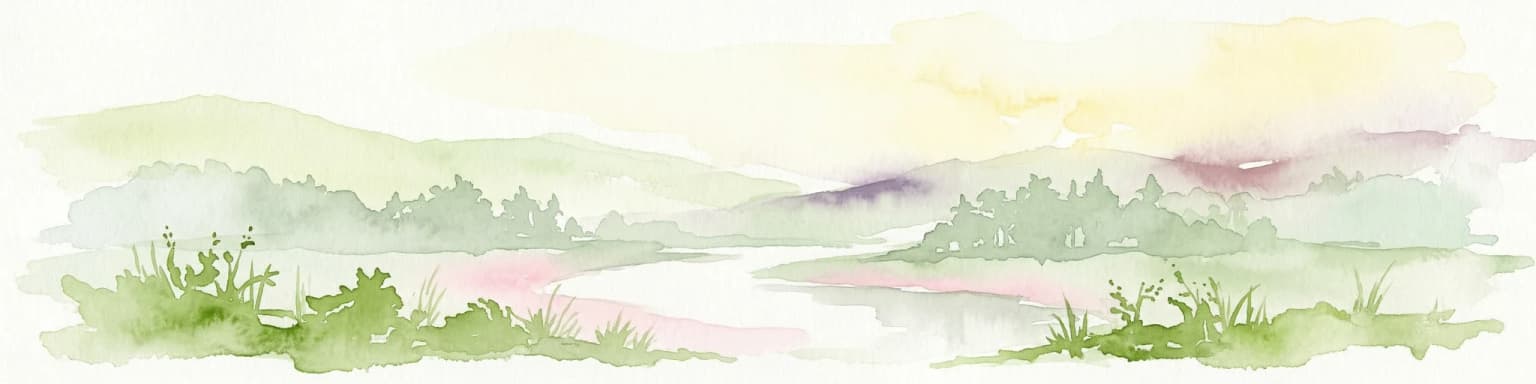
The landscape of Wigry National Park bears the unmistakable imprint of glacial processes that dominated this region approximately 12,000 years ago during the retreat of the last Scandinavian ice sheet. As the glacier slowly receded northward, it left behind a terrain characterized by terminal moraines, outwash plains, and numerous depressions that filled with water to form lakes. The park's name derives from Lake Wigry, a glacially carved lake with a complex, convoluted shoreline featuring numerous bays, coves, islands, and underwater ridges that create exceptional visual and ecological diversity.

The park contains 42 lakes representing a wide range of limnological types, differing in size, depth, fertility, thermal characteristics, and humic compound concentrations. The lakes vary from deep, clear, mesotrophic waters to shallow, dystrophic "suchar" lakes—small woodland pools surrounded by peat moss that represent the most pristine and chemically unique aquatic habitats in the park. Lake Wigry dominates the park's central area, covering 21.87 km² with a maximum depth of 73 meters, while smaller lakes like Pierty, Leszczewek, and Mulaczysko add to the aquatic complexity.

The terrain exhibits clear topographical variation: the northern part of the park rises into gently rolling hills reaching approximately 180 meters above sea level, while the southern portion is flatter and covered primarily by the Augustów Primeval Forest. Peat bogs have developed in many of the shallower lake basins over millennia, creating distinctive wetland habitats that contrast with the surrounding pine and spruce forests.

Wigry National Park ecosystems, habitats, and plant life

The ecological character of Wigry National Park reflects its position at the intersection of two major European biogeographical regions: the Masurian Lake District and the Augustów Primeval Forest. The park's vegetation is dominated by mossy coniferous forests of pine and spruce, with fir playing a significant role across all forest types—a notable feature given that beech is entirely absent from the park. This forest composition reflects the region's continental climate and the relatively poor soils that characterize much of the area.

The park supports approximately 800 species of vascular plants, over 200 species of mosses and liverworts, and roughly 300 species of lichens. The aquatic environments host a rich algal flora, while the wetland systems contain specialized plant communities adapted to saturated, acidic conditions. Notably, 75 plant taxa are protected under Polish law, including 61 under strict protection and 14 under partial protection. The park is particularly significant for orchids, hosting 22 species—including the critically endangered miodokwiat krzyżowy (Gentiana cruciata) and kukuczka kapturkowata (Orchis militaris)—representing a substantial portion of Poland's orchid diversity.

The aquatic ecosystems display considerable ecological diversity, ranging from productive, nutrient-rich lakes to dystrophic, humic-stained woodland pools. The shallowest lakes have evolved into peat bogs over time, creating wetland habitats of high conservation value. The Czarna Hańcza river system connects multiple lakes, facilitating fish migration and creating a dynamic aquatic environment.

Wigry National Park wildlife and species highlights

Wigry National Park supports an exceptional diversity of wildlife, with over 1,700 animal species documented within its boundaries. The vertebrate fauna includes 46 mammal species, 202 bird species, 12 amphibian species, 5 reptile species, and 32 fish species. Of these, 289 species are protected by Polish law, and 128 appear on the IUCN Red List of Threatened Species, representing a remarkable concentration of protected biodiversity.

The European beaver is the park's most characteristic mammal species, with a population of approximately 250 individuals thriving in the lakes and rivers. This represents one of the strongest beaver populations in Poland, a species that was nearly extirpated from the country in the early 20th century before reestablishing itself from populations that migrated from the Soviet Union. The park is also home to wolves, which maintain territories within the forested areas, and a range of other mammals including red deer, roe deer, wild boar, and smaller species.

The avifauna is exceptionally rich, with 202 bird species recorded, of which 185 receive legal protection. Waterfowl, forest birds, and wetland specialists all find habitat within the park's diverse environments. The fish community includes species of conservation and recreational importance, and the park operates a fish hatchery that produces material for restocking both park waters and lakes throughout the Suwalszczyzna region.

Wigry National Park conservation status and protection priorities

Wigry National Park holds significant conservation importance at both national and international levels. Its designation as a Ramsar Wetland of International Importance in 2002 recognizes the park's exceptional wetland ecosystems and their role in supporting biodiversity. The park's inclusion in the Natura 2000 network in 2004 further integrates it into Europe's conservation framework, specifically protecting habitats and species of European significance under the EU Birds and Habitats Directives.

The park's conservation value is grounded in its mosaic of lakes, peat bogs, and forests that represent some of the most intact ecological communities in northeastern Poland. The strictly protected zones, covering 6.23 km² including 2.83 km² of forest, provide refuges for sensitive species and allow natural processes to proceed without significant human interference. The park's 42 lakes, diverse peat bogs, and the Czarna Hańcza river system create a conservation network that supports species from aquatic invertebrates to large mammals.

Special conservation programs focus on beaver protection, orchid conservation, and fish population management. The beaver reintroduction success story—from near extinction to a population of approximately 250 individuals—demonstrates the park's effectiveness as a conservation mechanism. Similarly, orchid conservation efforts have involved habitat management and experimental translocation programs to ensure the survival of endangered species.

Wigry National Park cultural meaning and human context

While Wigry National Park is primarily valued for its natural ecosystems, the area does contain cultural elements that enrich its character. A former monastery within the park now hosts an artist residency operated by the Polish Ministry of Culture, providing a venue for creative work in a natural setting. This adaptive reuse of historical architecture reflects the park's role in the broader cultural landscape of the Suwalszczyzna region.

The park's name derives from Lake Wigry, which has been an important local feature for centuries. The region's history includes the presence of hydrobiological research in the interwar period, and the area has been subject to various forms of traditional land use including fishing and forestry. The park encompasses areas of the Augustów Primeval Forest that have been managed for timber extraction while maintaining their forest character, representing a landscape where natural and cultural processes have interacted over extended periods.

Top sights and standout views in Wigry National Park

Wigry National Park stands out for its exceptional lake-dominated landscape, with 42 lakes creating a complex aquatic environment centered on Lake Wigry. The park offers over 190 kilometers of tourist trails and extensive kayaking opportunities on the Czarna Hańcza river and connected lakes. The beaver population, estimated at 250 individuals, represents one of the strongest in Poland and has become a symbol of the park's conservation success. The wetland system, including the distinctive dystrophic "suchar" lakes surrounded by peat moss, represents some of the most pristine aquatic habitats in the region.

Best time to visit Wigry National Park

The park is most attractive during the summer months, when the warm season brings visitors to enjoy the lakes, kayaking, and forest trails. Northeastern Poland and the park itself are particularly popular destinations in July and August when the weather is favorable for outdoor activities on the water. The shoulder seasons of spring and autumn offer different experiences: spring brings bird migration and the awakening of forest life, while autumn paints the coniferous forests in golden hues and offers excellent foraging opportunities for wildlife viewing. Winter transforms the landscape, and while many activities are limited, the frozen lakes and snow-covered forests present a stark, beautiful character that appeals to those seeking a wilder, quieter experience.

Park location guide

Geography guide, regional context, and park location map for Wigry National Park

Wigry National Park park geography, regions, and map view in Poland
Understand where Wigry National Park sits in Poland through a broader geographic reading of the surrounding landscape, nearby location context, and its mapped position within the national park landscape.

How Wigry National Park fits into Poland

Poland, officially the Republic of Poland, is a Central European country spanning from the Baltic Sea in the north to the Carpathian Mountains in the south. It borders Germany, Czech Republic, Slovakia, Ukraine, Belarus, Lithuania, and Kaliningrad Oblast. The country has a temperate climate, diverse landscapes, and is known for its rich history, cultural heritage, and strong economic position within the EU.

Wider geography shaping Wigry National Park in Poland

Poland occupies 312,696 km2 in Central Europe, extending from the Baltic Sea coast in the north to the Sudetes and Carpathian Mountains in the south. It borders Germany to the west, Czech Republic and Slovakia to the south, Ukraine and Belarus to the east, and Lithuania and Kaliningrad Oblast to the northeast. The landscape includes lowland plains, uplands, and mountain ranges.

Map view of Wigry National Park

Use this park location map to pinpoint Wigry National Park in Poland, understand its exact geographic position, and read its mapped placement within the surrounding landscape more clearly.

Pigeon | © OpenStreetMap contributors

Location context for Wigry National Park

Podlaskie Voivodeship

Witness the unique glacial terrain, numerous lakes, and diverse wetland habitats that define this Polish protected area.

Wigry National Park: Visual Exploration of its Glacial Landscapes and Wetland Habitats
Visually explore the distinctive glacial landscapes, interconnected lakes, and extensive forested wilderness characterizing Wigry National Park in northeastern Poland. The detailed imagery provides essential visual context, revealing the park's unique aquatic ecosystems, pristine peat bogs, and the vital wetland habitats that underscore its conservation significance.

Wooden building with metal roof and wooden shutters, surrounded by forest, with staircase leading to entrance

Sunset over a calm lake reflecting the sun with a wooden pier on the left, reeds in the foreground, and a forested horizon under a pink and purple sky

Park atlas

Trace connected protected landscapes and regional park geography surrounding Wigry National Park

Explore Other National Parks and Protected Areas Near Wigry National Park
Continue your exploration from Wigry National Park to discover other national parks and protected areas across Poland's northeastern region. Compare various protected landscapes, from glacial lake districts to expansive forest wilderness, enhancing your understanding of the broader regional conservation efforts.
Watercolor painting showing a wetland scene with reeds, patches of water, and trees under a light sky
National parkPodlaskie Voivodeship

Biebrza National Park: Poland's Largest National Park and European Wetland Atlas

Explore the mapped geography of its vast protected fenlands.

Biebrza National Park represents a critical protected landscape in northeastern Poland, famed for its vast, intact Biebrza Marshes, the largest lowland peat bog complex in Europe. This national park page offers detailed geographic context, highlighting the unique fenland terrain, marshland ecosystems, and protected area boundaries. Discover why this region is internationally recognized for its biodiversity and its significance within the broader atlas of European protected lands.

Area
592.23 km²
Established
1993
IUCN
II
National park

Dzūkija National Park: Explore Lithuania's Largest Protected Forest and Inland Dune Landscapes

Mapped protected area geography and natural terrain of the Dainava region.

Delve into the protected landscape of Dzūkija National Park, Lithuania's expansive national park renowned for its vast primeval pine forests and extraordinary inland dune formations. This page provides a detailed atlas-style view of the park's mapped boundaries, diverse terrain, and significant natural features, offering insight into its protected territory and regional geographic importance. Examine the unique wetland systems and forest ecosystems that make this a crucial area for protected land discovery.

Area
584.53 km²
Established
1991
IUCN
II
Visitors
30K annual
National park

Trakai National Historic Park: Medieval Heritage and Lake District Protected Landscape

Explore Lithuania's historic park and its mapped geographic context.

Trakai National Historic Park offers a rich tapestry of medieval history intertwined with a captivating lake district landscape. As a protected area in southeastern Lithuania, it preserves significant architectural monuments, including the iconic Trakai Castle, set against a backdrop of interconnected lakes, forests, and wetlands. MoriAtlas provides a structured overview of its geographic boundaries and regional setting, facilitating atlas-style exploration of this historically significant protected landscape.

Access
Moderate access
Scope
Mixed
Watercolor painting showing a winding river through marshy fields with distant hills
National parkPodlaskie Voivodeship

Narew National Park: Discover Poland's Premier Wetland National Park with Unique River Geography

Explore its mapped boundaries and rich protected landscape.

Narew National Park represents a significant protected area within the Podlaskie Voivodeship, distinguished by its one-of-a-kind anastomosing river system where the Narew River splits into numerous interconnected channels. This dynamic wetland environment provides critical habitat and showcases a complex interplay of water, land, and diverse ecosystems. Users can explore the park's geographic features, understand its protected landscape status, and appreciate its vital role within the regional atlas through detailed mapping and factual context.

Area
73.5 km²
Established
1996
IUCN
II
Relief
Lowland
Watercolor illustration of a river flowing through grassy terrain with rolling hills in the background
National parkPodlaskie Voivodeship

Białowieża National Park: Europe's Last Unmodified Primeval Forest and Bison Habitat

Mapped protected landscape and regional geography in Podlaskie Voivodeship.

As Poland's most vital natural heritage site, Białowieża National Park protects an exceptionally rare example of an ancient temperate primeval forest. This national park, located within the Podlaskie Voivodeship, serves as a living ecological laboratory, showcasing natural processes in unmodified woodland habitats. Its significance extends to being a critical sanctuary for the European bison, housing the world's largest free-ranging population. MoriAtlas provides detailed map context and geographic insights into this globally important protected area and its unique landscape.

Area
105.17 km²
Established
1932
IUCN
II
Visitors
140K annual
Watercolor painting showing a river flowing through a forested landscape with green hills, distant mountains, and a pink and yellow sky
National park

Belavezhskaya Pushcha National Park: Ancient Primeval Forest & European Bison Sanctuary

Explore mapped protected areas and regional geography.

Belavezhskaya Pushcha National Park stands as a testament to Europe's ancient woodland heritage, a protected landscape of immense ecological value. This primeval forest, a sanctuary for the European bison, offers a unique glimpse into an ecosystem preserved for millennia. The park's mapped boundaries and geographic context provide essential detail for understanding its role as a critical natural monument and a cornerstone of regional protected areas.

Area
1,500.69 km²
Established
1932
IUCN
II
Visitors
300K annual
Watercolor painting of a coastal landscape featuring trees, birds, and soft pastel-colored hills
National parkKaliningrad Oblast

Curonian Spit National Park: Coastal Dunes and Baltic Protected Landscape

Explore a UNESCO World Heritage sand spit with unique terrain.

Curonian Spit National Park offers a remarkable study in coastal geography and protected landscapes, situated on one of the longest sand spits globally. This protected area within Russia's Kaliningrad Oblast features dynamic dune systems, distinctive forest formations, and serves as a vital corridor for migratory birds. Its UNESCO status underscores its international significance for natural heritage and landscape exploration, providing rich context for regional geography within the MoriAtlas platform.

Area
66 km²
Established
1987
Relief
Lowland
Climate
Temperate
Watercolor painting of a landscape with a river flowing through grassy fields, trees, and mountains in the background
National park

Curonian Spit National Park: Mapped Sand Dunes and Baltic Protected Landscape

Explore the unique geography of this Baltic national park.

Curonian Spit National Park represents a remarkable synthesis of natural processes and cultural heritage along the Lithuanian coast. Dominated by dramatic sand dunes, including the famed grey dunes of Nagliai and active dunes at Parnidžio, this national park showcases dynamic landscape evolution. Its designation as a UNESCO World Heritage site underscores its global importance as a protected area safeguarding unique coastal ecosystems and migratory bird pathways. MoriAtlas provides detailed mapping context for this exceptional protected landscape, enabling structured exploration of its geographic features and ecological significance.

Area
264.74 km²
Established
1991
IUCN
II
Visitors
400K annual

Common questions about visiting, size, designation, and location context for Wigry National Park

Wigry National Park FAQs for park facts, access, geography, and protected area context
Find quick answers about Wigry National Park, including protected-area facts, park geography, trail and visitor context, and how the park fits into its surrounding country and regional landscape.
MoriAtlas Explorer

Continue Your Protected Areas Search Across the Global Atlas

Deepen your exploration by continuing the structured search for national parks and protected areas worldwide. Utilize the comprehensive filtering capabilities to compare different conservation landscapes and refine your understanding of global park geography. Discover more about the distribution and characteristics of protected natural areas.

Global natural geography