Mori Atlas logo
National parkSamar Island Natural Park

Examining the interconnected mountain ranges, limestone karst systems, and dense old-growth rainforest corridors.

Samar Island Natural Park: Mapping the Largest Terrestrial Protected Area in the Philippines

Samar Island Natural Park anchors the central mountain range of Samar Island, forming a continuous block of old-growth dipterocarp and cloud forests across the Eastern Visayas. This vast protected landscape encompasses dramatic limestone formations, extensive cave networks like Langun-Gobingob, and critical watersheds that support island-wide biodiversity. By examining the park boundaries and rugged terrain, one gains insight into one of the most significant conservation landscapes in the Philippine archipelago.

old-growth forestlowland rainforestdipterocarp forestcloud forestlimestone karstcaves and natural bridges

Samar Island Natural Park

National park

Park overview

Structured park overview, official facts, and landscape profile for Samar Island Natural Park

Samar Island Natural Park park facts, protected area profile, and essential visitor context

Review the core facts for Samar Island Natural Park, including designation, size, terrain, visitor scale, habitats, and operating context in one park-focused overview.

About Samar Island Natural Park

Samar Island Natural Park is the centerpiece of conservation in the Eastern Visayas, occupying the low but rugged central spine of Samar Island. Its territory stretches from the northern municipalities of Northern Samar all the way down to the southern coast of Samar province, crossing through the dense interior forests of Eastern Samar in between. The park’s sheer size and continuity make it one of the most important forest landscapes in the Philippines, both ecologically and hydrologically.

The park was built by combining several earlier protected designations, including the Sohoton Natural Bridge Park, the Calbiga Caves Protected Landscape, the Taft Forest Wildlife Sanctuary, the Jicontol Watershed Forest Reserve, and the Bulosao Watershed Forest Reserve. Rather than being a single isolated reserve, it functions as a unified island-scale conservation system that links forests, caves, rivers, and mountains into one continuous management framework. This unification is considered a major step for biodiversity protection on Samar Island, because it preserves ecological corridors that would otherwise have been fragmented by agriculture, logging, and settlement.

Ecologically, the park protects a strikingly diverse range of habitats. Lowland mixed dipterocarp forest dominates much of the interior, while higher peaks support mossy and cloud forest vegetation with mid-mountain species composition. Around these uplands, the landscape transitions into limestone ridges and karst formations, caves, gorges, and natural bridges that contribute both scenic and geological significance. Grasslands, agroforestry areas, and riparian ecosystems add further variety to the park’s vegetation cover, allowing it to support a wide range of plant and animal species.

The headwaters of approximately twenty-five separate watersheds rise within the park’s slopes, feeding major rivers that sustain communities across Samar. The largest of these include the Suribao, Can-avid, Dolores, Catubig, Gandara, and Taft systems, each draining tens of thousands of hectares of forest. This watershed role gives the park major practical importance for water supply, irrigation, and flood regulation, alongside its conservation functions.

Culturally and scientifically, Samar Island Natural Park is closely tied to the natural history of the Philippines. It was on Samar, in the municipality of Paranas, that explorer John Whitehead first recorded the Philippine eagle in 1856. The park continues to host active research, conservation, and ecotourism initiatives, making it both a scientific reference site for Philippine biodiversity and a destination for visitors interested in tropical forests, caves, and rare wildlife.

Quick facts and research context for Samar Island Natural Park

Samar Island Natural Park covers roughly 333,300 hectares of core protected land on Samar Island, with a surrounding buffer zone of about 458,700 hectares that together account for around a third of the island.

It lies in the central mountain range of Samar and is shared by the provinces of Northern Samar, Samar, and Eastern Samar. The park is administered by the Department of Environment and Natural Resources and was first declared a forest reserve in 1996 before being elevated to a natural park in 2003, and later formally reclassified as a national park in 2018. The headwaters of about twenty-five watersheds originate within its slopes, supporting major rivers such as the Suribao, Can-avid, Dolores, Catubig, Gandara, and Taft systems.

Protection and recognition

Comprehensive protection history and terrestrial management scope records

Samar Island Natural Park Protection Status and Designated Area Facts

Samar Island Natural Park maintains a documented terrestrial protected area designation established in 2018. Official records compile formal conservation status parameters and baseline designation history for geographic analysis.

Protection details

Protection scope
Terrestrial
Designated year
2018
Transboundary protection
No
Buffer area
4,587 km²
Park context

Deeper park guide and search-rich context for Samar Island Natural Park

Samar Island Natural Park history, landscape, wildlife, and travel context

Explore Samar Island Natural Park through its history, landscape character, ecosystems, wildlife, conservation priorities, cultural context, and seasonal travel timing in a structured park guide built for atlas discovery and search intent.

Why Samar Island Natural Park stands out

Samar Island Natural Park is best known for being the largest block of remaining old-growth lowland and mid-elevation forest in the Philippines. Its unbroken forest canopy stretches across a large portion of Samar Island, providing one of the country’s most important strongholds for tropical forest biodiversity and watershed integrity. The park is especially associated with the Philippine eagle, the country’s iconic and critically endangered forest raptor, whose population here has helped place Samar on the global map of tropical wildlife conservation. It is also recognized for its limestone and karst landscapes, including the Sohoton Natural Bridge and the Langun-Gobingob cave system, which is regarded as the largest cave system in the Philippines.

Samar Island Natural Park history and protected-area timeline

Samar Island Natural Park has a layered history built from older protected-area designations on Samar Island. The earliest component, the Sohoton Natural Bridge Park, was established in 1935 through a proclamation issued during the American colonial period, recognizing the geological and scenic importance of the natural bridge and surrounding cave systems long before modern conservation frameworks existed in the Philippines.

In 1992, two watershed reserves were created to safeguard the island’s water sources. The Jicontol Watershed Forest Reserve was gazetted that year to protect the upper watersheds in central Samar, and the Bulosao Watershed Forest Reserve was established in the southern Samar range to secure water supply and irrigation for downstream municipalities. Both reserves were later reclassified as natural park components in 1998, strengthening their conservation status.

The broader park emerged from a large-scale forest reserve declared on February 20, 1996, covering the rugged central mountains of Samar. As awareness of the area’s biodiversity grew, this reserve was elevated to natural park status on August 13, 2003, consolidating older reserves and wildlife areas into one of the Philippines’ most significant protected landscapes. The Taft Forest Wildlife Sanctuary, established later in 1999 to protect the Philippine eagle’s habitat, became another important component linked into the park system.

The most recent institutional milestone came with the Expanded National Integrated Protected Areas System Act of 2018 (Republic Act No. 11038), signed by President Rodrigo Duterte in July 2018. Under this law, the park was formally declared a national park, consolidating its long-term legal protection and aligning it with the country’s broader system of terrestrial protected areas.

Samar Island Natural Park landscape and geographic character

The landscape of Samar Island Natural Park is shaped by the central mountain range that runs through Samar Island. Although the mountains are relatively low rather than towering, they are rugged, structurally complex, and heavily forested, giving the park a deeply wild and continuous interior character. The interior is dominated by accordant peaks with mid-mountain vegetation, surrounded by ridges that descend into surrounding valleys and coastal plains.

A defining feature of much of the park is its limestone and karst terrain. In the southern portion of the park, jungle-covered limestone ridges rise sharply, defining dramatic skylines above the forests below. This karst environment creates caves, sinkholes, gorges, and underground river systems, including the Langun-Gobingob cave complex, recognized as the largest cave system in the Philippines. The Sohoton Natural Bridge, a natural stone arch spanning a gorge between two mountain ridges, is another signature landscape element.

The park’s elevation range reaches its highest points at Mount Honop in the Bulosao area at around 731 meters, with peaks in the Mounts Cabalantian-Capotoan Complex reaching roughly 850 meters. These summits support mossy and cloud forest vegetation, contrasting with the lower dipterocarp and agroforestry zones. The geology is mostly Miocene and Holocene sedimentary formations, consisting of basement rocks overlain by clastic rocks and limestone, giving the park its distinctive layered and weathered topography.

The watersheds originating from the park’s slopes are equally central to its landscape identity. Large drainage basins such as the Suribao, Can-avid, Dolores, Catubig, Gandara, and Taft systems carve the interior of the park and connect its forested uplands to rivers flowing across the coastal lowlands of Samar Island.

Samar Island Natural Park ecosystems, habitats, and plant life

Samar Island Natural Park contains one of the most ecologically rich forest complexes in the Philippines. Its vegetation reflects a vertical and ecological gradient typical of tropical island mountains, with lowland mixed dipterocarp forest at its base, transitioning upward into mid-mountain dipterocarp and molave-dipterocarp associations, and reaching mossy and cloud forest on the highest peaks. This layered structure allows the park to support a wide variety of plant species adapted to different altitudes and moisture conditions.

The forests growing over limestone form a distinct habitat within the park, with specialized plant communities adapted to the karst terrain. Riparian ecosystems along rivers and streams further diversify the vegetation, while pockets of grassland and agroforestry areas appear in transitional zones. This habitat mosaic is central to the park’s high levels of biodiversity and endemism, particularly within the Eastern Visayas and Mindanao biogeographic region.

Part of the park, notably the Mounts Cabalantian-Capotoan Complex, is recognized as an Important Bird Area. The forests host many restricted-range and threatened species of the Mindanao and Eastern Visayas Endemic Bird Area, including species that depend on continuous stretches of intact forest for their survival. The combination of lowland and upland habitats, along with extensive forest cover, makes the park a critical refuge for plant diversity and a key component of the Philippines’ broader forest network.

Samar Island Natural Park wildlife and species highlights

Samar Island Natural Park is internationally recognized as one of the most important strongholds of the Philippine eagle, the country’s largest and most critically endangered forest raptor. The park’s old-growth forests offer the deep canopy and large hunting territories this species requires, making it a focal point for eagle conservation efforts in the Philippines. The species has a long historical connection with Samar itself, having first been recorded on the island in the municipality of Paranas by British explorer John Whitehead in 1856.

Beyond the eagle, the park supports an exceptional range of other endemic and threatened wildlife. Among the notable species recorded are the Philippine eagle-owl, the Philippine tarsier, the Philippine flying lemur, and the Philippine tree squirrel. The forests over limestone and the mid-mountain dipterocarp zones further sustain restricted-range birds of the Mindanao and Eastern Visayas Endemic Bird Area, including the Samar hornbill, the Visayan broadbill, and the yellow-breasted tailorbird. Sightings of the Southern silvery kingfisher have also been documented in the park’s interior forests.

The diversity of habitats, from lowland dipterocarp forest to mossy upland forest and karst environments, allows the park to host a wide array of mammals, birds, and invertebrates. Its ecological continuity gives it a particular importance for species that need large, undisturbed forest areas, and it is regarded as a center of endemism within the Philippine archipelago.

Samar Island Natural Park conservation status and protection priorities

Samar Island Natural Park holds exceptional conservation significance as the largest contiguous tract of old-growth forest remaining in the Philippines and the country’s largest terrestrial protected area. Its combined core area and buffer zone cover roughly a third of Samar Island, giving it an island-scale role in preserving tropical forest biodiversity, watershed integrity, and ecological connectivity in the Eastern Visayas.

The park provides a vital refuge for threatened and endemic species, particularly the Philippine eagle and a suite of restricted-range bird species of the Mindanao and Eastern Visayas Endemic Bird Area. Its forests over limestone and karst habitats add further conservation value by protecting specialized ecological communities adapted to those environments. The inclusion of earlier protected sites into a single management framework also strengthens protection against fragmentation caused by agricultural expansion, logging, and settlement.

Institutionally, the park benefits from its recognition as a national park under the Expanded National Integrated Protected Areas System Act of 2018, anchoring it within the Philippines’ broader protected-area system. It is administered by the Department of Environment and Natural Resources, and continues to play a central role in conservation planning, biodiversity research, and watershed protection across Samar Island.

Samar Island Natural Park cultural meaning and human context

Samar Island has a rich cultural identity tied closely to its forests, rivers, caves, and mountain landscapes, and the natural park sits at the heart of this relationship. The various components of the park, from the Sohoton Natural Bridge to the Taft Forest and Calbiga Caves, have long been recognized as distinctive places by local communities, and several were formally protected well before modern national park frameworks existed on the island.

The park also has a notable place in the scientific and exploratory history of the Philippines. The first recorded sighting of the Philippine eagle on Samar in 1856, during British explorer John Whitehead’s expedition in Paranas, marked an early milestone in the global recognition of the country’s unique biodiversity. This history continues to influence how the park’s forests are valued, both as a setting for ecological research and as a source of regional identity and natural heritage for Samar’s communities.

Top sights and standout views in Samar Island Natural Park

The park’s defining strength is the sheer scale and continuity of its old-growth forest, making it the Philippines’ most important single block of lowland and mid-elevation tropical forest. Its ecological significance is reinforced by the presence of the Philippine eagle and many other endemic species of the Eastern Visayas and Mindanao biogeographic region.

Equally compelling are the park’s geological features, including the Sohoton Natural Bridge, the Langun-Gobingob cave system, and extensive limestone and karst terrain in the south. Together with its role as the source of roughly twenty-five major watersheds, these highlights make Samar Island Natural Park both a conservation stronghold and a landscape of strong natural and cultural significance.

Best time to visit Samar Island Natural Park

The character of a visit to Samar Island Natural Park shifts with the regional climate of the Eastern Visayas. The dry season generally offers more stable conditions for forest trekking, river exploration, and visits to the park’s caves and karst features, when trails and river crossings tend to be more accessible and weather disruptions are less frequent. This period is often favored for activities such as birdwatching and wildlife observation, when denser forest cover can make sightings more focused near water sources and along forest edges.

The wetter months bring heavier rainfall, which can make interior trails more challenging but also transforms rivers, waterfalls, and cave systems, often enhancing the visual drama of the park’s karst landscapes. Visitors interested in lush forest scenery and full rivers may find this season visually rewarding, though access to remote forest areas can become more difficult. The park’s elevation range, from lowland forests to mossy uplands, means temperatures remain relatively warm throughout the year, with cooler, mistier conditions likely on the highest peaks during periods of high humidity.
Monthly climate preview

Long-term representative temperature and precipitation records across twelve recorded months

Samar Island Natural Park Climate Normals and Annual Weather Patterns

Representative coordinate records show measured monthly temperature variations alongside shifting daily precipitation averages throughout the year. Reviewing the complete multi-month profile helps analyze long-term climate normals and seasonal variations across the protected landscape.
Annual mean26 °C
25 °C27 °C
Jan25°
Feb25°
Mar25°
Apr27°
May27°
Jun27°
Jul26°
Aug26°
Sep26°
Oct26°
Nov26°
Dec25°
Warmest month
May

27.3 °C

Coolest month
January

24.6 °C

Wettest month
December

16.1 mm/day

Driest month
April

4.5 mm/day

Park location guide

Geography guide, regional context, and park location map for Samar Island Natural Park

Samar Island Natural Park park geography, regions, and map view in Philippines

Understand where Samar Island Natural Park sits in Philippines through a broader geographic reading of the surrounding landscape, nearby location context, and its mapped position within the national park landscape.

How Samar Island Natural Park fits into Philippines

The Philippines, officially the Republic of the Philippines, is an archipelagic nation in Southeast Asia comprising approximately 7,641 islands categorized into three main geographical divisions: Luzon, Visayas, and Mindanao. Located in the western Pacific Ocean, it shares maritime borders with Taiwan, Japan, Palau, Indonesia, Malaysia, Vietnam, and China. Manila serves as the capital city, while Quezon City is the most populated city, both within Metro Manila.

Wider geography shaping Samar Island Natural Park in Philippines

The Philippines is an archipelagic nation in Southeast Asia, positioned in the western Pacific Ocean. Its islands are bounded by the South China Sea to the west, Philippine Sea to the east, and Celebes Sea to the south. The country shares maritime borders with Taiwan to the north, Japan to the northeast, Palau to the east and southeast, Indonesia to the south, Malaysia to the southwest, Vietnam to the west, and China to the northwest.

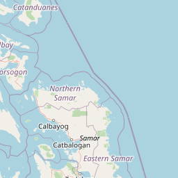
Map view of Samar Island Natural Park

Use this park location map to pinpoint Samar Island Natural Park in Philippines, understand its exact geographic position, and read its mapped placement within the surrounding landscape more clearly.

Pigeon | © OpenStreetMap contributors

Location context for Samar Island Natural Park

Samar
Park atlas

Compare surrounding protected areas and regional conservation zones across the Eastern Visayas

Parks Near Samar Island Natural Park And Related Protected Landscapes

Browsing other protected areas near Samar Island Natural Park reveals wider regional biodiversity patterns and connected forest ecosystems. Comparing these adjacent natural reserves provides a comprehensive geographic view of tropical conservation landscapes across the island.
National parkPalo
About 98 km away#1 closest

South

MacArthur Landing Memorial National Park: Protected Area Geography & Map Context

Explore the mapped boundaries of this national park in Palo, Philippines.

This entry details MacArthur Landing Memorial National Park, a protected national park located near Palo, Philippines. It focuses on its identity as a mapped landscape and a distinct protected area, offering insights into its geographic context and atlas presence. Understanding this park involves exploring its mapped boundaries and its contribution to the regional protected area landscape, providing a factual basis for geographic discovery.

Area
0.068 km²
Established
1977
Relief
Lowland
Climate
Tropical
National parkPhilippines
About 150 km away#2 closest

South

Kuapnit Balinsasayao National Park: Philippines Old-Growth Forest and Endemic Wildlife Atlas

Explore protected landscape boundaries and mountainous terrain on Leyte Island.

Kuapnit Balinsasayao National Park stands as a key protected area within the Philippines, distinguished by its mature old-growth forests and its critical role in conserving endemic bird species unique to the Eastern Visayas. Located on Leyte Island within the mountainous terrain of the Anonang-Lobi Mountain Range, the park's protected landscape identity is central to understanding its geographic significance. This park offers a valuable entry point for exploring the mapped natural features and conservation importance of protected areas across the Philippine archipelago.

Area
3.64 km²
Established
1937
IUCN
V
Relief
Mountain
A soft watercolor painting of a coastal landscape with green rolling hills, distant faint mountains, and light water reflections.
Protected landscapeLeyte
About 178 km away#3 closest

South

Cuatro Islas Protected Landscape/Seascape: Leyte Marine and Island Geography Exploration

Detailed protected area atlas for the Camotes Sea island group

The Cuatro Islas Protected Landscape/Seascape is a notable Philippine conservation zone consisting of four distinct islands including Apid, Mahaba, Digyo, and Himokilan. This geographic profile details the diverse terrain, ranging from uplifted former coral reefs to coral sand islets, while providing a clear understanding of the surrounding marine ecosystem and its role in regional conservation.

Area
125 km²
Established
2000
Scope
Mixed
Wildlife reserveCatanduanes
About 213 km away#4 closest

Northwest

Catanduanes Watershed Forest Reserve: A Mapping of Protected Mountain Catchments and Forested Terrain

Regional protected geography in the Bicol area of the Philippines.

Spanning over 26,000 hectares, the Catanduanes Watershed Forest Reserve is a defining geographic feature of the island. This reserve guards essential headwaters and diverse dipterocarp forest habitats, providing a critical study in how protected mountain terrain supports both regional hydrology and biodiversity conservation.

Area
260.1 km²
Established
1987
IUCN
II
Relief
Mountain
A watercolor painting showing a panoramic view of a lush wetland landscape with gentle green hills in the distance, a winding stream, and tall grasses and pink wildflowers in the foreground.
Wildlife reserveCentral Visayas
About 233 km away#5 closest

Southwest

Olango Island Wildlife Sanctuary: Coastal Protected Area and Migratory Bird Habitat in Central Visayas

Explore the interconnected mudflats, reefs, and mangrove forest ecosystems

Olango Island Wildlife Sanctuary stands as a key protected landscape in the Central Visayas, defined by its vast tidal flats and critical role in international bird migration patterns. This site features a unique mosaic of salt marshes, seagrass beds, and coral reef systems that support diverse coastal life within the low-lying terrain of the Olango Island Group.

Area
10.3 km²
Established
1992
Relief
Lowland
Climate
Tropical
Marine protected areaVisayas
About 256 km away#6 closest

Southwest

Tañon Strait Protected Seascape: Marine Geography and Protected Landscape Analysis

An expansive marine passage located within the central Visayas island group.

As the largest marine protected area in the Philippines, the Tañon Strait Protected Seascape represents a complex aquatic geography spanning 160 kilometres. Its protected waters serve as a vital corridor for marine biodiversity, linking the northern Visayan Sea to the southern Bohol Sea. This resource provides a detailed look at the strait's maritime boundaries, coastal ecosystems, and the distinct underwater terrain that defines this critical conservation zone.

Area
5,000 km²
Established
1998
IUCN
V
Scope
Marine
Protected landscapeSurigao del Norte
About 262 km away#7 closest

South

Siargao Islands Protected Landscape and Seascape: Geographic Atlas and Park Profile

Protected marine and island landscapes in Surigao del Norte

Spanning Siargao, Bucas Grande, and surrounding islets, this major reserve offers a unique look at the integration of karst-featured terrestrial landscapes with diverse marine zones. Trace the boundaries of a significant Philippine protected area defined by its dense coral reefs, sheltered lagoons, and expansive seagrass meadows supporting rare coastal biodiversity.

Area
2,789.14 km²
Established
1996
Relief
Upland
Climate
Tropical
Protected landscapeSurigao del Norte
About 263 km away#8 closest

South

Mahaba Island Protected Landscape and Seascape: Regional Geography and Island Reserve

A combined coastal and marine protected area in Surigao del Norte.

Spanning both a flat sandy island and its surrounding sea, Mahaba Island Protected Landscape and Seascape illustrates the integrated conservation model of the Philippines. Discover the layered geography of mangrove-fringed shorelines, interior coconut patches, and marine habitats that form this protected reserve in the Caraga region.

Area
57.04 km²
Established
1991
Relief
Lowland
Climate
Tropical

Common questions about visiting, size, designation, and location context for Samar Island Natural Park

Samar Island Natural Park FAQs for park facts, access, geography, and protected area context

Find quick answers about Samar Island Natural Park, including protected-area facts, park geography, trail and visitor context, and how the park fits into its surrounding country and regional landscape.
MoriAtlas Explorer

Continue Your Protected Areas Search Across the Global Atlas

Deepen your exploration by continuing the structured search for national parks and protected areas worldwide. Utilize the comprehensive filtering capabilities to compare different conservation landscapes and refine your understanding of global park geography. Discover more about the distribution and characteristics of protected natural areas.

Global natural geography