
Mori Atlas logo
Protected landscapeSeifersdorfer Tal

A mapped exploration of riverine valley terrain and 18th-century landscape design traditions

Seifersdorfer Tal Protected Landscape and Historic Garden Geography in Saxony Germany

The Seifersdorfer Tal represents a distinct protected landscape along the Große Röder river in Saxony. This site harmonizes a historic English-style garden, featuring monuments and allegorical structures, with a legally protected nature reserve and Natura 2000 corridor. Its terrain spans gentle meadows, wooded slopes, and riparian zones that preserve a significant cultural and ecological heritage near Dresden.

landscape gardenEnglish landscape garden18th-century garden heritageRomantic gardenSentimentalismbrühl family heritage
A graphic illustration depicting a fantasy-style castle with archways and battlements set against a cliff with a waterfall, a stone bridge crossing a river, and surrounding forest trees.

Seifersdorfer Tal

Protected landscape

Park overview

Structured park overview, official facts, and landscape profile for Seifersdorfer Tal

Seifersdorfer Tal park facts, protected area profile, and essential visitor context

Review the core facts for Seifersdorfer Tal, including designation, size, terrain, visitor scale, habitats, and operating context in one park-focused overview.

About Seifersdorfer Tal

The Seifersdorfer Tal is a section of the Große Röder valley north of Dresden, between the communities of Liegau-Augustusbad, Seifersdorf, Schönborn, and Grünberg in Saxony. Geographically and culturally it lies at the northern edge of the Dresden metropolitan region, in a gently wooded lowland valley with meadows, slopes, brooks, springs, and old tree stands.

Beginning in 1781, Christina von Brühl reshaped this natural valley into a deliberate landscape park, drawing on the English landscape garden tradition and the moral and aesthetic ideas of Christian Cay Lorenz Hirschfeld. Visitors encountered not a single ornamental garden but a sequence of carefully placed scenes: the Altar of Truth, the Temple of the Muses honoring Wieland, Petrarch's Hut with the Vaucluse spring, Lorenzo's Hut and grave from Sterne's Sentimental Journey, the Pythoras hut for contemplation, monuments to Anna Amalia, Herder, the composer Naumann, and the social reformer Duke Leopold of Brunswick, as well as rustic bridges, sources, benches, and small temples. Each scene carried inscriptions and was integrated into the topography of the valley floor, slopes, and waters.

The valley's significance today rests on this layered character. The 18th-century garden is preserved as a cultural monument under the care of local heritage associations, while the surrounding river landscape is protected under German landscape protection, nature reserve, and European Natura 2000 designations. The annual Whitsun singing festival, the Pfingstsingen, continues a tradition of using the valley as a stage for music and community gathering that reaches back to the Brühl family's original Singspiele and charity festivals on the Sängerwiese.

Quick facts and research context for Seifersdorfer Tal

The Seifersdorfer Tal is a landscape and garden monument in Saxony, situated along the Große Röder between Liegau-Augustusbad and the area near Ottendorf-Okrilla, at the northern edge of the Dresden cultural region. The valley was landscaped by Christina von Brühl beginning in 1781 into one of Germany's earliest English-style landscape gardens, completed in its main form by 1791.

In 1960 the valley, including the downstream Hermsdorf park, was designated a protected landscape area of roughly 288 hectares; a 58.6-hectare core around the Marienmühle has held nature reserve status since 1982. Since 2006 the entire valley has been part of the European Natura 2000 network, embedded within the larger Rödertal obehalb Medingen habitat protection area. The garden is maintained today by the Verein Seifersdorfer Thal and the Landesverein Sächsischer Heimatschutz.

Protection and recognition

Documented terrestrial conservation framework and official recognition records

Seifersdorfer Tal Protection Status and Designation History

Seifersdorfer Tal maintains a documented terrestrial protected area designation established in 1960. Official records compile the verified management scope and international recognition status for natural landscape analysis.

Protection details

Protection scope
Terrestrial
Designated year
1960
Transboundary protection
No
WDPA ID
324532
Core area
0.59 km²
Park context

Deeper park guide and search-rich context for Seifersdorfer Tal

Seifersdorfer Tal history, landscape, wildlife, and travel context

Explore Seifersdorfer Tal through its history, landscape character, ecosystems, wildlife, conservation priorities, cultural context, and seasonal travel timing in a structured park guide built for atlas discovery and search intent.

Why Seifersdorfer Tal stands out

The Seifersdorfer Tal is best known as one of Germany's earliest surviving English-style landscape gardens, designed in the late 18th century as a so-called pedagogical landscape. Christina von Brühl placed dozens of allegorical monuments, rustic huts, temples, fountains, and inscribed stones within the natural valley setting, each tied to themes of virtue, friendship, transience, and natural feeling drawn from Enlightenment thinking and the literature of Empfindsamkeit. It is also recognized as a layered cultural landscape where literary references to Sterne, Wieland, Klopstock, and Petrarca are made physically present in the terrain. The combination of a historic garden monument with a legally protected river valley gives it a distinctive dual identity as both a Romantic-era art work and a contemporary nature protection area.
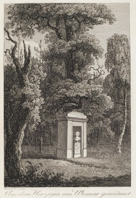
A black and white engraving showing a neoclassical memorial monument with a bust situated in a wooded forest clearing.
An 18th-century engraving depicting the monument to Duchess Anna Amalia in the Seifersdorfer Tal landscape park.

Seifersdorfer Tal history and protected-area timeline

The cultural history of the Seifersdorfer Tal begins in 1781, when Christina von Brühl, daughter-in-law of the Saxon Prime Minister Heinrich Count von Brühl, began transforming the natural valley of the Große Röder into an English-style landscape park. She had lived near the valley since 1775, in the manor house of the Seifersdorf estate, and worked on the park's design until its main completion in 1791.

Christina von Brühl drew direct inspiration from the Enlightenment garden theorist Christian Cay Lorenz Hirschfeld, whose work Gartentheorie had appeared in 1779, and from her personal exchanges with Goethe, Herder, Wieland, and Klopstock. The park was conceived as a pedagogical landscape, where allegory, inscriptions, and architectural features were intended to evoke civic virtues and emotional resonance rather than to dominate nature.

After Christina left Seifersdorf in 1811 following the death of her husband and died in Berlin in 1816, the valley gradually fell into neglect. It was rediscovered in 1881 by the geographer Sophus Ruge, and early protection efforts began in the late 19th century. The first formal conservation step came on 7 March 1960, when the valley and the adjacent Hermsdorf park were declared a protected landscape area. The core area around the Marienmühle received nature reserve status in 1982, and since 2006 the wider valley has belonged to the European Natura 2000 network within the Rödertal oberhalb Medingen Habitat Directive site. Volunteer restoration work has been ongoing since 1990 under the Verein Seifersdorfer Thal and, since 1997, under the ownership of the Landesverein Sächsischer Heimatschutz.

Seifersdorfer Tal landscape and geographic character

The Seifersdorfer Tal follows the course of the Große Röder through a modest, gently sloping valley. On either side of the small river, meadows, terraces, and wooded slopes alternate with old fieldstone walls, springs, and footpaths. The valley runs between the Grundmühle near Liegau-Augustusbad in the south and the Niedermühle near Grünberg, passing the Marienmühle where the road from Schönborn to Seifersdorf crosses the river at right angles. This crossing effectively divides the park into four quadrants that organize its many garden scenes.

The terrain offers varied micro-settings: open meadows, shaded groves of alder, oak, spruce, and linden, rocky outcrops carved by water, small cascades and spring-fed pools, and quiet waterside banks along the meandering river. Natural rock formations and the steep western slope were deliberately incorporated into the garden design, with terraced paths leading to elevated vantage points and to structures such as Petrarch's Hut or the Pythoras hut on the upper terraces.

This natural setting was deliberately preserved as the framework of the landscape garden, which is why the valley still reads as both a designed cultural landscape and a functioning lowland river ecosystem with mixed woodland, meadow, and riparian elements.
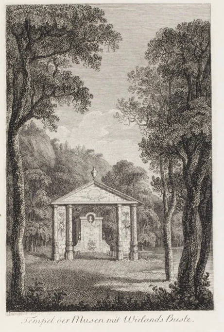
A black and white historical copperplate engraving of an open-air classical structure, the Temple of the Muses, nestled among trees in Seifersdorfer Tal.
A 1792 copperplate engraving by J. A. Darnstedt depicting the Temple of the Muses in Seifersdorfer Tal.

Seifersdorfer Tal ecosystems, habitats, and plant life

Ecologically, the Seifersdorfer Tal functions as a protected lowland river valley. The riparian vegetation along the Große Röder includes alder, willow, and ash, with oak, spruce, and linden dominating the slopes and higher terraces. Meadows, springs, and small rocky brooks contribute to a mosaic of habitat types within a relatively small area, including wet meadows near the river banks and drier oak-dominated woodland on the upper slopes.

The protected status of the valley reflects the value of this habitat mosaic. The valley has been a protected landscape area since 1960, the core around the Marienmühle a nature reserve since 1982, and the entire valley, together with the adjacent Hermsdorf park, became part of the European Natura 2000 network in 2006 as part of the larger Rödertal oberhalb Medingen Habitat Directive site. This designation imposes strict nature and bird protection rules intended to preserve the valley's flora, fauna, and hydrological character alongside its cultural heritage.
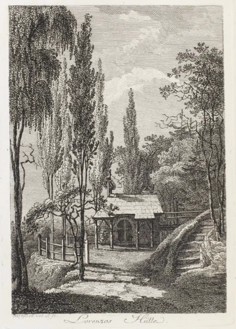
A black and white engraving of a rustic small hut nestled among tall trees and garden paths.
A 1792 copper engraving by J. A. Darnstedt depicting Lorenzo's Hut in the Seifersdorfer Tal landscape garden.

Seifersdorfer Tal wildlife and species highlights

While the Seifersdorfer Tal is best known as a cultural landscape, its protected ecological status means that the valley also functions as wildlife habitat. The waters, alder-willow gallery forests, springs, and meadows along the Große Röder support the typical fauna of Saxon lowland river valleys, including breeding and foraging habitat for birds that depend on riparian and meadow environments. The integration of the valley into the Natura 2000 network underscores its importance for habitat-continue species typical of Central European brook and stream valleys.

In the 18th-century garden era, the valley's naturalist layers included keystone features such as a small cascade, a natural bathing grotto on the Röder, and groves of oak and alder that provided both scenic setting and shelter for woodland species. Today the combination of old trees, undisturbed water edges, and adjacent agricultural land sustains a habitat structure that is rare in such a densely settled region near Dresden.
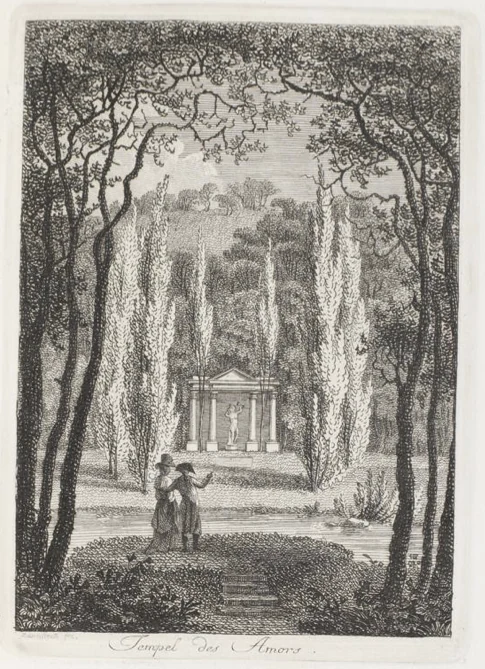
A black and white historical engraving showing the Temple of Amor in a garden setting, with two 18th-century figures standing in the foreground overlooking a small water feature.
A historical engraving of the Temple of Love in Seifersdorfer Tal.

Seifersdorfer Tal conservation status and protection priorities

The Seifersdorfer Tal is a clear example of layered conservation. In 1960 the valley and the downstream Hermsdorf park were declared a Saxon protected landscape area of roughly 288 hectares, providing a broad legal umbrella for the cultural and natural features of the valley. In 1982 a 58.6-hectare core around the Marienmühle received stricter nature reserve protection, focusing on the most ecologically sensitive riverine and meadow sections.

Since 2006 the entire valley has been incorporated into the European Natura 2000 network as part of the larger 770-hectare Habitat Directive site Rödertal oberhalb Medingen, binding the valley to EU-level habitat and species protection requirements. Conservation work is carried out by the Verein Seifersdorfer Thal in cooperation with the Landesverein Sächsischer Heimatschutz, which has owned the site since 1997. Major restoration efforts, supported by public funding, have been underway since 1999 to stabilize monuments, replant historic tree lines, and recover lost garden structures after decades of weathering and storm damage, notably the 2010 Whitsun tornado.

Seifersdorfer Tal cultural meaning and human context

The Seifersdorfer Tal is a landmark of 18th-century German garden culture and of the literary movement known as Empfindsamkeit. Christina von Brühl developed the valley into a physical, walkable encyclopedia of Enlightenment ideas, civic virtues, and literary references, drawing on Christian Cay Lorenz Hirschfeld's garden theory and on direct personal ties with Goethe, Herder, Wieland, Klopstock, Schiller, and other leading figures of late 18th-century German letters.

The park is also a site of family memory. Christina and her husband Hans Moritz Count von Brühl used the garden as an allegorical self-portrait of the Brühl family, including memorials to Christina's father-in-law, the controversial Saxon Prime Minister Heinrich Count von Brühl. Their son Carl, later Intendant of the Royal Theatres in Berlin, together with his wife Johanna, added additional monuments after 1811. After Christina's death in 1816, the valley fell into relative obscurity for several decades before being rediscovered by heritage-minded writers and associations in the late 19th and early 20th centuries.

Today the valley also hosts an annual Whitsun singing tradition, the Pfingstsingen, organized by the Seifersdorfer Heimatverein since 1959, which revives the original 18th-century use of the Sängerwiese as a stage for communal music and theatrical performance. The garden and valley are part of the cross-border Gartenkulturpfad beiderseits der Neiße, linking Seifersdorf to other historic garden sites along the Neiße river.
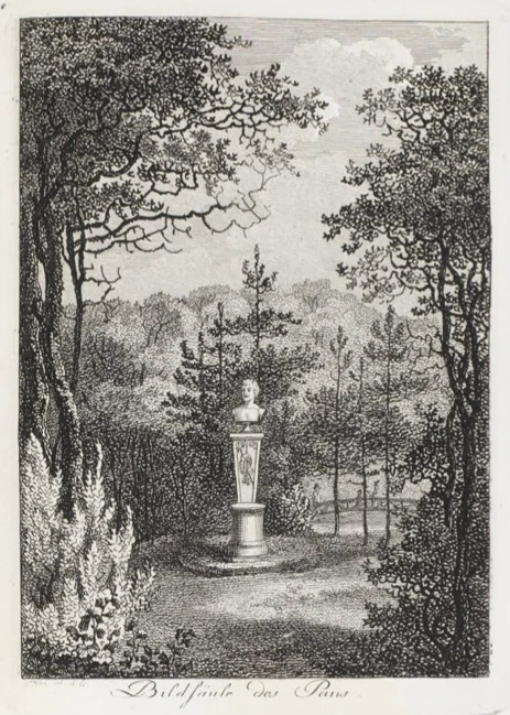
An antique black and white engraving showing a classical bust of Pan on a pedestal placed in a wooded landscape.
An 18th-century engraving depicting the Pan sculpture in Seifersdorfer Tal.

Top sights and standout views in Seifersdorfer Tal

Christina von Brühl's allegory-laden garden design of the 1780s and 1790s, with its surviving monuments such as the Altar of Truth, the Linde der Ruhe, Petrarch's Hut with the Vaucluse spring, the Pan statue site, and the Herder monument.

The layered legal protection of the valley as a Saxon protected landscape area, a nature reserve around the Marienmühle, and part of the European Natura 2000 network within the Rödertal oberhalb Medingen site.

The continued living tradition of the Pfingstsingen Whitsun singing festival and the long-running volunteer conservation work by the Verein Seifersdorfer Thal and the Landesverein Sächsischer Heimatschutz.
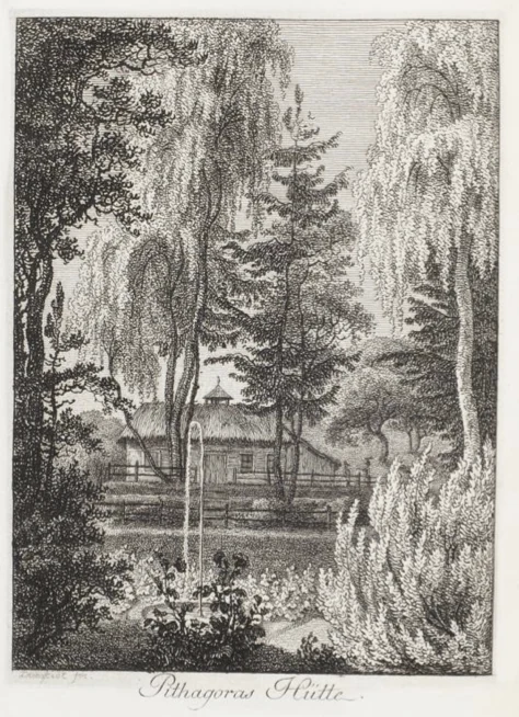
A black and white line engraving depicting a small, thatched-roof hut nestled among trees and shrubs, with a small fountain in the foreground and the label Pythagoras Hütte written in script at the bottom.
A historical engraving of the Pythagoras Hut in the Seifersdorfer Tal landscape park.

Best time to visit Seifersdorfer Tal

The Seifersdorfer Tal has a markedly seasonal character. Spring and early summer bring fresh green foliage, full flowing springs such as the Bergquelle Schöpfe schweigend, and the famous Whitsun Pfingstsingen music festival that fills the valley with choirs and visitors. Late spring is also the most atmospheric time to see the meadows around the Sängerwiese and the Laurawiese in bloom.

Summer offers the densest green tunnel effect along the valley paths, but also heavier shade that obscures some of the sightlines and inscriptions the original garden was designed around. Autumn arguably shows the valley at its most picturesque, with colored foliage highlighting the steep slopes and the gentle meanders of the Große Röder. Winter visits are quieter and reveal the underlying valley topography, water system, and surviving stone monuments most clearly, although some paths may be muddy in wet conditions.


Monthly climate preview

Long term representative measurements for monthly temperature and precipitation patterns in Saxony

Seifersdorfer Tal Climate Normals and Annual Temperature Rhythm

Historical climatology records for Seifersdorfer Tal document a measured annual temperature range from sub-zero winter minimums to warm summer maximums alongside consistent daily precipitation rates. Examining the full twelve-month profile provides deeper analytical context regarding long-term weather variations across the protected valley terrain.
Annual mean8 °C
-2 °C19 °C
Jan-2°
Feb-1°
Mar
Apr
May13°
Jun17°
Jul19°
Aug19°
Sep14°
Oct
Nov
Dec-1°
Warmest month
July

19.1 °C

Coolest month
January

-1.8 °C

Wettest month
July

2.8 mm/day

Driest month
April

1.3 mm/day

Park location guide

Geography guide, regional context, and park location map for Seifersdorfer Tal

Seifersdorfer Tal park geography, regions, and map view in Germany

Understand where Seifersdorfer Tal sits in Germany through a broader geographic reading of the surrounding landscape, nearby location context, and its mapped position within the national park landscape.

How Seifersdorfer Tal fits into Germany

Germany is a federal republic in Western and Central Europe with a population of over 83 million across sixteen constituent states. It is Europe's largest economy by nominal GDP and a major global exporter and importer. The capital is Berlin, and the country borders Denmark, Poland, Czech Republic, Austria, Switzerland, France, Luxembourg, Belgium, and the Netherlands.

Wider geography shaping Seifersdorfer Tal in Germany

Germany is located in Western and Central Europe, spanning 357,022 km². It borders Denmark to the north, Poland and the Czech Republic to the east, Austria and Switzerland to the south, and France, Luxembourg, Belgium, and the Netherlands to the west. The country has coastlines on the Baltic Sea and North Sea to the north, with the Alps located in the southern region.

Map view of Seifersdorfer Tal

Use this park location map to pinpoint Seifersdorfer Tal in Germany, understand its exact geographic position, and read its mapped placement within the surrounding landscape more clearly.

Pigeon | © OpenStreetMap contributors

Location context for Seifersdorfer Tal

Saxony

Visualizing protected valley habitats and historic garden terrain

Seifersdorfer Tal Landscape and Scenery Photography

Visual documentation captures the varied terrain, riverine woodlands, and historic garden structures that define Seifersdorfer Tal. Photographic records provide clear insight into the protected river valley, natural habitats, and enduring landscape character.

A black and white engraving showing a neoclassical memorial monument with a bust situated in a wooded forest clearing.

A detailed 18th century black and white copper engraving depicting a rustic, thatched roof hut partially obscured by dense forest and two prominent, slender trees in the foreground, with a simple wooden gate in front.

A black and white historical copperplate engraving of an open-air classical structure, the Temple of the Muses, nestled among trees in Seifersdorfer Tal.

A black and white engraving of a rustic small hut nestled among tall trees and garden paths.

A black and white historical engraving showing the Temple of Amor in a garden setting, with two 18th-century figures standing in the foreground overlooking a small water feature.

A black and white historical engraving showing a classical gazebo-like temple surrounded by tall thin trees and a landscaped garden setting.

An antique black and white engraving showing a classical bust of Pan on a pedestal placed in a wooded landscape.

A black and white line engraving depicting a small, thatched-roof hut nestled among trees and shrubs, with a small fountain in the foreground and the label Pythagoras Hütte written in script at the bottom.

A close up shot of a stone well or grotto structure built into a hillside, featuring an arched ceiling made of natural stone, surrounded by green ferns and mossy rocks.

A vintage black and white engraving showing a classical urn-style monument on a small mound surrounded by tall slender trees in a park setting.

A weathered stone urn monument decorated with carved swags, situated against a mossy rock face covered with ivy and fallen autumn leaves.

A black and white historical engraving showing a stone urn monument set in a dense, wooded garden landscape in Seifersdorfer Tal.

A black and white line engraving of a stone monument placed beneath tall, dense trees in a park-like setting.

A black and white archival photograph showing a rectangular stone pedestal topped with a small vase, resting on a rocky base in a grassy meadow surrounded by dense deciduous trees.

An 18th-century black and white engraving showing a stone obelisk surrounded by tall columnar trees in a park setting, with two figures standing nearby.

A black and white engraving showing a person sitting near a stone monument topped with a decorative urn within a wooded landscape.

Park atlas

Compare regional park geography and adjacent river valley reserves in Saxony

Other Parks Near Seifersdorfer Tal and Surrounding Protected Landscapes

Visitors exploring Seifersdorfer Tal can browse other nearby parks and protected areas sharing similar valley terrain. Expanding the geographic comparison reveals broader regional conservation networks across the surrounding landscape.
Nature reserveSachsen
About 9.9 km away#1 closest

Northwest

Waldmoore bei Großdittmannsdorf: A Protected Wetland Landscape in Sachsen, Germany

Mapping forest mires and rare swamp woodland habitats

Waldmoore bei Großdittmannsdorf represents a carefully maintained nature reserve in eastern Germany, spanning roughly 93 hectares of forest mire and bog structures. The site supports a rare transition of swamp woodland, sedge-rich wet stands, and spring flushes within the Laußnitzer Heide. As a designated Natura 2000 area, it plays a key role in safeguarding regional wetland connectivity and providing a refuge for specialist flora and fauna in the Saxon landscape.

Area
0.935 km²
Established
2000
IUCN
IV
Watercolor painting of a soft landscape featuring distant hills and foreground vegetation in shades of green, yellow, and soft red.
Nature reserveSachsen
About 13 km away#2 closest

South

Dresdner Elbtalhänge Nature Reserve: Geography, Mapped Boundaries, and Landscape Context

An essential nature reserve along the Elbe valley in Sachsen

Dresdner Elbtalhänge captures the striking transition between the flat Elbe floodplain and the Westlausitz hill region. This detailed atlas entry covers the reserve's unique geomorphology, including its incised ravine systems, south-facing oak forests, and exposed rock formations that define its protected character within Sachsen.

Area
203.6 km²
Established
2007
IUCN
IV
A watercolor painting showing a calm pond with a small island of green trees and distant rolling hills under a soft pink and yellow sky.
Nature reserveMeißen District
About 14 km away#3 closest

West

Frauenteich Moritzburg: Mapping the Protected Wetland Landscapes of Meißen District

Glacial pond basins and diverse forest habitats in Saxony.

Frauenteich Moritzburg serves as a core component of Saxony's pond landscape, protecting a rich sequence of shoreline vegetation and open water. Its geography reflects the results of ancient glacial activity, creating a unique environment where sandy ridges and wet meadows coexist. This nature reserve provides essential refuge for bird populations, making it a focal point for understanding the natural, protected terrain within the broader Meißen District environment.

Area
2.02 km²
Established
1954
IUCN
IV
Relief
Lowland
A horizontal watercolor illustration showing a calm pond in the foreground, with lush green vegetation on the banks and rolling hills in the background under a soft sky.
Nature reserveMeißen
About 15 km away#4 closest

West

Dippelsdorfer Teich Nature Reserve: Geographic Insights and Landscape Context

Historic Saxon pond management and regional protected landscape.

The Dippelsdorfer Teich serves as a primary example of historical pond construction and nature protection in the northern Dresden countryside. This 69 hectare reservoir captures a blend of ecological, cultural, and recreational values within the Meißen region. Users can examine its physical layout, the dam structure, and the integration of heritage transport within this managed lowland environment.

Area
0.69 km²
Established
1528
Relief
Lowland
Scope
Terrestrial
A pale, soft watercolor illustration showing a horizontal landscape of light green trees, shrubs, and rolling grassy plains on a white background.
Nature reserveGermany
About 16 km away#5 closest

South

Elbinseln Pillnitz und Gauernitz: A Study in Protected Saxon River Landscapes

Examining floodplain geography and rare river island ecosystems

Located in the Elbe valley between Dresden and Meissen, Elbinseln Pillnitz und Gauernitz preserves the final natural river islands within the state of Saxony. This protected nature reserve anchors a vital network of alluvial soils, riparian woodlands, and unarmored riverbanks, offering a unique perspective on the dynamic floodplain geography of Germany's major river corridors.

Area
0.235 km²
Established
2006
IUCN
IV
Relief
Lowland
Watercolor painting showing a landscape with green hills, trees, and a river winding through the scene
National parkGermany
About 21 km away#6 closest

Southeast

Saxon Switzerland National Park: Protected Area Geography and Map Exploration

Discover its mapped boundaries and regional landscape context.

Saxon Switzerland National Park, a protected national park in Germany, offers a distinct focus for geographic and atlas-based discovery. This page details the park's specific protected landscape, its mapped boundaries, and its contribution to the regional geography. MoriAtlas allows for in-depth exploration of such natural areas, providing essential context for understanding their place within broader natural systems and mapped terrains.

Area
93.5 km²
Established
1990
IUCN
II
Visitors
1.7M annual
A watercolor illustration depicting rolling, soft hills and green vegetation with distant, faded mountains in the background, set against a plain white background.
Nature reserveGermany
About 22 km away#7 closest

South

Spargründe bei Dohna: Nature Reserve and Protected Valley Landscapes in Germany

Examining the crystalline ravines and forest ecosystems of the Saxon landscape

Spargründe bei Dohna stands as a distinct nature reserve at the northern margin of the Elbtalschiefergebirge. The site encompasses narrow, steeply-sided valleys carved into Dohna Granodiorite, creating a rugged terrain of rocky ridges and shaded deciduous woodland. This geographic overview examines the boundaries and natural features of the reserve, highlighting its role within the wider Müglitztal protected area network.

Area
0.373 km²
Relief
Upland
Climate
Temperate
Access
Easy access
Nature reserveFreistaat Sachsen
About 23 km away#8 closest

Southwest

Windberg Nature Reserve: Mapping the Forested Ridge and Protected Landscape of Saxony

Geology, mining heritage, and protected oak-beech forest ecosystems

Windberg serves as the prominent local landmark for Freital, defined by its elongated forested plateau and complex tectonic geography. This nature reserve offers a study in the intersection of environmental conservation and human industrial history, featuring Saxony's deepest cave and varied habitats within the eastern Ore Mountains foothills.

Established
1967
Relief
Mountain
Climate
Temperate
Access
Easy access

Common questions about visiting, size, designation, and location context for Seifersdorfer Tal

Seifersdorfer Tal FAQs for park facts, access, geography, and protected area context

Find quick answers about Seifersdorfer Tal, including protected-area facts, park geography, trail and visitor context, and how the park fits into its surrounding country and regional landscape.
MoriAtlas Explorer

Continue Your Protected Areas Search Across the Global Atlas

Deepen your exploration by continuing the structured search for national parks and protected areas worldwide. Utilize the comprehensive filtering capabilities to compare different conservation landscapes and refine your understanding of global park geography. Discover more about the distribution and characteristics of protected natural areas.

Global natural geography