
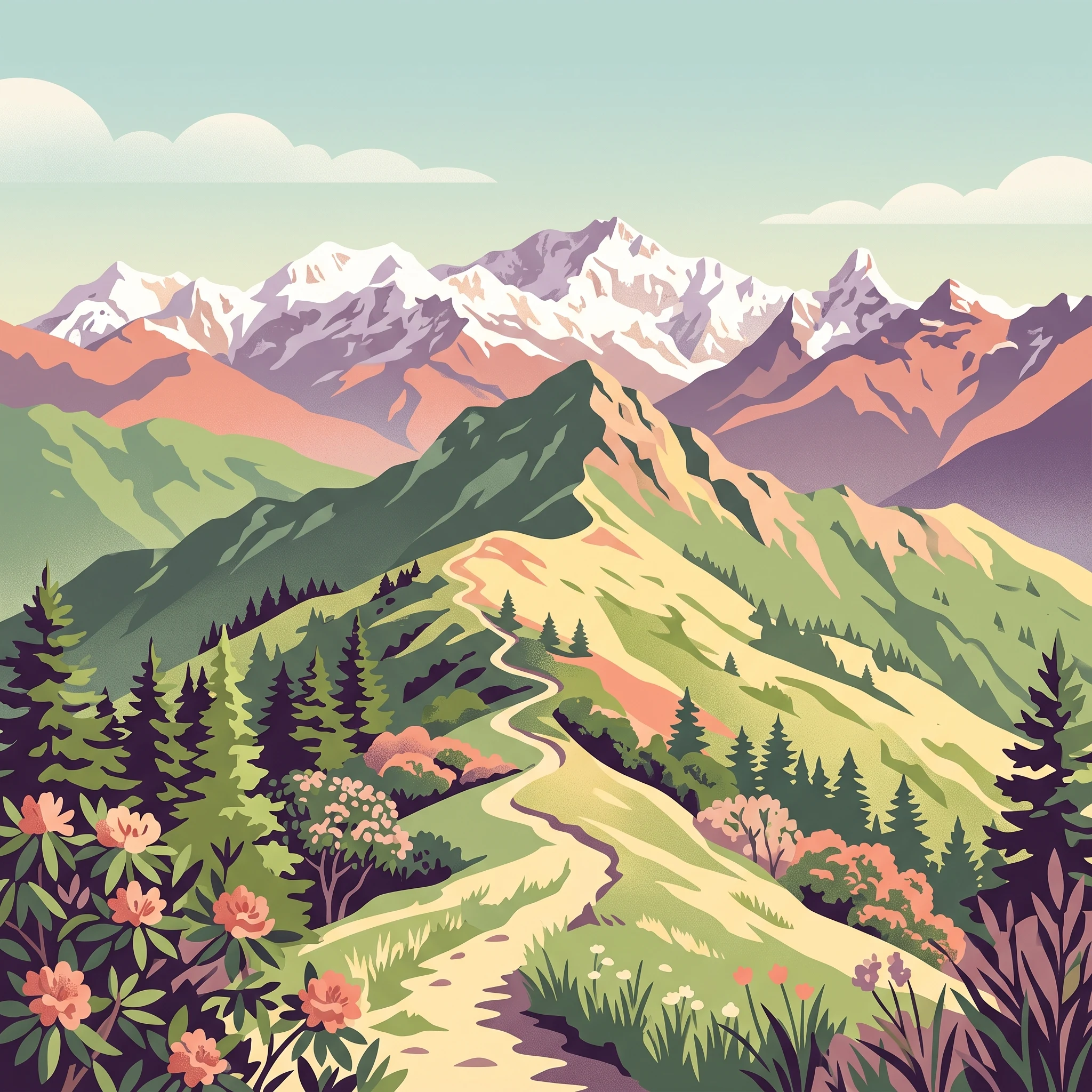
Seasonal Planning
When to Visit Singalila National Park: Defining Your Ideal Window
Choosing Your Seasonal Window
The best time to visit Singalila National Park depends primarily on whether you prioritize clear, expansive Himalayan panoramas or the vibrant, living color of the park's high-altitude flora. Because the park is situated on a high-elevation ridge reaching up to 4,000 meters, your travel date acts as a filter for visibility, temperature, and trail accessibility. While the park remains a distinct mountain wilderness year-round, the atmospheric conditions transition sharply between dry, crisp intervals and the heavy humidity of the monsoon period, which effectively governs the window for reliable trekking.
The Trade-off Between Visibility and Bloom
Most visitors find that the choice between spring and autumn involves a fundamental compromise. Spring, typically spanning from March through May, is defined by the progressive bloom of rhododendrons and other alpine wildflowers. During these months, the forest canopy transforms, offering a visually dynamic landscape. However, as the season progresses toward May, humidity levels rise, increasing the likelihood of cloud cover that may obscure the iconic views of the Kangchenjunga and Everest ranges.
In contrast, the post-monsoon period,beginning in mid-September and extending through November,offers the highest probability of clear, dry air. As the heavy rains of the summer months dissipate, the atmosphere typically stabilizes, providing the sharpest visibility of the distant peaks. This period is favored by those whose primary goal is landscape photography or trekking the ridgeline to Sandakphu and Phalut for the sake of the vistas. While the landscape is less floral than in spring, the trade-off is a higher degree of atmospheric clarity and lower humidity.
Understanding Elevation and Atmospheric Constraints
The park's environment is dictated by its location at the intersection of the Singalila Ridge and the borderlands. At elevations exceeding 2,300 meters, temperatures remain cool even when conditions are clear. You should expect significant variations in temperature depending on whether you are trekking through the lower forest zones or moving across the higher, wind-swept meadows near the summits. While winter months bring drier, clearer skies, the plummeting temperatures at high altitude require specialized preparation for cold, as do the rapidly changing weather patterns that can occur throughout the transition periods. Because the park experiences a restricted access cycle due to heavy seasonal precipitation, planning must account for the reality that the most stable trekking periods are bracketed by climatic shifts that fundamentally alter both the character of the environment and the practical ease of traversing the ridge.
Seasonal Comparison
Best Visiting Windows for Singalila National Park
Spring Trekking: The Rhododendron Window
Visiting during the spring months of March and April offers the best opportunity to witness the park’s signature floral displays. As temperatures at mid-elevations begin to rise, with average daily highs climbing toward 28°C and 31°C respectively, the higher ridges remain cool enough for sustained trekking. This period is favored by those prioritizing botanical diversity, as the rhododendron blooms typically peak during these months, transforming the forest landscape into a vibrant alpine environment. The trade-off for this visual reward is an increase in humidity and a higher likelihood of afternoon cloud cover, which can obscure distant mountain vistas compared to the drier autumn months. Travelers should expect variable weather that necessitates layered clothing, as the transition from winter cold to early summer warmth is active throughout these weeks.
Post-Monsoon Autumn: Seeking Peak Visibility
For trekkers who prioritize unobstructed views of the Kangchenjunga and Everest ranges, the post-monsoon period in October and November represents the premier choice. Following the heavy rains of the monsoon season, the atmosphere is generally purged of dust and haze, resulting in the year's clearest air quality and most consistent visibility. October serves as a bridge, where lingering moisture from the monsoon begins to dissipate, while November offers significantly drier, crisper conditions with lower precipitation risk. Daytime temperatures in these months are mild, making them ideal for long hours on the trail. However, those visiting early in this window should be prepared for potential trail conditions impacted by the preceding monsoon, while those arriving in late November will encounter rapidly dropping temperatures as winter sets in.
Considerations for Early and Late Season Transitions
While the primary windows are well-defined by distinct climate patterns, the transition months of May and September require careful consideration regarding weather stability. May often sees a buildup of humidity and rising precipitation, signaling the approach of the monsoon, while September often remains wet as the rains subside. Visitors aiming for these shoulder periods often seek to avoid the peak crowds of the primary spring and autumn windows, but they must accept a higher risk of rain, trail mud, and limited visibility. These periods are best suited for flexible itineraries that allow for weather-dependent adjustments. Regardless of the chosen month, all travelers should verify the current status of park access, as the official closure from mid-June through mid-September creates a strict operational boundary that ignores early or late season shifts.
Annual Climate Overview
Understanding Singalila National Park Weather and Climate by Month
The Annual Temperature Progression
Singalila National Park experiences a distinct thermal rhythm dictated by the interplay of elevation and the changing seasons. The annual temperature cycle begins with cool, crisp conditions in the winter months of December and January, where mean temperatures often hover near the lowest points of the year. As spring arrives, a steady climb in temperature is observed, peaking in the transition toward the pre-monsoon period in May. During these peak spring months, daily maximums can reach into the low thirties at lower elevations of the park boundary, though the higher ridgelines near Sandakphu will consistently remain significantly cooler than the regional sampling baseline.
Following the monsoon, as humidity levels begin their gradual decline, temperatures settle into a moderate range throughout October and November. This transition creates the stable, comfortable climate that many trekkers favor. It is critical for visitors to remember that these long-term climate normals, measured from a specific regional baseline, serve as a historical reference rather than a guarantee of conditions on the ground. Weather on the Singalila Ridge can fluctuate rapidly, and temperature conditions at the higher trekking altitudes of 3,000 to 4,000 meters will be consistently colder than the data recorded at the base of the mountain complex.
Patterns of Rainfall and Atmospheric Humidity
The most significant climatic divider for this park is the monsoon, which effectively bifurcates the year into two distinct moisture regimes. From June through September, the region experiences substantial precipitation, with peak rainfall normals often occurring in July. During this window, humidity levels rise sharply, frequently exceeding 85 percent, which creates dense cloud cover and obscured visibility across the ridgeline. This period of high atmospheric moisture corresponds with the annual closure of the park, reflecting the practical challenges posed by these weather patterns.
Conversely, the months of November through March represent the driest phase of the year. During this interval, precipitation averages are minimal, and relative humidity often drops significantly, occasionally falling below 50 percent. This combination of dry air and reduced cloud cover is what provides the exceptionally clear vistas of the Everest and Kangchenjunga ranges. The dry season is defined by these stable atmospheric conditions, allowing for the crisp, long-distance visibility that defines the classic Himalayan trekking experience.
Daylight Availability and Seasonal Wind Shifts
Daylight hours follow a predictable solar cycle, expanding from approximately 10.3 hours in the winter solstice month of December to a peak of over 13.5 hours during the summer months of June and July. While longer days in late spring and early summer offer more time for movement, the trade-off is the concurrent increase in monsoon-related moisture. Visitors should note that wind patterns also shift throughout the year. The wind environment is generally more energetic during the spring months as the landscape transitions between seasonal regimes, whereas the post-monsoon autumn months typically offer a calmer, more settled air mass. These variations in daylight and wind are not just statistical differences but represent fundamental changes in the trekking environment, influencing everything from the pacing of daily hikes to the feeling of exposure on the open ridgelines. When planning, prioritize these daylight and wind trends alongside moisture levels to align your trip with the type of mountain experience you prefer.
Annual Weather Cycles
Seasonal Patterns and Weather Transitions in Singalila National Park
The Rhythm of the Singalila Ridge
Singalila National Park does not experience a traditional four-season cycle. Instead, the climate is dictated by the dramatic shift between the monsoon and the dry, high-visibility months that define the trekking year. The annual weather cycle is best understood through three distinct phases: the crisp, dry winter window, the vibrant spring transition, and the moisture-laden monsoon period. These segments are defined by their humidity levels and the amount of precipitation, which exert direct control over the park landscape and local atmospheric clarity.
The Dry Winter Window
From late November through February, the park enters its most stable atmospheric state. This period is characterized by the lowest precipitation levels of the year, with monthly values remaining below 0.5 mm per day. Humidity is significantly lower during this stretch, often dipping below 55 percent, which creates the crisp, dry air necessary for clear mountain views. While temperatures at the lower elevations remain moderate, the high-altitude ridgeline experiences freezing temperatures that require specialized preparation. This phase offers the most consistent mountain visibility but limits access to some of the higher-elevation meadows due to the risk of frost or thin layers of snow that can affect trail conditions.
The Spring Transition
Beginning in March and extending through May, the park undergoes a noticeable change as the weather warms and humidity begins to climb. March serves as a classic transition month, where temperatures rise steadily and the air remains relatively dry compared to the coming summer. As the season progresses into April and May, the daily average temperature climbs above 20 degrees Celsius at mid-elevations. This warming trend is accompanied by an increase in precipitation and rising humidity levels as the atmosphere prepares for the seasonal monsoon. This is the period when the landscape undergoes its most significant change, as melting snow and rising temperatures trigger the iconic rhododendron blooms. Visitors during this window should expect a mix of stable mornings followed by increasing afternoon cloud cover, which is a hallmark of the transition period.
The Monsoon and Post-Monsoon Shift
From June through mid-September, the park is dominated by heavy rainfall and high humidity. Precipitation levels peak in July, often exceeding 10 mm per day, accompanied by persistent cloud cover that frequently obscures the mountain ranges. This phase is characterized by saturated ground and high relative humidity levels, often approaching 90 percent. Access is restricted during this window, as the heavy moisture creates unstable trail conditions.
By late September and early October, the pattern breaks, marking the start of the post-monsoon period. This is the most sought-after window for long-distance trekkers, as the retreating monsoon leaves behind fresh, clean air and saturated, green landscapes that gradually dry out. This transition back to the dry, high-visibility conditions of late autumn completes the cycle, providing the final major window of the year before the cycle resets with the colder, drier weather of December.
Seasonal Experiences
What Visiting Singalila National Park Is Like Throughout the Year
Trekking the Singalila Ridge
The primary activity defining the park is the high-altitude trek toward Sandakphu and Phalut. Because this route follows an exposed ridge bordering Nepal and Sikkim, your experience is dictated by the interaction between elevation and the seasonal dry cycle. During the spring months of March and April, the path transitions from forests to open meadows as snow recedes, allowing for clearer passage toward the higher camps. In contrast, the post-monsoon window of October and November offers the most stable walking conditions, as the monsoon rains have ceased, leaving the trail surfaces relatively firm and the ridgeline air crisp.
Seasonal Birdwatching Dynamics
Singalila is a critical corridor for Himalayan birding, and your sightings are closely tied to the shifting vegetation stages throughout the year. The spring months, characterized by the blooming of various rhododendron species, create a localized attraction for bird species that feed on nectar and forest insects. For those visiting during this period, the forest canopy often provides more activity at lower and middle elevations as birds forage amid the blooms. During the quieter autumn months, bird movement remains significant, though the experiential focus shifts toward open mountain species as the park prepares for the transition into winter. The variety of endemics, such as the blood pheasant and satyr tragopan, requires patience regardless of the season, but the increased visibility during post-monsoon months can assist in spotting raptors like the Himalayan Vulture circling the thermals near the ridge.
Landscape Transformations
The park landscape undergoes a distinct visual shift that changes the nature of a visit from month to month. Spring is defined by the vertical gradient of color as rhododendron blooms progress, typically starting at lower elevations and moving toward the summits as the season advances. Visitors trekking in late March or April will encounter these forests in transition, where the contrast between the dense, humid understory and the stark, open alpine peaks becomes most apparent. In the post-monsoon months of October and November, the landscape sheds the dampness of the rainy season, revealing the clear-cut contours of the Kangchenjunga and Everest ranges. This is the period when the alpine meadows appear most golden and the mountain vistas are defined by sharp, high-contrast silhouettes rather than the softer, moisture-laden atmosphere of the pre-monsoon spring. Visitors should note that while these seasonal cycles are observable, they are subject to annual variations in temperature and moisture, which can delay or accelerate the flowering and clearing processes.
Travel Priorities
Choosing the Best Time to Visit Singalila National Park for Specific Interests
Prioritizing Clear Mountain Views
For travelers whose primary goal is witnessing the high Himalayan peaks like Kangchenjunga and Everest, the post-monsoon window of October and November offers the most consistent results. During these months, the air is scrubbed clean by the preceding rains, and humidity levels drop significantly from the high averages seen during the summer. While late autumn brings colder temperatures, the trade-off is superior atmospheric clarity. Visitors should expect sharp, crisp days where distant peaks appear with high contrast against the sky, as opposed to the spring months which, while warmer, often feature more atmospheric haze due to changing weather fronts and increased forest moisture.
Selecting for Comfortable Hiking Temperatures
If your priority is trekking in the most moderate temperatures, the mid-spring window of March and April is typically the best fit. At this time, the average mean temperatures at lower elevations begin to climb, making the lower stages of the ascent more pleasant than the biting cold of early winter or the tail end of the autumn season. March, in particular, provides a balance of mild daytime highs and manageable nighttime lows as the transition from winter takes hold. The compromise here is the increased risk of spring cloud cover or light precipitation, which may momentarily obscure the peaks, unlike the dry but much colder conditions found in December.
Planning for Floral and Birding Interests
Travelers interested in the park's renowned biodiversity, specifically the rhododendron blooms and the diverse avian population, should focus their plans on late March and April. The timing of the blooms creates a direct spike in local wildlife activity, making this the most effective period for observing resident species and spring migrants. The increase in daylight hours during this phase allows for longer days in the field, which is a practical benefit for those whose priority is observation rather than just distance-based trekking. The main trade-off is that these months represent a busier time for the region, and the higher humidity compared to the autumn months can make physical exertion on the steeper trail sections feel more demanding despite the pleasant temperatures.
Navigating the Trade-off of Drier Conditions
For visitors who prioritize dry trails and lower humidity, the period from November through early December is arguably the most stable. Precipitation values during these weeks reach their annual minimum, and relative humidity stays low, which reduces the presence of mud on the trail and minimizes the chance of trail-level fog. This environment is ideal for those who prefer consistent ground conditions for long, multi-day treks. However, travelers choosing this late-season window must accept that daylight hours are significantly shorter than in spring, and temperatures at higher elevations like Sandakphu will be at their lowest, requiring robust cold-weather gear to ensure comfort during the night.
Logistics and Permits
Seasonal Access and Practical Planning for Singalila National Park
Access Points and Transportation Logistics
Reaching the park typically begins in Manebhanjyang, a village located approximately one hour or 30 kilometers west of Darjeeling. This serves as the primary gateway for most trekking parties. For those looking to conclude their journey elsewhere, Rimbik is a common exit point, while Bijanbari offers an alternative, albeit more strenuous, route that adds a day of walking to the standard itinerary. The roads in this region are noted for their circuitous nature, often resulting in a travel experience characterized by constant elevation changes. Travellers should check with current local transport providers regarding the availability and condition of vehicle transfers, as road conditions can fluctuate significantly based on seasonal weather patterns and maintenance schedules.
Requirements for Park Entry and Documentation
Visitors entering the protected area must comply with established entry regulations. Current policy requires the payment of a formal entry fee and mandates that visitors hire a guide for their trek. Given that the Singalila Ridge trail system crosses segments of the international border between India and Nepal, carrying a valid passport is essential for all trekkers. These operational requirements are subject to change by local authorities, so it is imperative to verify current permit regulations and guide mandates with official park offices or authorized agencies in Darjeeling before finalizing your travel plans. Booking through established trekking companies is a standard practice, as these organizations often handle the coordination of necessary documentation, logistics, and on-ground staffing arrangements.
Preparing for Seasonal Route Accessibility
While climate normals provide a baseline for understanding the regional weather, they should not be treated as a calendar of trail accessibility. The high-altitude nature of the Singalila Ridge means that physical access to paths like those leading to Sandakphu and Phalut can be influenced by sudden environmental shifts, including late-season snowfall or monsoon-driven trail degradation. There are no fixed, immutable opening dates for the park. Instead, accessibility is managed on a rolling basis, influenced by the safety of mountain passes and the stability of the terrain. Always consult the latest bulletins from the West Bengal Forest Department or relevant forest officials for the most current information regarding route status and potential closures. Relying on historical patterns to assume the status of a trail during any specific month is insufficient for safe planning, as management protocols and mountain conditions require real-time verification.
Safety and Preparation
Weather Expectations, Safety, and Essential Preparation for Singalila National Park
Adapting to High-Altitude Temperature Variability
Visitors to Singalila should prepare for substantial temperature shifts driven by the ridge-line elevation, which ranges from 2,300 to over 4,000 meters. Long-term climate normals indicate that while lowland bases may experience mild mean temperatures, the alpine environments at Sandakphu and Phalut are significantly colder. Layering is the most practical preparation strategy. During the spring transition in March and April, daytime warmth can fluctuate rapidly as moisture levels rise, while winter and late autumn demand thermal layers capable of handling nights where temperatures frequently drop well below the mean values recorded at lower-altitude monitoring stations.
Managing Exposure to Wind and Moisture
Wind exposure is a defining feature of the Singalila Ridge. Because the trail runs along an exposed mountain spine, guests encounter consistent wind speeds regardless of the season. Protection against wind-chill is vital, as even on sunny days, the effective temperature can feel much lower than the ambient air temperature. Furthermore, the transition into the monsoon months from May through September brings a sharp rise in humidity and precipitation. During these periods, waterproof gear is essential, but visitors should prioritize breathability, as the combination of high humidity and steep terrain increases the need for effective moisture management to stay comfortable during long trekking days.
Preparation for Variable Daylight and Terrain
Daylight hours fluctuate significantly throughout the year, spanning from roughly 10.3 hours in December to over 13.5 hours in June and July. This variation directly impacts the time available for daily trekking stages. In the shorter days of late autumn and winter, travellers must plan their daily start times carefully to ensure arrival at mountain huts well before sunset. The terrain itself, consisting of mixed forest paths and alpine meadows, demands sturdy footwear with good grip. Because the ridge crosses into remote, high-altitude terrain, the responsibility for individual physical readiness rests with the visitor. This includes maintaining a pace that accounts for the effects of elevation on stamina.
Staying Updated on Current Conditions
Climate data provides a broad baseline for what to expect, but mountain weather remains inherently unpredictable. Localized storms or rapid visibility shifts can occur regardless of seasonal averages. Always verify the current state of trekking routes, trail conditions, and mountain hut availability through official park authorities or your designated guide before departure. Check local weather forecasts immediately before beginning your journey, as these provide the only accurate picture of upcoming conditions that might influence your specific itinerary, pacing, or safety considerations.
Final Planning
Deciding the Best Time to Visit Singalila National Park Based on Your Priorities
Choosing Between Spring Blooms and Autumn Clarity
Your final decision on when to visit the Singalila Ridge should rest on which Himalayan experience you value more: the vivid, floral vibrancy of spring or the sharp, long-distance mountain visibility of autumn. These two primary windows offer distinct trade-offs that extend beyond simple weather preferences. If your priority is witnessing the annual rhododendron bloom, which typically peaks between March and April, plan for a season defined by increasing humidity and a higher likelihood of afternoon cloud cover. This period provides a softer aesthetic, where the foreground of the park comes alive with color, yet the high-altitude peaks of Everest and Kangchenjunga may occasionally disappear behind the mist that rolls in with the rising temperatures of the approach to summer.
Conversely, if your primary goal is unobstructed, crisp-air vistas of the high peaks, the post-monsoon period in October and November is superior. During these months, the summer rains have thoroughly scrubbed the atmosphere of dust, resulting in exceptional clarity. While you lose the carpet of spring flowers, you gain the most reliable conditions for panoramic mountain photography and clear-sky trekking. The air is thinner, colder, and significantly drier during this window, necessitating a more robust approach to layering and protection against the wind.
Matching Personal Priorities to Seasonal Realities
Beyond these two main windows, consider your tolerance for cold and your flexibility regarding trail conditions. If you are a birding enthusiast or a wildflower photographer, the spring transition is the clear choice despite the risk of lingering moisture. The blooming cycle provides a dynamic layer of interest that is entirely absent during the late autumn months. However, if you are a hiker seeking dry, stable footpaths and the most predictable weather patterns, the late autumn window is objectively more reliable.
Regardless of which period aligns with your goals, remember that these seasonal patterns represent climate normals rather than absolute forecasts. Unexpected weather events can occur in any month, especially given the rapid changes in elevation along the ridge. Always verify current operating status, permit requirements, and local safety alerts with official authorities shortly before your departure. By balancing your personal appetite for mountain views against your tolerance for seasonal shifts in humidity and precipitation, you can select the time that best guarantees the specific experience you seek in this unique Himalayan wilderness.