
Mori Atlas logo
Natural monumentSlánská hora

Examining the volcanic terrain, columnar basalt formations, and stratified archaeological heritage of this protected hilltop site

Slánská hora Natural Monument: Geological Mapping and Protected Landscape Geography in Středočeský kraj

(Přírodní památka Slánská hora)

Slánská hora represents a compact yet distinctive volcanic outlier situated at the southern edge of the České středohoří range in Středočeský kraj. Rising above the Červený potok valley, the site preserves essential remnants of a Tertiary volcanic vent characterized by dramatic columnar basalt outcrops and complex geological fissures. Beyond its geological significance, the protected area maintains a rich intersection of thermophilic rock-steppe flora and mixed deciduous woodland. The hill remains a primary record of Central Bohemian archaeology, featuring traces of ancient settlements and a historic Bronze Age hillfort.

volcanic geologybasalt outcropscolumnar basaltrock steppethermophilic floramixed deciduous forest
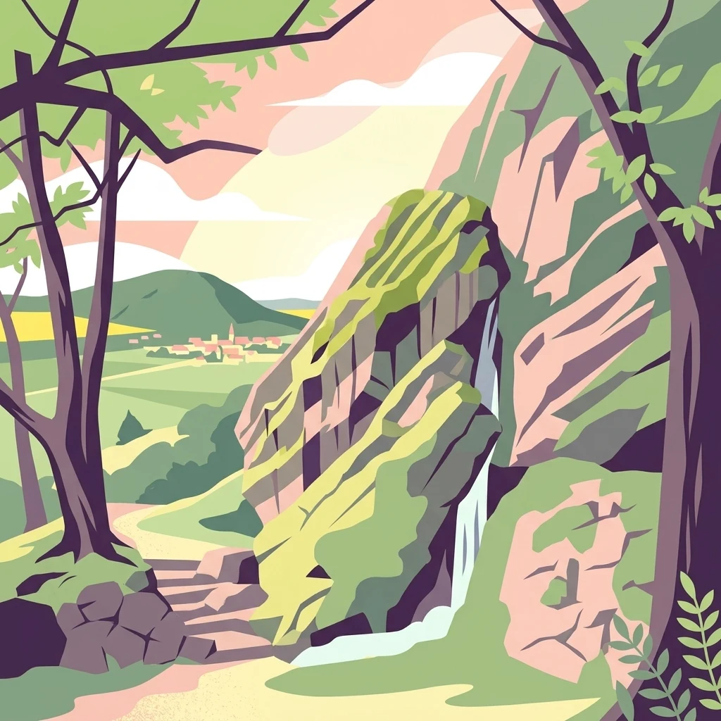
A stylized flat-design illustration showing a central rocky cliff, a small town in the distance, and foreground trees framing the scene.

Slánská hora

Natural monument

Park overview

Structured park overview, official facts, and landscape profile for Slánská hora

Slánská hora park facts, protected area profile, and essential visitor context

Review the core facts for Slánská hora, including designation, size, terrain, visitor scale, habitats, and operating context in one park-focused overview.

About Slánská hora

Slánská hora is a compact protected hill in the Central Bohemian landscape that brings together geology, ecology, archaeology, and local history within an area of only a few hectares. Standing immediately east of the town of Slaný in the Kladno District, the hill is a solitary landmark on the otherwise gently undulating Pražská plošina plateau. From the town, it rises about 70 metres above the valley of the Červený potok stream, and its 330-metre summit offers broad views over Slaný and the surrounding countryside.

The hill is a basalt outlier, forming the southern end of the volcanic belt associated with the České středohoří and sitting together with the neighbouring Vinařická hora as the most southernly known expression of that volcanic province within Bohemia. Its origin lies in Tertiary volcanism along the intersection of the Slaný fault system and the Kladno fault, where an effusive vent produced pyroclastic tuffs and subsequently a lava lake of olivine nephelinite. As the lava cooled against the crater walls, it formed the radiating and inverted-fan columnar basalt formations still visible in the rock faces today. The remaining body of the hill essentially represents a preserved volcanic conduit rather than a true stratovolcanic cone, which gives it unusual geological value at such a modest size.

Around the surviving core of basalt, the protected site combines three distinct biotopes. Steeper north- and west-facing slopes carry mixed deciduous woodland dominated by linden, maple, and ash with hornbeam-oak forest communities. Sun-exposed rock outcrops and the summit plateau support thermophilic rock-steppe vegetation with carnations, cinquefoils, rare rock cress, mountain garlic, and steppe grasses, while the abandoned quarry floor has returned to meadow vegetation. Together, these habitats give the hill an unusually diverse flora for such a small site and support thermophilic species that are otherwise rare in the region.

Slánská hora is also a deeply layered cultural landmark. Archaeological excavations have documented settlement sequences spanning the Funnel Beaker culture, the Řivnáč culture, the Bronze Age Únětice culture, the Hallstatt period, and an early medieval Slavic fortified settlement. Its summit has long been a symbolic focal point above the town, marked since 1662 by three large wooden crosses erected at the behest of Bernard Ignác of Martinic to commemorate the suffering of local people during the Thirty Years' War. In 2025 these crosses were replaced with steel versions of the same form. Today, the hill is reached by an eleven-stop nature trail first established in 1984 and refreshed in 2008, and since 2015 it has also hosted a series of via ferrata climbing routes that make its dramatic basalt faces accessible to outdoor enthusiasts right beside the town.

Quick facts and research context for Slánská hora

Slánská hora is a protected natural monument (Přírodní památka) located on the edge of the town of Slaný in the Kladno District of the Central Bohemian Region, Czech Republic. It reaches an elevation of about 330 metres and rises roughly 70 metres above the surrounding valley. Geologically, it is a basalt hill representing the southernmost expression of the České středohoří volcanic province. The protected area covers about 2.23 hectares of the remaining summit and slopes, with an additional buffer zone of around 8 hectares. It was officially designated as a natural monument on 1 February 1998 by the Kladno District Office. The hill is notable for its columnar basalt outcrops, small rock caves, thermophilic rock-steppe vegetation, hornbeam-oak woodland fragments, and a documented archaeological sequence stretching from the Neolithic through to the early medieval Slavic period.

Protection and recognition

Examine the verified terrestrial protection metrics and official designation records for Slánská hora.

Slánská hora Protection Status and Documented Conservation Scope

Slánská hora features documented terrestrial protection status and structured conservation management records for geographic analysis. Review verified designation data, administrative scope, and recognized international frameworks associated with the protected landscape.

Protection details

Protection scope
Terrestrial
Transboundary protection
No
Buffer area
0.08 km²
Park context

Deeper park guide and search-rich context for Slánská hora

Slánská hora history, landscape, wildlife, and travel context

Explore Slánská hora through its history, landscape character, ecosystems, wildlife, conservation priorities, cultural context, and seasonal travel timing in a structured park guide built for atlas discovery and search intent.

Why Slánská hora stands out

Slánská hora is best known for being one of the two southernmost volcanic outposts of the České středohoří in Bohemia, with clear exposures of columnar basalt that document the hill's origin as a remnant feeder channel of a Tertiary volcanic vent. It is equally recognized for the dramatic contrast between its surviving natural slopes, covered with mixed forest and warm-loving rock-steppe flora, and the scars of former basalt quarries that once consumed more than half of its eastern side. The hill is also known for its archaeological depth: nearly five millennia of stratified settlement, culminating in a Bronze Age hillfort of the Únětice culture and a later Slavic stronghold, made it an important prehistoric site before quarrying destroyed much of the eastern slopes. Together, its compact combination of volcanic geology, thermophilic vegetation, woodland, hilltop crosses, hillfort, and accessible nature trail makes it a small but unusually content-rich natural monument for the Central Bohemian landscape.
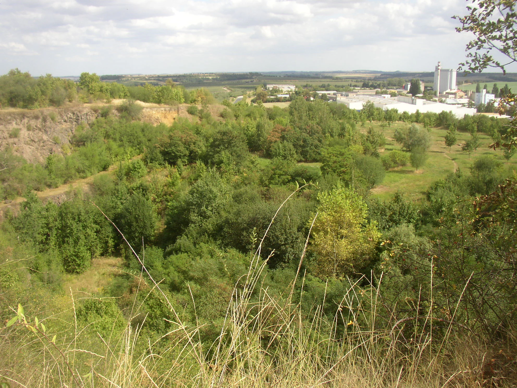
An elevated landscape view looking down into a green valley containing a former quarry, with industrial buildings visible on the horizon.
A view looking over the reclaimed quarry at Slánská hora toward nearby industrial facilities.

Slánská hora history and protected-area timeline

The documented human story of Slánská hora stretches back nearly five thousand years. The more gently sloping southeastern flanks of the hill, now largely destroyed by quarrying, were occupied repeatedly across prehistory, producing cultural layers up to three metres thick. The earliest attested settlements belong to the Eneolithic Funnel Beaker culture of the mid-fourth millennium BC and to the Řivnáč culture at the start of the third millennium BC. The most significant phase of occupation came during the early Bronze Age, when the Únětice culture established a fortified hillfort on the summit, probably later reused by the Věteřov group during subsequent habitation phases.

Iron Age traces include late Hallstatt-period settlement remains of the earlier first millennium BC, and an early medieval Slavic stronghold at the turn of the older and middle hillfort period in the 8th and 9th centuries AD. Archaeological interest in the site emerged in the 1820s, when Václav Krolmus, František Karel Miltner, and Matyáš Kalina z Jäthensteinu recorded finds from Slánská hora; the latter even classified it among prehistoric sacrificial sites. Further discoveries followed in 1861 during landscaping of the hill by local citizen Hynek Holweg, whose collection later passed to the National Museum. In 1892 the Slaný Museum Society led by Václav Štech uncovered substantial material including a Funnel Beaker burial. Josef Ladislav Píč, Jan Felcman, and Eduard Zahrádka also excavated at the site, though Zahrádka's Leipzig-stored finds were destroyed in the Second World War. After a 1942 rescue excavation by Miloš Šolle, summarised later by Jaroslav Böhm, the final pre-quarry rescue campaign ran between 1955 and 1964.

In the early modern period, the summit acquired its most famous symbol: three large wooden crosses erected in 1662 on the initiative of Count Bernard Ignác of Martinic to commemorate the suffering of local inhabitants during the Thirty Years' War. The crosses stood on the hilltop for more than 360 years and were replaced in 2025 with black-painted steel crosses of the same shape, preserving their role as a memorial landmark visible from much of the town below.

The nature conservation history of Slánská hora is comparably meaningful. After two large basalt quarries on the eastern side consumed more than half of the original hill and severely damaged the underlying archaeological deposits, considerable conservation effort was devoted to stabilising the site. The exhausted quarry was partly backfilled and replanted with trees and shrubs, helping to reshape this part of the protected landscape. The surviving summit and slopes were formally protected as a natural monument on 1 February 1998 by the Kladno District Office, and the site has since been managed jointly as a geological, ecological, archaeological, and recreational landmark. A nature trail was established across the hill in 1984 and renewed in 2008, and in 2015 the first climbing via ferrata was opened, with several further routes and two suspension bridges added in 2017.

Slánská hora landscape and geographic character

Slánská hora presents a striking small-scale volcanic landscape that contrasts strongly with the gently rolling Central Bohemian plateau around it. Although the hill reaches only about 330 metres in elevation, it rises approximately 70 metres above the valley of the Červený potok and forms a clear horizontal accent on the eastern edge of the town of Slaný. Most of the original eastern flank has been removed by quarrying, but what remains still reads visually as a steep wooded hill crowned by a rocky plateau.

At a geological level, the hill is a basalt volcanic remnant rather than a true cone. It originated along the crossing of the Slaný fault system with the Kladno fault, where an effusive Tertiary volcano first ejected pyroclastic tuffs and tuffites and then poured out olivine nephelinite lava. As the lava cooled against the cooler walls of the vent, it crystallised into the characteristic columnar basalt visible today, with multiple column arrangements interpreted as inverted fans formed within a lava lake. Compositionally, the basalt contains nepheline, sodalite, magnetite, pyroxene, and olivine, and former quarry cavities once yielded aragonite, calcite, chlorites, and zeolite mineral specimens.

The exposed bedrock itself shapes the local scenery. The northern and western flanks display bizarre basalt rock formations weathered into fissures, small crevice caves, and ventarola cavities that punctuate the otherwise forested slopes. These rock outcrops not only create dramatic texture on the hill but also frame the broad, open vistas from the summit and the western edge of the ridge over the rooftops of Slaný and across the surrounding agricultural countryside. Together, the vertical relief, the columnar basalt, and the patchwork of remaining woodland, abandoned quarry, and rocky steppe patches give the hill a landscape intensity well beyond what its modest size would suggest.
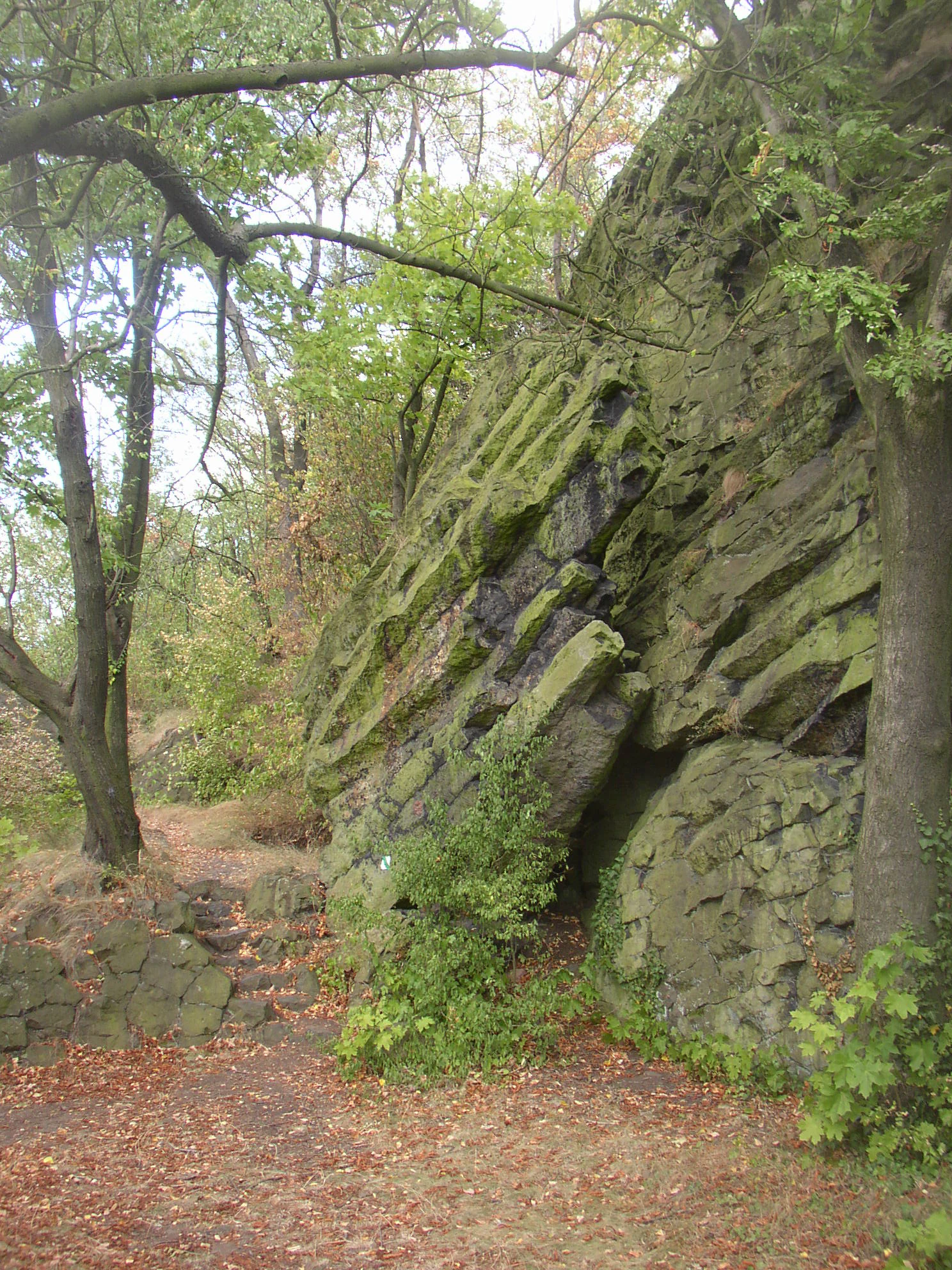
A steep, mossy rock face displaying prominent diagonal basalt columns, surrounded by trees on a forest path.
Basalt columns forming part of the volcanic geological structure on the slopes of Slánská hora.

Slánská hora ecosystems, habitats, and plant life

Ecologically, Slánská hora functions as an island of natural habitat within an otherwise heavily used Central Bohemian environment. Despite its very small size of about 2.23 hectares, the protected area combines three clearly distinguishable biotopes that together support a striking variety of plant communities. The steeper wooded slopes are dominated by mixed deciduous forest with linden, maple, and ash intermingled with hornbeam-oak associations, and an understorey of nitrophilous species such as greater celandine and wild chervil together with spring ephemerals including hepatica, wood anemone, sweet violet, wood bluegrass, stinking cranesbill, spotted dead-nettle, and black bryony.

The sun-exposed rock outcrops and the summit plateau form a second, very different biotope of warm-loving rock steppe. Here, typical species include the Carthusian pink and various cinquefoils, together with rarer plants such as rock candytuft, mountain garlic, feather grass, Pannonian thyme, meadow saxifrage, pyramidal saxifrage, common speedwell, and squill. Thermophilic shrubs such as common privet frame the rocks, while common rock cotoneaster grows directly on the rocky surfaces.

The third biotope is the meadow vegetation that has reclaimed the floor of the disused quarry, where creeping clover, varied milkvetch, couch grass, and bush grass now form open grassy communities. This mosaic of woodland, dry steppe, and quarry meadow makes Slánská hora an unusually compact showcase of habitat diversity for lowland Bohemia and gives the hill an ecological value that goes well beyond its modest area.

The caves, fissures, and rock cavities in the basalt outcrops provide shelter for bats, rock kestrels, and stone martens, while the surrounding mosaic of deciduous forest, rocky ledges, and open quarry floor supports a broader community of small woodland and edge-of-habitat wildlife. The dry, sun-warmed rock-steppe is also valuable for invertebrates and small reptiles, which benefit from the combination of bare rock and low herbaceous vegetation across the summit and the upper slopes.
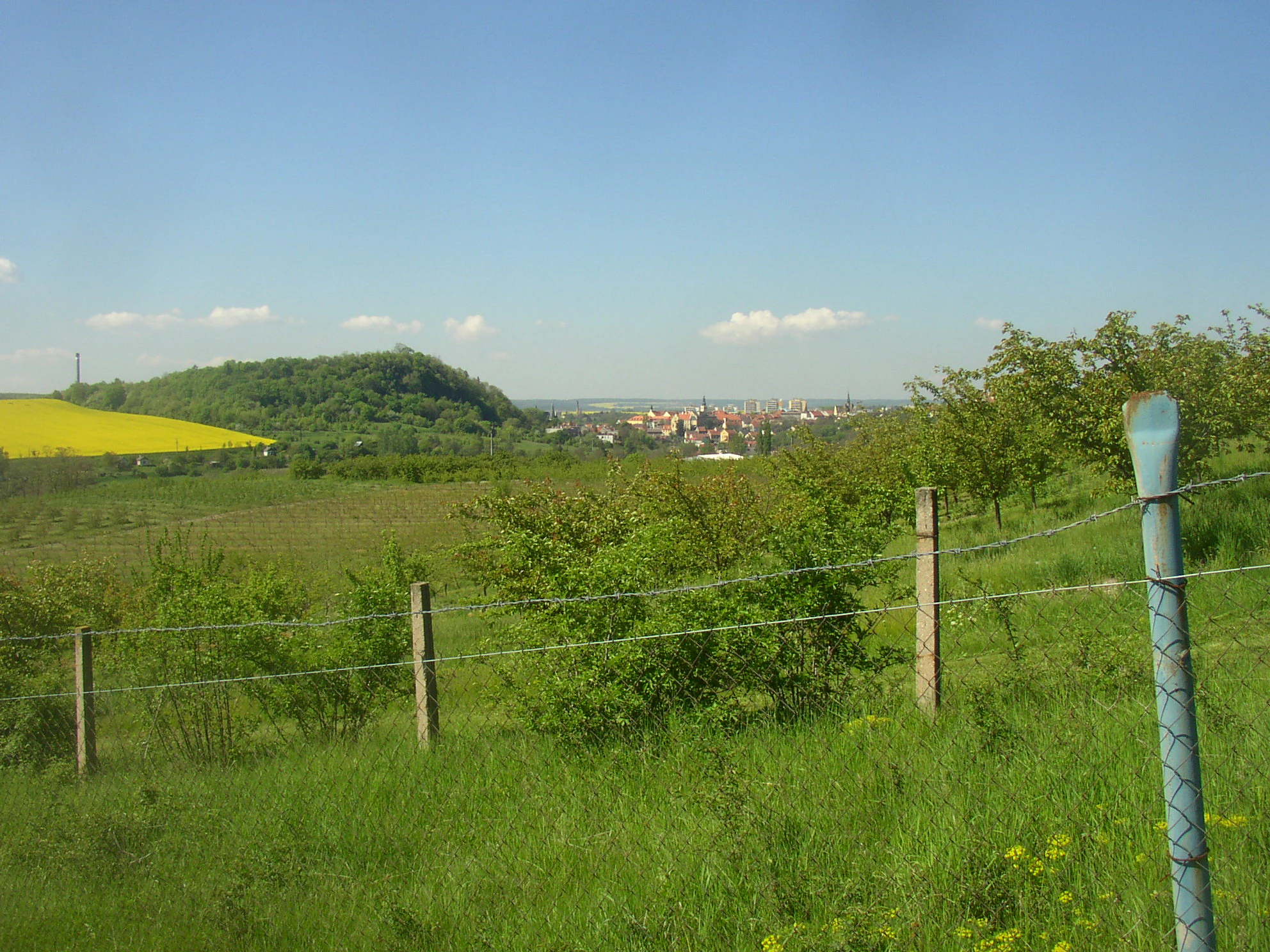
A wide shot looking across a grassy field with a fence in the foreground, toward a green hill under a clear blue sky, with the town of Slaný visible in the distance.
A view of Slánská hora from the hillside above Ovčáry, showcasing the surrounding rural landscape near Slaný.

Slánská hora wildlife and species highlights

The wildlife of Slánská hora is shaped by the strong contrast between shaded deciduous forest, exposed warm rock faces, and the partly reclaimed former quarry, allowing several distinct animal communities to coexist across a very small area. The rocky cavities and crevices provide shelter for bats, including rarer species, while the open basalt faces and ledges are used as nesting and hunting habitat by common kestrels. Stone martens also den in the fissures of the basalt rocks.

In the woodland and along the edges, red squirrels and various wood mice are commonly observed, alongside a bird community that includes warblers, leaf warblers, thrushes, European robins, and more occasional sightings of owls and nightingales. The mix of closed-canopy forest, open steppe patches, warm rocky ledges, and meadow in the old quarry provides both roosting and foraging niches for these species within easy reach of one another.

Although the protected site itself is tiny, the hill's position at the edge of Slaný means it functions as a small but unusually rich biodiversity refuge within an otherwise intensively managed agricultural and urban landscape. The combination of natural cavities, thermophilic plant communities, and a varied vertical profile gives the hill a wildlife profile that is noticeably richer than its modest footprint would suggest.
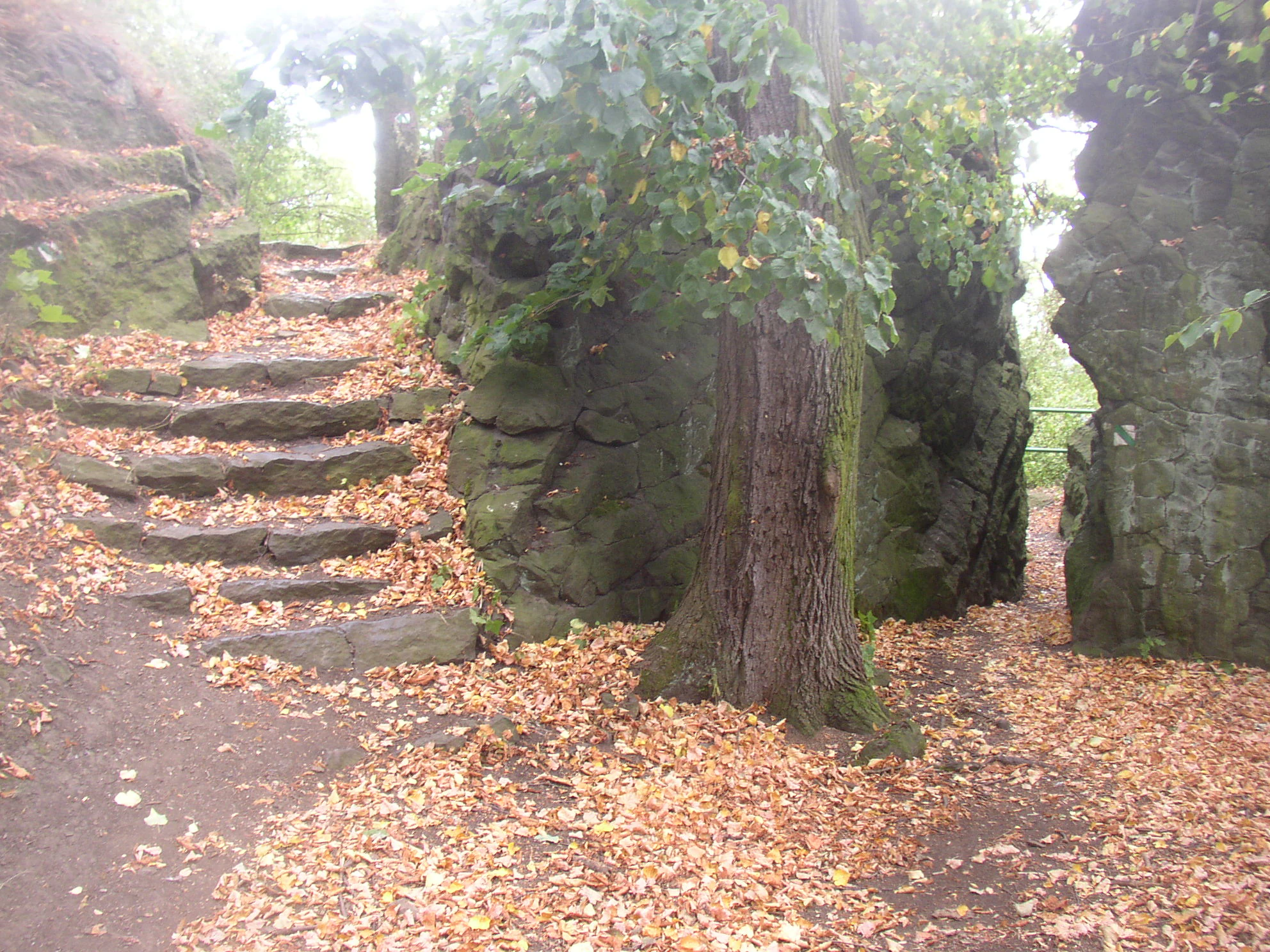
A path winds through a natural rock formation at Slánská hora, featuring stone steps covered in fallen autumn leaves.
A narrow passage along the educational trail between basalt rock formations at Slánská hora.

Slánská hora conservation status and protection priorities

The conservation significance of Slánská hora rests primarily on the fact that it preserves one of the southernmost known geological expressions of the České středohoří volcanic province within Bohemia. Its remaining basalt outcrops expose a rare example of columnar jointing and crevice-cave development directly linked to a reconstructed volcanic conduit, making the hill an important teaching and reference site for Tertiary volcanism in the region. Together with neighbouring Vinařická hora, it marks the geographical limit of that volcanic belt and documents the broader tectonic history of the Slaný and Kladno fault systems.

Beyond geology, the protected area conserves fragments of thermophilic rock-steppe vegetation carrying rare warm-loving species, as well as natural hornbeam-oak forest communities that are increasingly scarce in the intensively farmed Central Bohemian landscape. By protecting these plant communities within a formally designated natural monument, the site helps to maintain a small but valuable reservoir of steppe biodiversity in an area dominated by agriculture and urban development.

Formal protection was established on 1 February 1998, when the Kladno District Office declared the hill a natural monument. The designation recognised that previous quarrying had already consumed more than half of the eastern side of the hill and damaged important archaeological deposits, and it set out to safeguard the remainder of the geological, ecological, and archaeological heritage for the future.

Slánská hora cultural meaning and human context

Slánská hora has long stood as the dominant natural landmark above the town of Slaný and has been woven into local identity in both spiritual and practical ways. The town itself takes its name from the two salt springs that historically emerged at the foot of the hill, which gave the settlement its name and its early economic significance, even though the springs no longer carry salt today.

The archaeological record on the hill's gentler southeastern slopes shows nearly five millennia of cultural layering, from Eneolithic and Bronze Age settlements through the Únětice-culture hillfort, Hallstatt-period occupation, and an early medieval Slavic stronghold, making the site a meaningful reference point for understanding long-term human presence in the Slaný region. This deep archaeological heritage was largely destroyed by 20th-century quarrying, an event that shaped the hill's modern cultural memory and prompted the conservation effort that led to its protected status.

Since 1662, the three large crosses erected on the summit by Count Bernard Ignác of Martinic to commemorate the suffering of the local population during the Thirty Years' War have served as a visible memorial landmark. Renewed in 2025 in steel, they remain central to the hill's identity as a place of remembrance. Today the hill also carries a newer recreational identity, with an eleven-stop nature trail, climbing via ferrata routes opened from 2015 onwards, panoramic viewpoints across the town, and rocky passages that together turn a small protected geological landmark into a focal point for local outdoor life.
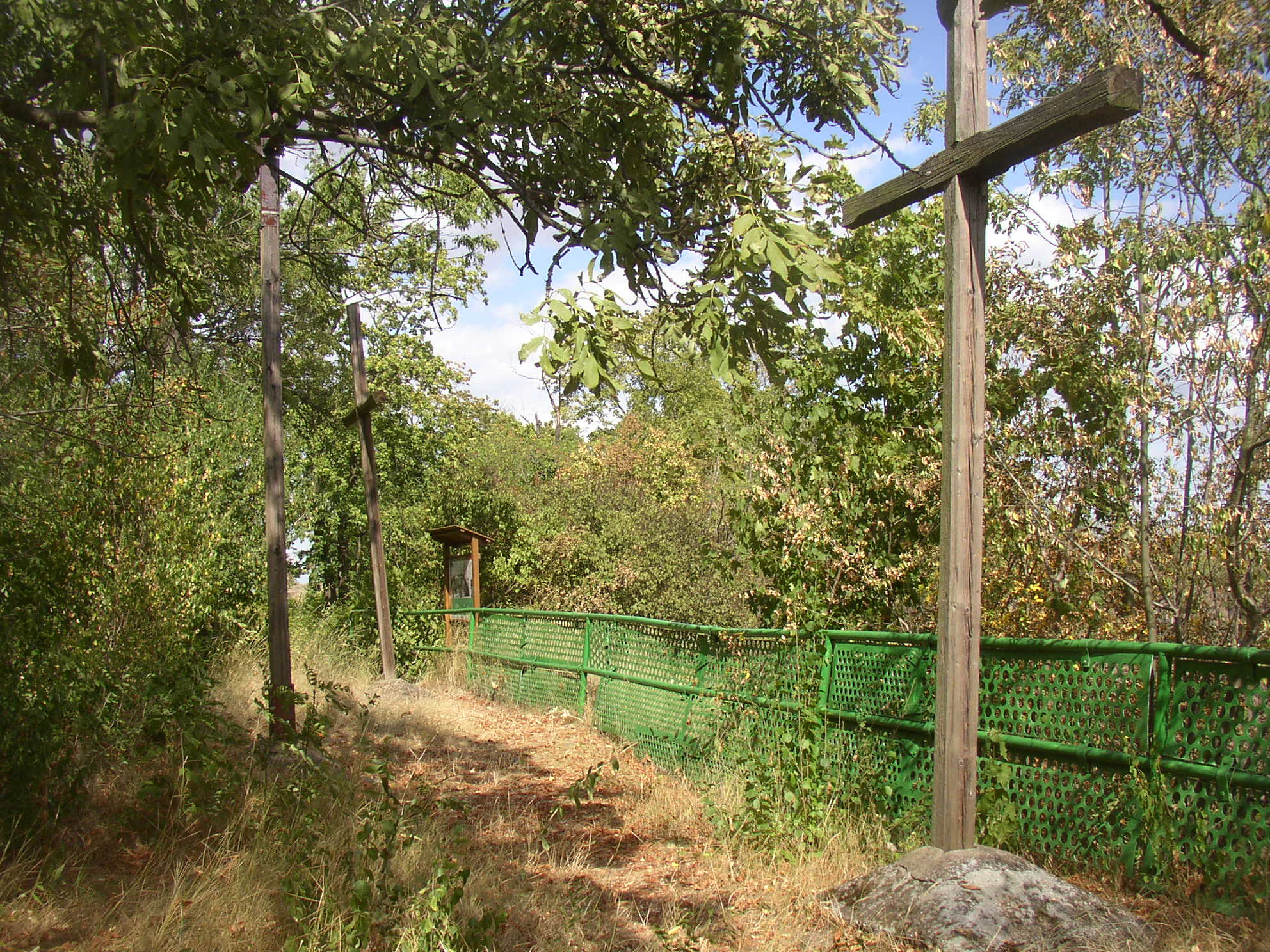
A dirt path along a wooded area featuring tall wooden crosses and a green metal fence with an educational trail sign in the background.
The Three Crosses landmark, a historic site on the Slánská hora educational trail.

Top sights and standout views in Slánská hora

Slánská hora offers a remarkably concentrated combination of geological, ecological, archaeological, and cultural interest within a footprint of only a few hectares. Its volcanic origin, exposed columnar basalt outcrops, and crevice caves make it a compact showcase of Tertiary volcanism at the very southern edge of the České středohoří province. The contrast between surviving forested and rocky slopes and the scars of former basalt quarries gives the hill one of its most distinctive visual elements and underscores why formal protection was ultimately needed. Above all, Slánská hora stands out as a place where ancient settlement, a hillfort, three memorial crosses, mixed woodland, and warm-loving steppe all meet on a single small ridge above the town of Slaný.
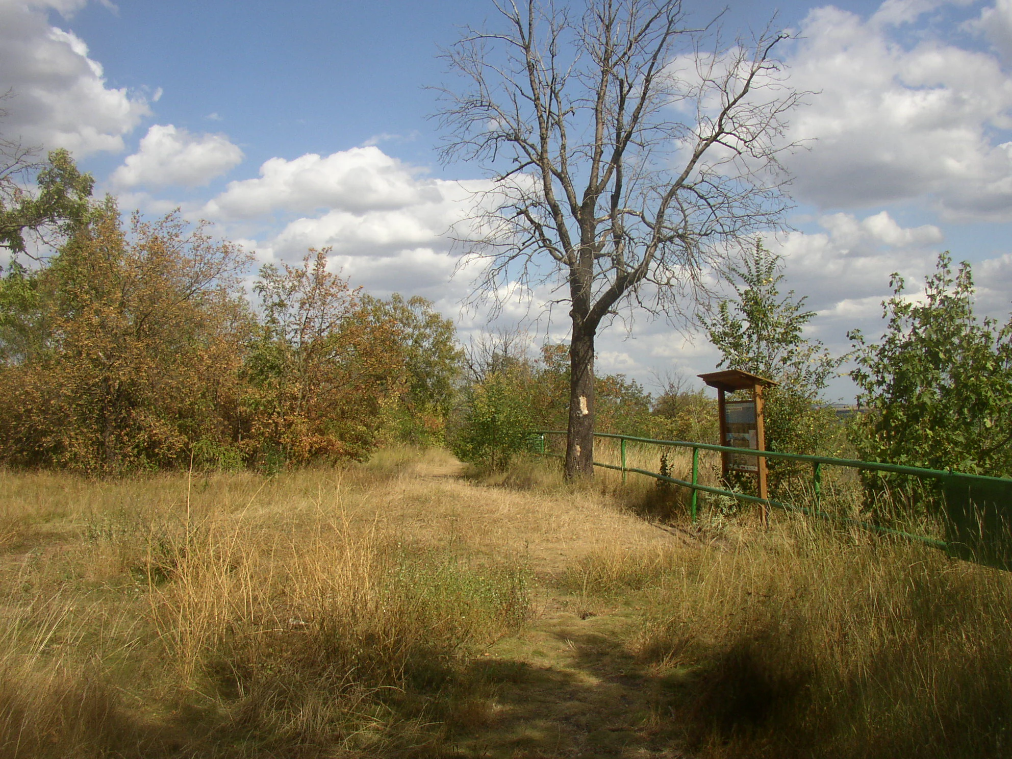
An educational trail sign standing beside a metal railing along a grassy path with a large, leafless tree in the background.
A trail stop along the educational path at Slánská hora.

Best time to visit Slánská hora

Slánská hora is a low-elevation hill at the edge of a Bohemian town, so it can be visited comfortably across much of the year. Late spring and early summer are arguably the most rewarding periods, when the mixed forest understorey of hepatica, wood anemone, and sweet violet gives way to fresh deciduous foliage and the rock-steppe grasses and wildflowers on the sunny outcrops are at their most visible. Early summer mornings also offer the best chances to see woodland and rock-dwelling birdlife and small mammals active along the nature trail. Autumn brings warm-toned forest colour and crisp views over the town of Slaný from the summit and western viewpoints, while the hill's bare basalt faces and rocky paths can also be appreciated in winter, when the surrounding snow-free lowlands put its relief into strong contrast.

Monthly climate preview

Long-term representative measurements tracking monthly weather patterns across the protected landscape

Slánská hora Climate Normals, Annual Temperature and Precipitation Rhythm

Representative coordinate records show measured monthly temperature variations spanning sub-zero winter minimums to warm summer maximums alongside steady daily precipitation rates. Examining the full twelve-month profile provides complete historical averages for detailed climate comparison.
Annual mean9 °C
-2 °C20 °C
Jan-2°
Feb-1°
Mar
Apr
May13°
Jun17°
Jul20°
Aug19°
Sep14°
Oct
Nov
Dec-1°
Warmest month
July

19.7 °C

Coolest month
January

-2.2 °C

Wettest month
June

2.6 mm/day

Driest month
February

1.1 mm/day

Park location guide

Geography guide, regional context, and park location map for Slánská hora

Slánská hora park geography, regions, and map view in Czechia

Understand where Slánská hora sits in Czechia through a broader geographic reading of the surrounding landscape, nearby location context, and its mapped position within the national park landscape.

How Slánská hora fits into Czechia

Czech Republic is a landlocked Central European country with a population of approximately 10.9 million people. The nation was established as an independent state on January 1, 1993, following the dissolution of Czechoslovakia. Its capital and largest city is Prague, with other major urban centers including Brno, Ostrava, Plzeň, and Liberec.

Wider geography shaping Slánská hora in Czechia

The Czech Republic is a landlocked country in Central Europe. It is bordered by Germany to the west, Austria to the south, Poland to the northeast, and Slovakia to the southeast. The landscape is predominantly hilly, with the territory covering 78,871 square kilometers.

Map view of Slánská hora

Use this park location map to pinpoint Slánská hora in Czechia, understand its exact geographic position, and read its mapped placement within the surrounding landscape more clearly.

Pigeon | © OpenStreetMap contributors

Location context for Slánská hora

Středočeský kraj

Examine the columnar basalt outcrops, rocky steppe vegetation, and dramatic topography of a unique Bohemian volcanic remnant.

Slánská hora Photos and Landscape Scenery: Visualizing the Volcanic Terrain and Protected Habitats

Photographic records reveal the distinct volcanic topography, exposed columnar basalt formations, and mixed deciduous woodland that define the protected natural monument. Visual documentation provides essential geographic context for understanding the steep relief, geological history, and ecological character of the ridge above Slaný.

An elevated landscape view looking down into a green valley containing a former quarry, with industrial buildings visible on the horizon.

A medium shot of a tree-covered hill rising behind a residential area in the Czech Republic.

A steep, mossy rock face displaying prominent diagonal basalt columns, surrounded by trees on a forest path.

A wide shot looking across a grassy field with a fence in the foreground, toward a green hill under a clear blue sky, with the town of Slaný visible in the distance.

A path winds through a natural rock formation at Slánská hora, featuring stone steps covered in fallen autumn leaves.

A wooden informational trail sign stands on a dirt path covered with fallen autumn leaves in a dense forest.

A dirt path along a wooded area featuring tall wooden crosses and a green metal fence with an educational trail sign in the background.

An educational trail sign standing beside a metal railing along a grassy path with a large, leafless tree in the background.

An educational information sign standing on a dirt path next to a green metal railing, overlooking a large volcanic rock cliff face covered in vegetation at Slánská hora.

An elevated panoramic view looking down over the town of Slany, Czech Republic, from the wooded summit of Slanska hora.

A view of a rugged, exposed basalt rock cliff in the background, with a green grassy meadow and a central deciduous tree in the foreground.

A dirt path leads to a summit area on a hill, featuring a small black metal marker mounted on a rock in the middle ground, with a distant town visible in the background.

A dirt path through a grassy, reclaimed landscape with small trees and a wooden information sign frame on the right.

A view of the forested Slánská hora hill rising above an urban road with parked cars, traffic signage, and commercial buildings.

Park atlas

Compare regional volcanic landmarks, columnar basalt outcrops, and nearby protected landscapes

Explore Parks Near Slánská Hora and Surrounding Protected Natural Areas

Continue browsing parks near Slánská hora to discover connected volcanic terrain, geological remnants, and protected natural areas across Central Bohemia. Comparing adjacent regional sites reveals broader patterns in regional topography and protected landscape preservation.
Natural monumentStředočeský kraj
About 5.2 km away#1 closest

South

Vinařická hora Natural Monument: A Volcanic Geography and Protected Terrain Study

Key protected area and geological landmark in the Středočeský kraj region.

Vinařická hora is a compact, asymmetric hill serving as a vital natural monument for the study of Tertiary volcanic processes and dry-slope plant communities. Its abandoned quarries provide a clear stratigraphic record of ash and lava, while its summit offers panoramic views across the central Bohemian plateau. This site represents a convergence of deep geological history and specialized modern habitat preservation.

Area
0.684 km²
Established
1985
IUCN
III
Relief
Upland
A wide watercolor painting showing a landscape of green hills, scattered trees, and distant pink and purple mountains under a pale sky.
Natural monumentStředočeský kraj
About 6.1 km away#2 closest

Southwest

Smečno Natural Monument: A Protected Woodland Ecosystem in Středočeský Kraj

Geography and conservation mapping in the Czech Republic

Located in the Kladno District, Smečno Natural Monument preserves mature deciduous trees essential for the survival of the hermit beetle. The site acts as a geographical link between distinct landform units, offering a clear look at how small, cavity-rich forest patches maintain ecological connectivity within the broader Central Bohemian landscape.

Area
0.772 km²
Established
2012
IUCN
IV
Relief
Upland
A horizontal watercolor painting showing a winding stream flowing through a lush, green valley with rolling hills and distant mountains under a soft light.
Natural monumentCentral Bohemian Region
About 8.7 km away#3 closest

Southwest

Smečenská rokle Natural Monument: Geological Gorge and Protected Landscape

Geological cross section in the Central Bohemian Region

Smečenská rokle is a compact natural monument featuring a deep erosional canyon cut into the marlstone plateau. The site offers a detailed stratigraphic view of Bohemian Cretaceous Basin sediments while preserving rare patches of scree and ravine forest within the broader agricultural environment of Central Bohemia.

Area
0.062 km²
Established
1987
IUCN
III
Relief
Upland
A horizontal watercolor illustration showing a soft-toned landscape with green trees in the foreground, rolling yellow-green fields in the midground, and faint mountains in the background.
Natural monumentStředočeský kraj
About 13 km away#4 closest

West

Smradovna Natural Monument: Geography and Protected Habitats in Central Bohemia

A protected stream valley system within the Stredocesky kraj region.

Smradovna preserves a unique concentration of lowland habitats, including calcareous beech forests and rare alkaline fens. This protected natural monument, located near Bilichov, is defined by its characteristic travertine springs and continuous stream-corridor ecosystem. Gain insight into the regional geography and botanical significance of this tightly knit protected landscape through our structured mapping and data.

Area
1.556 km²
Established
2014
IUCN
IV
Relief
Upland
Watercolor illustration of a peaceful, open landscape with gentle hills in the background and clusters of trees in the foreground.
Nature reserveStředočeský kraj
About 14 km away#5 closest

West

Na Pilavě Nature Reserve: A Detailed Botanical Atlas of the Středočeský kraj Landscape

Mapping protected orchid habitats and forest flora in the Džbán highland.

Na Pilavě is a specialized nature reserve in the Kladno District, valued for its dense concentration of rare woodland orchids and the critically endangered black false hellebore. Set within the forested slopes of the Pilavské údolí, this protected area serves as a vital refuge for thermophilic plant communities and ancient deciduous forest flora.

Area
0.031 km²
Established
1969
IUCN
IV
Relief
Upland
A horizontal watercolor illustration depicting a soft, rolling landscape with green hills, a small winding stream, and meadow vegetation on a white background.
Natural monumentÚstecký kraj
About 16 km away#6 closest

North

Na Dlouhé stráni Natural Monument: Regional Protected Area and Botanical Landscape

A conservation-focused look at the Mšenský potok valley slope

Na Dlouhé stráni is a designated natural monument in the Czech Republic, renowned for its concentration of thermophilous grassland flora. This protected area, located near Mšené-lázně, preserves a specific slope habitat that supports declining plant species. The site offers an important look at regional conservation efforts and the mapping of small-scale protected habitats within the diverse Ústecký kraj geography.

Area
0.126 km²
Established
2012
IUCN
IV
Relief
Lowland
Natural monumentÚstecký kraj
About 16 km away#7 closest

Northwest

V hlubokém Natural Monument: Protected Calcareous Landscapes and Terrain in Ústecký kraj

A study of rare sesleria grasslands and opuka slope geography

V hlubokém serves as a significant protected site in the Czech Republic, encompassing twenty hectares of hillside defined by soft calcareous opuka rock. This natural monument is recognized for its rare sesleria grasslands and thermophilic plant assemblages that contrast with the surrounding woodland. The protected area forms a critical link in the broader geography of the Débeř valley, offering a clear example of localized botanical diversity supported by unique alkaline substrate conditions.

Area
0.202 km²
Established
1947
IUCN
III
Relief
Upland
Natural monumentStředočeský kraj
About 17 km away#8 closest

East

Veltrusy Natural Monument: Protected Woodland and Historic Park Geography in Středočeský kraj

English-style designed landscapes and floodplain ecological habitats.

Veltrusy Natural Monument is a protected area located on the right bank of the Vltava River, defined by its horseshoe-shaped layout and mosaic of oak-beech woodlands. The site represents a rare intersection of cultural heritage and nature conservation, preserving veteran trees that support significant invertebrate populations. Its geography consists of gently undulating floodplain terrain shaped by the Mlýnský potok, historic avenues, and managed meadows.

Area
2.555 km²
Established
2013
IUCN
III
Relief
Lowland

Common questions about visiting, size, designation, and location context for Slánská hora

Slánská hora FAQs for park facts, access, geography, and protected area context

Find quick answers about Slánská hora, including protected-area facts, park geography, trail and visitor context, and how the park fits into its surrounding country and regional landscape.
MoriAtlas Explorer

Continue Your Protected Areas Search Across the Global Atlas

Deepen your exploration by continuing the structured search for national parks and protected areas worldwide. Utilize the comprehensive filtering capabilities to compare different conservation landscapes and refine your understanding of global park geography. Discover more about the distribution and characteristics of protected natural areas.

Global natural geography