
Mori Atlas logo
Natural monumentSmečenská rokle

Explore the stratigraphic cross section and protected woodland fragments of this regional gorge

Smečenská rokle Natural Monument: A Deeply Incised Geological Gorge in Central Bohemia

(Přírodní památka Smečenská rokle)

Smečenská rokle represents a significant protected geological site situated within the Džbán plateau of the Central Bohemian Region. This erosional gorge serves as a vital natural reference for Cretaceous marine sediments, showcasing a complete sequence from Cenomanian sandstones to Turonian marlstones. The steep terrain acts as a biological refuge for relict plant communities and native forest, providing a stark contrast to the surrounding intensively cultivated agricultural landscape.

natural monumentCzech protected areaCretaceous geologyCretaceous marlstoneerosional gorgeravine forest
A stylized flat-art illustration showing a narrow canyon with layered rock walls, a small waterfall flowing into a stream, and trees framing the scene.

Smečenská rokle

Natural monument

Park overview

Structured park overview, official facts, and landscape profile for Smečenská rokle

Smečenská rokle park facts, protected area profile, and essential visitor context

Review the core facts for Smečenská rokle, including designation, size, terrain, visitor scale, habitats, and operating context in one park-focused overview.

About Smečenská rokle

Smečenská rokle is a compact geological and ecological reserve in Central Bohemia, protected primarily for the scientific value of its exposed rock sequence. The protected area occupies a long, narrow erosional valley that cuts sharply into an otherwise nearly flat agricultural plateau. The surrounding landscape shows clearly how unusual the reserve is: visitors approaching from the adjacent field see the surrounding plain drop abruptly into the steep-walled canyon within only a few steps, and small marlstone fragments scattered across the cultivated surface hint at the underlying geology.

The gorge was excavated by the upper reaches of the Svinařovský potok and today contains an intermittent stream channel with seasonal pools separated by sediment bars. The walls of the canyon rise up to roughly seven meters and widen toward the top in places, producing a small canyon impression within an otherwise gentle plateau landscape. From a geological perspective, the site belongs to the Kladno plateau portion of the Bohemian Cretaceous Basin, and the exposed profile is considered regionally significant for understanding the Upper Cretaceous succession of central Bohemia.

Beyond geology, the reserve is valued for the woodland that has survived on its slopes. The terrain is too rugged and rocky for ordinary forestry or pasture, so a relatively natural stand of scree and ravine forest has persisted here, dominated by sycamore maple, Norway maple, pedunculate oak, European beech, and hornbeam, with alder dominating the wetter bottom and ash along the stream. Although the forest is small and altered by invasive species, it still offers a glimpse of the forest vegetation that once covered the broader Džbán region before agricultural clearance.

Quick facts and research context for Smečenská rokle

Smečenská rokle is a natural monument (přírodní památka) covering roughly six hectares in the western part of the Kladno District, Central Bohemian Region. It lies southwest of Smečno and northwest of Kladno, within the Džbán plateau, and belongs administratively to the cadastral territory of Smečno. The reserve protects a steep erosional gorge cut by the Svinařovský potok stream into Cretaceous marlstones, sandstones, and claystones, exposing a complete regional cross-section of Džbán-type Cretaceous sediments down to their Carboniferous base. The site was established as a protected natural monument in 1987 and forms part of the larger Přírodní park Džbán protected landscape area.

Protection and recognition

Analysis of terrestrial protected area boundaries and international recognition

Smečenská rokle Protection Status and Documented Conservation Scope

Smečenská rokle holds a defined terrestrial protection status within its regional landscape boundary. Documented records outline management scope and official conservation designations for this protected natural area.

Protection details

Protection scope
Terrestrial
Transboundary protection
No
Park context

Deeper park guide and search-rich context for Smečenská rokle

Smečenská rokle history, landscape, wildlife, and travel context

Explore Smečenská rokle through its history, landscape character, ecosystems, wildlife, conservation priorities, cultural context, and seasonal travel timing in a structured park guide built for atlas discovery and search intent.

Why Smečenská rokle stands out

Smečenská rokle is best known for its exceptionally well exposed natural geological profile of Cretaceous sediments, particularly the Džbán-type marlstones of the Bělohora Formation and underlying Peruc-Korycany sandstones. The narrow, canyon-like gorge reveals a complete stratigraphic sequence from Cenomanian sandstones at the base up through Turonian marlstones near the rim, capped by Carboniferous conglomerates in the deepest parts. Equally important is the survival of fragmentary scree forest and wetland alder vegetation on slopes so steep that they were never converted to farmland, providing a small refuge of largely natural forest composition amid intensively cultivated countryside.
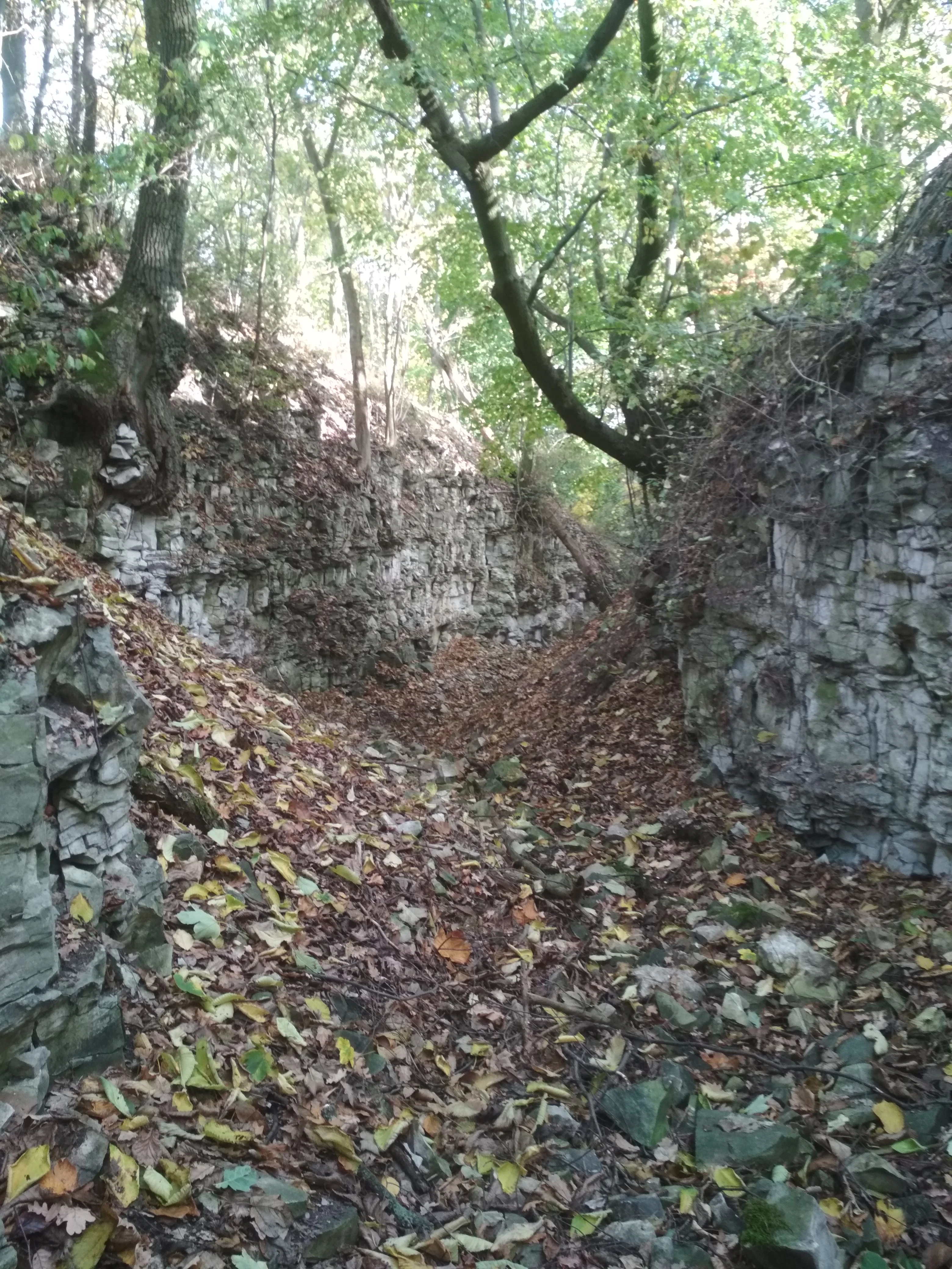
A narrow canyon path flanked by vertical, layered marlstone rock walls, covered with fallen autumn leaves and sheltered by overhanging deciduous trees.
The canyon walls within the Smečenská rokle natural monument, showing exposed marlstone formations and surrounding deciduous forest.

Smečenská rokle history and protected-area timeline

Smečenská rokle has been continuously forested in all known historical records, a condition directly tied to the steepness of its slopes. Cultivation was impossible on the canyon walls themselves, although the presence of a former agricultural homestead known as Ovčín below the gorge suggests that woodland pasture may once have been practiced within or near the reserve. On the southern edge of the canyon, traces of an old avenue still survive as aging oaks and lindens marking what was once a planted approach to the area.

In 1987, the local district national committee in Kladno declared Smečenská rokle a protected natural monument under the older Nature Conservation Act (No. 40/1956 Sb.), grouping it together with related protected features such as Cikánský dolík and Pašijová draha within a single regional ordinance. After the 1992 Nature Conservation and Landscape Protection Act (No. 114/1992 Sb.), the site's earlier designation as a protected natural creation was reclassified into the modern category of přírodní památka, or natural monument. Today the reserve sits within the broader Přírodní park Džbán, which extends regional-scale landscape protection across much of the surrounding plateau.

Smečenská rokle landscape and geographic character

The defining landscape element of Smečenská rokle is the deep erosional trench cut into the otherwise smoothly undulating Džbán plateau. The protected area lies around 370 to 420 meters above sea level and the canyon walls reach up to about seven meters in the narrowest sections, while near its mouth the gorge widens enough to create a tight canyon-like corridor. From the plateau rim, the land falls away abruptly into the gorge, and the flat farmland of the surrounding region contrasts starkly with the vertical rocky walls and shaded ravine floor below.

The floor of the canyon carries the seasonal channel of the Svinařovský potok, which frequently shifts its course among its own sediments. Small pools form during wetter periods and dry into sediment-filled depressions in summer, while coarse marlstone scree tumbles down from the steep sides and accumulates in pale bands at the bottom of the stream. Toward the southeastern edge of the reserve, the older hedgerow avenue of oaks and lindens adds a subtle human element to the otherwise natural-looking landscape.
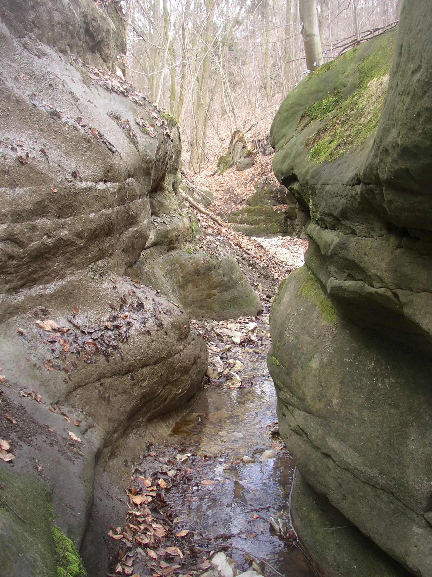
A small, narrow stream flowing between weathered, moss-covered sandstone rock walls in a forest setting.
A narrow stream flowing through a sandstone ravine at Smečenská rokle.

Smečenská rokle ecosystems, habitats, and plant life

Ecologically, the reserve is dominated by forest vegetation because the rocky slopes excluded the kind of agricultural and forestry conversion that transformed the rest of the Džbán plateau. The canopy of these ravine and scree forests includes sycamore maple, Norway maple, pedunculate oak, European beech, and hornbeam, with scattered Norway spruce and larch from past plantings, while the bottom of the gorge supports wetland woodland dominated by black alder along the stream and ash in the eastern, slightly drier sections. A shrub layer of hawthorn, hazel, alpine currant, elder, honeysuckle, and spindle frames the upper forest edge.

The herb layer is comparatively rich for such a narrow reserve, reflecting the calcareous influence of the marlstone substrate. Typical woodland species include dog's mercury, red baneberry, lady fern, broad-leaved willowherb, yellow archangel, spring pea, wood sorrel, and stinging nettle, with several rare or sensitive plants documented on the Czech Red List such as pine mistletoe, small-leaved elm, and perennial lettuce. The plant community is nevertheless under pressure from invasive species, particularly black locust, ash-leaved maple, and Japanese knotweed, whose spread continues to affect both the woodland and the geological profile.
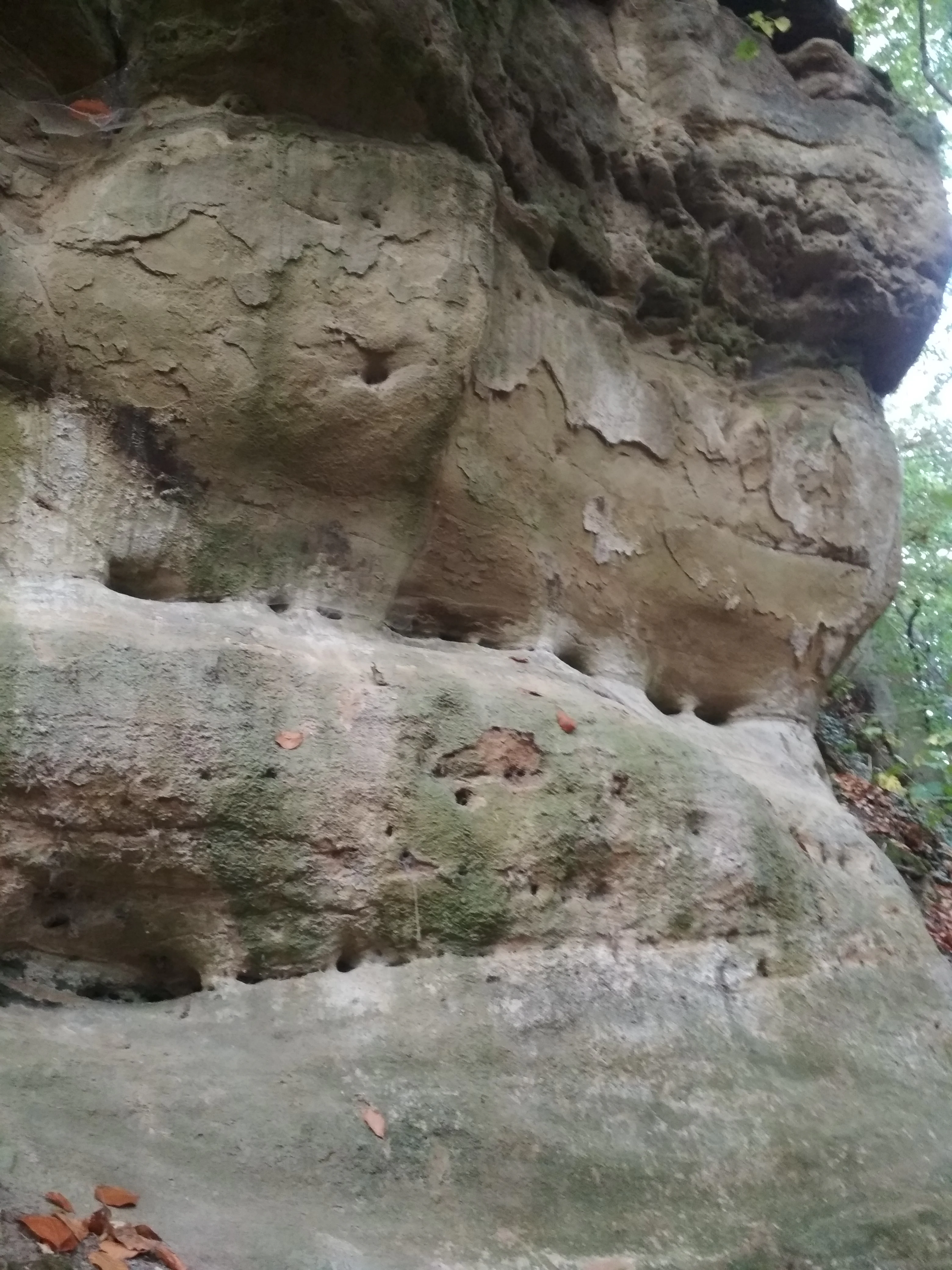
A close-up view of a vertical sandstone rock wall showing natural erosion patterns, holes, and weathered textures, with some moss and scattered leaves.
A detailed view of the Cretaceous sandstone rock formations found within Smečenská rokle.

Smečenská rokle wildlife and species highlights

The fauna of Smečenská rokle mirrors the small size and forested character of the reserve. Amphibians are an important group because the seasonal pools along the Svinařovský potok provide breeding habitat; the fire salamander is recorded here and is believed to reproduce in these pools, alongside common frog, agile frog, and common toad. Wet, shaded ravine conditions favor these moisture-loving species and reinforce the ecological contrast with the drier farmland surrounding the reserve.

Birds recorded in or near the reserve mix forest species with those hunting over the surrounding open country. Raptor presence is documented through the northern goshawk, while the more open agricultural surroundings attract black-headed gull and grey partridge. Typical woodland species include great tit, blue tit, coal tit, Eurasian nuthatch, great spotted woodpecker, and hawfinch. Among mammals, the red squirrel, bank vole, and European badger are noted, while invertebrates contribute additional diversity through scorpionflies, butterflies such as the ringlet and small white, hunting spiders, and numerous snail species including several door snails and the garden snail, with the mollusc fauna considered one of the least explored but most interesting components of the reserve.
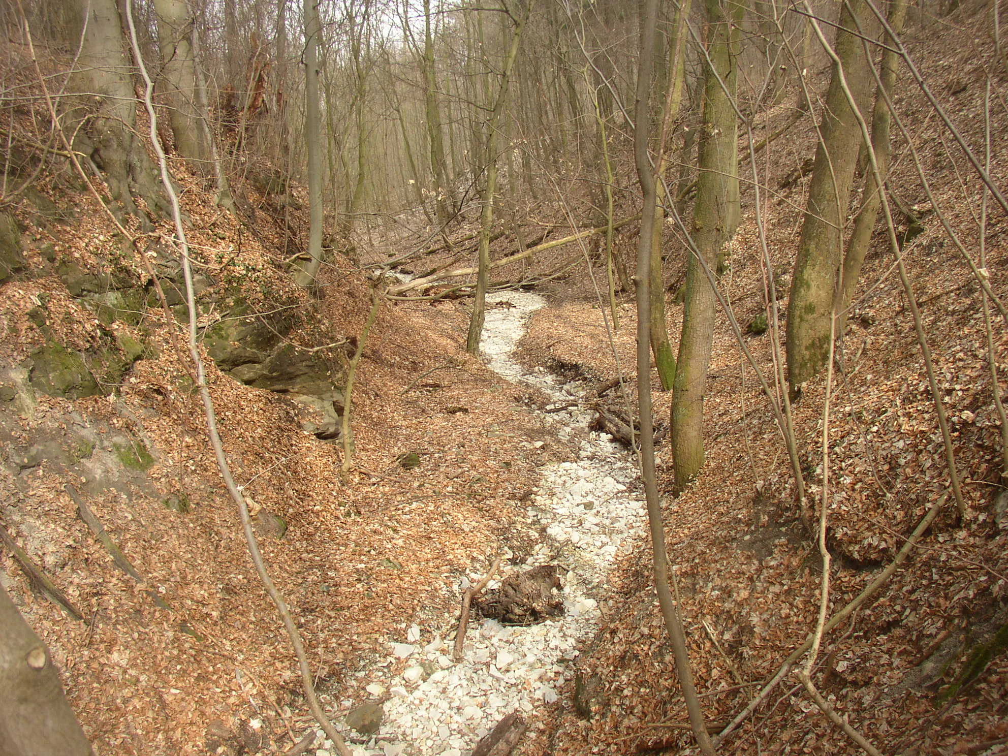
A narrow stream bed covered with light-colored stones winding through a deciduous forest with bare trees and leaf-covered slopes.
The stream bed of Smečenská rokle, characterized by pale opuka rubble among fallen leaves in a dormant forest.

Smečenská rokle conservation status and protection priorities

From a conservation standpoint, Smečenská rokle matters primarily as a reference site for the geology of the Bohemian Cretaceous Basin and as a refuge of relatively natural forest vegetation within a heavily changed agricultural landscape. The protection of the site aims to preserve the exposed Cretaceous cross-section, including the transition into underlying Carboniferous sediments, together with the calcareous-loving plant communities associated with the marlstone substrate. Because the rock profile forms the principal object of protection, regular removal of invasive woody regrowth from the upper rim of the profile is needed to keep the exposures clean and visible.

Conservation management focuses heavily on controlling invasive species. Japanese knotweed has been actively treated with herbicide applications at the start and end of each growing season, combined with mechanical disruption of regenerating shoots. Black locust and ash-leaved maple are addressed through forestry measures, with recommendations including trunk ringing, herbicide treatment of stumps, and cutting back of suckers in late summer. The management plan also encourages retaining veteran oaks, beeches, and lindens to die in place, supporting natural regeneration of the mixed forest and the continuity of dead and decaying wood, which is vital for many of the protected invertebrates and fungi.

Additional threats include illegal dumping of organic and other waste along the road-facing side of the reserve and the runoff of pesticides and fertilizers from surrounding farmland, which collects at the lowest point of the agricultural catchment. Because the underlying rock is permeable, salt and chemical contaminants easily reach the canyon floor, prompting recommendations to limit road salting and to maintain buffer practices in adjacent fields. The reserve is also embedded within the larger Přírodní park Džbán, which extends landscape-level protection to the broader plateau context.

Smečenská rokle cultural meaning and human context

Although small, Smečenská rokle sits in a landscape with long-standing human use. The presence of the historic Ovčín homestead at the foot of the gorge points to a tradition of woodland pasture and small-scale rural land use that once extended into the forested slopes. On the southern rim of the canyon, the surviving line of old oaks and lindens is interpreted as a remnant avenue leading toward the gorge, suggesting the site was visited and valued locally even before its formal protection. As part of the broader Džbán region, the gorge belongs to a cultural landscape shaped by generations of mixed agriculture and forestry in central Bohemia.
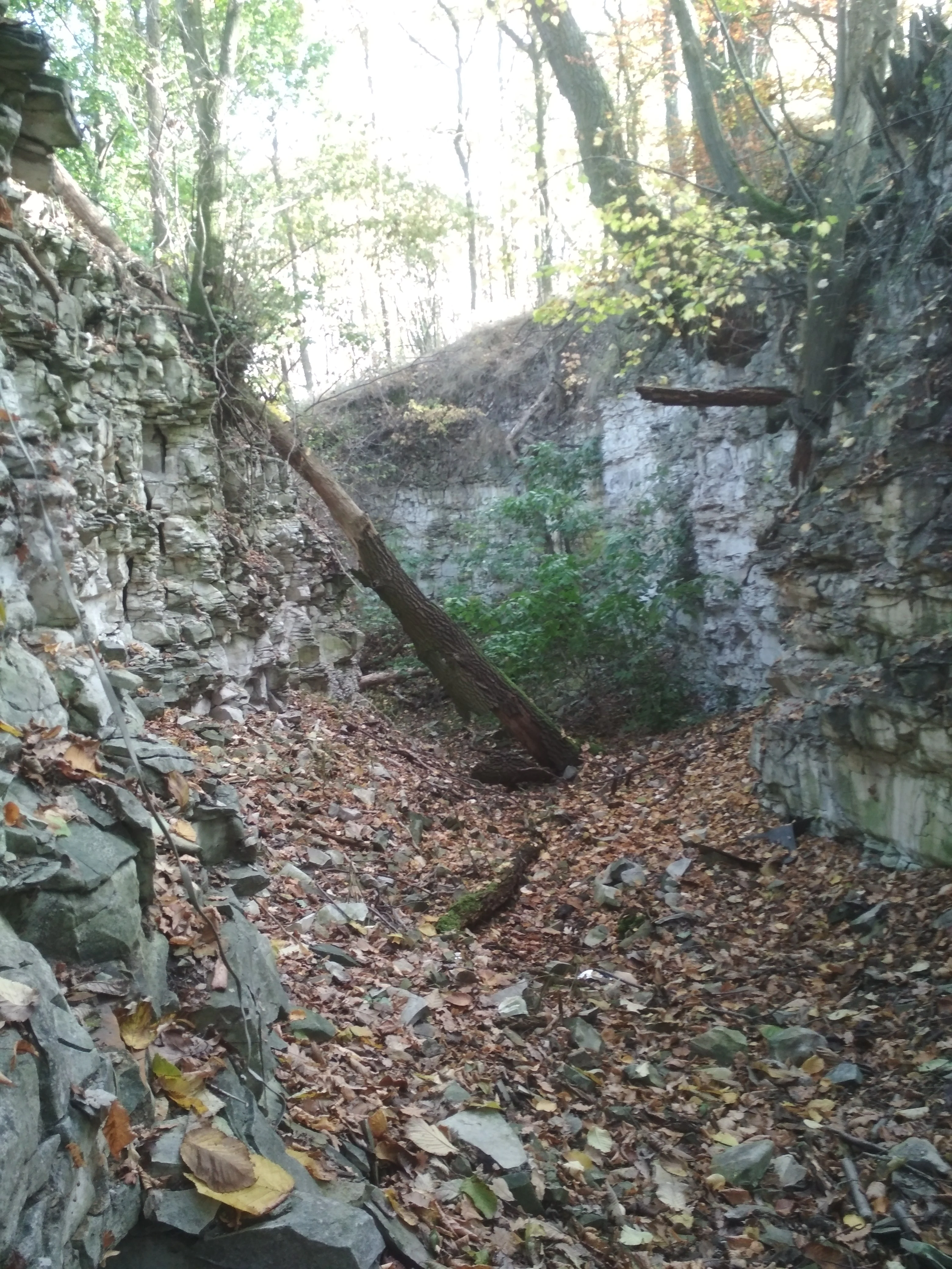
A view looking into a narrow gorge with steep, layered rock walls and a forest canopy above; a fallen tree trunk lies across the gorge floor, which is covered in dead leaves.
A view into the deep erosion valley of Smečenská rokle, showcasing its rocky geological walls and wooded environment.

Top sights and standout views in Smečenská rokle

Smečenská rokle offers several distinct points of interest in a very compact area: a textbook Cretaceous geological profile transitioning from Cenomanian sandstones through Turonian marlstones to underlying Carboniferous sediments, a sharply incised erosional canyon in an otherwise flat agricultural plateau, surviving patches of natural scree and ravine forest, seasonal amphibian breeding pools in the floor of the gorge, and an unusual concentration of molluscs representing one of the least-studied but most diverse animal groups on the site. Together these features make the reserve a small but unusually rich combination of geological, woodland, and freshwater habitat within intensively used Central Bohemian countryside.
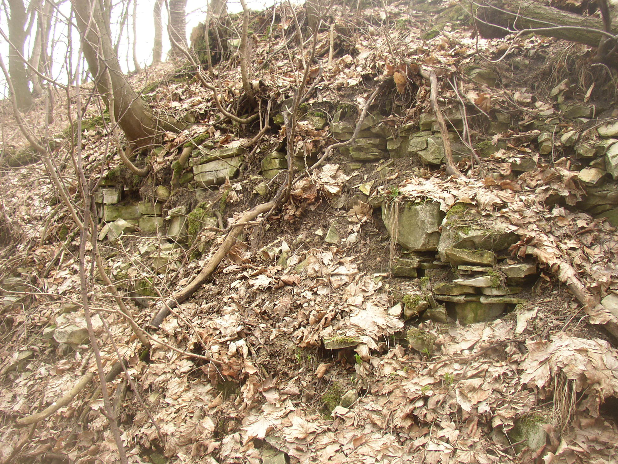
A close up view of layered marlstone rock outcrops on a forested slope, covered in fallen dry leaves.
Marlstone outcrops visible on the slopes of the Smečenská rokle ravine.

Best time to visit Smečenská rokle

Smečenská rokle is most rewarding to visit during the warmer months when the seasonal pools of the Svinařovský potok are active and the forest vegetation is fully leafed out, generally between late spring and early autumn. Spring brings active amphibian breeding in the canyon pools and flowering woodland herbs such as spring pea and yellow archangel, while summer highlights the contrast between the dry cultivated plateau and the cool, shaded, green ravine below. Autumn is favorable for appreciating the geology and for mushroom foraging on the wooded slopes, though visitors should expect some sections of the gorge to be slippery because of loose marlstone scree falling from the high walls after wet weather.


Monthly climate preview

Measured monthly temperature ranges and precipitation patterns across representative terrain elevations

Smečenská rokle Climate Normals and Long Term Weather by Month

Smečenská rokle exhibits long term temperature variations alongside consistent monthly precipitation records from representative coordinate sampling between 1991 and 2020. Examining the complete twelve month climate profile reveals detailed shifts in average maximum and minimum values across the protected terrain.
Annual mean8 °C
-2 °C19 °C
Jan-2°
Feb-1°
Mar
Apr
May13°
Jun17°
Jul19°
Aug19°
Sep14°
Oct
Nov
Dec-1°
Warmest month
July

19.2 °C

Coolest month
January

-2.4 °C

Wettest month
June

2.6 mm/day

Driest month
February

1.1 mm/day

Park location guide

Geography guide, regional context, and park location map for Smečenská rokle

Smečenská rokle park geography, regions, and map view in Czechia

Understand where Smečenská rokle sits in Czechia through a broader geographic reading of the surrounding landscape, nearby location context, and its mapped position within the national park landscape.

How Smečenská rokle fits into Czechia

Czech Republic is a landlocked Central European country with a population of approximately 10.9 million people. The nation was established as an independent state on January 1, 1993, following the dissolution of Czechoslovakia. Its capital and largest city is Prague, with other major urban centers including Brno, Ostrava, Plzeň, and Liberec.

Wider geography shaping Smečenská rokle in Czechia

The Czech Republic is a landlocked country in Central Europe. It is bordered by Germany to the west, Austria to the south, Poland to the northeast, and Slovakia to the southeast. The landscape is predominantly hilly, with the territory covering 78,871 square kilometers.

Map view of Smečenská rokle

Use this park location map to pinpoint Smečenská rokle in Czechia, understand its exact geographic position, and read its mapped placement within the surrounding landscape more clearly.

Pigeon | © OpenStreetMap contributors

Location context for Smečenská rokle

Central Bohemian Region

Visual reference for the geological gorge, scree forest, and terrain of Central Bohemia.

Smečenská Rokle Landscape Photos and Protected Area Scenery

Photographic documentation reveals the deep erosional trench, marlstone rock faces, and relict woodland habitats defining the protected natural monument. Visual browsing provides a clear reference for the geological profile and narrow ravine environment preserved within agricultural plateaus.

A narrow canyon path flanked by vertical, layered marlstone rock walls, covered with fallen autumn leaves and sheltered by overhanging deciduous trees.

A steep, narrow ravine floor in a deciduous forest during late autumn or winter, featuring fallen trees, mossy rocks, and scattered dry leaves.

A small, narrow stream flowing between weathered, moss-covered sandstone rock walls in a forest setting.

A close-up view of a vertical sandstone rock wall showing natural erosion patterns, holes, and weathered textures, with some moss and scattered leaves.

A narrow stream bed covered with light-colored stones winding through a deciduous forest with bare trees and leaf-covered slopes.

Close-up view of moss-covered sandstone rock faces in a narrow gorge, with a forest floor covered in fallen autumn leaves.

A view looking into a narrow gorge with steep, layered rock walls and a forest canopy above; a fallen tree trunk lies across the gorge floor, which is covered in dead leaves.

A close up view of layered marlstone rock outcrops on a forested slope, covered in fallen dry leaves.

A view of the edge of a wooded ravine adjacent to an open agricultural field under an overcast sky.

Park atlas

Compare regional geology, wooded ravines, and protected natural monuments across Central Bohemia

Explore Parks Near Smečenská Rokle and Surrounding Protected Landscapes

Continue geographic comparison by browsing other protected areas located near Smečenská rokle and the surrounding regional terrain. Examining adjacent reserves provides deeper context into the geological formations and woodland habitats defining the broader territory.
A wide watercolor painting showing a landscape of green hills, scattered trees, and distant pink and purple mountains under a pale sky.
Natural monumentStředočeský kraj
About 1.2 km away#1 closest

North

Smečno Natural Monument: A Protected Woodland Ecosystem in Středočeský Kraj

Geography and conservation mapping in the Czech Republic

Located in the Kladno District, Smečno Natural Monument preserves mature deciduous trees essential for the survival of the hermit beetle. The site acts as a geographical link between distinct landform units, offering a clear look at how small, cavity-rich forest patches maintain ecological connectivity within the broader Central Bohemian landscape.

Area
0.772 km²
Established
2012
IUCN
IV
Relief
Upland
Natural monumentStředočeský kraj
About 5.3 km away#2 closest

East

Vinařická hora Natural Monument: A Volcanic Geography and Protected Terrain Study

Key protected area and geological landmark in the Středočeský kraj region.

Vinařická hora is a compact, asymmetric hill serving as a vital natural monument for the study of Tertiary volcanic processes and dry-slope plant communities. Its abandoned quarries provide a clear stratigraphic record of ash and lava, while its summit offers panoramic views across the central Bohemian plateau. This site represents a convergence of deep geological history and specialized modern habitat preservation.

Area
0.684 km²
Established
1985
IUCN
III
Relief
Upland
Watercolor painting of a pastoral landscape featuring rolling green hills, patches of trees, and a river flowing through the center.
Natural monumentStředočeský kraj
About 8.7 km away#3 closest

Northeast

Slánská hora Natural Monument: Volcanic Geography and Protected Hilltop Terrain in Central Bohemia

Detailed geological mapping of a Tertiary volcanic outlier and historic monument

Slánská hora functions as a significant geological landmark where basaltic vent remnants meet centuries of human history. This natural monument offers a window into the volcanic processes of the region through exposed columnar basalt and rock fissures. The site serves as a vital protected area, balancing remnants of warm-loving steppe vegetation and deciduous forest with the legacy of former quarries and ancient archaeological strata atop the Slaný ridge.

Area
0.022 km²
Established
1998
IUCN
III
Relief
Mountain
A soft, painterly watercolor illustration of a wetland scene with gentle green fields, faint distant hills, and low-growing vegetation in the foreground against a white background.
Natural monumentStředočeský kraj
About 10 km away#4 closest

West

Na Novém rybníce Natural Monument: Wetland Geography and Protected Area Atlas

A diverse protected mosaic of meadows and pond basins

Examine the detailed landscape of Na Novém rybníce, an ecologically rich natural monument in the Středočeský kraj. This protected area showcases a compact assemblage of pond, reed marsh, and rare fen meadow vegetation that illustrates the unique character of lowland Bohemian wetlands.

Area
0.054 km²
Established
1990
IUCN
III
Relief
Lowland
Watercolor illustration of a peaceful, open landscape with gentle hills in the background and clusters of trees in the foreground.
Nature reserveStředočeský kraj
About 11 km away#5 closest

Northwest

Na Pilavě Nature Reserve: A Detailed Botanical Atlas of the Středočeský kraj Landscape

Mapping protected orchid habitats and forest flora in the Džbán highland.

Na Pilavě is a specialized nature reserve in the Kladno District, valued for its dense concentration of rare woodland orchids and the critically endangered black false hellebore. Set within the forested slopes of the Pilavské údolí, this protected area serves as a vital refuge for thermophilic plant communities and ancient deciduous forest flora.

Area
0.031 km²
Established
1969
IUCN
IV
Relief
Upland
A horizontal watercolor illustration showing a soft-toned landscape with green trees in the foreground, rolling yellow-green fields in the midground, and faint mountains in the background.
Natural monumentStředočeský kraj
About 13 km away#6 closest

Northwest

Smradovna Natural Monument: Geography and Protected Habitats in Central Bohemia

A protected stream valley system within the Stredocesky kraj region.

Smradovna preserves a unique concentration of lowland habitats, including calcareous beech forests and rare alkaline fens. This protected natural monument, located near Bilichov, is defined by its characteristic travertine springs and continuous stream-corridor ecosystem. Gain insight into the regional geography and botanical significance of this tightly knit protected landscape through our structured mapping and data.

Area
1.556 km²
Established
2014
IUCN
IV
Relief
Upland
Watercolor painting of a rolling Czech landscape featuring meadow flowers in the foreground, forest in the midground, and distant hazy hills.
Natural monumentStředočeský kraj
About 15 km away#7 closest

Southeast

Markův mlýn Natural Monument: Exploring the Geography and Protected Flora of Central Bohemia

A rare botanical reserve featuring unique rock-steppe plant communities

Markův mlýn is a protected natural monument situated in the Středočeský kraj region, characterized by its rare combination of dry, thin-soil hillside meadows and stream-influenced valley terrain. The area serves as a critical habitat for specialized steppe flora, including the protected Bohemian pasqueflower. This record offers a detailed look at the site's compact geography and the specific environmental conditions that sustain its unusual plant communities.

Area
0.001 km²
Established
1987
IUCN
III
Relief
Lowland
Natural monumentÚstecký kraj
About 21 km away#8 closest

North

V hlubokém Natural Monument: Protected Calcareous Landscapes and Terrain in Ústecký kraj

A study of rare sesleria grasslands and opuka slope geography

V hlubokém serves as a significant protected site in the Czech Republic, encompassing twenty hectares of hillside defined by soft calcareous opuka rock. This natural monument is recognized for its rare sesleria grasslands and thermophilic plant assemblages that contrast with the surrounding woodland. The protected area forms a critical link in the broader geography of the Débeř valley, offering a clear example of localized botanical diversity supported by unique alkaline substrate conditions.

Area
0.202 km²
Established
1947
IUCN
III
Relief
Upland

Common questions about visiting, size, designation, and location context for Smečenská rokle

Smečenská rokle FAQs for park facts, access, geography, and protected area context

Find quick answers about Smečenská rokle, including protected-area facts, park geography, trail and visitor context, and how the park fits into its surrounding country and regional landscape.
MoriAtlas Explorer

Continue Your Protected Areas Search Across the Global Atlas

Deepen your exploration by continuing the structured search for national parks and protected areas worldwide. Utilize the comprehensive filtering capabilities to compare different conservation landscapes and refine your understanding of global park geography. Discover more about the distribution and characteristics of protected natural areas.

Global natural geography