
Why Stirling Range National Park stands out
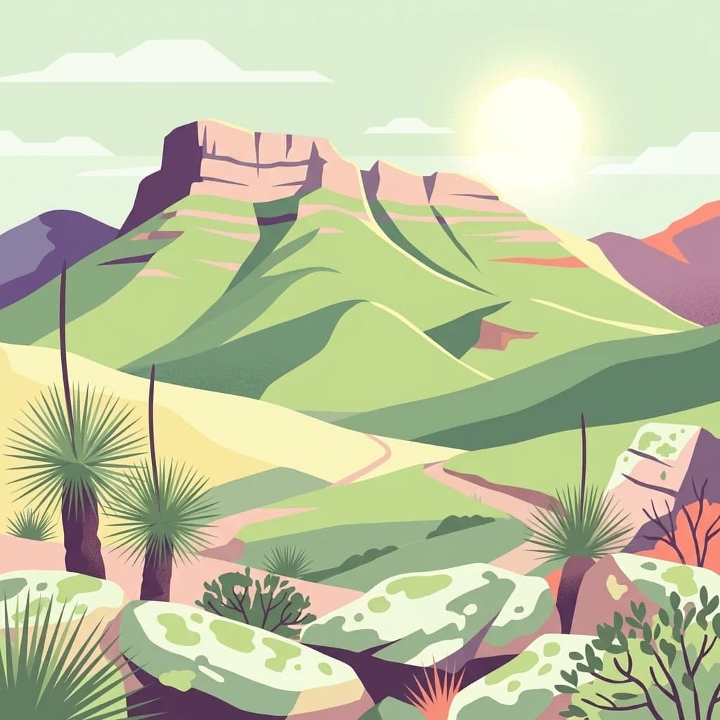
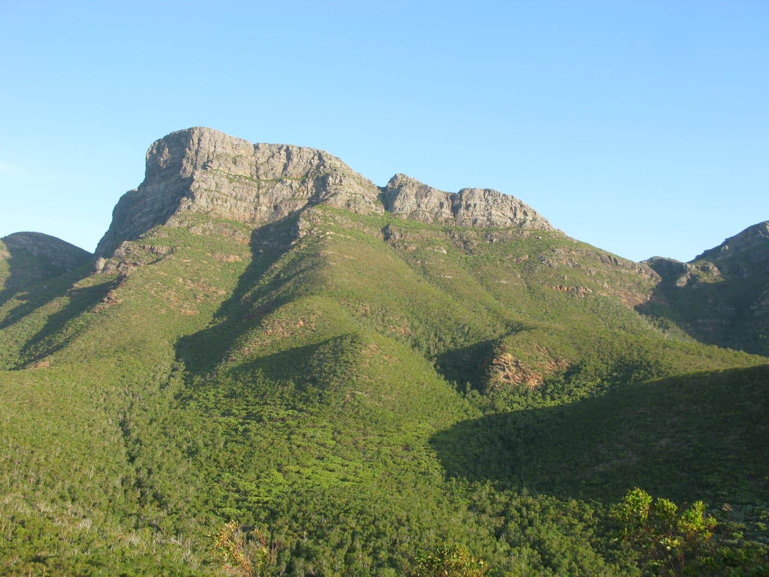
Stirling Range National Park is best known for its extraordinary botanical diversity and dramatic mountain scenery. The ranges contain over 1,500 flowering plant species with exceptional endemism, including ten species of mountain bells (Darwinia) of which only one occurs outside the park. Bluff Knoll, the tallest peak in southwestern Australia, offers panoramic views from its summit. The park features distinctive vegetation communities ranging from thicket and mallee-heath on higher elevations to woodlands, wetlands, and salt lake systems on the lower slopes. The landscape includes the iconic silhouette known as the Sleeping Princess, visible from the nearby Porongurup Range.
Stirling Range National Park history and protected-area timeline
The Stirling Ranges have been home to the Mineng and Koreng groups of the Noongar peoples for tens of thousands of years, with the surrounding lowlands providing abundant food sources including seeds, roots, fruit, and game. The first European to sight the range was Matthew Flinders in January 1802, who named it Mount Rugged while exploring the southern Australian coast. Ensign Dale explored the area in 1832 and became the first European to climb Toolbrunup. The range was formally named Stirling Range by surveyor John Septimus Roe in 1835 after Governor James Stirling of the Swan River Colony, though Stirling never visited the area. Sandalwood cutters established a track through the region around 1848, followed by European settlers arriving in the late 1800s. John Forrest climbed Toolbrunup in 1881 with Henry Samuel Ranford, erecting a cairn at the summit. In 1908, Jas Hope, Chief Draftsperson of the Lands and Survey Department, proposed the park boundaries, which were approved by Minister N.J. Moore. The National Park was gazetted in 1913, with the first park ranger appointed in 1964. The park received National Heritage listing in 2006. A lightning-sparked bushfire in 2020 devastated 40,000 hectares of the park, while significant snowfall in August 2022 blanketed the peaks.
Stirling Range National Park landscape and geographic character
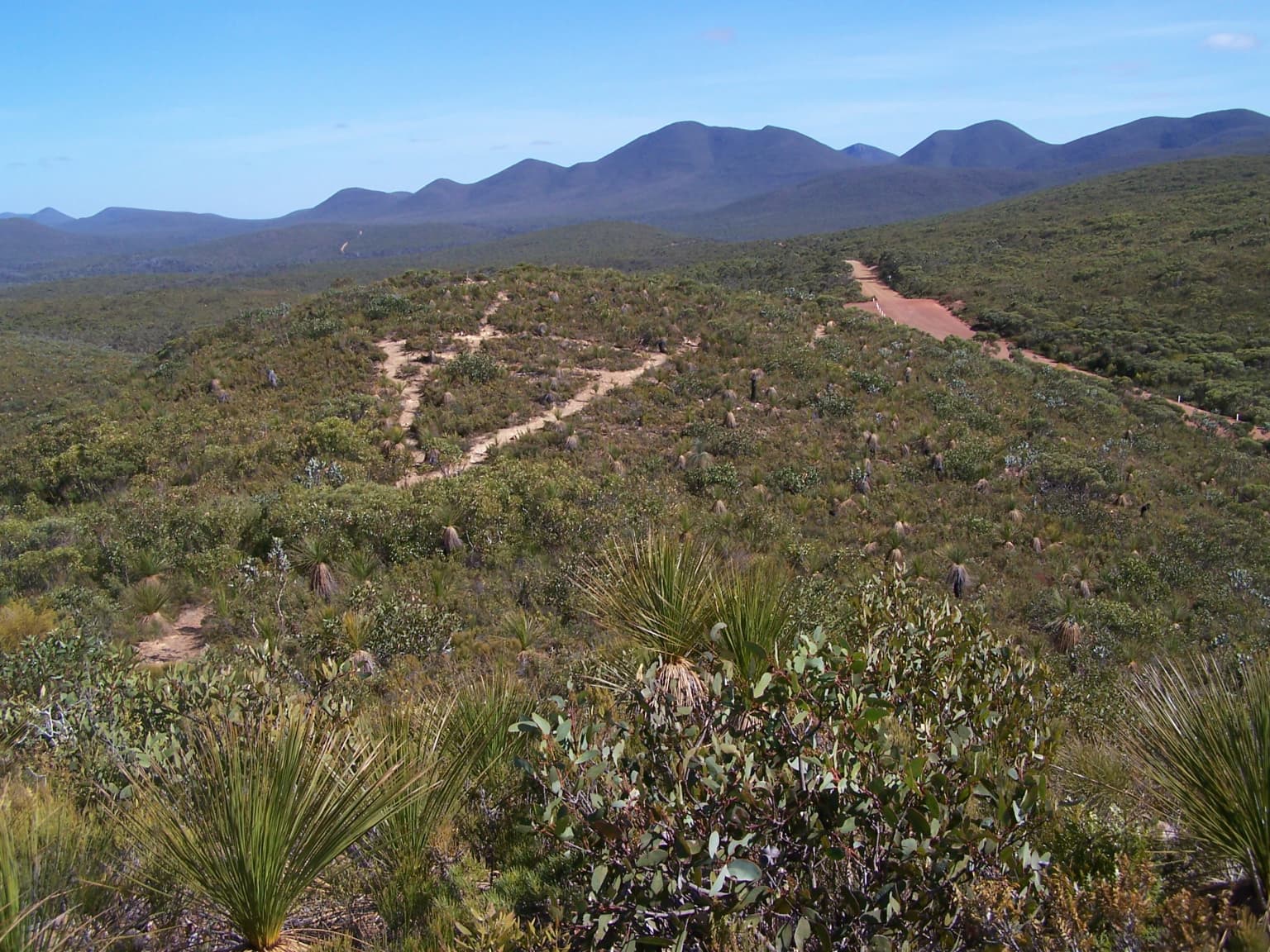
The Stirling Ranges present a dramatic mountainous landscape rising abruptly from the flat wheatbelt plain of southwestern Australia. The mountain chain extends over 65 kilometres in width, with peaks reaching elevations that create a striking visual barrier against the horizon. Notable geological features include Bluff Knoll, the tallest peak in the southwestern Australian region, and Toolbrunup, which was climbed by early European explorers. The distinctive silhouette known as the Sleeping Princess can be viewed from the Porongurup Range to the south, adding to the mythological character of the landscape. The terrain varies from steep ridgelines and rocky summits to sheltered gullies and forested valleys. Higher elevations support distinctive thicket and mallee-heath communities, while lower slopes and surrounding plains give way to woodlands, wetlands, and salt lake systems. The visual contrast between the rugged mountain terrain and the surrounding agricultural landscape emphasizes the ecological and scenic significance of this isolated mountain system.
Stirling Range National Park ecosystems, habitats, and plant life
The Stirling Ranges represent one of the richest floristic regions in the world, displaying exceptional biogeographic and evolutionary significance. Despite the area's low soil fertility, over 1,500 different flowering plant species thrive within the park, with more than 87 species found exclusively within its boundaries. The park is particularly notable for its diversity of banksias, eucalypts, orchids, and verticornias. Ten species of mountain bells (Darwinia) have been identified in the park, with only one species found outside the Stirling Range, demonstrating the extraordinary level of endemism. Five major vegetation communities are recognized: thicket and mallee-heath at higher elevations, transitioning through woodlands and wetlands to salt lake communities on the lower slopes and plains. The critically endangered Stirling Range Wattle (Acacia awestoniana) is endemic to an area near the park's northern boundary. The combination of geological isolation, diverse habitats, and Mediterranean climate has created conditions for remarkable speciation and plant diversity.
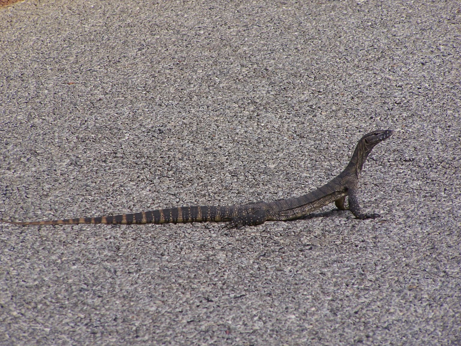
Stirling Range National Park wildlife and species highlights
Stirling Range National Park has been identified by BirdLife International as an Important Bird Area due to its significance for endangered bird species. The park supports populations of short-billed black cockatoos and western whipbirds, both classified as endangered, while long-billed black-cockatoos visit seasonally. Mammal species found within the park include the western pygmy possum and western grey kangaroo. The deeper shaded gullies of the ranges provide habitat for ancient species including land snails, trapdoor spiders, and giant earthworms whose lineage dates back millions of years. The combination of diverse habitats from alpine heath through woodlands to wetlands supports a range of fauna, though the park's reputation rests primarily on its botanical significance rather than large mammal diversity. The birdlife, particularly the endangered cockatoo species, represents a key conservation value for the park.
Stirling Range National Park conservation status and protection priorities
Stirling Range National Park holds significant conservation value as a refuge for Australia's extraordinary plant diversity. The park's recognition as one of the world's richest floristic regions, combined with high levels of endemism, makes it a priority area for botanical conservation. The presence of 87 endemic plant species, including the critically endangered Stirling Range Wattle, underscores the park's importance in protecting rare and threatened flora. The park's designation as an Important Bird Area for endangered cockatoo species and the western whipbird adds faunal conservation significance. The 2006 National Heritage listing further recognizes the park's outstanding universal values. Conservation challenges include managing the impacts of bushfire, with a 2020 fire devastating 40,000 hectares, and addressing threats from introduced species and changing fire regimes in the Mediterranean climate.
Stirling Range National Park cultural meaning and human context
The Stirling Ranges hold deep cultural significance for the Noongar people, specifically the Mineng and Koreng traditional owner groups. The local Noongar names for the ranges, Koikyennuruff or Koi Kyenunu-ruff, translate to 'mist moving around the mountains,' reflecting an intimate understanding of the landscape's weather patterns and atmospheric qualities. The surrounding lowlands historically provided abundant food resources, with women gathering seeds, roots, and fruit while men hunted kangaroos and other game. This traditional connection to Country represents continuity of Indigenous land management and spiritual association spanning tens of thousands of years. European exploration began with Matthew Flinders in 1802, and the subsequent naming by John Septimus Roe after Governor James Stirling reflects the colonial history of the region. The landscape continues to hold cultural meaning for contemporary Noongar communities.
Top sights and standout views in Stirling Range National Park
Stirling Range National Park offers exceptional experiences centered on its unique mountain environment and botanical richness. Bluff Knoll summit provides the opportunity to stand atop the highest peak in southwestern Australia with panoramic views across the ranges and surrounding plain. The multi-day Stirling Ridge Walk traverses the most spectacular ridgeline, connecting Ellen Peak with Bluff Knoll through terrain that showcases the park's diverse vegetation. The exceptional plant diversity, with over 1,500 species including numerous endemics, makes the park a living laboratory for botanical enthusiasts. Seasonal wildflower displays transform the landscape, particularly in spring. The mountain environment supports opportunities for abseiling and gliding, while birdwatching reveals endangered black cockatoos and the elusive western whipbird.
Best time to visit Stirling Range National Park
The optimal time to visit Stirling Range National Park is during the Australian spring months from September to November when wildflower displays are at their peak and temperatures are pleasant for hiking. The summer months of December through February can be hot, with peak temperatures on exposed ridges and peaks making strenuous walks challenging. Autumn and winter bring cooler conditions suitable for bushwalking but can include cold, wet weather. The park has experienced significant snowfall in winter, with August 2022 bringing unusual heavy snow to the peaks. Summer also carries elevated bushfire risk, as demonstrated by the 2020 lightning-sparked fire that burned 40,000 hectares. Visitors planning multi-day walks like the Stirling Ridge Walk should check current conditions and fire restrictions before setting out.