

Mori Atlas logo
National parkStirling Range National Park

Discover the mapped boundaries and regional atlas of this vital national park.

Stirling Range National Park: Explore Protected Landscape and Geographic Context in Western Australia

Stirling Range National Park represents a significant protected landscape within the diverse geography of Western Australia. This entry serves as a canonical point for understanding the park's specific protected area identity, its mapped terrain, and its place within the broader regional atlas. Explore the geographic context and learn what makes this national park a distinct feature of Australia's natural heritage.

Mountain landscapesBiodiversity hotspotsEndemic floraNational parksWestern AustraliaImportant Bird Areas
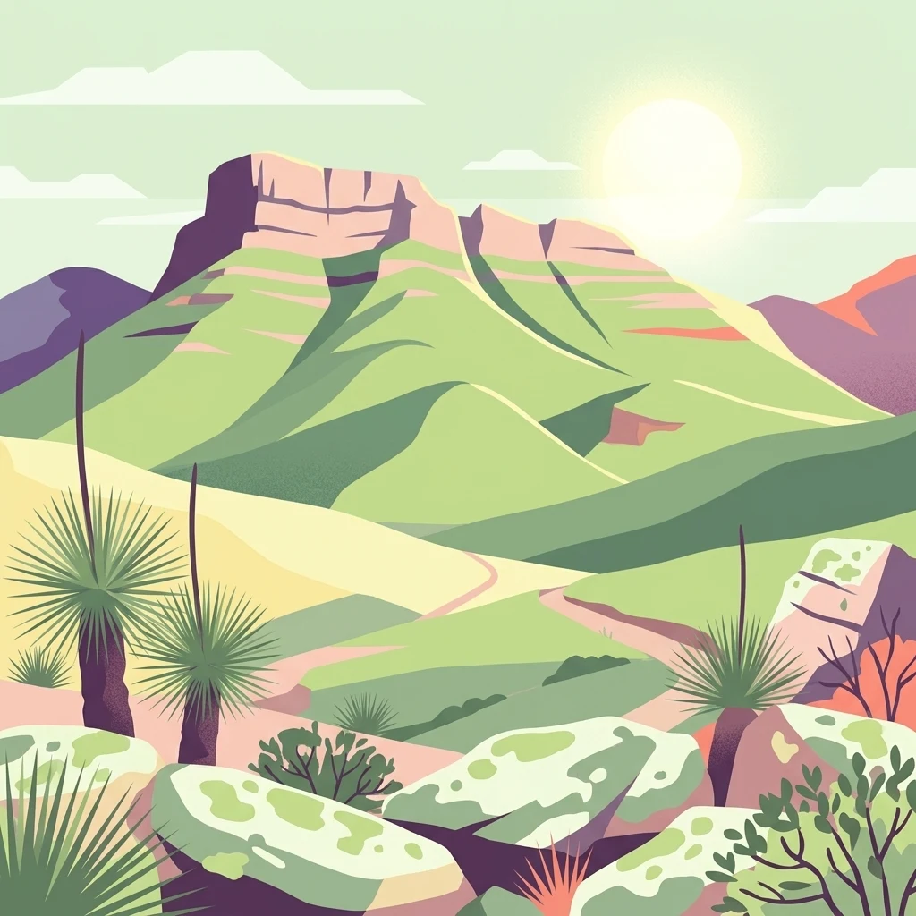
Illustration of Stirling Range National Park showing a mountain range with green hills, rocky formations, native vegetation, and a sunlit sky

Stirling Range National Park

National park

Park overview

Structured park overview, official facts, and landscape profile for Stirling Range National Park

Stirling Range National Park park facts, protected area profile, and essential visitor context

Review the core facts for Stirling Range National Park, including designation, size, terrain, visitor scale, habitats, and operating context in one park-focused overview.

About Stirling Range National Park

Stirling Range National Park protects a landscape of outstanding natural and cultural significance in southern Western Australia. The park encompasses the Stirling Ranges, a formation of ancient mountains that rise dramatically from the surrounding agricultural plain, creating a stark and visually striking environment. The ranges stretch over 65 kilometres from west to east, straddling the highway between Mount Barker and Cranbrook and extending eastward past Gnowangerup. The park's mountain peaks, including Bluff Knoll, Toolbrunup, and Mount Trio, form a distinctive skyline that has become emblematic of the Great Southern region. Beyond its geological and ecological significance, the area holds profound importance for the Noongar people, whose traditional connection to this landscape spans millennia. The park offers visitors opportunities for bushwalking, abseiling, and gliding, with the Stirling Ridge Walk providing a premier multi-day hiking experience through the most easterly peaks. Camping is permitted only at the Moingup campsite within the park boundaries.

Quick facts and research context for Stirling Range National Park

Stirling Range National Park occupies 1,159.2 square kilometres in the Great Southern region of Western Australia. The park was gazetted in 1913 and is governed by the Department of Parks and Wildlife. It protects the Stirling Ranges, a mountain system featuring peaks including Bluff Knoll, Toolbrunup, and Mount Trio. The park is recognized as an Important Bird Area by BirdLife International, supporting endangered species including short-billed black cockatoos and western whipbirds. The area holds National Heritage status and represents one of the richest floristic regions in the world.

Protection and recognition

Exploring the terrestrial management scope and official protection details of the park

Official Protected Area Status of Stirling Range National Park

Terrestrial classification data provides essential context regarding the formal protection status and designated management boundaries of Stirling Range National Park. Reviewing certified conservation frameworks alongside official database records helps clarify how the physical landscape is structured for long-term preservation.

Protection details

Protection scope
Terrestrial
Transboundary protection
No
Park context

Deeper park guide and search-rich context for Stirling Range National Park

Stirling Range National Park history, landscape, wildlife, and travel context

Explore Stirling Range National Park through its history, landscape character, ecosystems, wildlife, conservation priorities, cultural context, and seasonal travel timing in a structured park guide built for atlas discovery and search intent.

Why Stirling Range National Park stands out

Stirling Range National Park is best known for its extraordinary botanical diversity and dramatic mountain scenery. The ranges contain over 1,500 flowering plant species with exceptional endemism, including ten species of mountain bells (Darwinia) of which only one occurs outside the park. Bluff Knoll, the tallest peak in southwestern Australia, offers panoramic views from its summit. The park features distinctive vegetation communities ranging from thicket and mallee-heath on higher elevations to woodlands, wetlands, and salt lake systems on the lower slopes. The landscape includes the iconic silhouette known as the Sleeping Princess, visible from the nearby Porongurup Range.
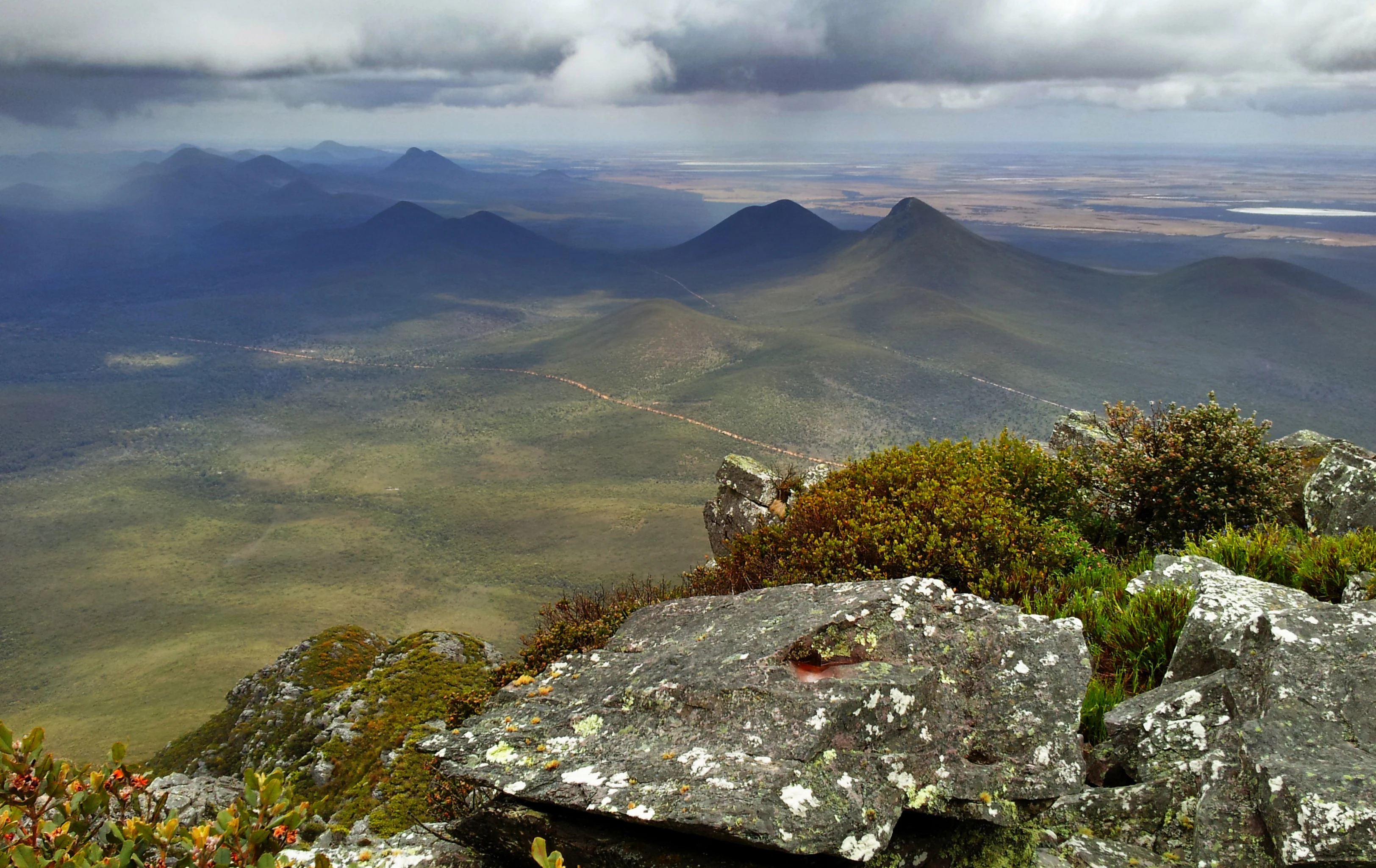
Panoramic landscape view from a mountain summit showing rocky terrain with lichen, low vegetation, and distant rolling hills under a cloudy sky
Panoramic view of Stirling Range National Park featuring rocky foreground and distant mountain peaks under a partly cloudy sky

Stirling Range National Park history and protected-area timeline

The Stirling Ranges have been home to the Mineng and Koreng groups of the Noongar peoples for tens of thousands of years, with the surrounding lowlands providing abundant food sources including seeds, roots, fruit, and game. The first European to sight the range was Matthew Flinders in January 1802, who named it Mount Rugged while exploring the southern Australian coast. Ensign Dale explored the area in 1832 and became the first European to climb Toolbrunup. The range was formally named Stirling Range by surveyor John Septimus Roe in 1835 after Governor James Stirling of the Swan River Colony, though Stirling never visited the area. Sandalwood cutters established a track through the region around 1848, followed by European settlers arriving in the late 1800s. John Forrest climbed Toolbrunup in 1881 with Henry Samuel Ranford, erecting a cairn at the summit. In 1908, Jas Hope, Chief Draftsperson of the Lands and Survey Department, proposed the park boundaries, which were approved by Minister N.J. Moore. The National Park was gazetted in 1913, with the first park ranger appointed in 1964. The park received National Heritage listing in 2006. A lightning-sparked bushfire in 2020 devastated 40,000 hectares of the park, while significant snowfall in August 2022 blanketed the peaks.

Stirling Range National Park landscape and geographic character

The Stirling Ranges present a dramatic mountainous landscape rising abruptly from the flat wheatbelt plain of southwestern Australia. The mountain chain extends over 65 kilometres in width, with peaks reaching elevations that create a striking visual barrier against the horizon. Notable geological features include Bluff Knoll, the tallest peak in the southwestern Australian region, and Toolbrunup, which was climbed by early European explorers. The distinctive silhouette known as the Sleeping Princess can be viewed from the Porongurup Range to the south, adding to the mythological character of the landscape. The terrain varies from steep ridgelines and rocky summits to sheltered gullies and forested valleys. Higher elevations support distinctive thicket and mallee-heath communities, while lower slopes and surrounding plains give way to woodlands, wetlands, and salt lake systems. The visual contrast between the rugged mountain terrain and the surrounding agricultural landscape emphasizes the ecological and scenic significance of this isolated mountain system.
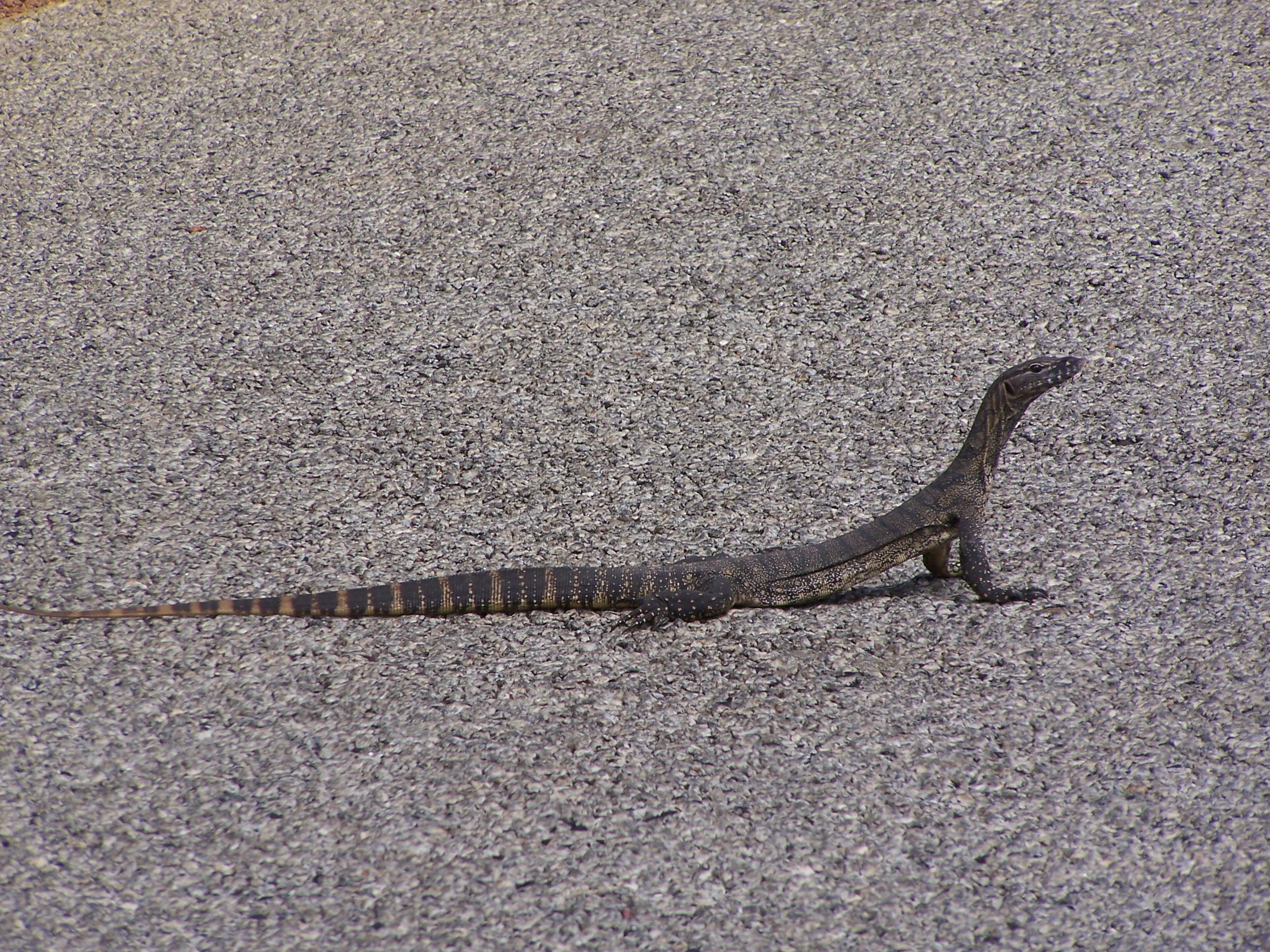
A goanna lizard on a gravel road
A goanna on a gravel road in Stirling Range National Park

Stirling Range National Park ecosystems, habitats, and plant life

The Stirling Ranges represent one of the richest floristic regions in the world, displaying exceptional biogeographic and evolutionary significance. Despite the area's low soil fertility, over 1,500 different flowering plant species thrive within the park, with more than 87 species found exclusively within its boundaries. The park is particularly notable for its diversity of banksias, eucalypts, orchids, and verticornias. Ten species of mountain bells (Darwinia) have been identified in the park, with only one species found outside the Stirling Range, demonstrating the extraordinary level of endemism. Five major vegetation communities are recognized: thicket and mallee-heath at higher elevations, transitioning through woodlands and wetlands to salt lake communities on the lower slopes and plains. The critically endangered Stirling Range Wattle (Acacia awestoniana) is endemic to an area near the park's northern boundary. The combination of geological isolation, diverse habitats, and Mediterranean climate has created conditions for remarkable speciation and plant diversity.
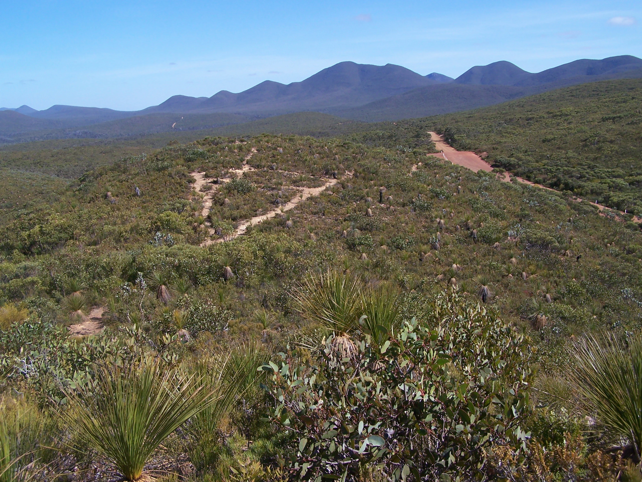
View of Stirling Range National Park heathland with multiple trails winding through green hills, distant mountains under clear blue sky
Heathland in Stirling Range National Park viewed from a central lookout looking west

Stirling Range National Park wildlife and species highlights

Stirling Range National Park has been identified by BirdLife International as an Important Bird Area due to its significance for endangered bird species. The park supports populations of short-billed black cockatoos and western whipbirds, both classified as endangered, while long-billed black-cockatoos visit seasonally. Mammal species found within the park include the western pygmy possum and western grey kangaroo. The deeper shaded gullies of the ranges provide habitat for ancient species including land snails, trapdoor spiders, and giant earthworms whose lineage dates back millions of years. The combination of diverse habitats from alpine heath through woodlands to wetlands supports a range of fauna, though the park's reputation rests primarily on its botanical significance rather than large mammal diversity. The birdlife, particularly the endangered cockatoo species, represents a key conservation value for the park.

Stirling Range National Park conservation status and protection priorities

Stirling Range National Park holds significant conservation value as a refuge for Australia's extraordinary plant diversity. The park's recognition as one of the world's richest floristic regions, combined with high levels of endemism, makes it a priority area for botanical conservation. The presence of 87 endemic plant species, including the critically endangered Stirling Range Wattle, underscores the park's importance in protecting rare and threatened flora. The park's designation as an Important Bird Area for endangered cockatoo species and the western whipbird adds faunal conservation significance. The 2006 National Heritage listing further recognizes the park's outstanding universal values. Conservation challenges include managing the impacts of bushfire, with a 2020 fire devastating 40,000 hectares, and addressing threats from introduced species and changing fire regimes in the Mediterranean climate.

Stirling Range National Park cultural meaning and human context

The Stirling Ranges hold deep cultural significance for the Noongar people, specifically the Mineng and Koreng traditional owner groups. The local Noongar names for the ranges, Koikyennuruff or Koi Kyenunu-ruff, translate to 'mist moving around the mountains,' reflecting an intimate understanding of the landscape's weather patterns and atmospheric qualities. The surrounding lowlands historically provided abundant food resources, with women gathering seeds, roots, and fruit while men hunted kangaroos and other game. This traditional connection to Country represents continuity of Indigenous land management and spiritual association spanning tens of thousands of years. European exploration began with Matthew Flinders in 1802, and the subsequent naming by John Septimus Roe after Governor James Stirling reflects the colonial history of the region. The landscape continues to hold cultural meaning for contemporary Noongar communities.

Top sights and standout views in Stirling Range National Park

Stirling Range National Park offers exceptional experiences centered on its unique mountain environment and botanical richness. Bluff Knoll summit provides the opportunity to stand atop the highest peak in southwestern Australia with panoramic views across the ranges and surrounding plain. The multi-day Stirling Ridge Walk traverses the most spectacular ridgeline, connecting Ellen Peak with Bluff Knoll through terrain that showcases the park's diverse vegetation. The exceptional plant diversity, with over 1,500 species including numerous endemics, makes the park a living laboratory for botanical enthusiasts. Seasonal wildflower displays transform the landscape, particularly in spring. The mountain environment supports opportunities for abseiling and gliding, while birdwatching reveals endangered black cockatoos and the elusive western whipbird.

Best time to visit Stirling Range National Park

The optimal time to visit Stirling Range National Park is during the Australian spring months from September to November when wildflower displays are at their peak and temperatures are pleasant for hiking. The summer months of December through February can be hot, with peak temperatures on exposed ridges and peaks making strenuous walks challenging. Autumn and winter bring cooler conditions suitable for bushwalking but can include cold, wet weather. The park has experienced significant snowfall in winter, with August 2022 bringing unusual heavy snow to the peaks. Summer also carries elevated bushfire risk, as demonstrated by the 2020 lightning-sparked fire that burned 40,000 hectares. Visitors planning multi-day walks like the Stirling Ridge Walk should check current conditions and fire restrictions before setting out.
Monthly climate preview

Long-term monthly temperature and precipitation rhythm for Western Australia

Stirling Range National Park Climate Normals and Average Temperature Patterns

Representative coordinates track measured monthly temperature swings and precipitation averages across the protected terrain. Analyzing the complete twelve-month normals reveals long-term atmospheric patterns for the entire protected area.
Annual mean15 °C
10 °C20 °C
Jan20°
Feb20°
Mar19°
Apr17°
May14°
Jun11°
Jul10°
Aug11°
Sep12°
Oct14°
Nov17°
Dec19°
Warmest month
February

20.4 °C

Coolest month
July

10.2 °C

Wettest month
August

2.6 mm/day

Driest month
January

0.7 mm/day

Park location guide

Geography guide, regional context, and park location map for Stirling Range National Park

Stirling Range National Park park geography, regions, and map view in Australia

Understand where Stirling Range National Park sits in Australia through a broader geographic reading of the surrounding landscape, nearby location context, and its mapped position within the national park landscape.

How Stirling Range National Park fits into Australia

Australia is a constitutional monarchy and federal parliamentary democracy comprising six states and ten territories. With a population of nearly 28 million, it is one of the world's most urbanised countries, with most people concentrated on the eastern seaboard. The country has a high Human Development Index and is known for its cultural diversity, ancient Aboriginal heritage, and unique wildlife.

Wider geography shaping Stirling Range National Park in Australia

Australia occupies the entire Australian continent, the island of Tasmania, and numerous smaller islands. It is the world's flattest and driest inhabited continent, featuring vast deserts in the interior (the Outback), tropical rainforests along the eastern coast, and a coastline bordering the Indian and Pacific Oceans.

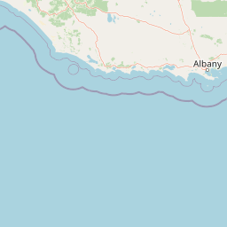
Map view of Stirling Range National Park

Use this park location map to pinpoint Stirling Range National Park in Australia, understand its exact geographic position, and read its mapped placement within the surrounding landscape more clearly.

Pigeon | © OpenStreetMap contributors

Location context for Stirling Range National Park

Western Australia
Recorded earthquake history

Explore the Historical Earthquake and Seismic Record for Stirling Range National Park

Examine documented seismic events and historical earthquake data associated with the geography of Stirling Range National Park. Use these MoriAtlas records to visualize the frequency and distribution of past activity near this significant mountain range in Western Australia.

Stirling Range National Park Earthquake History

Catalogued events

5 events

Strongest magnitude

Magnitude 4.5

Most recent event

Aug 1, 2019

This history includes earthquakes recorded inside the park or within 50 km of its borders

Visually explore Stirling Range National Park's unique mountain scenery, diverse habitats, and protected landscape character.

Explore Stirling Range National Park Photos: Visualizing Western Australia's Dramatic Mountain Landscapes

Browse detailed imagery of Stirling Range National Park to understand its dramatic mountain terrain, unique botanical diversity, and striking landscapes. Visual references help map its distinct ecosystems, high peaks like Bluff Knoll, and the overall protected area environment of Western Australia.

Panoramic landscape view from a mountain summit showing rocky terrain with lichen, low vegetation, and distant rolling hills under a cloudy sky

A mountain peak with rocky summit and lush green slopes under a clear blue sky.

A goanna lizard on a gravel road

View of Stirling Range National Park heathland with multiple trails winding through green hills, distant mountains under clear blue sky

Park atlas

Trace the regional spread of protected areas surrounding Stirling Range, comparing diverse landscapes and conservation value across Western Australia.

Discover Other National Parks and Protected Areas Near Stirling Range National Park, Western Australia

Discover other national parks and protected areas across the diverse Western Australia region surrounding Stirling Range National Park. Compare their unique landscape features, trace geographic context, and assess conservation significance to deepen your understanding of the area's natural heritage.
Nature reserveWestern Australia
About 1.5 km away#1 closest

East

Yarrabee Wesfarmers Reserve: Mapping Woodland Conservation and Regional Geography

A vital protected nature reserve in Western Australia

Yarrabee Wesfarmers Reserve forms a significant link in the regional landscape of Western Australia, protecting marri and jarrah woodland adjacent to the Stirling Range. Through ongoing restoration, the area maintains a mosaic of mallee and Banksia habitats, supporting regional species and contributing to broader environmental connectivity.

Area
9.23 km²
Established
2006
Relief
Upland
Climate
Mediterranean
National parkWestern Australia
16 km away#2 closest

Southeast

Hassell National Park National Park: Mapped Protected Landscape in Western Australia

Explore the geographic identity and park boundaries of Hassell National Park.

Hassell National Park offers a focused view of protected natural landscapes within Western Australia. This atlas entry details the park's specific geographic scope and its designation as a national park, providing essential context for understanding its mapped features and regional landscape. Explore how Hassell National Park contributes to the protected area geography of the state.

Area
12.65 km²
Established
1971
IUCN
II
Scope
Mixed
National parkWestern Australia
20 km away#3 closest

South

Porongurup National Park: Ancient Granite Peaks and Karri Forest Protected Landscape

Mapped terrain and geologic history in Western Australia.

Delve into Porongurup National Park, a protected landscape in Western Australia characterized by its ancient, billion-year-old granite peaks and a rare outlier of towering karri forest. This national park offers a unique geographic perspective, showcasing dramatic mountain terrain that has stood for eons. Explore the mapped boundaries and the distinct ecosystems that thrive within this ancient mountain system, providing rich context for regional atlas discovery and understanding the park's geological significance.

Area
26.21 km²
Established
1971
IUCN
II
Relief
Mountain
National parkGreat Southern
34 km away#4 closest

Southwest

Mount Lindesay National Park: Australian National Park Protected Landscape Details

Explore mapped boundaries and regional geographic context in Great Southern.

Gain a structured understanding of Mount Lindesay National Park, a designated national park in Australia's Great Southern region. This detail view focuses on its protected landscape identity, mapped geographic features, and its place within the nation's network of conservation areas. Discover the specific terrain and regional atlas context that makes this park a distinct element of Australia's natural geography.

Area
395.73 km²
Established
2004
IUCN
II
Relief
Mountain
Nature reserveWestern Australia
36 km away#5 closest

East

Chereninup Creek Reserve: Geographic Identity and Protected Land Context

Explore the landscape and regional geography of this Western Australian nature reserve.

Chereninup Creek Reserve represents a key site within the Gondwana Link initiative of Western Australia. This nature reserve serves as an important ecological connection, featuring a diverse patchwork of eucalypt woodlands and Kwongan heath. Gain insight into its role as a protected area that restores former farmland into a continuous landscape for local flora and fauna.

Area
8.77 km²
Established
2003
Relief
Upland
Scope
Terrestrial
National parkWestern Australia
37 km away#6 closest

Southeast

Waychinicup National Park: National Park Protected Landscape Atlas Entry

Explore Western Australia's mapped natural landscapes and park geography.

Gain a structured understanding of Waychinicup National Park as a key protected landscape within Western Australia. This detailed atlas entry focuses on its geographic distribution and mapped boundaries, providing essential context for regional park and natural landscape exploration. Discover the unique characteristics of this national park's setting and its place within the broader mapped terrain.

Area
39.82 km²
Established
1990
IUCN
II
Relief
Mixed relief
National parkGreat Southern
42 km away#7 closest

Southwest

Mount Roe National Park: Detailed Protected Landscape and Geographic Exploration

Mapped boundaries and natural terrain of this national park.

Mount Roe National Park offers a distinct protected landscape for atlas exploration, situated within the geographic scope of the Great Southern region. This detail page provides a structured view of the park's mapped boundaries and its natural terrain. Understand how Mount Roe National Park contributes to the regional geography and the overall map of protected areas in Australia.

Area
1,278 km²
Established
2004
IUCN
II
Scope
Terrestrial
Nature reserveWestern Australia
48 km away#8 closest

East

Beringa Reserve Nature Reserve: Western Australia Protected Woodland Geography

Restoration landscapes and riparian corridors near Peniup Creek

Beringa Reserve serves as a significant private nature reserve in Western Australia, focusing on the restoration of eucalyptus woodland and mallee heath. This landscape acts as a functional buffer within the Gondwana Link, protecting riparian vegetation along Peniup Creek and fostering the recovery of native mammal habitats through intensive revegetation efforts.

Area
25.06 km²
Established
2007
Relief
Lowland
Climate
Mediterranean

Common questions about visiting, size, designation, and location context for Stirling Range National Park

Stirling Range National Park FAQs for park facts, access, geography, and protected area context

Find quick answers about Stirling Range National Park, including protected-area facts, park geography, trail and visitor context, and how the park fits into its surrounding country and regional landscape.
MoriAtlas Explorer

Continue Your Protected Areas Search Across the Global Atlas

Deepen your exploration by continuing the structured search for national parks and protected areas worldwide. Utilize the comprehensive filtering capabilities to compare different conservation landscapes and refine your understanding of global park geography. Discover more about the distribution and characteristics of protected natural areas.

Global natural geography