Mori Atlas logo
National parkWaychinicup National Park

Understand the geographic setting and mapped boundaries of this protected natural area.

Waychinicup National Park: National Park Protected Landscape in Western Australia

Waychinicup National Park stands as a significant protected natural area within the diverse geography of Western Australia. This page offers a detailed atlas-centric view, focusing on the park's mapped boundaries and its role as a protected landscape. Explore the inherent geographic context and understand how this national park contributes to the regional natural landscape of Western Australia.

Coastal protected areaMarsupial sanctuaryEndangered species habitatImportant Bird AreaWestern Australian national parkMarine mammal habitat

Waychinicup National Park

National park

Park overview

Structured park overview, official facts, and landscape profile for Waychinicup National Park

Waychinicup National Park park facts, protected area profile, and essential visitor context
Review the core facts for Waychinicup National Park, including designation, size, terrain, visitor scale, habitats, and operating context in one park-focused overview.

About Waychinicup National Park

Waychinicup National Park represents a significant protected coastal corridor in the southernmost reaches of Western Australia, where the Southern Ocean meets a landscape of exceptional ecological richness and fragility. The park's location along the Great Southern coast places it within a recognized biodiversity hotspot, characterized by a unique blend of temperate coastal heath, forested valley systems, and marine environments that support species found nowhere else on Earth. The park's terrain is marked by dramatic contrast: exposed coastal headlands give way to sheltered valleys where freshwater streams cascade over moss-covered boulders before reaching the sea. This topographic diversity creates a range of microhabitats that support both terrestrial and marine biodiversity. The park's establishment in 1990 reflected growing recognition that this stretch of coastline contained ecological values that warranted formal protection, particularly given the concentration of rare and threatened species. Today, Waychinicup serves not only as a wilderness preserve but as a critical component in regional conservation planning, working in concert with adjacent protected areas to maintain ecological corridors and population connectivity for vulnerable species.

Quick facts and research context for Waychinicup National Park

Waychinicup National Park occupies a 39.82-square-kilometre coastal strip along the Southern Ocean in far southwestern Western Australia, positioned roughly midway between Albany and the town of Bremer Bay. The park's landscape ranges from dramatic cliff-lined coastline to forested valleys with clear freshwater streams and moss-covered boulder fields. Established in 1990, the park is managed by the Department of Environment and Conservation and forms part of a larger network of protected areas in the region that includes the adjacent Mount Manypeaks Nature Reserve and offshore Bald Island Nature Reserve. The park's conservation value is disproportionate to its relatively modest size, supporting multiple species that are among the most endangered in Australia.

Park context

Deeper park guide and search-rich context for Waychinicup National Park

Waychinicup National Park history, landscape, wildlife, and travel context
Explore Waychinicup National Park through its history, landscape character, ecosystems, wildlife, conservation priorities, cultural context, and seasonal travel timing in a structured park guide built for atlas discovery and search intent.

Why Waychinicup National Park stands out

Waychinicup National Park is best known for its remarkable concentration of threatened and endangered Australian wildlife. The park protects one of the few remaining mainland populations of quokkas, the small marsupial famously known as the world's happiest animal. More significantly, it serves as a crucial sanctuary for Gilbert's potoroo, a critically endangered marsupial that was once thought to be extinct until rediscovered in 1994. The park also harbours the critically endangered noisy scrubbird, a ground-dwelling bird that was formally declared extinct before being rediscovered in 1962 and subsequently translocated to Waychinicup from Two Peoples Bay Nature Reserve. The coastal waters adjacent to the park provide habitat for southern right whales, which can be observed swimming offshore during their seasonal migrations.

Waychinicup National Park history and protected-area timeline

Waychinicup National Park was formally established in 1990, designated under the National Parks and Wildlife Conservation Act to protect the significant natural values of this coastal region in far southwestern Western Australia. The park was created as part of broader expansion of Western Australia's protected area network during the late twentieth century, recognizing the ecological importance of the southern coastline between Albany and the Great Australian Bight. Prior to formal protection, the area had long been recognized by naturalists for its unique fauna, particularly the discovery of the critically endangered noisy scrubbird in the broader Two Peoples Bay region during the 1960s. Conservation translocation programs began in the early 1980s, with noisy scrubbirds moved from Two Peoples Bay Nature Reserve to Waychinicup in 1983 and 1985, establishing what would become a successful and self-sustaining population. In 2010, the park was selected as the site for an insurance population of Gilbert's potoroo, a critically endangered marsupial that had been rediscovered in the southwest and required protected habitat to establish secure populations away from threats facing wild colonies. The management of the park falls under the Western Australian Department of Environment and Conservation, which oversees visitor facilities including a basic camping area and access to the Waychinicup River inlet.

Waychinicup National Park landscape and geographic character

The landscape of Waychinicup National Park presents a striking combination of coastal and upland environments that define the character of far southwestern Australia. The park's coastline extends between Normans Beach and Cheynes Beach, featuring rugged cliffs, sandy beaches, and exposed rock platforms where the full force of the Southern Ocean is visible. Inland, the terrain rises through boulder-strewn hillsides and descends into deeply-incised valleys carved by perennial streams that flow through the park toward the coast. These valley corridors are characterized by dense vegetation and the distinctive presence of moss-covered boulders along stream courses, creating an atmosphere of damp, shaded refuge amid the more exposed coastal terrain. The vegetation ranges from coastal heath on exposed ridges to taller forest and scrub in the sheltered valleys, with species adapted to the region's Mediterranean climate and proximity to the Southern Ocean. The park's boundaries are defined by the Southern Ocean to the south, Mount Manypeaks Nature Reserve to the east, and cleared agricultural land to the north, creating a landscape where protected wilderness meets human-modified farmland.

Waychinicup National Park ecosystems, habitats, and plant life

The ecological character of Waychinicup National Park reflects the unique environmental conditions of southwestern Australia's temperate coastal zone. The park lies within a region recognized for its exceptional biodiversity and high degree of endemism, where species have evolved in isolation from the rest of the continent. The combination of coastal, valley, and upland habitats creates a mosaic of environments that support diverse plant communities ranging from heathlands to forested corridors. The valley streams and their associated riparian zones provide fresh water and more humid microhabitats that contrast sharply with the surrounding drier terrain, supporting species dependent on these water sources. The marine environment adjacent to the park, where the Southern Ocean provides nutrient-rich waters, contributes additional ecological value and supports organisms ranging from intertidal invertebrates to migratory whales. The broader region forms part of the Two Peoples Bay and Mount Manypeaks Important Bird Area, identified by BirdLife International as being of global significance for the conservation of several rare and threatened bird species.

Waychinicup National Park wildlife and species highlights

The wildlife of Waychinicup National Park is distinguished by the presence of multiple species that rank among Australia's most endangered. Among the mammals, the quokka represents one of the few remaining mainland populations of this small wallaby, a species more commonly associated with island habitats such as Rottnest Island near Perth. The establishment of Gilbert's potoroo insurance population in 2010 proved significant for conservation of this marsupial, which numbered only around 100 individuals globally as of late 2018, with the 20 individuals at Waychinicup representing approximately one-fifth of the entire world population. Other mammals include the quenda, a type of bandicoot, and ring-tailed possums. The marine environment off the park's coastline provides seasonal habitat for southern right whales during their migration along the southern Australian coast. The bird fauna is equally remarkable, with the park protecting one of the only populations of the critically endangered noisy scrubbird, a ground-dwelling bird once thought extinct before its rediscovery in 1962 and subsequent translocation to Waychinicup. The vulnerable western bristlebird also persists here, representing one of the few remaining strongholds for this species whose populations have declined since the late nineteenth century.

Waychinicup National Park conservation status and protection priorities

Waychinicup National Park holds exceptional conservation significance disproportionate to its relatively modest 39.82-square-kilometre area. The park forms a critical component of a network of protected areas in far southwestern Western Australia that collectively protect some of Australia's most endangered species. The establishment of an insurance population of Gilbert's potoroo reflects the park's role as a sanctuary for species requiring predator-free or managed environments, though challenges emerged when native carpet pythons entered the enclosure and began preying on the marsupials. The successful establishment of the noisy scrubbird population demonstrates the park's suitability for conservation translocation, with the original 30 individuals introduced in 1983 and 1985 growing to an estimated 223 males by 1994. The designation of the broader region as an Important Bird Area by BirdLife International recognizes its global significance for rare and threatened bird species. The park works in conjunction with adjacent Mount Manypeaks Nature Reserve and the offshore Bald Island Nature Reserve to form a coherent conservation landscape that maintains habitat connectivity and population viability for vulnerable species.

Waychinicup National Park cultural meaning and human context

The Waychinicup area occupies a place within the cultural landscape of the Noongar people, the traditional custodians of the southwestern region of Western Australia. While the park itself was formally established under Western Australian conservation legislation in 1990, the land has been part of Aboriginal country for thousands of years, with the coastal regions and their abundant marine resources forming important parts of traditional life. The name Waychinicup derives from the local Noongar language, reflecting the area's Indigenous heritage and the connection between place names and language in the region. The coastal location near Bremer Bay places the park within a broader region of European settlement history, though the area remained relatively remote and less developed than other parts of the Western Australian coast. The combination of Indigenous place names and the park's role in protecting natural values creates a context where contemporary conservation practice builds upon a landscape that has held significance for both Aboriginal and settler communities.

Top sights and standout views in Waychinicup National Park

The coastal wilderness of Waychinicup National Park combines dramatic Southern Ocean scenery with extraordinary biodiversity protection, making it a distinctive destination within Western Australia's national park system. Visitors experience a landscape where rugged headlands and surf-pounded beaches contrast with tranquil forested valleys, while the presence of some of Australia's rarest wildlife adds a conservation dimension that elevates the park beyond typical scenic appeal. The opportunity to observe southern right whales offshore and to encounter species such as the quokka in their natural habitat represents encounters with wildlife found in few other places on Earth. The park's status as a crucial refuge for the critically endangered Gilbert's potoroo and noisy scrubbird illustrates how a relatively small protected area can play an outsized role in preventing species extinction.

Best time to visit Waychinicup National Park

The park can be visited year-round, though the temperate climate of far southwestern Western Australia offers distinct seasonal experiences. Summer months from December through February typically bring warmer conditions ideal for beach activities and camping, with longer daylight hours providing more time for exploration. The winter months from June to August bring cooler temperatures and increased rainfall that sustains the valley streams and keeps the landscape verdant, though visitor numbers are typically lower during this period. Southern right whales are most reliably observed along the coast from June through October when they migrate through the region. The park's relatively remote location means that visitor numbers remain modest throughout the year, allowing for a more solitary wilderness experience compared to more heavily visited parks closer to population centres.
Park location guide

Geography guide, regional context, and park location map for Waychinicup National Park

Waychinicup National Park park geography, regions, and map view in Australia
Understand where Waychinicup National Park sits in Australia through a broader geographic reading of the surrounding landscape, nearby location context, and its mapped position within the national park landscape.

How Waychinicup National Park fits into Australia

Australia is a constitutional monarchy and federal parliamentary democracy comprising six states and ten territories. With a population of nearly 28 million, it is one of the world's most urbanised countries, with most people concentrated on the eastern seaboard. The country has a high Human Development Index and is known for its cultural diversity, ancient Aboriginal heritage, and unique wildlife.

Wider geography shaping Waychinicup National Park in Australia

Australia occupies the entire Australian continent, the island of Tasmania, and numerous smaller islands. It is the world's flattest and driest inhabited continent, featuring vast deserts in the interior (the Outback), tropical rainforests along the eastern coast, and a coastline bordering the Indian and Pacific Oceans.

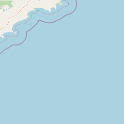
Map view of Waychinicup National Park

Use this park location map to pinpoint Waychinicup National Park in Australia, understand its exact geographic position, and read its mapped placement within the surrounding landscape more clearly.

Pigeon | © OpenStreetMap contributors

Location context for Waychinicup National Park

Western Australia
Park atlas

Uncover more protected landscapes and wildlife refuges across the Southern Western Australian region.

Find Other National Parks and Protected Areas Near Waychinicup National Park, Western Australia
Continue your exploration of Australia's protected areas by discovering other national parks and conservation landscapes near Waychinicup National Park, tracing similar coastal terrain and biodiversity-rich environments. This regional overview helps compare protected wildlands, map adjacent ecosystems, and understand the broader geographic context of Western Australia's unique conservation efforts.
National parkWestern Australia

Hassell National Park National Park: Mapped Protected Landscape in Western Australia

Explore the geographic identity and park boundaries of Hassell National Park.

Hassell National Park offers a focused view of protected natural landscapes within Western Australia. This atlas entry details the park's specific geographic scope and its designation as a national park, providing essential context for understanding its mapped features and regional landscape. Explore how Hassell National Park contributes to the protected area geography of the state.

Area
12.65 km²
Established
1971
IUCN
II
Scope
Mixed
National parkWestern Australia

Gull Rock National Park: Protected Landscape and Geographic Atlas Exploration

Discover mapped boundaries and natural terrain in Western Australia.

Gull Rock National Park serves as a key protected area for exploring the geographic diversity of Western Australia. As a national park, it offers a focal point for understanding mapped landscape features, conservation boundaries, and the unique natural terrain of the region. This entry provides essential context for atlas-based discovery of protected lands across Australia.

Area
21.04 km²
Established
2006
IUCN
II
Relief
Lowland
National parkWestern Australia

Torndirrup National Park National Park: Mapped Boundaries and Regional Landscape Context

Explore protected lands within Western Australia's geography.

Torndirrup National Park serves as a significant protected natural area, offering valuable insights into the geographic character of Western Australia. This detailed entry focuses on its mapped boundaries and its role as a protected landscape, providing essential context for atlas-based exploration of Australia's diverse regions and natural terrains.

Area
39.36 km²
Established
1918
IUCN
II
Visitors
250K annual
National parkWestern Australia

Porongurup National Park: Ancient Granite Peaks and Karri Forest Protected Landscape

Mapped terrain and geologic history in Western Australia.

Delve into Porongurup National Park, a protected landscape in Western Australia characterized by its ancient, billion-year-old granite peaks and a rare outlier of towering karri forest. This national park offers a unique geographic perspective, showcasing dramatic mountain terrain that has stood for eons. Explore the mapped boundaries and the distinct ecosystems that thrive within this ancient mountain system, providing rich context for regional atlas discovery and understanding the park's geological significance.

Area
26.21 km²
Established
1971
IUCN
II
Relief
Mountain
Watercolor illustration of rolling hills, mountains, and a coastal body of water
National parkWestern Australia

West Cape Howe National Park: Western Australia's Southernmost Coastal Protected Landscape

Explore dramatic sea cliffs, ancient karri forests, and Torbay Head.

West Cape Howe National Park offers a distinct protected landscape experience in Western Australia, highlighted by its position at mainland Australia's southernmost point, Torbay Head. This park showcases a rugged 23-kilometer stretch of the Southern Ocean coastline, featuring towering sea cliffs that descend to pristine beaches and rocky shores. Inland, visitors find ancient karri forests and diverse vegetation types, contributing to a rich mosaic of protected habitats. Its geographic significance and unique coastal terrain make it a key destination for understanding regional protected area geography.

Area
36.05 km²
Established
1985
IUCN
II
Relief
Lowland
National parkGreat Southern

Mount Lindesay National Park: Australian National Park Protected Landscape Details

Explore mapped boundaries and regional geographic context in Great Southern.

Gain a structured understanding of Mount Lindesay National Park, a designated national park in Australia's Great Southern region. This detail view focuses on its protected landscape identity, mapped geographic features, and its place within the nation's network of conservation areas. Discover the specific terrain and regional atlas context that makes this park a distinct element of Australia's natural geography.

Area
395.73 km²
Established
2004
IUCN
II
Relief
Mountain
Watercolor illustration of a coastal landscape with green vegetation, pink rock formations, and a calm body of water
National parkWestern Australia

William Bay National Park: Mapped Protected Area in Western Australia's Geography

Explore its national park boundaries and regional landscape context.

Delve into the protected landscape of William Bay National Park, a designated national park situated within the diverse geography of Western Australia. This resource provides critical information on its mapped boundaries and its role as a protected natural area. Understand the park's specific geographic setting and its contribution to the regional atlas of conservation landscapes, essential for detailed park and landscape discovery.

Area
17.34 km²
Established
1971
IUCN
II
Visitors
238K annual
National parkGreat Southern

Mount Roe National Park: Detailed Protected Landscape and Geographic Exploration

Mapped boundaries and natural terrain of this national park.

Mount Roe National Park offers a distinct protected landscape for atlas exploration, situated within the geographic scope of the Great Southern region. This detail page provides a structured view of the park's mapped boundaries and its natural terrain. Understand how Mount Roe National Park contributes to the regional geography and the overall map of protected areas in Australia.

Area
1,278 km²
Established
2004
IUCN
II
Scope
Terrestrial

Common questions about visiting, size, designation, and location context for Waychinicup National Park

Waychinicup National Park FAQs for park facts, access, geography, and protected area context
Find quick answers about Waychinicup National Park, including protected-area facts, park geography, trail and visitor context, and how the park fits into its surrounding country and regional landscape.
MoriAtlas Explorer

Continue Your Protected Areas Search Across the Global Atlas

Deepen your exploration by continuing the structured search for national parks and protected areas worldwide. Utilize the comprehensive filtering capabilities to compare different conservation landscapes and refine your understanding of global park geography. Discover more about the distribution and characteristics of protected natural areas.

Global natural geography