Mori Atlas logo
National parkTorndirrup National Park

Explore mapped boundaries and regional geographic context for this national park.

Torndirrup National Park: Australia's Protected Landscape in Western Australia

Torndirrup National Park represents a distinct protected landscape within the vast geography of Western Australia. As a national park, it offers critical context for understanding Australia's mapped natural areas and regional diversity. This page provides detailed atlas-style information, focusing on the park's protected boundaries and its place within the broader Western Australian landscape.

Coastal national parksGranite rock formationsWestern AustraliaGreat Southern regionGeological heritageMarine coast

Torndirrup National Park

National park

Park overview

Structured park overview, official facts, and landscape profile for Torndirrup National Park

Torndirrup National Park park facts, protected area profile, and essential visitor context
Review the core facts for Torndirrup National Park, including designation, size, terrain, visitor scale, habitats, and operating context in one park-focused overview.

About Torndirrup National Park

Torndirrup National Park protects a spectacular stretch of Western Australia's southern coastline, where the Southern Ocean has sculpted an extraordinary landscape of granite cliffs, arches, and blowholes over millions of years. The park lies along the western shore of King George Sound, approximately 400 kilometres southeast of Perth and just 10 kilometres from Albany, making it one of the most accessible coastal wilderness areas in the state. The geological foundation of the park is exceptionally ancient, with gneiss rocks dating back 1,300 to 1,600 million years forming the oldest components of the landscape. Granite intrusions occurred around 1,160 million years ago when the Australian Plate collided with the Antarctic Plate, forcing molten rock toward the surface. These granites now form the prominent tors visible throughout the park, particularly atop Stony Hill. The coastal scenery is characterised by steep cliffs, deep gullies, narrow chasms, and curved rock arches that showcase the raw power of ocean erosion. The park's position at the meeting point of the Southern Ocean and the southern Australian coast creates a distinctive maritime environment where visitors can witness the constant interaction between water and rock. Beyond the dramatic coastal features, the park encompasses inland areas of heathland, woodland, and forest, providing habitat for diverse plant and animal communities. The combination of geological antiquity, coastal drama, and ecological diversity makes Torndirrup a cornerstone of Western Australia's protected area network.

Quick facts and research context for Torndirrup National Park

Torndirrup National Park covers 39.36 square kilometres along the coast near Albany in Western Australia's Great Southern region. The park was established in 1918 and officially named in 1969 after the local Indigenous Australian clan. It features spectacular granite rock formations shaped over millions of years, including The Gap, Natural Bridge, and the Blowholes. The park contains flora and fauna typical of the southwest Australian biodiversity hotspot, including several rare and endangered species. The park receives around 250,000 visitors per year, making it the most visited national park in Western Australia.

Park context

Deeper park guide and search-rich context for Torndirrup National Park

Torndirrup National Park history, landscape, wildlife, and travel context
Explore Torndirrup National Park through its history, landscape character, ecosystems, wildlife, conservation priorities, cultural context, and seasonal travel timing in a structured park guide built for atlas discovery and search intent.

Why Torndirrup National Park stands out

Torndirrup National Park is best known for its dramatic coastal rock formations carved from ancient granite. The Gap is a striking natural chasm where the Southern Ocean surges through a narrow gorge, creating powerful waves that crash against the cliff walls. The Natural Bridge is a renowned geological feature, a natural arch formed by centuries of wave action on weaker rock layers. The Blowholes represent another impressive coastal phenomenon, where seawater is forced through gaps in the rock with considerable force. These three features form the core of the park's identity and draw the majority of visitors. The park's accessibility from Albany, combined with the dramatic spectacle of ocean meeting ancient rock, makes it a defining destination for understanding the coastal geography of southern Western Australia.

Torndirrup National Park history and protected-area timeline

Torndirrup National Park traces its institutional origins to 1918, when it was gazetted as one of the first national parks established in Western Australia. The park's creation reflected a growing recognition in the early twentieth century of the need to preserve outstanding natural landscapes for public enjoyment and conservation. For decades, the area operated under relatively minimal management, with the first official park ranger appointed only in 1973. In 1969, the park received its formal name, derived from the Indigenous Australian clan that historically inhabited this coastal region, acknowledging the deep human connection to the landscape predating European settlement. The park has faced significant fire events that have shaped its modern management and ecological character. A large bushfire in 2010 burnt through 700 hectares of bushland and caused the closure of Frenchman Bay Road, isolating both tourists and local residents. A subsequent fire in 2015 destroyed 616 hectares between Stony Hill and the Blowholes, including critically impacting populations of the endangered Banksia verticillata. In 2016, a major infrastructure upgrade costing A$6.1 million was completed at The Gap and Natural Bridge, introducing universally accessible viewing platforms including a cantilevered grated platform extending 40 metres above the ocean. Today, the park welcomes approximately 250,000 visitors annually, making it the most frequently visited national park in Western Australia.

Torndirrup National Park landscape and geographic character

The landscape of Torndirrup National Park is defined by the dramatic encounter between ancient crystalline rock and the perpetual forces of the Southern Ocean. The dominant geological material is granite, which forms the backbone of the park's most distinctive features. Along the coastline, the granite has been carved into spectacular cliff faces, deep vertical gullies, and natural arches that showcase the power of wave erosion over geological time. The Gap represents perhaps the most impressive example of this erosion, a narrow chasm where waves surge with tremendous violence, particularly during strong swell events. The Natural Bridge demonstrates how weaker rock layers succumb to wave action, creating a curved arch that has become one of the park's most photographed features. The Blowholes illustrate another dimension of coastal dynamics, where seawater forced through narrow rock fissures creates dramatic geysers. Inland from the coast, the landscape transitions to heath-covered slopes and woodland, with prominent granite tors such as Stony Hill rising above the surrounding terrain. The park encompasses the Torndirrup Peninsula, extending into King George Sound, with the Bald Head walk trail traversing this peninsula to its eastern terminus. The combination of vertical coastal cliffs, wave-carved formations, and inland rocky outcrops creates a landscape of exceptional visual variety and geological significance.

Torndirrup National Park ecosystems, habitats, and plant life

The natural environment of Torndirrup National Park reflects the extraordinary biodiversity of southwest Australia's Mediterranean climate zone, one of the world's recognised biodiversity hotspots. The park supports a rich array of plant communities adapted to the nutrient-poor soils and seasonal rainfall patterns of the region. Heathlands dominated by coastal plants such as native rosemary, banjine, and thick-leaved fanflower cover much of the park's non-forested areas. Woodland communities include the peppermint tree, a distinctive species with drooping willow-like foliage, and the swamp yate, a malleebark eucalyptus characteristic of wetter depressions. Banksias feature prominently throughout the park, with multiple species contributing to the park's floral character, including Banksia grandis with its large cylindrical flower spikes. The park contains several plant species of significant conservation concern. The Albany woolly-bush represents a rare hybrid, while the blue tinsel lily is listed as critically endangered with only a single known population remaining. These rare species underscore the park's conservation significance beyond its geological attractions. The habitat diversity, from coastal heath to woodland and forest, supports correspondingly diverse animal communities across the park's 39.36 square kilometre extent.

Torndirrup National Park wildlife and species highlights

Torndirrup National Park supports a variety of mammal, reptile, and bird species reflecting the ecological richness of the Great Southern region. Mammals commonly encountered include kangaroos, particularly western grey kangaroos that graze in open areas, along with smaller species such as bush rats and short-nosed bandicoots. Pygmy possums represent the park's smaller marsupial fauna, while echidnas may be spotted foraging in woodland areas. The park has historical significance for the dibbler, a rare marsupial first recorded in the area in 1876, though populations are now more commonly associated with other southwest Australian habitats. Reptile diversity includes several snake species common to the region, including tiger snakes and dugites, while the bardick and Children's python represent additional reptilian residents. Birdlife is particularly diverse, with honeyeaters and wattlebirds forming characteristic components of the park's avifauna. Western rosella, a colourful parakeet restricted to the southwest of Australia, occurs throughout wooded areas, while button quail inhabit heathland zones. Seabirds frequent the coastline, and seasonal congregations of whales and seals can be observed from cliff viewpoints during appropriate times of year. The discovery of the rare Main's assassin spider during a 2008 survey confirmed the presence of this ancient and threatened spider family within the park, adding to its conservation significance.

Torndirrup National Park conservation status and protection priorities

Torndirrup National Park exemplifies the dual challenges and responsibilities of protecting both geological heritage and ecological diversity in a heavily visited coastal setting. The park's geological features, with formations exceeding one billion years in age, represent an important record of Earth's early continental development and the processes that shaped the Australian continent. Several plant species within the park carry significant conservation status, with the critically endangered blue tinsel lily existing at only a single population globally. The 2015 bushfire that burnt 616 hectares notably impacted populations of Banksia verticillata, another critically endangered species, highlighting the vulnerability of the park's rare flora to fire events. The Main's assassin spider, discovered in the park in 2008 and listed as threatened, represents an ancient lineage of spiders with limited distribution, adding a significant faunal conservation dimension to the park's value. The park's extreme popularity, with 250,000 annual visitors, creates ongoing management challenges balancing public access with conservation outcomes. Infrastructure developments such as the 2016 upgrade at The Gap and Natural Bridge have sought to manage visitor impact through designed pathways and viewing platforms that concentrate foot traffic while protecting surrounding areas.

Torndirrup National Park cultural meaning and human context

The name Torndirrup derives from the Indigenous Australian clan that historically inhabited this coastal region, reflecting the deep connection between the park's landscape and Aboriginal heritage predating European settlement. The geological features of the area, particularly the dramatic coastal formations, held significance in traditional Indigenous understanding of the landscape, as places where natural forces and cultural narratives intersected. European exploration and settlement of the Albany region beginning in the early nineteenth century eventually led to recognition of the area's outstanding natural values, culminating in its protection as one of Western Australia's earliest national parks in 1918. The naming of the park in 1969 after the traditional custodians represented an acknowledgment of Indigenous heritage that continues to inform contemporary management approaches. The park's proximity to Albany, Western Australia's oldest permanent European settlement, provides historical context for the long relationship between the regional community and this distinctive coastal landscape.

Top sights and standout views in Torndirrup National Park

The dramatic coastal rock formations of Torndirrup National Park represent its most compelling attraction. The Gap offers a powerful spectacle where the Southern Ocean forces its way through a narrow granite chasm, with waves crashing against the cliff walls with remarkable force. The Natural Bridge provides a striking example of natural arch formation, a curved opening carved by relentless wave action through weaker rock layers. The Blowholes demonstrate another aspect of coastal dynamics, creating geysers of seawater when conditions allow. The park's network of walking trails, including the popular Jimmy Newhills walk and the Stony Hill Heritage Trail, provides access to both coastal features and inland viewpoints. The 10-kilometre Bald Head Walk along the Torndirrup Peninsula offers a more extended experience, culminating at the park's eastern edge with views across King George Sound. The 2016 infrastructure improvements, particularly the cantilevered viewing platform at The Gap, have enhanced visitor access while maintaining the dramatic sense of exposure to the ocean forces below.

Best time to visit Torndirrup National Park

Torndirrup National Park can be visited throughout the year, though the southern Australian climate creates distinct seasonal experiences. Summer months from December to February typically bring warmer temperatures and longer daylight hours, making early morning or late afternoon visits ideal to avoid peak heat and crowds. The Southern Ocean remains powerful year-round, with winter storms sometimes creating particularly dramatic wave conditions at The Gap and Blowholes, though rainfall increases during the winter months of June to August. Autumn and spring represent transitional seasons with moderate temperatures and reduced visitor numbers, potentially offering the most comfortable conditions for walking and sightseeing. Wildlife viewing opportunities vary with season, as whales may be observable from coastal lookouts during their migration periods. The park's popularity means that weekday visits or early morning arrivals during peak season provide the best opportunities for a more contemplative experience of the landscape.
Park location guide

Geography guide, regional context, and park location map for Torndirrup National Park

Torndirrup National Park park geography, regions, and map view in Australia
Understand where Torndirrup National Park sits in Australia through a broader geographic reading of the surrounding landscape, nearby location context, and its mapped position within the national park landscape.

How Torndirrup National Park fits into Australia

Australia is a constitutional monarchy and federal parliamentary democracy comprising six states and ten territories. With a population of nearly 28 million, it is one of the world's most urbanised countries, with most people concentrated on the eastern seaboard. The country has a high Human Development Index and is known for its cultural diversity, ancient Aboriginal heritage, and unique wildlife.

Wider geography shaping Torndirrup National Park in Australia

Australia occupies the entire Australian continent, the island of Tasmania, and numerous smaller islands. It is the world's flattest and driest inhabited continent, featuring vast deserts in the interior (the Outback), tropical rainforests along the eastern coast, and a coastline bordering the Indian and Pacific Oceans.

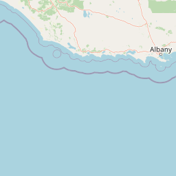
Map view of Torndirrup National Park

Use this park location map to pinpoint Torndirrup National Park in Australia, understand its exact geographic position, and read its mapped placement within the surrounding landscape more clearly.

Pigeon | © OpenStreetMap contributors

Location context for Torndirrup National Park

Great SouthernWestern Australia
Park atlas

Trace the regional spread of protected coastal landscapes in Western Australia, comparing geological heritage and diverse marine environments.

Explore Nearby National Parks and Protected Areas Around Torndirrup National Park
After exploring Torndirrup National Park's dramatic granite cliffs and coastal features, browse other national parks and protected areas across Western Australia's Great Southern region. Compare their unique geological heritage, diverse marine ecosystems, and broader regional context to deepen your geographic discovery of protected landscapes.
National parkWestern Australia

Gull Rock National Park: Protected Landscape and Geographic Atlas Exploration

Discover mapped boundaries and natural terrain in Western Australia.

Gull Rock National Park serves as a key protected area for exploring the geographic diversity of Western Australia. As a national park, it offers a focal point for understanding mapped landscape features, conservation boundaries, and the unique natural terrain of the region. This entry provides essential context for atlas-based discovery of protected lands across Australia.

Area
21.04 km²
Established
2006
IUCN
II
Relief
Lowland
Watercolor illustration of rolling hills, mountains, and a coastal body of water
National parkWestern Australia

West Cape Howe National Park: Western Australia's Southernmost Coastal Protected Landscape

Explore dramatic sea cliffs, ancient karri forests, and Torbay Head.

West Cape Howe National Park offers a distinct protected landscape experience in Western Australia, highlighted by its position at mainland Australia's southernmost point, Torbay Head. This park showcases a rugged 23-kilometer stretch of the Southern Ocean coastline, featuring towering sea cliffs that descend to pristine beaches and rocky shores. Inland, visitors find ancient karri forests and diverse vegetation types, contributing to a rich mosaic of protected habitats. Its geographic significance and unique coastal terrain make it a key destination for understanding regional protected area geography.

Area
36.05 km²
Established
1985
IUCN
II
Relief
Lowland
National parkWestern Australia

Porongurup National Park: Ancient Granite Peaks and Karri Forest Protected Landscape

Mapped terrain and geologic history in Western Australia.

Delve into Porongurup National Park, a protected landscape in Western Australia characterized by its ancient, billion-year-old granite peaks and a rare outlier of towering karri forest. This national park offers a unique geographic perspective, showcasing dramatic mountain terrain that has stood for eons. Explore the mapped boundaries and the distinct ecosystems that thrive within this ancient mountain system, providing rich context for regional atlas discovery and understanding the park's geological significance.

Area
26.21 km²
Established
1971
IUCN
II
Relief
Mountain
National parkWestern Australia

Waychinicup National Park: National Park Protected Landscape Atlas Entry

Explore Western Australia's mapped natural landscapes and park geography.

Gain a structured understanding of Waychinicup National Park as a key protected landscape within Western Australia. This detailed atlas entry focuses on its geographic distribution and mapped boundaries, providing essential context for regional park and natural landscape exploration. Discover the unique characteristics of this national park's setting and its place within the broader mapped terrain.

Area
39.82 km²
Established
1990
IUCN
II
Relief
Mixed relief
National parkGreat Southern

Mount Lindesay National Park: Australian National Park Protected Landscape Details

Explore mapped boundaries and regional geographic context in Great Southern.

Gain a structured understanding of Mount Lindesay National Park, a designated national park in Australia's Great Southern region. This detail view focuses on its protected landscape identity, mapped geographic features, and its place within the nation's network of conservation areas. Discover the specific terrain and regional atlas context that makes this park a distinct element of Australia's natural geography.

Area
395.73 km²
Established
2004
IUCN
II
Relief
Mountain
Watercolor illustration of a coastal landscape with green vegetation, pink rock formations, and a calm body of water
National parkWestern Australia

William Bay National Park: Mapped Protected Area in Western Australia's Geography

Explore its national park boundaries and regional landscape context.

Delve into the protected landscape of William Bay National Park, a designated national park situated within the diverse geography of Western Australia. This resource provides critical information on its mapped boundaries and its role as a protected natural area. Understand the park's specific geographic setting and its contribution to the regional atlas of conservation landscapes, essential for detailed park and landscape discovery.

Area
17.34 km²
Established
1971
IUCN
II
Visitors
238K annual
National parkWestern Australia

Hassell National Park National Park: Mapped Protected Landscape in Western Australia

Explore the geographic identity and park boundaries of Hassell National Park.

Hassell National Park offers a focused view of protected natural landscapes within Western Australia. This atlas entry details the park's specific geographic scope and its designation as a national park, providing essential context for understanding its mapped features and regional landscape. Explore how Hassell National Park contributes to the protected area geography of the state.

Area
12.65 km²
Established
1971
IUCN
II
Scope
Mixed
National parkGreat Southern

Mount Roe National Park: Detailed Protected Landscape and Geographic Exploration

Mapped boundaries and natural terrain of this national park.

Mount Roe National Park offers a distinct protected landscape for atlas exploration, situated within the geographic scope of the Great Southern region. This detail page provides a structured view of the park's mapped boundaries and its natural terrain. Understand how Mount Roe National Park contributes to the regional geography and the overall map of protected areas in Australia.

Area
1,278 km²
Established
2004
IUCN
II
Scope
Terrestrial

Common questions about visiting, size, designation, and location context for Torndirrup National Park

Torndirrup National Park FAQs for park facts, access, geography, and protected area context
Find quick answers about Torndirrup National Park, including protected-area facts, park geography, trail and visitor context, and how the park fits into its surrounding country and regional landscape.
MoriAtlas Explorer

Continue Your Protected Areas Search Across the Global Atlas

Deepen your exploration by continuing the structured search for national parks and protected areas worldwide. Utilize the comprehensive filtering capabilities to compare different conservation landscapes and refine your understanding of global park geography. Discover more about the distribution and characteristics of protected natural areas.

Global natural geography
Torndirrup National Park: National Park Map & Protected Area Details, Western Australia