Mori Atlas logo
National parkMount Lindesay National Park

Discover the mapped boundaries and regional geography of this Australian national park.

Mount Lindesay National Park: National Park Protected Landscape & Geographic Context

Mount Lindesay National Park stands as a key protected landscape within Australia's Great Southern region. This page provides detailed atlas-style insight into its geographic extent, mapped boundaries, and its role within the national park system. Explore the specific natural terrain and landscape context that defines this significant conservation area, ideal for understanding Australia's protected lands distribution.

National ParkWestern AustraliaGreat Southern RegionWalpole Wilderness AreaJarrah-Karri ForestSouthwest Australia Woodlands

Mount Lindesay National Park

National park

Park overview

Structured park overview, official facts, and landscape profile for Mount Lindesay National Park

Mount Lindesay National Park park facts, protected area profile, and essential visitor context
Review the core facts for Mount Lindesay National Park, including designation, size, terrain, visitor scale, habitats, and operating context in one park-focused overview.

About Mount Lindesay National Park

Mount Lindesay National Park represents a significant conservation achievement in southwestern Australia, established in 2004 as part of a coordinated effort to protect the outstanding natural values of the Walpole region. The park forms part of a larger wilderness area that includes several other national parks and reserves, creating a contiguous protected landscape that preserves ecological corridors and biological connectivity across the southern coastal zone of Western Australia. The park's location at the eastern boundary of this wilderness complex positions it at the transition between different ecological communities, with the jarrah-karri forest and shrublands of the southern portion extending to the coast, while the northern areas fall within the southwest Australia woodlands. This ecological diversity makes the park an important reference area for understanding the biodiversity patterns of the Great Southern region. The park's administrative oversight by the Parks and Wildlife Service ensures management consistent with the broader conservation objectives for the Walpole Wilderness Area, which emphasizes wilderness preservation, ecosystem integrity, and sustainable visitor experiences.

Quick facts and research context for Mount Lindesay National Park

Mount Lindesay National Park occupies a coastal position in the Great Southern region of Western Australia, forming part of the Walpole Wilderness Area established in 2004. The park covers 395.73 square kilometers and represents the easternmost protected area within this wilderness complex. It is administered by the Parks and Wildlife Service of the Department of Biodiversity, Conservation and Attractions. The park straddles the boundary between the jarrah-karri forest and shrublands ecoregion along its southern coastal extent and the southwest Australia woodlands ecoregion to the north.

Park context

Deeper park guide and search-rich context for Mount Lindesay National Park

Mount Lindesay National Park history, landscape, wildlife, and travel context
Explore Mount Lindesay National Park through its history, landscape character, ecosystems, wildlife, conservation priorities, cultural context, and seasonal travel timing in a structured park guide built for atlas discovery and search intent.

Why Mount Lindesay National Park stands out

The park is best known for its position at the eastern edge of the Walpole Wilderness Area, protecting a transition zone between two major southwestern Australian bioregions. The jarrah-karri forest and shrublands that dominate the southern portions of the park represent some of Australia's most species-rich temperate woodlands, while the park's coastal positioning provides access to scenic vistas from Granite Peak toward Mount Roe. The wilderness area designation reflects the region's outstanding natural character and relatively undisturbed landscapes.

Mount Lindesay National Park history and protected-area timeline

Mount Lindesay National Park was designated in 2004 as part of the establishment of the Walpole Wilderness Area, a major conservation initiative that brought together multiple national parks and reserves under a unified wilderness protection framework. The creation of this wilderness area represented a significant expansion of Western Australia's protected area network in the Great Southern region, consolidating protection for the distinctive landscapes and ecological communities of the southern coast. The park was named after Mount Lindesay, a prominent geographic feature in the region, and was positioned to complement the existing protected areas including adjacent Mount Roe National Park to the north and northwest. The establishment of the park and the broader wilderness area reflected growing recognition of the ecological significance of southwestern Australia's forests and woodlands, which support high levels of endemism and represent some of Australia's most important temperate ecosystems.

Mount Lindesay National Park landscape and geographic character

The landscape of Mount Lindesay National Park reflects the transitional character of its position along the southern coast of Western Australia. The terrain encompasses the forested slopes and ridgelines associated with the southern extension of the jarrah-karri forest, with the landscape descending toward the coast where the vegetation transitions to more open shrubland communities. The park includes scenic viewpoints such as Granite Peak, from which visitors can view Mount Roe rising in the adjacent national park. The combination of forested slopes, coastal exposure, and the relative remoteness of the area contributes to the wilderness character that distinguishes this portion of the Great Southern coastline. The park's terrain supports the diverse ecological communities that characterize the transition between the major bioregions it encompasses.

Mount Lindesay National Park ecosystems, habitats, and plant life

The ecological character of Mount Lindesay National Park is defined by its position at the boundary of two significant Australian bioregions. The southern and coastal portions of the park fall within the jarrah-karri forest and shrublands ecoregion, one of the most biodiverse temperate forest ecosystems in Australia, characterized by the iconic jarrah and karri tree species and a rich understory of shrubs and herbs. The northern areas of the park are part of the southwest Australia woodlands, a more open woodland ecosystem adapted to the region's Mediterranean climate and nutrient-poor soils. This ecological transition zone within a single protected area enhances the park's conservation value by preserving the connectivity between these distinct plant communities and the associated fauna they support.

Mount Lindesay National Park wildlife and species highlights

The wildlife of Mount Lindesay National Park is characteristic of southwestern Australia's temperate forest and woodland ecosystems. The jarrah-karri forests and southwest Australia woodlands provide habitat for a diverse array of bird species, mammals, and reptiles adapted to these Mediterranean-climate environments. While the Wikipedia source provides limited specific detail on wildlife species, the broader Walpole Wilderness Area is known for populations of western grey kangaroos, various possum species, and diverse birdlife including parrots, cockatoos, and honeyeaters. The old-growth forests and relatively unmodified landscapes support ecological communities that maintain healthy populations of native fauna.

Mount Lindesay National Park conservation status and protection priorities

Mount Lindesay National Park contributes significantly to the conservation of southwestern Australia's unique ecosystems as the easternmost component of the Walpole Wilderness Area. The park's protection of the transition between jarrah-karri forest and southwest Australia woodlands preserves ecological communities that are endemic to the Southwest Australian Floristic Region, one of the world's biodiversity hotspots recognized for its exceptional concentration of plant species found nowhere else on Earth. The wilderness area designation reflects the national and international significance of these landscapes, with the 2004 establishment of the park and surrounding protected areas representing a major commitment to long-term conservation of this region's outstanding natural values.

Mount Lindesay National Park cultural meaning and human context

The Mount Lindesay area is situated within the traditional lands of Aboriginal peoples with historical connections to the southern coast of Western Australia. While the Wikipedia source provides limited detail on cultural history, the broader Walpole region contains places of significance to local Indigenous communities, and the establishment of the protected area has involved consideration of Aboriginal cultural values. The park's name references Mount Lindesay, which was named by early European explorers or surveyors, reflecting the colonial naming practices that characterized the mapping and settlement of the Great Southern region.

Top sights and standout views in Mount Lindesay National Park

The easternmost position of Mount Lindesay National Park within the Walpole Wilderness Area makes it a key access point for visitors exploring this protected landscape complex. The park offers access to the distinctive transition between jarrah-karri forest and southwest Australia woodlands, providing opportunities to experience the ecological diversity that characterizes this corner of Western Australia. The views from Granite Peak toward Mount Roe showcase the scenic character of the protected coastline, while the park's proximity to other components of the wilderness area enables exploration of the broader protected landscape. The wilderness area designation emphasizes the region's retained natural character and opportunities for remote, nature-focused experiences.

Best time to visit Mount Lindesay National Park

The optimal time to visit Mount Lindesay National Park aligns with the warmer months from late spring through summer, when the weather is generally mild and conducive to outdoor exploration. The Mediterranean climate of the Great Southern region brings warmer, drier conditions from December through February, making this the most popular period for bushwalking and scenic drives. Autumn and winter bring cooler temperatures and increased rainfall, which can limit access to some trails but also bring a different character to the landscape as the vegetation responds to the seasonal moisture. The park can be visited year-round, though visitors should be prepared for variable weather conditions and should check current conditions before traveling to more remote areas.

Park location guide

Geography guide, regional context, and park location map for Mount Lindesay National Park

Mount Lindesay National Park park geography, regions, and map view in Australia
Understand where Mount Lindesay National Park sits in Australia through a broader geographic reading of the surrounding landscape, nearby location context, and its mapped position within the national park landscape.

How Mount Lindesay National Park fits into Australia

Australia is a constitutional monarchy and federal parliamentary democracy comprising six states and ten territories. With a population of nearly 28 million, it is one of the world's most urbanised countries, with most people concentrated on the eastern seaboard. The country has a high Human Development Index and is known for its cultural diversity, ancient Aboriginal heritage, and unique wildlife.

Wider geography shaping Mount Lindesay National Park in Australia

Australia occupies the entire Australian continent, the island of Tasmania, and numerous smaller islands. It is the world's flattest and driest inhabited continent, featuring vast deserts in the interior (the Outback), tropical rainforests along the eastern coast, and a coastline bordering the Indian and Pacific Oceans.

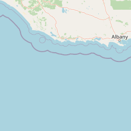
Map view of Mount Lindesay National Park

Use this park location map to pinpoint Mount Lindesay National Park in Australia, understand its exact geographic position, and read its mapped placement within the surrounding landscape more clearly.

Pigeon | © OpenStreetMap contributors

Location context for Mount Lindesay National Park

Great SouthernWestern Australia
Park atlas

Discover Adjoining National Parks and Protected Landscapes in Western Australia's Great Southern Region, Extending from Mount Lindesay National Park

Explore Nearby National Parks and Protected Areas Around Mount Lindesay National Park, Western Australia
Explore a curated selection of national parks and other protected areas situated near Mount Lindesay National Park in Western Australia's Great Southern region. Compare the mapped geography of contiguous wilderness areas, examine diverse forest and coastal landscapes, and understand the regional spread of protected conservation efforts.
Watercolor illustration of a coastal landscape with green vegetation, pink rock formations, and a calm body of water
National parkWestern Australia

William Bay National Park: Mapped Protected Area in Western Australia's Geography

Explore its national park boundaries and regional landscape context.

Delve into the protected landscape of William Bay National Park, a designated national park situated within the diverse geography of Western Australia. This resource provides critical information on its mapped boundaries and its role as a protected natural area. Understand the park's specific geographic setting and its contribution to the regional atlas of conservation landscapes, essential for detailed park and landscape discovery.

Area
17.34 km²
Established
1971
IUCN
II
Visitors
238K annual
Watercolor illustration of rolling hills, mountains, and a coastal body of water
National parkWestern Australia

West Cape Howe National Park: Western Australia's Southernmost Coastal Protected Landscape

Explore dramatic sea cliffs, ancient karri forests, and Torbay Head.

West Cape Howe National Park offers a distinct protected landscape experience in Western Australia, highlighted by its position at mainland Australia's southernmost point, Torbay Head. This park showcases a rugged 23-kilometer stretch of the Southern Ocean coastline, featuring towering sea cliffs that descend to pristine beaches and rocky shores. Inland, visitors find ancient karri forests and diverse vegetation types, contributing to a rich mosaic of protected habitats. Its geographic significance and unique coastal terrain make it a key destination for understanding regional protected area geography.

Area
36.05 km²
Established
1985
IUCN
II
Relief
Lowland
National parkGreat Southern

Mount Roe National Park: Detailed Protected Landscape and Geographic Exploration

Mapped boundaries and natural terrain of this national park.

Mount Roe National Park offers a distinct protected landscape for atlas exploration, situated within the geographic scope of the Great Southern region. This detail page provides a structured view of the park's mapped boundaries and its natural terrain. Understand how Mount Roe National Park contributes to the regional geography and the overall map of protected areas in Australia.

Area
1,278 km²
Established
2004
IUCN
II
Scope
Terrestrial
National parkWestern Australia

Porongurup National Park: Ancient Granite Peaks and Karri Forest Protected Landscape

Mapped terrain and geologic history in Western Australia.

Delve into Porongurup National Park, a protected landscape in Western Australia characterized by its ancient, billion-year-old granite peaks and a rare outlier of towering karri forest. This national park offers a unique geographic perspective, showcasing dramatic mountain terrain that has stood for eons. Explore the mapped boundaries and the distinct ecosystems that thrive within this ancient mountain system, providing rich context for regional atlas discovery and understanding the park's geological significance.

Area
26.21 km²
Established
1971
IUCN
II
Relief
Mountain
National parkWestern Australia

Torndirrup National Park National Park: Mapped Boundaries and Regional Landscape Context

Explore protected lands within Western Australia's geography.

Torndirrup National Park serves as a significant protected natural area, offering valuable insights into the geographic character of Western Australia. This detailed entry focuses on its mapped boundaries and its role as a protected landscape, providing essential context for atlas-based exploration of Australia's diverse regions and natural terrains.

Area
39.36 km²
Established
1918
IUCN
II
Visitors
250K annual
National parkWestern Australia

Walpole-Nornalup National Park: Explore Protected Landscape and Regional Geography

Mapped boundaries and natural terrain context in Western Australia.

Walpole-Nornalup National Park offers a focused lens for understanding protected landscapes. As a designated national park in Western Australia, it provides valuable insights into regional geography and mapped natural terrain. This detailed view allows for a clear appreciation of the park's specific protected area characteristics and its place within the larger geographic atlas of the state.

Area
194.48 km²
Established
1910
IUCN
II
Visitors
158.2K annual
National parkWestern Australia

Mount Frankland National Park: Explore Western Australia's Old-Growth Forested Landscape

Granite peaks and unique regional geography within a protected wilderness area.

Mount Frankland National Park in Western Australia is a protected area renowned for its exceptional old-growth karri and red tingle forests, some of the world's tallest tree species. The park's landscape is shaped by low granite hills and dramatic peaks, including the 411-meter Mount Frankland, offering expansive views across the wilderness. As a key component of the Walpole Wilderness Area, this national park provides a rich geographical context for understanding conservation and mapped natural landscapes in Southwest Australia.

Area
373.59 km²
Established
1988
IUCN
II
Relief
Upland
National parkWestern Australia

Gull Rock National Park: Protected Landscape and Geographic Atlas Exploration

Discover mapped boundaries and natural terrain in Western Australia.

Gull Rock National Park serves as a key protected area for exploring the geographic diversity of Western Australia. As a national park, it offers a focal point for understanding mapped landscape features, conservation boundaries, and the unique natural terrain of the region. This entry provides essential context for atlas-based discovery of protected lands across Australia.

Area
21.04 km²
Established
2006
IUCN
II
Relief
Lowland

Common questions about visiting, size, designation, and location context for Mount Lindesay National Park

Mount Lindesay National Park FAQs for park facts, access, geography, and protected area context
Find quick answers about Mount Lindesay National Park, including protected-area facts, park geography, trail and visitor context, and how the park fits into its surrounding country and regional landscape.
MoriAtlas Explorer

Continue Your Protected Areas Search Across the Global Atlas

Deepen your exploration by continuing the structured search for national parks and protected areas worldwide. Utilize the comprehensive filtering capabilities to compare different conservation landscapes and refine your understanding of global park geography. Discover more about the distribution and characteristics of protected natural areas.

Global natural geography