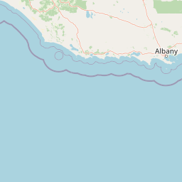
Why Mount Lindesay National Park stands out
The park is best known for its position at the eastern edge of the Walpole Wilderness Area, protecting a transition zone between two major southwestern Australian bioregions. The jarrah-karri forest and shrublands that dominate the southern portions of the park represent some of Australia's most species-rich temperate woodlands, while the park's coastal positioning provides access to scenic vistas from Granite Peak toward Mount Roe. The wilderness area designation reflects the region's outstanding natural character and relatively undisturbed landscapes.
Mount Lindesay National Park history and protected-area timeline
Mount Lindesay National Park was designated in 2004 as part of the establishment of the Walpole Wilderness Area, a major conservation initiative that brought together multiple national parks and reserves under a unified wilderness protection framework. The creation of this wilderness area represented a significant expansion of Western Australia's protected area network in the Great Southern region, consolidating protection for the distinctive landscapes and ecological communities of the southern coast. The park was named after Mount Lindesay, a prominent geographic feature in the region, and was positioned to complement the existing protected areas including adjacent Mount Roe National Park to the north and northwest. The establishment of the park and the broader wilderness area reflected growing recognition of the ecological significance of southwestern Australia's forests and woodlands, which support high levels of endemism and represent some of Australia's most important temperate ecosystems.
Mount Lindesay National Park landscape and geographic character
The landscape of Mount Lindesay National Park reflects the transitional character of its position along the southern coast of Western Australia. The terrain encompasses the forested slopes and ridgelines associated with the southern extension of the jarrah-karri forest, with the landscape descending toward the coast where the vegetation transitions to more open shrubland communities. The park includes scenic viewpoints such as Granite Peak, from which visitors can view Mount Roe rising in the adjacent national park. The combination of forested slopes, coastal exposure, and the relative remoteness of the area contributes to the wilderness character that distinguishes this portion of the Great Southern coastline. The park's terrain supports the diverse ecological communities that characterize the transition between the major bioregions it encompasses.
Mount Lindesay National Park ecosystems, habitats, and plant life
The ecological character of Mount Lindesay National Park is defined by its position at the boundary of two significant Australian bioregions. The southern and coastal portions of the park fall within the jarrah-karri forest and shrublands ecoregion, one of the most biodiverse temperate forest ecosystems in Australia, characterized by the iconic jarrah and karri tree species and a rich understory of shrubs and herbs. The northern areas of the park are part of the southwest Australia woodlands, a more open woodland ecosystem adapted to the region's Mediterranean climate and nutrient-poor soils. This ecological transition zone within a single protected area enhances the park's conservation value by preserving the connectivity between these distinct plant communities and the associated fauna they support.
Mount Lindesay National Park wildlife and species highlights
The wildlife of Mount Lindesay National Park is characteristic of southwestern Australia's temperate forest and woodland ecosystems. The jarrah-karri forests and southwest Australia woodlands provide habitat for a diverse array of bird species, mammals, and reptiles adapted to these Mediterranean-climate environments. While the Wikipedia source provides limited specific detail on wildlife species, the broader Walpole Wilderness Area is known for populations of western grey kangaroos, various possum species, and diverse birdlife including parrots, cockatoos, and honeyeaters. The old-growth forests and relatively unmodified landscapes support ecological communities that maintain healthy populations of native fauna.
Mount Lindesay National Park conservation status and protection priorities
Mount Lindesay National Park contributes significantly to the conservation of southwestern Australia's unique ecosystems as the easternmost component of the Walpole Wilderness Area. The park's protection of the transition between jarrah-karri forest and southwest Australia woodlands preserves ecological communities that are endemic to the Southwest Australian Floristic Region, one of the world's biodiversity hotspots recognized for its exceptional concentration of plant species found nowhere else on Earth. The wilderness area designation reflects the national and international significance of these landscapes, with the 2004 establishment of the park and surrounding protected areas representing a major commitment to long-term conservation of this region's outstanding natural values.
Mount Lindesay National Park cultural meaning and human context
The Mount Lindesay area is situated within the traditional lands of Aboriginal peoples with historical connections to the southern coast of Western Australia. While the Wikipedia source provides limited detail on cultural history, the broader Walpole region contains places of significance to local Indigenous communities, and the establishment of the protected area has involved consideration of Aboriginal cultural values. The park's name references Mount Lindesay, which was named by early European explorers or surveyors, reflecting the colonial naming practices that characterized the mapping and settlement of the Great Southern region.
Top sights and standout views in Mount Lindesay National Park
The easternmost position of Mount Lindesay National Park within the Walpole Wilderness Area makes it a key access point for visitors exploring this protected landscape complex. The park offers access to the distinctive transition between jarrah-karri forest and southwest Australia woodlands, providing opportunities to experience the ecological diversity that characterizes this corner of Western Australia. The views from Granite Peak toward Mount Roe showcase the scenic character of the protected coastline, while the park's proximity to other components of the wilderness area enables exploration of the broader protected landscape. The wilderness area designation emphasizes the region's retained natural character and opportunities for remote, nature-focused experiences.
Best time to visit Mount Lindesay National Park
The optimal time to visit Mount Lindesay National Park aligns with the warmer months from late spring through summer, when the weather is generally mild and conducive to outdoor exploration. The Mediterranean climate of the Great Southern region brings warmer, drier conditions from December through February, making this the most popular period for bushwalking and scenic drives. Autumn and winter bring cooler temperatures and increased rainfall, which can limit access to some trails but also bring a different character to the landscape as the vegetation responds to the seasonal moisture. The park can be visited year-round, though visitors should be prepared for variable weather conditions and should check current conditions before traveling to more remote areas.