

Mori Atlas logo
National parkHassell National Park

Map Hassell National Park's protected landscape within the diverse geography of Western Australia.

Hassell National Park National Park: Protected Area Boundaries and Geographic Context

Hassell National Park represents a distinct protected area within the vast geography of Western Australia. This page serves as a dedicated atlas entry for understanding the park's specific boundaries, its role as a national park, and its unique position within the state's broader natural landscape context. Delve into the mapped features and geographic identity that define Hassell National Park for structured discovery.

Wildlife CorridorWestern AustraliaGreat Southern RegionProtected AreaBanksiaKwongan

Hassell National Park

National park

Park overview

Structured park overview, official facts, and landscape profile for Hassell National Park

Hassell National Park park facts, protected area profile, and essential visitor context
Review the core facts for Hassell National Park, including designation, size, terrain, visitor scale, habitats, and operating context in one park-focused overview.

About Hassell National Park

Hassell National Park represents a conservation refuge in one of Australia's most biologically diverse regions. The park's strategic position along the South Coast Highway places it at the intersection of multiple distinct environmental zones, allowing it to function as a vital passage for wildlife movement between coastal heathlands, inland forests, and riverine environments. The corridor role that Hassell plays is particularly significant given the extent of agricultural conversion in the surrounding Great Southern region, which has left much of the original vegetation isolated in remnant patches. By connecting these fragmented habitats, the park supports genetic exchange between wildlife populations that would otherwise be isolated, enhancing the resilience and viability of species throughout the broader landscape. The park's protection extends to the diverse plant communities that characterize the area, including the distinctive shrublands and heath associations typical of southwestern Australia's Mediterranean climate zone. While the park lacks the dramatic geological features or iconic landscapes of larger reserves, its ecological importance is substantial given the corridor function it serves and the rare species it harbours.

Quick facts and research context for Hassell National Park

Hassell National Park occupies 12.65 square kilometres in the Great Southern region of Western Australia, situated along the South Coast Highway between Manypeaks and Wellstead. The park was formally established in 1971 and is managed by the Western Australian Department of Environment and Conservation. It serves as an important wildlife corridor connecting multiple significant ecological areas in the southern part of the state. The park contains a rare population of Brown's banksia, with an estimated 100 to 200 individual plants recorded within its boundaries. Unlike many national parks, Hassell offers no visitor facilities and charges no entry fee, reflecting its primary role as a conservation reserve rather than a developed tourist destination.

Park context

Deeper park guide and search-rich context for Hassell National Park

Hassell National Park history, landscape, wildlife, and travel context
Explore Hassell National Park through its history, landscape character, ecosystems, wildlife, conservation priorities, cultural context, and seasonal travel timing in a structured park guide built for atlas discovery and search intent.

Why Hassell National Park stands out

Hassell National Park is best known for its role as a critical wildlife corridor linking fragmented ecosystems across the Great Southern landscape. The park contains one of the few remaining populations of Brown's banksia, a highly endangered plant species with only 100 to 200 individuals recorded within the reserve. This Banksia species is recognized as a significant conservation priority due to its limited distribution and rarity. The corridor function of the park connecting Mount Manypeaks and Waychinicup to Cheynes Beach and the Pallinup River makes it especially important for maintaining ecological connectivity in a region where agricultural development has fragmented much of the native vegetation.

Hassell National Park history and protected-area timeline

The park was named in honour of John Hassell, a retired sea captain who became a significant figure in the early pastoral development of Western Australia's southern regions during the mid-nineteenth century. Hassell extended his pastoral operations eastward from the Frankland area to as far as Jerramungup during the 1850s, effectively opening up extensive tracts of previously unexplored or unused land for grazing purposes. His activities contributed to the broader pattern of European settlement and agricultural expansion that transformed much of the Great Southern region. The park was formally declared as a protected area in 1971, recognizing both its ecological values and its significance as a living record of the region's pastoral heritage. The establishment of the reserve reflected growing awareness of the need to preserve remaining native vegetation and wildlife habitats in areas that had escaped intensive agricultural development.

Hassell National Park landscape and geographic character

The landscape of Hassell National Park consists primarily of undulating terrain typical of the Great Southern region's coastal plain, with vegetation dominated by dense scrub and heath associations characteristic of southwestern Australia's kwongan plant community. The area lies inland from the immediate coastline but retains strong connections to the coastal environments through the corridor that links to the Mount Manypeaks area and the Cheynes Beach region. The South Coast Highway passes through the park, creating a transport corridor that divides the reserve while also providing the connective link to surrounding environmental areas. The terrain supports a range of soil types that sustain the diverse plant communities, with the vegetation structure providing important habitat for numerous species despite the relatively limited area of the reserve.

Hassell National Park ecosystems, habitats, and plant life

The ecological character of Hassell National Park is defined by its function as a vegetation and wildlife corridor within a broader landscape that has been extensively modified by agricultural activities. The park supports plant communities representative of the Great Southern bioregion, including the kwongan heath formations that are a distinctive feature of southwestern Australia's flora. The dense scrub and shrubland habitats provide shelter and foraging resources for a variety of native species, while the corridor function enables movement between larger protected areas and remnant vegetation patches. The presence of Brown's banksia within the park represents a particularly significant ecological element, as this species is restricted to very limited populations in the wild and depends on fire and specific pollination relationships for successful recruitment.

Hassell National Park wildlife and species highlights

The wildlife corridor function of Hassell National Park is its most important ecological characteristic, supporting the movement of fauna between the Mount Manypeaks and Waychinicup areas and the Cheynes Beach and Pallinup River regions. The dense vegetation provides habitat for various bird species, reptiles, and small mammals that depend on connected habitats for foraging, breeding, and genetic exchange. The presence of Brown's banksia, while a plant rather than animal species, indicates good ecological health and appropriate fire regimes, as this species requires specific conditions for germination and survival. The corridor is particularly valuable for mobile species that require large home ranges or seasonal movement patterns, allowing them to traverse between areas that would otherwise be isolated by cleared agricultural land.

Hassell National Park conservation status and protection priorities

Hassell National Park contributes to conservation outcomes in the Great Southern region primarily through its role as a connective link between larger protected areas and intact vegetation remnants. The corridor function is critical in a landscape where agricultural development has fragmented native ecosystems, making connectivity essential for maintaining viable wildlife populations and enabling species to respond to environmental changes. The protection of Brown's banksia represents a specific conservation priority, as this species is listed as endangered and depends on the limited populations within the park for its survival. The reserve also preserves examples of the kwongan plant community that has been extensively cleared across its former range, maintaining representative samples of the region's original vegetation types. The park's designation as a Category II protected area under the IUCN classification reflects its primary purpose of ecosystem conservation and protection of natural values.

Hassell National Park cultural meaning and human context

The park carries historical significance through its association with John Hassell, whose pastoral activities during the 1850s shaped much of the early European settlement pattern in the Great Southern region. Hassell's extension of his leasehold properties from Frankland eastward to Jerramungup represented the frontier expansion of grazing enterprises into lands that had previously supported indigenous communities and remained relatively untouched by European settlers. The naming of the park preserves this historical connection to Western Australia's pastoral development era, providing a tangible link between the contemporary conservation reserve and the region's colonial history. The South Coast Highway corridor that passes through the park represents the modern transportation route that follows much the same path as the early pastoral expansion, linking the areas that Hassell opened to settlement.

Top sights and standout views in Hassell National Park

Hassell National Park's standout feature is its role as a critical wildlife corridor connecting multiple significant ecological areas in the Great Southern region. The park protects one of only a few known populations of Brown's banksia, an endangered plant species of limited distribution. Its location along the South Coast Highway between Manypeaks and Wellstead positions it as a vital link in the regional conservation network. The absence of visitor facilities and entry fees underscores its primary function as a conservation reserve focused on protecting ecological values rather than providing recreational experiences. The park demonstrates how smaller protected areas can play disproportionate conservation roles through corridor connectivity in heavily modified agricultural landscapes.

Best time to visit Hassell National Park

The most suitable time to visit Hassell National Park would be during the cooler months of autumn and spring when temperatures are moderate and the characteristic heathland vegetation is likely to display seasonal flowering. The southwestern Australian climate means that spring typically brings wildflower blooms throughout the kwongan, adding visual interest to the landscape. Summer months can be hot and dry, potentially making outdoor exploration less comfortable, while winter may bring wet conditions that could affect access and visibility. As the park offers no facilities, visitors should be self-sufficient and prepared for aPrimitive experience focused on nature observation rather than recreational amenities.
Park location guide

Geography guide, regional context, and park location map for Hassell National Park

Hassell National Park park geography, regions, and map view in Australia
Understand where Hassell National Park sits in Australia through a broader geographic reading of the surrounding landscape, nearby location context, and its mapped position within the national park landscape.

How Hassell National Park fits into Australia

Australia is a constitutional monarchy and federal parliamentary democracy comprising six states and ten territories. With a population of nearly 28 million, it is one of the world's most urbanised countries, with most people concentrated on the eastern seaboard. The country has a high Human Development Index and is known for its cultural diversity, ancient Aboriginal heritage, and unique wildlife.

Wider geography shaping Hassell National Park in Australia

Australia occupies the entire Australian continent, the island of Tasmania, and numerous smaller islands. It is the world's flattest and driest inhabited continent, featuring vast deserts in the interior (the Outback), tropical rainforests along the eastern coast, and a coastline bordering the Indian and Pacific Oceans.

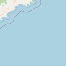
Map view of Hassell National Park

Use this park location map to pinpoint Hassell National Park in Australia, understand its exact geographic position, and read its mapped placement within the surrounding landscape more clearly.

Pigeon | © OpenStreetMap contributors

Location context for Hassell National Park

Western Australia
Park atlas

Browse surrounding conservation landscapes and regional park geography for ecological comparison

Discover Other National Parks and Protected Areas Near Hassell National Park in Western Australia
Explore other national parks and protected areas geographically connected to Hassell National Park within Western Australia's Great Southern region, tracing wildlife corridors and diverse kwongan communities. Compare these adjacent conservation landscapes to understand regional protected-area spread, identifying further opportunities for exploring unique ecosystems across Australia's southwest.
National parkWestern Australia

Waychinicup National Park: National Park Protected Landscape Atlas Entry

Explore Western Australia's mapped natural landscapes and park geography.

Gain a structured understanding of Waychinicup National Park as a key protected landscape within Western Australia. This detailed atlas entry focuses on its geographic distribution and mapped boundaries, providing essential context for regional park and natural landscape exploration. Discover the unique characteristics of this national park's setting and its place within the broader mapped terrain.

Area
39.82 km²
Established
1990
IUCN
II
Relief
Mixed relief
National parkWestern Australia

Porongurup National Park: Ancient Granite Peaks and Karri Forest Protected Landscape

Mapped terrain and geologic history in Western Australia.

Delve into Porongurup National Park, a protected landscape in Western Australia characterized by its ancient, billion-year-old granite peaks and a rare outlier of towering karri forest. This national park offers a unique geographic perspective, showcasing dramatic mountain terrain that has stood for eons. Explore the mapped boundaries and the distinct ecosystems that thrive within this ancient mountain system, providing rich context for regional atlas discovery and understanding the park's geological significance.

Area
26.21 km²
Established
1971
IUCN
II
Relief
Mountain
National parkWestern Australia

Gull Rock National Park: Protected Landscape and Geographic Atlas Exploration

Discover mapped boundaries and natural terrain in Western Australia.

Gull Rock National Park serves as a key protected area for exploring the geographic diversity of Western Australia. As a national park, it offers a focal point for understanding mapped landscape features, conservation boundaries, and the unique natural terrain of the region. This entry provides essential context for atlas-based discovery of protected lands across Australia.

Area
21.04 km²
Established
2006
IUCN
II
Relief
Lowland
National parkWestern Australia

Torndirrup National Park National Park: Mapped Boundaries and Regional Landscape Context

Explore protected lands within Western Australia's geography.

Torndirrup National Park serves as a significant protected natural area, offering valuable insights into the geographic character of Western Australia. This detailed entry focuses on its mapped boundaries and its role as a protected landscape, providing essential context for atlas-based exploration of Australia's diverse regions and natural terrains.

Area
39.36 km²
Established
1918
IUCN
II
Visitors
250K annual
Watercolor illustration of rolling hills, mountains, and a coastal body of water
National parkWestern Australia

West Cape Howe National Park: Western Australia's Southernmost Coastal Protected Landscape

Explore dramatic sea cliffs, ancient karri forests, and Torbay Head.

West Cape Howe National Park offers a distinct protected landscape experience in Western Australia, highlighted by its position at mainland Australia's southernmost point, Torbay Head. This park showcases a rugged 23-kilometer stretch of the Southern Ocean coastline, featuring towering sea cliffs that descend to pristine beaches and rocky shores. Inland, visitors find ancient karri forests and diverse vegetation types, contributing to a rich mosaic of protected habitats. Its geographic significance and unique coastal terrain make it a key destination for understanding regional protected area geography.

Area
36.05 km²
Established
1985
IUCN
II
Relief
Lowland
National parkGreat Southern

Mount Lindesay National Park: Australian National Park Protected Landscape Details

Explore mapped boundaries and regional geographic context in Great Southern.

Gain a structured understanding of Mount Lindesay National Park, a designated national park in Australia's Great Southern region. This detail view focuses on its protected landscape identity, mapped geographic features, and its place within the nation's network of conservation areas. Discover the specific terrain and regional atlas context that makes this park a distinct element of Australia's natural geography.

Area
395.73 km²
Established
2004
IUCN
II
Relief
Mountain
Watercolor illustration of a coastal landscape with green vegetation, pink rock formations, and a calm body of water
National parkWestern Australia

William Bay National Park: Mapped Protected Area in Western Australia's Geography

Explore its national park boundaries and regional landscape context.

Delve into the protected landscape of William Bay National Park, a designated national park situated within the diverse geography of Western Australia. This resource provides critical information on its mapped boundaries and its role as a protected natural area. Understand the park's specific geographic setting and its contribution to the regional atlas of conservation landscapes, essential for detailed park and landscape discovery.

Area
17.34 km²
Established
1971
IUCN
II
Visitors
238K annual
National parkGreat Southern

Mount Roe National Park: Detailed Protected Landscape and Geographic Exploration

Mapped boundaries and natural terrain of this national park.

Mount Roe National Park offers a distinct protected landscape for atlas exploration, situated within the geographic scope of the Great Southern region. This detail page provides a structured view of the park's mapped boundaries and its natural terrain. Understand how Mount Roe National Park contributes to the regional geography and the overall map of protected areas in Australia.

Area
1,278 km²
Established
2004
IUCN
II
Scope
Terrestrial

Common questions about visiting, size, designation, and location context for Hassell National Park

Hassell National Park FAQs for park facts, access, geography, and protected area context
Find quick answers about Hassell National Park, including protected-area facts, park geography, trail and visitor context, and how the park fits into its surrounding country and regional landscape.
MoriAtlas Explorer

Continue Your Protected Areas Search Across the Global Atlas

Deepen your exploration by continuing the structured search for national parks and protected areas worldwide. Utilize the comprehensive filtering capabilities to compare different conservation landscapes and refine your understanding of global park geography. Discover more about the distribution and characteristics of protected natural areas.

Global natural geography