
Mori Atlas logo
Protected landscapeTiefenbachtal

A preserved mosaic of meadows and woodland foothills within the Esslingen district geography

Tiefenbachtal Protected Landscape in the Baden-Württemberg Region of Southwestern Germany

(Landschaftsschutzgebiet „Tiefenbachtal“)

The Tiefenbachtal landscape protection area preserves a distinct valley segment situated within the Middle Alb Foreland of Baden-Württemberg. This protected entity maintains a traditional patchwork of meadows and small forest stands that defines the foothills of the Swabian Alb. Through integrated map data and regional context, the area provides a window into the rolling pre-Alb countryside and the historical land management patterns characteristic of the Esslingen district in Germany.

landscape protection areavalley landscapemeadow and forest mosaicSwabian Alb foothillsBaden-WürttembergEsslingen district
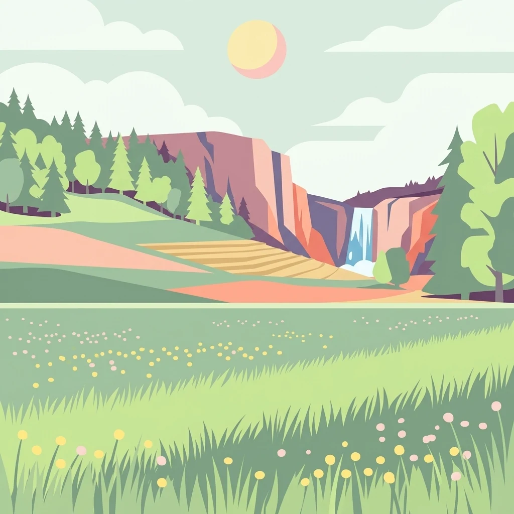
A flat-style digital illustration of a valley landscape showing a grassy foreground with small flowers, a middle ground with trees and terraced fields, and a background with steep cliffs, a waterfall, and a pale sun in the sky.

Tiefenbachtal

Protected landscape

Park overview

Structured park overview, official facts, and landscape profile for Tiefenbachtal Landscape Protection Area

Tiefenbachtal Landscape Protection Area park facts, protected area profile, and essential visitor context

Review the core facts for Tiefenbachtal Landscape Protection Area, including designation, size, terrain, visitor scale, habitats, and operating context in one park-focused overview.

About Tiefenbachtal Landscape Protection Area

The Tiefenbachtal Landscape Protection Area is one of many small landscape protection areas, or Landschaftsschutzgebiete, that together shape the protected countryside of the Esslingen district in Baden-Württemberg. Located on the municipal land of Beuren, it lies roughly three kilometers north of the village center, where the valley of the Tiefenbach stream cuts gently through the rolling foothills leading up toward the Swabian Alb. The neighboring municipalities of Frickenhausen, Nürtingen, and Dettingen unter Teck border the protected area, placing it at the meeting point of several communities whose landscapes have long been intertwined.

Natural-regionally, the area belongs to the Mittleres Albvorland, the middle foreland of the Swabian Alb. This is the transitional belt where the relatively level agricultural country of the Neckar basin begins to climb toward the steep escarpment and karst plateaus of the Alb. In this setting, valleys like the Tiefenbachtal are characteristic landforms, cutting shallow courses through farmland and occasionally opening small, sheltered basins where traditional meadows and field-edge woodlands have persisted. The Tiefenbachtal reserve captures precisely this kind of setting, rather than a high-mountain or coastal environment.

The protected area's identity is closely tied to its history of protection. The entire Tiefenbachtal was originally placed under landscape protection in 1940, but during later reorganizations of neighboring reserves a stretch of the valley was inadvertently left out. To close this gap, the remaining section around the Sonnenhof farm was designated as its own independent landscape protection area on 15 October 1958, and it has retained this status since. Administratively, it is managed by the Landkreis Esslingen, and it carries the LSG number 1.16.074, recognized internationally through its entry in the World Database on Protected Areas as ID 325166.

At roughly 35 hectares, the area is modest in size but consistent in purpose. Its primary objective is the long-term conservation of an ecologically valuable portion of the valley where meadows and forests occur in close combination. In doing so, it supports one of the defining landscape characters of the Swabian Alb foreland, where small valleys with mixed land use continue to provide habitat continuity and visual coherence in a region otherwise marked by intensive agriculture and expanding settlement.

Quick facts and research context for Tiefenbachtal Landscape Protection Area

The Tiefenbachtal Landscape Protection Area lies on the municipal territory of Beuren, north of the village, bordering the areas of Frickenhausen, Nürtingen, and Dettingen unter Teck. Natural-regionally it belongs to the Mittleres Albvorland, the middle foreland of the Swabian Alb. With about 35 hectares, it is a relatively compact protected landscape focused on a single section of the Tiefenbach stream valley.

It carries the official LSG number 1.16.074 and is registered in the World Database on Protected Areas under ID 325166. The reserve is administered by the Landkreis Esslingen and is classified as an IUCN Category V protected landscape. The protected status dates from 15 October 1958, supplementing an earlier 1940 landscape protection order that had covered the broader valley.

Protection and recognition

Terrestrial conservation framework and documented Natura 2000 recognition sources

Tiefenbachtal Protection Status and International Recognition Data

Tiefenbachtal maintains a recorded terrestrial protection status alongside verified Natura 2000 recognition data. Conservation tracking aggregates official designation details and international registry sources to clarify management scope.

International recognition

Protection details

Protection scope
Terrestrial
Transboundary protection
No
WDPA ID
325166
Park context

Deeper park guide and search-rich context for Tiefenbachtal Landscape Protection Area

Tiefenbachtal Landscape Protection Area history, landscape, wildlife, and travel context

Explore Tiefenbachtal Landscape Protection Area through its history, landscape character, ecosystems, wildlife, conservation priorities, cultural context, and seasonal travel timing in a structured park guide built for atlas discovery and search intent.

Why Tiefenbachtal Landscape Protection Area stands out

The area is best known for preserving a representative stretch of the Tiefenbach valley on the slope of the Middle Alb Foreland. It captures the classic transition zone where agricultural valley meadows meet small woodland areas, a pattern that has long defined the Swabian Alb foothills landscape. The protected focus on the area around the Sonnenhof farm gives it a recognizable, locally meaningful identity within the dense network of valley and escarpment reserves in the Esslingen district. Its significance is more ecological and cultural than spectacular. The reserve exemplifies how small, locally anchored landscape protection areas maintain the long continuity of meadow and forest mosaics in southern Germany's pre-Alb countryside, rather than marking a single dramatic natural landmark.
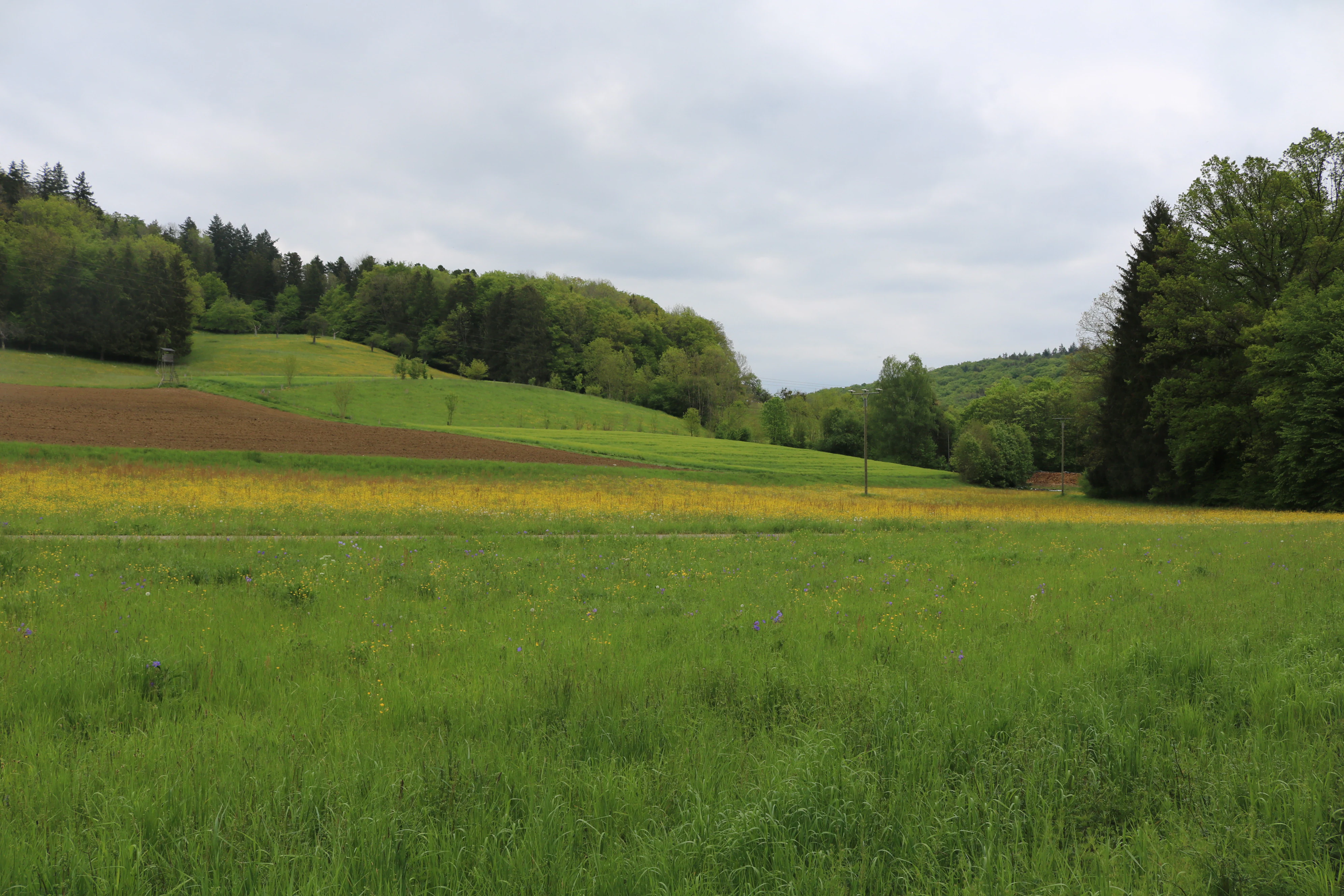
A landscape view of open green meadows with scattered trees and dense forest edges under a cloudy sky.
The rolling meadows and forests of the Tiefenbachtal protected landscape area in Germany.

Tiefenbachtal Landscape Protection Area history and protected-area timeline

The history of protection in the Tiefenbachtal begins earlier than the current designation. On 19 October 1940, the entire Tiefenbach valley was placed under landscape protection by order of the relevant nature conservation authority, reflecting the early German tradition of safeguarding characteristic valley landscapes even at a time when detailed ecological assessments were limited.

Over the following decades, however, the network of protected areas in the region was gradually reorganized. Neighboring reserves were redesignated or modified, and in the course of these adjustments a small section of the Tiefenbachtal near the Sonnenhof farm was left without formal protection. To correct this, the responsible authority at the former Landratsamt Nürtingen issued a new order on 15 October 1958 establishing the Tiefenbachtal landscape protection area as an independent entity, with the LSG number 1.16.074. This designation has remained in force and now falls under the administration of the Landkreis Esslingen.

The history of the reserve is therefore less about dramatic conservation milestones and more about the steady administrative process of maintaining valley landscapes through successive layers of protective orders. Its story reflects the broader pattern in Baden-Württemberg, where small landscape protection areas have been reaffirmed repeatedly to preserve the visual and ecological character of traditional countryside.

Tiefenbachtal Landscape Protection Area landscape and geographic character

The landscape of the Tiefenbachtal reserve is shaped by its position on the lower slopes of the Middle Alb Foreland. The terrain here is gently rolling rather than steep, with the Tiefenbach stream cutting a shallow valley that gradually rises toward the foot of the Swabian Alb. The valley floor and lower slopes are dominated by meadows used for traditional agriculture, while the upper edges and parts of the slopes carry small woodland stands that break up the open farmland.

This mosaic of grassland and forest is one of the most recognizable features of the pre-Alb countryside in this part of Baden-Württemberg. The woodlands often occupy the steeper or rockier sections where cultivation is impractical, while the flatter ground is given over to hay meadows and pasture. As a result, the valley retains a patchwork appearance even today, with field patterns, hedgerows, and small forest blocks blending into one another along the length of the protected section.

The impression conveyed by the area is one of quiet, contained beauty: a sheltered valley floor surrounded by wooded slopes, framed by the broader farmland of the surrounding municipalities. Although it lacks dramatic relief, the landscape offers a coherent example of the valley scenery that defines much of the Esslingen district's western edge.

Tiefenbachtal Landscape Protection Area ecosystems, habitats, and plant life

Ecologically, the Tiefenbachtal reserve owes its value to the combination of meadow and woodland habitats that meet along the course of the Tiefenbach stream. The grassland areas include both regularly mown meadows and more extensively used sections, supporting a range of flowering plants typical of Swabian valley floors. These open habitats in turn provide feeding areas for insects and ground-nesting species that benefit from continuity in land use.

The woodland patches interspersed with the meadows contribute further ecological variety. They include both broadleaf-dominated forest on the valley slopes and smaller field-edge woods, which act as habitat islands within the agricultural matrix. The transition zone between forest and meadow is particularly important, supporting shrub-layer species and edge-of-forest fauna that depend on this kind of mixed structure.

The Tiefenbach stream itself is a defining ecological axis, adding moisture and microclimate variety to the surrounding habitats. Its banks and immediate surroundings contribute to the local habitat network, while the broader valley landscape provides the structural continuity needed for many species to persist in an otherwise heavily used agricultural region.

Tiefenbachtal Landscape Protection Area wildlife and species highlights

The wildlife value of the Tiefenbachtal reserve is closely tied to its habitat mosaic. The meadows and field edges host a variety of insects, including butterflies and other pollinators that depend on the flowering plants of traditionally managed grasslands. These insects in turn support bird species that use the valley as a feeding area during the breeding season and, for some species, as a stopover during migration.

The woodland patches provide shelter and nesting opportunities for forest birds, while the edges between forest and open ground create rich hunting grounds for generalist species. Small mammals typical of Swabian valley landscapes are also likely to use the mix of woodland cover, hedgerow, and meadow for cover and food.

Fauna in the reserve is best understood as part of the broader ecological network of the Middle Alb Foreland. While the area itself is too small to support wide-ranging large species, its consistent mosaic of habitats helps maintain populations of smaller, habitat-sensitive species that contribute to the regional biodiversity of the pre-Alb countryside.

Tiefenbachtal Landscape Protection Area conservation status and protection priorities

The primary conservation purpose of the Tiefenbachtal Landscape Protection Area is the long-term safeguarding of an ecologically valuable portion of the Tiefenbach valley. Rather than focusing on a single rare species or habitat type, the protection aims at maintaining the integrated landscape: the combination of meadows, woodland, and valley floor that together form a coherent ecological unit. This integrative aim reflects the classical purpose of German landscape protection areas, which emphasize the preservation of characteristic landscapes alongside their natural values.

By preserving this valley section, the reserve contributes to the larger conservation network in the Landkreis Esslingen. It connects, both functionally and administratively, with nearby protected areas along the Swabian Alb fringe, including escarpment and valley landscapes such as Albtrauf Beuren and Marbachtal. Together, these areas form a network of protected countryside that helps counter the pressures of agricultural intensification and urban expansion around the Nürtingen area.

The reserve's designation as an IUCN Category V protected landscape/Seascape underscores its conservation role at the international level. Within this category, the focus is on maintaining harmonious interactions between people and nature through the protection of traditional landscapes, and the Tiefenbachtal reserve fits this purpose well through its continued emphasis on meadow and woodland continuity in a working agricultural valley.

Tiefenbachtal Landscape Protection Area cultural meaning and human context

The Tiefenbachtal reserve is closely tied to the cultural landscape of the Swabian Alb foreland. The valley's meadows and small woodlands have been shaped by generations of agricultural use, and individual farms such as the Sonnenhof near the protected stretch are part of the local settlement and land-use history. The reserve thus protects not only natural features but also the visual and structural character of a valley shaped by traditional farming.

The broader region around Beuren, with its long history as part of the Württemberg countryside, has long valued the maintenance of characteristic valley and escarpment landscapes. Landscape protection designations in the area often reflect this cultural commitment, reinforcing local identity and continuity in land use alongside ecological goals.

Top sights and standout views in Tiefenbachtal Landscape Protection Area

The Tiefenbachtal Landscape Protection Area stands out for its compact protection of a characteristic valley landscape in the Middle Alb Foreland. Its combination of meadows and small woodland stands near the Sonnenhof farm represents one of the typical pre-Alb valley environments of the Esslingen district, and its long history of formal protection, from the 1940 order to the current 1958 designation, highlights the region's commitment to maintaining these traditional landscapes.

Its recognition as a distinct protected entity within the larger network of Landkreis Esslingen landscape protection areas, along with its inclusion in the World Database on Protected Areas, gives it a clear identity despite its modest size. The reserve's enduring value lies in preserving the continuous, locally rooted character of the Tiefenbach valley rather than any single dramatic natural feature.

Best time to visit Tiefenbachtal Landscape Protection Area

The valley landscape protected in the Tiefenbachtal reserve is pleasant to experience across much of the year, with spring and early summer offering the richest display of meadow flowers and the most active birdlife. Late spring, when grasses and wildflowers are at their peak, generally provides the most varied impression of the meadow-forest mosaic.

Autumn brings a different character, with woodland sections displaying seasonal color and the agricultural landscape taking on a quieter feel after the harvest. Winter scenes are typically subdued but expose the structure of the valley more clearly, making it easier to read the underlying pattern of meadows, woodland, and slopes that defines the protected area.

Monthly climate preview

Long term average temperature and monthly precipitation statistics for Tiefenbachtal

Tiefenbachtal Climate Normals and Measured Annual Weather Patterns

Representative coordinate measurements record monthly mean temperatures ranging from negative 1.12 to 18.22 degrees Celsius alongside steady precipitation rhythms across the twelve month cycle. Consulting the complete twelve month climate profile provides deeper analytical depth for monthly temperature extremes and precipitation averages.
Annual mean8 °C
-1 °C18 °C
Jan-1°
Feb
Mar
Apr
May13°
Jun16°
Jul18°
Aug18°
Sep14°
Oct
Nov
Dec
Warmest month
July

18.2 °C

Coolest month
January

-1.1 °C

Wettest month
July

3.2 mm/day

Driest month
February

1.7 mm/day

Park location guide

Geography guide, regional context, and park location map for Tiefenbachtal Landscape Protection Area

Tiefenbachtal Landscape Protection Area park geography, regions, and map view in Germany

Understand where Tiefenbachtal Landscape Protection Area sits in Germany through a broader geographic reading of the surrounding landscape, nearby location context, and its mapped position within the national park landscape.

How Tiefenbachtal Landscape Protection Area fits into Germany

Germany is a federal republic in Western and Central Europe with a population of over 83 million across sixteen constituent states. It is Europe's largest economy by nominal GDP and a major global exporter and importer. The capital is Berlin, and the country borders Denmark, Poland, Czech Republic, Austria, Switzerland, France, Luxembourg, Belgium, and the Netherlands.

Wider geography shaping Tiefenbachtal Landscape Protection Area in Germany

Germany is located in Western and Central Europe, spanning 357,022 km². It borders Denmark to the north, Poland and the Czech Republic to the east, Austria and Switzerland to the south, and France, Luxembourg, Belgium, and the Netherlands to the west. The country has coastlines on the Baltic Sea and North Sea to the north, with the Alps located in the southern region.

Map view of Tiefenbachtal Landscape Protection Area

Use this park location map to pinpoint Tiefenbachtal Landscape Protection Area in Germany, understand its exact geographic position, and read its mapped placement within the surrounding landscape more clearly.

Pigeon | © OpenStreetMap contributors

Location context for Tiefenbachtal Landscape Protection Area

Baden-Württemberg

Explore protected area views, valley terrain, and meadow mosaics.

Tiefenbachtal Landscape Photography and Valley Scenery Visual Guide

Visual records capture the gentle terrain and traditional meadow mosaics that define the Tiefenbachtal protected valley environment. Examining photographic documentation helps observers understand the regional landscape character and ecological continuity of the pre Alb foothills.

A landscape view of open green meadows with scattered trees and dense forest edges under a cloudy sky.

Park atlas

Compare nearby valley reserves and connected pre-Alb foothills geography.

Explore Protected Areas Near Tiefenbachtal and Surrounding Regional Landscapes

Continue browsing other protected areas near Tiefenbachtal to examine similar valley landscapes and meadow mosaics across the surrounding region. Comparing adjacent terrain helps reveal the broader network of protected terrain spanning the Swabian Alb foothills.
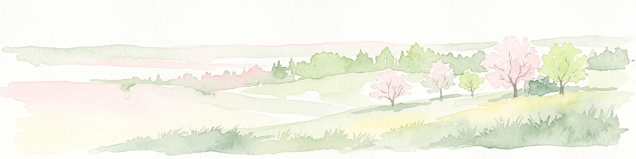
A pale watercolor landscape illustration showing rolling green hills and meadows under a soft yellow sky.
Protected landscapeBaden-Württemberg
About 2.6 km away#1 closest

Southeast

Owen Protected Landscape: A Geographic Analysis of Orchard Meadows and Teckberg Terrain

Baden-Württemberg protected area and regional landscape map

Examine the detailed landscape composition of the Owen protected area, a vital reserve in the Mittleres Albvorland. This atlas entry focuses on the interaction between traditional orchard meadow mosaics, hedgerows, and the abrupt topographical shift toward the Teckberg peak, providing a clear geographic context for this protected natural region.

Area
5.67 km²
Established
1974
IUCN
V
Protected landscapeBaden-Württemberg
About 5.9 km away#2 closest

Southwest

Neuffen auf Gemarkungen Neuffen und Kappishäusern Protected Area and Regional Landscape

Geography of the Swabian Alb escarpment and riparian zones

This protected landscape defines the visual and ecological character of the area surrounding the Hohenneuffen and Jusi hills. The terrain spans limestone slopes, fruit-bearing orchards, and the Steinach river valley. By integrating local habitat protection with regional biosphere networks, the region serves as a vital transition point between the plateau and the Neckar basin.

Area
13.41 km²
Established
1993
IUCN
V
Relief
Mountain
Protected landscapeBaden-Württemberg
About 7.1 km away#3 closest

North

Wendlingen am Neckar Protected Landscape: Regional Geography and Habitat Connectivity

A structured Swabian countryside mosaic in Baden-Württemberg

This protected area safeguards a unique, fragmented landscape comprising traditional orchard meadows and brookside woodland corridors. Located on the Filder plateau, it acts as a critical ecological refuge, maintaining the transition between settled zones and the natural terrain of the Mittleres Albvorland through long-standing landscape conservation measures.

Area
2.27 km²
Established
1992
IUCN
V
Protected landscapeBaden-Württemberg
About 10 km away#4 closest

Northeast

Notzingen Protected Landscape: Mapping the Voralb Foothills and Swabian Alb Terrain

Regional protected area analysis in Landkreis Esslingen

Notzingen represents a coherent protected landscape composed of three parcels near the Swabian Alb foothills. The area is defined by a delicate intersection of stream-side riparian habitats and traditional Streuobstwiesen orchard meadows. This atlas-focused entry provides spatial context for understanding how these protected lands maintain the character of the southern German countryside.

Area
3.15 km²
Established
1989
IUCN
V
Relief
Upland
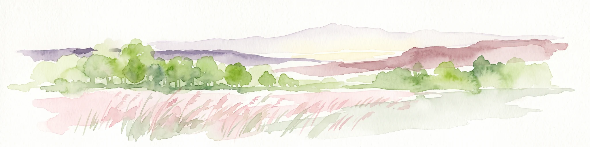
A minimalist watercolor painting depicting a soft-focus landscape with rolling hills, distant ridgelines, and scattered trees across a meadow, rendered in muted greens, purples, and pinks on a white background.
Protected landscapeBaden-Württemberg
About 11 km away#5 closest

Northeast

Ohmden-Holzmaden Protected Landscape: Swabian Alb Foothill Mapping

A diverse mosaic of traditional orchards and stream valleys

Ohmden-Holzmaden encompasses a vital protected landscape in the Esslingen district, defined by the Trinkbach, Seebach, and Aubach valleys. This geography of traditional orchards, meadows, and hedgerows maintains an open, structured rural habitat that serves as a critical refuge within the broader Swabian Alb foothill region of Germany.

Area
3.111 km²
Established
1993
IUCN
V
Relief
Upland
Protected landscapeLandkreis Esslingen
About 11 km away#6 closest

North

Wernau (Neckar) Protected Landscape: Geographic Overview and Mapped Cultural Terrain

Landscape protection area within the Landkreis Esslingen region

Trace the boundaries of the Wernau (Neckar) protected landscape, an ecologically significant mosaic of meadow orchards, riparian vegetation, and small woodlands. Situated in the Landkreis Esslingen of Baden-Württemberg, this area functions as a critical buffer zone that maintains the continuity of local habitats between the Filder plain and the Swabian Alb foothills.

Area
2.27 km²
Established
1995
IUCN
V
Protected landscapeBaden-Württemberg
About 12 km away#7 closest

East

Weilheim an der Teck auf Gemarkungen Weilheim und Hepsisau Protected Landscape Atlas

Volcanic hill geography in the Baden-Württemberg region

This protected area safeguards a richly structured landscape where rolling foothills meet the steep escarpments of the Swabian Alb. Centered on the volcanic peaks of Limburg and Egelsberg, the region maintains a vital balance between forest corridors and open agricultural plains within the district of Esslingen.

Area
13.615 km²
Established
1979
IUCN
V
Protected landscapeBaden-Württemberg
About 12 km away#8 closest

North

Unteres Körschtal Protected Landscape: Geography and Mapped Boundaries in Baden-Württemberg

An ecological green corridor within the Swabian Keuper-Lias landscape

Unteres Körschtal protects the natural valley floor and adjacent slopes of the lower Körsch river. This landscape conservation area provides essential habitat and recreational space between the Filder plateau and the Neckar valley, standing as a primary example of regional geography in Germany.

Area
4.729 km²
Established
1978
IUCN
V

Common questions about visiting, size, designation, and location context for Tiefenbachtal Landscape Protection Area

Tiefenbachtal Landscape Protection Area FAQs for park facts, access, geography, and protected area context

Find quick answers about Tiefenbachtal Landscape Protection Area, including protected-area facts, park geography, trail and visitor context, and how the park fits into its surrounding country and regional landscape.
MoriAtlas Explorer

Continue Your Protected Areas Search Across the Global Atlas

Deepen your exploration by continuing the structured search for national parks and protected areas worldwide. Utilize the comprehensive filtering capabilities to compare different conservation landscapes and refine your understanding of global park geography. Discover more about the distribution and characteristics of protected natural areas.

Global natural geography