
Mori Atlas logo
Nature reserveUmtamvuna Nature Reserve

Examining the transition from highland grasslands to forested sandstone river valleys in South Africa

Umtamvuna Nature Reserve: A Detailed Geographic Atlas of the Mtamvuna River Gorge Landscapes

Umtamvuna Nature Reserve represents a protected natural area where the Mtamvuna River has carved deep, dramatic gorges into Natal Group Sandstone. This geographic record maps the transition between open Pondoland Sourveld plateaus and dense Coastal Scarp Forest environments found along the KwaZulu-Natal coastline. The terrain displays a distinct, layered identity shaped by riverine erosion and endemic botanical substrates.

coastal reservePondolandriver gorgesandstone cliffsPondoland SourveldCoastal Scarp Forest
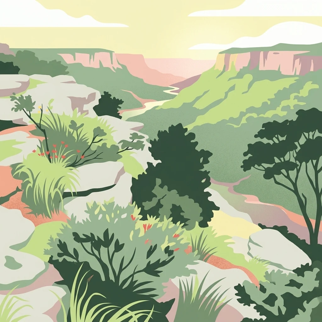
A stylized digital illustration of a deep river gorge with rocky cliffs, coastal forest vegetation, and a winding river at sunset.

Umtamvuna Nature Reserve

Nature reserve

Park overview

Structured park overview, official facts, and landscape profile for Umtamvuna Nature Reserve

Umtamvuna Nature Reserve park facts, protected area profile, and essential visitor context

Review the core facts for Umtamvuna Nature Reserve, including designation, size, terrain, visitor scale, habitats, and operating context in one park-focused overview.

About Umtamvuna Nature Reserve

Umtamvuna Nature Reserve occupies a stretch of the south coast of KwaZulu-Natal, South Africa, where the Mtamvuna River forms a natural boundary inland. The reserve was proclaimed in 1971 and today covers approximately 3,257 hectares, stretching from the outskirts of the coastal town of Port Edward roughly nineteen kilometres upstream along the river.

The reserve's defining characteristic is its dramatic vertical relief. The Mtamvuna River and its tributary, the Bulolo River, have cut deep gorges into the underlying Natal Group Sandstone, producing cliffs reported to reach up to about 240 metres in places. These sandstone formations are geologically significant because they weather into substrates that support a notable number of endemic plant species, giving the reserve considerable botanical importance within the Pondoland region.

Above the gorge, the plateau landscape is covered by Pondoland Sourveld grasslands, a grassy vegetation type typical of this stretch of the eastern coast. These open landscapes transition sharply downslope into Coastal Scarp Forest in the sheltered gorge below, producing a compact but ecologically rich gradient from open highland grassland to dense evergreen forest within the reserve. This overlap of grassland, scarp forest, and riverine woodland helps define Umtamvuna's identity as a reserve.

Umtamvuna is administered by Ezemvelo KZN Wildlife, the public body responsible for biodiversity stewardship in KwaZulu-Natal. The reserve includes about twenty-eight kilometres of river frontage along the Mtamvuna and Bulolo rivers and offers a roughly fourteen kilometre nature trail designed for prepared hikers. The combination of river, cliff, plateau, and forest ecosystems makes Umtamvuna a compact but varied protected area on South Africa's southern KwaZulu-Natal coast.

Quick facts and research context for Umtamvuna Nature Reserve

Umtamvuna Nature Reserve lies on the KwaZulu-Natal side of the Mtamvuna River, close to the town of Port Edward in the south of the province. It was proclaimed in 1971 and encompasses about 3,257 hectares of land reaching roughly nineteen kilometres inland from the coast along the river.

The reserve is administered by Ezemvelo KZN Wildlife, the provincial body responsible for protected areas in KwaZulu-Natal. Its landscape combines Pondoland Sourveld grasslands on the plateau with Coastal Scarp Forest in the gorge and includes river frontage on the Mtamvuna and a tributary, the Bulolo River.

Protection and recognition

Documented terrestrial protection scope and international recognition records

Umtamvuna Nature Reserve Protection Status and Recognized Designations

Umtamvuna Nature Reserve maintains a documented terrestrial protection scope within its regional landscape. Official conservation data tracks international recognition sources and management frameworks for the reserve.

Protection details

Protection scope
Terrestrial
Transboundary protection
No
Park context

Deeper park guide and search-rich context for Umtamvuna Nature Reserve

Umtamvuna Nature Reserve history, landscape, wildlife, and travel context

Explore Umtamvuna Nature Reserve through its history, landscape character, ecosystems, wildlife, conservation priorities, cultural context, and seasonal travel timing in a structured park guide built for atlas discovery and search intent.

Why Umtamvuna Nature Reserve stands out

Umtamvuna is best known for the dramatic Mtamvuna River gorge, where near vertical sandstone cliffs rise above Coastal Scarp Forest and a river valley. The cliffs, formed by the river cutting into Natal Group Sandstone, host a colony of Cape vultures and support a suite of endemic plants on sandstone-derived soils and substrates. The reserve is also recognised for its Pondoland Sourveld grasslands, which produce seasonal wildflower displays in late spring following appropriate rainfall and fire cycles. Altogether, Umtamvuna represents a notable meeting point between highland grassland, scarp forest, and a wooded river gorge along the KwaZulu-Natal south coast.
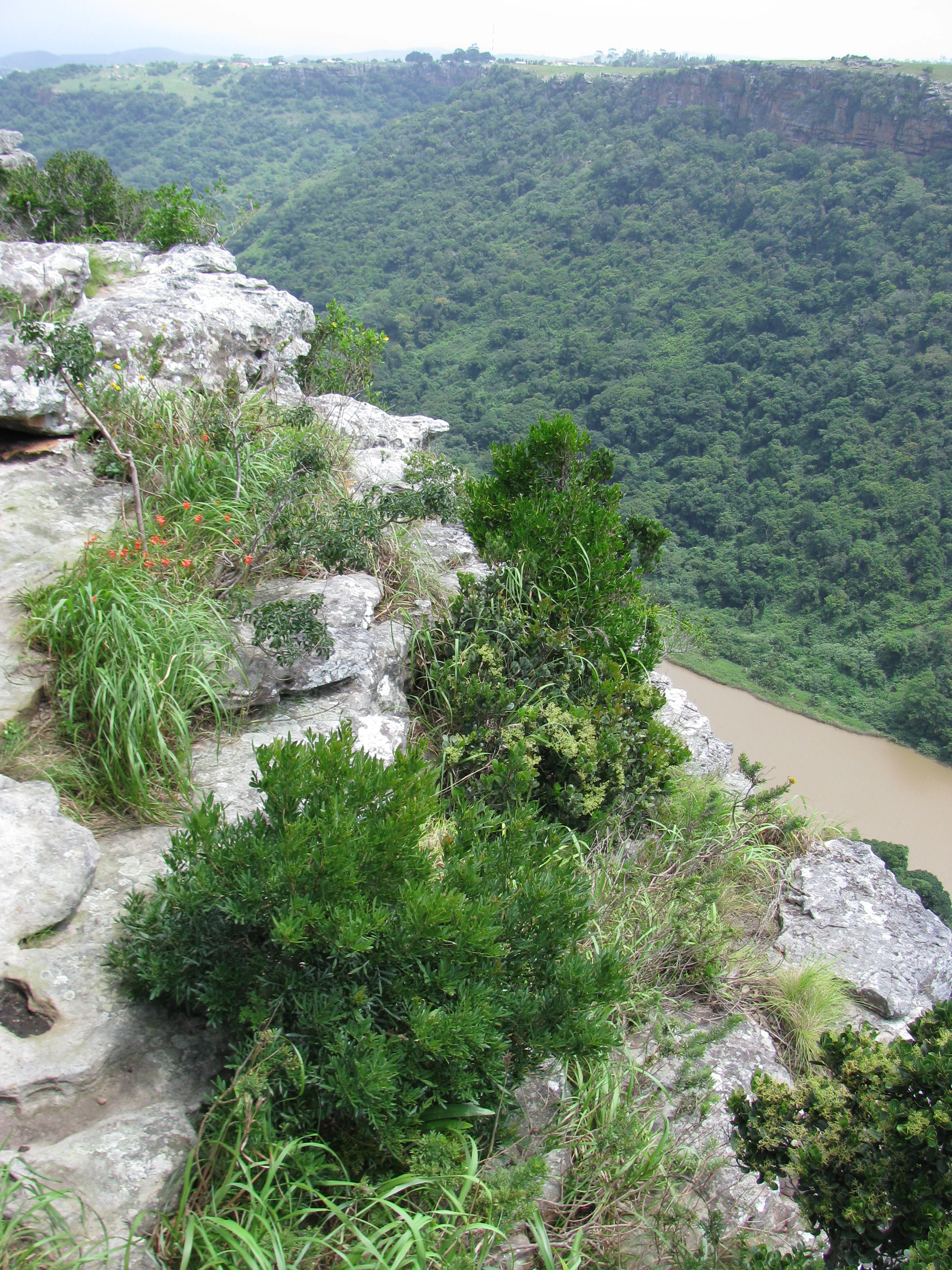
A high angle view looking down from a rocky cliff edge into a deep river gorge densely covered in green vegetation.
The Umtamvuna River flows through a deep, forested gorge within the Umtamvuna Nature Reserve.

Umtamvuna Nature Reserve history and protected-area timeline

Umtamvuna Nature Reserve was officially established on 25 July 1971, setting aside a stretch of the Mtamvuna River valley and its associated plateaus as a protected area under the then provincial conservation authority. From its inception the reserve was conceived as a place to safeguard the distinctive combination of gorge, cliff, and highland grassland habitat found along this section of the river.

Administration of the reserve later passed to Ezemvelo KZN Wildlife, the body currently responsible for managing provincial protected areas in KwaZulu-Natal. Throughout its history the reserve has remained focused primarily on conserving the sandstone gorge ecosystem, the surrounding Pondoland Sourveld grasslands, and the river frontage along the Mtamvuna and Bulolo rivers.

Umtamvuna Nature Reserve landscape and geographic character

The most striking landscape feature of Umtamvuna Nature Reserve is the Mtamvuna River gorge. Over millions of years the river, together with its tributary the Bulolo River, has incised into layers of Natal Group Sandstone, producing steep cliffs reported to rise as high as around 240 metres in places. The result is a sharply contrasting terrain in which near vertical rock walls tower above a narrow, forested river valley.

Above the gorge, the land opens out into rolling grassy plateaus that form part of the broader Pondoland landscape. These plateaus carry Pondoland Sourveld grasslands, a vegetation type characteristic of this region of the eastern South African coast. The transition between the open plateau and the steep forested gorge is abrupt, which is part of what gives the reserve its strongly layered visual identity.

The reserve extends roughly nineteen kilometres inland from the outskirts of Port Edward and includes about twenty-eight kilometres of river frontage, giving the terrain a strongly linear, river centred character. Sandstone is the dominant underlying rock, and its weathering contributes to the soils and substrates on which many of the reserve's endemic plant species are found.

Umtamvuna Nature Reserve ecosystems, habitats, and plant life

Ecologically, Umtamvuna Nature Reserve sits at the interface between highland grassland and forested gorge. The plateau areas are dominated by Pondoland Sourveld grasslands, an open grassy vegetation type associated with the Pondoland coast and known for its seasonal wildflower displays in late spring, particularly in years with suitable rainfall and after burning cycles.

Below the plateau edge, the sheltered slopes and the river valley support Coastal Scarp Forest, a moist evergreen forest type found on the deeply incised coastal river gorges of the region. The river system itself, including the Mtamvuna and the Bulolo River tributary, adds a third important habitat layer of riverine woodland and aquatic environments.

Many of the plant species recorded in the reserve grow specifically on the sandstone substrates and soils derived from Natal Group Sandstone, and a notable proportion of these are endemic to the region. While the reserve is modest in size, the convergence of grassland, scarp forest, riverine woodland, and cliff habitats within its boundaries gives it an unusually high habitat diversity for a coastal KwaZulu-Natal protected area.

Umtamvuna Nature Reserve wildlife and species highlights

The mammal community of Umtamvuna Nature Reserve includes samango monkeys, which are particularly associated with the forested gorge environment, as well as blue duiker, a small forest dwelling antelope typical of dense coastal scarp forest. Bushbuck are also recorded in the reserve, generally along the forest edges and riverine areas where cover is heaviest.

Larger and more elusive predators are also present, with leopards reported from the reserve, though sightings are uncommon. Birdlife is a notable feature of Umtamvuna, with a colony of Cape vultures reported to nest on the high cliff faces of the gorge. These cliffs provide the kind of vertical rock habitat that large cliff nesting raptors require, making the reserve one of the few protected areas in this stretch of coast with active vulture breeding sites.

The mix of grassland and forest habitats also supports a broader community of smaller mammals, reptiles, and forest birds associated with Coastal Scarp Forest, though the reserve is most celebrated for its combination of forest monkeys, duiker, and the Cape vulture colony.

Umtamvuna Nature Reserve conservation status and protection priorities

Umtamvuna Nature Reserve plays an important conservation role in protecting a relatively intact section of the Mtamvuna River gorge and its surrounding plateau and forest habitats. The gorge ecosystem, in particular, is of high botanical value because many of the plant species found on the sandstone cliffs and on soils derived from Natal Group Sandstone are endemic to the region and depend on habitats that have been reduced elsewhere along the coast.

By safeguarding a continuous stretch of Coastal Scarp Forest linked to Pondoland Sourveld grassland, the reserve helps maintain ecological connectivity in a landscape otherwise affected by coastal development and agriculture in nearby Port Edward and surrounding areas. The river frontage along the Mtamvuna and Bulolo rivers is also protected, contributing to the conservation of freshwater and riverine habitats that are vulnerable to upstream land use change.

The presence of a breeding colony of Cape vultures adds further conservation significance, because Cape vultures are sensitive to disturbance at nesting sites and depend on secure cliff habitats. Ezemvelo KZN Wildlife's management of the reserve focuses on maintaining these habitats and on providing controlled access through a defined trail system that limits pressure on sensitive cliff and forest environments.

Umtamvuna Nature Reserve cultural meaning and human context

The reserve takes its name from the Mtamvuna River, which also marks part of the broader cultural and geographical boundary between KwaZulu-Natal and the neighbouring Eastern Cape. The Pondoland region in which Umtamvuna sits carries a long history of human settlement along this river corridor, and the upland grasslands of the area have traditionally supported grazing and seasonal land use practices that influence the present vegetation patterns, including fire regimes that help shape the grassy plateaus of the reserve.

Top sights and standout views in Umtamvuna Nature Reserve

Umtamvuna Nature Reserve's standout features include the deeply incised Mtamvuna River gorge with its near vertical sandstone cliffs, the transition from open Pondoland Sourveld grasslands above into Coastal Scarp Forest below, and the river frontage along both the Mtamvuna and Bulolo rivers. The reserve is also notable for its endemic sandstone flora and its Cape vulture breeding colony on the high cliffs.

A roughly fourteen kilometre nature trail links many of these environments, taking hikers along the plateau edge and into the gorge, and making the reserve's layered landscape accessible to prepared visitors interested in both scenery and natural history.

Best time to visit Umtamvuna Nature Reserve

Umtamvuna's character changes meaningfully with the seasons. Late spring is often the most striking time on the plateau, when the Pondoland Sourveld grasslands produce natural displays of wildflowers, particularly after seasons with adequate rainfall and following the cyclical burns that help maintain these grasslands. During this period the open plateau scenery is at its most colourful.

The forested gorge and river environments are less seasonally dramatic but remain attractive year round, and cooler months can make hiking the longer nature trail more comfortable. Birding and vulture viewing tend to be productive whenever weather is clear enough for good visibility along the cliffs, while very wet conditions can make trail sections more challenging.
Monthly climate preview

Long-term representative temperature and precipitation metrics by month

Umtamvuna Nature Reserve Climate Normals and Annual Weather Patterns

Umtamvuna Nature Reserve exhibits measured annual temperature ranges and monthly precipitation variations derived from historical coordinate sampling. Examining the complete twelve-month record clarifies long-term thermal rhythms and moisture distributions across the reserve.
Annual mean19 °C
15 °C22 °C
Jan22°
Feb22°
Mar21°
Apr19°
May17°
Jun15°
Jul15°
Aug16°
Sep17°
Oct18°
Nov20°
Dec21°
Warmest month
February

22.4 °C

Coolest month
July

14.7 °C

Wettest month
November

5.4 mm/day

Driest month
June

1 mm/day

Park location guide

Geography guide, regional context, and park location map for Umtamvuna Nature Reserve

Umtamvuna Nature Reserve park geography, regions, and map view in South Africa

Understand where Umtamvuna Nature Reserve sits in South Africa through a broader geographic reading of the surrounding landscape, nearby location context, and its mapped position within the national park landscape.

How Umtamvuna Nature Reserve fits into South Africa

South Africa is the southernmost country in Africa, spanning 1.22 million km² with a population of over 63 million. The country operates with three capital cities, Pretoria (executive), Cape Town (legislative), and Bloemfontein (judicial), and is renowned for its biodiversity, national parks, and multicultural society.

Wider geography shaping Umtamvuna Nature Reserve in South Africa

South Africa occupies the southernmost region of Africa, with coastline along both the Atlantic Ocean to the west and the Indian Ocean to the east. The interior features elevated plateaus including the Highveld, with the Drakensberg escarpment marking the eastern highlands. The country shares borders with Namibia, Botswana, Zimbabwe, Mozambique, Eswatini, and Lesotho.

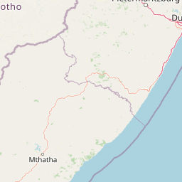
Map view of Umtamvuna Nature Reserve

Use this park location map to pinpoint Umtamvuna Nature Reserve in South Africa, understand its exact geographic position, and read its mapped placement within the surrounding landscape more clearly.

Pigeon | © OpenStreetMap contributors

Location context for Umtamvuna Nature Reserve

KwaZulu-Natal

Visual reference of sandstone cliffs, river gorges, and coastal scarp forests

Umtamvuna Nature Reserve Photos and Landscape Scenery

Examine detailed visual records of Umtamvuna Nature Reserve to understand its rugged terrain, vertical river gorges, and plateau grasslands. Photographic documentation reveals the distinct ecological transitions between open highland veld and dense scarp woodlands across the protected area.

A high angle view looking down from a rocky cliff edge into a deep river gorge densely covered in green vegetation.

A Sykes' monkey sitting on a mossy rock, holding and eating a small piece of fruit in a forest setting.

Park atlas

Compare regional park geography and adjacent protected landscapes

Parks Near Umtamvuna Nature Reserve and Surrounding Protected Areas

Browsing other protected areas near Umtamvuna Nature Reserve reveals broader ecological patterns across the eastern South African coast. Evaluating adjacent reserves provides valuable context for understanding regional sandstone gorges, coastal scarp forests, and river valley terrains.
A soft watercolor painting depicting a coastal landscape with a waterfall cascading toward the ocean, surrounded by rolling hills and greenery.
Nature reserveEastern Cape
About 28 km away#1 closest

Southwest

Mkhambathi Nature Reserve: A Coastal Protected Area in the Eastern Cape, South Africa

Endemic flora, forested river ravines, and Ramsar-listed wetland geography.

Mkhambathi Nature Reserve protects a striking coastal corridor along the Wild Coast. The area is characterized by rolling grasslands, indigenous swamp forests, and dramatic river incisions. This Ramsar wetland site supports rare floral endemism and critical bird habitats, serving as a primary study site for understanding the unique biological connectivity between South African coastal forests and marine environments.

Area
77.2 km²
Established
2009
Nature reserveKwaZulu-Natal
About 92 km away#2 closest

Northwest

Mount Currie Nature Reserve: A Detailed Geographic Atlas of KwaZulu-Natal Mountains

High-altitude wetlands and protected Drakensberg foothills

Mount Currie Nature Reserve encompasses a rugged expanse of Drakensberg foothills characterized by sharp dolerite cliffs and expansive central wetland systems. This protected area acts as a crucial ecological intersection, bridging montane grassland and Afromontane forest patches while providing a sanctuary for diverse avian life and significant cultural heritage sites.

Area
17.77 km²
Established
1980
IUCN
IV
Relief
Mountain
Nature reserveKwaZulu-Natal
About 109 km away#3 closest

Northwest

Ntsikeni Nature Reserve: High-Elevation Wetland Geography and Protected Landscape Atlas

A remote Drakensberg foothills wetland and montane grassland reserve.

Ntsikeni Nature Reserve is recognized as the largest and one of the highest wetlands in South Africa. Located in the KwaZulu-Natal province, this protected area features a unique, misty plateau landscape that sustains diverse orchid flora and essential headwater ecosystems. Use these geographic maps to examine the terrain, park boundaries, and the ecological transition between rolling foothills and the Drakensberg escarpment.

Area
92.87 km²
Established
1978
Relief
Upland
Climate
Temperate
Nature reserveKwaZulu-Natal
About 138 km away#4 closest

Northwest

Coleford Nature Reserve: Protected Grasslands and Wetlands in KwaZulu-Natal

Tracing the landscape of a key Drakensberg foothill reserve

The Coleford Nature Reserve represents a critical protected area in the Southern Drakensberg, featuring threatened Drakensberg Foothill Moist Grassland. Its landscape is defined by the Ngwagwane River valley and diverse wetland systems, providing essential habitat for endangered bird species. This reserve functions as a gateway to the broader montane geography of the southwestern KwaZulu-Natal region.

Area
12.72 km²
Established
1948
IUCN
IV
Relief
Highland
Protected areaKwaZulu-Natal
About 150 km away#5 closest

North

uKhahlamba-Drakensberg Park: Protected Mountain Landscapes and Escarpment Geography in South Africa

Exploring the basalt cliffs and alpine plateau of KwaZulu-Natal.

uKhahlamba-Drakensberg Park encompasses an expansive protected region where the Drakensberg escarpment rises sharply from the foothills of KwaZulu-Natal. This atlas record details the park landscape, including its transition from sandstone terraces to high-altitude basalt, its extensive river gorges, and the concentration of archaeological cave sites. Use this resource to understand the geographic scale of this transboundary conservation area.

Area
2,429.13 km²
Relief
Mountain
Climate
Temperate
Access
Access unknown
A watercolor illustration featuring soft, green rolling hills in the foreground with pale, layered mountain peaks in the background, set against a plain white field.
Protected areaKwaZulu-Natal
About 150 km away#6 closest

Northwest

Maloti-Drakensberg Park Geography: Mountain Escarpments and Alpine Plateau Exploration

A transboundary protected landscape spanning South Africa and Lesotho

Spanning the core of the Drakensberg mountain system, Maloti-Drakensberg Park provides a unique window into high-altitude biodiversity and geological drama. The protected area features basalt cliffs, rolling valleys, and an extensive plateau, forming a critical ecological and cultural corridor. This atlas entry covers the topographic features and spatial distribution of one of southern Africa's most significant protected landscapes.

Area
2,493.13 km²
Established
2001
Relief
Mountain
Climate
Alpine
National parkQacha's Nek District
About 154 km away#7 closest

Northwest

Sehlabathebe National Park: Mapped Protected Landscape in Lesotho's Maloti Mountains

Explore high-altitude terrain, waterfalls, and ancient rock art sites.

Sehlabathebe National Park stands as a protected national park within the rugged Maloti Mountains of Lesotho's Qacha's Nek District. This destination is vital for understanding the geographic context of protected areas, featuring dramatic cliffs, iconic waterfalls like Tsoelikana, and numerous rock art sites that speak to its cultural and historical significance. Its high-altitude Afro-Alpine and sub-alpine ecosystems offer unique landscape characteristics and support notable biodiversity, making it a key point of interest for atlas-driven exploration of natural and protected terrains.

Area
69.5 km²
Established
1969
IUCN
IV
Relief
Mountain
Nature reserveKwaZulu-Natal
About 156 km away#8 closest

North

Impendle Nature Reserve: Protecting Endangered Grasslands and Mistbelt Ecosystems

A highland conservation sanctuary in the KwaZulu-Natal region

Located in the mist-prone foothills of the Drakensberg, Impendle Nature Reserve stands as a critical block of surviving Midlands Mistbelt Grassland. The reserve terrain combines rugged dolerite ridges with moisture-rich seepage zones and wetlands, providing a specialized habitat for threatened bird species. This protected area remains a significant site for regional biodiversity, emphasizing scientific conservation over expansive development within the KwaZulu-Natal landscape.

Area
30.46 km²
Established
1983
IUCN
IV
Relief
Upland

Common questions about visiting, size, designation, and location context for Umtamvuna Nature Reserve

Umtamvuna Nature Reserve FAQs for park facts, access, geography, and protected area context

Find quick answers about Umtamvuna Nature Reserve, including protected-area facts, park geography, trail and visitor context, and how the park fits into its surrounding country and regional landscape.
MoriAtlas Explorer

Continue Your Protected Areas Search Across the Global Atlas

Deepen your exploration by continuing the structured search for national parks and protected areas worldwide. Utilize the comprehensive filtering capabilities to compare different conservation landscapes and refine your understanding of global park geography. Discover more about the distribution and characteristics of protected natural areas.

Global natural geography