
Mori Atlas logo
Nature reserveFFH-Gebiet Wald-, Moor- und Heidelandschaft der Fröruper Berge und Umgebung

Mapped glacial end moraines, peatland corridors, and diverse heath ecosystems in Northern Germany.

FFH-Gebiet Wald-, Moor- und Heidelandschaft der Fröruper Berge und Umgebung Protected Area Atlas

The FFH-Gebiet Wald-, Moor- und Heidelandschaft der Fröruper Berge und Umgebung encompasses a rich mosaic of Hainsimsen beech forests, degraded raised bogs, and inland dunes across the Schleswig-Holstein landscape. This protected area connects the forested ridge of the Fröruper Berge with the surrounding Holmingfeld heathlands to form a coherent Natura 2000 complex. The site highlights the regional geography of end moraines, glacial soils, and wetland habitats that characterize this section of the northern German geest.

Natura 2000FFH-Gebietbeech forestraised boglowland miredry heath
A stylized flat illustration of a peaceful lake surrounded by trees and vegetation with a wooden park bench in the foreground.

FFH-Gebiet Wald-, Moor- und Heidelandschaft der Fröruper Berge und Umgebung

Nature reserve

Park overview

Structured park overview, official facts, and landscape profile for Wald-, Moor- und Heidelandschaft der Fröruper Berge und Umgebung

Wald-, Moor- und Heidelandschaft der Fröruper Berge und Umgebung park facts, protected area profile, and essential visitor context

Review the core facts for Wald-, Moor- und Heidelandschaft der Fröruper Berge und Umgebung, including designation, size, terrain, visitor scale, habitats, and operating context in one park-focused overview.

About Wald-, Moor- und Heidelandschaft der Fröruper Berge und Umgebung

The Wald-, Moor- und Heidelandschaft der Fröruper Berge und Umgebung sits in northern Germany, in the state of Schleswig-Holstein, just inland from Flensburg. It belongs to the Kreis Schleswig-Flensburg and crosses the municipal boundaries of Oeversee, Großsolt, Havetoft, and Sieverstedt. Although the area is small in absolute terms, it packs a remarkable range of habitats into one protected complex. The Fröruper Berge themselves form a low ridge shaped by the end moraines of the last three ice ages, marking the western edge of the broader Schleswig-Holsteinisches Hügelland. Surrounding and interleaved with that ridge are remnants of bog and heath landscapes that historically extended much further but were progressively drained and converted to pasture and cropland through the nineteenth and twentieth centuries.

The current Natura 2000 site exists as two separate components. The larger and more ecologically rich component wraps around the Fröruper Berge forest, extending from the Heidweg in Oeversee along the Treene in the north, to the former B76 (now L317) in the west, the L193 Großsolter Straße near Süderschmedeby in the south, and the eastern edge of the Großsolter Moor in the east. The smaller component, Holmingfeld, lies further east near Havetoft and was still open heathland as recently as 1858, according to the Danish General Staff maps of that era. Today it is mostly covered by plantation-style deciduous woodland established as compensatory areas under a single owner's eco-account system, with surviving pockets of dry heath and acidic grassland around its fringes.

What makes the area distinctive is the way these different habitat legacies sit side by side. Hainsimsen beech forest dominates the hilly forest interior, while degraded raised bogs, lowland fens, and bog woodlands occupy wetter pockets and lowlands such as the Ihlseestrom basin in the southwest and the Großsolter Moor in the east. The artificial stillwater Schmidts Wiese, created by a forester on a clearing in the northeast, has become a small biodiversity hotspot in its own right, supporting white waterlilies, dragonflies, amphibians including the protected Kammmolch (Triturus cristatus), and grass snakes. In Holmingfeld, dry European heaths, species-rich Borstgrasrasen on silicate soils, transition and quaking mires, and inland dunes add a very different ecological signature within the same site.

For visitors, the Fröruper Berge component functions as a near-city landscape: a forested ridge with signposted circular walking trails, an extensive network of meadows and heath used by robust cattle and a migratory sheep flock from the Schäferei Obere Treenelandschaft, and the historic Pilgerroute am Ochsenweg long-distance pilgrimage path winding through the Ihlseestrom lowland. Holmingfeld, by contrast, has almost no marked visitor infrastructure and very limited public access, which gives it a quieter, less-trafficked character.

Quick facts and research context for Wald-, Moor- und Heidelandschaft der Fröruper Berge und Umgebung

The site is a designated Fauna-Flora-Habitat (FFH) area under the EU Habitats Directive in Schleswig-Holstein, Germany. It was formally proposed as a Site of Community Importance in 2004, confirmed by the EU in 2007, and nationally designated as a special area of conservation in 2010. It was created by merging the earlier FFH areas 1322-303 Fröruper Berge and 1323-381 Holmingfeld. The territory has a combined area of about 940 hectares and sits on the western edge of the Schleswig-Holsteinisches Hügelland natural region, formed by end moraines of the last three glacial periods. Site management is overseen by the Schleswig-Holstein Ministry for Energy Transition, Agriculture, Environment, Nature and Digitalization, with on-the-ground stewardship handled by the Naturschutzverein Obere Treenelandschaft.

Protection and recognition

Explore the documented terrestrial protection scope and historical designation records for this protected area.

FFH-Gebiet Wald-, Moor- und Heidelandschaft der Fröruper Berge und Umgebung Protection Status and Designated History

Documented protection status records outline the terrestrial management scope and 2010 establishment history for FFH-Gebiet Wald-, Moor- und Heidelandschaft der Fröruper Berge und Umgebung. Structured atlas data compiles official designation facts and international recognition sources to support verified regional research.

Protection details

Protection scope
Terrestrial
Designated year
2010
Transboundary protection
No
WDPA ID
555517801
Park context

Deeper park guide and search-rich context for Wald-, Moor- und Heidelandschaft der Fröruper Berge und Umgebung

Wald-, Moor- und Heidelandschaft der Fröruper Berge und Umgebung history, landscape, wildlife, and travel context

Explore Wald-, Moor- und Heidelandschaft der Fröruper Berge und Umgebung through its history, landscape character, ecosystems, wildlife, conservation priorities, cultural context, and seasonal travel timing in a structured park guide built for atlas discovery and search intent.

Why Wald-, Moor- und Heidelandschaft der Fröruper Berge und Umgebung stands out

The protected area is best known for the Fröruper Berge themselves, a small forested ridge of glacial end moraines that hosts the largest share of the Hainsimsen-Buchenwald (Luzulo-Fagetum) beech forest habitat type within the site. Equally distinctive are its extensive peatland features, including the Butschimoor in the center of the Fröruper Berge, the Großsolter Moor along the eastern boundary with open water surfaces above historic peat cuttings, and the artificial stillwater known as Schmidts Wiese with its white waterlily cover. The Holmingfeld sub-area adds variety through dry European heaths, species-rich acidic Borstgrasrasen grasslands, transition mires, and inland dune features, giving the overall site a rare mix of forest, bog, heath, and sandy inland-dune habitats in one compact Natura 2000 complex.
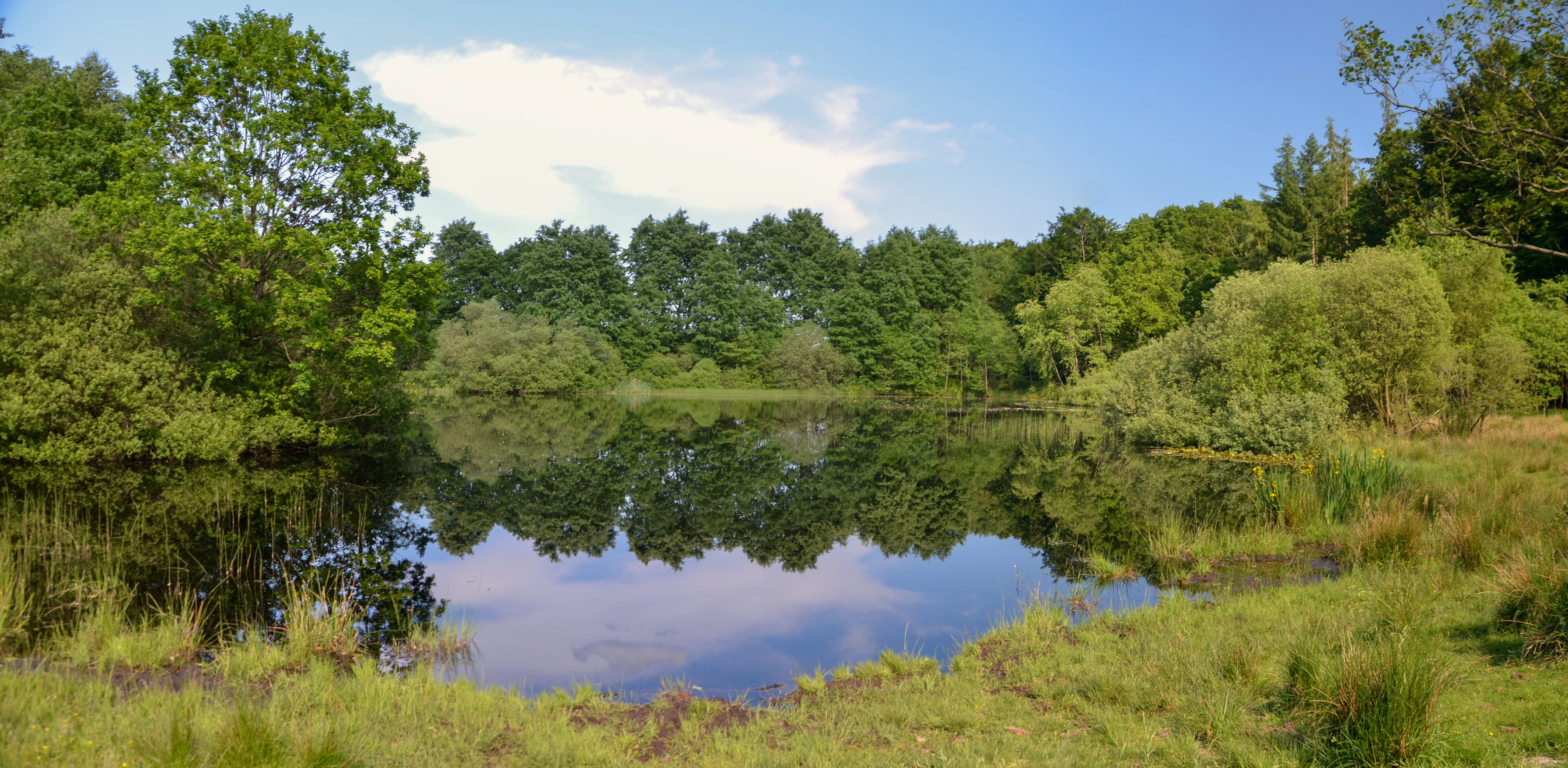
A calm, dark-water pond reflecting trees under a blue sky, surrounded by grassy banks and green deciduous forest.
A serene pond reflecting the surrounding forest and vegetation in the Froeruper Berge nature area.

Wald-, Moor- und Heidelandschaft der Fröruper Berge und Umgebung history and protected-area timeline

The Fröruper Berge have been a continuously forested site for a very long time, appearing in nineteenth-century Danish General Staff maps of 1858 essentially under woodland, while the Holmingfeld area east of the ridge was still open heathland at that date. Over the nineteenth and twentieth centuries, the wider landscape around the Fröruper Berge was progressively transformed: the surrounding moors and heaths were drained in stages to feed a growing population, and large areas were converted to improved pasture and arable farmland. By the late twentieth century, ecologists and land managers began to view this drainage trend very differently, recognizing drained peatlands as a source of carbon loss and an obstacle to climate-resilient land use, and so rewetting and extensification became central aims.

Modern conservation history at the site begins in the 1990s with the larger Naturschutzgroßprojekt Obere Treenelandschaft, which covered about 6,950 hectares, roughly seven times the size of the present FFH site. This project already applied many of the methods that later became standard across Natura 2000 areas, including rewetting peatlands, reintroducing extensive grazing, and rebuilding habitat connectivity. As a result, when the EU Habitats Directive was applied to the area, the site did not yet receive an EU-standard management plan; for a long time, the relevant document was the 2006 care and development plan for the Obere Treenelandschaft project. The Natura 2000 site itself was built from the merger of two earlier FFH proposals: the Fröruper Berge area (1322-303) and the Holmingfeld area (1323-381).

The FFH standard data form for the unified area was prepared in June 2004 by the Landesamt für Landwirtschaft, Umwelt und ländliche Räume (LLUR), submitted as a proposed Site of Community Importance in September 2004, confirmed by the European Union in November 2007, and formally designated as a special area of conservation under German federal and Schleswig-Holstein nature conservation law in January 2010. In 2015, the Obere Treenelandschaft was set up as a formal Naturschutzgebiet by state ordinance, of which the FFH site is now a part. In 2016, the FFH conservation features and conservation objectives for the area were officially published in the state's official gazette. Practical site management has been delegated to the local conservation association, Naturschutzverein Obere Treenelandschaft. The site's ecological status has been monitored in periodic cartography rounds, with the mapped extent of FFH habitat types growing modestly between the initial surveys, the 2009 follow-up, and the 2017 EU standard data form.

Wald-, Moor- und Heidelandschaft der Fröruper Berge und Umgebung landscape and geographic character

The Fröruper Berge are the visual and geological core of the area: a low, forested ridge composed of end moraines deposited during the last three glacial periods. Although modest in scale, the ridge rises to 54.4 meters at its two highest points, in the wooded Augaardholz area in the north and in the central forest east of Frörupholz. From these summits the land drops to about 19 meters in the Ihlseestrom lowland, which runs through the southwestern part of the site between the L317 road and the road to Frörupholz. The Holmingfeld sub-area is gentler still, climbing only from about 29 meters in the north to roughly 34 meters at its southern rim.

Geologically, this is classic glacial terrain. The end moraines of successive ice ages stacked up on what is now the western flank of the Schleswig-Holsteinisches Hügelland, leaving a hummocky ridge of sandy and loamy substrates. That substrate legacy matters ecologically: sandy, acidic, sometimes nutrient-poor soils shape both the beech forest character of the higher ground and the heath and bog communities of the flatter, wetter surroundings. Inland dune formations add further sandy character to the Holmingfeld component.

Hydrologically, the site sits at the upper end of the Treene river system, with the Heidweg and the Treene defining the northern boundary of the Fröruper Berge component. Small streams and ditches run through the Ihlseestrom lowland, while the Großsolter Moor along the eastern boundary carries open water surfaces above historical peat cuttings. Standing water is rare but striking when present: the artificial pond known as Schmidts Wiese lies in a forest clearing in the northeast and in summer carries a floating carpet of white waterlilies. Across both sub-areas, the landscape alternates between enclosed beech forest, open heath and grassland, wet bog expanses, and quiet woodland pools.
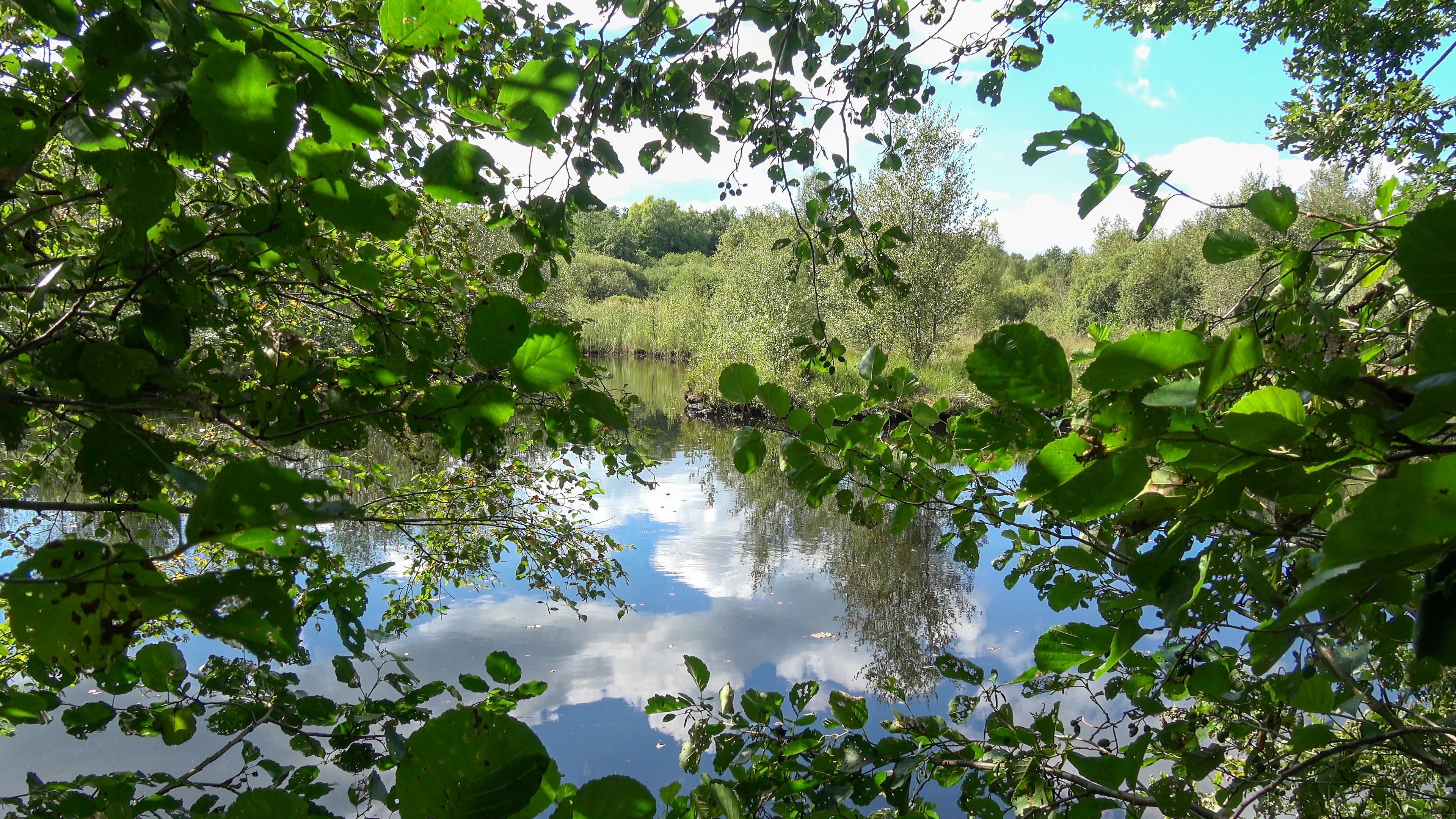
A tranquil forest pond reflecting a blue sky with white clouds, framed by green leafy branches in the foreground.
A reflective pond surrounded by lush forest and woodland vegetation within the Fröruper Berge protected area.

Wald-, Moor- und Heidelandschaft der Fröruper Berge und Umgebung ecosystems, habitats, and plant life

Ecologically, the site is defined by contrast rather than uniformity, with forest, peatland, and dry open habitats set within a relatively short distance of one another. By far the largest share of the area is occupied by the Hainsimsen-Buchenwald (Luzulo-Fagetum) woodland type, a beech forest community typical of acidic, nutrient-poor soils. It carpets much of the hilly forest interior of the Fröruper Berge and gives the protected site its continuous wooded backdrop. Secondary forest features of conservation interest include old, acidic oak woods on sandy plains with pedunculate oak and mire woodland, both of which are explicitly identified as restoration targets in the conservation objectives for the area.

The peatland story is also central. Several distinct wetland communities are present, including degraded raised bogs that, under restoration, have potential to recover; active lowland fens and fen woodlands such as the alder carr that fringes the southern stillwater near Schmidts Wiese; transition and quaking mires in the Holmingfeld sub-area; and the open water and rewetted cutover landscapes of the Großsolter Moor along the eastern edge. These peatlands are now valued as effective carbon stores, and their rewetting is one of the key management strategies.

On the open sandy substrates of the Holmingfeld the picture changes again. Here dry European heaths of conservation interest persist in fragments, alongside species-rich Borstgrasrasen grasslands on silicate soils and inland dunes. The mosaic of heath, acid grassland, and dune is unusual within an otherwise forest-dominated site and gives Holmingfeld a distinctly different feel from the Fröruper Berge. Around the edges of the forest and into the wider Obere Treenelandschaft, this mosaic extends into the traditional Knick landscape, with hedgerow-lined fields that frame the protected site and provide additional habitat structure for a range of species.
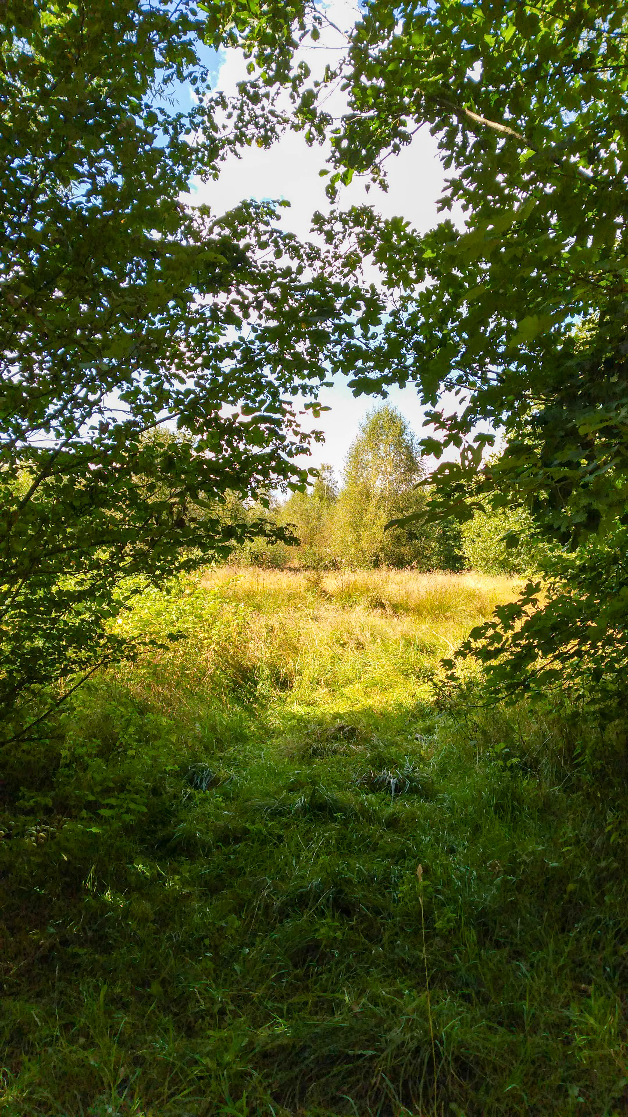
A view through a leafy, sunlit opening in a forest revealing a golden, grassy meadow and a line of distant trees under a bright sky.
A view of the varied meadow and forest habitat within the Fröruper Berge protected area.

Wald-, Moor- und Heidelandschaft der Fröruper Berge und Umgebung wildlife and species highlights

Although the area is not primarily marketed as a wildlife destination, it carries meaningful fauna, especially when measured against its compact size. The single officially reported Annex II and IV species from the EU standard data form is the Kammmolch (great crested newt, Triturus cristatus), which is present in both sub-areas and underscores the importance of small standing waters for amphibian breeding.

Alongside this legally protected species, the site supports a documented bat community of at least five species: the Breitflügelfledermaus (serotine), Fransenfledermaus (Natterer's bat), Großer Abendsegler (noctule), Rauhautfledermaus (Leisler's bat), and Zwergfledermaus (common pipistrelle). For these bats, an abandoned house in the southwest of the Fröruper forest was converted by the local conservation association, in cooperation with the Kurt and Erika Schrobach Foundation, into a winter roost with nearby fen and lagoon-rich woodland offering good hunting grounds.

The reptile and amphibian cast is similarly modest but ecologically valuable. The Zauneidechse (sand lizard) is recorded as a further protected reptile species, and the Moorfrosch (moor frog) is present alongside the Kammmolch. Grass snakes are regularly glimpsed on the Schmidts Wiese pond, where they hunt amphibians across the water surface. Dragonflies are abundant in summer over the same pond and along adjacent wet woodland edges. Across the heathland and peatland, the invertebrate fauna is diverse enough to support a working apiary within the protected area, with beehives taking advantage of the flowering meadows and heaths. Birdlife is shaped by the forest-mire-heath mosaic rather than by single charismatic species: woodland birds occupy the beech stands, while heath and bog fringes carry specialist species tied to open, undisturbed ground.
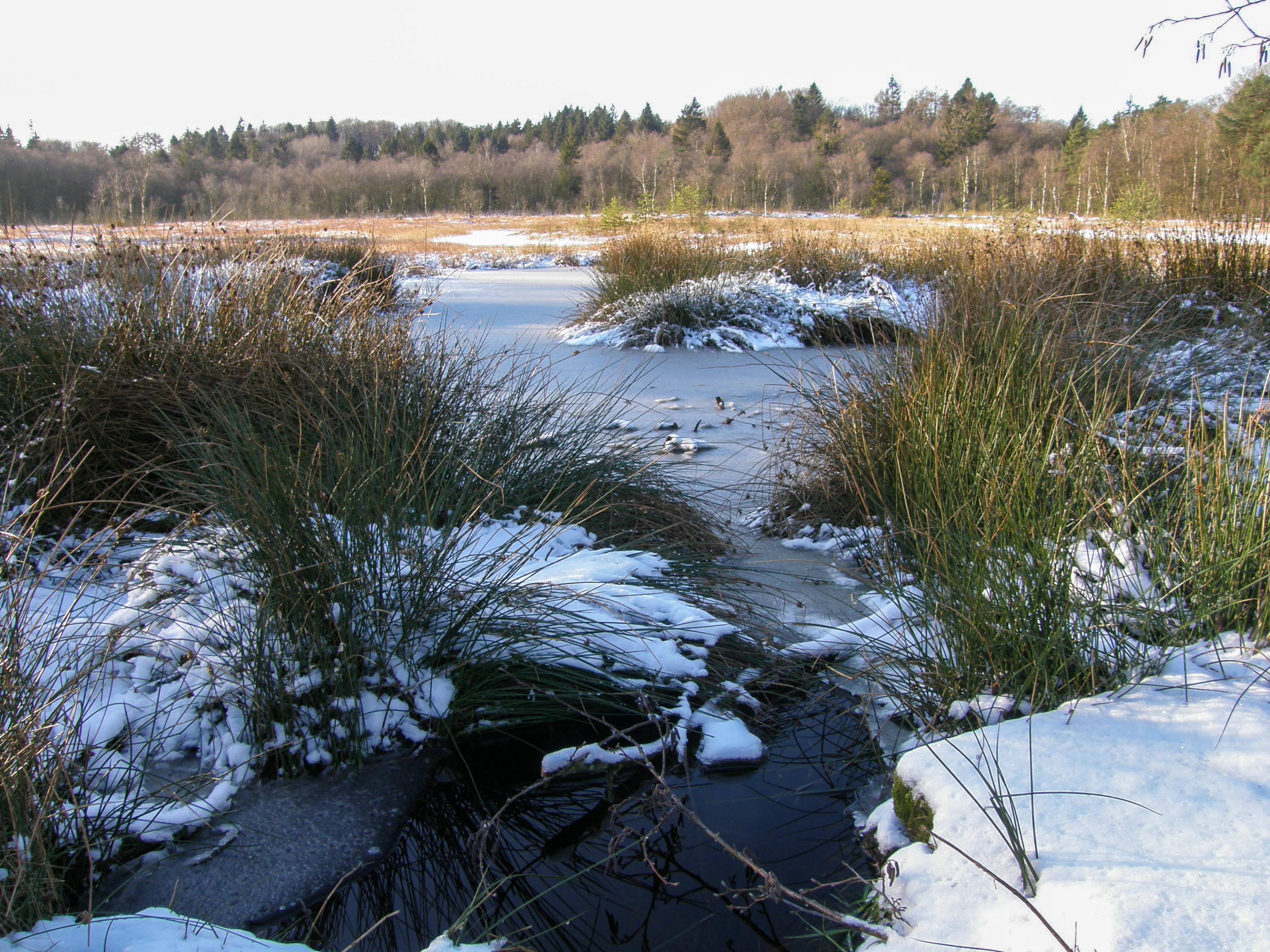
A snowy, marshy landscape with a partially frozen pond in the foreground and a line of deciduous and coniferous trees in the background under an overcast sky.
A winter view of the moorland landscape in the Fröruper Berge protected area, featuring a partially frozen pool surrounded by snow and marsh vegetation.

Wald-, Moor- und Heidelandschaft der Fröruper Berge und Umgebung conservation status and protection priorities

Conservation is the defining purpose of this site. It is a designated Natura 2000 area under the EU Habitats Directive, classified as a special area of conservation under both the federal BNatSchG and the Schleswig-Holstein LNatSchG, and it forms part of the broader Obere Treenelandschaft nature protection area set up by state ordinance in 2015. Its conservation significance lies in how much habitat diversity it captures within a small footprint: Hainsimsen beech forest, degraded raised bogs with restoration potential, acidic oak woods, mire woodland, lowland fens, dry heaths, species-rich Borstgrasrasen grasslands, transition and quaking mires, and inland dunes are all listed as conservation features.

Peatland rewetting is a central management lever. Surrounding bogs and heaths were drained for agricultural use over the past two centuries, but modern management treats those degraded peatlands as important carbon stores and biodiversity reservoirs, so they are being progressively rewetted and taken out of intensive production. In the wider Obere Treenelandschaft, formerly improved land is being shifted back to extensive pasture, fallow, or low-intensity grazing, often using robust cattle breeds and a migratory sheep flock from the Schäferei Obere Treenelandschaft.

Forest management aims at a slow compositional shift away from conifer plantations, historically favored in the Fröruper Berge, toward site-typical deciduous species better suited to a changing climate. Water retention in the forests, restoration of straightened watercourses, creation of new small biotopes, and the reintroduction of Knick hedgerows on the sandy geest soils are all part of a long-term strategy spelled out in the 2006 care and development plan and reaffirmed in the 2016 official conservation objectives. Monitoring shows modest but real progress, with reported FFH habitat area increasing from the initial surveys to the 2017 EU standard data form, and a 2009 follow-up survey recording 53 Red List plant species within the area.

Wald-, Moor- und Heidelandschaft der Fröruper Berge und Umgebung cultural meaning and human context

The cultural context of the site is shaped by its role as a near-city landscape for Flensburg, just a few kilometers to the east. The Fröruper Berge have historically been a forested island in a wider mosaic of bog, heath, and farmland, and that pattern is still legible in the field today. The Holmingfeld area carried open heath as late as 1858, recording in the Danish General Staff cartography of that period an early stage in the long transformation of the Geest landscape toward improved agriculture.

Traditional land-use patterns still frame the protected area. Working methods such as the Knick hedgerow system, which structures the surrounding farmland, are recognized in conservation planning as both a cultural and ecological asset, supporting wind erosion control and biodiversity. Extensive grazing with robust cattle and the use of a migratory sheep flock from the Schäferei Obere Treenelandschaft are contemporary expressions of this older pastoral heritage, while a small working apiary inside the area continues a long association between heathland flowering and local beekeeping.

Walking culture is also central to the site's identity. The Fröruper Berge component is laced with signposted round walking trails, and the long-distance Pilgerroute am Ochsenweg passes through the Ihlseestrom lowland, linking the area into a wider regional pilgrimage tradition. By contrast, the Holmingfeld sub-area has almost no visitor infrastructure, with no marked walking routes and very limited public access, leaving its cultural feel quieter and more private than the better-known Fröruper forest.
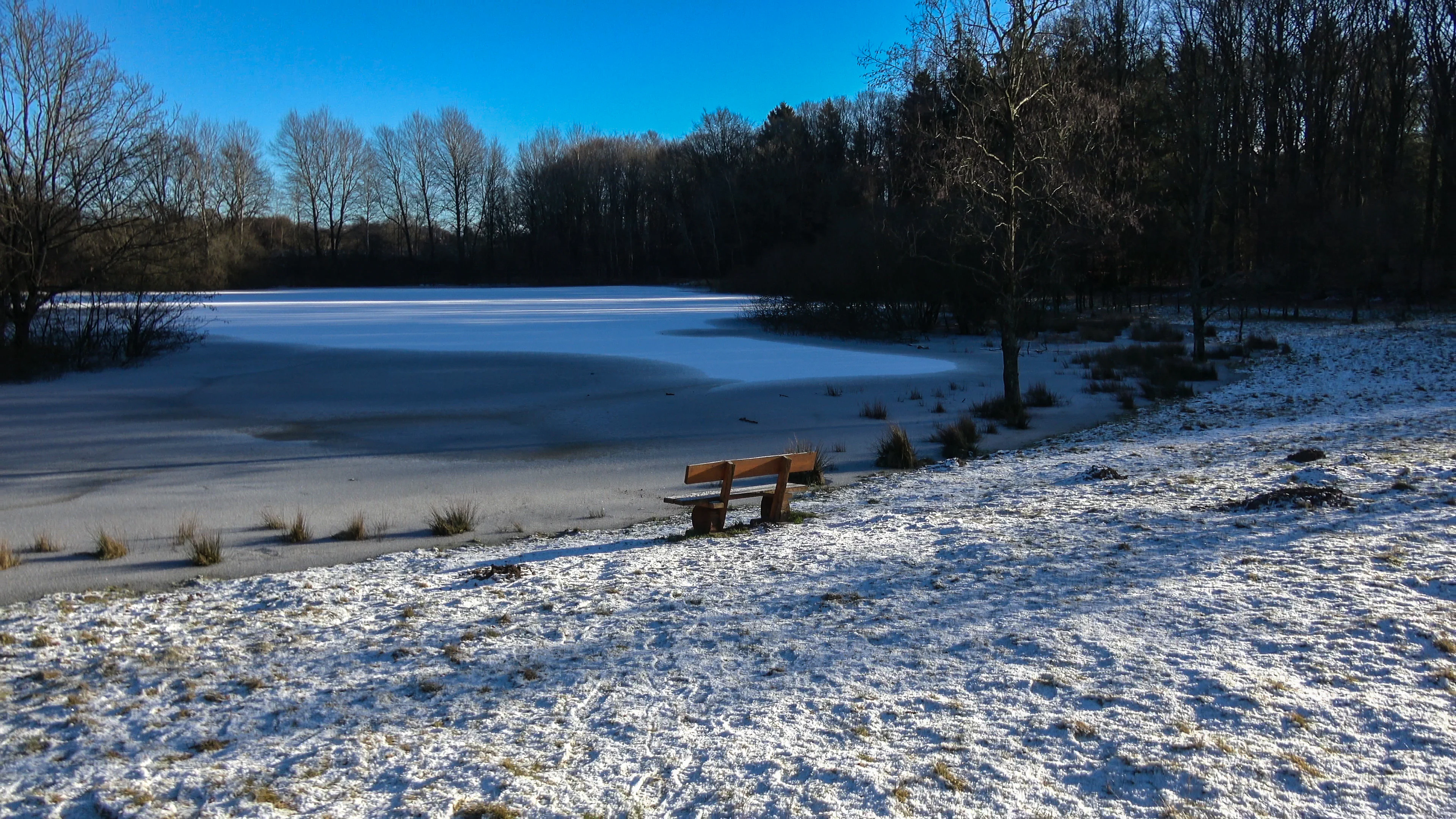
A frozen lake sits in a snow-covered clearing, bordered by a dark forest of bare trees. A wooden bench is situated on the bank facing the ice.
A snow-covered landscape with a frozen lake and a solitary wooden bench in the Fröruper Berge protected area.

Top sights and standout views in Wald-, Moor- und Heidelandschaft der Fröruper Berge und Umgebung

Standout features of the Wald-, Moor- und Heidelandschaft der Fröruper Berge und Umgebung include the Hainsimsen beech forest covering most of the Fröruper Berge ridge and the parallel heritage of degraded raised bogs, lowland fens, and mire woodland being actively rewetted. The two highest points of the protected area, both at 54.4 meters, sit within this forest, giving the site an unusually compact altitudinal structure despite its modest size.

The water features are small but striking. Schmidts Wiese, an artificial stillwater in a forest clearing, hosts white waterlily carpets in summer, dragonflies, amphibians including the protected Kammmolch, and grass snakes, and it sits beside a southern fen and alder carr that doubles as bat-hunting habitat. The Großsolter Moor on the eastern boundary carries open water across old peat cuttings, while the Butschimoor in the center of the Fröruper Berge represents the kind of degraded raised bog that rewetting targets aim to restore.

In the Holmingfeld sub-area, the highlights shift toward dry habitats: surviving patches of dry European heath, species-rich Borstgrasrasen on silicate soils, an inland dune system, and a transition moor in the northern part. Across both sub-areas, the extensive Knick hedgerow landscape of the surrounding geest, the grazing herds and the Schäferei Obere Treenelandschaft, and the Pilgerroute am Ochsenweg long-distance path together give the protected area a strong sense of regional identity within Schleswig-Holstein.
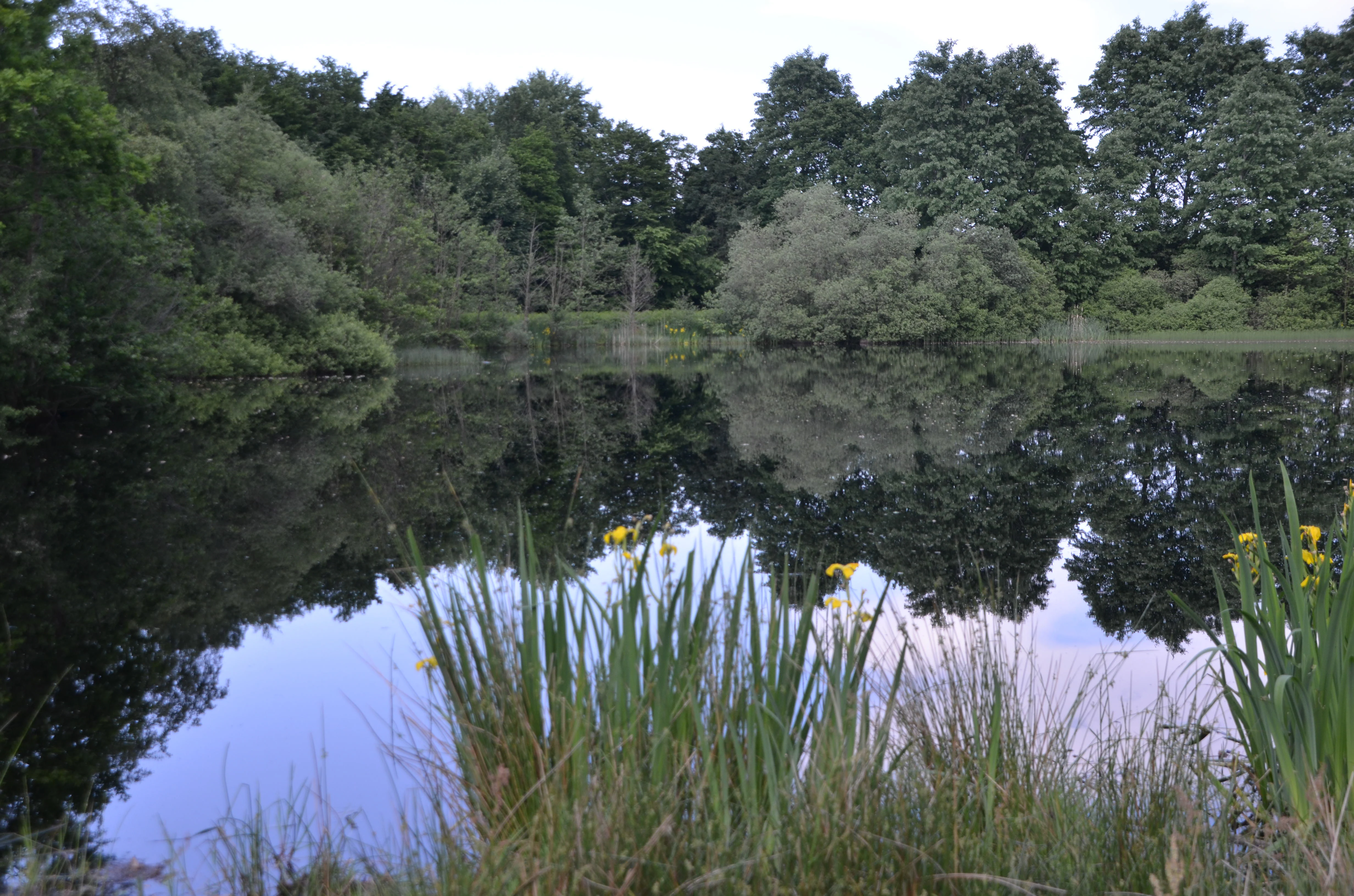
A still pond surface reflects a line of dense green trees, with tall grasses and yellow wildflowers visible along the shoreline in the foreground.
A serene pond reflecting the surrounding forest and vegetation in the Fröruper Berge protected area.

Best time to visit Wald-, Moor- und Heidelandschaft der Fröruper Berge und Umgebung

Spring and early summer tend to be the most rewarding seasons for visiting the Fröruper Berge component of the site. As the beech forest comes into fresh leaf, woodland birds are most vocal, and the open meadows and heath edges used by the grazing herds and the migratory sheep flock are at their most colorful with flowering plants that also sustain the on-site apiary. Schmidts Wiese, the artificial pond in the northeast, is at its most photogenic from late spring into mid-summer, when the white waterlily carpet spreads across part of the surface and dragonflies are most active above the water.

Late summer and early autumn are good for walking the longer trails under drier, more stable conditions, when the Ihlseestrom lowland and the Pilgerroute am Ochsenweg can be walked comfortably. Autumn also brings the most atmospheric forest colors across the Hainsimsen beech stands. In winter the area becomes quieter and the moorland edges feel more exposed; access remains possible on the Fröruper Berge side, while the Holmingfeld sub-area is best avoided in poor weather because of limited marked paths and few public access points.

Wildlife viewing is generally most rewarding around dawn and dusk in the warmer months, especially for bats near the converted winter roost in the southwestern forest and for amphibians around the Schmidts Wiese pond. Visitors planning to walk the Pilgerroute am Ochsenweg should be prepared for typical Schleswig-Holstein weather and the boggy ground conditions that can follow heavy rain.

Monthly climate preview

Long-term temperature and precipitation patterns across representative coordinates

FFH-Gebiet Wald-, Moor- und Heidelandschaft der Fröruper Berge und Umgebung Climate Normals

Representative coordinate records outline annual temperature fluctuations and monthly precipitation measurements for FFH-Gebiet Wald-, Moor- und Heidelandschaft der Fröruper Berge und Umgebung. Complete monthly climatology profiles provide structured comparisons for researchers analyzing regional environmental conditions.
Annual mean9 °C
1 °C17 °C
Jan
Feb
Mar
Apr
May12°
Jun15°
Jul17°
Aug17°
Sep14°
Oct10°
Nov
Dec
Warmest month
August

17.4 °C

Coolest month
January

1.3 °C

Wettest month
August

2.7 mm/day

Driest month
April

1.4 mm/day

Park location guide

Geography guide, regional context, and park location map for Wald-, Moor- und Heidelandschaft der Fröruper Berge und Umgebung

Wald-, Moor- und Heidelandschaft der Fröruper Berge und Umgebung park geography, regions, and map view in Germany

Understand where Wald-, Moor- und Heidelandschaft der Fröruper Berge und Umgebung sits in Germany through a broader geographic reading of the surrounding landscape, nearby location context, and its mapped position within the national park landscape.

How Wald-, Moor- und Heidelandschaft der Fröruper Berge und Umgebung fits into Germany

Germany is a federal republic in Western and Central Europe with a population of over 83 million across sixteen constituent states. It is Europe's largest economy by nominal GDP and a major global exporter and importer. The capital is Berlin, and the country borders Denmark, Poland, Czech Republic, Austria, Switzerland, France, Luxembourg, Belgium, and the Netherlands.

Wider geography shaping Wald-, Moor- und Heidelandschaft der Fröruper Berge und Umgebung in Germany

Germany is located in Western and Central Europe, spanning 357,022 km². It borders Denmark to the north, Poland and the Czech Republic to the east, Austria and Switzerland to the south, and France, Luxembourg, Belgium, and the Netherlands to the west. The country has coastlines on the Baltic Sea and North Sea to the north, with the Alps located in the southern region.

Map view of Wald-, Moor- und Heidelandschaft der Fröruper Berge und Umgebung

Use this park location map to pinpoint Wald-, Moor- und Heidelandschaft der Fröruper Berge und Umgebung in Germany, understand its exact geographic position, and read its mapped placement within the surrounding landscape more clearly.

Pigeon | © OpenStreetMap contributors

Location context for Wald-, Moor- und Heidelandschaft der Fröruper Berge und Umgebung

Schleswig-Holstein

Visualizing glacial end moraines, beech forests, and protected peatland habitats across Schleswig-Holstein

FFH-Gebiet Wald-, Moor- und Heidelandschaft der Fröruper Berge und Umgebung Photos and Landscape Scenery

Visual records capture the mosaic of Hainsimsen beech forest, raised bogs, dry heath, and inland dunes that define the protected terrain. Detailed photography reveals the natural topography and habitat structure of the regional conservation landscape.

A calm, dark-water pond reflecting trees under a blue sky, surrounded by grassy banks and green deciduous forest.

A frozen, snow-covered moorland landscape with a forest border in the background under low winter sunlight.

A tranquil forest pond reflecting a blue sky with white clouds, framed by green leafy branches in the foreground.

A view through a leafy, sunlit opening in a forest revealing a golden, grassy meadow and a line of distant trees under a bright sky.

A snowy, marshy landscape with a partially frozen pond in the foreground and a line of deciduous and coniferous trees in the background under an overcast sky.

A wooden-framed information board with text and images in German and Danish about the 'Pilgerroute' or pilgrim path, featuring small photos of a church and historical imagery.

A frozen lake sits in a snow-covered clearing, bordered by a dark forest of bare trees. A wooden bench is situated on the bank facing the ice.

A still pond surface reflects a line of dense green trees, with tall grasses and yellow wildflowers visible along the shoreline in the foreground.

A grass snake with its head and neck above the water surface, swimming toward a reed stalk in a calm, dark body of water, while a dragonfly flies in the background.

A calm, dark-water pond surrounded by lush green forest, with a cluster of water lilies floating near the center.

A dirt path leads through a dense deciduous forest with sunlight filtering through the canopy.

A green, sunlit meadow with a small, narrow drainage channel running through the center, surrounded by dense green forest foliage.

A sunny day view of a grassy meadow leading into a dense deciduous forest with a blue sky and white clouds.

A low, stone-walled structure with multiple arched openings, partially covered by earth and grass, located in a woodland clearing with a wooden bench in the foreground.

A small, dark pond surrounded by leafless trees and grassy terrain with an information sign on a wooden post to the right.

A yellow rectangular sign attached to a wooden fence reads Imkerei im Landschaftsschutzgebiet obere Treenelandschaft with contact details below, featuring a small illustration of a landscape with a river.

Park atlas

Compare regional protected areas, glacial landforms, and connected habitats

Explore Other Parks Near FFH-Gebiet Wald-, Moor- und Heidelandschaft der Fröruper Berge und Umgebung

Browse nearby protected landscapes, glacial end moraines, and river valley reserves located across the surrounding Schleswig-Holstein region. Comparing adjacent natural habitats helps reveal broader regional conservation patterns and connected ecological networks.
Watercolor illustration of a landscape featuring a winding river through a green valley with rolling purple hills and trees in soft pastel colors
Nature reserveSchleswig-Holstein
About 10 km away#1 closest

East

FFH-Gebiet Wälder an der Bondenau: Nature Reserve Geography and Mapped Forest Landscapes

Protected lowland forest blocks in the Angeln peninsula of Germany

Investigate the protected deciduous woodlands of FFH-Gebiet Wälder an der Bondenau through detailed geographic context. This Natura 2000 site contains historic beech and oak-hornbeam forest stands within a glacial tunnel valley, providing significant habitat conservation and insight into the environmental heritage of Schleswig-Holstein.

Area
1.26 km²
Established
2004
Nature reserveSchleswig-Holstein
About 14 km away#2 closest

South

FFH-Gebiet Wellspanger-Loiter-Oxbek-System und angrenzende Wälder Protected Landscapes

Schleswig-Holstein nature reserve map and geography

This protected area bundles a wide range of priority habitat types, including calcareous springs, inland dunes, and old-growth beech forests. Spanning the Angeln peninsula, the site protects a hydrological backbone of stream systems and rare wet meadows that remain critical for regional biodiversity in Northern Germany.

Area
14.34 km²
Established
2004
Relief
Upland
Climate
Temperate
Nature reserveSchleswig-Holstein
About 16 km away#3 closest

Southwest

Wälder im Süderhackstedtfeld: Protected Nature Reserve and Geest Landscape Atlas

Examining forest habitats in northern Schleswig-Holstein

Trace the boundaries of Wälder im Süderhackstedtfeld, a notable nature reserve in Schleswig-Holstein. This site contains priority atlantic beech and oak forest types within a classic glacial ridge topography, showcasing long-term woodland continuity and structured forest restoration within a compact geographic footprint.

Area
0.76 km²
Established
2004
Relief
Upland
Climate
Temperate
Nature reserveBrandenburg
About 19 km away#4 closest

Southeast

Tiergarten Nature Reserve: Geography and Protected Habitat Mapping in Brandenburg, Germany

Ancient oak woodland, riparian wetlands, and historic forest trails.

Spanning 158 hectares, the Tiergarten nature reserve serves as an ecologically rich sanctuary of oak-hornbeam forests and wet meadows. This area, formerly a royal hunting ground, offers a dense mosaic of riparian zones along the Staabe river, protecting essential habitats within the broader Brandenburg landscape.

Area
1.58 km²
Established
1995
IUCN
IV
Protected areaSchleswig-Holstein
About 21 km away#5 closest

Southwest

Wälder der Ostenfelder Geest: Geographic Mapping of Protected Forests in Northern Germany

A twelve-parcel woodland mosaic in the Schleswig-Holstein Geest.

Wälder der Ostenfelder Geest serves as a prime example of lowland conservation. This protected area connects diverse forest types across a glacial landscape, providing a stable habitat for beech and oak woodland communities while preserving the historic character of the Bredstedt-Husumer terrain.

Area
7.33 km²
Established
2004
Relief
Lowland
Climate
Temperate
Wildlife reserveSchleswig-Holstein
About 29 km away#6 closest

East

Vogelschutzgebiet Schlei: Protected Brackish Coastal Landscapes and Fjord Geography

Wildlife reserve mapping within the Schleswig-Holstein region

Vogelschutzgebiet Schlei acts as a critical wildlife reserve along the Baltic coastline, characterized by a 40-kilometer fjord system. The protected area encompasses varied terrain including shallow sand flats, freshwater fens, and dense beech woodlands. Analyze the geographical extent of this Natura 2000 corridor and explore how its salt marshes and reedbeds serve as central features within the Schleswig-Holstein coastal landscape.

Area
86.86 km²
Established
1997
IUCN
IV
Protected areaSchleswig-Holstein
About 29 km away#7 closest

West

FFH-Gebiet Wälder an der Lecker Au: Protected Forest Landscapes and Geest Geography

A mapped Natura 2000 deciduous woodland corridor in North Friesland

FFH-Gebiet Wälder an der Lecker Au comprises three specialized sub-areas of ancient deciduous woodland in Schleswig-Holstein. This protected landscape documents centuries of forest continuity, hosting diverse habitats including beech, oak, and alluvial forests that anchor the regional biotope network within the flat Lecker Geest terrain.

Area
0.5 km²
Established
2004
Relief
Lowland
Climate
Temperate
A horizontal watercolor painting depicting a soft, rolling landscape with green trees in the foreground, a light-colored meadow or field in the midground, and distant muted hills in the background.
Protected areaSchleswig-Holstein
About 32 km away#8 closest

Southeast

FFH-Gebiet Wälder der Hüttener Berge: Protected Area and Glacial Moraine Atlas

Ancient beech woodland mosaics in Schleswig-Holstein.

FFH-Gebiet Wälder der Hüttener Berge comprises eleven distinct state forest parcels stretching across northern Germany. This atlas entry details the site's rich habitat structure, including rare Atlantic beech forests, transition mires, and glacial soils, providing essential geographic context for this vital Natura 2000 protected territory.

Area
4.16 km²
Established
2004
Relief
Upland
Climate
Temperate

Common questions about visiting, size, designation, and location context for Wald-, Moor- und Heidelandschaft der Fröruper Berge und Umgebung

Wald-, Moor- und Heidelandschaft der Fröruper Berge und Umgebung FAQs for park facts, access, geography, and protected area context

Find quick answers about Wald-, Moor- und Heidelandschaft der Fröruper Berge und Umgebung, including protected-area facts, park geography, trail and visitor context, and how the park fits into its surrounding country and regional landscape.
MoriAtlas Explorer

Continue Your Protected Areas Search Across the Global Atlas

Deepen your exploration by continuing the structured search for national parks and protected areas worldwide. Utilize the comprehensive filtering capabilities to compare different conservation landscapes and refine your understanding of global park geography. Discover more about the distribution and characteristics of protected natural areas.

Global natural geography