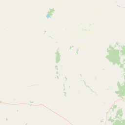
Why Warrumbungle National Park stands out
Warrumbungle National Park is best known for its extraordinary volcanic rock formations that create one of the most visually striking landscapes in eastern Australia. The Breadknife, a narrow vertical volcanic dyke stretching skyward, has become the park's most recognizable icon and was featured in David Bowley's 1983 music video for Let's Dance. Beyond its daytime appeal, the park's Dark Sky Park designation recognizes its exceptional nocturnal environment where the Milky Way and celestial bodies are visible with remarkable clarity, a rare quality in Australia's increasingly light-polluted eastern regions. The combination of dramatic volcanic terrain, unique biodiversity, and world-class astronomical resources makes Warrumbungle distinctive among Australian protected areas.
Warrumbungle National Park history and protected-area timeline
The movement to protect the Warrumbungle Range began in 1936 when the National Parks and Primitive Areas Council proposed reserving the more scenic portions as the Warrumbungle National Monument. This proposal languished for nearly two decades before the area was finally proclaimed as a reserve in 1953. The formal establishment as a national park followed, with management responsibilities transferred to the NSW National Parks and Wildlife Service in 1967.
Under the guidance of the park's first ranger, Carl Dow, a network of walking tracks was constructed by hand, opening up the park's interior for visitor exploration. The construction of the John Renshaw Parkway in 1966 provided sealed road access from Coonabarabran, facilitating visitor access to the eastern side of the park.
Warrumbungle National Park was added to the Australian National Heritage List in December 2006, recognizing its significance as an extensive and spectacular geomorphological site with bold volcanic landforms unrivalled anywhere else in Australia, its unique transition-zone ecology between arid and coastal zones, and its importance as a refugium for species in inland southeast Australia.
In January 2013, approximately 80 percent of the park was devastated by a major bushfire that started from lightning and also destroyed homes in surrounding areas, the visitor centre, and much of the park's infrastructure. The park has since reopened following extensive remediation works.
Warrumbungle National Park landscape and geographic character
The Warrumbungle landscape is defined by its volcanic origins, with the mountain range representing the eroded remains of an ancient volcanic complex. The most distinctive features are the vertical volcanic dykes, particularly The Breadknife, which rises as a thin blade of resistant rock amid the surrounding terrain. Other prominent formations include Belougery Spire, a dramatic needle of volcanic rock, Crater Bluff with its steep cliff faces, Bluff Mountain, and Mount Exmouth, the highest point in the park.
The terrain varies from steep, rocky slopes and sheer cliffs to more gentle ridges and valleys. The underlying basaltic lava flows have produced fertile soils that support vegetation communities quite different from the surrounding semi-arid pastoral lands. Creeks and drainage lines traverse the park, providing water sources for wildlife and adding to the landscape diversity.
Warrumbungle National Park ecosystems, habitats, and plant life
The park sits within the temperate savanna grasslands of southeast Australia, though the mountainous terrain creates microhabitats that support diverse vegetation types. The park lies within the Pilliga Important Bird Area, identified by BirdLife International for its importance to a range of woodland bird species, many of which face conservation concerns. The transition-zone position of the park means it supports plant and animal species from both the more arid western interior and the wetter coastal regions, creating an ecologically diverse environment that serves as an important refugium in inland southeast Australia.
Warrumbungle National Park wildlife and species highlights
The park supports a variety of wildlife, particularly bird species associated with woodland and rocky habitats. The Pilliga Important Bird Area designation reflects the presence of numerous bird species, including several threatened woodland birds that depend on the park's habitats for survival. Prior to the 2013 bushfire, the park contained a population of koalas, though the massive fire event is believed to have wiped out this population entirely. Reptiles, amphibians, and smaller mammals occupy the various habitats throughout the park, though comprehensive species documentation in the source material is limited.
Warrumbungle National Park conservation status and protection priorities
Warrumbungle National Park holds significant conservation value at multiple levels. Its listing on the Australian National Heritage List recognizes outstanding universal values, particularly its unique volcanic geomorphology that represents the most spectacular example of such formations in Australia. The park's position as a transition zone between arid and coastal ecological regions makes it an important biodiversity corridor and refugium.
The Dark Sky Park designation adds another dimension to conservation, protecting the nocturnal environment and supporting the astronomical research conducted at the adjacent Siding Spring Observatory. This combination of geological, ecological, and astronomical conservation values makes Warrumbungle distinctive among Australian protected areas. The 2013 bushfire demonstrated the vulnerability of the landscape to extreme events and has informed ongoing restoration efforts.
Warrumbungle National Park cultural meaning and human context
The Warrumbungle Range holds significance in the cultural landscape of the Wirrayaraay people, the traditional custodians of this land. The dramatic volcanic formations feature in Indigenous narratives and Traditional Owner connections to Country, though detailed documentation of cultural heritage values is limited in the available source material. The park's proximity to several small rural communities, including Coonabarabran, Baradine, and Coonamble, reflects the broader regional identity of the Orana area of New South Wales.
Top sights and standout views in Warrumbungle National Park
The Breadknife formation stands as the park's most iconic feature, a dramatic volcanic dyke visible from the Grand High Tops track. The network of walking tracks, including routes to Belougery Spire and across the high country, provides access to the park's most scenic locations. The Dark Sky Park status offers exceptional stargazing opportunities, with the Milky Way and celestial objects visible in remarkable detail. The adjacent Siding Spring Observatory represents a unique combination of natural landscape protection and scientific research. Rock climbing and abseiling are popular activities among the park's dramatic cliff formations.
Best time to visit Warrumbungle National Park
The cooler months from autumn through to spring, typically April through October, generally offer the most comfortable conditions for exploring Warrumbungle National Park. Summer temperatures can be extreme, making outdoor activities challenging and increasing bushfire risk. Winter may bring cold nights but clear days are common. The Dark Sky Park designation makes any season suitable for night sky viewing, though winter typically offers clearer skies and longer nights for astronomical observation. Visitors should check park conditions and any closures before traveling, particularly following the 2013 fire recovery and any subsequent natural events.