Mori Atlas logo
Nature reserveWindmühlenberg

Analyzing the glacial hill geography and steppe-like sand-dry grassland ecosystems

Windmühlenberg Nature Reserve: Mapped Protected Landscapes of Western Berlin

(Naturschutzgebiet Windmühlenberg)

Windmühlenberg sits as a distinct glacial feature on the eastern edge of the Nauen Plateau in Berlin. This nature reserve protects a rare mosaic of sand-dry grassland, known as Sand-Trockenrasen, which remains a vital steppe relict within the western Havel river valley. The site preserves nutrient-poor sandy substrates and specialized insect habitats, forming an essential ecological island within the surrounding agricultural and heath landscape of the Gatow district.

sand-dry grasslandsteppe relictglacial hillnature reserveBerlin-SpandauGatow

Windmühlenberg

Nature reserve

Park overview

Structured park overview, official facts, and landscape profile for Windmühlenberg Nature Reserve

Windmühlenberg Nature Reserve park facts, protected area profile, and essential visitor context

Review the core facts for Windmühlenberg Nature Reserve, including designation, size, terrain, visitor scale, habitats, and operating context in one park-focused overview.

About Windmühlenberg Nature Reserve

Windmühlenberg sits in the heart of Gatow, a historically village-like locality in Berlin's Spandau borough that still preserves much of its rural character despite belonging to the German capital. The roughly 52-meter hill rises only about four hundred meters west of the Havel and is surrounded on three sides by the small residential area known as the Siedlung am Windmühlenberg. Beyond that settlement, the landscapes of the former Gatow sewage farms (Rieselfelder) stretch to the north, while the Gatow Feldflur, a landscape protection area of about 350 hectares that includes one of the last large connected agricultural tracts in Berlin, extends to the west and southwest, and the Gatow Heath lies to the south.

Geologically, the hill belongs to the eastern slope of the Nauen Plateau, a coherent formation of ground moraines laid down during the Saale and the most recent Weichselian glaciations, with some end-moraine overlays. As the glaciers of roughly 15,000 years ago melted away, undulating deposits of glacial till and sand were left behind, and where the plateau slopes down toward the Havel lowland, broad stretches of near-surface high-plateau sand appear, including at Windmühlenberg and in the neighboring Feldflur and Gatow Heath. These nutrient-poor, dry, sandy soils are precisely what allow the sand-dry grassland vegetation to persist.

Ecologically, the reserve is small in area but exceptionally rich in character. The windmill hill hosts a community of dry-turf specialists that includes grasses, low-growing herbs, and Colorful flowering plants such as the purple Carthusian pink (Dianthus carthusianorum), with the spring spurrey (Spergula morisonii) standing out as a particularly rare sand specialist. The hedgerow and woodland fringes along the edges of the open turf add common soapwort (Saponaria officinalis), ground elder (Aegopodium podagraria), dog rose (Rosa canina), and pedunculate oak (Quercus robur), the last of which can dominate the upper stand and can reach extremely old ages on its preferred slightly loamy sandy soils. Maintaining the open character of the central grassland is one of the central management requirements embedded in the reserve's ordinance.

Culturally and historically, the hill carries an additional layer of identity through its lost and partly restored windmill. Until 1921, the crown of the hill was topped by a post mill dating from the mid-19th century; in that year the owners sold it to film producer Richard Eichberg, who burned it down for the production of a now-lost film. In the early 2000s, a local heritage association, the Förderverein historisches Gatow, acquired a similar mill from the Prignitz region and rebuilt it at the edge of the reserve between 2006 and 2008, returning a familiar Gatow landmark to the landscape without disturbing the protected grassland itself.

Quick facts and research context for Windmühlenberg Nature Reserve

Windmühlenberg is a designated nature reserve (NSG-33 among Berlin's roughly 35 such protected areas) located in Berlin-Gatow, Spandau, on a 52-meter hill a few hundred meters west of the Havel. It covers approximately 5.1 hectares of sand-dry grassland and supporting vegetation on glacial sandy soils of the Nauen Plateau.

The reserve was legally established through an ordinance dated 17 December 2001 and announced on 9 February 2002, with the stated purpose of preserving rare sandy open habitat, securing habitats for endangered plants, reptiles, insects, and spiders, and maintaining an ecologically significant site for research and education.

Protection and recognition

Examine documented conservation scope and official establishment timelines.

Windmühlenberg Protection Status and Terrestrial Designation History

Windmühlenberg maintains a recorded terrestrial protection status established in the year 2002. Structured conservation records outline the official management scope and designation history for this protected landscape.

Protection details

Protection scope
Terrestrial
Designated year
2002
Transboundary protection
No
Park context

Deeper park guide and search-rich context for Windmühlenberg Nature Reserve

Windmühlenberg Nature Reserve history, landscape, wildlife, and travel context

Explore Windmühlenberg Nature Reserve through its history, landscape character, ecosystems, wildlife, conservation priorities, cultural context, and seasonal travel timing in a structured park guide built for atlas discovery and search intent.

Why Windmühlenberg Nature Reserve stands out

Windmühlenberg is known above all for its surviving sand-dry grassland (Sand-Trockenrasen), a relict of steppe-like vegetation that has become exceptionally rare in the Berlin area. The reserve is one of the few places in the city where open, fire-prone sandy turf with characteristic grasses, low-growing herbs, and specialist wildflowers such as the Carthusian pink and the spring spurrey can still be observed. Beyond the grassland itself, the hill is recognized for its specialized fauna of ground beetles and grasshoppers adapted to dry, sparsely vegetated habitats, and for its role as a small but distinctive ecological island within the broader open-landscape mosaic of western Berlin at the foot of the Nauen Plateau.
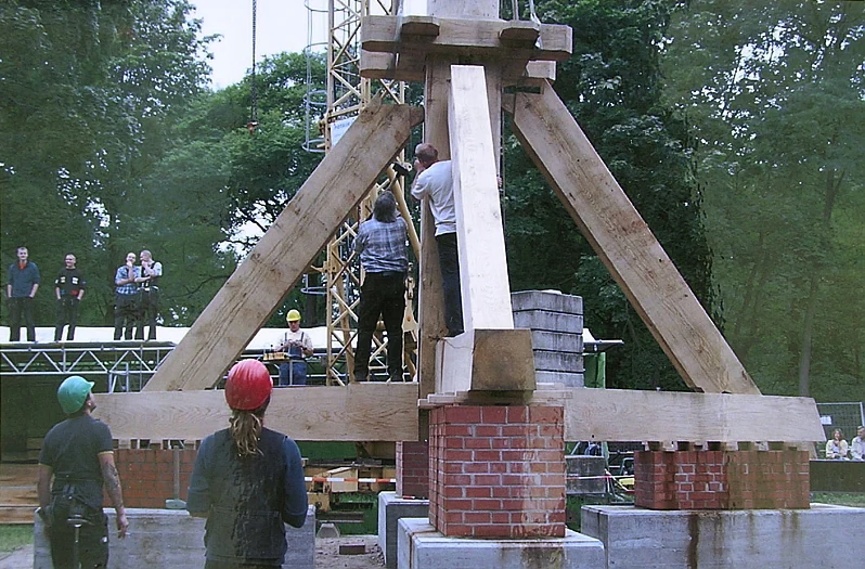
Workers in hard hats assembling the large wooden A-frame trestle of a post mill on brick piers, with scaffolding and onlookers in the background.
Construction of the wooden trestle for the Berlin-Spandau post mill at Windmühlenberg.

Windmühlenberg Nature Reserve history and protected-area timeline

Windmühlenberg's modern history as a protected site begins with the ordinance establishing the Naturschutzgebiet Windmühlenberg, dated 17 December 2001 and officially announced on 9 February 2002. The ordinance framed the reserve's purpose around three explicit goals: preserving the characteristic sand-dry grassland flora as a threatened and increasingly rare Berlin vegetation type, securing habitat for endangered plants, reptiles, insects, and spiders, and safeguarding an ecologically significant location for research and teaching.

The cultural history of the hill itself is older and more unusual. From the mid-19th century until 1921, a post mill (Bockwindmühle) stood on the summit of the hill, serving as a widely recognized local landmark. In 1921, the owners sold the mill to film producer Richard Eichberg, who had it burned down as a dramatic effect for a film whose title is recorded as `Die Liebesabenteuer der schönen Evelyne oder Die Mordsmühle auf Evanshill.` The film itself is now considered lost. For decades afterwards the hill stood without its mill, until the local heritage initiative Förderverein historisches Gatow acquired a comparable mill from Metzelthin in the Prignitz region in 2004. After earlier plans to relocate it to Wriezen in the Oderbruch failed, the parts had already been dismantled and stored at the Wriezen station, from where the association transported them to Gatow. Between 2006 and 2008 the mill was reassembled at the edge of the nature reserve, in a location deliberately chosen to harmonize with the conservation requirements of the protected grassland.

Windmühlenberg Nature Reserve landscape and geographic character

Windmühlenberg is a low, glacial hill that reaches about 52 meters in elevation and rises only a few hundred meters west of the Havel river. Its gentle undulations are typical of the eastern margin of the Nauen Plateau, where ground moraine deposits from the Saale and Weichsel glaciations have been locally overlaid by end moraine features. As the plateau slopes down toward the Havel lowland, near-surface deposits of high-plateau sand become exposed, and these sandy, nutrient-poor substrates define both the surface of the hill and the surrounding field-flur landscape.

The hill itself is a compact, almost island-like feature within the surrounding open country: open sandy turf occupies the upper slopes, while the lower edges grade into hedgerow and oak-dominated fringes. To the north lie the former Gatow sewage farm fields, to the west and southwest the broad agricultural Gatow Feldflur with its network of hedges, and to the south the Gatow Heath. The combination of hill, heath, agricultural plain, and riverside lowland gives the site a layered, transitional character that is unusual within Berlin's mostly built-up territory.
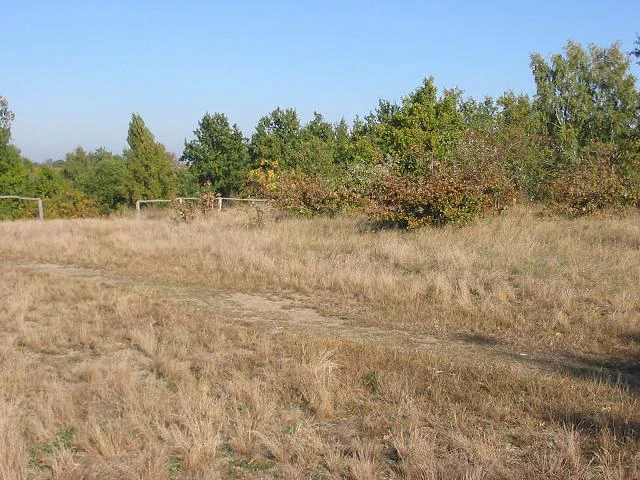
A wide field of dry brown grass leading to a line of green trees and bushes under a clear blue sky, with a few wooden posts visible.
Dry grassland field with a tree line in the background at Windmühlenberg nature reserve.

Windmühlenberg Nature Reserve ecosystems, habitats, and plant life

Sand-dry grassland (Sand-Trockenrasen) is the defining ecosystem of Windmühlenberg and the principal reason for its protected status. This vegetation type is a relict of once more widespread steppe-like plant communities, and in Berlin it has become exceptionally rare. At Windmühlenberg the grassland consists of loose, sometimes patchy turf of grasses with a generally grey-green to brownish tone, interspersed with low-growing herbs and Colorful wildflowers that thrive on the dry, acidic, nutrient-poor sands.

The reserve's flora includes characteristic specialists such as the Carthusian pink (Dianthus carthusianorum), whose purple flowers brighten the slopes from June to September, the rare spring spurrey (Spergula morisonii), a typical sand specialist, and along the margins and fringes common soapwort (Saponaria officinalis), ground elder (Aegopodium podagraria), dog rose (Rosa canina), and pedunculate oak (Quercus robur). A central management objective, written into the reserve's ordinance, is to keep the grassland free of advancing shrubs and trees, so that the open sandy character of the habitat is preserved.
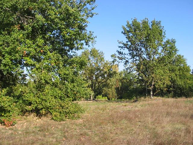
A field of dry brown grass with green trees and a clear blue sky.
Sunny view of dry grassland and scattered trees at Windmühlenberg nature reserve.

Windmühlenberg Nature Reserve wildlife and species highlights

The dry, sparsely vegetated character of Windmühlenberg's sandy turf supports a specialized insect and spider fauna typical of sand-dry grassland habitats. Ground beetles (Laufkäfer) and grasshoppers (Heuschrecken) are particularly characteristic. Among the species highlighted at the site are the protected blue-winged locust (Oedipoda caerulescens), which favors dry, vegetation-poor terrain, and the blue-winged sand grasshopper (Sphingonotus caerulans). The reserve's protection also extends to rare hymenopterans, weevils, and xylobiont beetles associated with the trees and hedges that fringe the open grassland.

The ordinance framing the reserve specifically identifies reptiles, insects, and spiders as priority groups to be conserved, alongside plants, reflecting the broader ecological value of the dry-sand habitat complex beyond its flora alone.

Windmühlenberg Nature Reserve conservation status and protection priorities

Windmühlenberg carries the official designation NSG-33 within the network of Berlin's roughly 35 protected nature reserves. The governing ordinance sets out three explicit conservation aims: preserving the sandy open areas with their characteristic sand-dry grassland flora as a threatened and rare Berlin vegetation type; safeguarding habitat for endangered plants, reptiles, insects, and spiders; and maintaining an ecologically important site for research and teaching.

Management practice follows directly from those aims. Keeping the central grassland free of encroaching woody growth is identified as one of the most important duties of the reserve's stewardship, and the site functions as an almost seamless ecological extension of the adjacent Gatow Feldflur landscape protection area, with its roughly 350 hectares of farmland and hedgerows. Together the two protected areas form one of the last large, coherent open-land complexes in Berlin, making Windmühlenberg disproportionately important for the long-term survival of sand-dry grassland and its associated fauna in the city.

Windmühlenberg Nature Reserve cultural meaning and human context

Windmühlenberg sits beside the historic village core of Gatow, a Spandau locality that has retained much of its village character despite belonging to Berlin. The hill itself once carried a post mill (Bockwindmühle) dating from the mid-19th century that served as the area's signature landmark until 1921, when the mill was sold to a film producer and burned as a set piece. The loss of the mill became a local cultural gap, and the early-21st-century rebuilding of a comparable mill by the Förderverein historisches Gatow is a small but meaningful act of cultural and landscape restoration, deliberately sited so as not to conflict with the reserve's conservation goals.

Best time to visit Windmühlenberg Nature Reserve

Late spring through early autumn tends to be the most rewarding time to experience Windmühlenberg, when the sand-dry grassland is in active growth and flowering, with the Carthusian pink lighting up the slopes in purple from June to September. The site's habitats, especially its insect and grasshopper fauna, are most active in warm, dry summer weather, which is also when the open sandy turf that defines the reserve is most expressive of its character; in winter the grassland remains a quiet, exposed sandy landscape of more subtle interest. Visitors should treat the protected turf as sensitive and stay on existing paths so that the rare species and fragile soil crusts are not damaged.
Monthly climate preview

Long-term representative point measurements for monthly weather patterns in Berlin

Windmühlenberg Climate Normals and Annual Temperature Rhythm

Windmühlenberg exhibits a measured annual temperature range from sub-zero winter minimums to warm summer maximums alongside consistent daily precipitation throughout the year. Reviewing the complete twelve-month climate profile provides deeper context on long-term temperature averages and monthly precipitation normals.
Annual mean9 °C
-1 °C20 °C
Jan-1°
Feb
Mar
Apr
May14°
Jun18°
Jul20°
Aug20°
Sep15°
Oct
Nov
Dec
Warmest month
July

20.3 °C

Coolest month
January

-0.7 °C

Wettest month
July

2.4 mm/day

Driest month
April

1 mm/day

Park location guide

Geography guide, regional context, and park location map for Windmühlenberg Nature Reserve

Windmühlenberg Nature Reserve park geography, regions, and map view in Germany

Understand where Windmühlenberg Nature Reserve sits in Germany through a broader geographic reading of the surrounding landscape, nearby location context, and its mapped position within the national park landscape.

How Windmühlenberg Nature Reserve fits into Germany

Germany is a federal republic in Western and Central Europe with a population of over 83 million across sixteen constituent states. It is Europe's largest economy by nominal GDP and a major global exporter and importer. The capital is Berlin, and the country borders Denmark, Poland, Czech Republic, Austria, Switzerland, France, Luxembourg, Belgium, and the Netherlands.

Wider geography shaping Windmühlenberg Nature Reserve in Germany

Germany is located in Western and Central Europe, spanning 357,022 km². It borders Denmark to the north, Poland and the Czech Republic to the east, Austria and Switzerland to the south, and France, Luxembourg, Belgium, and the Netherlands to the west. The country has coastlines on the Baltic Sea and North Sea to the north, with the Alps located in the southern region.

Map view of Windmühlenberg Nature Reserve

Use this park location map to pinpoint Windmühlenberg Nature Reserve in Germany, understand its exact geographic position, and read its mapped placement within the surrounding landscape more clearly.

Pigeon | © OpenStreetMap contributors

Location context for Windmühlenberg Nature Reserve

Berlin

Explore detailed field imagery capturing glacial hill terrain, rare steppe flora, and open reserve habitats.

Windmühlenberg Photos and Scenery: Visualizing Protected Sand-Dry Grassland Landscapes

Photographic records reveal the distinct topography and sandy soils defining Windmühlenberg across its glacial hill slopes. Visualizing these protected habitats helps observers understand rare grassland ecology and surrounding rural mosaics in western Berlin.

Workers in hard hats assembling the large wooden A-frame trestle of a post mill on brick piers, with scaffolding and onlookers in the background.

A dry sandy grassland field with sparse brown and green vegetation, a wooden post-and-rail fence running across the middle ground, and a line of green deciduous trees in the background under a clear blue sky.

A wide field of dry brown grass leading to a line of green trees and bushes under a clear blue sky, with a few wooden posts visible.

A field of dry brown grass with green trees and a clear blue sky.

Park atlas

Compare regional geography, glacial terrain, and connected open-land reserves.

Explore Parks Near Windmühlenberg and Surrounding Protected Landscapes

Continue browsing other parks near Windmühlenberg to discover adjacent protected areas across the surrounding region. Comparing these nearby natural reserves reveals broader patterns in regional park geography and local conservation landscapes.
Protected landscapeBerlin
About 4 km away#1 closest

Northeast

Tiefwerder-Wiesen Protected Landscape: Berlin Riverine Geography and Floodplain Map

Mapping the historic Havel river floodplains and wetland habitats.

Tiefwerder-Wiesen serves as an important ecological corridor in Berlin, safeguarding the last functional pike spawning grounds within the city. This protected landscape contains a dense network of river arms, ditches, and sedge meadows that illustrate the historical and ongoing geomorphological processes of the Havel river valley.

Area
0.667 km²
Established
1960
Relief
Lowland
Climate
Temperate
Watercolor illustration of a serene wetland scene with soft green hills and a light pink sky.
Nature reserveBerlin
About 4.1 km away#2 closest

East

Sandgrube im Jagen 86 Nature Reserve: Mapped Geography and Protected Area Context

A unique habitat mosaic within the Berlin forest region

Sandgrube im Jagen 86 functions as a protected nature reserve in Berlin, characterized by a bowl-shaped terrain of glacial sands. The area provides a critical habitat for specialized wildlife by balancing nutrient-poor grasslands with open water bodies and sun-exposed slopes, illustrating an effective example of managed conservation within an urban forest.

Area
0.135 km²
Established
1992
IUCN
IV
Relief
Lowland
Nature reserveBerlin
About 5 km away#3 closest

Northeast

Fließwiese Ruhleben: A Glacial Nature Reserve and Wetland Mosaic in Berlin

Mapping a unique urban protected area and its peat marsh topography

Fließwiese Ruhleben is a protected nature reserve in western Berlin that preserves a distinct relic of Weichselian glaciation. The site features a narrow, basin-like depression carved by glacial meltwater, supporting a rich diversity of peat-forming marshland and alder swamp forests. This protected area remains a vital node for regional biodiversity, contrasting sharply with the surrounding urban landscape of the Teltow plateau.

Area
0.118 km²
Established
1959
Relief
Lowland
Climate
Temperate
A soft watercolor painting showing rolling green hills, patches of open land, and trees against a pale sky background.
Nature reserveHavelland
About 5.5 km away#4 closest

West

Döberitzer Heide Nature Reserve: Geographic Atlas and Protected Landscape Mapping

Glacial sand flats and heathlands in the Havelland region

Döberitzer Heide occupies a unique position on the southeastern Nauener Platte, providing a study of dry heath, grassland, and wetland habitats. Once a restricted military training ground, the area now functions as a vital protected landscape where European bison and wild horses maintain open terrains. This atlas entry focuses on the regional geography and the structural components of this nature reserve situated near the urban centers of Berlin and Potsdam.

Area
34.15 km²
Established
1997
Relief
Upland
Climate
Temperate
Nature reserveBerlin
About 5.6 km away#5 closest

Southeast

Riemeisterfenn Nature Reserve and Protected Peatland Landscape in Berlin

A rare bog ecosystem within the city glacial lake chain

Riemeisterfenn is a distinct nature reserve in Berlin, characterized by its marshy lowlands, reed beds, and alder carr vegetation. This site offers an essential look at a preserved peatland habitat and the Fennkanal hydrology that connects these protected areas to the wider Grunewald forest ecosystem.

Area
0.072 km²
Established
1987
Relief
Lowland
Climate
Temperate
A horizontal watercolor painting showing a wetland landscape with calm water, marshy vegetation, and a background of soft rolling hills and mixed forest trees.
Nature reserveBerlin
About 5.7 km away#6 closest

Southeast

Langes Luch / Dachsheide: Nature Reserve and Glacial Wetland Geography in Berlin

Protected mosaic of bog, forest, and inland dune habitats

Langes Luch / Dachsheide encompasses a rare urban protected area in Berlin, defined by the interplay between low-lying swampy depressions and elevated sandy heath. The site features complex glacial meltwater channels, open transitional mires, and historical terrain modifications, forming an essential study area for local conservation and regional landscape ecology.

Area
0.324 km²
Established
1960
IUCN
IV
Relief
Lowland
A watercolor painting showing a soft green marshy landscape with low hills in the background and a winding stream in the foreground.
Nature reserveBerlin
About 6 km away#7 closest

East

Hundekehlefenn Nature Reserve: Geography and Protected Wetland Landscapes in Berlin

Glacial meltwater channel and moorland in Grunewald

Hundekehlefenn represents one of the last surviving pieces of original Berlin vegetation, preserved as a nature reserve within the city limits. This compact protected area showcases a glacial meltwater channel geography, featuring marshy depressions, mesotrophic bog remnants, and alder swamp forests. It serves as an essential ecological link within the Grunewaldseenkette lake chain, providing a window into the natural terrain history of the region.

Area
0.1 km²
Established
1987
Relief
Lowland
Climate
Temperate
A horizontal watercolor illustration depicting a calm lake surrounded by soft green forest and distant hazy hills.
Protected areaBerlin
About 8.4 km away#8 closest

Southwest

EU-Vogelschutzgebiet Westlicher Düppeler Forst: Protected Area and Regional Geography

Ecological sanctuary and Havel lakeshore landscape in Berlin

Located in the Steglitz-Zehlendorf district, this protected area spans nearly 10 square kilometres of diverse woodland and aquatic terrain. The site combines historical cultural landmarks with essential breeding grounds for migratory birds, including significant woodpecker populations and varied riparian corridors throughout the southwestern Berlin borderlands.

Area
9.44 km²
Established
2003

Common questions about visiting, size, designation, and location context for Windmühlenberg Nature Reserve

Windmühlenberg Nature Reserve FAQs for park facts, access, geography, and protected area context

Find quick answers about Windmühlenberg Nature Reserve, including protected-area facts, park geography, trail and visitor context, and how the park fits into its surrounding country and regional landscape.
MoriAtlas Explorer

Continue Your Protected Areas Search Across the Global Atlas

Deepen your exploration by continuing the structured search for national parks and protected areas worldwide. Utilize the comprehensive filtering capabilities to compare different conservation landscapes and refine your understanding of global park geography. Discover more about the distribution and characteristics of protected natural areas.

Global natural geography